Cape Wrath – Scotland’s Must Do Daytrip

In a previous post I described why driving Scotland’s North Coast 500 was an absolute imperative for anyone who has an interest in great coastal drives of the world. One of the places I recommended as a must visit was Cape Wrath, the most northwesterly point of mainland Britain. It is remote and you can’t get their on your own, but taking a day trip with the operators of the ferry and mini bus services that deliver you right to the lighthouse hundreds of feet above the ocean is an experience you will never forget; particularly if you luck out with great weather as we did on our visit last July. Here’s why you absolutely need to take this trip to Cape Wrath if you’re driving the North Coast 500.
Why to Go
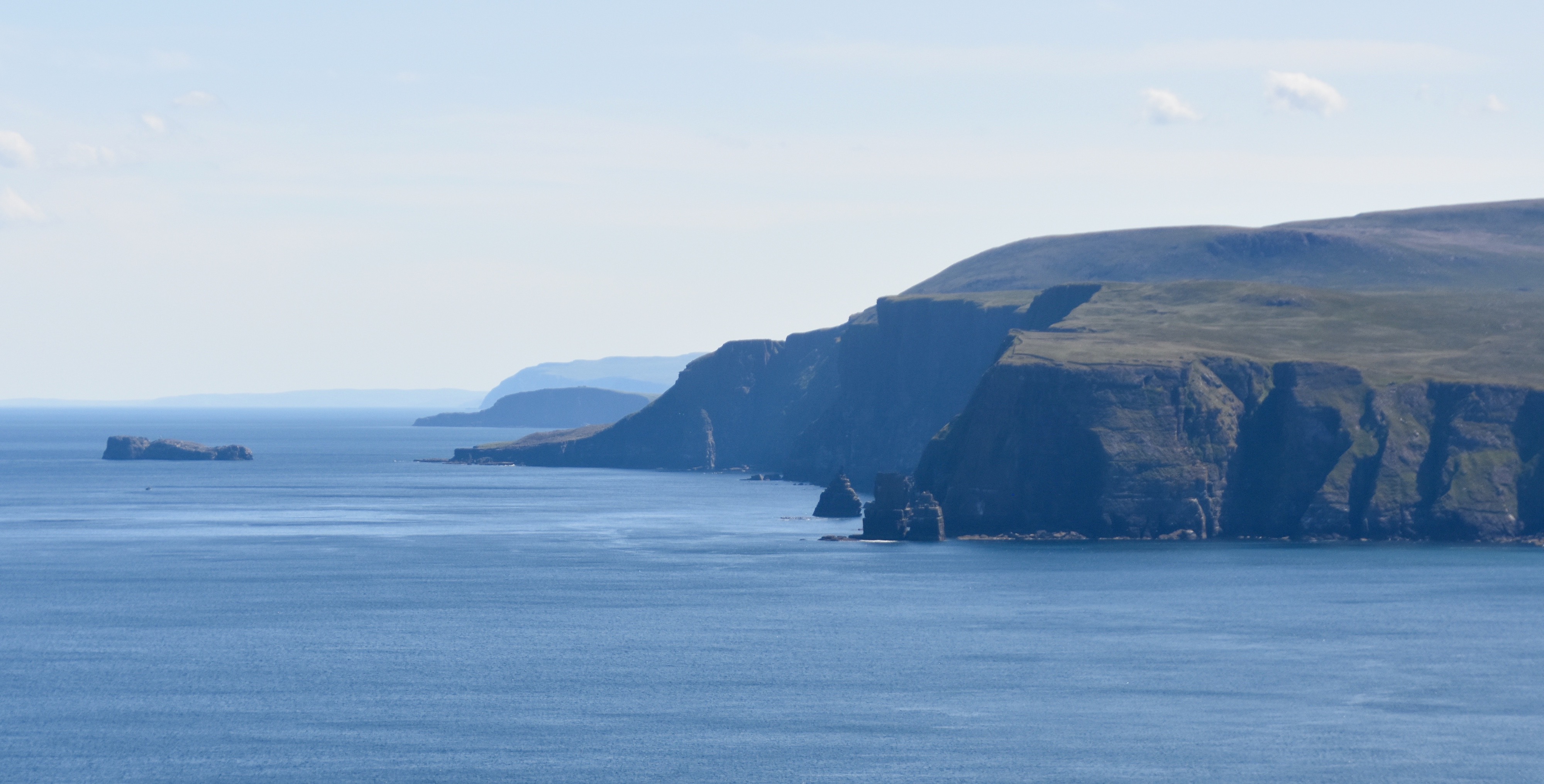
There’s more than a few good reasons to take the time and effort to get to Cape Wrath. As noted above, if you’re are a geography nut you might want to add Cape Wrath to your list of ‘most (name your direction) places’. If you followed my advice and driven the North Coast 500 in a counterclockwise direction you will already have bagged the most northerly point in mainland Great Britain, Dunnet Head and now you can add the most northwesterly point as well. However, that’s not the only record breaker you’ll find at Cape Wrath. Once there you can view the highest cliffs in mainland Britain, Clo Mor that rise 281 metres (921 feet) straight up from the sea.
There’s also the chance to photograph one of the most scenic lighthouses in Britain designed by famed lighthouse builder Robert Stevenson, father of the writer Robert Louis Stevenson. You can have tea or a beer and sandwich at Britain’s most remote restaurant, the Ozone Cafe. You can look down at a huge nesting seabird colony. On the way there you will drive through a landscape so barren it was used to train troops for the invasion of the Falkland Islands. The Kyle of Furness is one of the prettiest little lochs in Scotland and crossing it in an open boat is a great way to start and end the trip. Cape Wrath is nature at its unspoiled finest, period.
OK, if that’s not enough to convince you, then you probably prefer theme parks or Las Vegas.
How to Get There
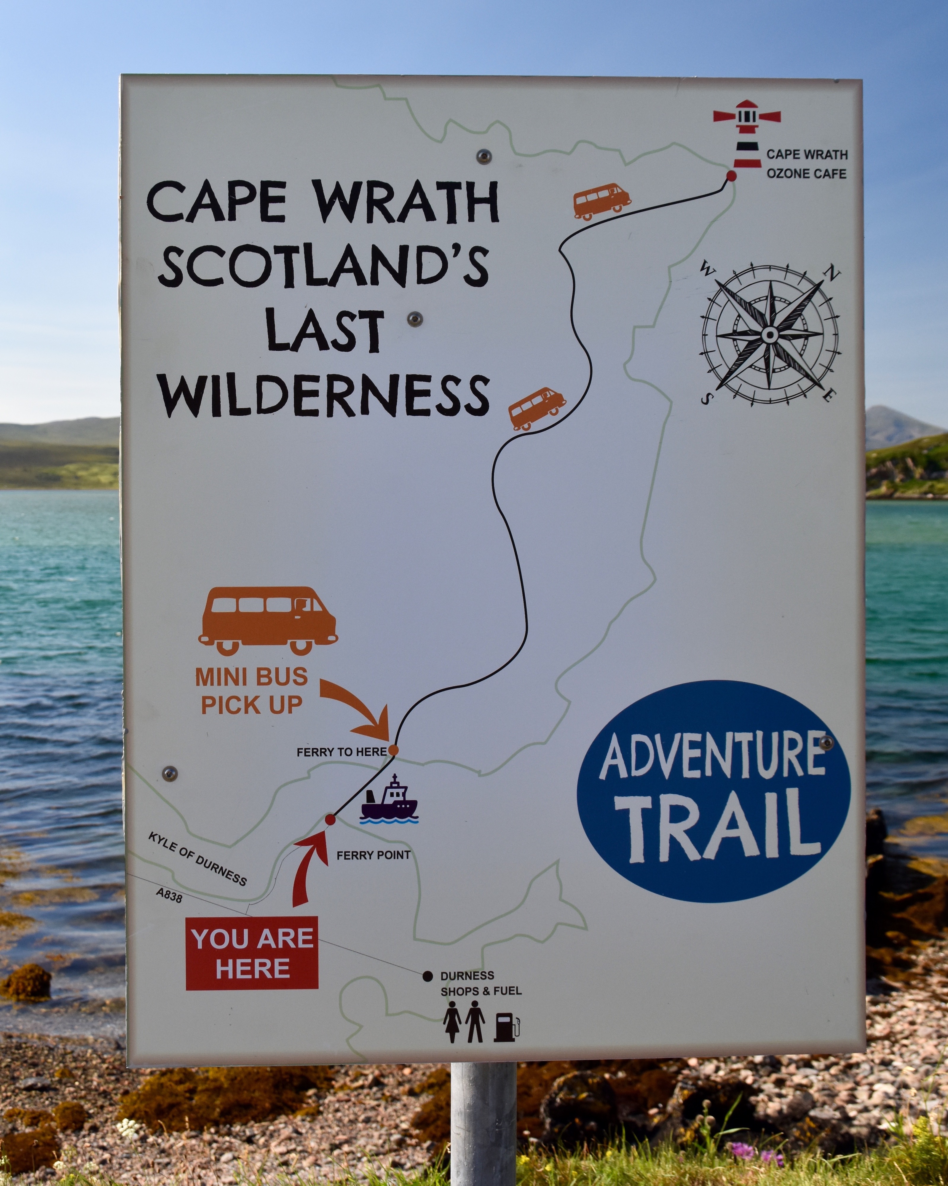
It’s important to do a little preparation starting with getting in touch with the fellows who run the minibus service. This is a link to their website and you can email them to confirm reservations and departure times. The Kyle of Durness is tidal and at some points the ferry may not run so you should give them a call as your departure date approaches. The closest town is Durness which is fairly close, but you can also get to the Kyle of Durness crossing from Scourie to the south, as we did. There’s a small paved road that runs off the A838 to the parking area for the ferry. It’s impossible to miss if you are on the right road. If you end up at the Durness Golf Course as we did, you’re on the wrong road.
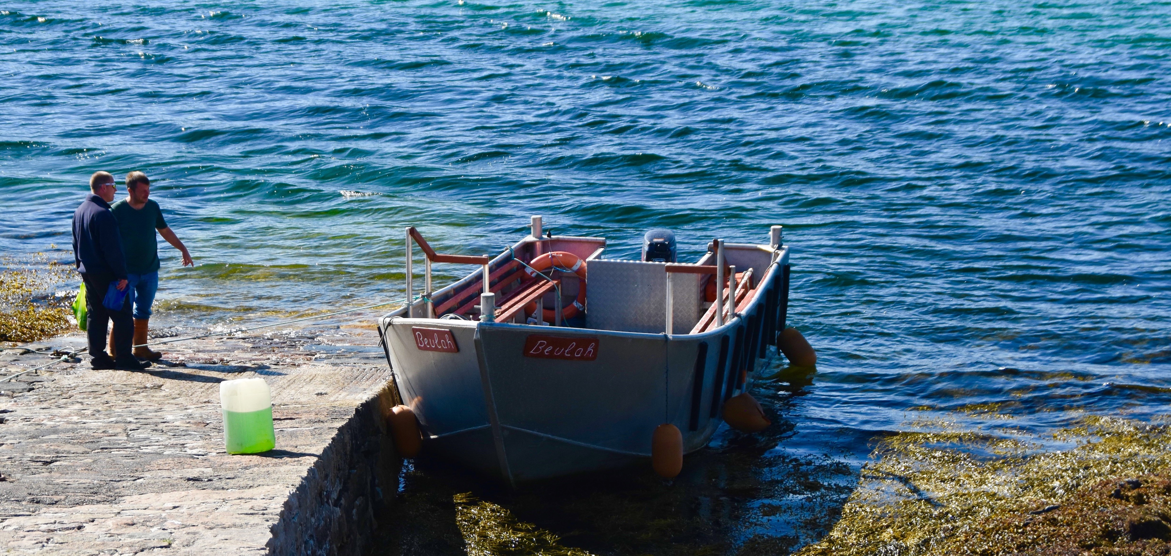
This is the mighty Beulah which will ferry you across the Kyle of Furness. You pay the boatman in cash and there are no advance reservations. It’s a very short but pleasant ride to an old jetty on the other side where you’ll find this minibus waiting for you. It’s a homely looking thing, but it did the trick.
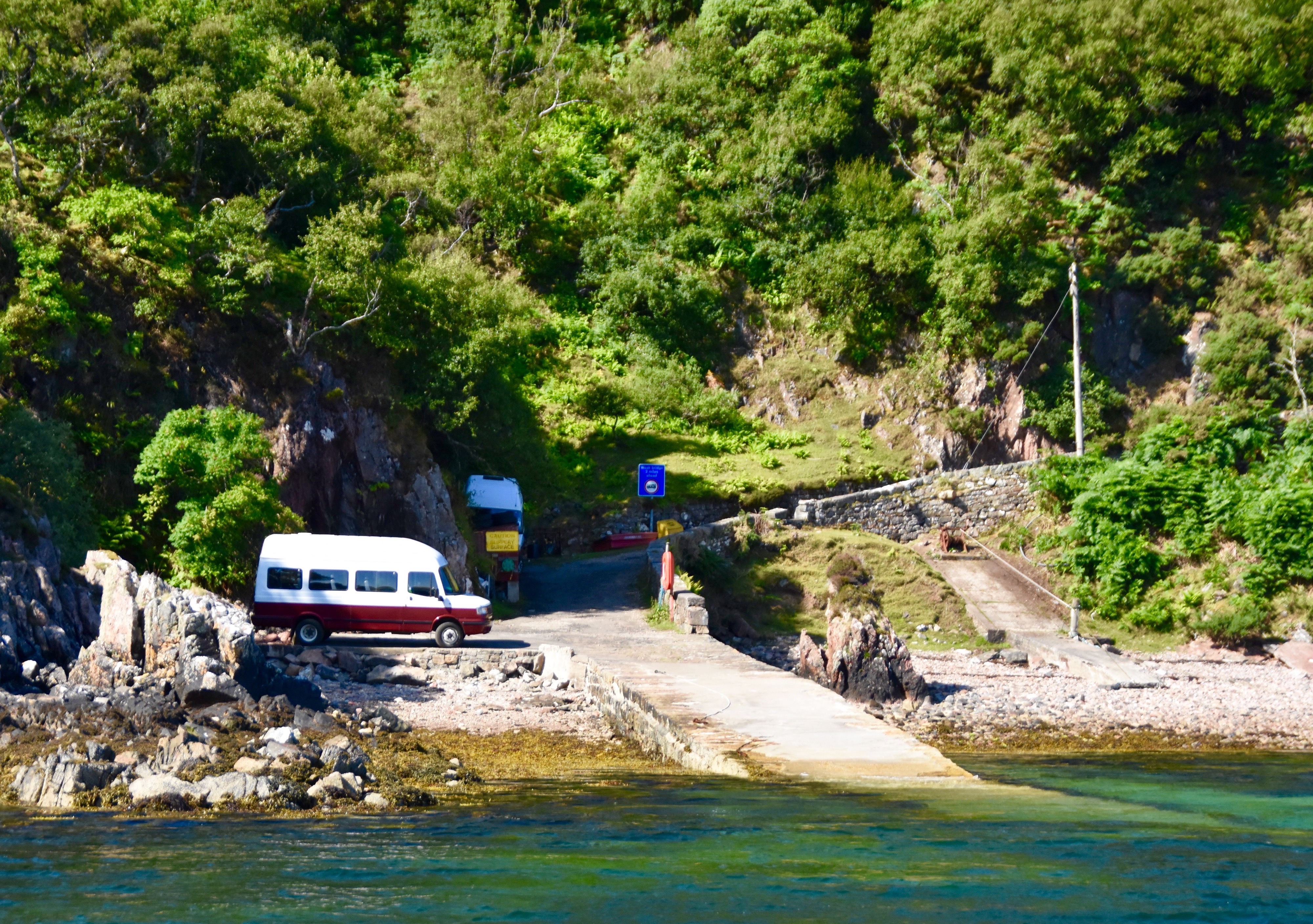
The bus will take up to 16 people which is more than the Beulah can handle so you might have to wait for a second ferry crossing, but it’s only about fifteen minutes. On the day we went, despite it being the height of tourist season and an absolutely gorgeous day, there were only about ten people on the trip.
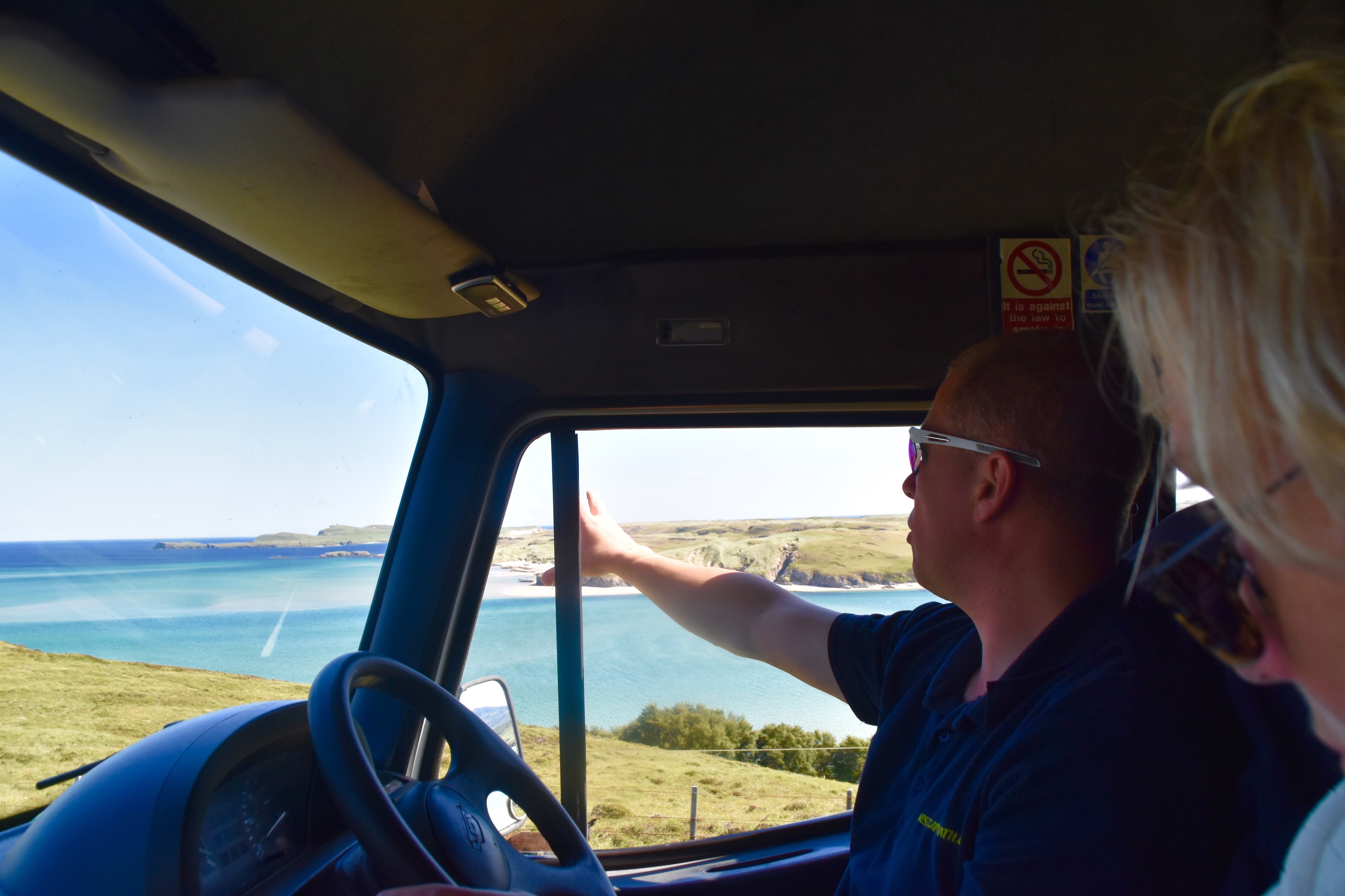
This was our driver and guide, Derrick who really seemed to enjoy his job and was constantly pointing things out that we otherwise would never have noticed. As you can see the skies were blue and the temperature way above normal with Derrick wearing short sleeves. What you can’t see is that the winds were virtually non-existent in a place where they are known to howl in gale force proportions for much of the time. As an aside, Cape Wrath is not named for the English word wrath which would seem to make sense given the remoteness and ferocity of the weather, but rather the Norse word hvarf which means turning point. The Vikings believed that once they rounded Cape Wrath it was the turning point for better sailing going south and vice versa going north.
Cape Wrath – What You’ll See
It’s 11 miles (18 kms.) from the starting point to the lighthouse, but it’s on a very narrow and rugged road so Derrick never got above 15 mph. However, it didn’t feel like we were going really slow as there was so much to see and photograph along the way. All told it took about 90 minutes to go those 11 miles.
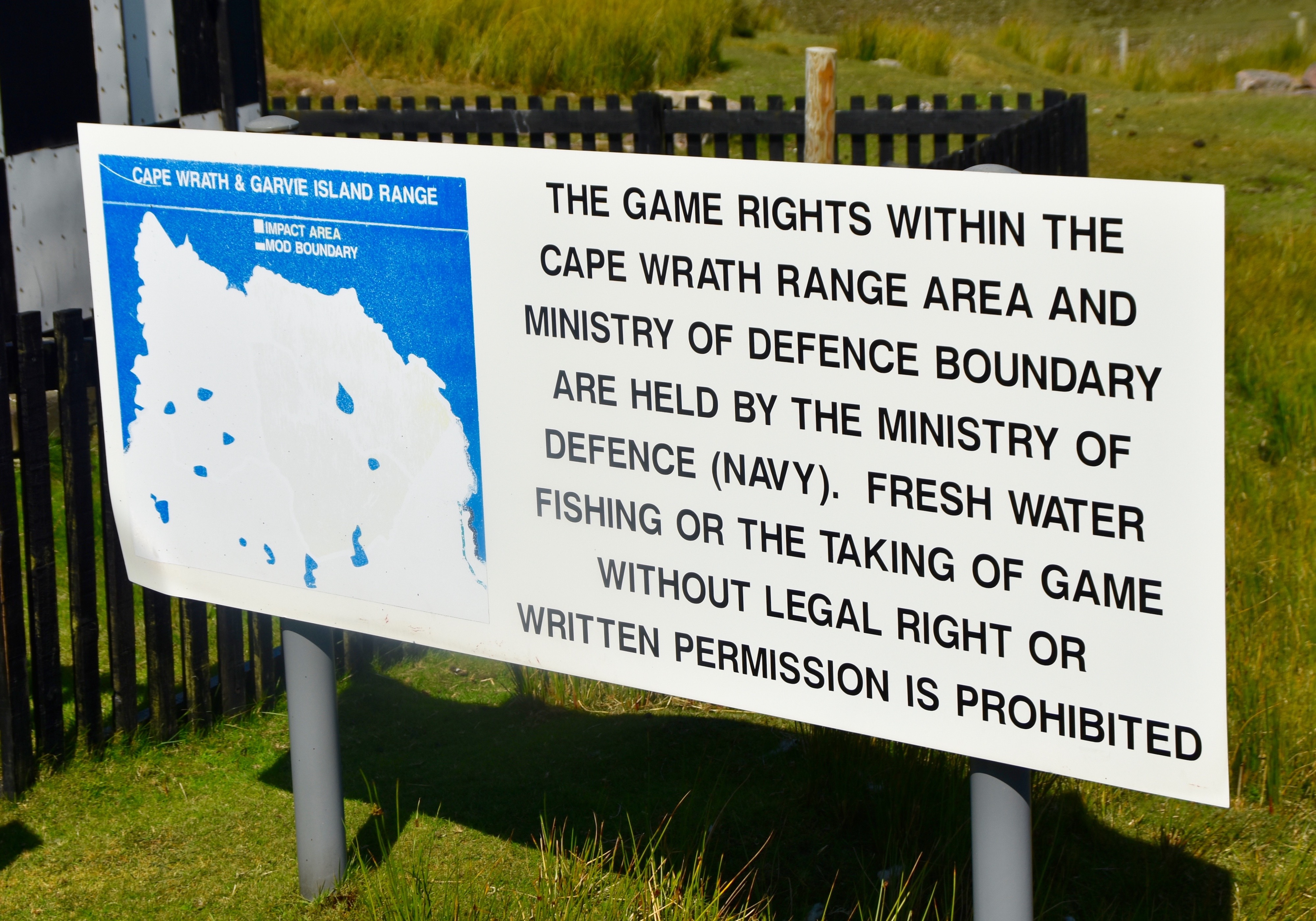
Almost all of the land between the starting point and Cape Wrath is owned by the Ministry of Defence who still occasionally use nearby Garvie Island as an artillery and missile target. That’s another reason to check in with the minibus company ahead of time to find out if the road to the lighthouse is closed. Otherwise you might only get as far as this sign.
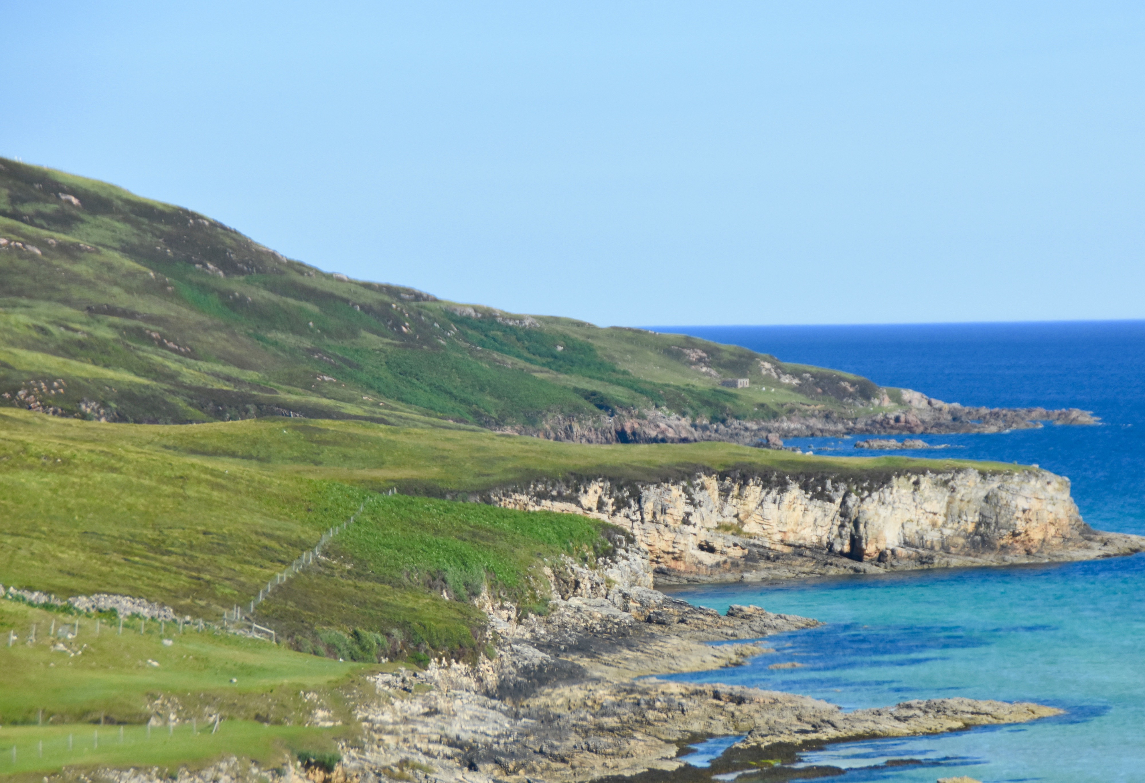
This is a view of the coastline of the south side of the Kyle of Durness as you head up to higher ground and away from the coast.
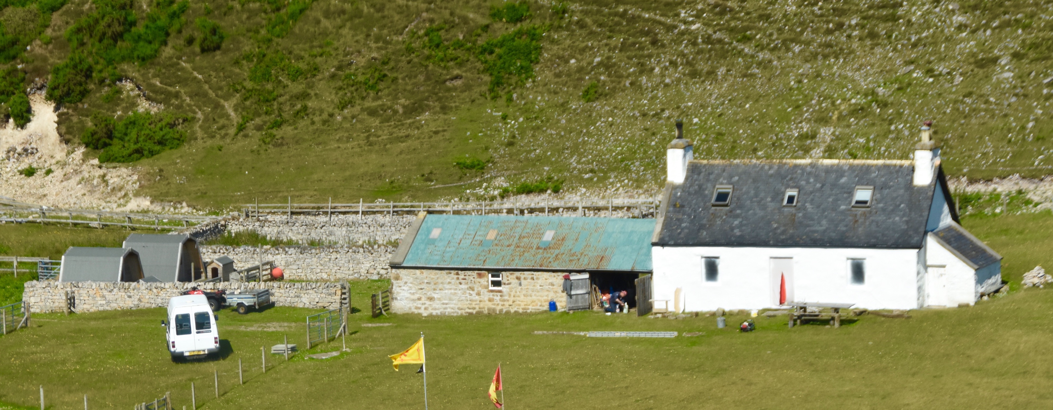
If perchance you wish to stay overnight in the Cape Wrath area this is the only place you can stay.
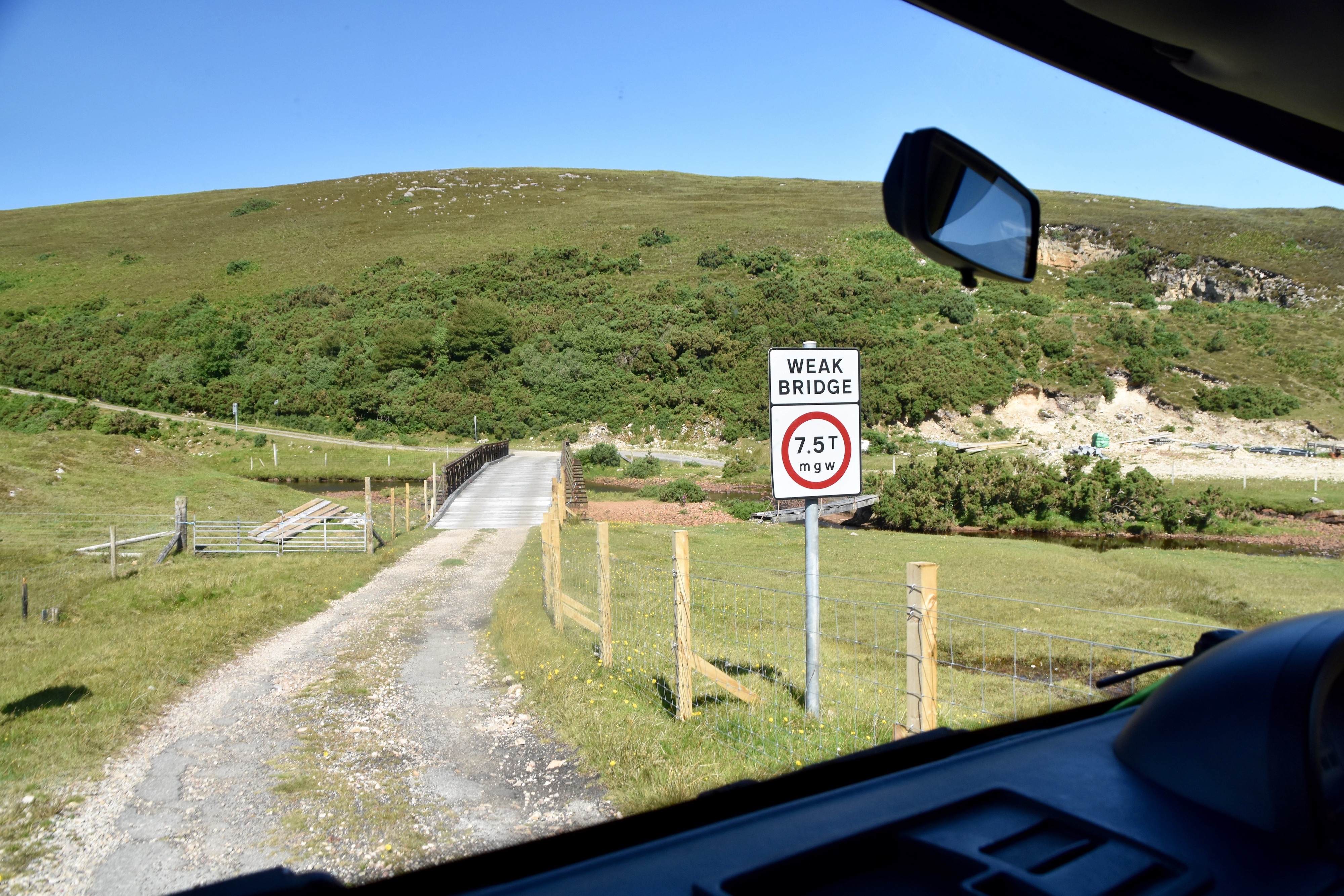
The only possible danger on the way to Cape Wrath is this wooden bridge which has held up so far.
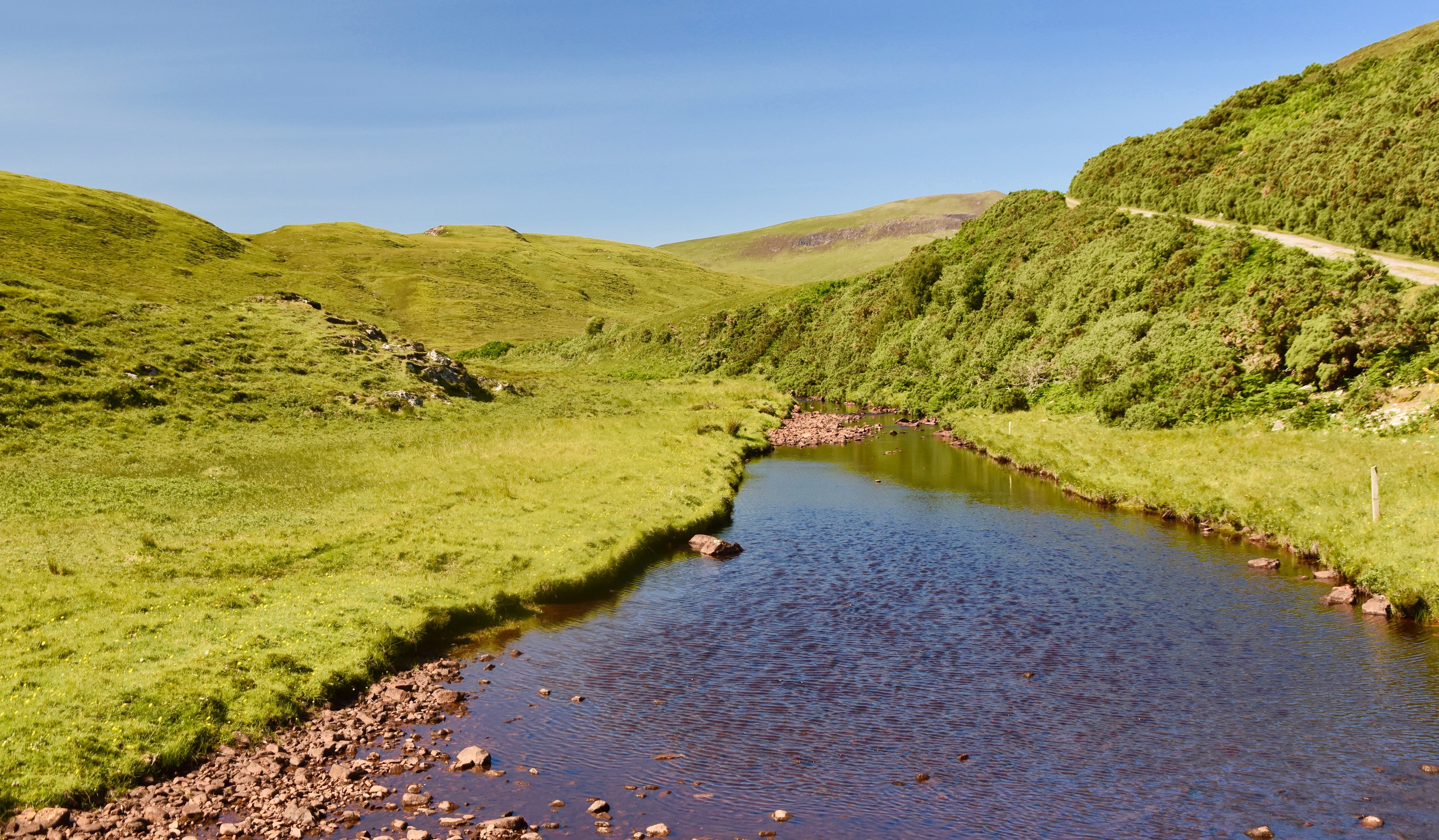
This is a photo taken from the weal bridge showing the grass and gorse that is typical of most of the Cape Wrath area.
After crossing the bridge the road climbs to a high plateau which is the area that Derrick said the British Armed Forces used to practice for the invasion of the Falkland Islands because the terrain was so similar. I’ve never been to the Falklands, but if you have see how it compares to this video.
Shortly after this you come to the longest straight stretch on the road to Cape Wrath which locals call The Autobahn. Derrick really let her rip as you can see from this video.
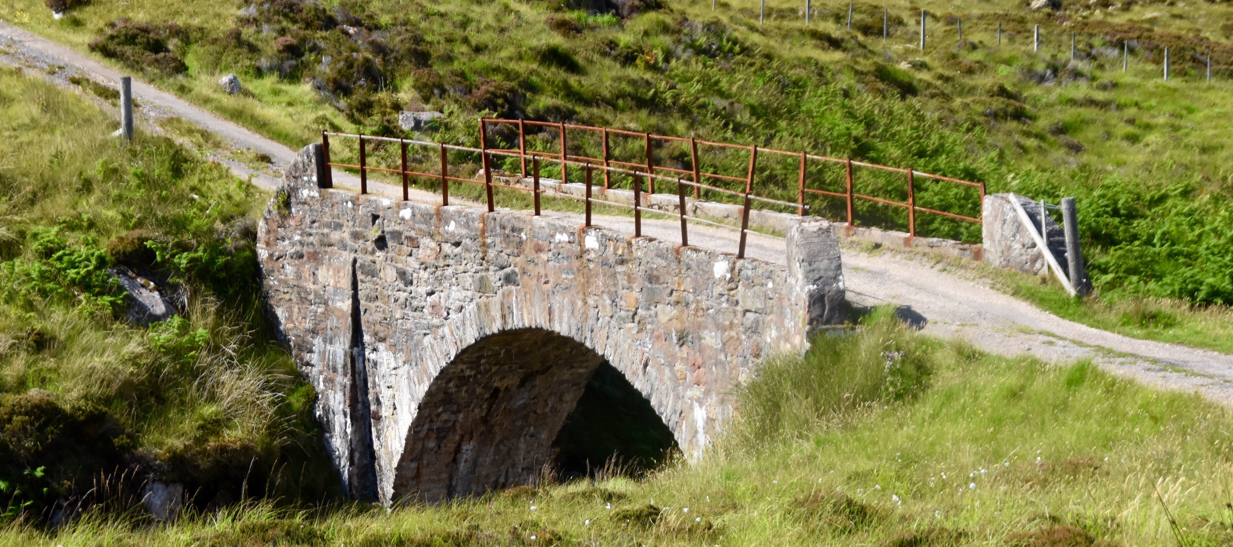
Back to twists and turns you come to a much sturdier bridge built in the style of the ones constructed by British General George Wade after the First Jacobite Rebellion in 1715. This is not a Wade bridge, but rather one probably built by Robert Stevenson when he was commissioned to build the lighthouse at Cape Wrath which is not far away now.
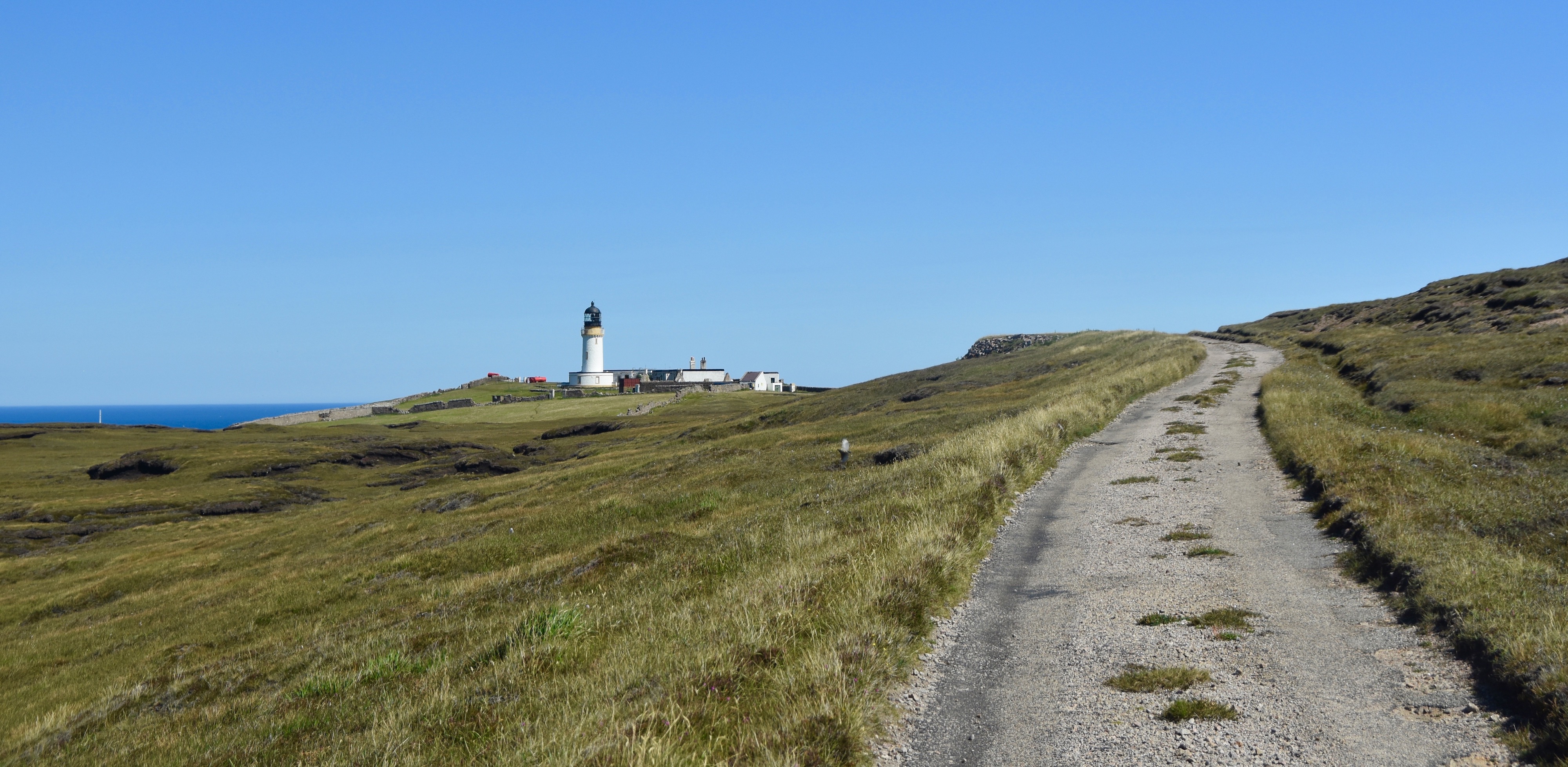
This is the view as you approach the Cape Wrath lighthouse and the end point of the drive.
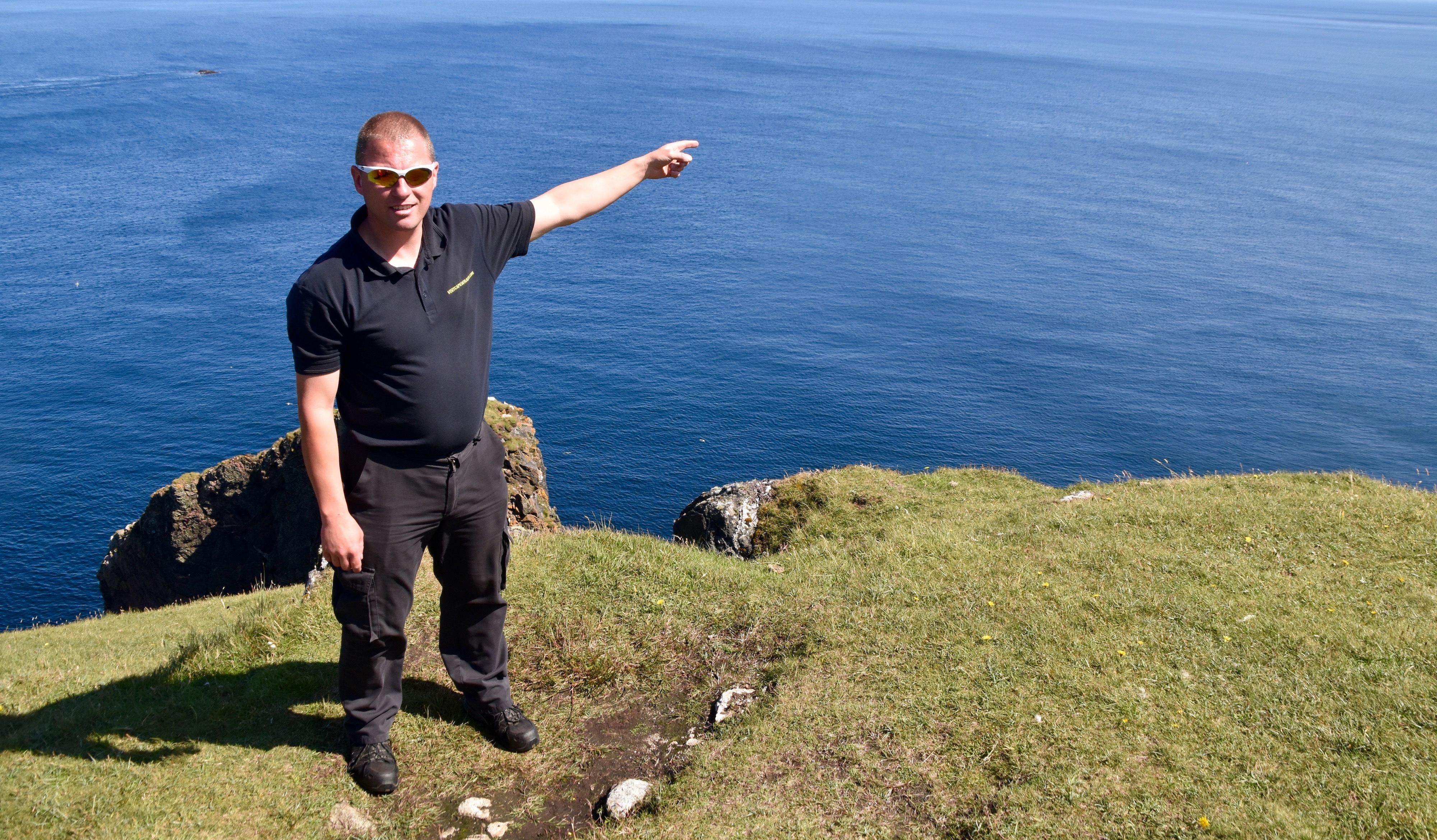
After parking the minibus Derrick escorted us to the edge of the cliffs to point out a number of landmarks. One step backward and he’d fall hundreds of feet. It gave me the willies just watching him.
That’s Garvie Island and the Cliffs of Clo Mor.
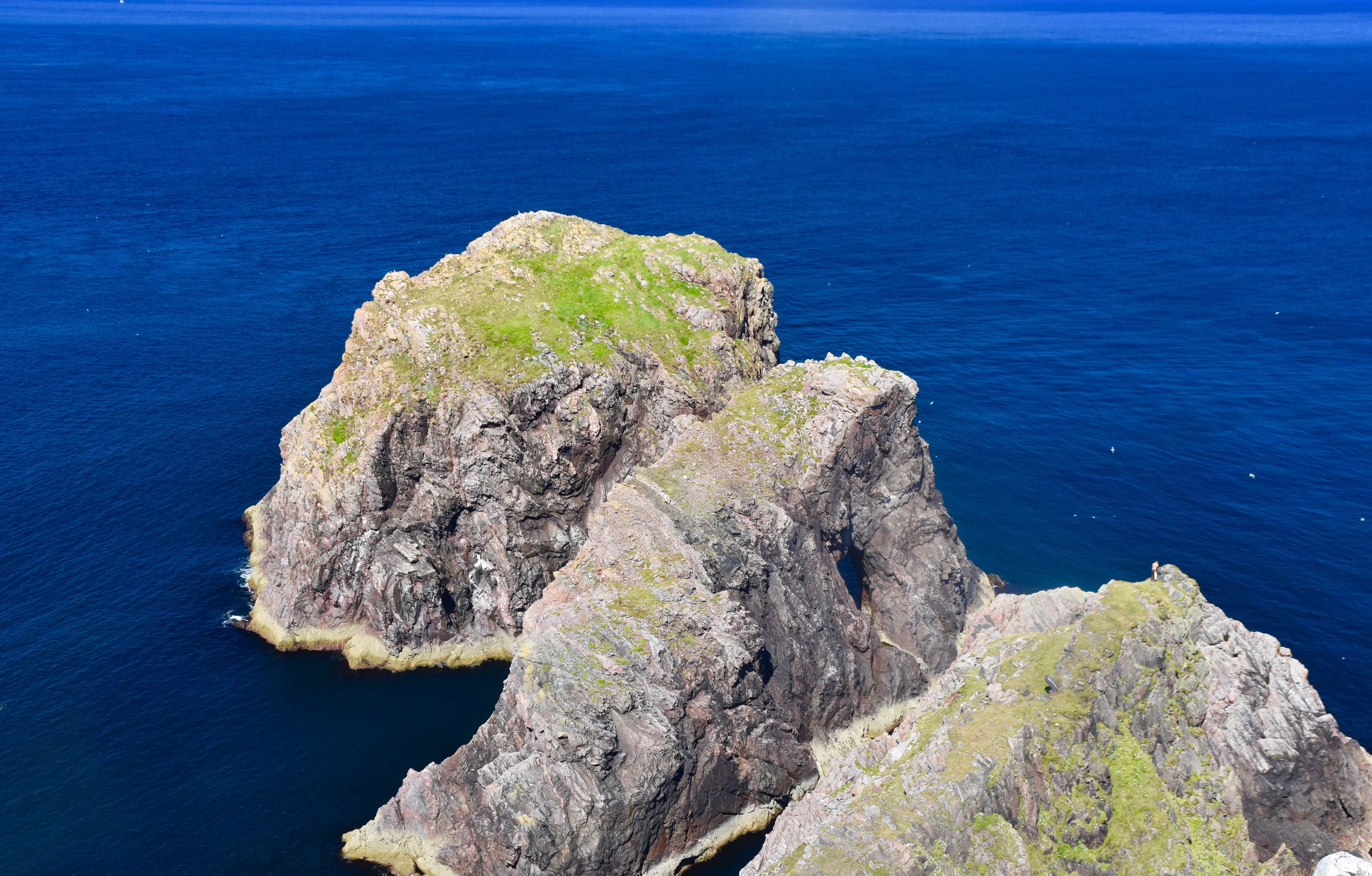
These are three small stacks that are the home to breeding puffins, murres, guillemots, fulmars and kittiwakes. If you look closely on the right side of the closest stack you can see a climber on top.
After surveying the beautiful Scottish coastline we turned our attention to the lighthouse. Unlike many lighthouses around the world today, this one is in very good shape and still very much operational, albeit by automation and not a real lighthouse keeper. It was built way back in 1828 by famed lighthouse builder Robert Stevenson who was responsible for some of the most notable lighthouses in the world including Bell Rock and the one at Turnberry now owned by the President of the United States.
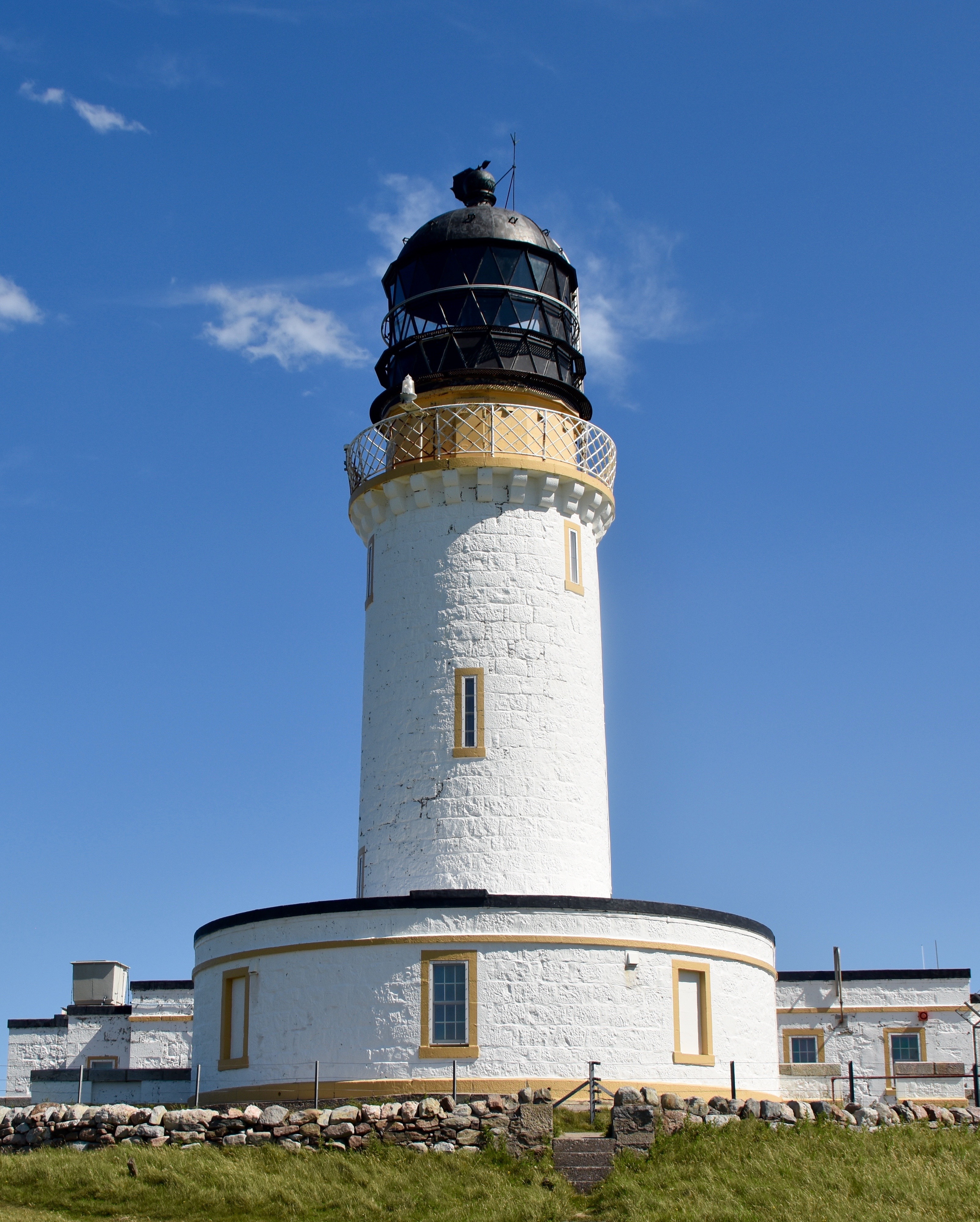
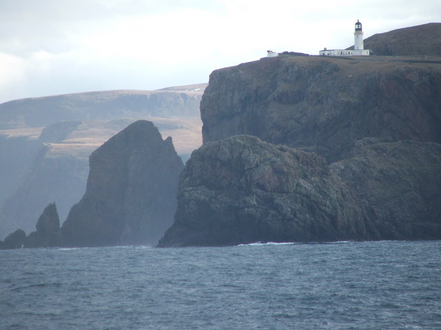
By lighthouse standards it’s not that tall, only 66 feet (20 metres), but it doesn’t need to be as it sits high on the tip of Cape Wrath and its beam is visible for a very long distance. It stand 400 feet (122 metres) above the ocean below. This is what it looks like from the water.
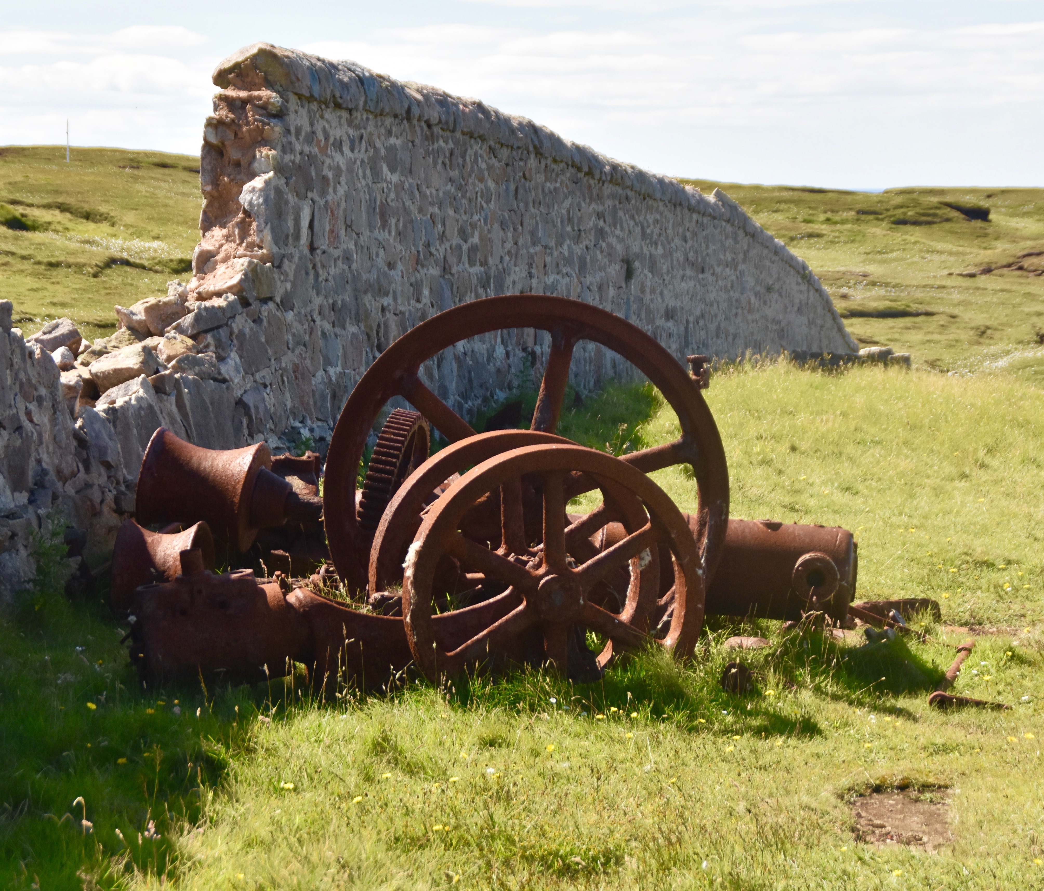
Surrounding some areas of the lighthouse are the detritus of former military and insurance endeavours. Lloyd’s of London maintained a signalling station at Cape Wrath for a short period of time from the late 1800’s until 1903.
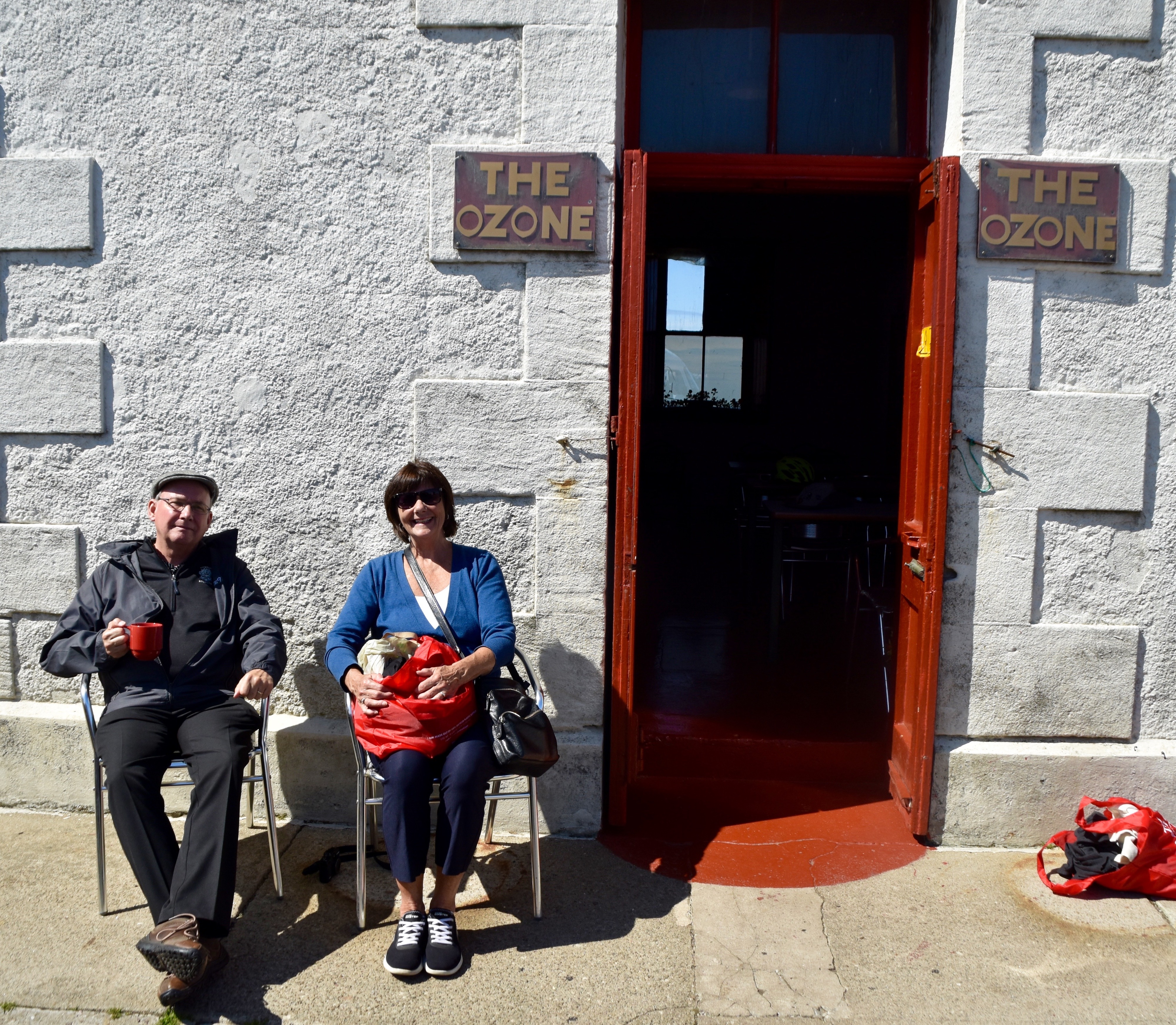
Although you cannot access the lighthouse per se you can drop in to the most remote cafe in Britain, The Ozone which is in its base. You can have a spot of tea like our friends Rob and Janet Purdy.
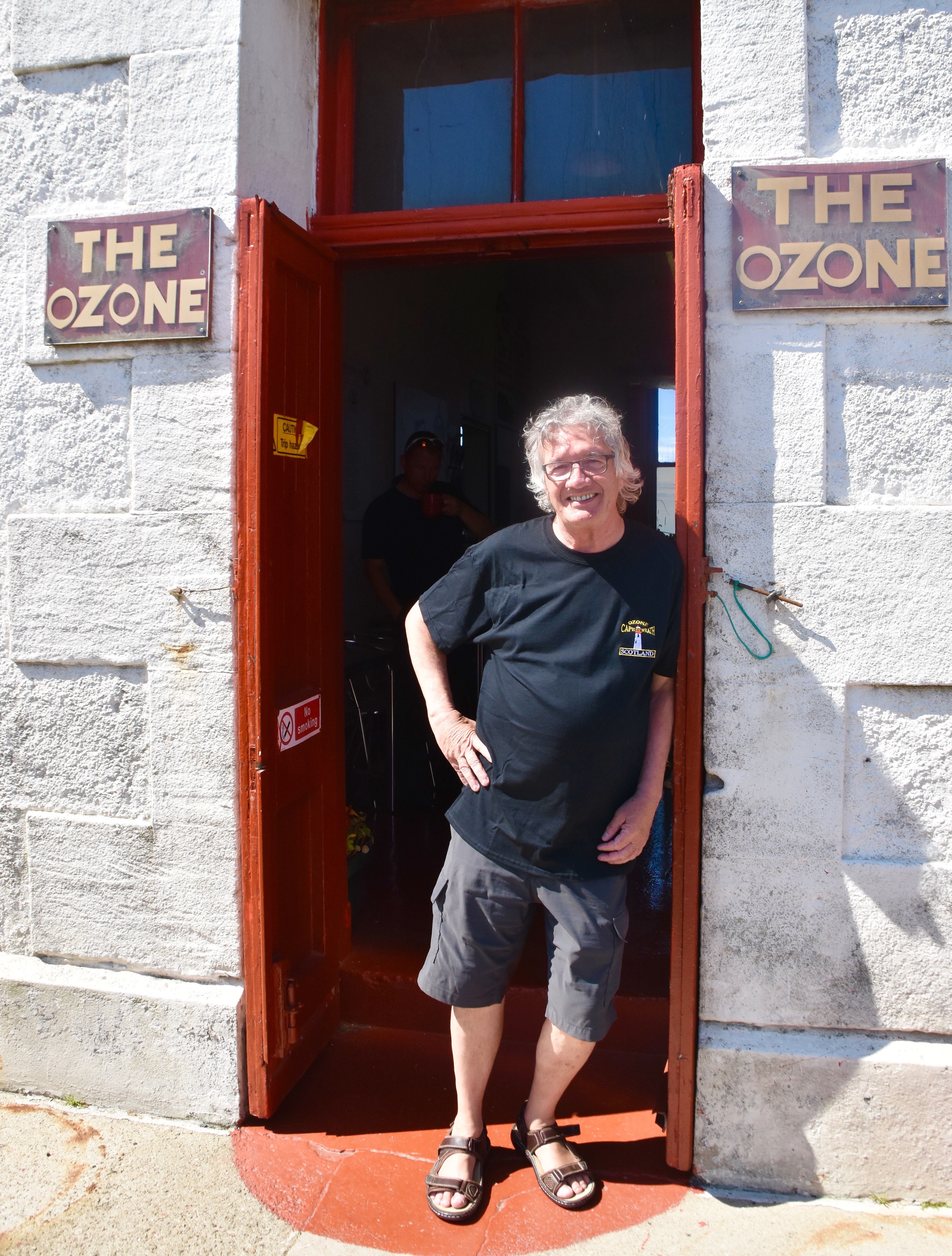
Or you can buy the t-shirt (and a beer) like I did.
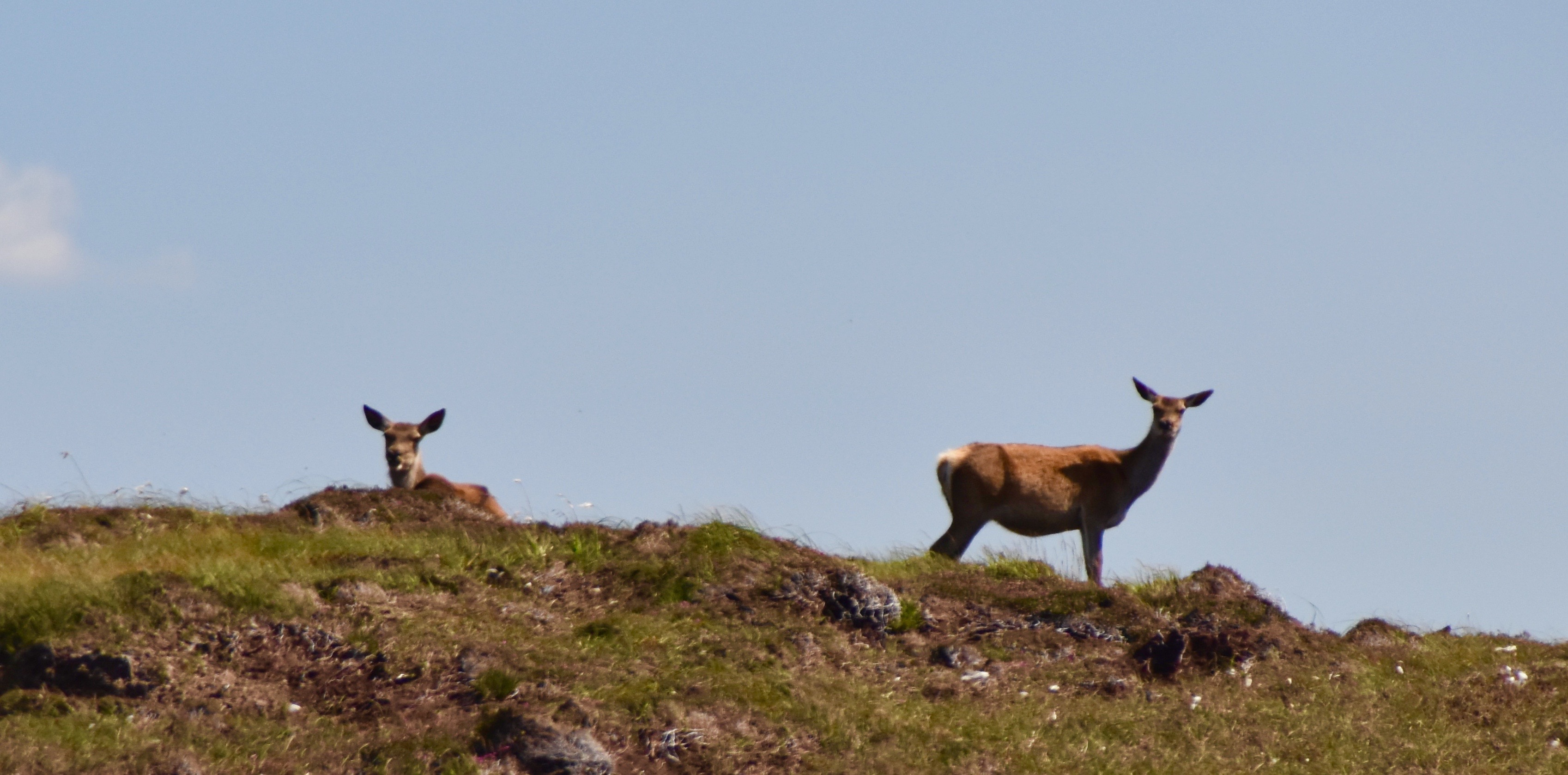
All too soon given what a beautiful day it was at Cape Wrath, Derrick was herding us back to the minibus. The ride on the way back presented completely different views than on the way out including some interesting wildlife like these curious highland deer.
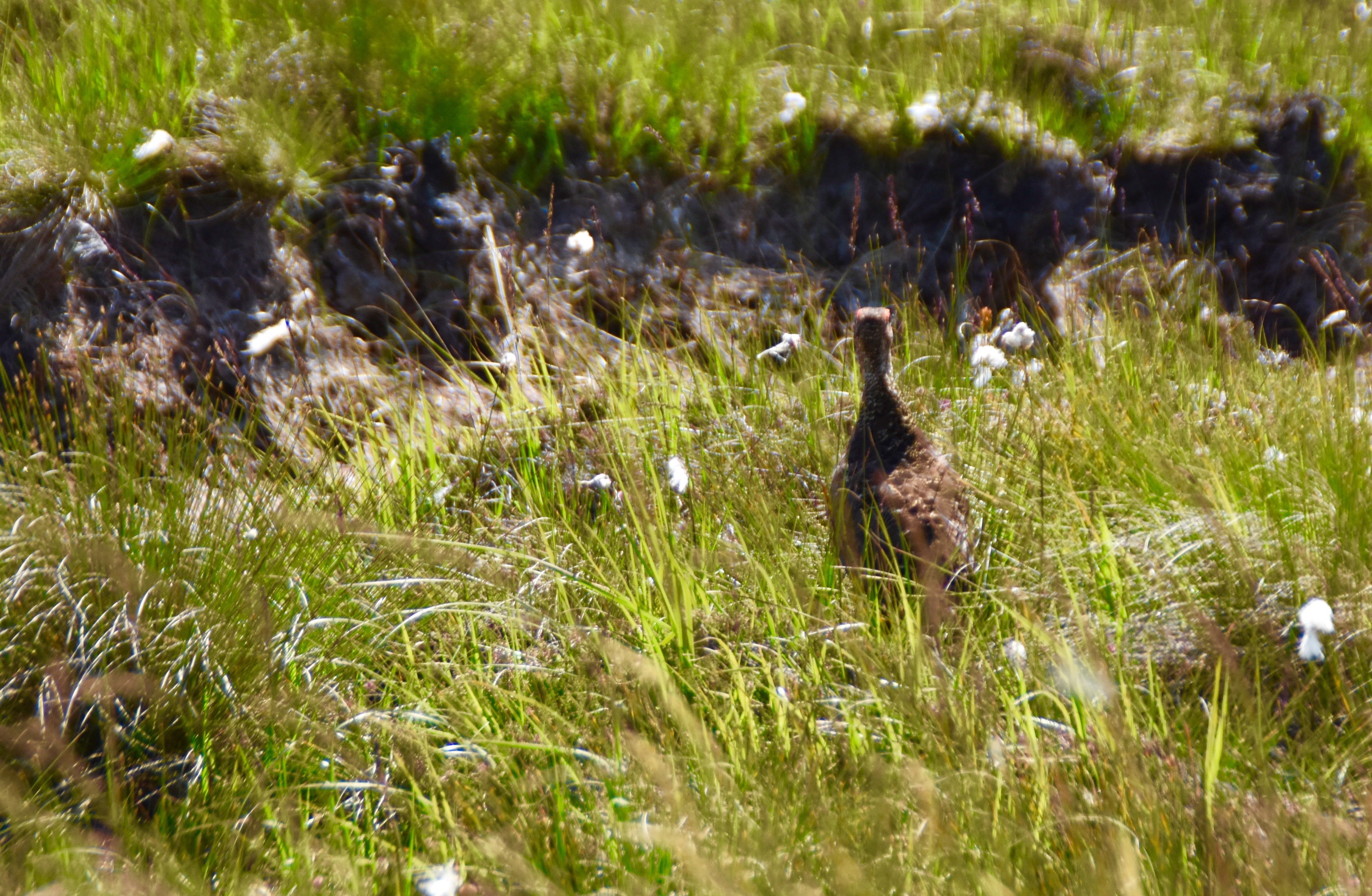
And a bevy of highland grouse which were fleeing on foot from a patrolling falcon. As long as they didn’t fly they were safe, but that wouldn’t help them if one of Cape Wrath’s huge golden eagles was in the area.
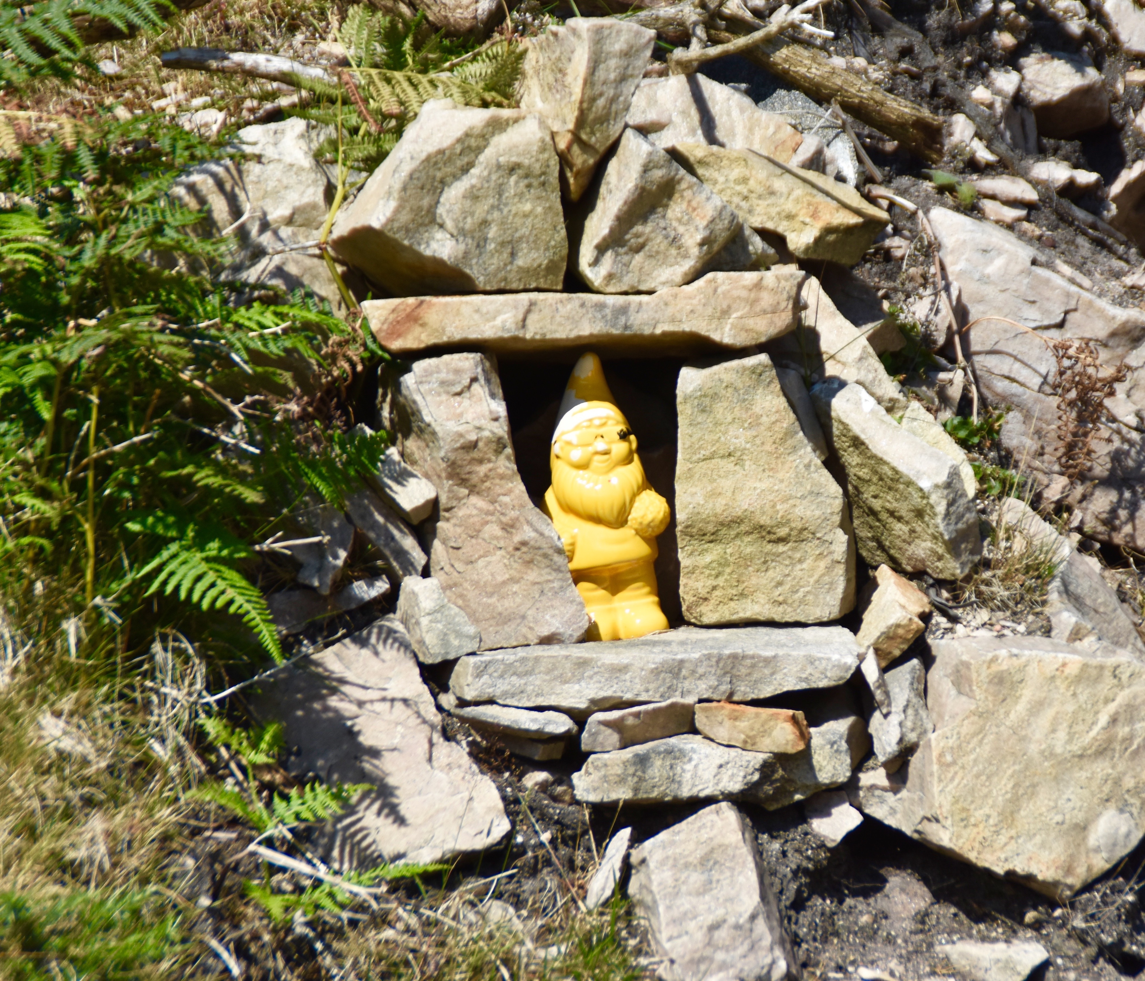
There were other forms of wildlife that were harder to spot, like this gnome that I wouldn’t have noticed had Derrick not pointed him out. These guys show up everywhere these days.
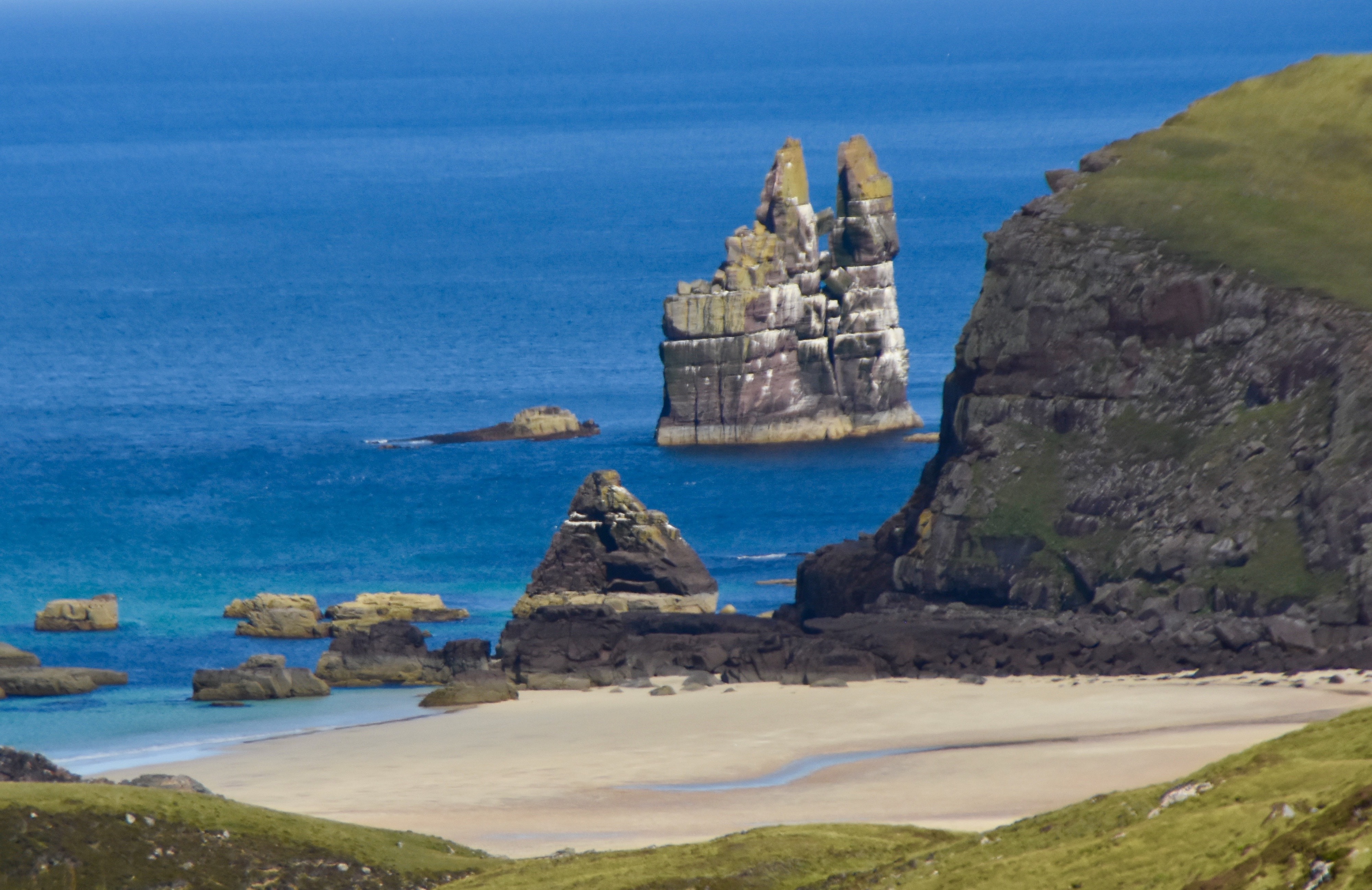
Taking in the bigger picture was even more interesting, these sea stacks and this beach being a good example.
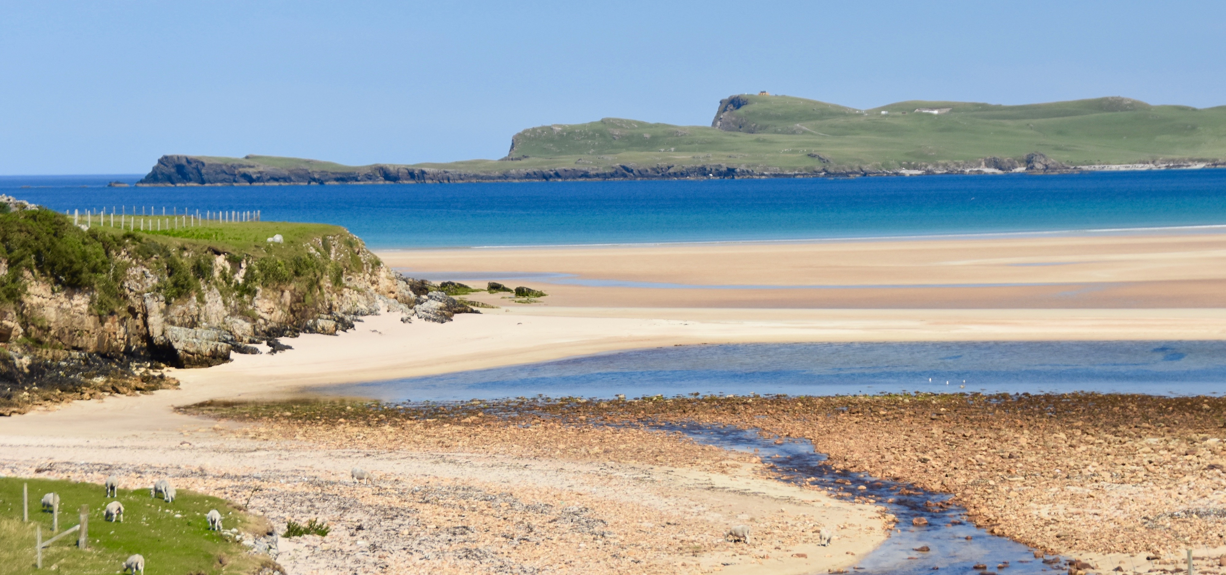
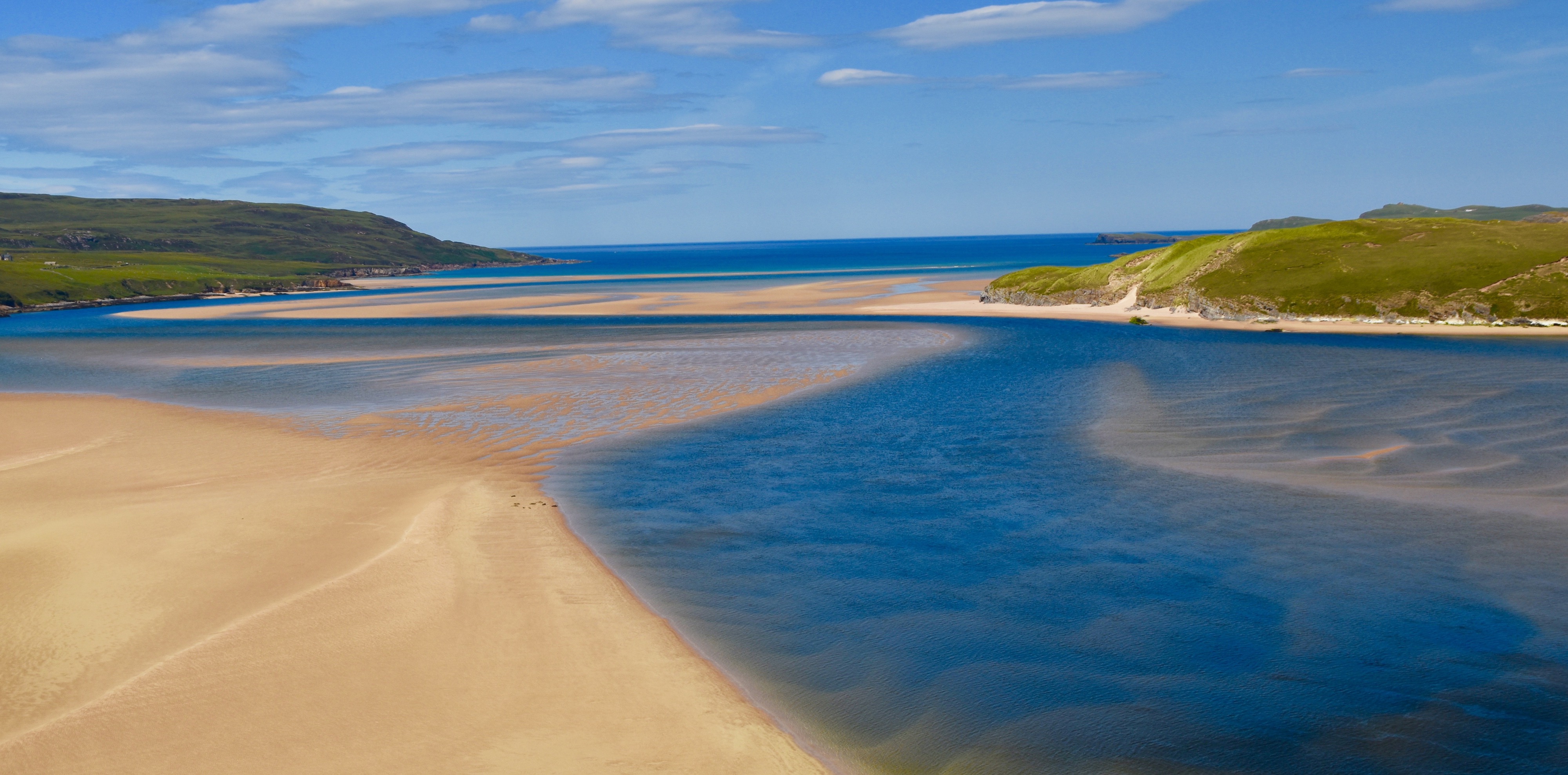
As you come down from the high plateau and the Kyle of Durness comes back into view the views are simply fantastic. By now the tide had receded and this is what we saw.
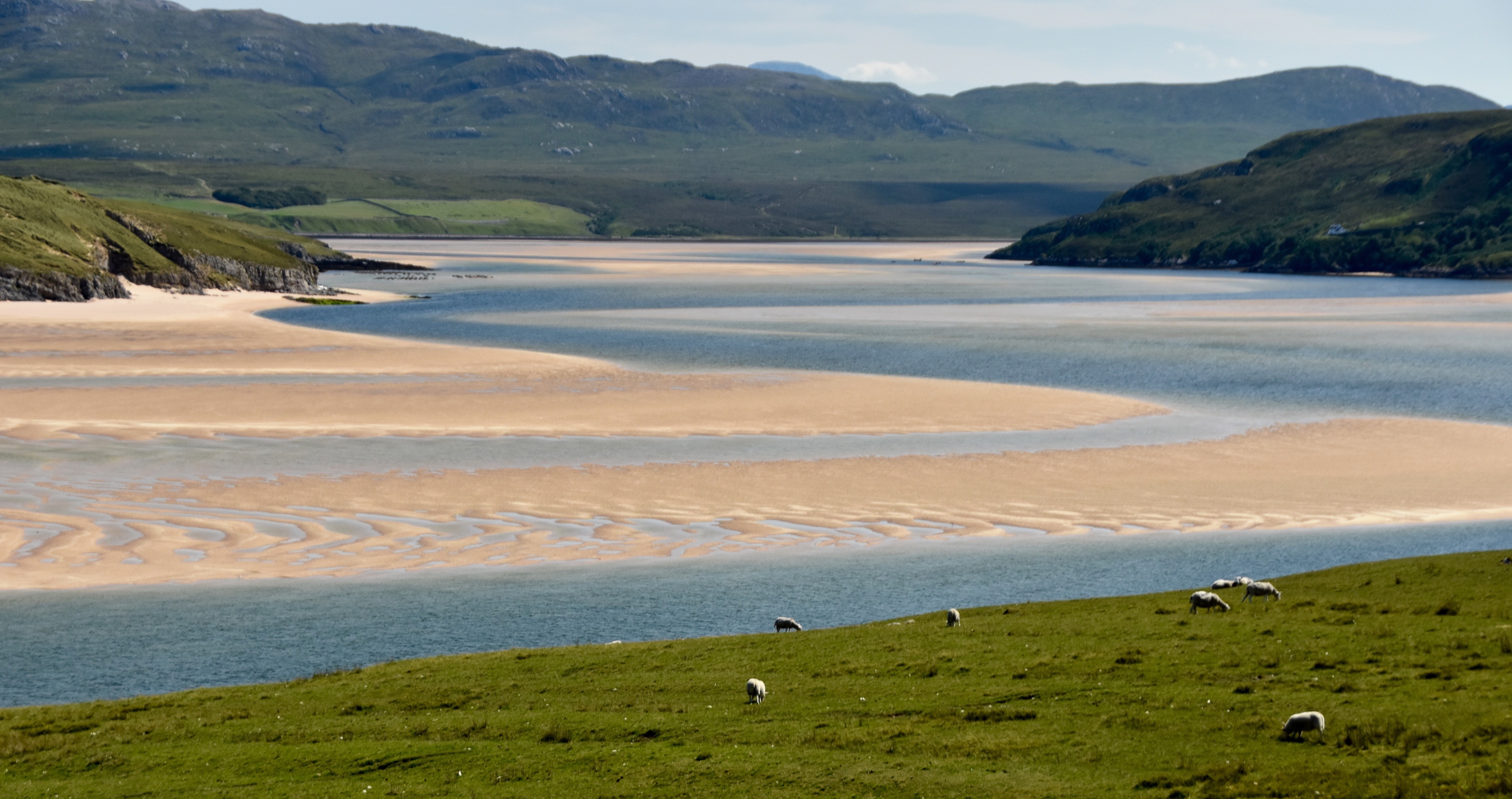
I think this pastoral scene of grazing sheep with the loch and the highlands in the background is one of the nicest I’ve seen anywhere in my travels.
Finally, this was the view just before getting back to the jetty and the Beulah. Pretty damn nice.
I hope you’ve enjoyed this trip to Cape Wrath and will put it on your agenda while touring the North Coast 500. I guarantee the scenery will be out of this world. I wish I could guarantee the weather as well.
Next we’ll visit the seabird colonies of Handa Island and I’ll explain why it has a close connection with my home province of Nova Scotia.