Hueco Tanks S.P. – Great El Paso Day Trip

We had just wrapped up a great SATW conference in the west Texas city of El Paso that I wrote about in this post and the plan was to do some exploring in the immediate area before moving on to Guadalupe Mountains National Park and then New Mexico. A little online research quickly revealed that Hueco Tanks State Park & Historic Site was the best suited for a day trip that would involve a combination of interesting Indigenous history and some decent hiking. It turned out to be a great choice. Here’s why.
What are the Hueco Tanks?
The first thing to know is the proper pronunciation of Hueco which is ‘way co’ and this of course brings to mind the Texas city of Waco, which was named for the Hueco tribe that inhabited parts of central Texas from the 1700’s onward. However, I can find no connection between the Hueco tribe and this area of west Texas, so the meaning comes from the Spanish word ‘hueco’ which simply means hollow, referring to a place that is a hollow in the ground and not one that is hollow inside. The word ‘tanks’ in this context does not refer to Shermans or Panzers, but rather natural collection places for water in an area where water is scarce. The tanks at Hueco Tanks S.P. are all contained within a syenite pluton which is a geological rock intrusion that bulges out from the earth like a big blister. Some famous plutons include Mount Denali in Alaska and more similar to Hueco tanks, Stone Mountain in Georgia.
Rainwater trickles into the tanks where it can remain unevaporated for great periods of time and provide a vital resource for people and other living things. Not surprisingly, like Saharan oases, the Hueco tanks have been visited by people in search of water for over 10,000 years starting with the Folsom culture who were primarily hunters following the herds of the now extinct Ice Age bison. They were followed by one group after another as the climate grew drier and hotter and the type of game available to hunt became smaller and reliance on a plant based diet more and more necessary. Around 1000, agriculture was introduced to the area by the Mogollon culture who were the same people who created the Gila Cliff Dwellings of New Mexico. They in turn were followed by modern Indigenous tribes like the Apaches who migrated down from Canada, the Kiowas and the Comanches. Throw in a dose of Spanish, Mexican and American frontier history and you have a site that is an archaeological road map of the southwest almost unrivalled anywhere else in the United States.
The Rock Pictographs
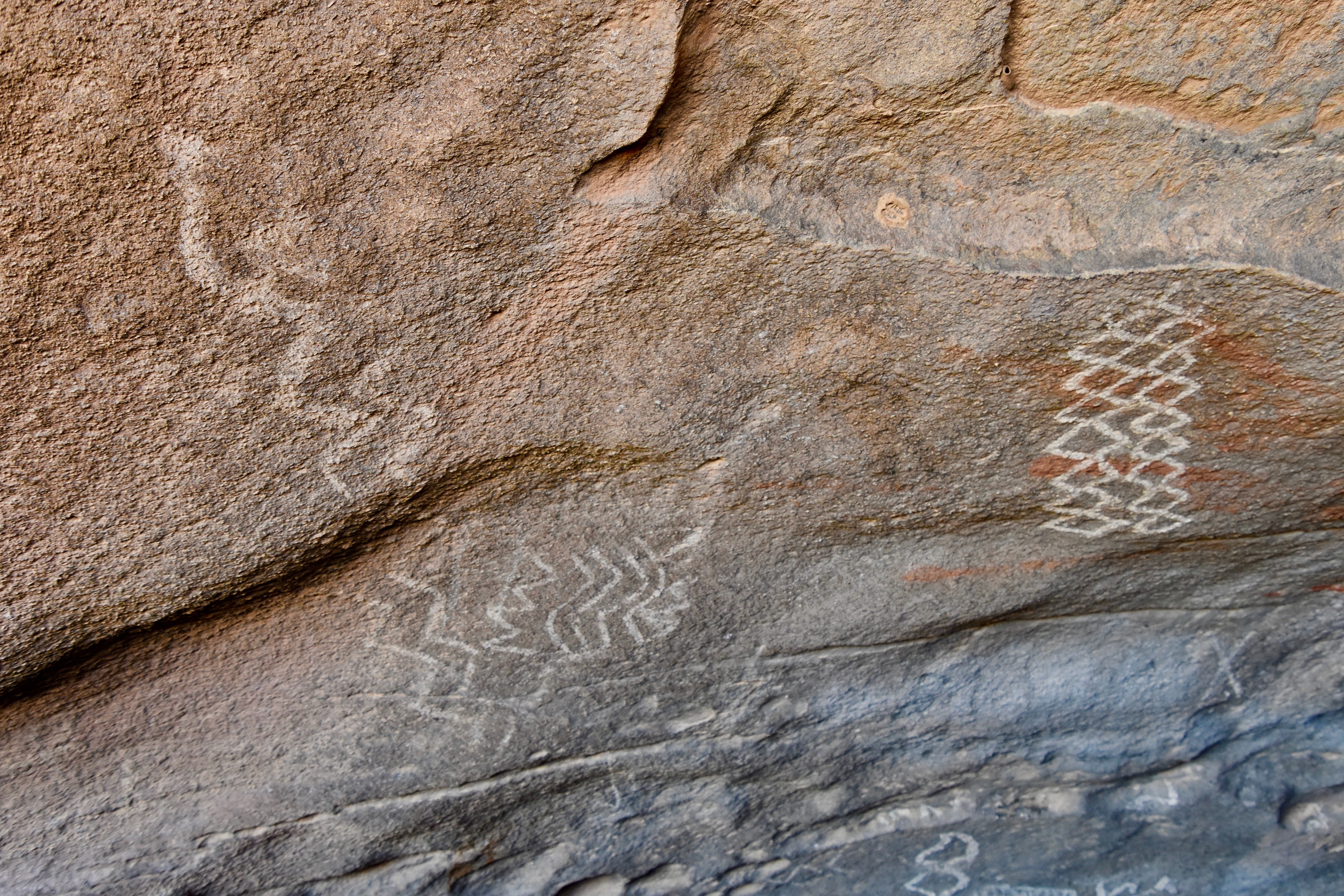
The many cultures who have inhabited or passed through the Hueco Tanks over many thousands of years have left indelible marks of their presence in the hundreds of pictographs found throughout the park. Ranging in age from 6,000 B.C. to as recently as a couple of hundred years they contain geometric designs, more realistic depictions of hunters and game and what I found most interesting, depictions of the Meso-American rain god Tlaloc and the man-god Quetzalcoatl. These latter two are closely associated with the Aztecs of central Mexico and at first I was quite skeptical of the idea that they were worshipped this far north, but several sources have confirmed the veracity of these claims. Also, I recalled that the Aztecs did migrate into central Mexico from the north so the connections between that mighty nation destroyed by Cortéz and the state of Texas are legit.
Now during my visit I did not see any of these particular pictographs which is why I recommend taking a guided tour. However, I did get to see some without much difficulty. The photo above was taken a short distance from the Interpretive Center and was quite easy to access, although I did have to crawl under a ledge to look up at the pictographs.
Viewing the pictographs is probably what draws most people to the area as they represent something quite unique in the American southwest.
Visiting Hueco Tanks S.P.
Because of the unique nature of the Hueco Tanks area both geologically and historically, it is not a park you can simply pay an entry fee to get in and wander off on your own. In fact, over two-thirds of the area is strictly off limits to all but guided tours and these need to be booked well in advance. Unfortunately, I was not able to do this so Alison and I settled for Plan B which is what you can do if you are exploring on your own.
We visited Hueco Tanks in late October, in what is the low season, so we had no difficulty buying a one-day permit. Entry to the park is limited to 70 people a day, but on the day we hiked it there were only about a dozen others, if that many. Before being allowed to explore the area known as North Mountain on your own you are required to watch a video at the Interpretive Center which explains the history and geology of the area and the various do’s and don’t while visiting. The most obvious of these is not to touch or deface the pictographs and don’t tramp through the huecos . You wouldn’t think that would need to be stated, but every year some idiots do exactly that.
After the orientation we walked the short way up to the overhanging ledge where was saw the pictographs shown above.
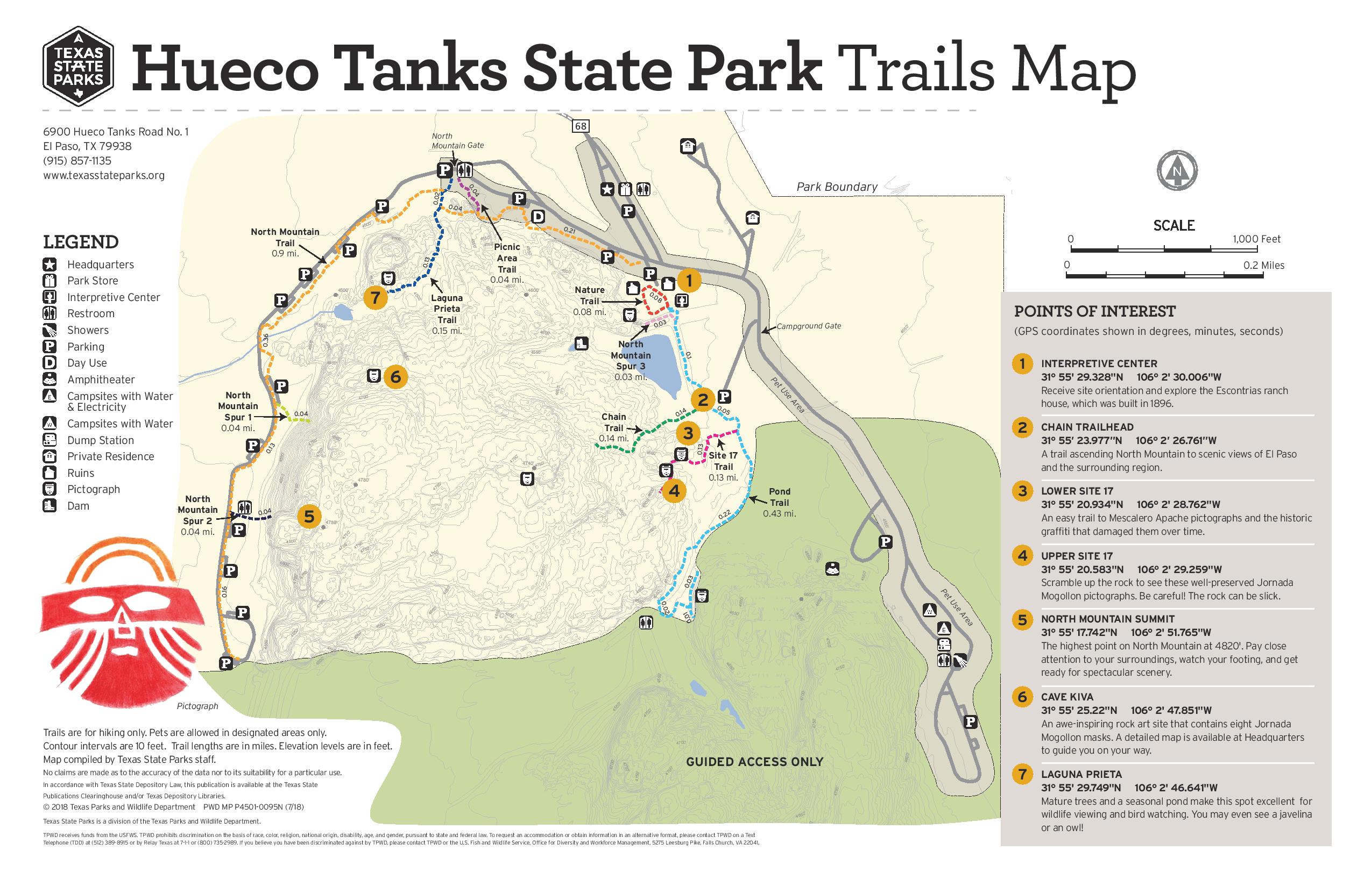
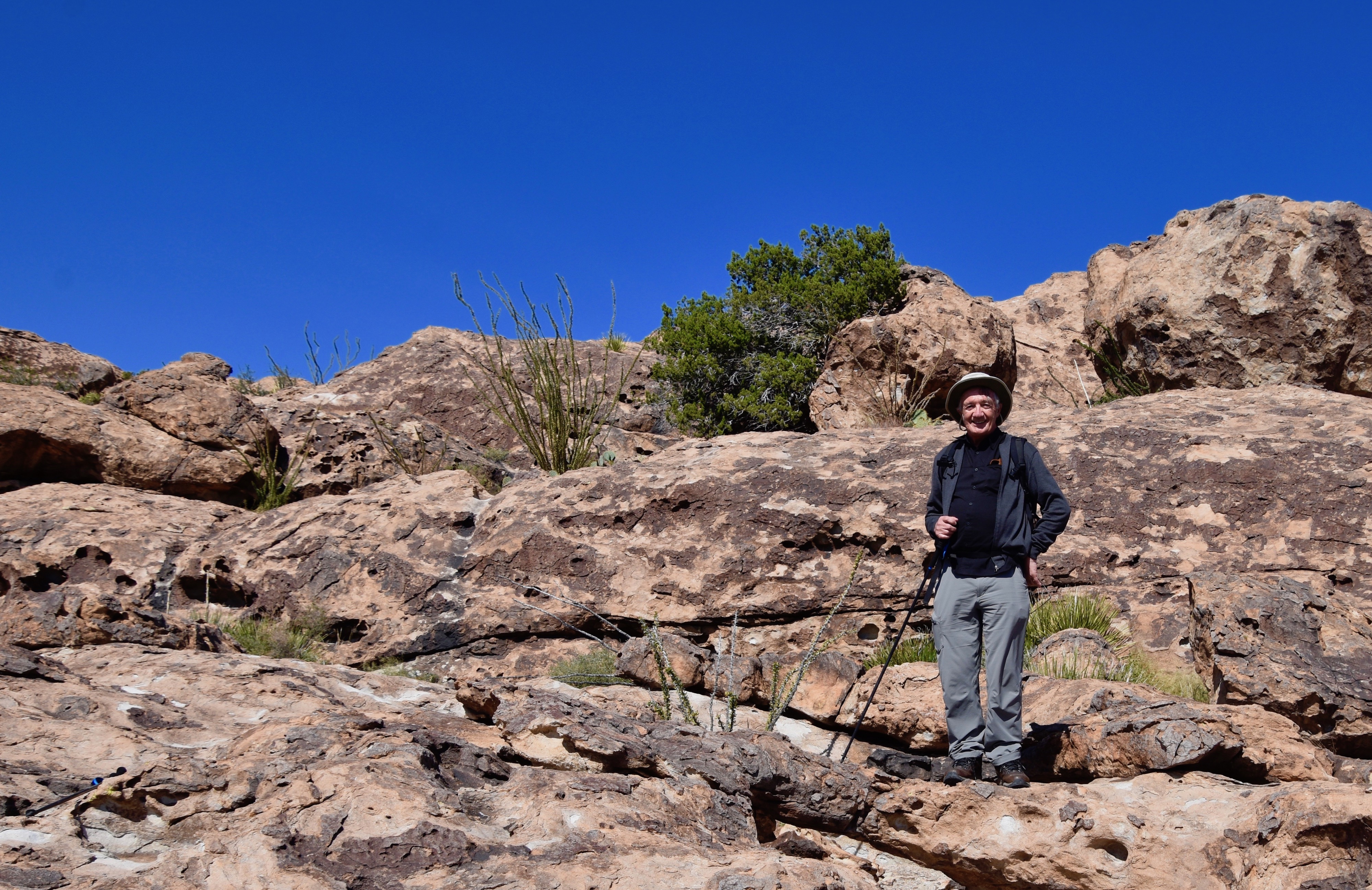
After returning to the Interpretive Center we then walked to the Chain Trailhead not far away. It’s called the Chain Trail because in places there is a chain that you hold onto to get your way to the top. If it sounds a bit daunting, it’s not if you are in reasonable shape, but you will be huffing and puffing by the time you get to the top.
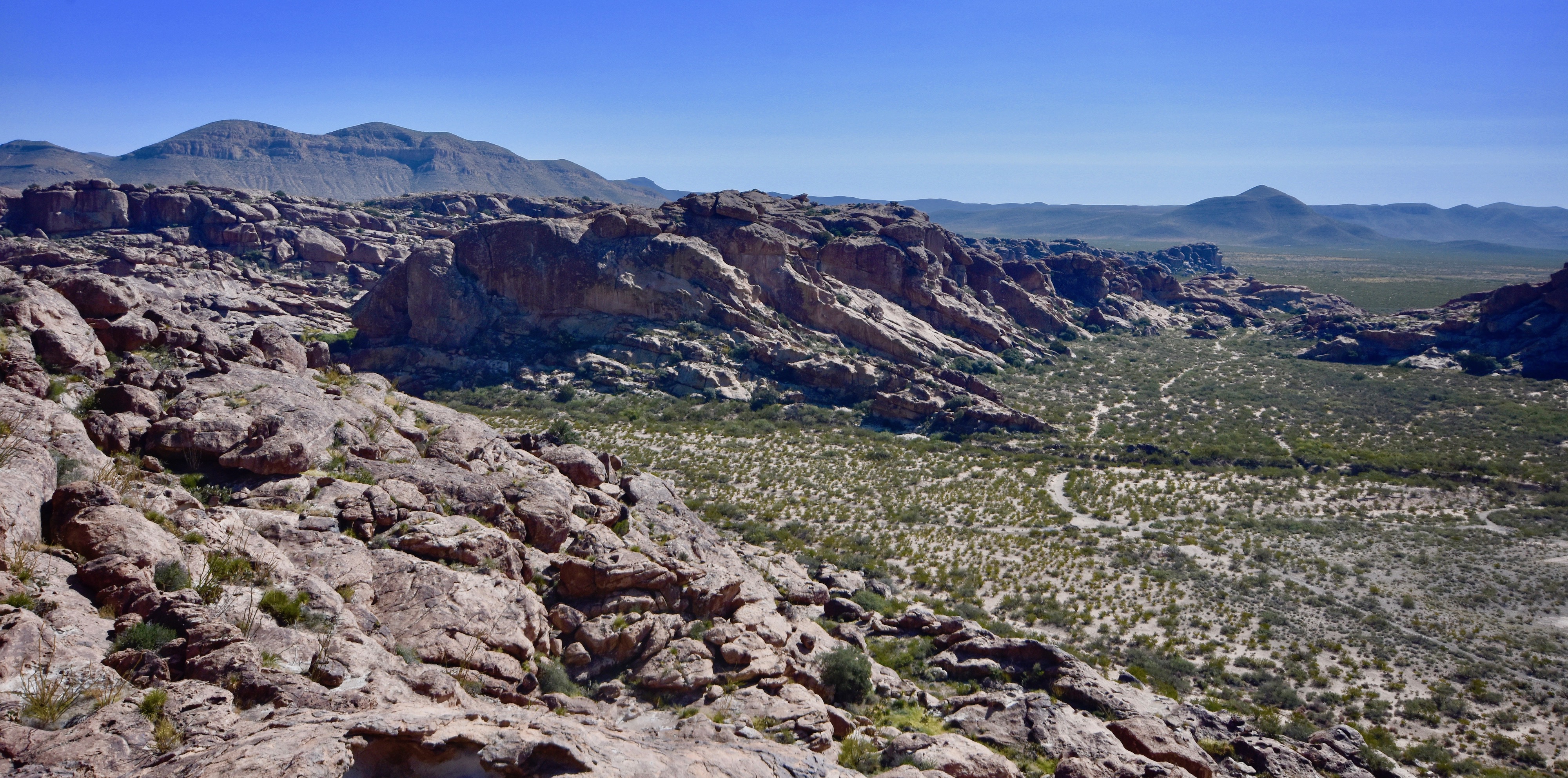
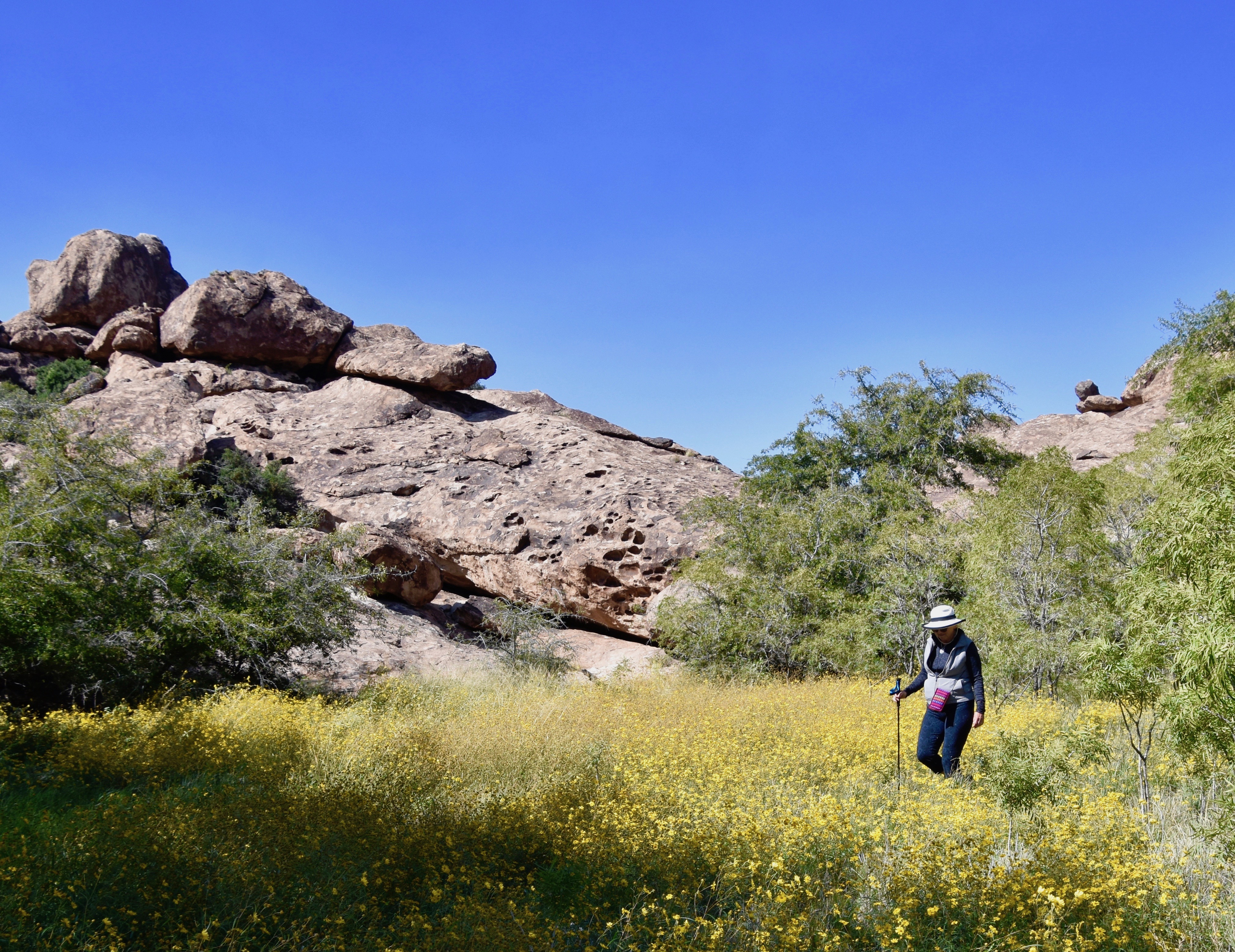
Once you get to the top or close to it, Hueco Tanks reveals its beauty in the form of the vegetation, the rock shapes and the incredible vistas from what is really one giant boulder. Here there are no distinct trail markings and you can pretty well wander where you want, but expect to do some serious rock scrambling in places. This is one of the reasons I recommend taking a guided tour, so you don’t end up retracing your steps as we had to on several occasions. At one point Alison, even suggested we might be lost, but I declined to entertain that notion. We just hadn’t found the way back yet was all.
What follows are some of the photos I took at Hueco Tanks on what turned out to be a really great if somewhat disoriented hike.
This is looking out over dry scrubland about 300 feet below.
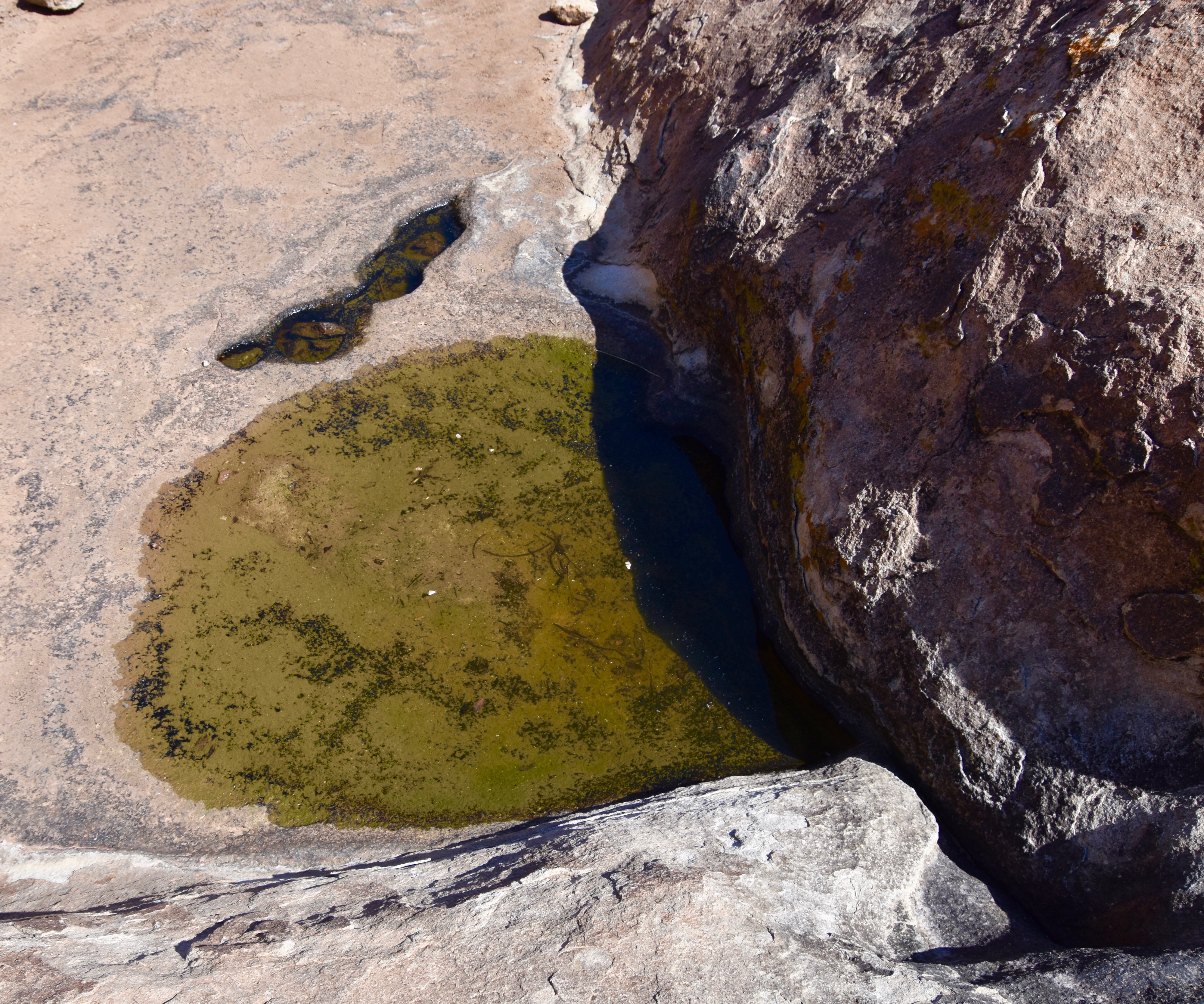
We found lots of huecos, most of them quite small, but with the exception of one that was protected by the shade from the side of a cliff, they were all dry.
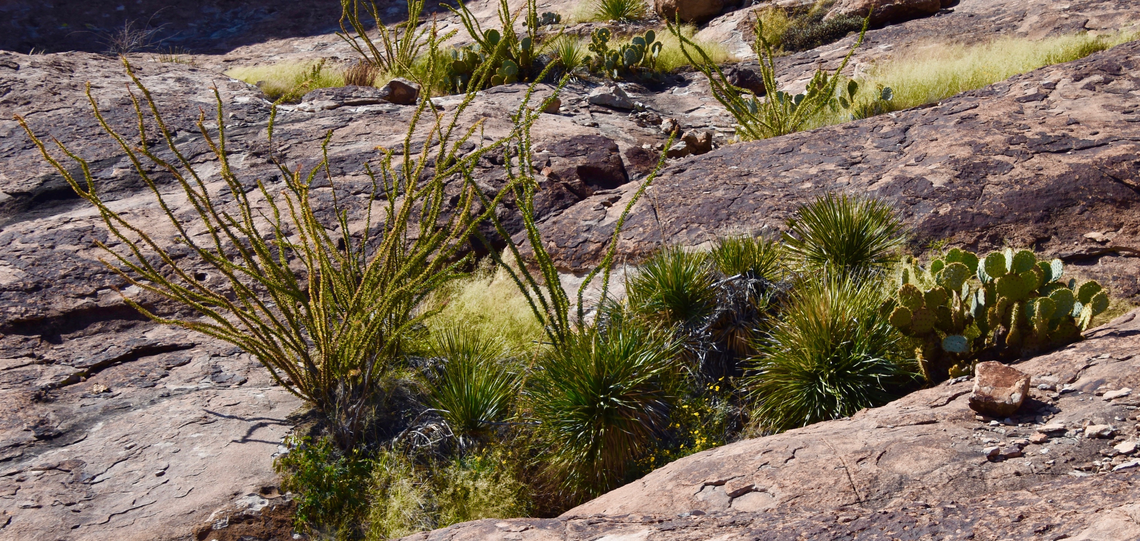
I mentioned the vegetation of the Huecos Tanks as being interesting and here’s an example. While Huecos Tanks is mostly bare rock, in places where there is even a hint of soil, plant life abounds like this ocotillo, prickly pear and yucca combination.
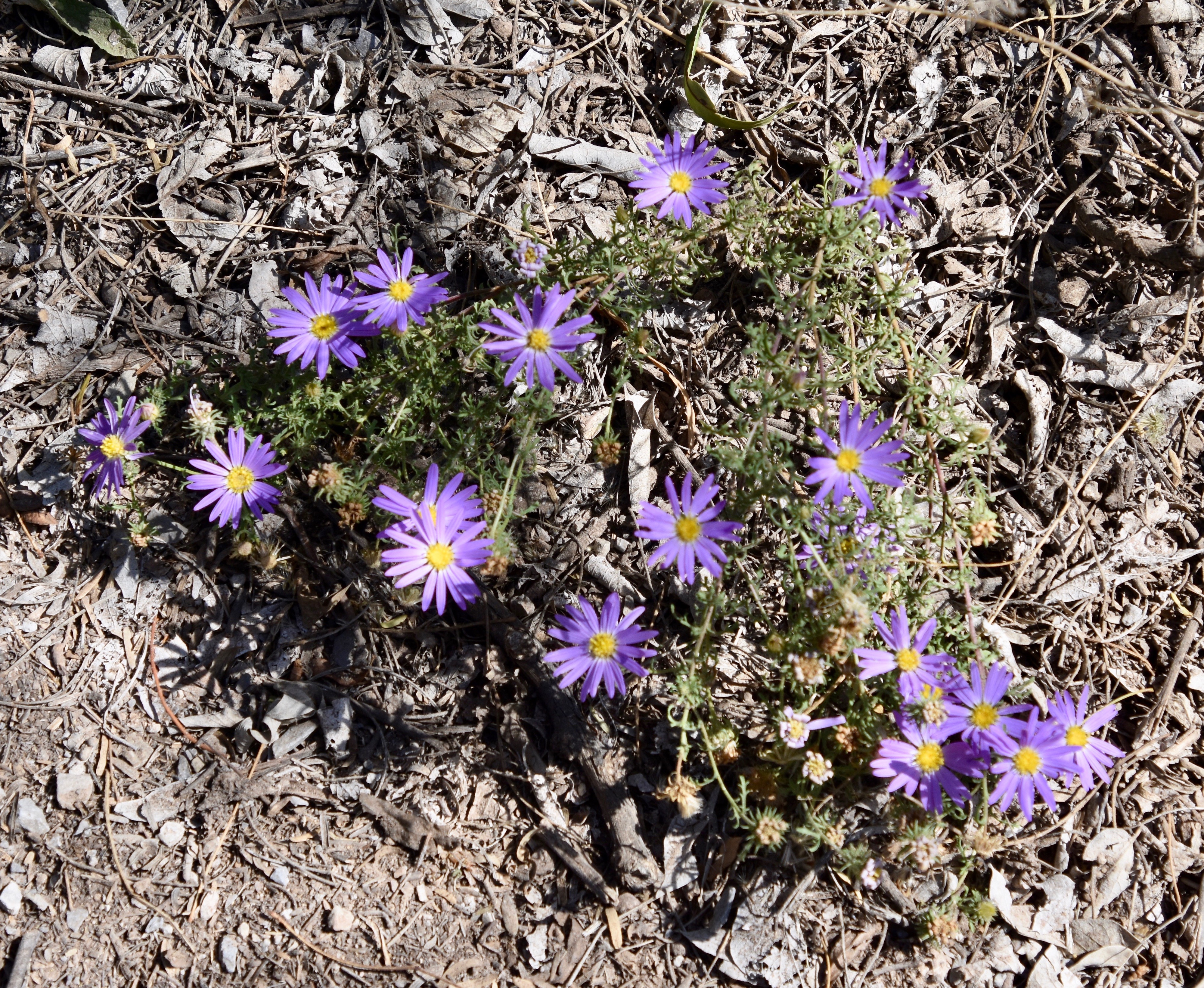
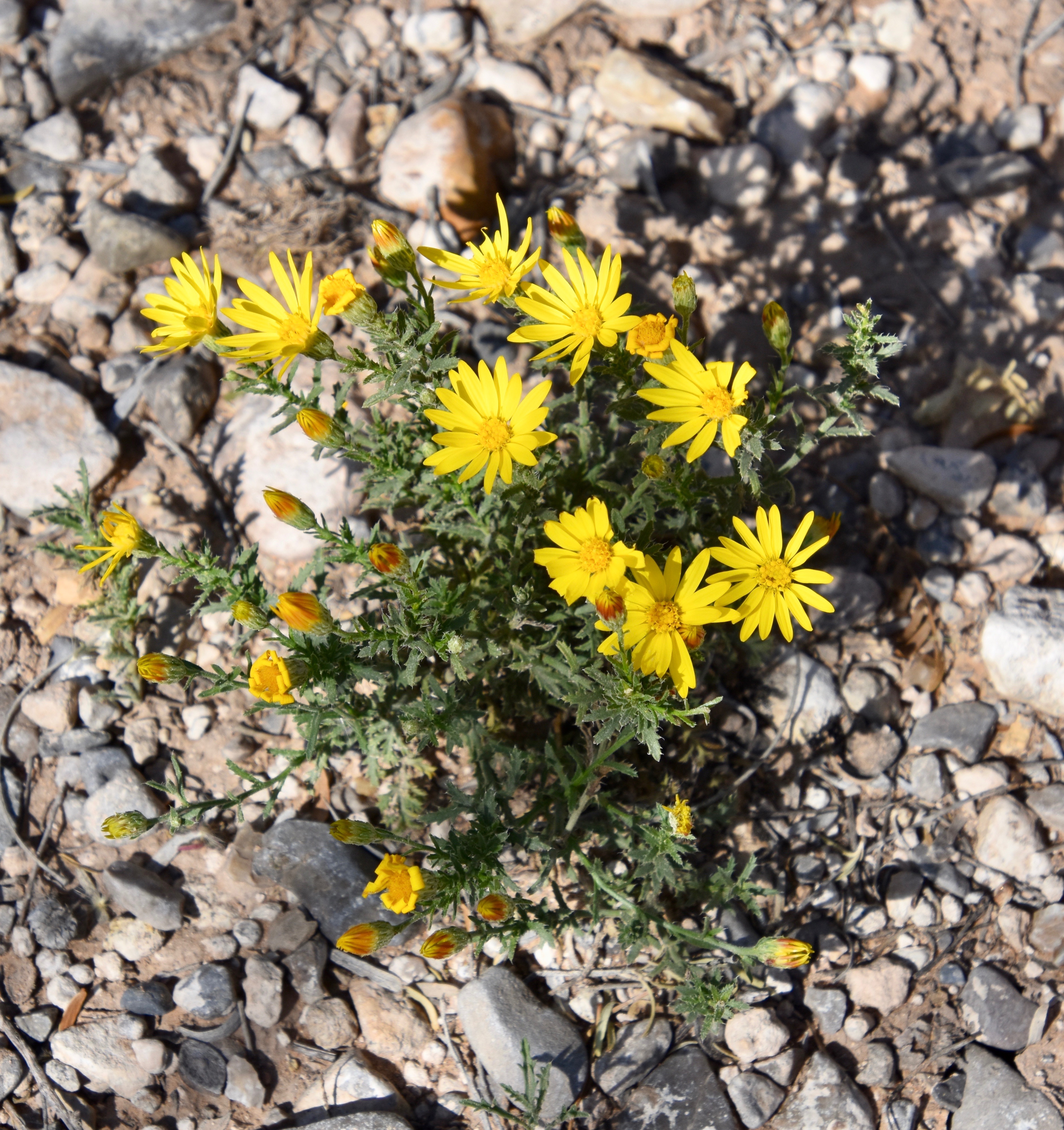
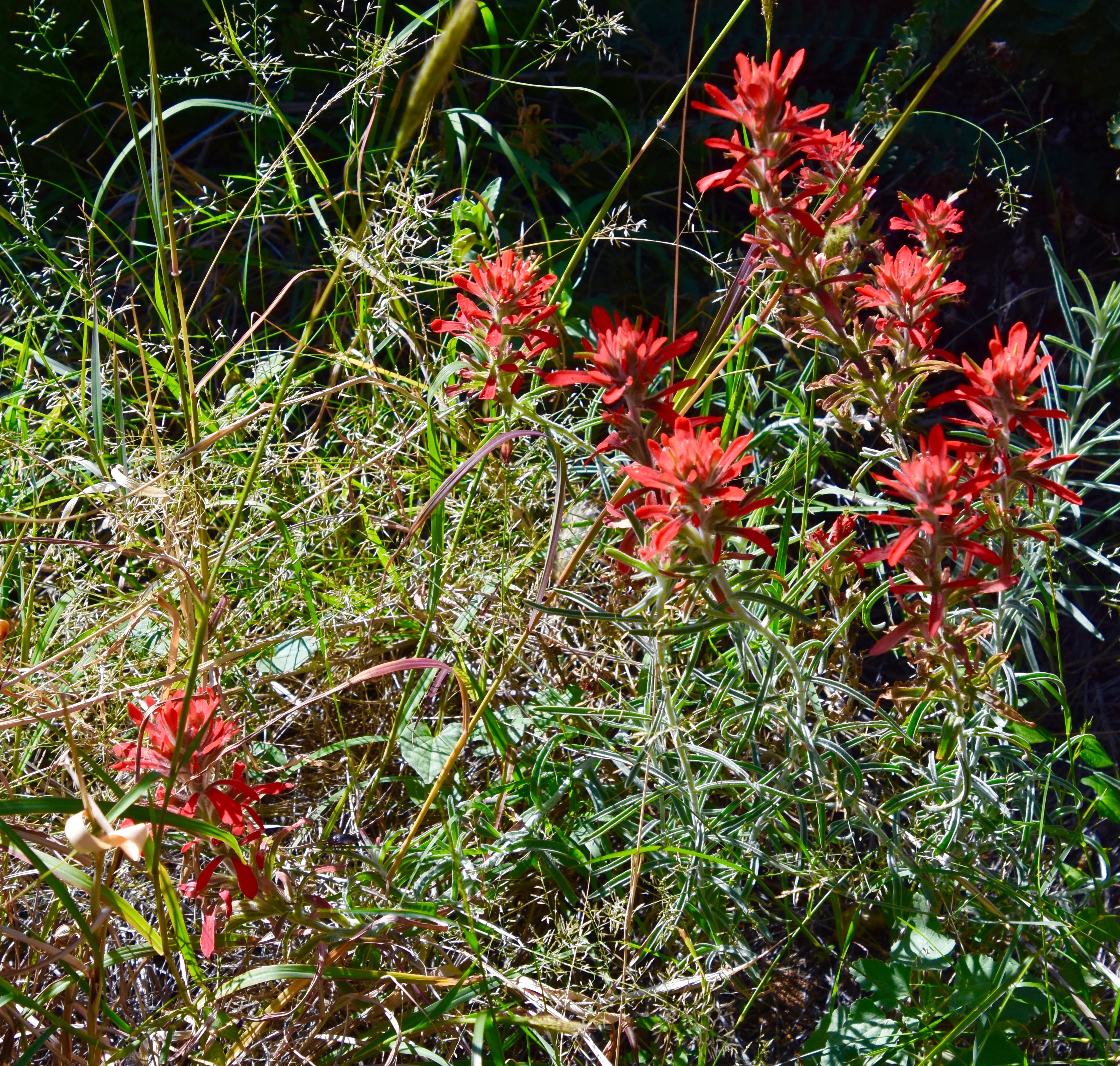
Despite the dryness, there were quite a few areas that were abundant with blooming flowers, especially asters and
Marguerites and
and possibly Cardinal flowers
and especially coreopsis.
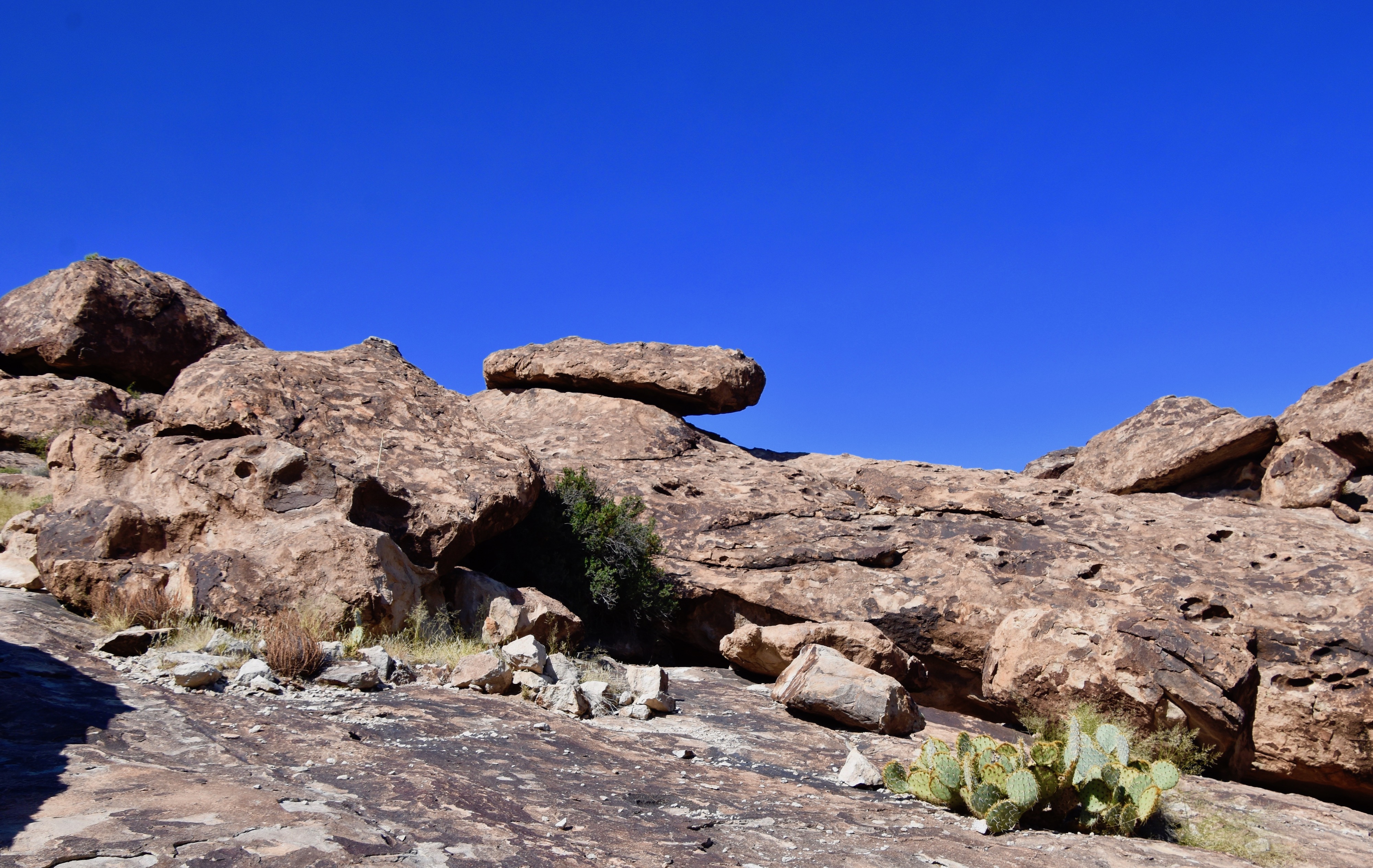
I also mentioned the unusual rock formations which included a number of small natural arches and
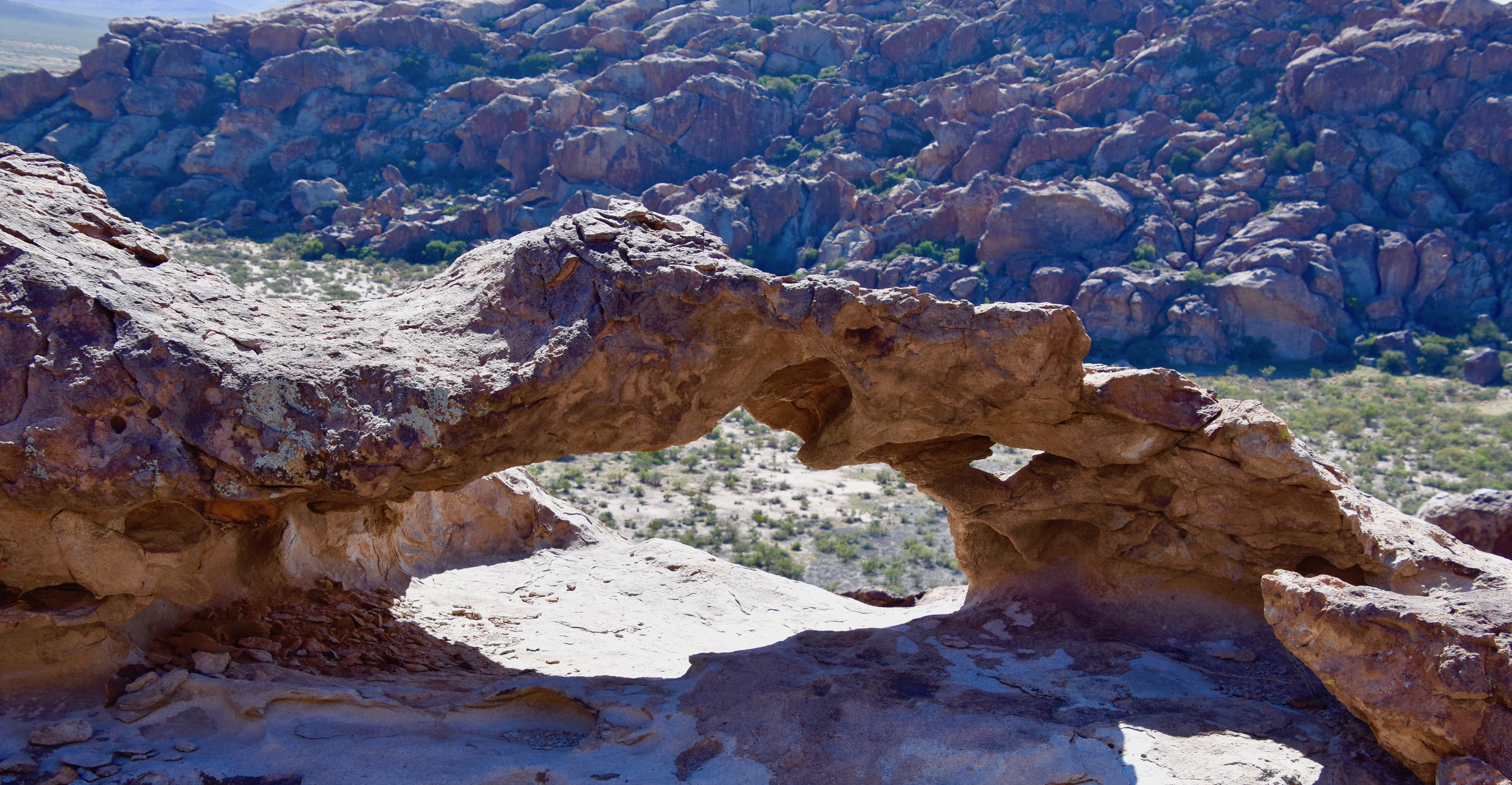
a few balancing type rocks.
I do not feel I have done justice to the Hueco Tanks in this post. It really deserved a more thorough visit with a guide. Perhaps even an overnight stay at one of the twenty campsites where I’m sure the dark skies would be remarkable.
But, better to have visited even for a short time than not at all.
Now, off to Guadalupe Mountains National Park. See you there.