Guadalupe Mountains N.P. – Smith Springs Hike

For such a large state, Texas has surprisingly few national parks; only two in fact – Big Bend which opened in 1944 and the much newer Guadalupe Mountains which only opened in 1972. After the recent SATW conference in El Paso, Alison and I set out to explore west Texas before moving on to New Mexico. We started by visiting the amazing Hueco Tanks State Park on a day trip from El Paso and now our destination was Guadalupe Mountains National Park some 113 miles (181 kms.) almost due east on Highway 62. Our plan was to spend the better part of a day hiking in the park to at least get some kind of feel for why this area is so special. We settled on the loop trail to Smith Spring and found a whole new type of ecosystem that we had no idea existed in Texas. Here’s why it was so special.
About Guadalupe Mountains National Park
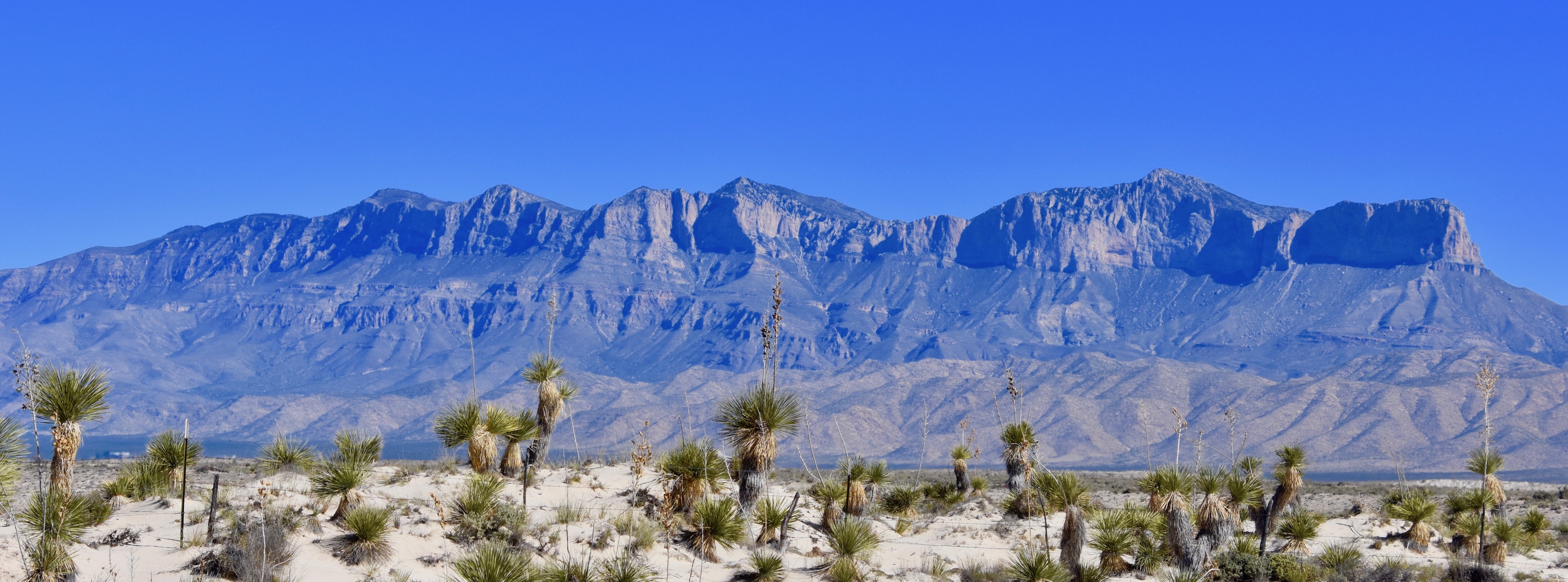
The Guadalupe Mountains are the highest in Texas with Guadalupe Peak topping out at 8,751 feet (2,667 metres) and three more that are taller than any other point in the state. The range rises sharply from the Chihuahua Desert and can be seen from many, many miles away. I took this photo a good twenty miles from the park entrance. One of the natural wonders of the world are mountains that were actually once massive reefs created by living organisms on the beds of ancient seas, and that’s exactly what you are looking at here. The Guadalupe Mountains are the remains of part of Capitan Reef which was created between 260 and 270 million years ago in a vast sea that covered western Texas. The vestiges of that horseshoe shaped reef were then lifted by tectonic faulting and projected high above the bed of the long dry sea. This is one of those places that fascinate geologists and palaeontologists alike who find marine fossils thousands of feet up and hundreds of miles from the nearest ocean.
Officially the Guadalupe Mountains are in what is classified as a cold desert climate which means that it doesn’t get as hot as most deserts and has a little more precipitation as well, up to twenty inches a year in the form of both rain and snow. These relatively more pleasant conditions translate into a greater variety of ecosystems than you might expect, with a true four season environment among the hardwood forests found near the upper elevations of some of the canyons in the park. These ecosystems have been attracting human kind for over 10,000 years, but there has never been any large population living here at any time. The Spanish knew of the area as early as the 16th century, but largely ignored it. However, they did have some of their horses escape which over time were tamed by the Mescalero Apaches who used them to help hunt the abundant wildlife of the area. Up until the mid-1800’s the Apaches were about the only people living in the Guadalupe Mountains, but as was repeated throughout the west time and again, the U.S.Cavalry was sent in to force them onto reserves and after a thirty year hold out, they lost their traditional hunting grounds.
The first United States intercontinental mail route, the Butterfield Overland Mail Company went through the Guadalupe Mountains and over 5, 543 foot Guadalupe Pass for three years from 1858-61. After that there were a few ranches and the odd settler, but of all the areas in the continental United States you’d be hard pressed to find such a large one with so little human activity.
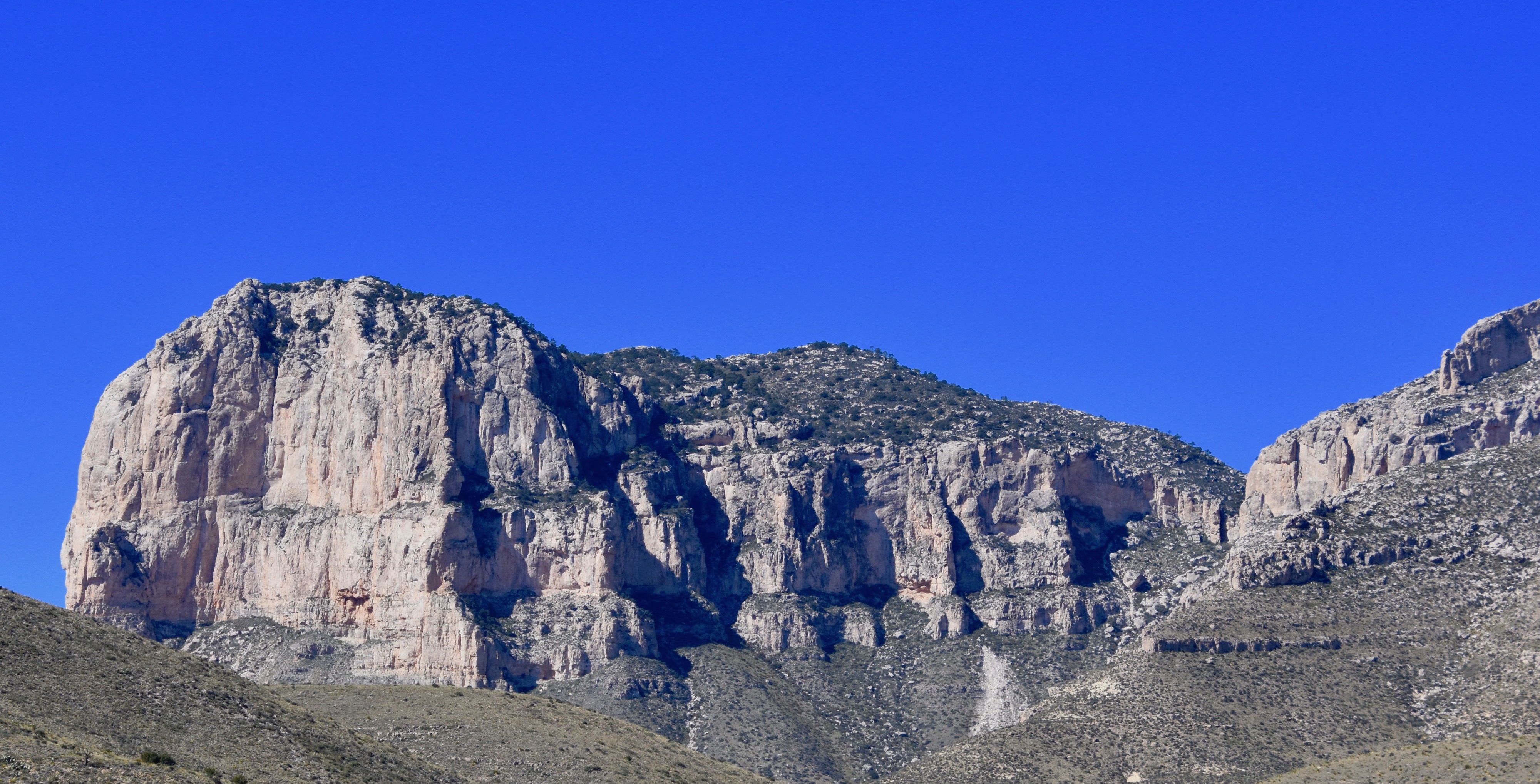
Today access to the Guadalupe Mountains is only possible by way of a few roads, none of which penetrate very far into the park. Before entering the park you get a good view of El Capitan, with its sheer cliff, the most picturesque of the Guadalupe Mountains and an echo of the more famous one in Yosemite. While there is a trail to the top of Guadalupe Peak, there is none to El Capitan and if you want to get a better look will have to confine yourself to the 11.3 mile trail that skirts the base.
Guadalupe Mountains National Park is a place that can only be fully explored on foot or more traditionally, by horse via the many miles of hiking/horse trails and by staying at back country camp sites. For the day visitor there are a few options for hikes and by stopping first at the Pine Springs Visitor Center just past the southern entrance to the park I’m hoping get a suitable recommendation.
Our first choice was the 4.2 mile Devil’s Hall trail that starts near the Visitor Center, but surprisingly the parking lot was completely full and signs made it clear that we’d be ticketed or worse, towed away, if we parked anywhere but the parking lot. Undeterred we moved on a few miles further to the Frijole Ranch turnoff and found plenty of space to park and hike the combined Manzanita Spring/Smith Spring loop which is a 2.7 mile trail that gains considerable elevation as it ascends into an ever narrowing canyon before arriving at the spring.
However, before setting out we first visited the Frijole Ranch which dates back to 1876 and is one of the few remaining links to the brief period when the Guadalupe Mountains were the site of mixed use ranches that were many miles from the nearest settlement.
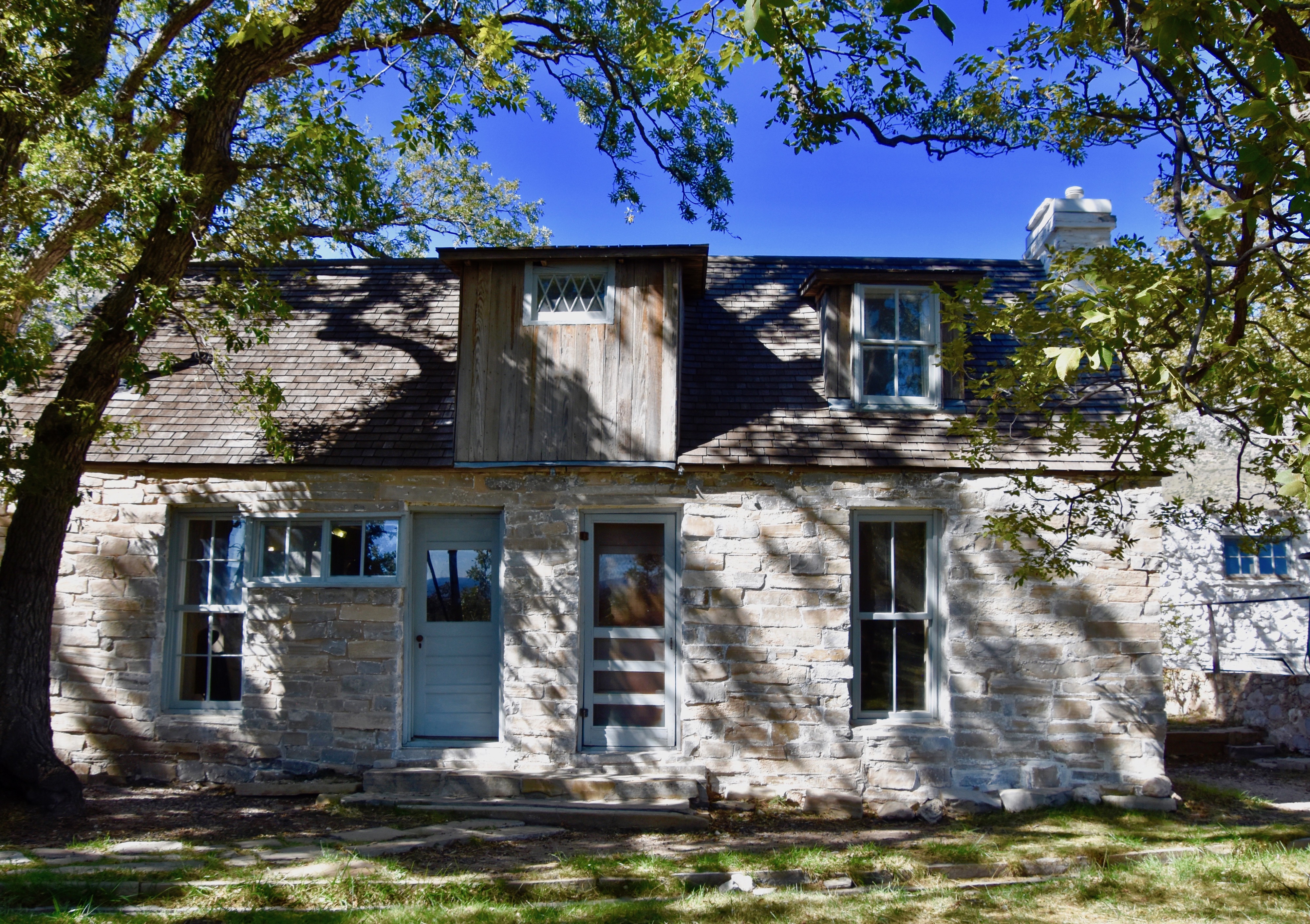
The ranch consists of this house, built entirely out of local limestone, a barn, a one room schoolhouse, a bunkhouse and a shed that covers the Frijole spring that is still producing the cool, clear water that first led the Rader brothers to choose this site for their ranch. It was an active operation until 1966 when the last of a series of owners sold it to the National Park Service. One of the owners were the Smith family for whom the springs that we will visit on the hike were named.
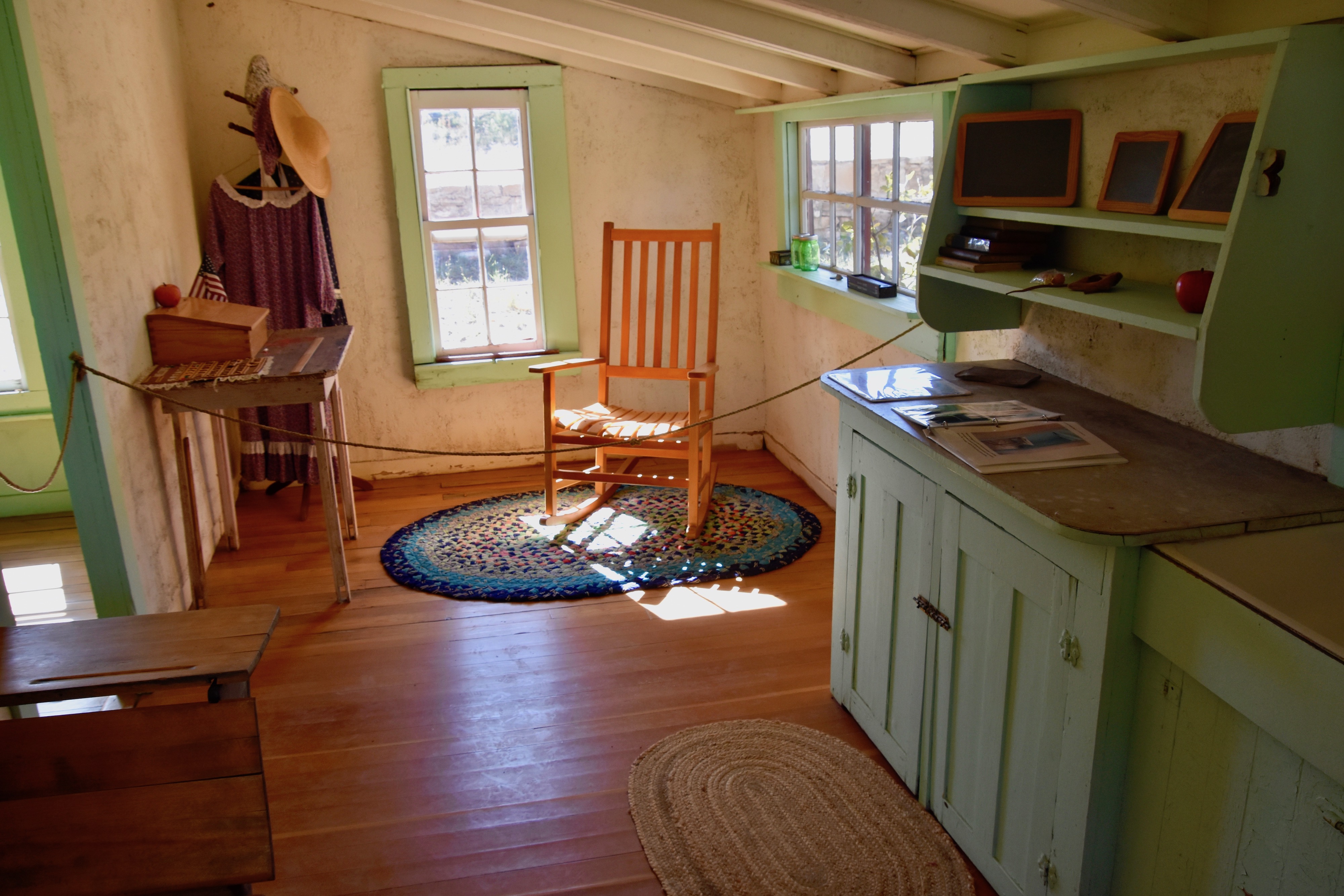
This is the interior of the tiny schoolhouse adjacent to the main house where for many years a young school marm would journey, perhaps from as far away as the east coast, to live in this room and teach the children of the ranch their ABC’s. According to the history listed in the ranch museum, at least one of these young ladies ended up marrying one of the elder sons and stayed on for the rest of her life, raising her own family here.

It is hard to imagine today the intrepidity required to undertake such a journey by a girl who was not much more than a child herself.
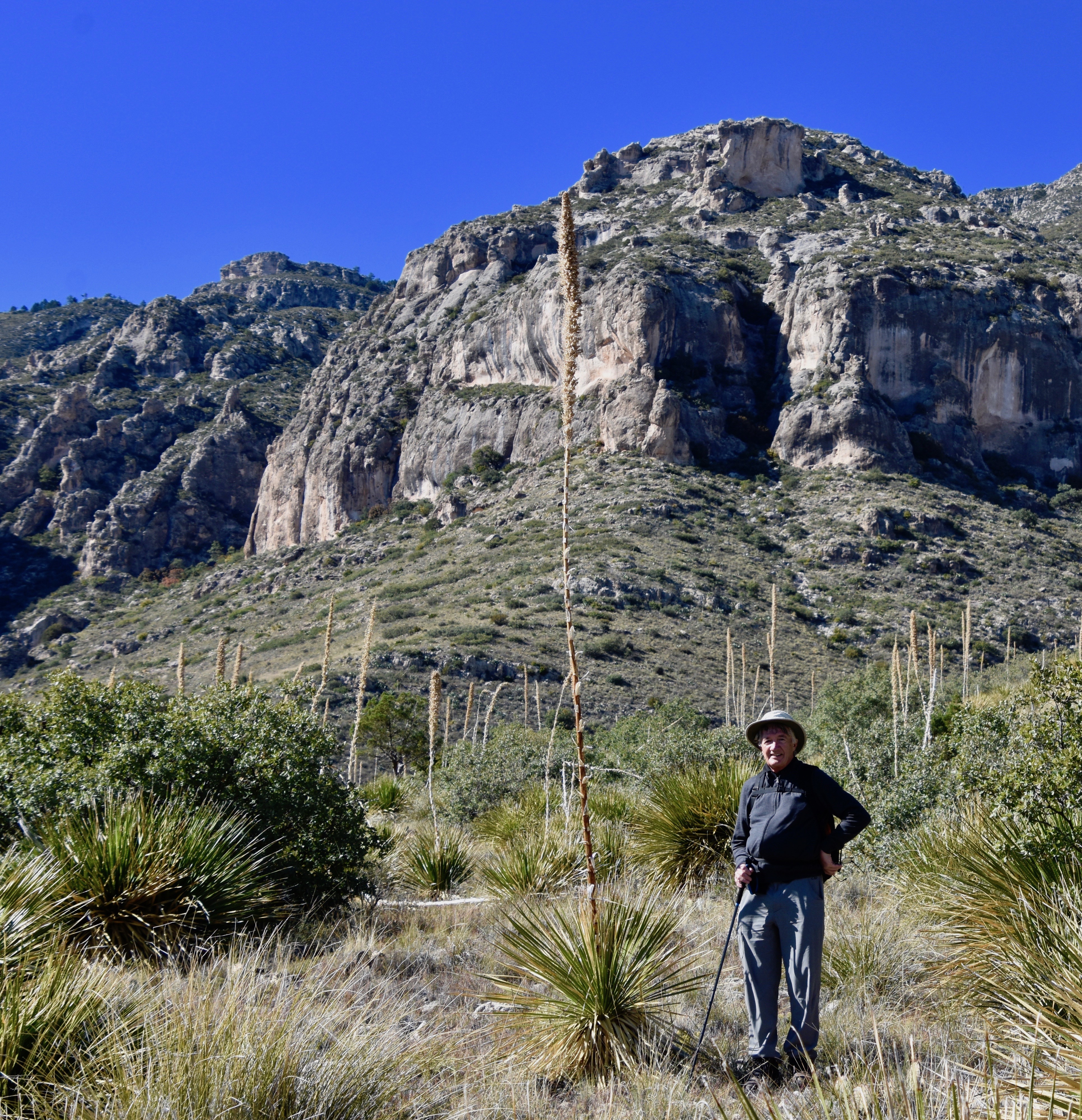
The first part of the hike to Smith’s Springs is extremely easy, along a flat paved path that is wheelchair accessible and provides exposure to flora and fauna of the Chihuahua Desert. On the day we were here it was clear, slightly cool and very quiet with almost no wind. Despite the fact that the parking lot at the Visitor Center was full, here, only a few miles away, we encountered only one other person on the entire hike.
After leaving the paved section of the trail it begins a gradual ascent that is at no point strenuous, but does require good footwear. We took our hiking boots, a walking stick, lots of water, sun screen and a wide brimmed hat. The simplest precautions means not having any worries should one get tired and need a rest for a cold drink. These hikes are meant to be a joy and not an ordeal.
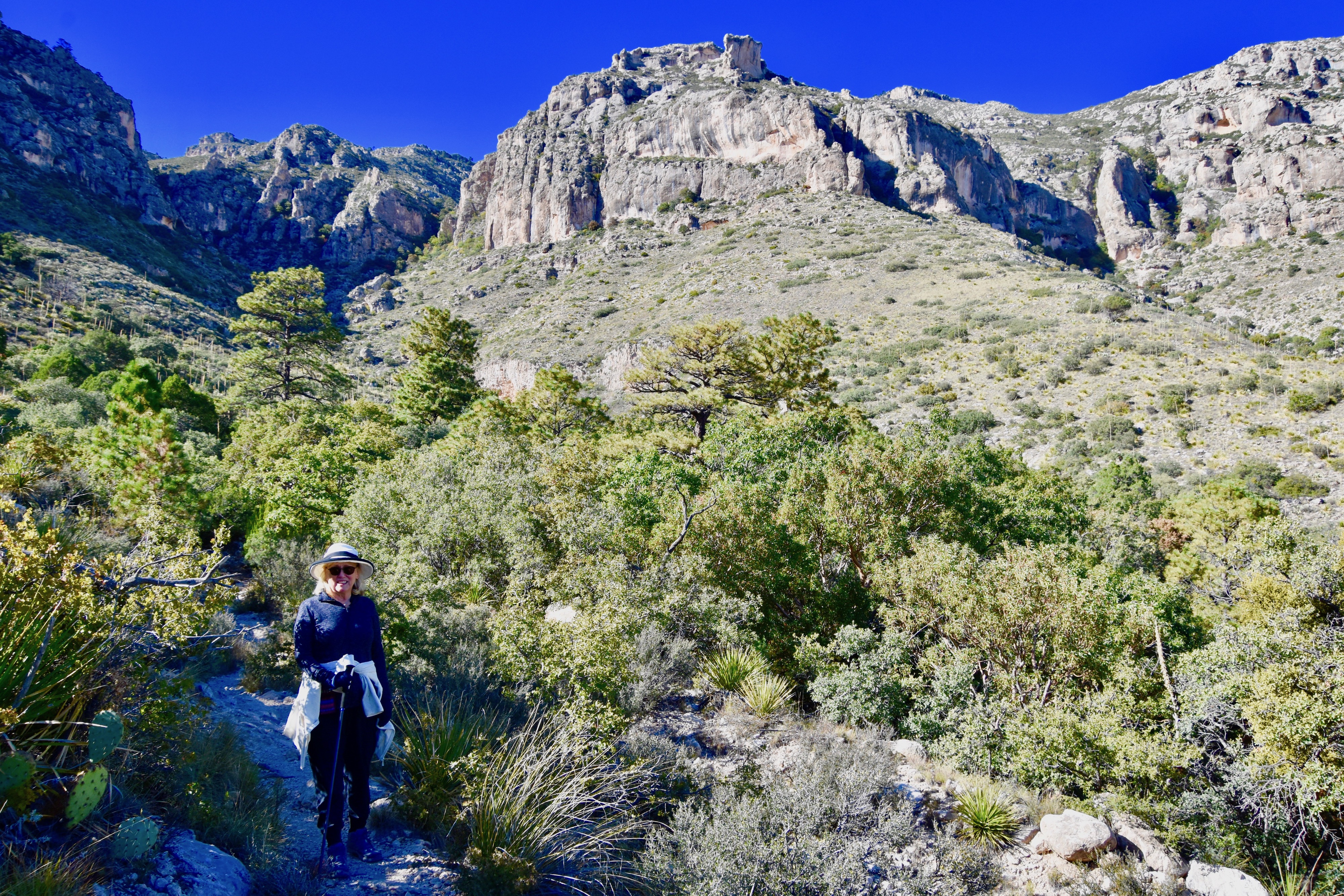
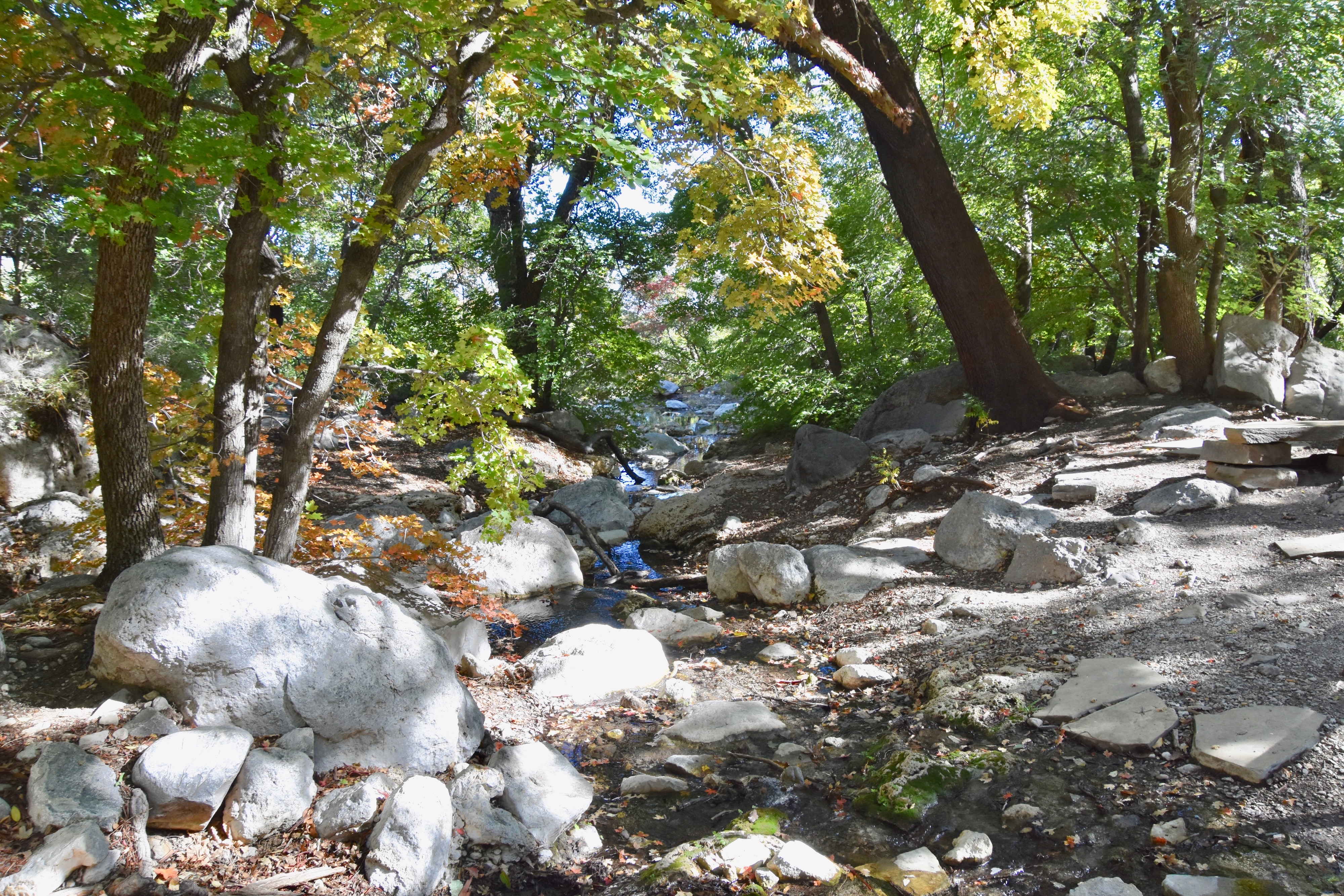
As you can see the trail after leaving the desert floor follows the course of dried up stream beds that still have enough moisture in the ground to support a greater variety of vegetation than does the Chihuahua Desert.
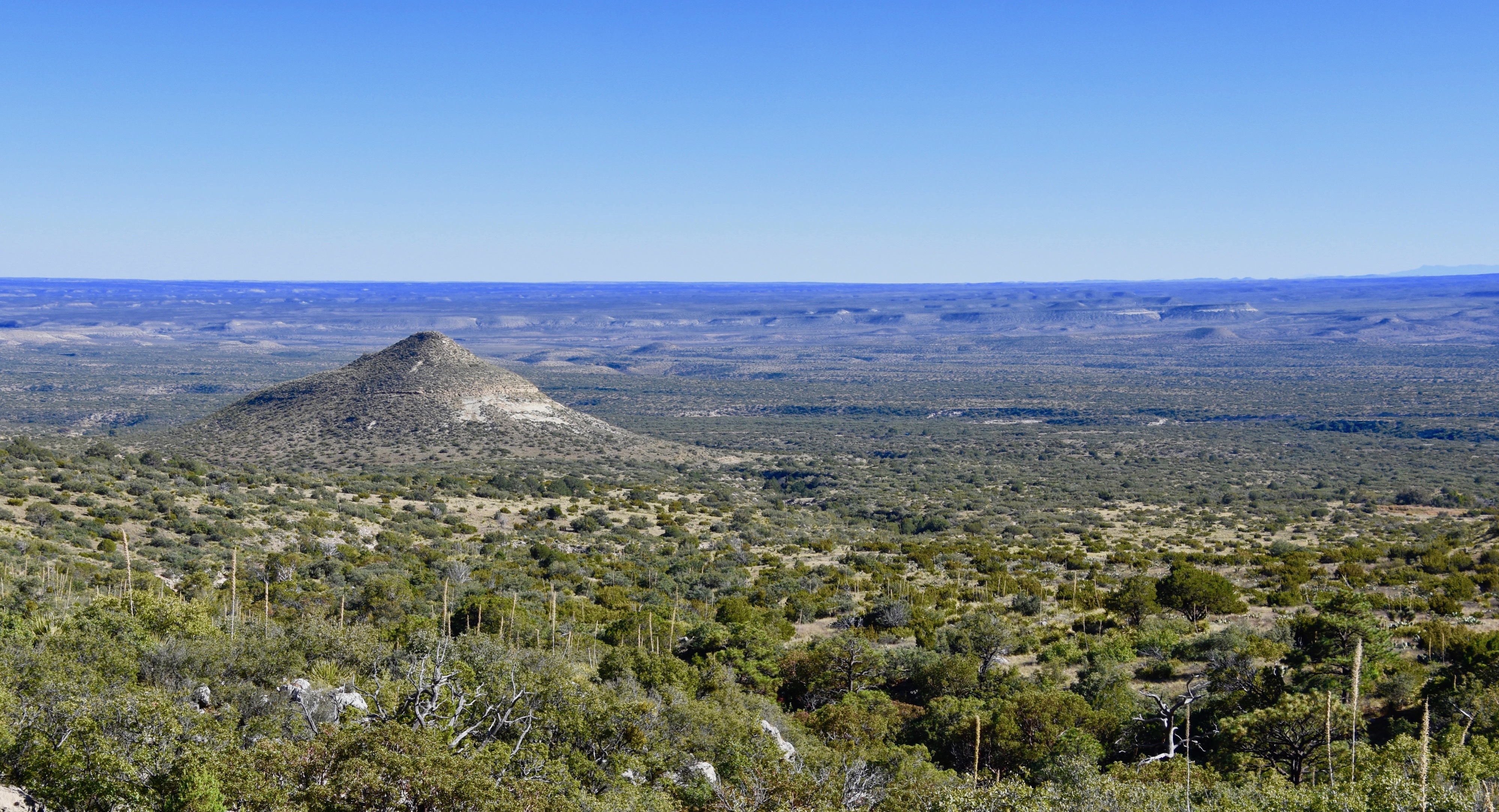
As you get higher you get great views below of that desert with a Chinese hat mesa that was actually above you when the trail began. Looking at this photo, I can’t help but thinking of The Who’s song I Can See for Miles and realizing that at this elevation that is more than literally true. There was just something about being here on this trail, just the two of us with seemingly all of Texas laid out before us that created one of those magic moments that travel is all about.
Pushing on, we entered a canopy of hardwoods over a small stream and although this photo does not adequately capture it, real fall foliage. Fall foliage in west Texas – who knew?
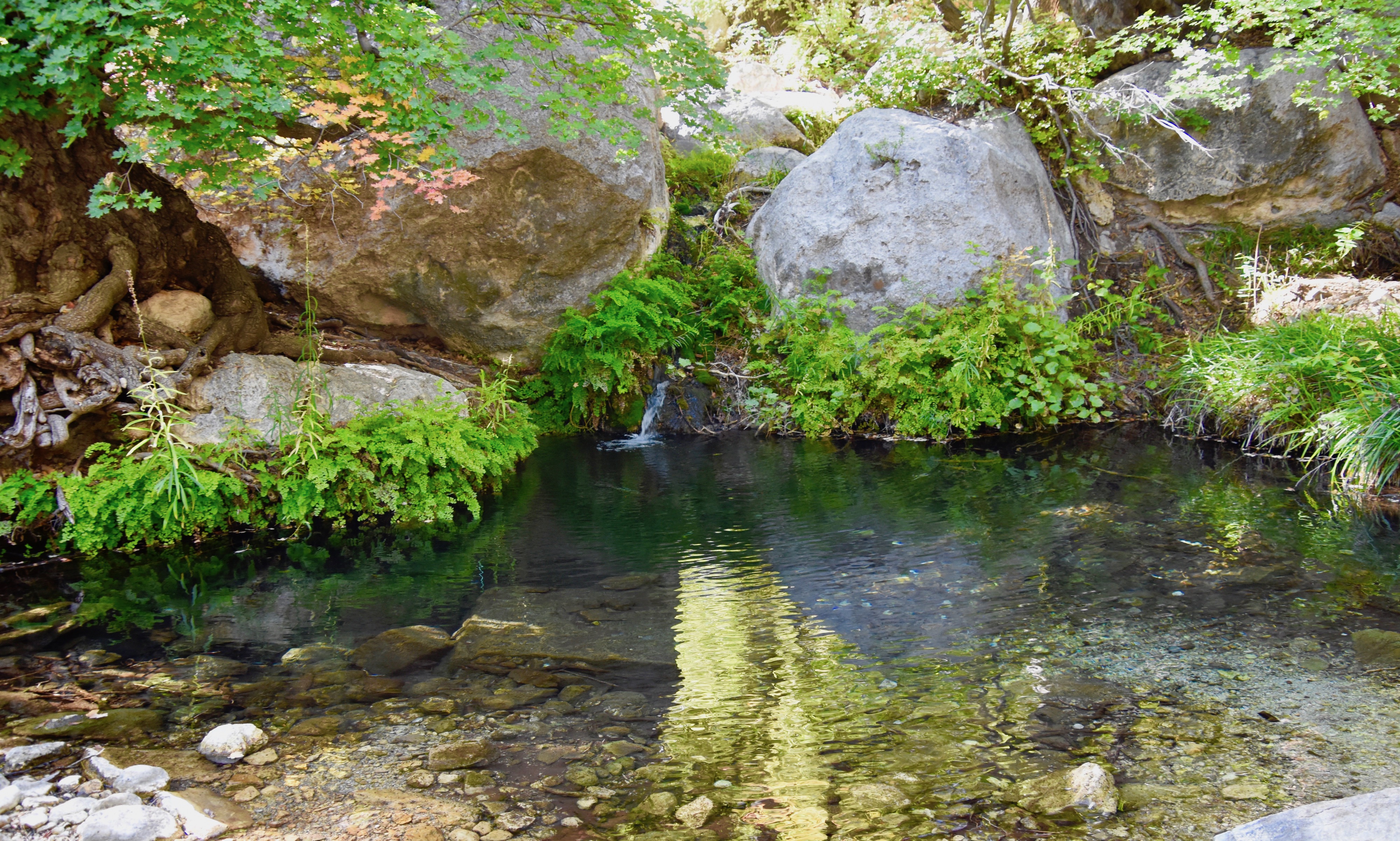
Not far from here was the trail’s destination, Smith Spring and a beautiful little spring it was – a tiny streamlet gurgling water into a crystal clear pool surrounded by ferns and shadowed by the leaves of big tooth maple trees, a species endemic to the Guadalupe Mountains. It’s always a pleasure when the ultimate destination turns out to be worth the effort to get there and Smith Spring delivers in that regard.
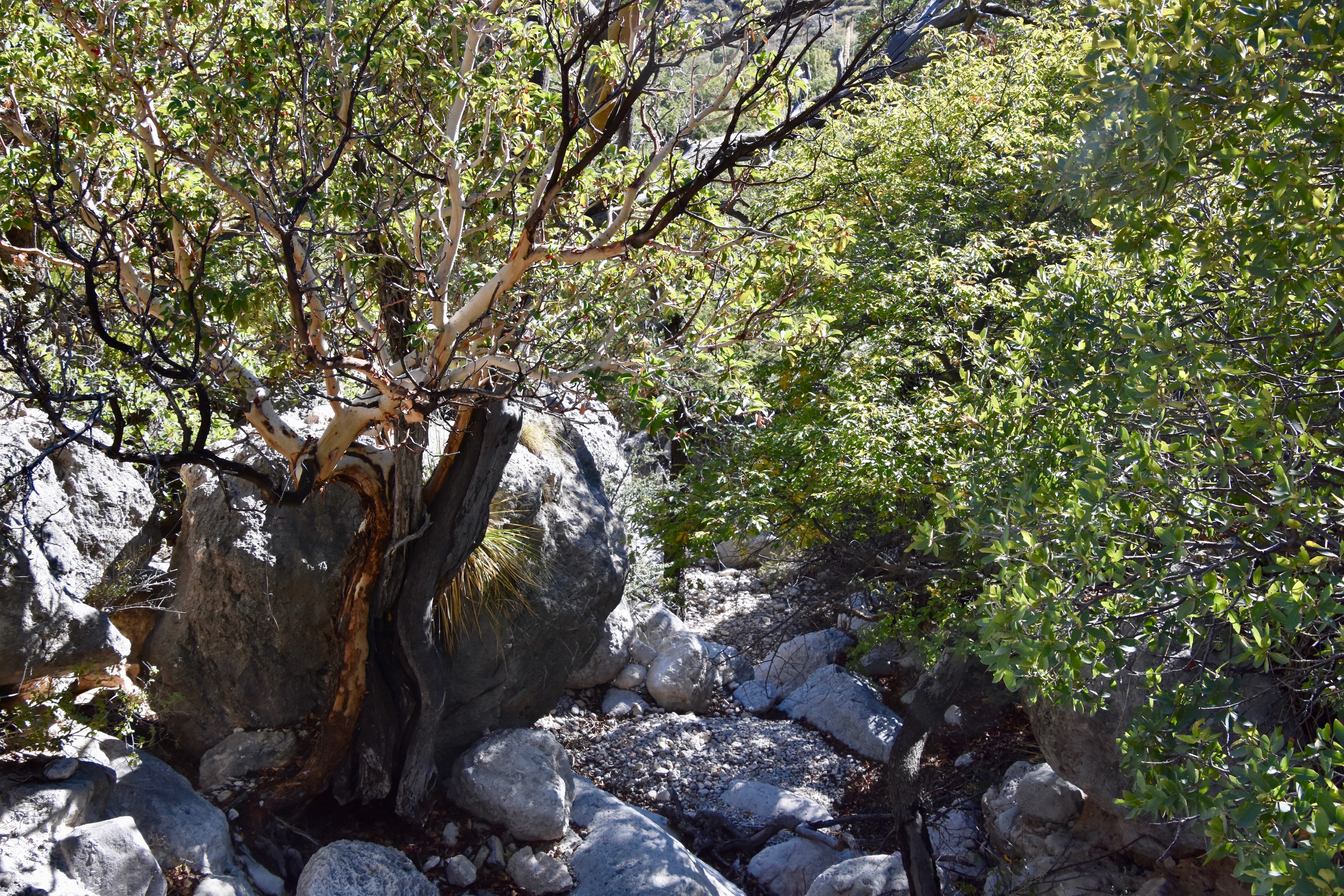
The return journey is via a different path than the one up to the spring and makes for a very nice loop trail that crosses a number of dry gulches along the way.
Frankly, we did not see a lot of wildlife on this trail, but noticed lots of scat. In the parking lot we met some young women who had just seen a small group of javelinas, the wild pigs of the Chihuahua Desert. There’s also mule deer and elk that inhabit the area along with much rarer mountain lions and black bears. However, as with all desert environments, almost all native species are much more active at night than in the day.
In summary, if you a looking for a moderate introductory hike in Guadalupe Mountains National Park, give serious consideration to the Smith Spring Trail. I guarantee you won’t be disappointed.