Cape Reinga and Waipuoa Forest

This is my fourth and final post from New Zealand’s amazing Northland Peninsula, an area usually overlooked by international tourists, to their detriment as I explained in this post from the Bay of Islands. For Canadians and Nova Scotians in particular, the town of Waipu, founded by Scots from New Scotland, should be a must visit destination. For golfers, there are four, yes four, courses rated in the top 50 in the world including Kauri Cliffs which Alison and I had the good fortune to play on a beautiful day with no wind. But wait, just like a TV ad promoting something you don’t need and can’t afford – there’s more! Except these two things are definitely worth seeing and best of all, they’re both free. So please join Alison and I as we finish our visit to the Northland with visits to Cape Reinga and Waipoua kauri forest.
Cape Reinga
Cape Reinga is the northernmost point in New Zealand that you can physically visit. Technically North Cape is a bit further north, but it’s a scientific reserve and off limits to visitors. However, Cape Reinga is by far the more interesting place because it sits at the conjunction of the Tasman Sea to the west and the South Pacific Ocean to the east. This unique location has been sacred to the Maori people from the time they first arrived in New Zealand. It is their belief that this is the place that dead souls make their departure from the earthly realm and return to Hawaiki from whence their ancestors first arrived. Reinga literally means ‘underworld’ in the Maori language.
Getting to Cape Reinga from Paihia where Alison are based, involves a full day’s commitment as its about 200 kms. (125 miles) in each direction, all on single lane highways, much of it through very winding territory where you’re apt to get stuck behind a logging truck for a bit. Patience is truly a virtue on this drive. But, the upside is that it’s quite scenic and between Paihia and Kaitaia you have a different route to take on the way up and the way back.
Once you reach Kaitaia, you are at the base of the Aupōuri Peninsula and there are basically no services between here and Cape Reinga. I foolishly assumed that there would be a restaurant and gift shop at the end, but as it is sacred ground, no facilities other than a restroom are allowed. Eating is actually forbidden at Cape Reinga, so if you need to, gas up and grab a bite in Kaitaia.
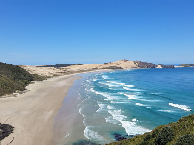
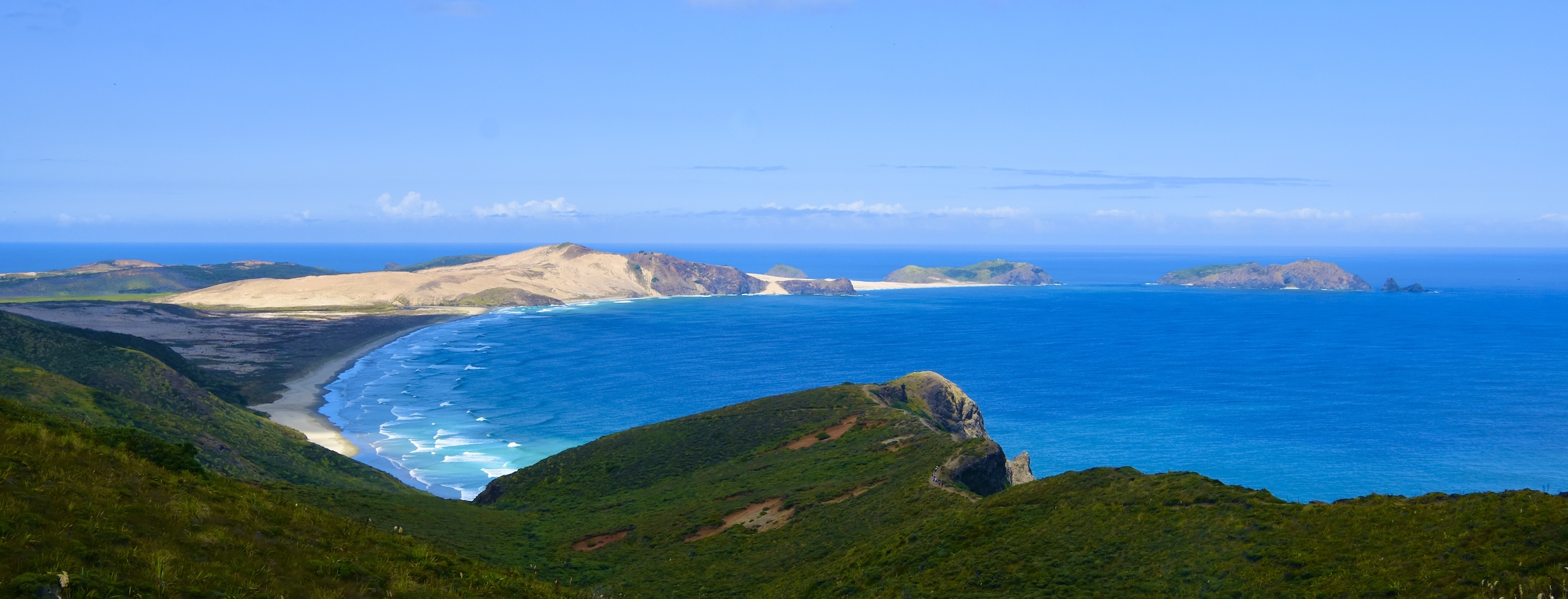
This is also the start of Ninety-Mile Beach which runs along almost the entire west side of the Aupōuri Peninsula, ending only a few kilometres from Cape Reinga. If you are daring or stupid, you can actually drive the entire length of the beach which is actually 88 kms. (55 miles) long. I say stupid, because rental cars are not allowed to drive on the beach, but people do it all the time, get stuck and end up with a huge bill for their troubles.
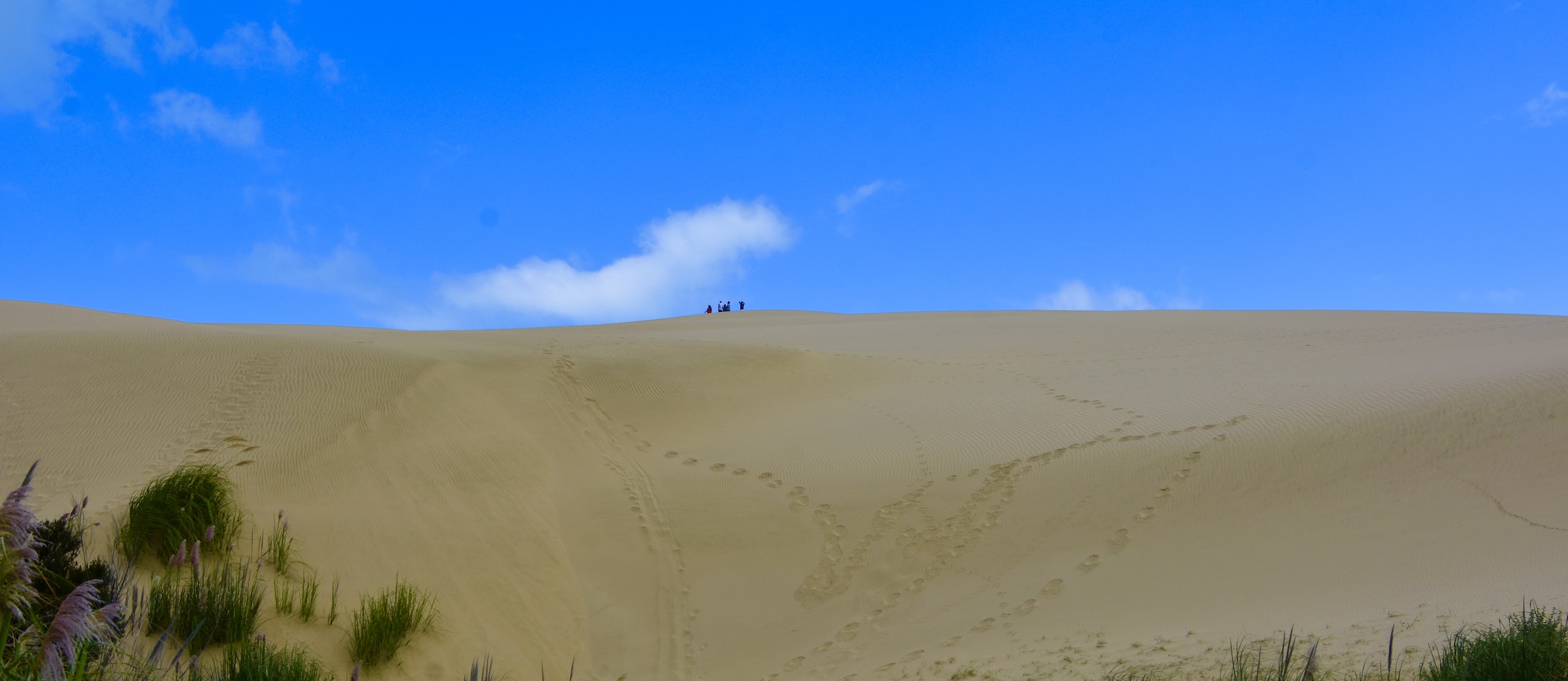
What is worth doing however, is staying on the actual highway until you get to almost to the end and then turn left at the sign for Te Paki. Here you can get a chance, if you are daring or stupid, to try your hand at sandboarding, which is essentially dune surfing. Alternatively, if you are old and decrepit, you can just marvel at the size of the dunes and look up at the people who have climbed them and now are too afraid to get on the sandboards they just paid a lot of money to rent.
Not far after this you enter Te Paki Recreation Reserves where the road narrows considerably and climbs up high enough that you get your first glance of the Tasman Sea.
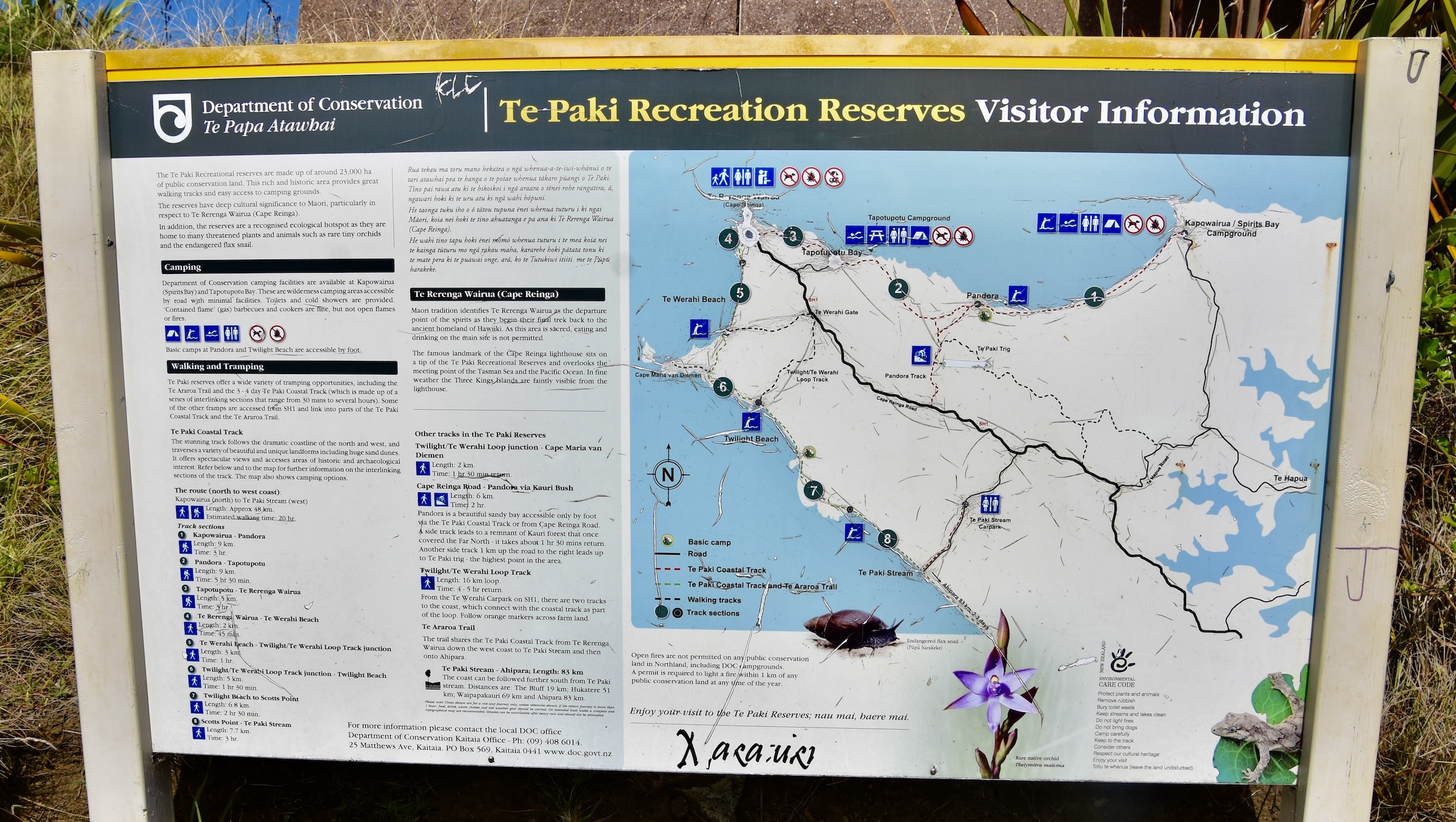
There are a number of hiking trails that lead down to sea on both sides of Cape Reinga. This is the trail head to Te Werahi Beach and Cape Maria van Diemen. History buffs might recall that Abel Tasman, a Dutch explorer in the employ of the Dutch East India Company was the first European to lay eyes upon both Australia and New Zealand in his voyage of 1642-43. He first spotted Tasmania which he called Van Diemen’s Land after the governor of the Dutch East Indies. That name didn’t stick as Tasman got the credit he deserved when it was renamed after him in 1856. However, what did stick was the name he gave to this point of land, the westernmost on the North Island, which he named after the governor’s wife. It has to be one of the most beautiful viewpoints you’ll find anywhere.
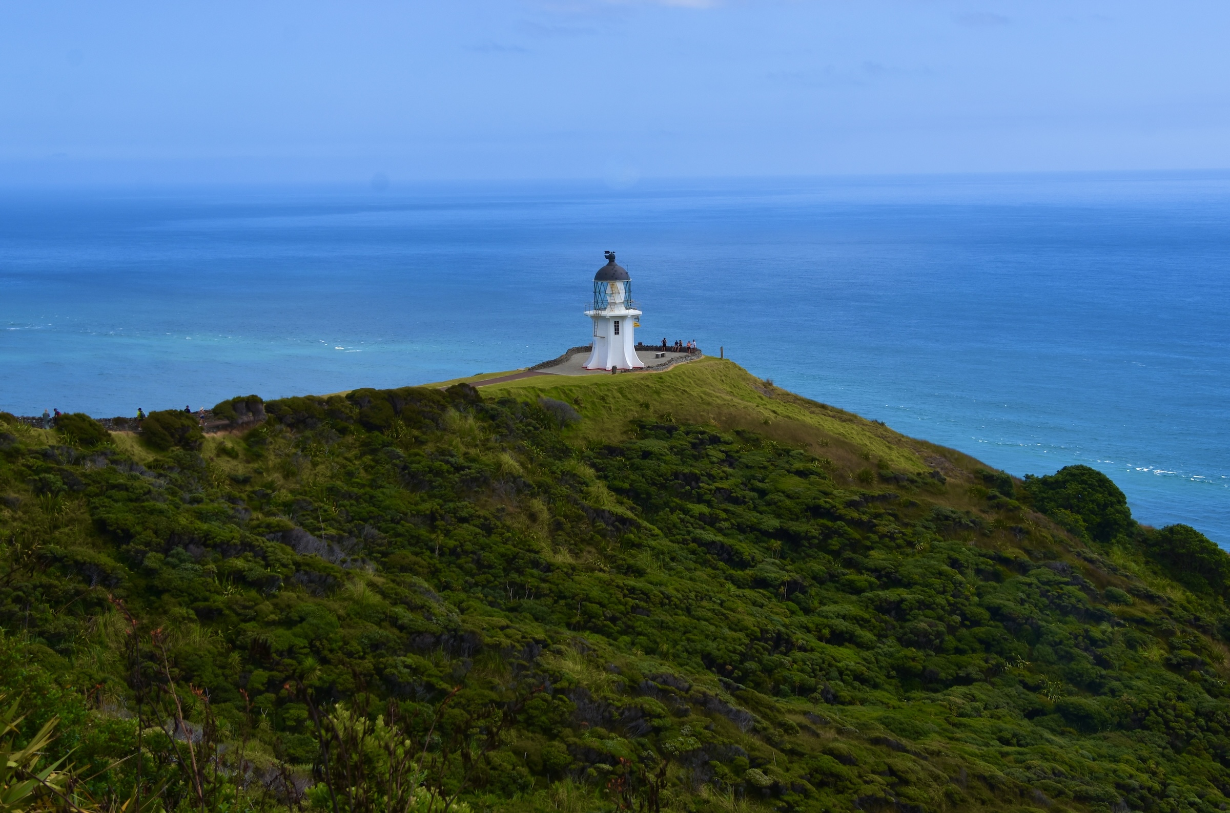
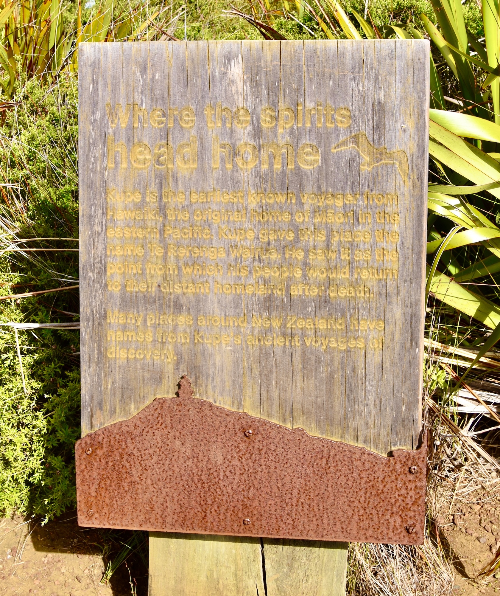
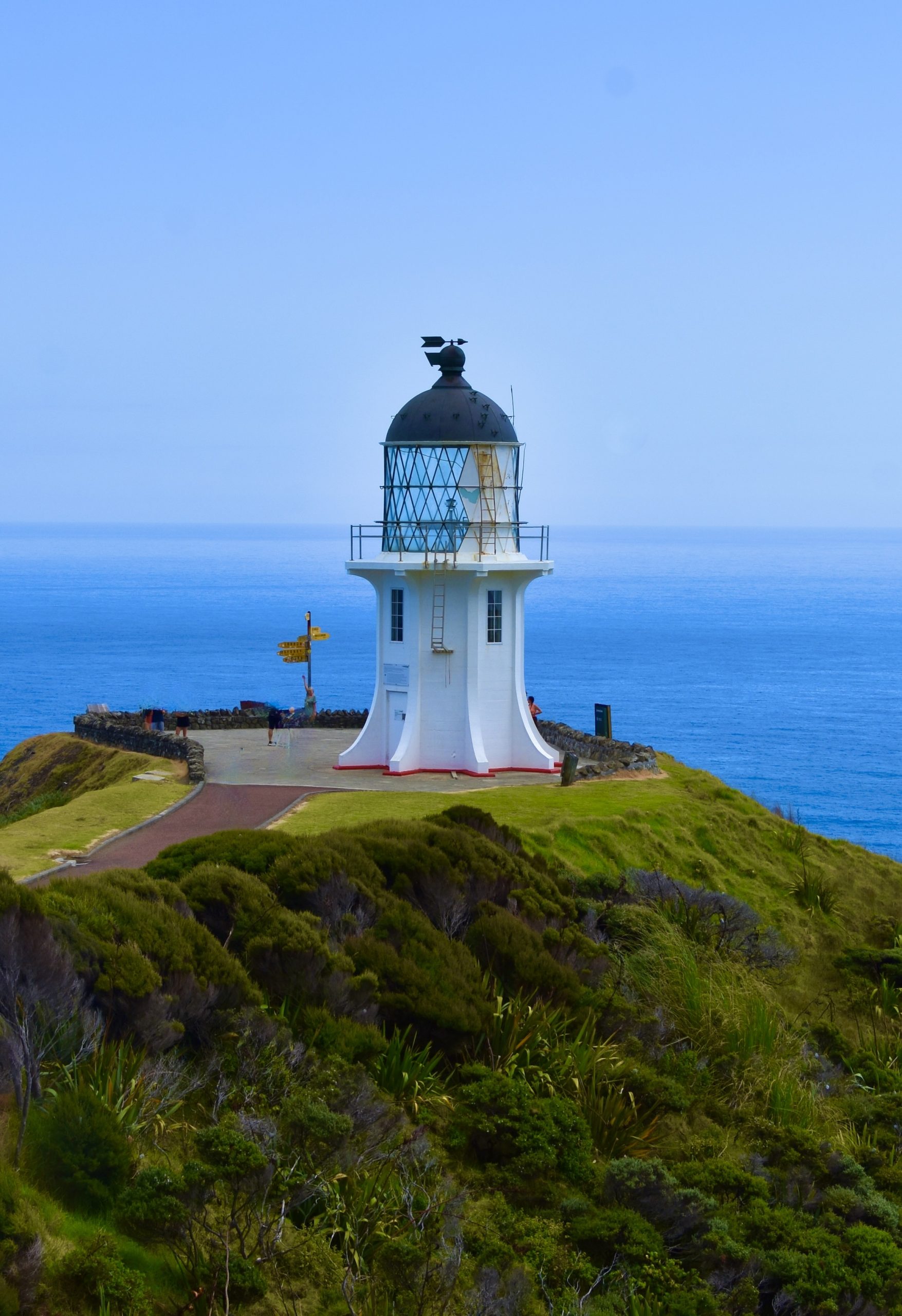
The lighthouse at Cape Reinga is well below the parking lot and is reached via an easy 800 metre path that makes a gradual descent that is handicap accessible. Along the way there are a number of signs that are environmentally friendly, but very hard to read. This one tells the story of Cape Reinga as the place where the spirits head home.
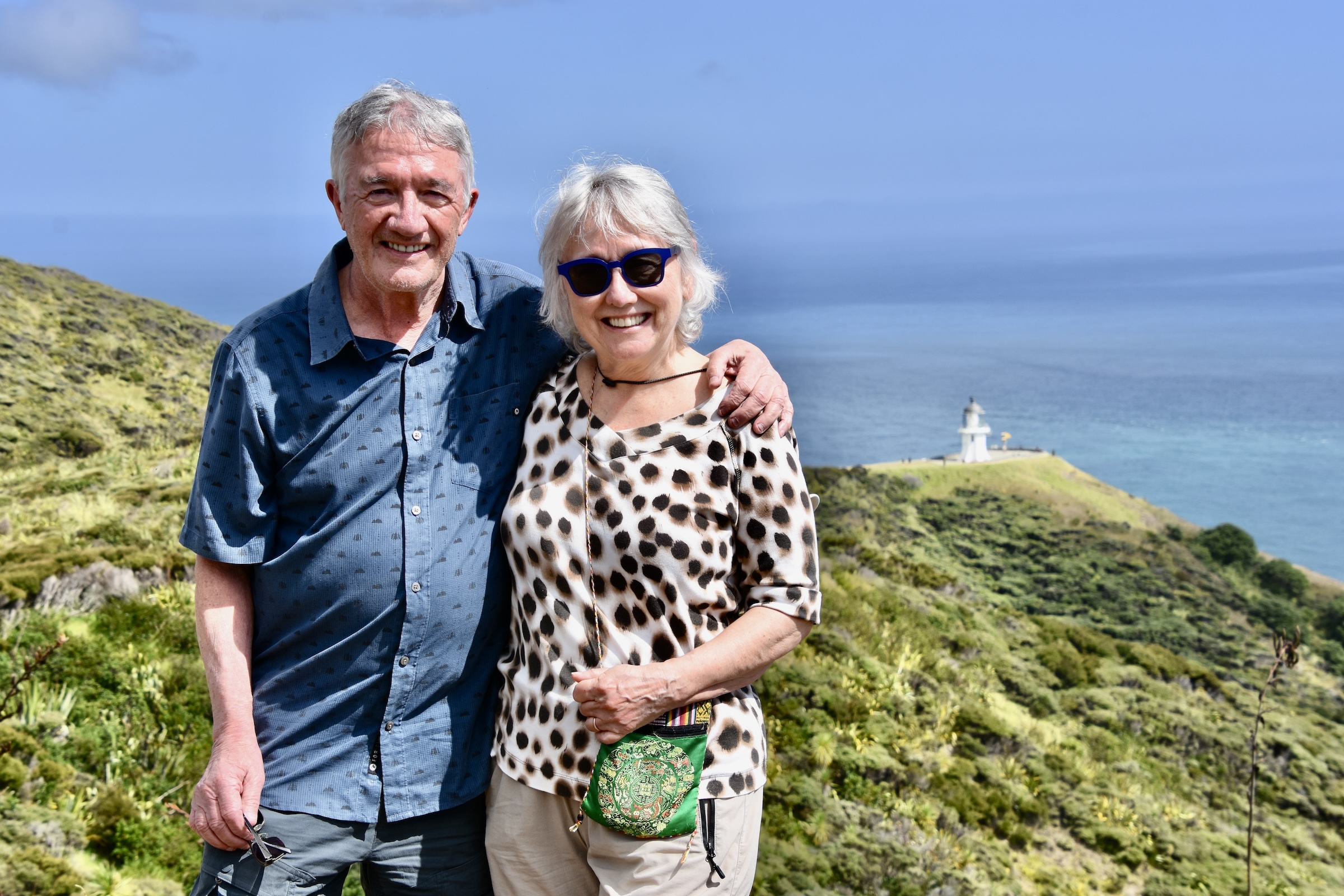
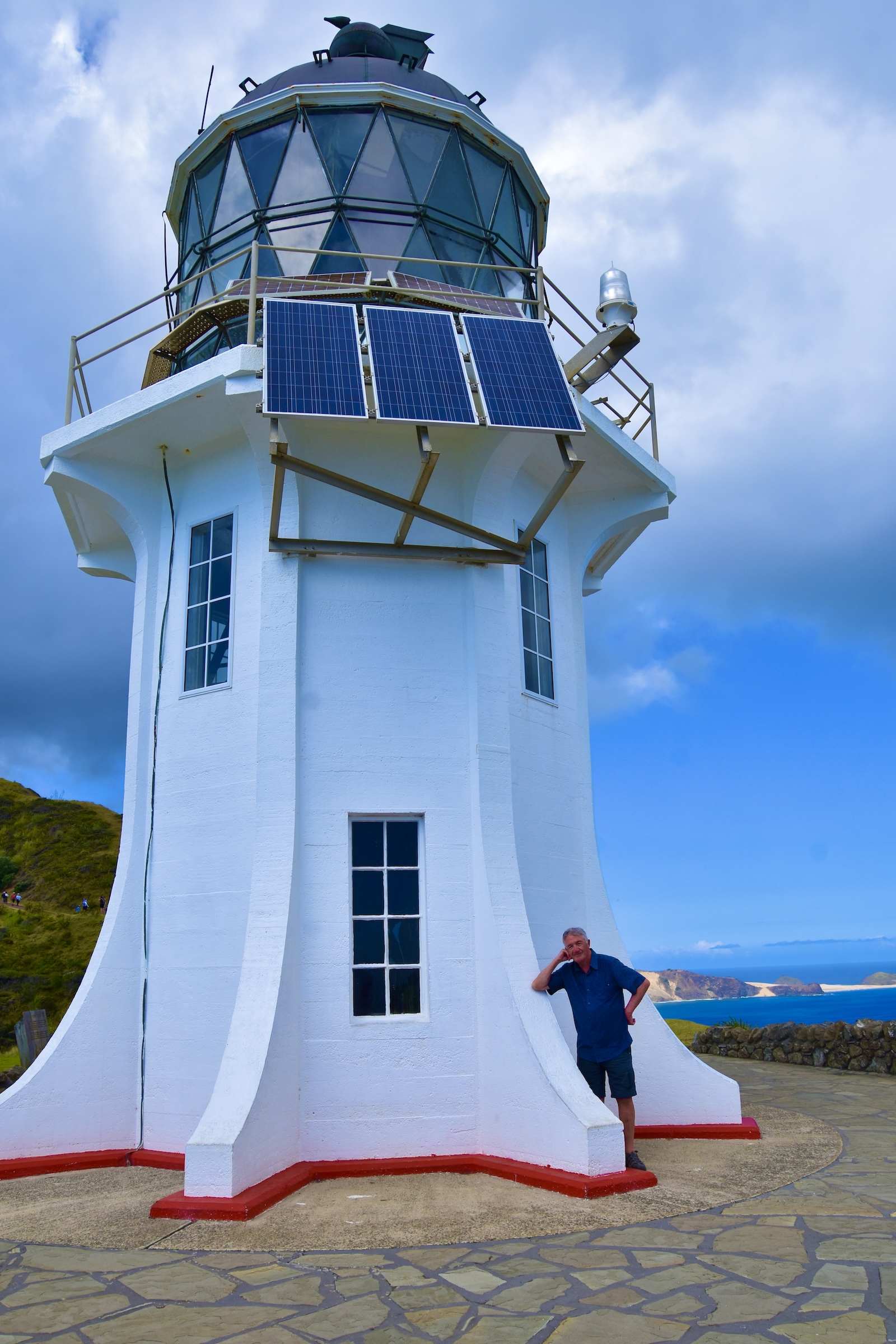
You will definitely want to corral one of the other folks making their way down to the lighthouse to take your picture at this wondrous spot.
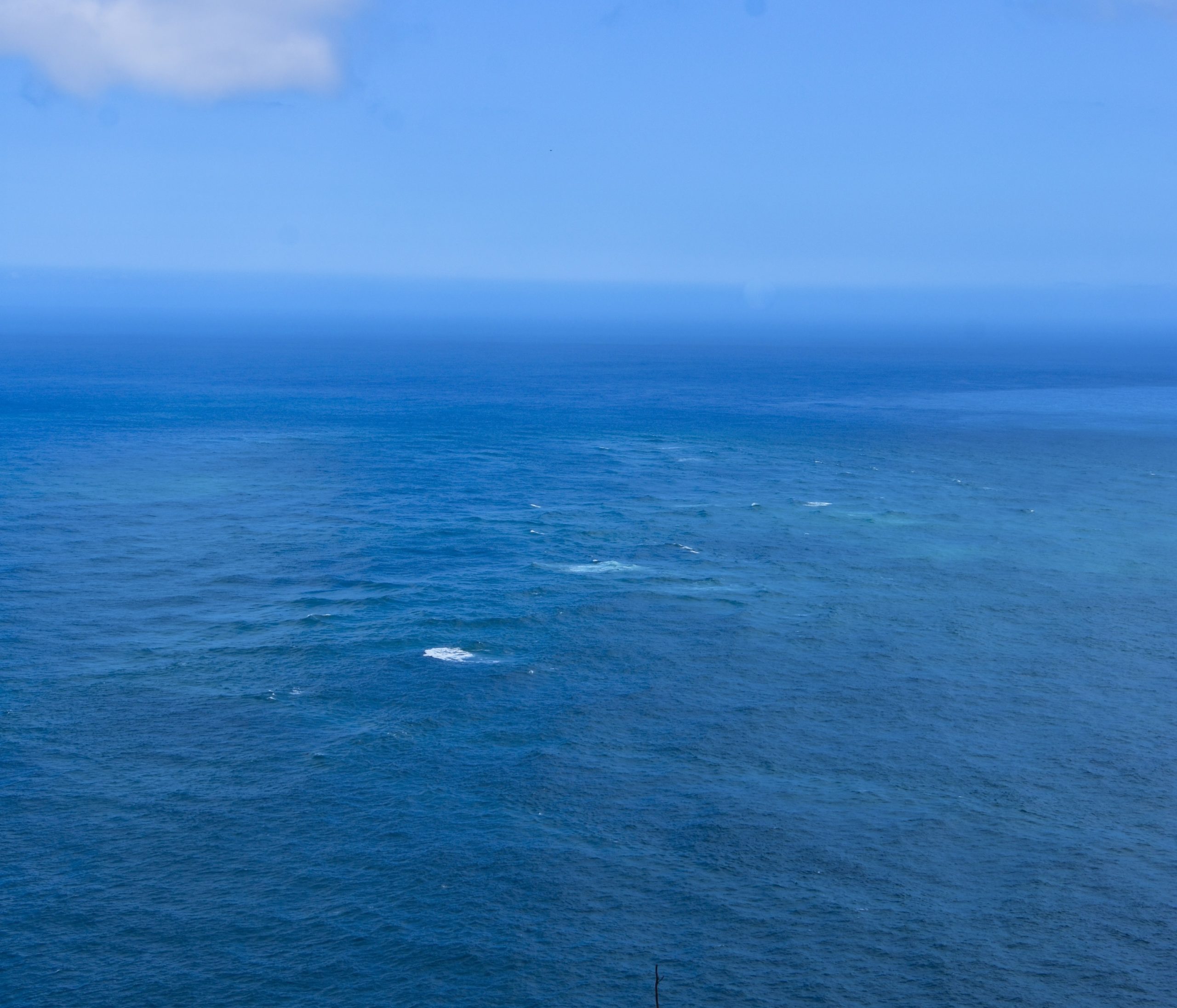
One thing that does not live up to the hype, is the convergence of the Tasman Sea and the Pacific Ocean, which is variously described as ‘a clash of swirling currents’ ‘a visually striking display’ and according to Maori lore, the mating spot between the female Te Moana-a-Rehua and the male Te Tai-o-Whitirea. Based on what I saw on the web I was expecting it to look something like this.
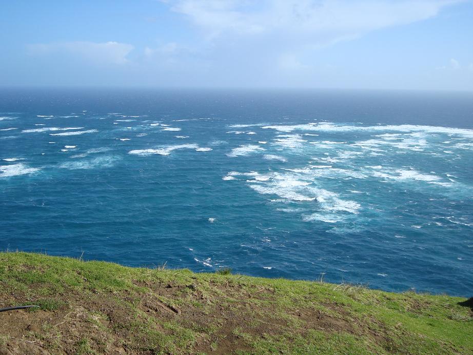
Instead what I saw was this much more tranquil scene. Instead of a clash of swirling currents, we got a friendly hug. It actually reminded me of the exaggeration around our famous Bay of Fundy tidal bores which tourists are led to believe is a veritable tidal wave coming in when it’s usually not much more than a big ripple.
Everything else about Cape Reinga more than lives up to its reputation. The lighthouse is a beauty.
You’ll want another photo here.
And the view looking down to the actual tip of Cape Reinga is gorgeous.
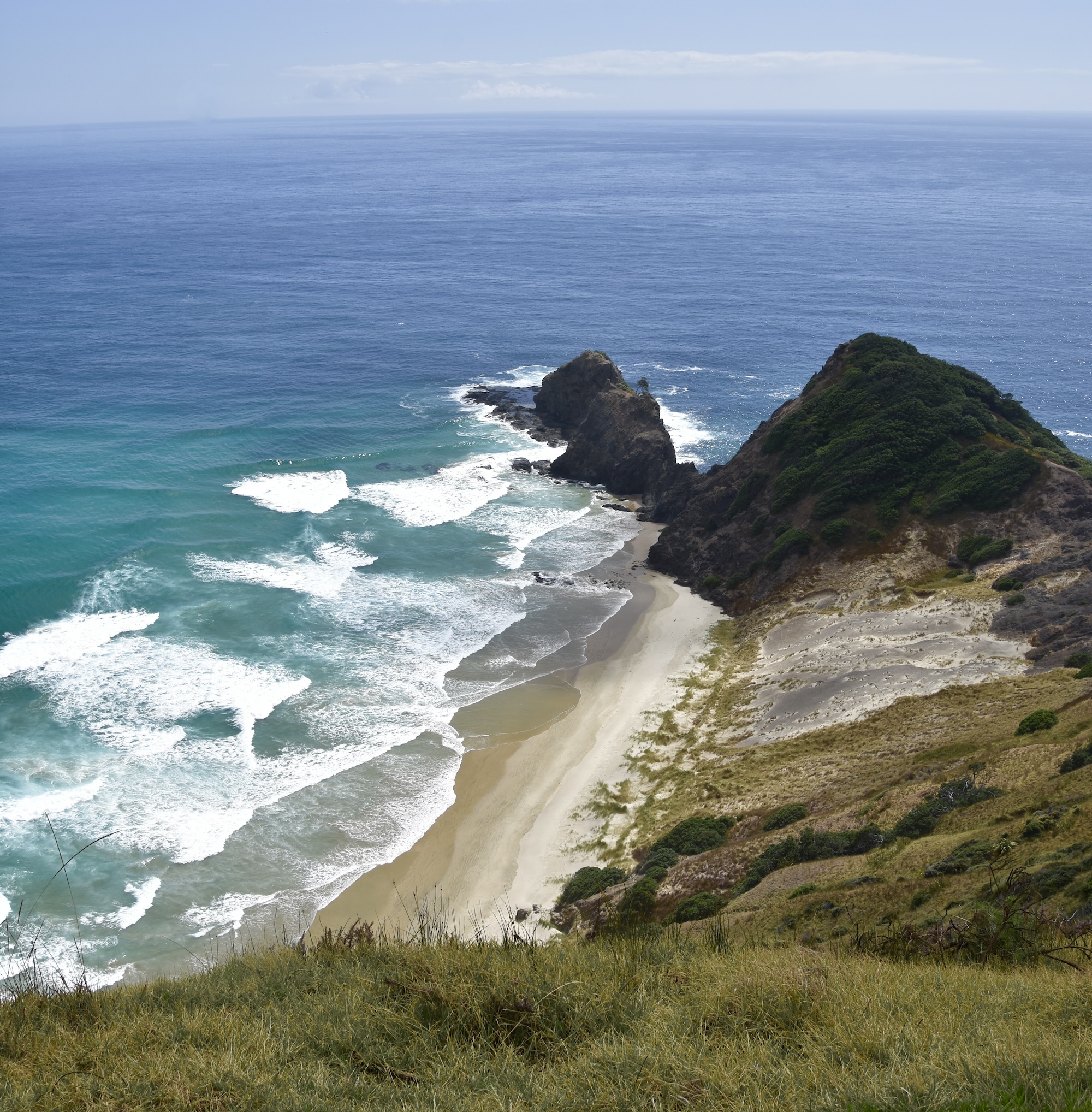
Once you’ve been here, it’s not hard to understand why this is believed to be the last place on earth that your soul would see before departing forever.
Waipoua Kauri Forest
On our way back to Auckland from Paihia we took a completely different route than we had taken on the way up. Although I will always take a new route over repeating one already travelled, I had a definite purpose in mind and that was to see some of the largest and oldest trees on the planet at Waipoua Kauri Forest.
When the Maori arrived in New Zealand both islands were heavily forested with many species of trees that had evolved in isolation ever since Zealandia broke away from Gondwanaland over 80 million years earlier. While there were many species useful to the Maori such as the tōtara and the rimu, there was one that stood out for its sheer size and majesty, the kauri tree. Found only on the northernmost parts of North Island, it was ideal as a building material for canoes, houses and carvings. It also produced a resin or gum that was prized. The Maori did do a considerable amount of deforestation in the time between their arrival and that of the Europeans, reducing the overall forest coverage from 80% to 50% of the two islands. However, the kauri forests were largely intact. With the arrival of the Europeans that changed dramatically as the kauri trees were perfect for the much larger scale boat building and housing that was required by the new comers. From 1820 until 1950 there was a relentless assault on the kauri forests with the result that today less than 4% of the original forests remain.
The most significant of these is Waipoua forest which preserves 80 square kms. of native forest and is home to two of the largest and oldest trees on the planet, Tāne Mahuta and Te Matua Ngahere. It is located on the western side of the Northland which involves a quite pleasant drive of over two hours from Paihia mostly on NZ 12. Like the trip to Cape Reinga, there are very few services in the Waipoua area and once you enter the forest, which the highway bisects on its way south, there is nothing but one restroom at one trailhead.
Unfortunately, even though kauri trees are now strictly protected, they are under threat from a root fungus that results in kauri dieback disease. The fungus is spread by contact with the ground from contaminated footwear, i.e. humans spread it. The result is that one cannot just walk into the forest wherever you want. There are two trails that lead to the giant trees. Before entering the trails you must first disinfect your shoes by dipping them in sterigene, which won’t harm your shoes, but will kill any root fungus spores. There are very friendly Maori women at each trailhead to answer any questions you might have and to make sure you do the disinfection process properly.
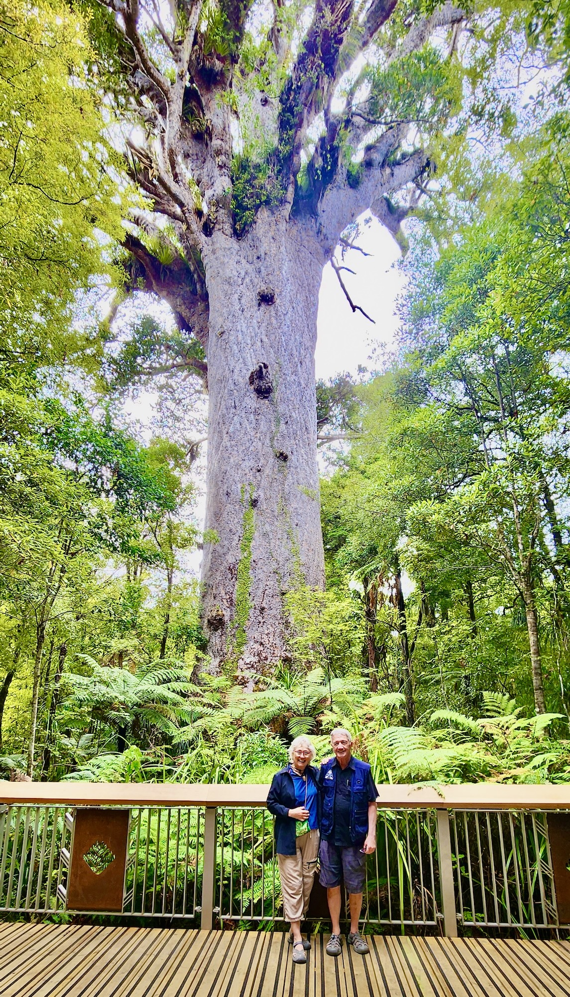
The first trail coming from the north is the Tāne Mahuta Walk that is only 166 metres (181 yards) along an accessible boardwalk that leads to a tree that is 45 metres (148 feet) tall and may be as old as 2,500 years. The name translates as Lord of the Forest and this photo does not remotely depict the sheer majesty of this tree. In its presence, I could not help but think of Treebeard, the shepherd of the trees from Lord of the Rings.
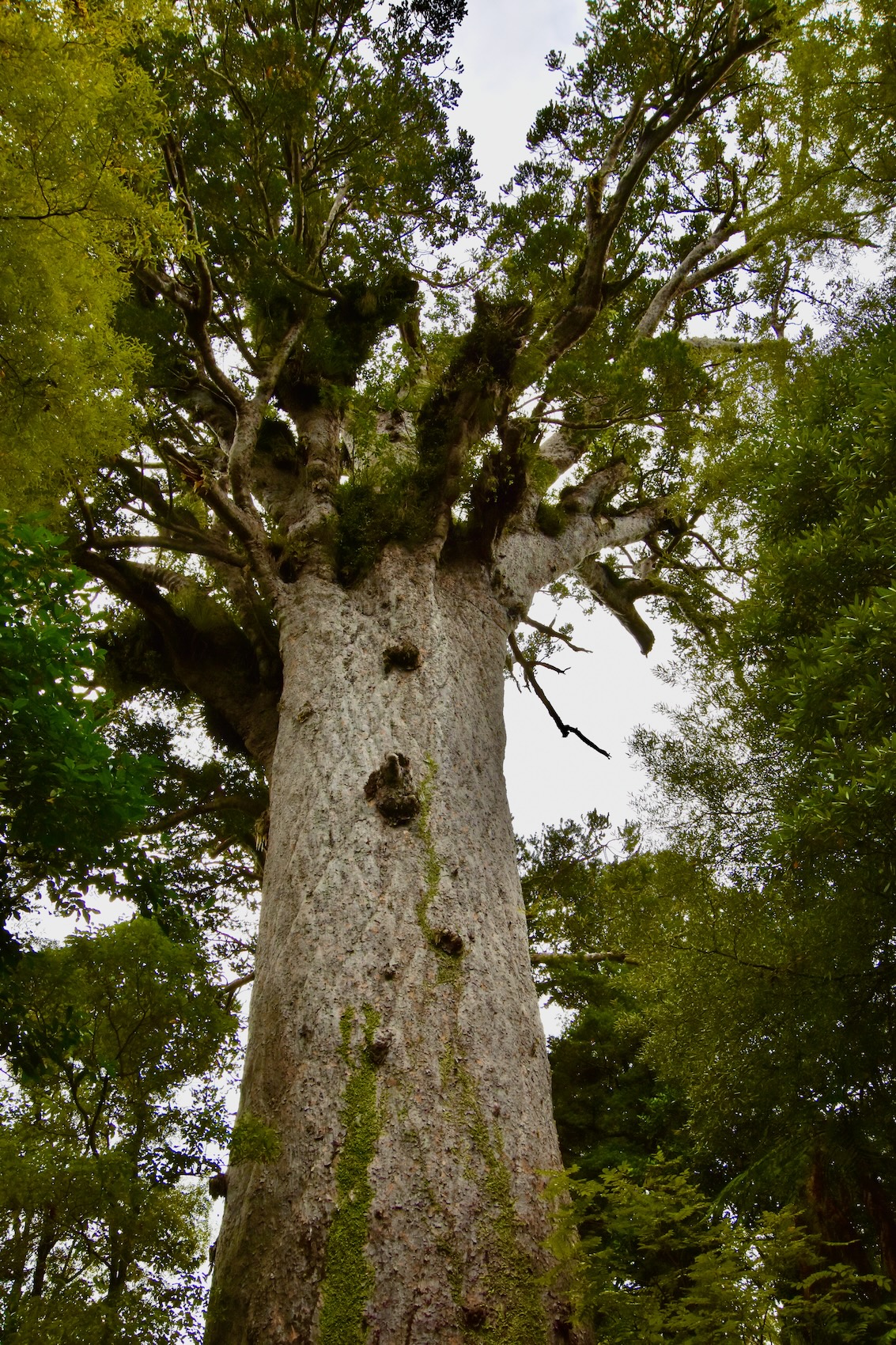
There is a better viewing area by continuing past where you first come upon Tāne Mahuta and we were fortunate that a couple from Germany were also on the trail and were able to take this photo. Look at it and realize that the trees that surround Tāne Mahuta are what you would call a normal size forest and you will get some inkling of just how big this tree is.
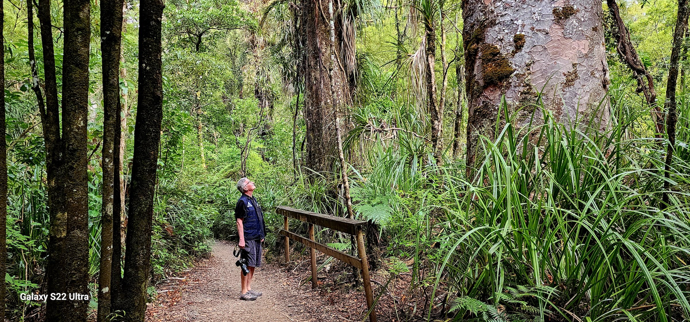
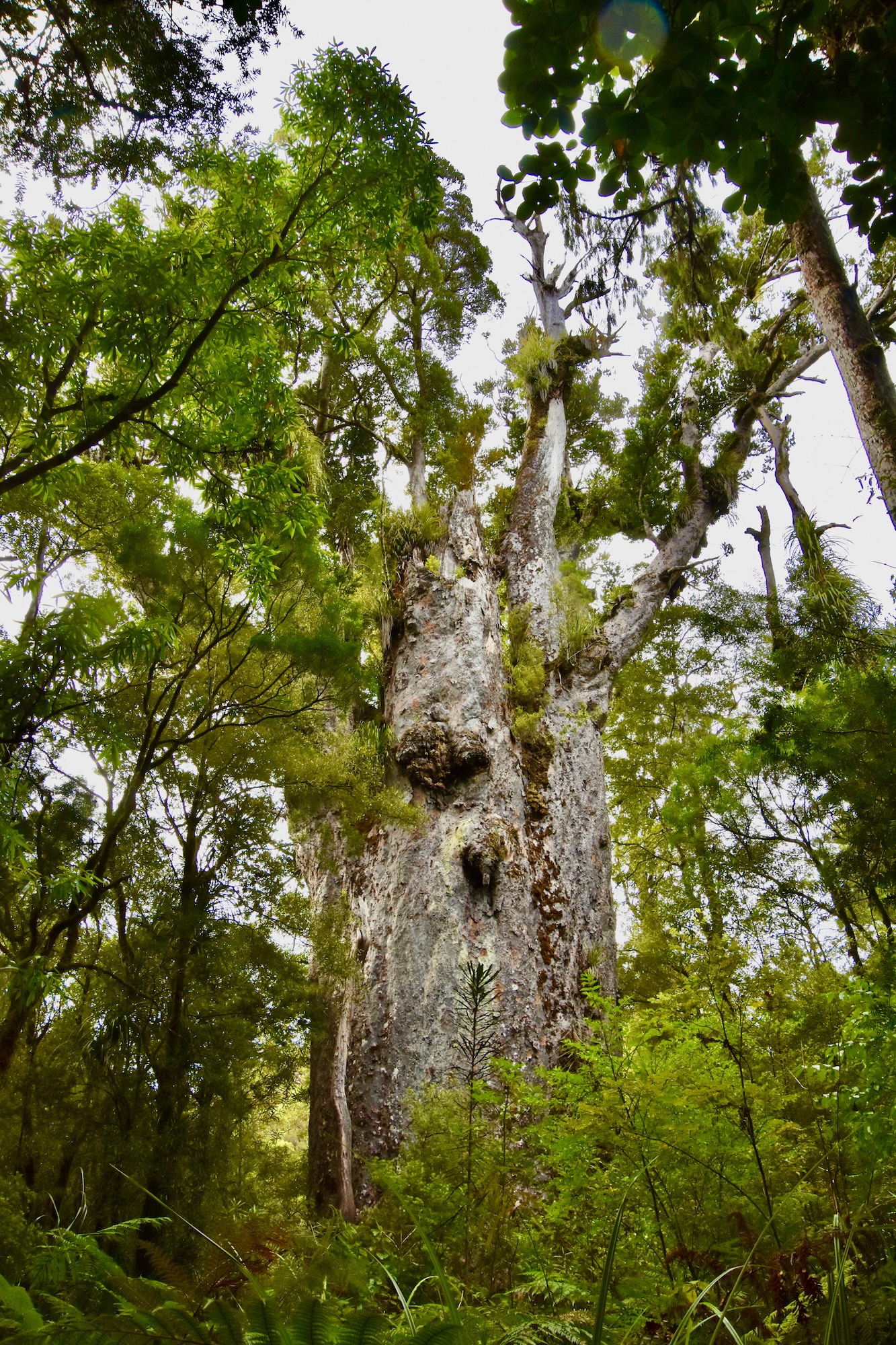
Further on is the Te Matua Ngahere walk which is a twenty minute walk to the second largest kauri tree whose name translates to Father of the Forest. If you only do one walk in a New Zealand forest this has to be the one. It is truly magical and chances are, you might be the only people in this enchanted forest. We were.
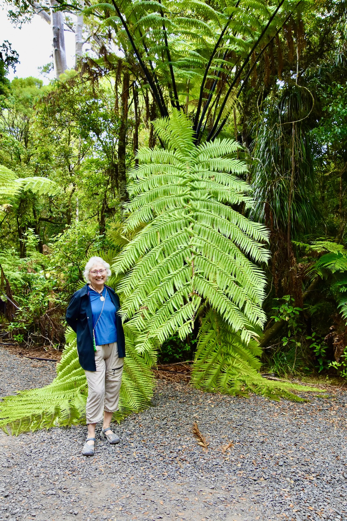
In addition to the kauri trees this is a great place to find New Zealand’s famous tree ferns which look like something right out of Jurassic Park.
The trail ends at a viewing platform where you get a look at Te Matua Ngahere which is not as imposing as Tāne Mahuta, but the walk here and back is much more inspiring than the short trek to the latter. The bottom line is that you must do both walks to really get an inkling of the power of these kauri trees. I’ve been awed by the redwoods, sequoias and Douglas firs of California and British Columbia, but honestly, I’ve never been as humbled by a living tree as I was on seeing Tāne Mahuta.
Alison and are sad to depart from New Zealand’s Northland, it has been such an unexpected adventure, but we are looking forward to reuniting with our friend Chris Tripodi and joining the Adventures Abroad tour for the next two weeks. I know it will be a blast and I hope you’ll join us.