Greenwich Dunes – The Best of PEI

This is my sixth post from a recent golf trip to Prince Edward Island, but Alison and I have been doing much more than just playing golf. During our stay in Mill River we took the time to explore some new destinations along the North Cape Coastal Drive in western PEI. While at Brudenell River we went in the opposite direction and toured the north eastern part of the province as far as the lighthouse at East Point and wrote about it in this post. We have moved on from the excellent Brudenell Fairway Chalets to Chef Michael Smith’s superb Inn at Bay Fortune which I’ll be writing about in an upcoming post. Instead of playing a fourth round of golf, which was tempting, we have opted instead to spend most of the day hiking the three trails at the Greenwich Dunes segment of Prince Edward Island National Park. This is something we have long looked forward to, especially after TourismPEI starting using aerial footage of the floating boardwalk on the Greenwich Dunes trail in its TV promotions. It looks absolutely amazing – so I hope you’ll join us in finding out if it’s as good as it looks in the ads.
Prince Edward Island National Park
When I first started coming to Prince Edward Island National Park as a boy it was a very different place than it is today. At that time the park, which dates all the way back to 1937, placed the emphasis on family fun at the beach with the little town of Cavendish at the centre of things. By the 1960’s Cavendish had become extremely popular and taken on almost a carnival atmosphere with places like Rainbow Valley attracting throngs of visitors. While there was an excellent Stanley Thompson golf course and the famous Anne of Green Gables house, there was not a lot of what one would normally associate with a national park like wilderness areas or hiking trails. It got to the point that the ecological status of the park was in peril simply due to the crushing number of visitors who were trampling the dunes and driving away native nesting birds like the piping plovers. It was almost the antithesis of what a national park should be. Except for an occasional round of golf at Green Gables I stopped going to Cavendish and opted to spend most of my time in PEI on the eastern part of the island which was much less touristy and provided more opportunities for canoeing, kayaking, biking and hiking.
Fortunately, the long range thinkers at Parks Canada prevailed and a plan was put in place to restore the damaged dunes, protect the nesting birds and most importantly for the purposes of this post, obtain more land that had not been ravaged by over tourism. In 1998 the Federal Government acquired land at Greenwich Point on St. Peter’s Bay some fifteen kilometres or so from the main body of the park which had the largest and most unique dune system on the island. The idea was to preserve this land in its pristine state while still allowing people to visit and get an understanding of the importance of dune systems to the environment. To that end an interpretation centre and three trails were built, but there is no camping or commercial activity. There is access to the beach at only two points, one of which has changing stations and washrooms.
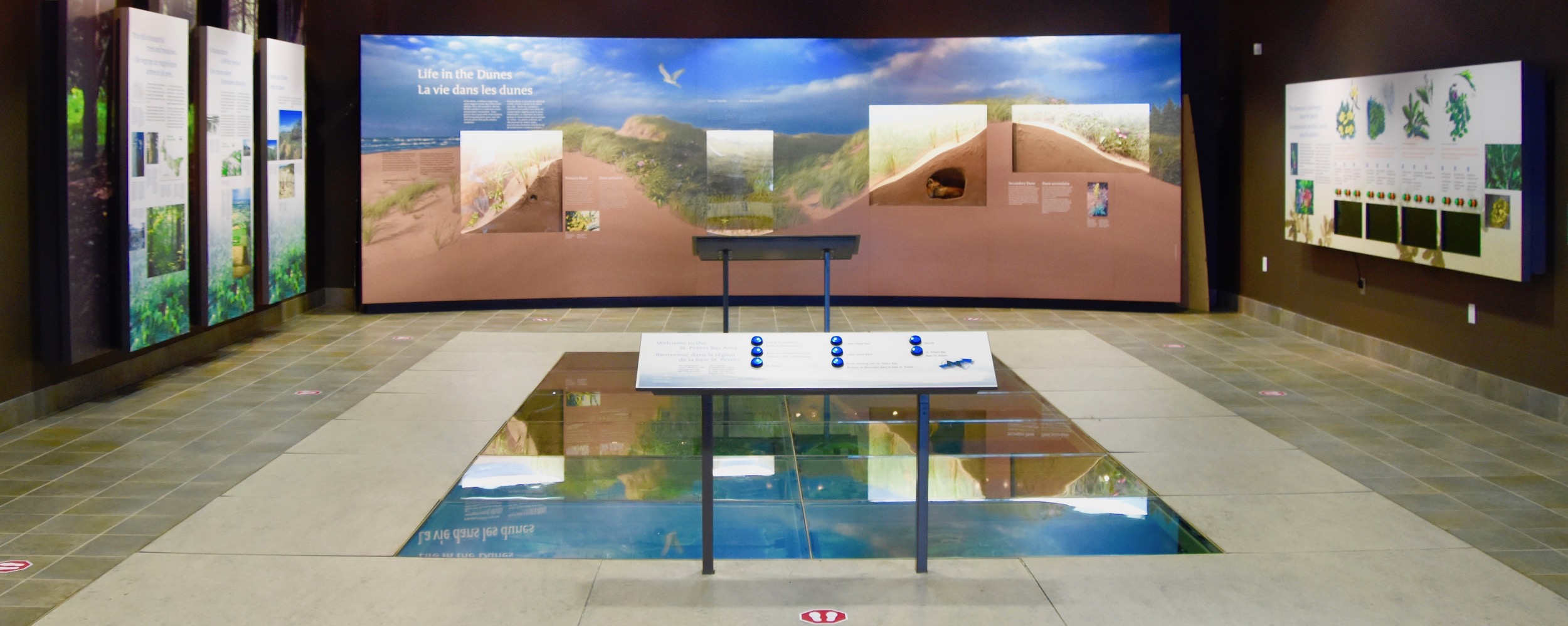
Greenwich Dunes Interpretive Centre
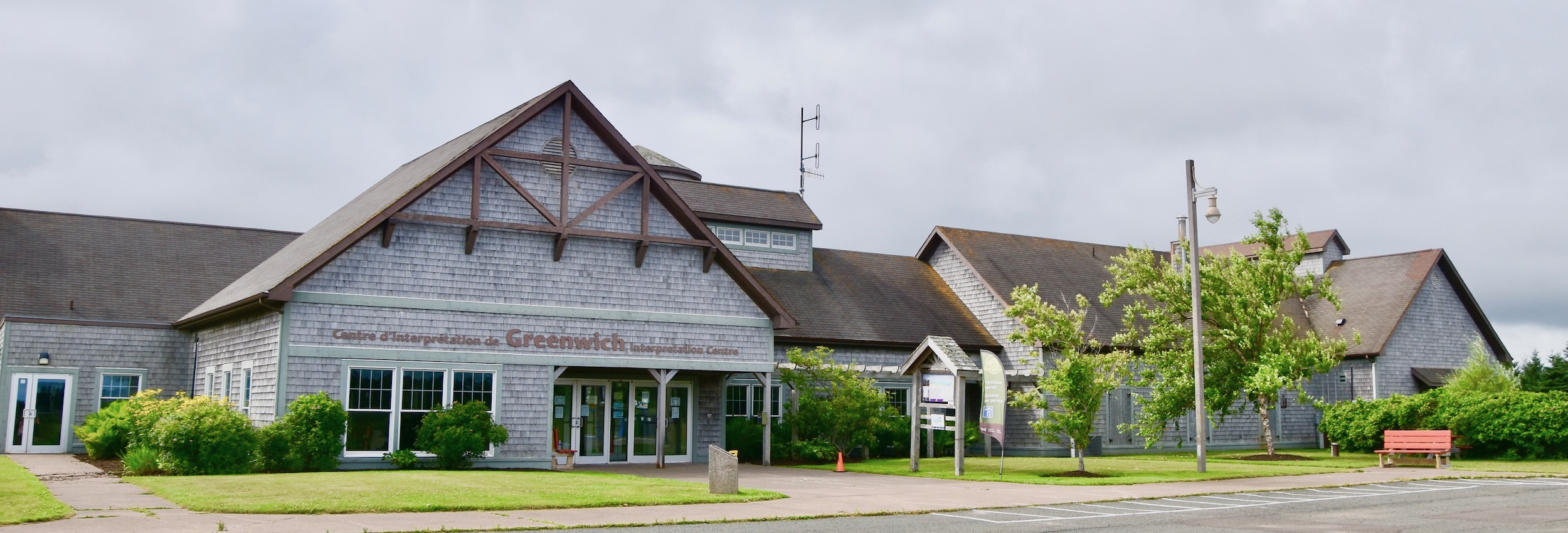
You get to the Greenwich Dunes portion of PEI National Park by driving to the small town of St. Peter’s and turning onto Route 313 that dead ends just after the park entrance. The first stop should be at the Interpretive Centre which we thought might be closed because there were no other cars in the parking lot. Fortunately it wasn’t. Inside we bought our day pass (my Parks Canada pass literally expired the day before our visit on August 1) and toured the spacious building. We learned that the dunes at Greenwich are a quite rare type known as parabolic dunes and thus different from those at Cavendish. There was also the usual collection of stuffed birds and mammals that are found in the park with this notable caveat – none of the animals on display were deliberately killed for the express purposes of putting them on display.
Greenwich Dunes Beach
Leaving the Interpretive Centre we decided to take the short road to the beach access in this part of the park. Once again, we were the only people in the parking lot.
From here it’s a short walk over a boardwalk to the beach.
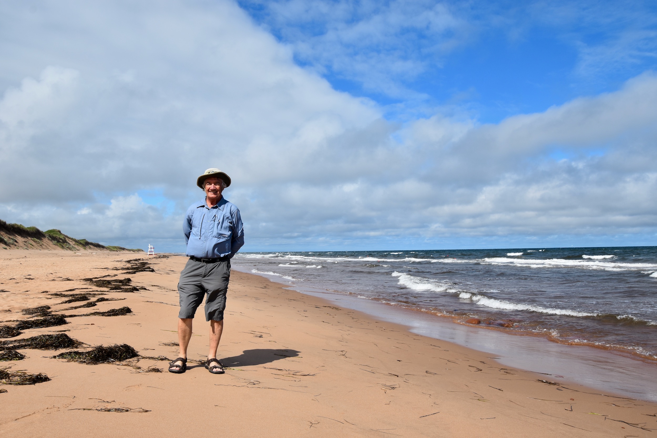
As expected, the beach was completely deserted, something almost unthinkable on an early August day in PEI before Covid. This is what it looked like and probably not that different from when the first Indigenous people arrived here roughly 10,000 years ago.
Here’s a short video taken on the beach.
Alison took the obligatory ‘prove you were there’ photo and we headed back to the vehicle for the short ride to the trail head parking lot.
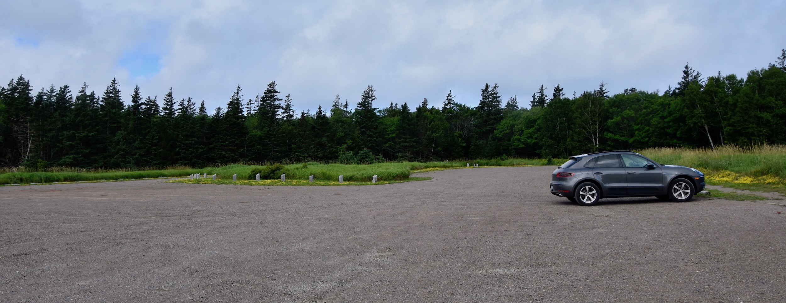
The Greenwich Dunes section of PEI National Park has three hiking trails all of which are accessed from the one parking lot. Looking at the distances of each we determined that we could hike all three with little difficulty starting with the quite short Havre St. Pierre trail.
Havre St. Pierre Trail
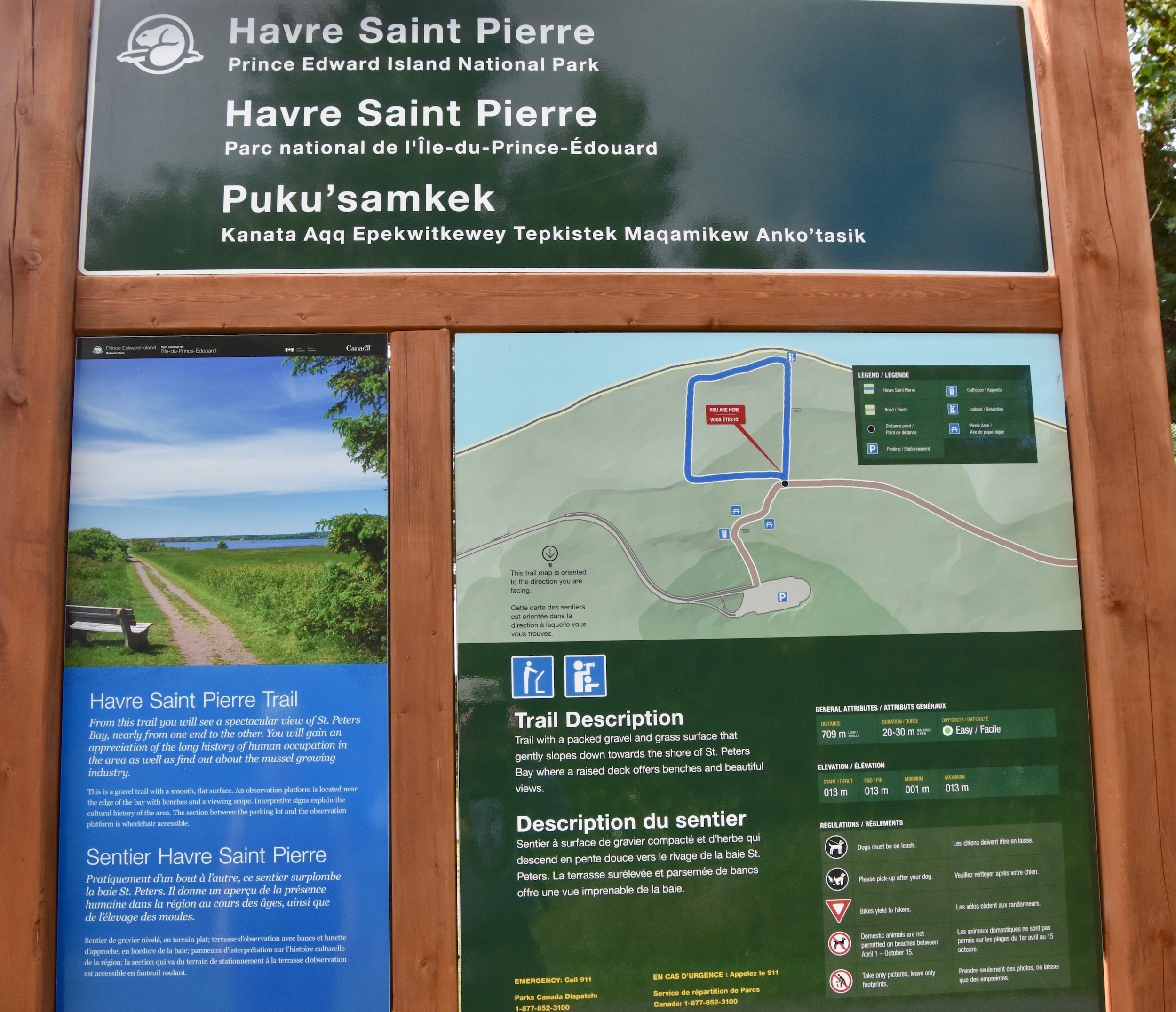
This is a short rectangular trail that is a nice warm up walk before tackling the other two longer trails. It is very flat and provides great views of St. Peter’s Bay. It has been the site of archaeological digs that have found evidence of human habitation dating back almost to the end of the last Ice Age. The name of the trail pays tribute to the original European settlement in this area by the French in 1720 at Havre St. Pierre which was later Anglicized into St. Peter’s Bay. It lay directly across the bay from Greenwich Point in what is now the town of St. Peter’s.
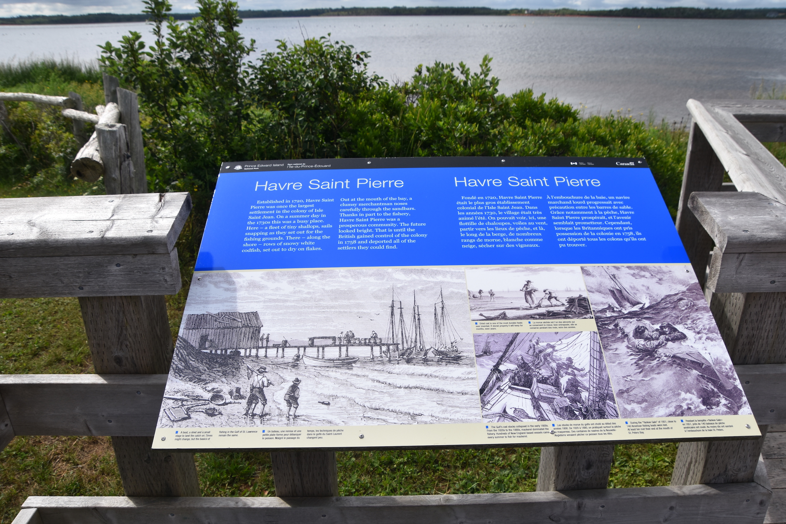
This interpretive panel tells the story of Havre St. Pierre which was the largest French settlement on what they called Ile Saint Jean. From 1720 to 1758 it was a prosperous fishing community which supplied France with the salt cod that at that time was very much a part of the ordinary French diet. It still is today in much of Spain and Portugal. While everyone knows about the expulsion of the Acadians from Nova Scotia in 1755, few know that the expulsions continued in other parts of the Maritimes for years. In 1758 the British rounded up everyone they could find in Havre St. Pierre and deported them to France. An estimated 3,000 people were deported from Prince Edward Island that year of which almost half perished from illness on the voyage to Europe. While Alison and I came to Greenwich Dunes for its natural beauty we were humbled to be looking at the spot where one of the Canada’s great historical tragedy’s took place.
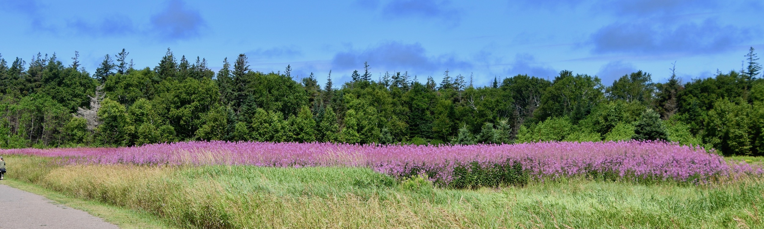
On a brighter note, literally, the Havre St. Pierre trail hosts fields of pink fireweed that have colonized what was once farmland for over three centuries.
Tlaqatik Trail
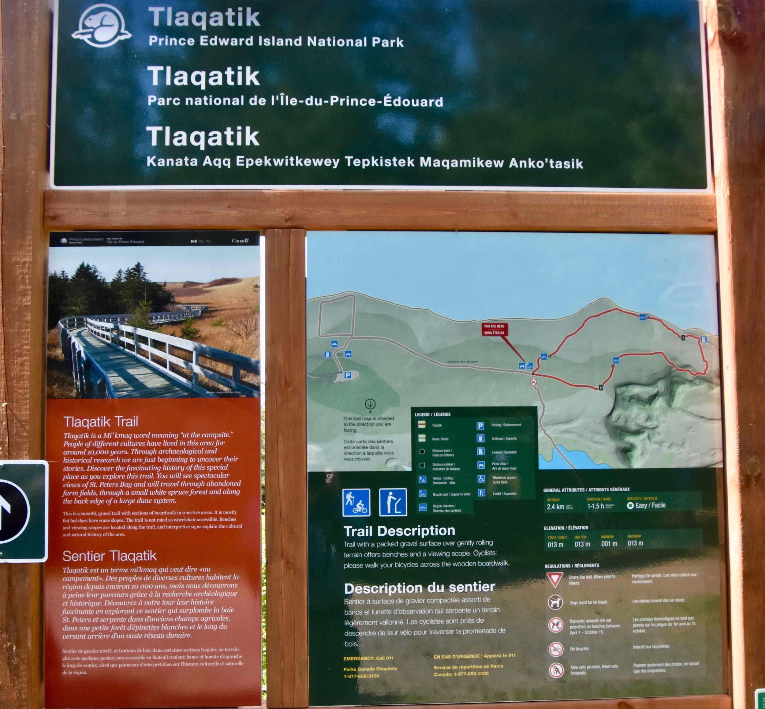
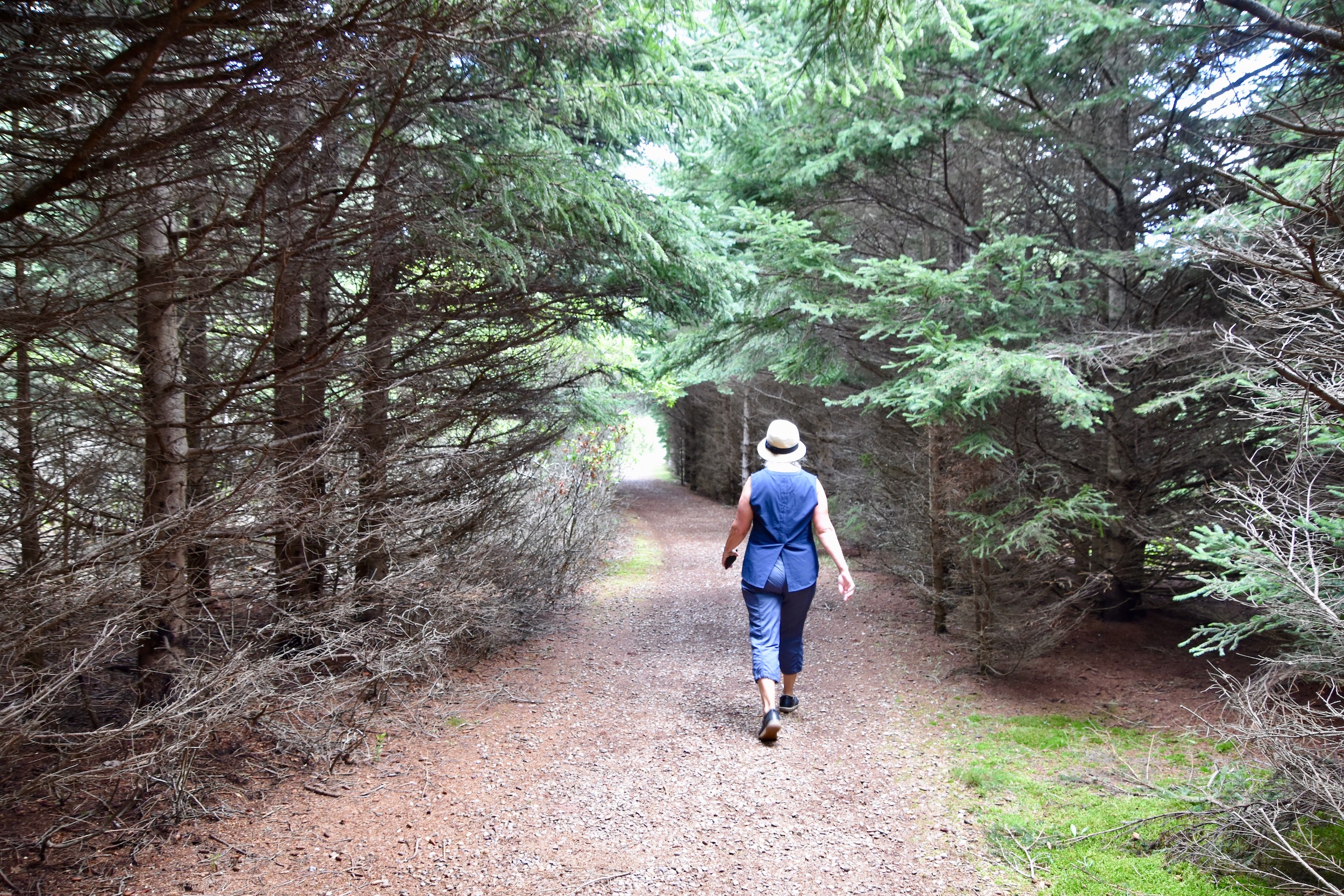
Finishing the Havre St. Pierre trail there is about a one kilometre walk to the next loop trail Tlaqatik which is 2.4 kms.(1.5 miles) in length or 4.8 kms. (3 miles) from the parking lot and back. This trail features a combination of open fields and forests culminating in a boardwalk along the back side of the parabolic dunes at Greenwich Dunes. The word Tlaqatik translates as ‘the campsite’ which in fact it has been for many thousands of years by Indigenous peoples. Being in the lee of the dunes it provides shelter from the constant Gulf of St. Lawrence winds while at the same time providing easy access to the abundance of fish and shellfish found in St. Peter’s Bay. While this trail is nowhere near as dramatic as the Greenwich Dunes trail, it is more than worth taking the hour or so to walk it. At one point there is a good view of the lighthouse at the entrance to St. Peter’s Bay.
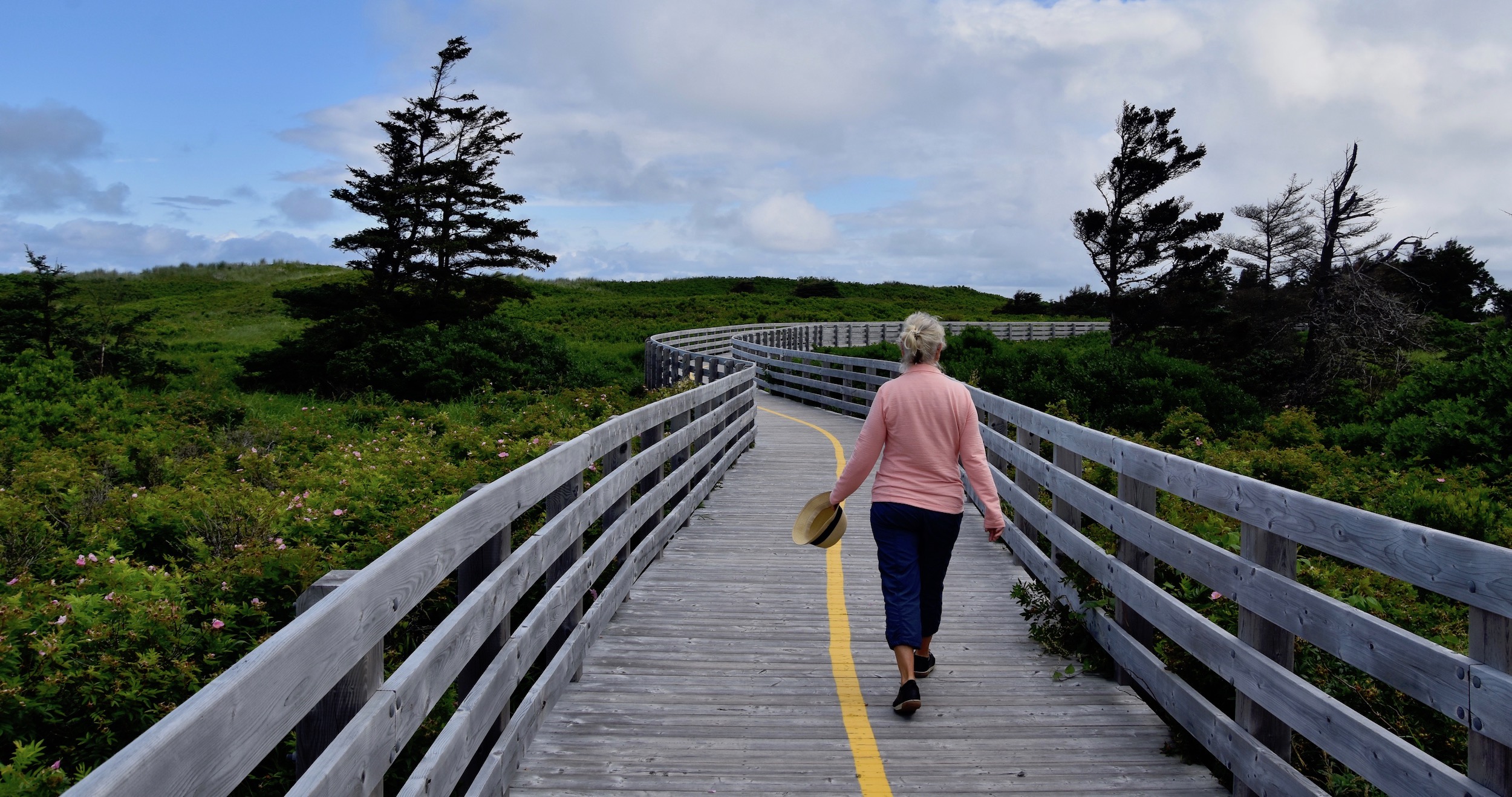
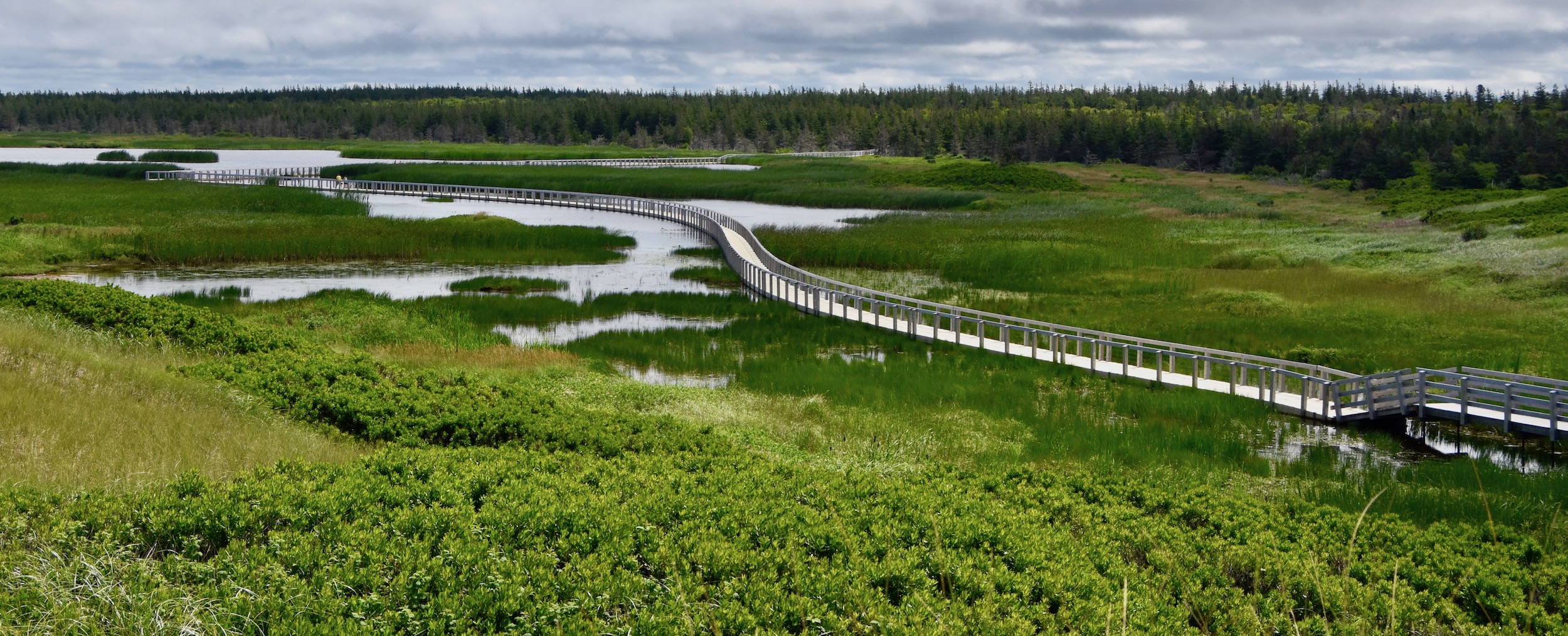
Greenwich Dunes Trail
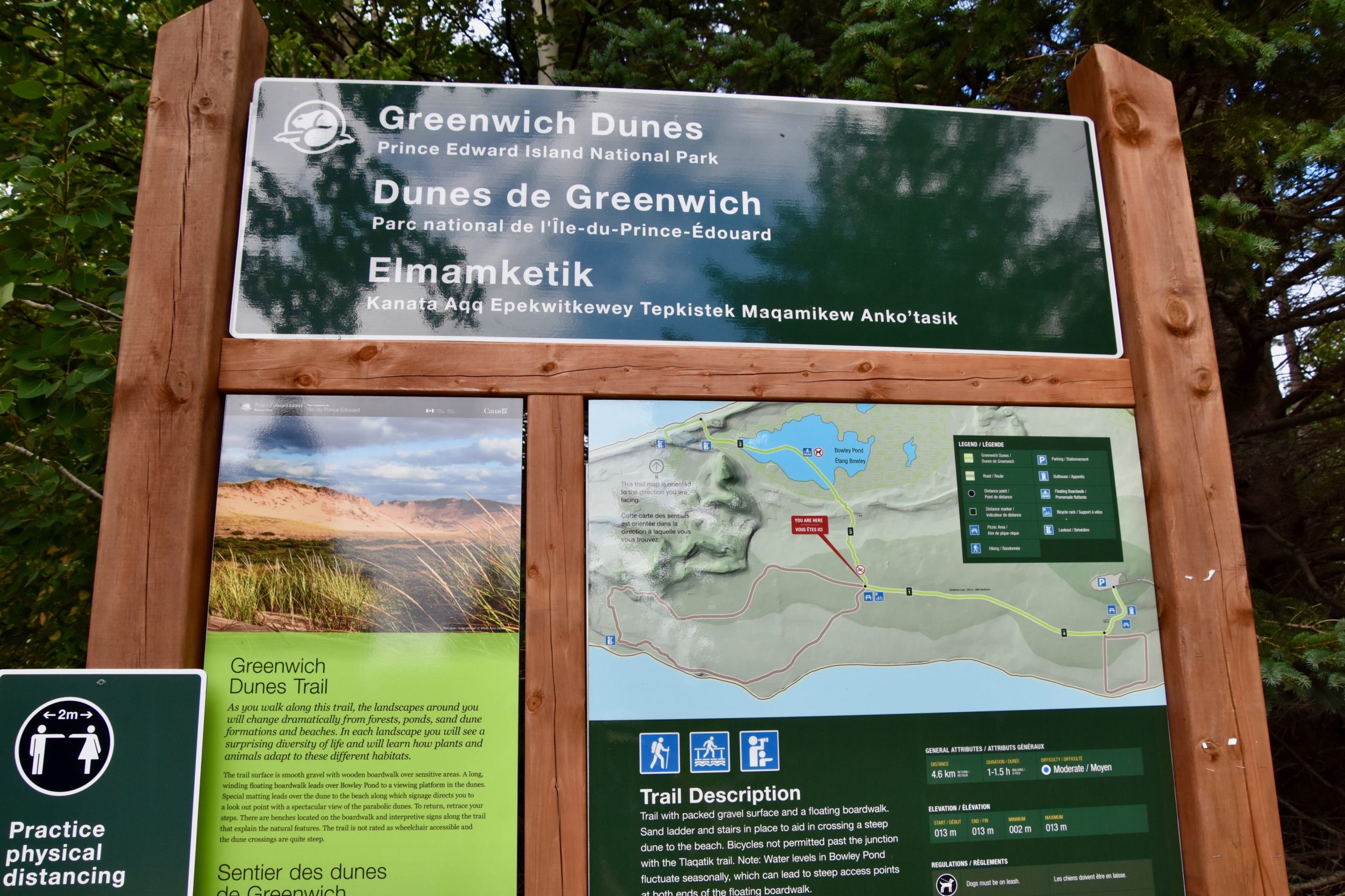
As always, I’ve saved the best for last. The Greenwich Dunes trail is not a loop and listed as 4.4 kms. (2.7 miles) from the parking lot and back. It is very flat and suitable for people of all ages. We saw a number of strollers which can make it as far as the base of the dunes fronting the beach and there is a place to park them there.
The trail starts off through the woods, much like the end of the Tlaqatik trail, but shortly comes out to a stationary boardwalk that then turns into the rapidly becoming famous floating boardwalk that crosses over the pond and marsh behind the beach front dunes.
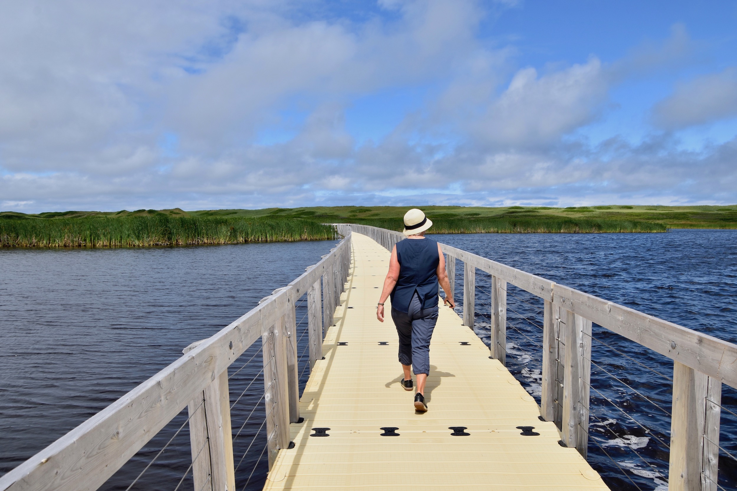
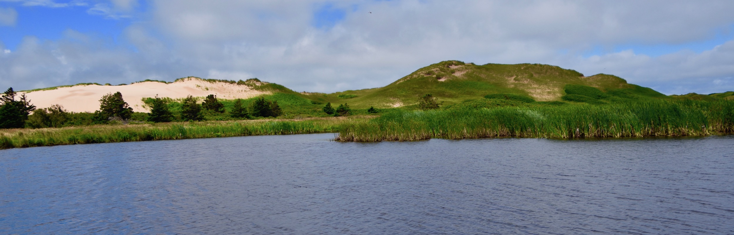
From this vantage point you get a great view of the dunes and an appreciation of just how big they are. These dunes are not the ones that you cross to get to the beach, but are further inland.
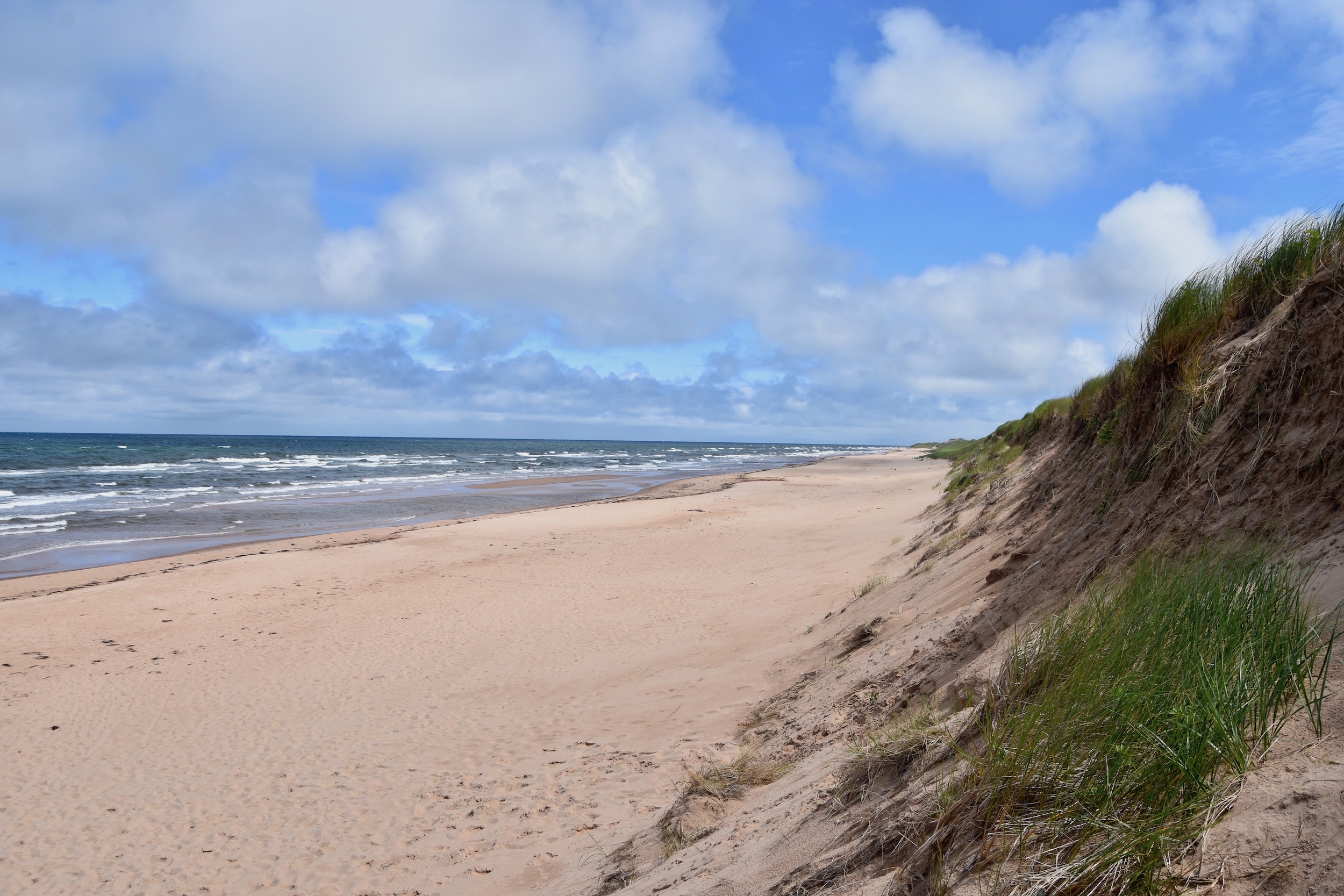
At the end of the floating boardwalk there are steps that lead up and over the coastal dunes to this section of Greenwich beach.
This beach was not as deserted as the section near the Interpretive Centre. There were all of eight people enjoying the waters here.
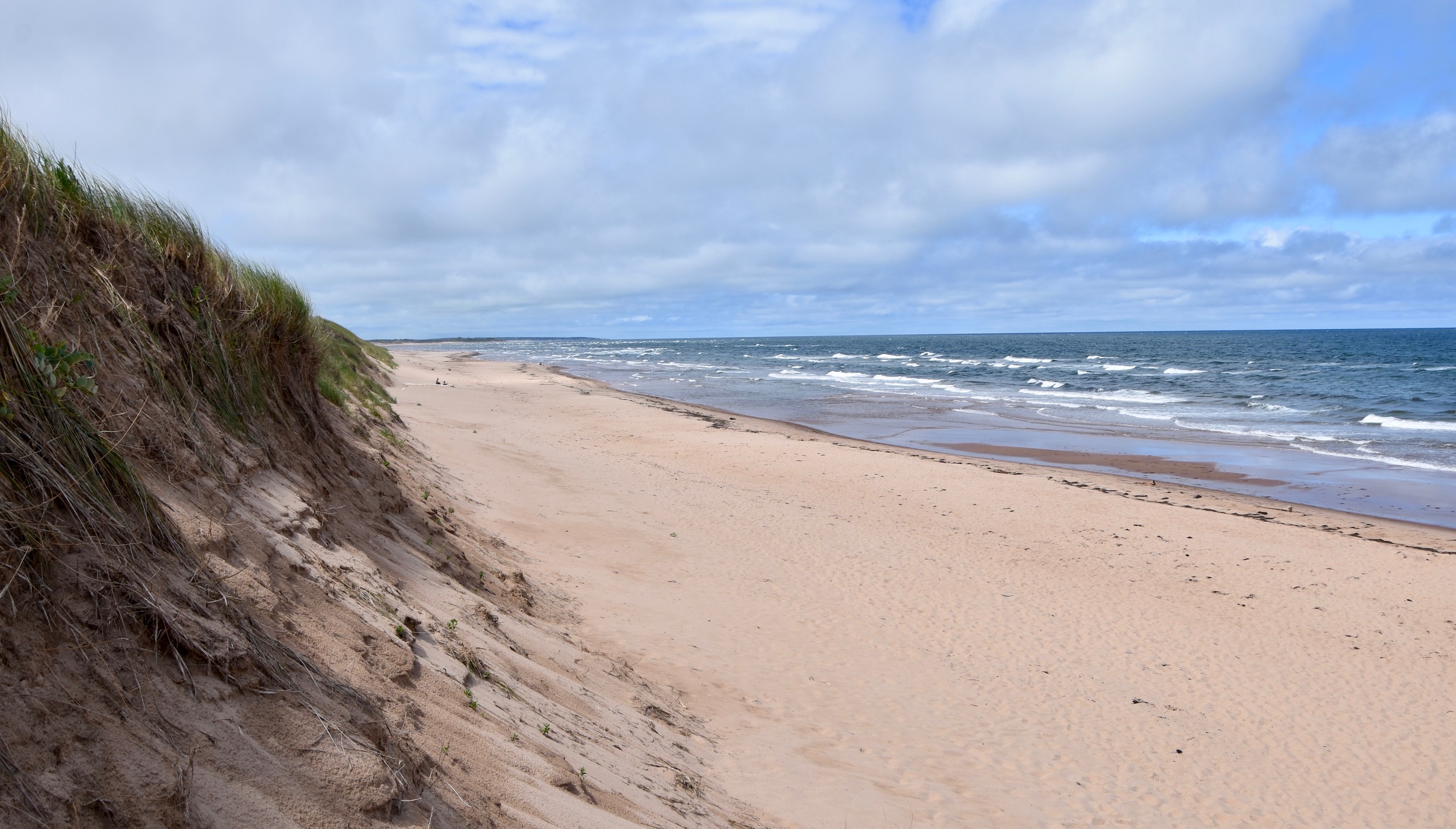
The best views on this entire trail system are to be had from the top of the coastal dune looking back at the boardwalk.
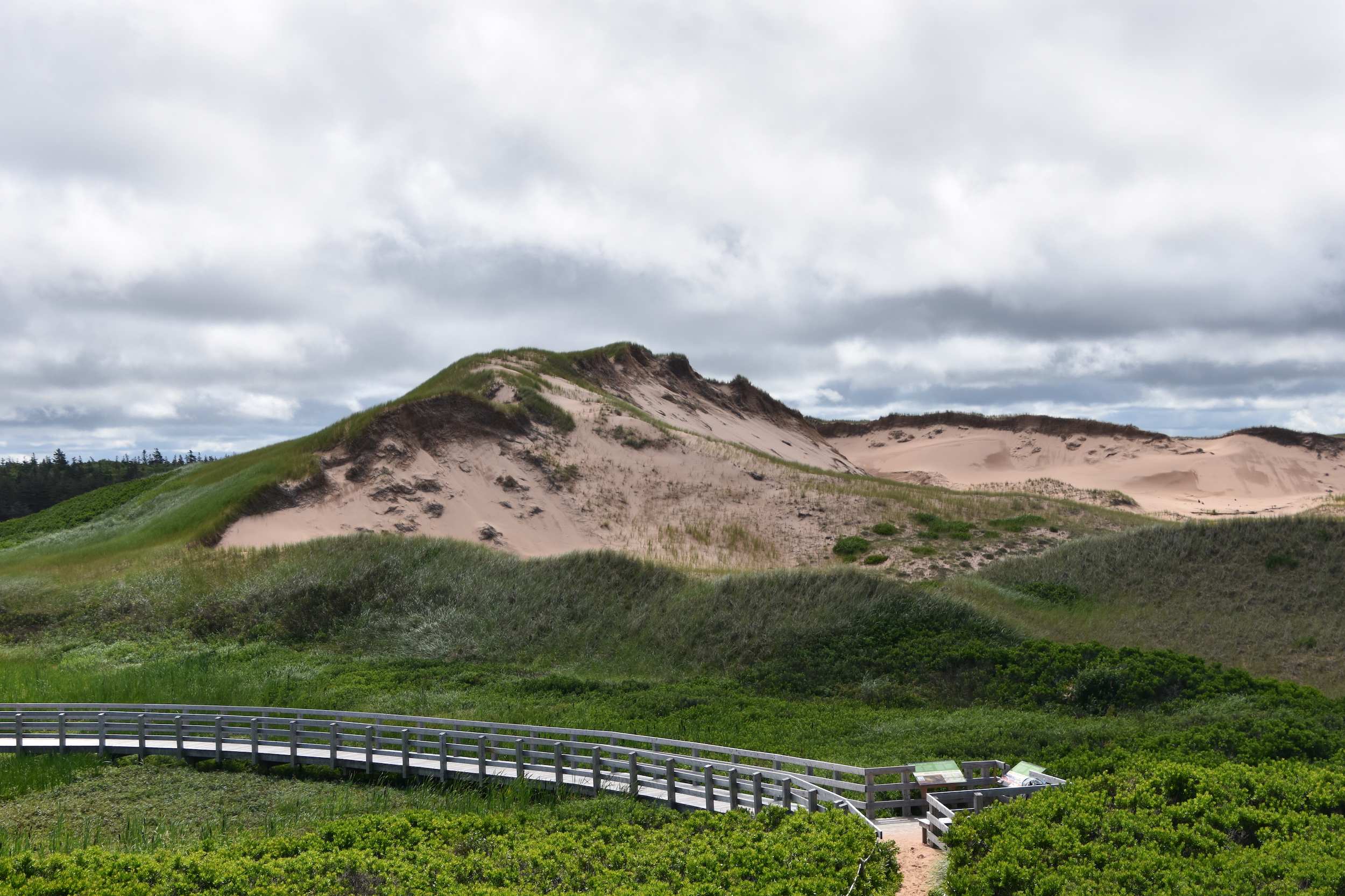
Tell me this is not a photo you wouldn’t walk a long way to shoot.
The bottom line is that the Greenwich Dunes trail more than lives up to its billing and should be added to every Maritimer’s must do list. The good news is that there is still plenty of time to hike it this year.
Another great spot to explore on Prince Edward Island is Point Prim which has a number of great attractions including a great lighthouse.