Bay of Islands – Exploring New Zealand’s Northland

In this post Alison and I are going to explore a small part of the very northern tip of the North Island of New Zealand, an area called, not surprisingly, just Northland. I have already put up two posts from Northland, one on the Nova Scotian founded settlement of Waipu and another on the Top 100 golf course Kauri Cliffs. This post will focus on the many historic and natural attractions of the Bay of Islands including the Treaty Grounds of Waitangi, the first capital of New Zealand at Russell, the delightful town of Paihia and of course, getting out on the water to visit some of those islands. There’s lots of ground to cover so let’s get started with a few maps to get a better sense of just where the Bay of Islands is located vis a vis the rest of the country.
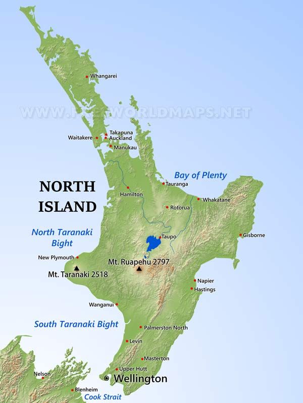
This is a map of North Island. Find Auckland at the narrowest point of the peninsula that juts out from the northwest side of North Island like the horn on a stag beetle and everything above that is Northland.
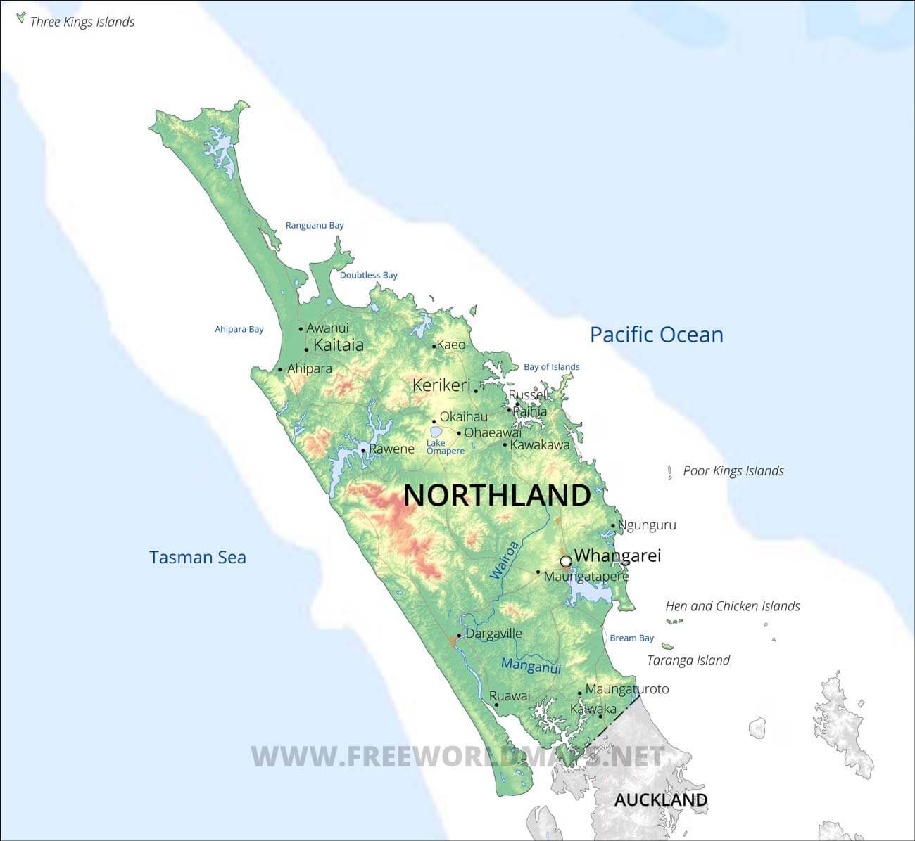
Now here’s a map of just Northland. Look half way up the right side and you’ll find the Bay of Islands. Everything in this post is found in that tiny area of Northland which is one of New Zealand’s real hidden treasures. Kiwis know about it, but most visitors to New Zealand head south after landing in Auckland and have no idea what they are missing. I am grateful to Cheryl Bailie from Hagen’s Travel & Cruises in North Vancouver for suggesting that we spend our first week in New Zealand in the Northland area, based in the town of Paihia.
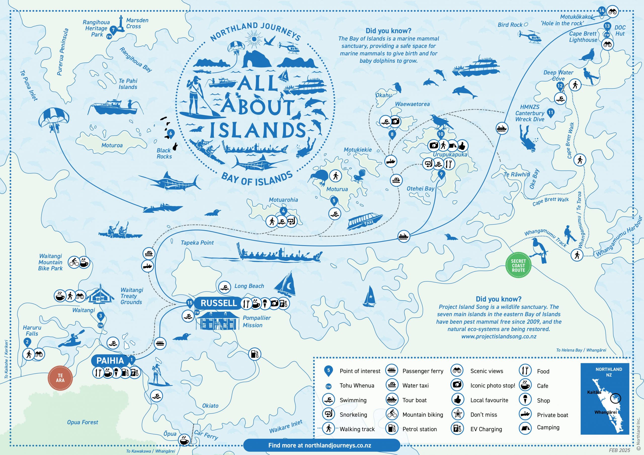
Here’s a tourist map of the Bay of Islands. You can see that there’s a hell of lot to do in the area, but first let’s get ourselves a place to stay.
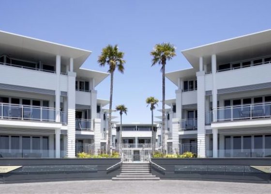
Paihia
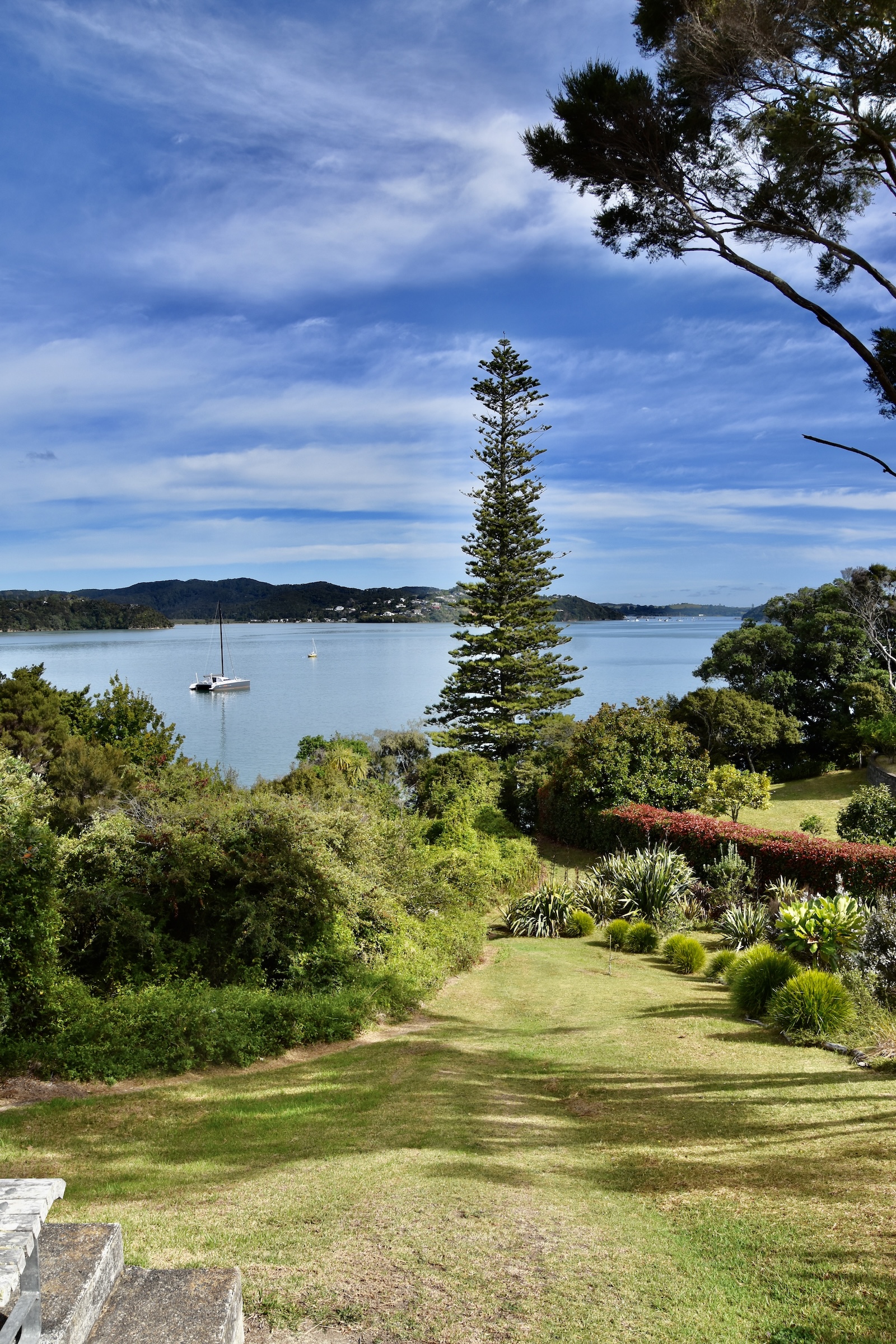
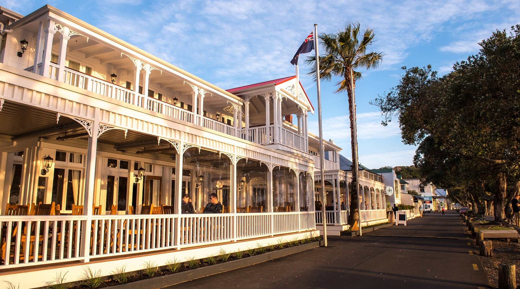
The place to stay in the Bay of Islands is the seaside resort town Paihia which has lots of accommodation, many good restaurants and bars, a nice not overly touristy shopping area and most importantly the pier from where you can take a ferry to the historic town of Russell or embark upon any number of on the water adventures. It is also within walking distance of the Waitangi Treaty Grounds.
I am indebted to Cheryl Bailie for booking us into the Waterfront Suites which is literally across the street from the pier, the information centre and several good restaurants. The suites are large fully equipped housekeeping units with balconies or as we had on the first floor, an outdoor patio. Here is a small gallery featuring the unit we stayed in. Double click to open a photo and double click again to enlarge.
-
- Waterfront Suites
-
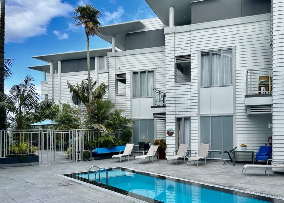
- View from Unit 108 Terrace
-
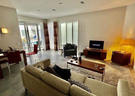
- Living Area
-
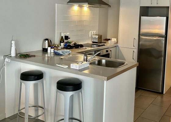
- Kitchen
-
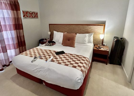
- Bedroom
-
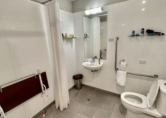
- Bathroom
You can literally park your car in the underground parking lot and leave it there for the duration of your stay in Paihia as everything I am going to describe in this post is within walking distance. You can book Waterfront Suites through this link.
Waitangi Treaty Grounds
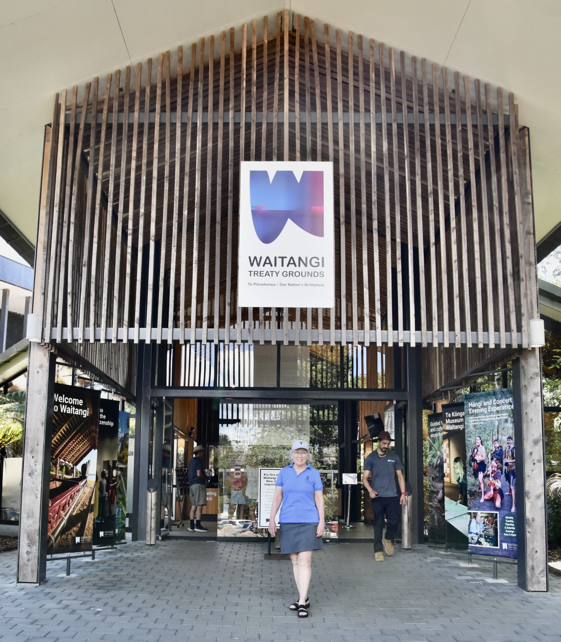
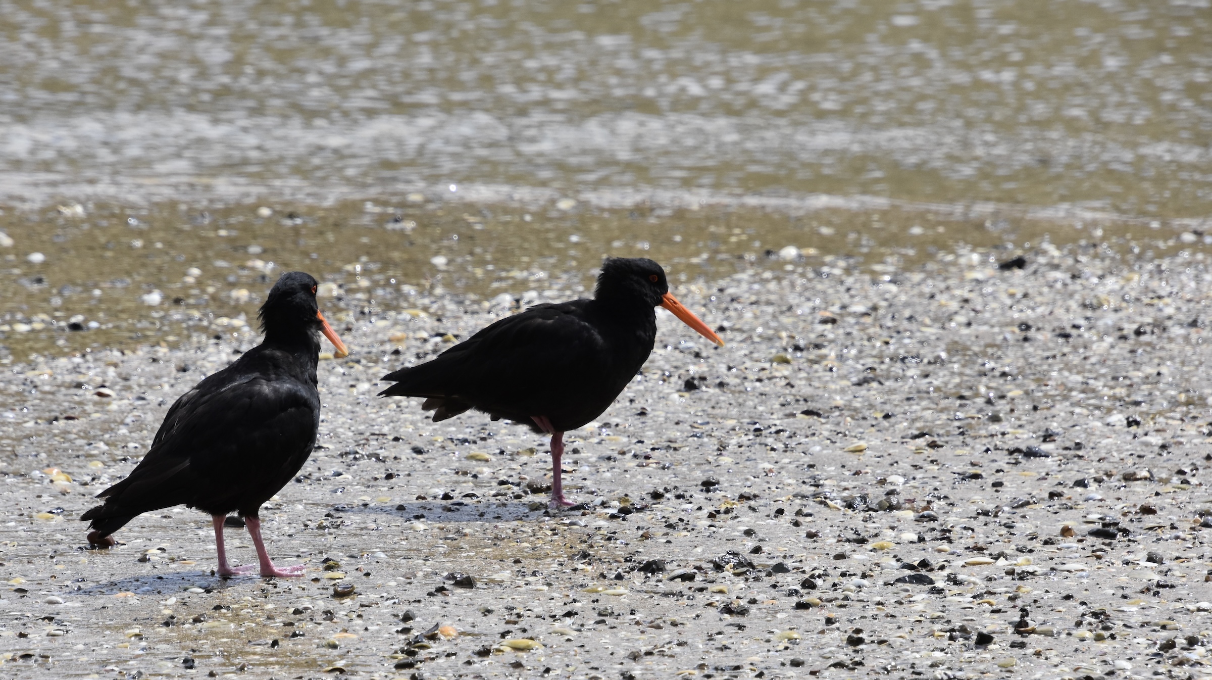
The most important historical site in all of New Zealand is found 2.2 kms. (1.3 miles) from Paihia Pier. It’s a very pleasant walk along the waterfront and over a bridge where the Waitangi River drains into Te Tii Bay. If you are a birder bring your binoculars because there are some interesting shorebirds to be seen including the variable oystercatchers aka red bills, that are endemic to New Zealand.
In my post on Auckland I made reference to the Treaty of Waitangi which was initially signed by a number of Maori rangatiras and a representative of Queen Victoria on the spot Alison and I are about to enter. Unlike Canada and United States, which signed multiple treaties with multiple groups of Indigenous peoples, all subject to their own interpretation, New Zealand had only the one treaty, ultimately signed by over 500 Maori rangatira. It is the sole foundation document for the entire country and it can truly be said that what happened at Waitangi on February 6, 1840 was the birth of a nation. Although the treaty was subject to different interpretations over the years, largely because the English and Maori written versions were not the same, ultimately to this day, the rights of both the Maoris and the pākehās (non Polynesians) are determined by this one piece of paper that contains only three articles.
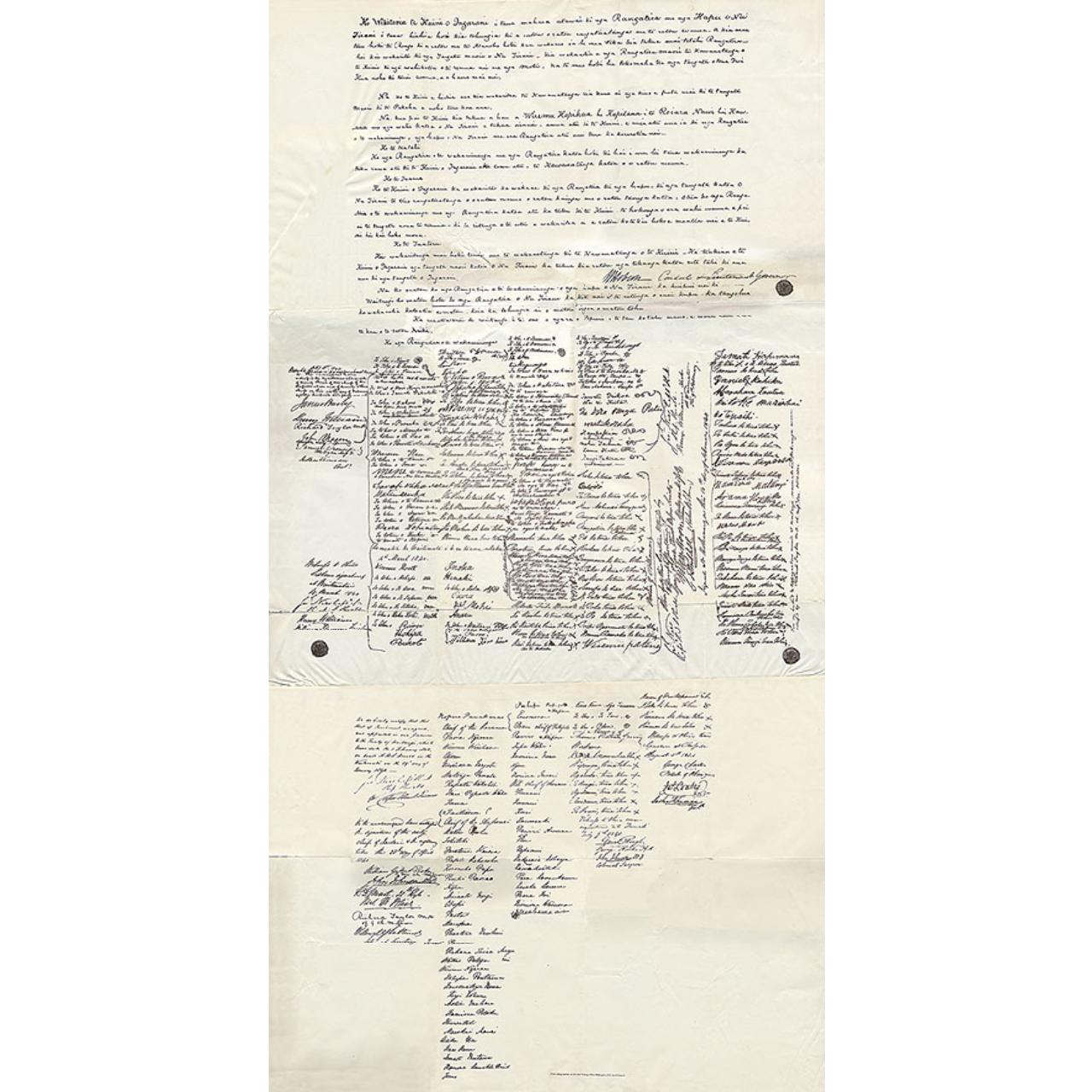
In preparing for our trip to New Zealand, Alison and I had listened to the audiobook version of The Penguin History of New Zealand by Michael King and learned of the monumental role that this document has played in New Zealand history and knew we had to visit the place where it was signed.
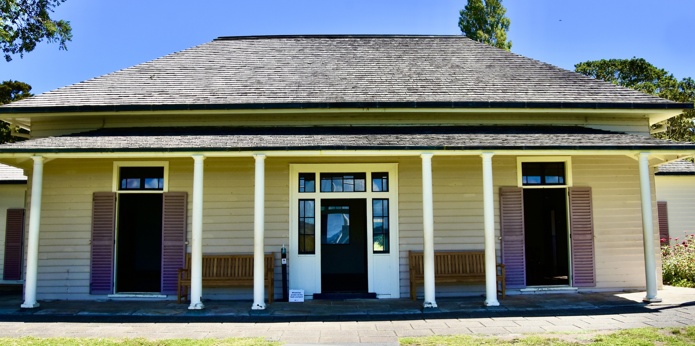
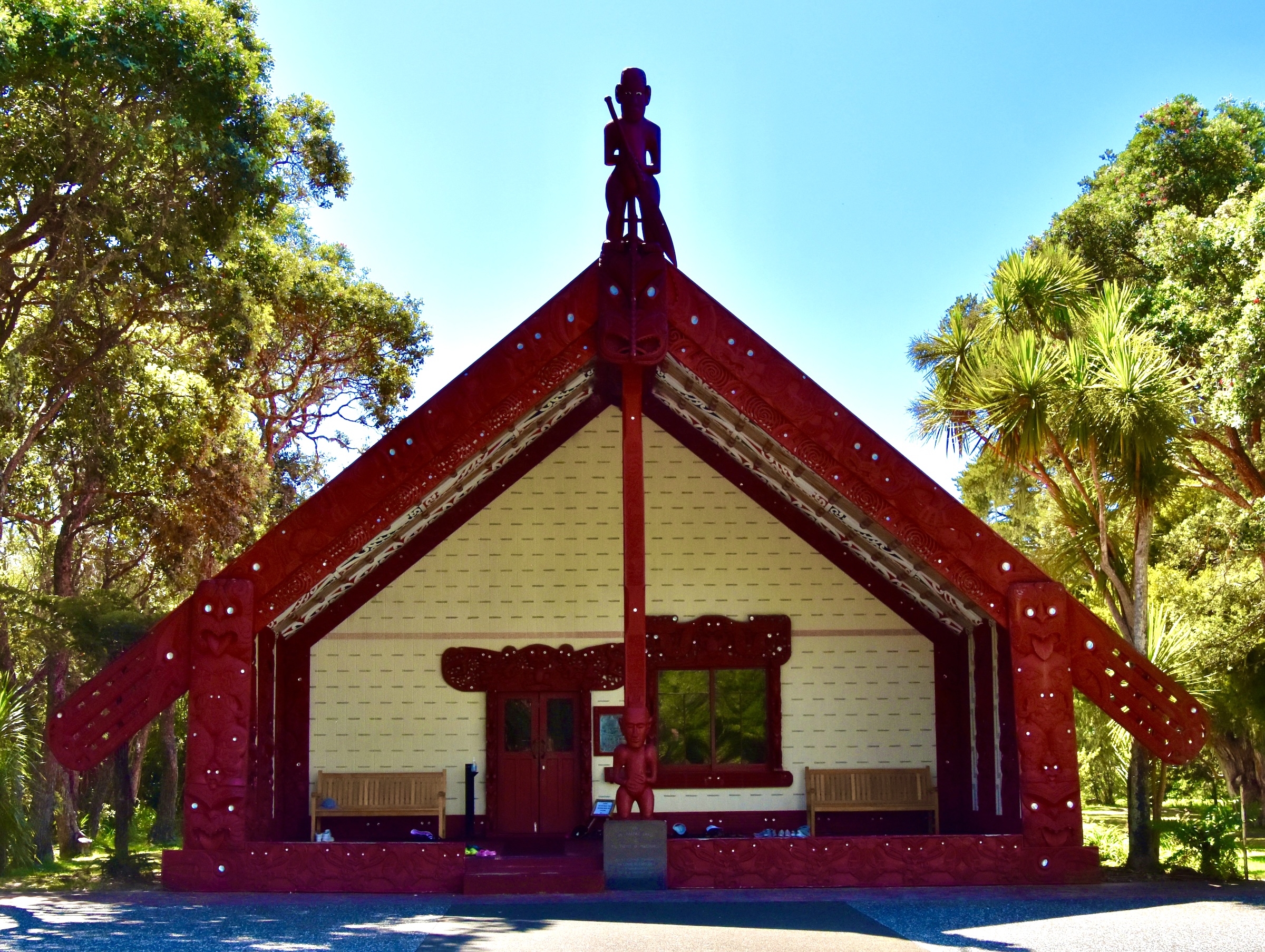
Today the Waitangi Treay Grounds are owned and administered by the Waitangi National Trust Board on behalf of all New Zealanders. The 506 hectare property was purchased in 1932 by the then Governor-General of New Zealand Charles Bathurst 1st Viscount Bledisloe for the express purpose of donating it to the nation to preserve what he rightly perceived to be the most sacred ground in the country. Today the Treaty Grounds consists of a number of museums, the original Busby House, a ceremonial marae, walking trails, a restaurant and more. Admission for international visitors is $70 NZD and includes a 50 minute guided tour and a 30 minute Maori cultural experience after which you can spend as much time as you would like exploring on your own.
The visit starts with a short walk through the forest to the shore where you’ll find the world’s largest ceremonial waka or what might loosely be translated as canoe although that hardly does it justice.
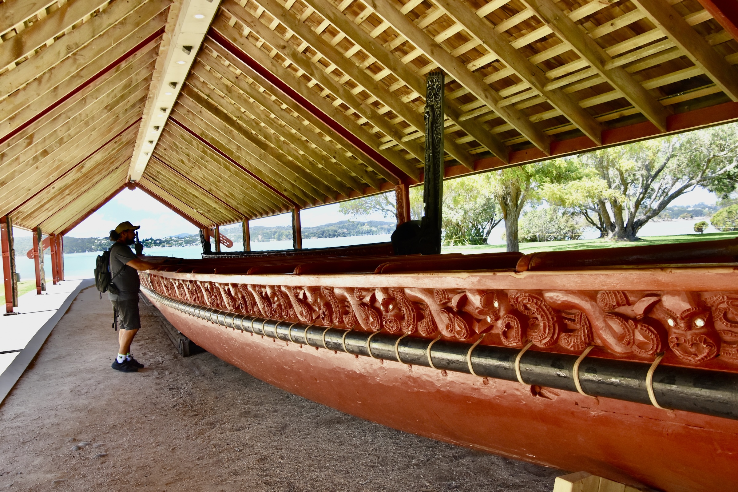
Officially named Ngātokimatawhaorua, it was built in 1940 by Northland Maori craftsmen to celebrate the centenary of the Treaty of Waitangi, it is now launched every February 6 for Waitangi Treaty Day. Believe it or not it can hold 80 paddlers and 55 passengers.
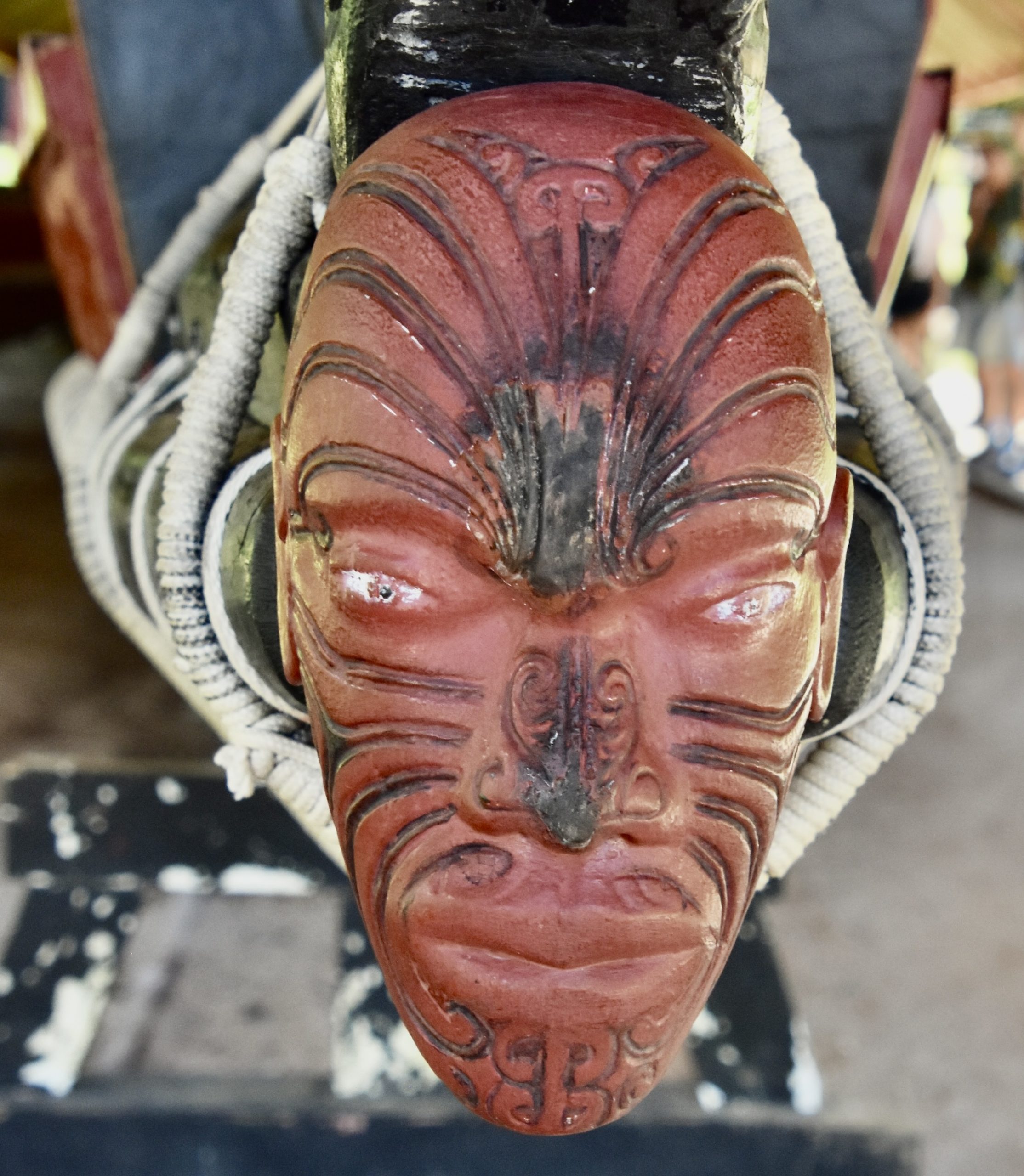
This is the figurehead.
Nearby the building where Ngātokimatawhaorua is stored, is Hobson Beach where British envoy William Hobson came ashore in early February, 1840 with instructions to make a treaty with the Maori rangatiras who had been gathering in the Bay of Islands for some time in anticipation of negotiations that would lead to an agreement.
The reason that Hobson landed here is that British resident James Busby had built a house here in 1834 and that is where the treaty was formally drawn up on February 5, 1840 with versions in both English and Maori. You might call this New Zealand’s version of Independence Hall.
The actual signing of the treaty took place on the grounds in front of the house after which is was taken around the country until eventually there were over 500 signatures on it.
After touring Treaty House and it’s very pretty gardens you have the option of attending a Kapa Haka or Maori Cultural Performance in this building, Te Whare Rūnanga.
I could do an entire post on the Waitangi Treaty Grounds, but there’s a lot more to see and do in the Bay of Islands so it’s time to move on.
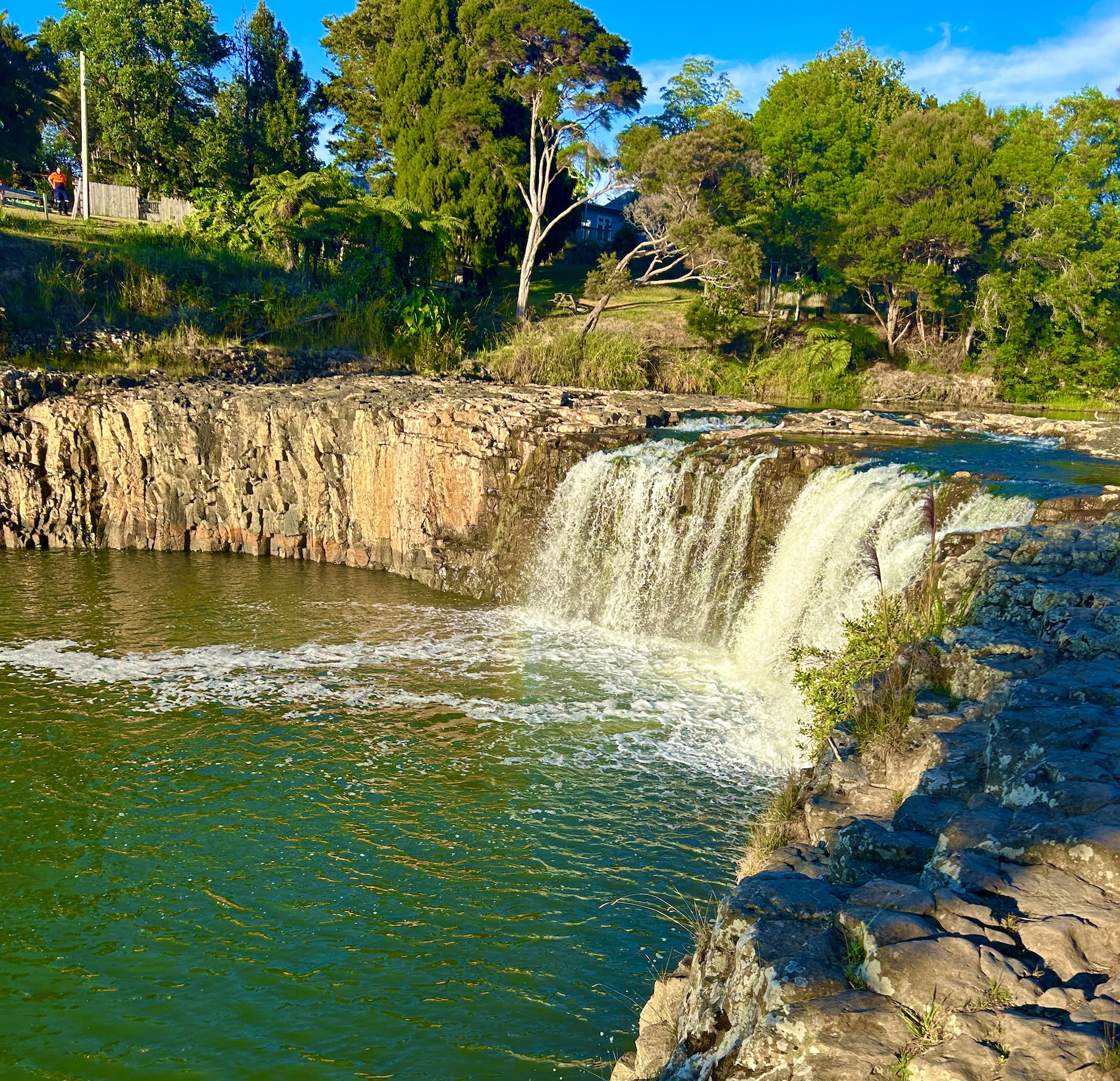
If you are up for a hike while in the area there is a great one alongside the Waitangi River to Haruru Falls that starts in the Waitangi Treaty Grounds parking lot. It’ll take you about an hour to get there so you you need to set aside about half a morning or afternoon to go there and back. If you are not up for the hike, you can drive to the parking lot at the other end of the trail from where it’s only a short walk to the falls. Either way, it’s a place you should visit while in the Bay of Islands area.
Russell, Bay of Islands
No visit to the Bay of Islands would be complete without a visit to the charming town of Russell, the oldest European settlement in New Zealand. It’s located at the end of a long peninsula which is a well over an hour’s drive from Paihia even though you can see it across the bay from Paihia pier. Luckily you can take a short cut either by taking one of the passenger ferries that leaves from the pier or take a car ferry from Opua a few kilometres down the road. It leaves every fifteen minutes and takes only about that long to make the crossing.
The car ferry terminal is very close to Okiato Point which was the original site of the town and for a very brief period the first capital of New Zealand. All that remains today is this small lot that is surrounded by some very expensive looking waterfront estates.
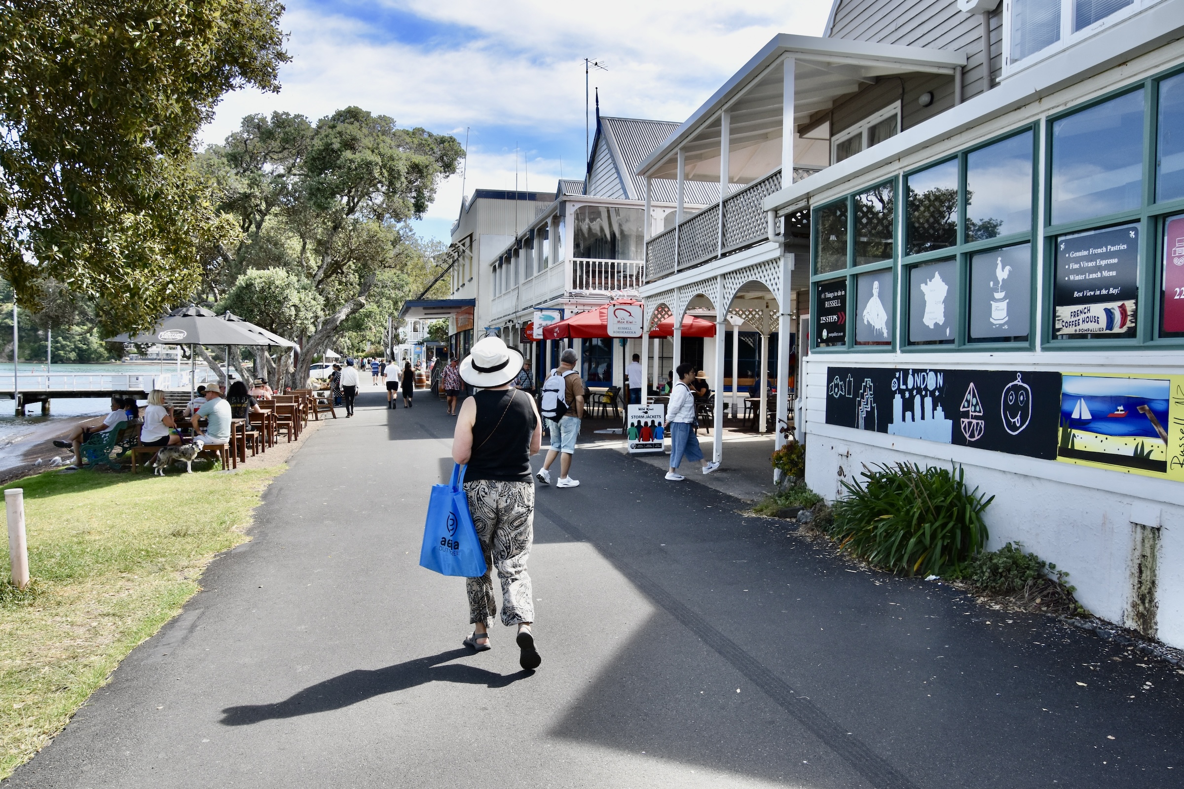
Russell itself is a few more kilometres down the road. There are plenty of places to park and you can easily explore the town on foot as there are only a few streets.
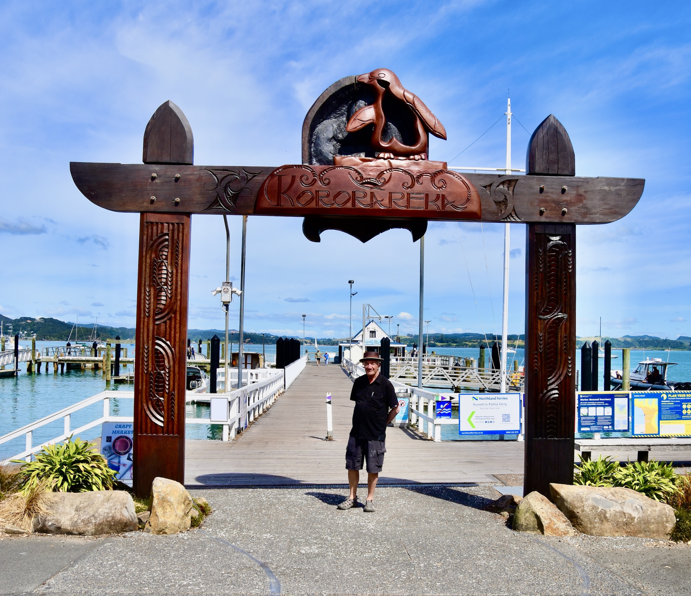
Long before the first Europeans arrived, Russell was the prosperous Maori settlement of Kororāreka. Then in 1769 on his first Pacific voyage, Captain James Cook sailed into what he called the Bay of Islands, mapped it and on his return to England spread the news about the wonderful climate and location of this place. That led to the first torrent of European settlers who set up camp and made Russell into a provisioning station for whalers and other sailing ships plying the South Pacific. With no law enforcement or government control it soon became known as ‘the hellhole of the Pacific’ and was one of the places the Maori rangatiras had in mind when they petitioned the British Crown for protection.
Not all the Maori rangatira were happy with the results of ceding sovereignty to Britain with the Treaty of Waitangi, including a number who did not like what was happening to Kororāreka which was now being overwhelmed by European settlers. One prominent rangatira Hōne Heke, who had been among the first to sign the treaty, had given a flagpole to James Busby which was erected at Flagstaff Hill above Kororāreka. Hōne Heke became disenchanted with the manner in which Busby was running the new colony, particularly the decision to move the capital to Auckland in 1841. He cut down the flagpole he had given as a gift and then three more in succession which eventually led to the Flagstaff War of 1944-45.
Kororāreka ended up being burnt to the ground and a number of British and Maori killed in the process. The rebellion spread across the entire North Island and there were a number of other pitched battles and sieges. As with all these Indigenous attempts to stop the spread of European settlement, whether it be in North or South America, Australia or here in New Zealand, the outcome was inevitable. However, unlike most other outcomes, Hōne Heke and his other allied rangatiras were not prosecuted, imprisoned or even hanged (think of Louis Riel in Canada), but actually gained prestige from both the Maori and the pākehā communities.
The town was rebuilt and renamed Russell, the original one at Okiato Point being destroyed as well.
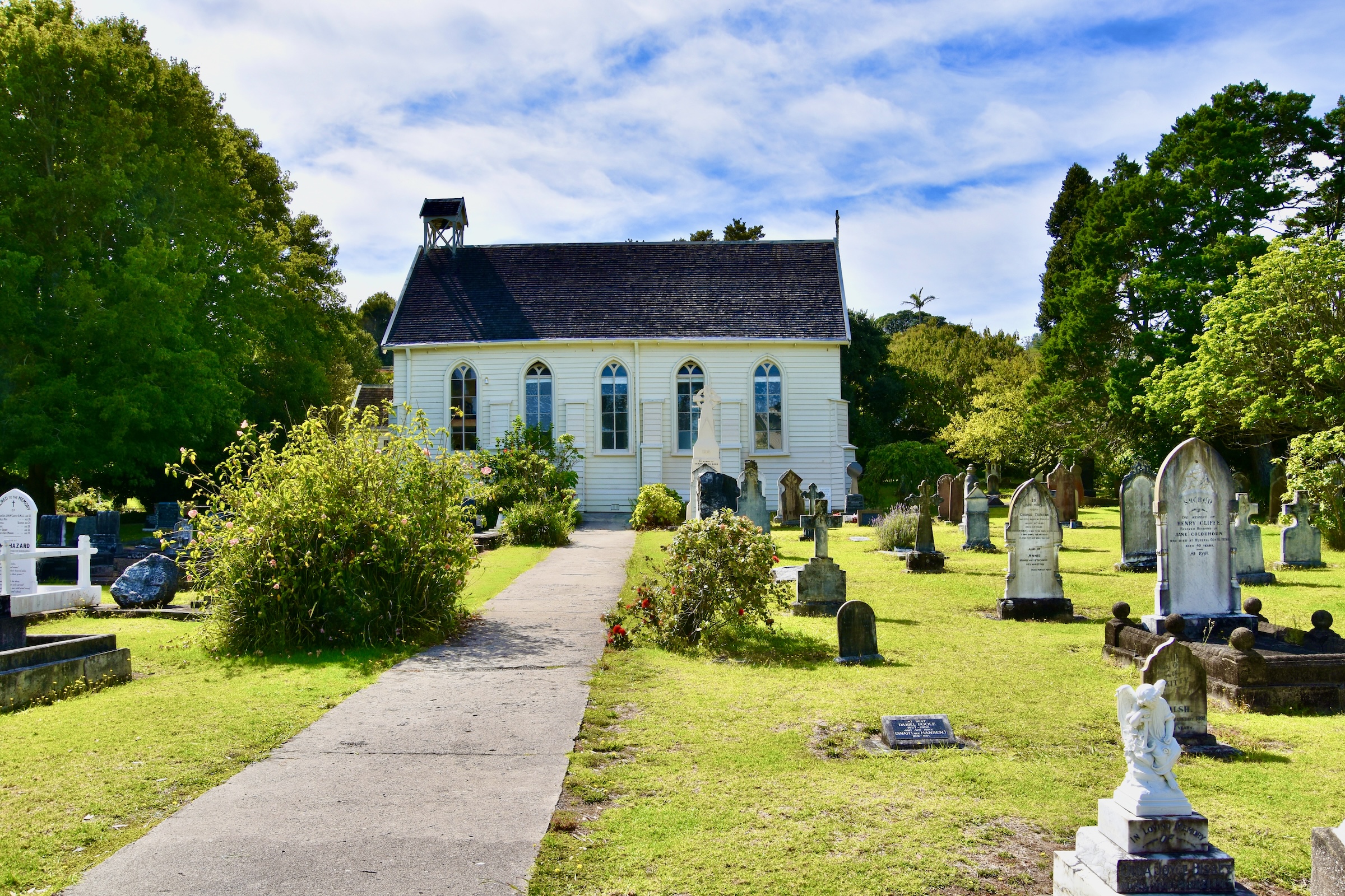
So there’s lots of history worth exploring in Russell starting with the oldest church in New Zealand. Christ Church was built in 1835 and provided services in both English and Maori. Charles Darwin, who visited the Bay of Islands on the H.M.S. Beagle in 1835, was one those who contributed to its construction costs. It was specifically spared burning during the Flagstaff War because Hōne Heke had converted to Christianity and had no beef with the church per se. The land for the church had been granted to it by a Maori rangatira on condition that the graveyard be open to both Maori and pākehā burials.
I love exploring church graveyards and this one is most interesting with many notable graves. Here are a few.
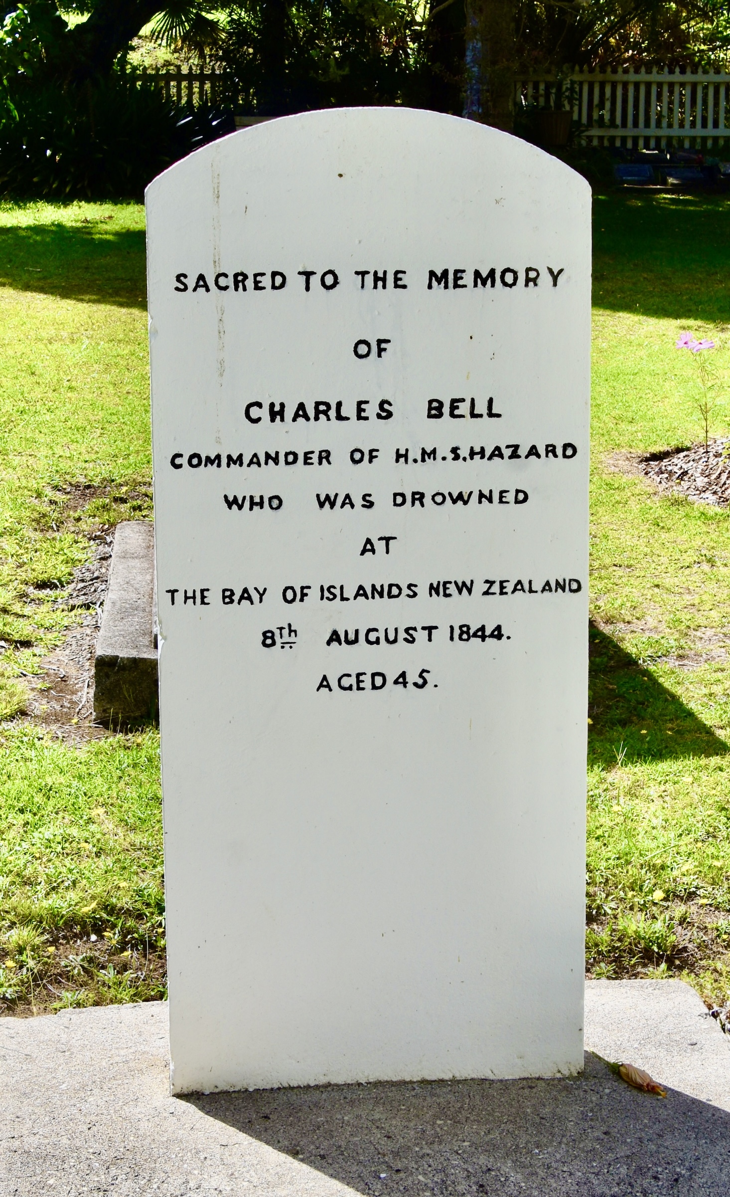
The H.M.S. Hazard had been dispatched to the Bay of Islands in 1844 before the Flagstaff War broke out. In one of the most ignoble deaths in British admiralty history, its Captain Charles Bell simply fell overboard and drowned.
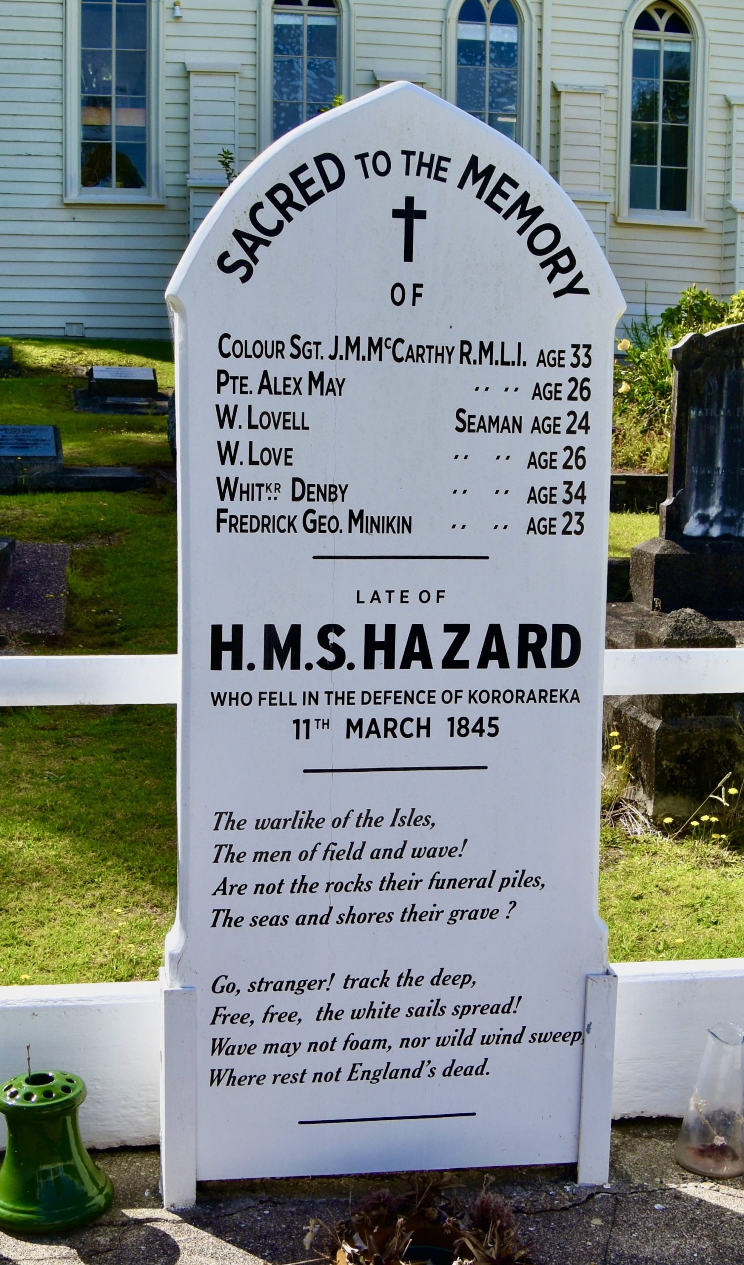
However, that was not the end of the story for the Hazard. This is the grave of six of its seamen who subsequently died in the unsuccessful defence of Kororāreka. Note the florid language which is from the final two stanzas of England’s Dead by Felicia Hemans .
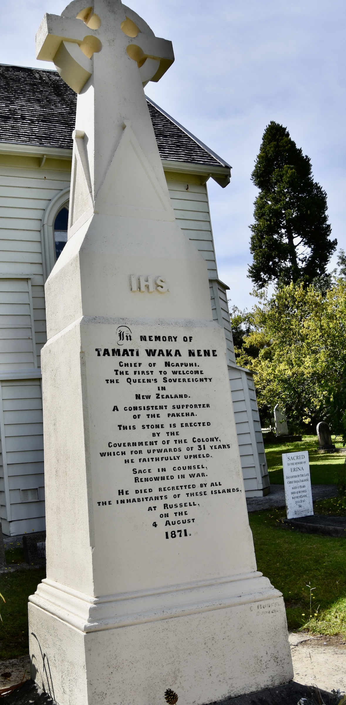
Not all the Maori rangatiras supported Hōne Heke’s efforts to oust the British. Chief among these was Tamaki Waka Nene who was an early convert to Christianity and as the gravestone attests, highly regarded by the pākehā community.
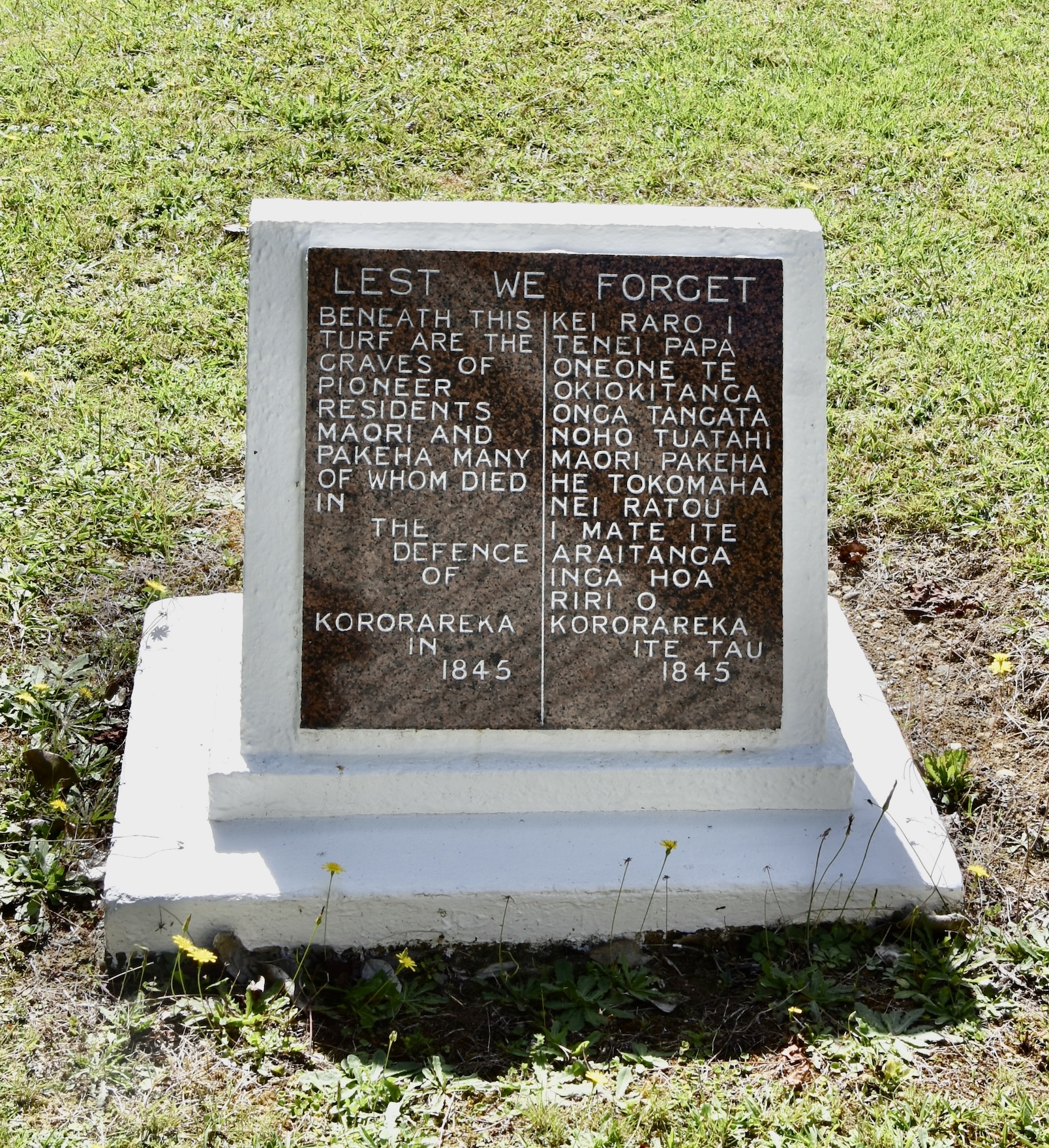
There is a second mass grave in Christ Church graveyard, this one for the Maoris and pākehās who died defending Kororāreka.
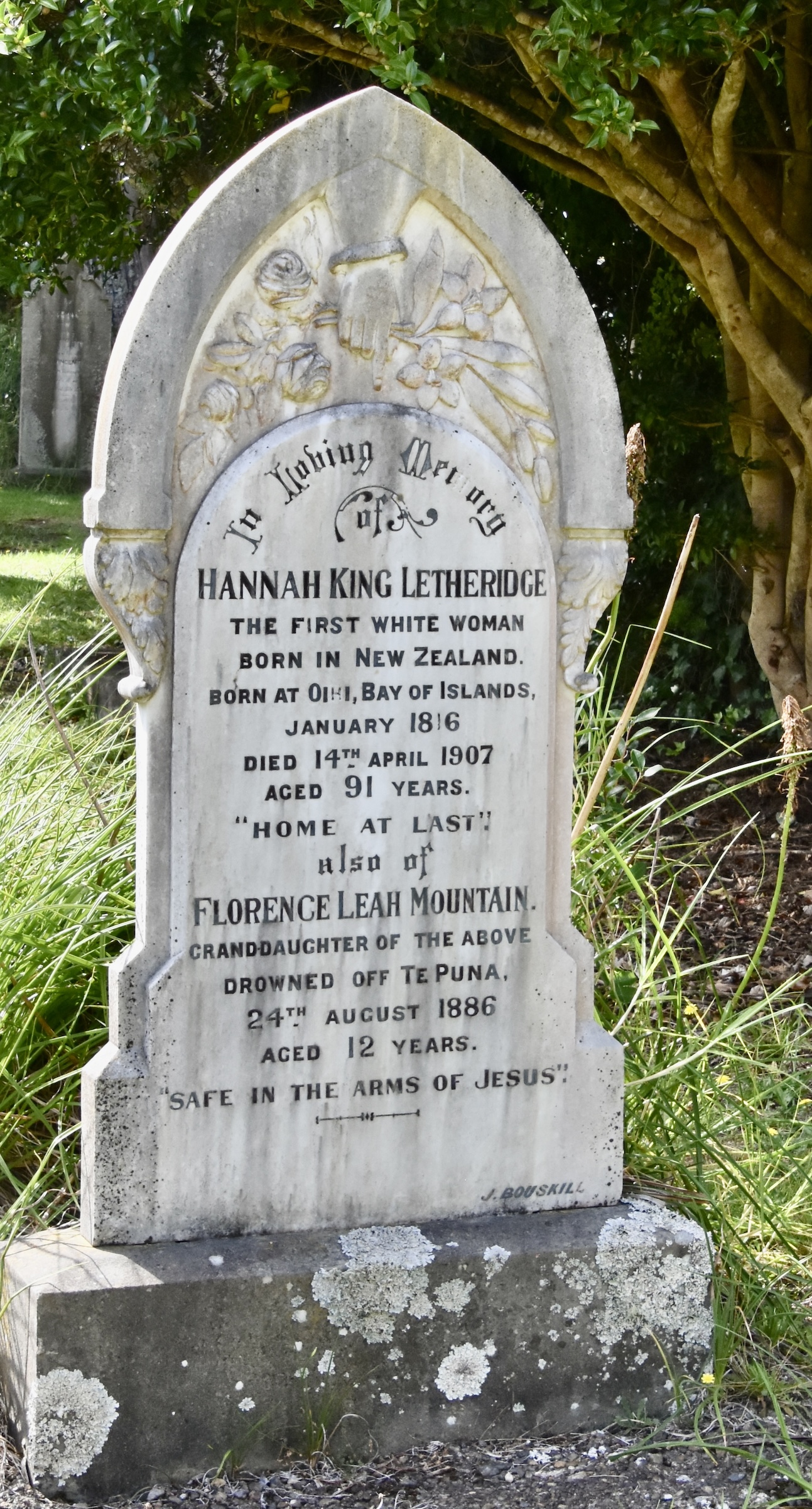
The last grave that caught my eye was this one. Hannah King Letheridge was the first woman of European descent to be born in New Zealand. Despite living for 91 years, there was clearly tragedy in her lifetime as it combines her grave with that of her granddaughter who like Captain Bell, drowned in the Bay of Islands.
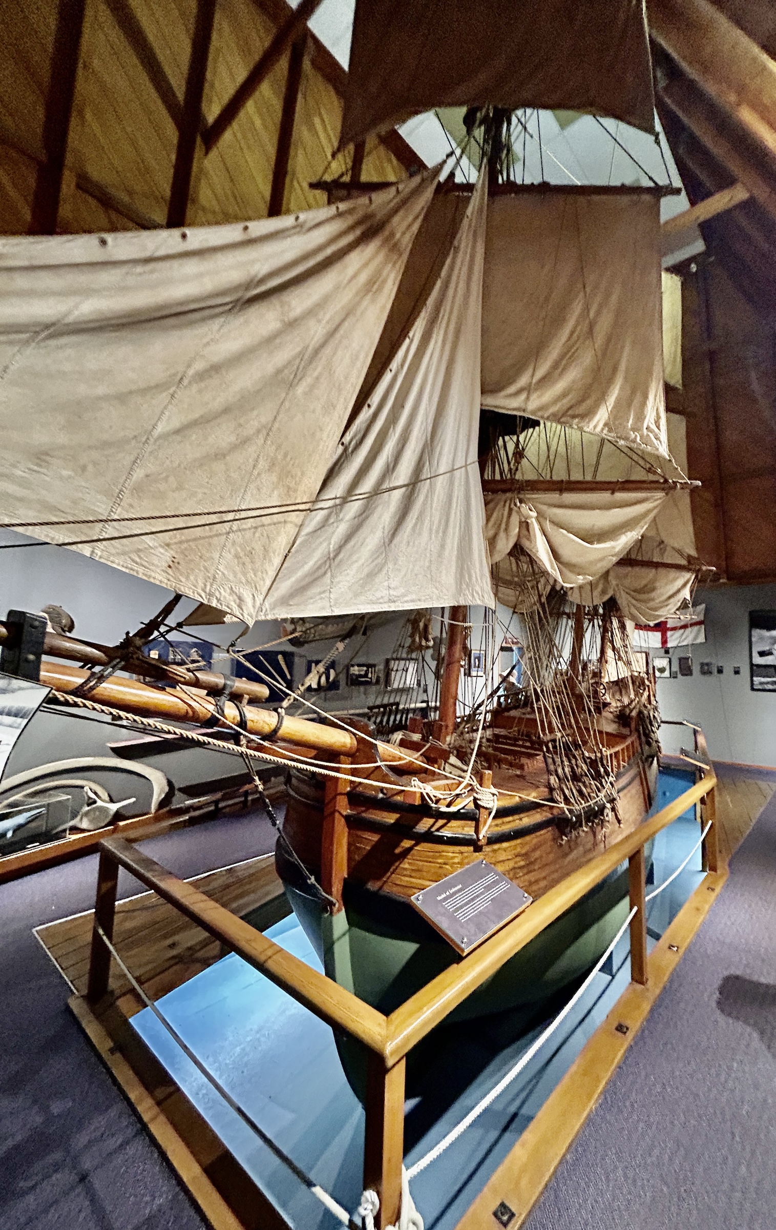
Close by the church is the Russell Museum which is definitely worth a visit. It has a lot of local history including much more detail about the early chaotic years. The most interesting exhibit is this one fifth scale model of Captain Cook’s ship H.M.S. Endeavour built in 1969 to commemorate the 200th anniversary of Cook’s arrival in the Bay of Islands.
At the backside of the museum you’ll find the walkway along Russell’s historic waterfront which has a number of restaurants and the oldest hotel in New Zealand, the venerable Duke of Marlborough which dates back to 1837. However, the current building dates from 1875 and was actually moved to the site from Cable Bay after the second hotel burnt to the ground in 1931. The first was razed during the Flagstaff War and burning of Kororāreka. It’s a very popular spot for dinner and drinks on the verandah.
If you arrive by way of the passenger ferry from Paihia you will land at this pier which will put you right in the middle of the action. Note the name Kororāreka on the crosspiece with the little blue penguin above it. These birds, the smallest of the penguin species, are found in various spots on the Bay of Islands. The Maori name for them is korora and once were a delicacy for Maori rangatiras. The name Kororāreka literally means ‘sweet penguin’.
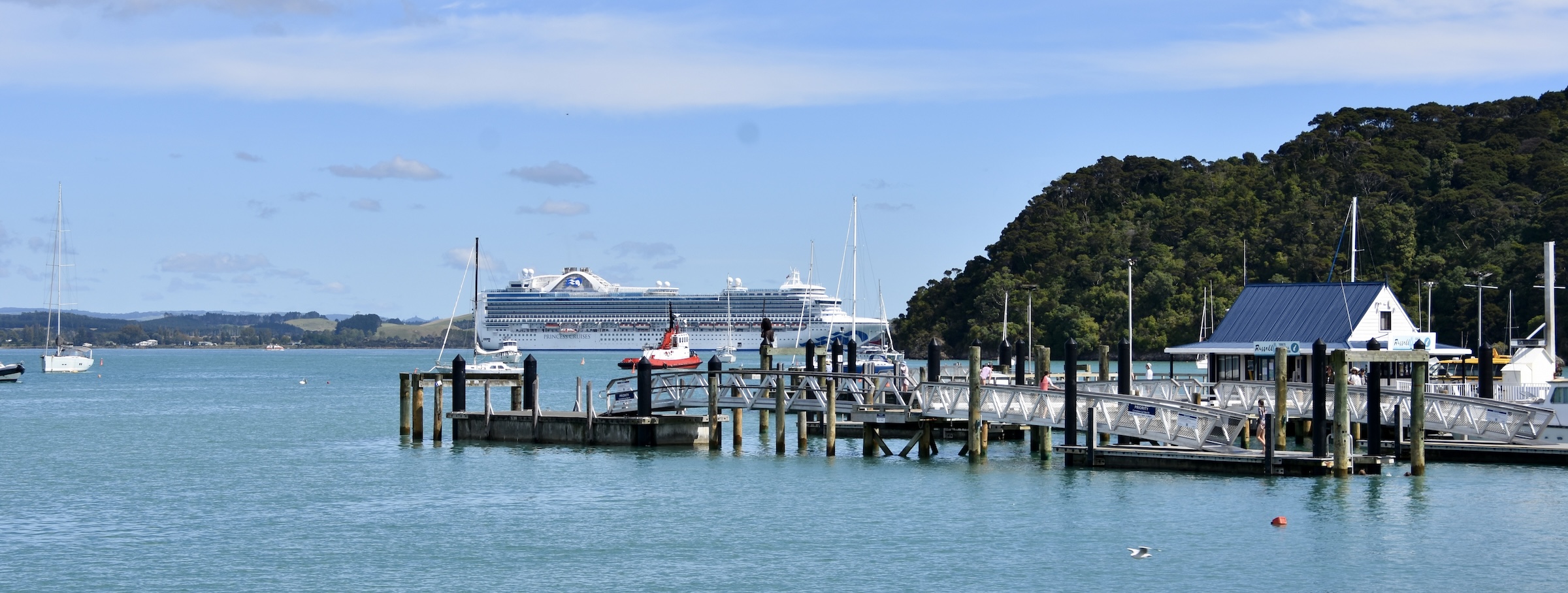
Walking out on the pier I see something that is as out of place as Cook’s ship must have looked to the Maoris when it first sailed into the Bay of Islands. There are only 790 residents in Russell, but that is about to be quadrupled once the hordes arrive from that monstrosity.
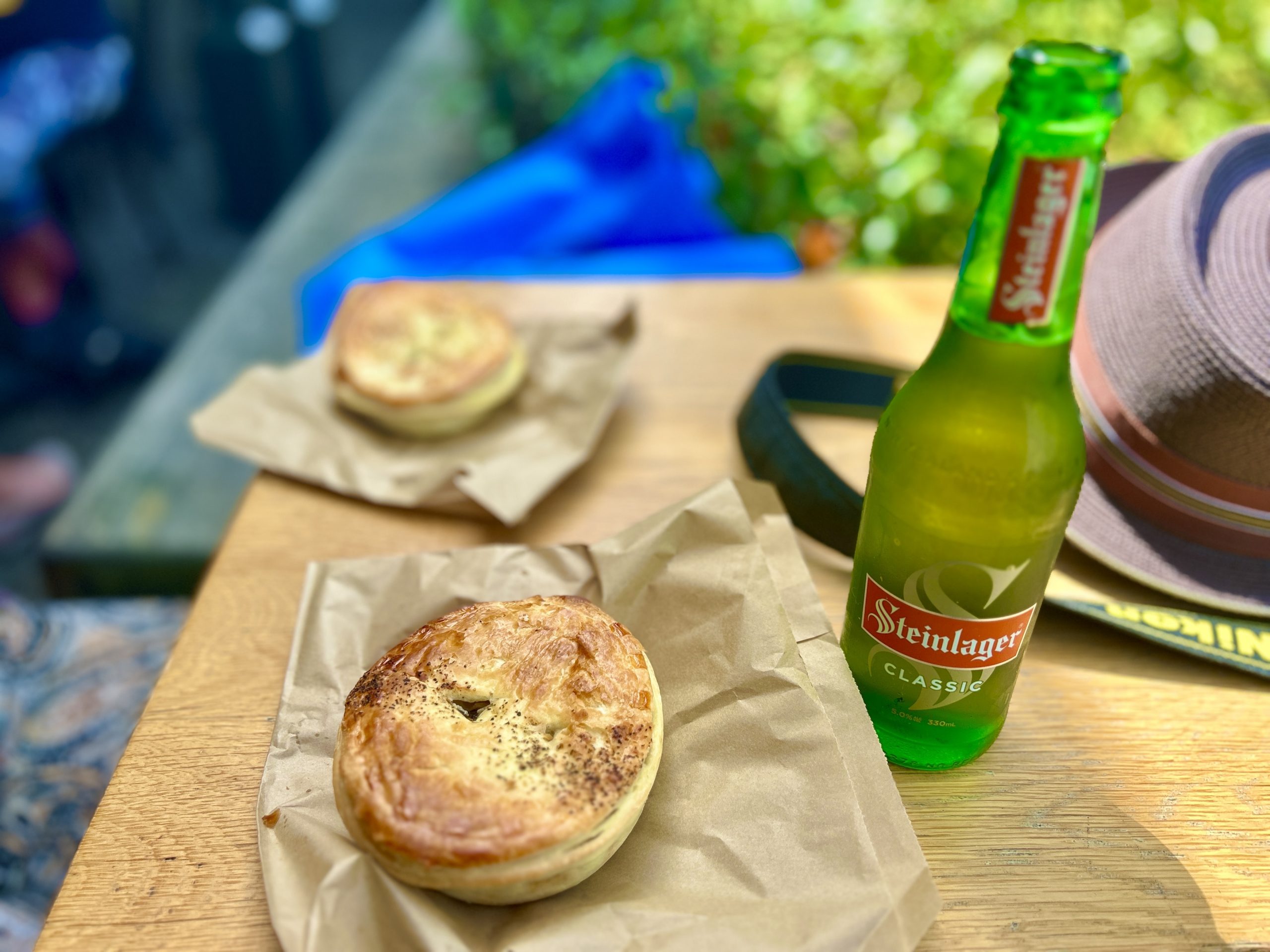
Time to get out of Dodge, but not before stopping for a couple of pies at the Grazing Table.
Bay of Islands Boat Tour
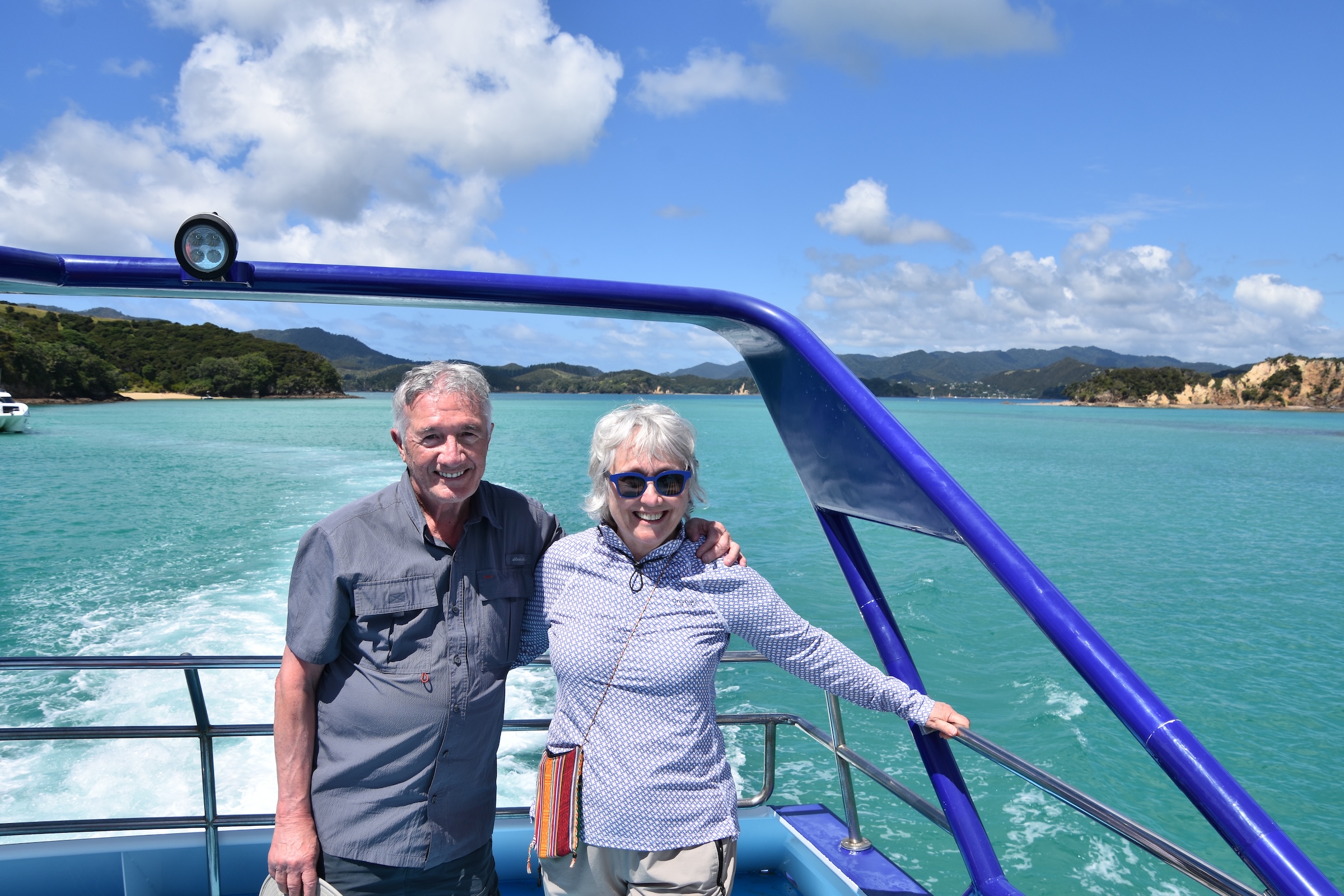
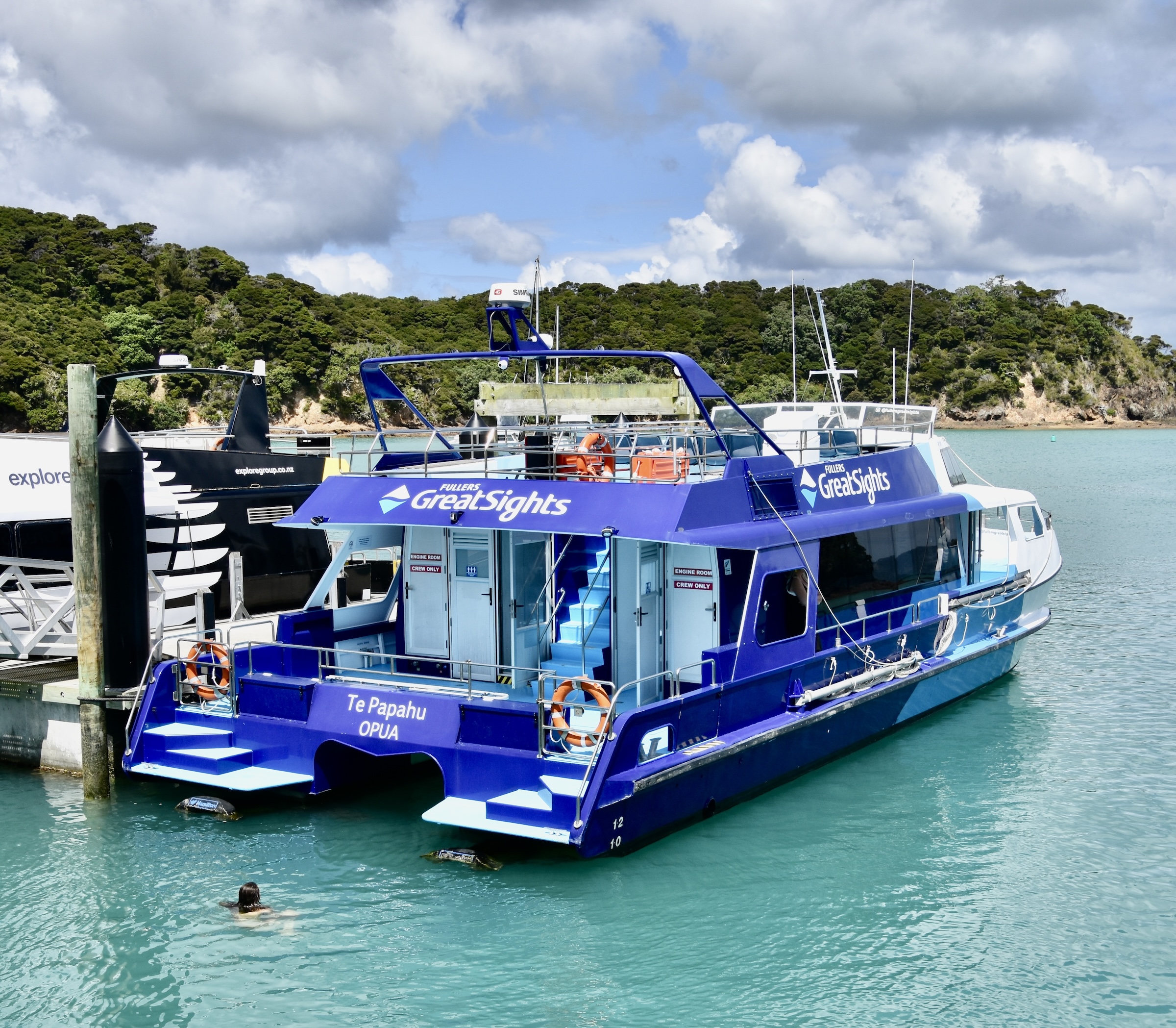
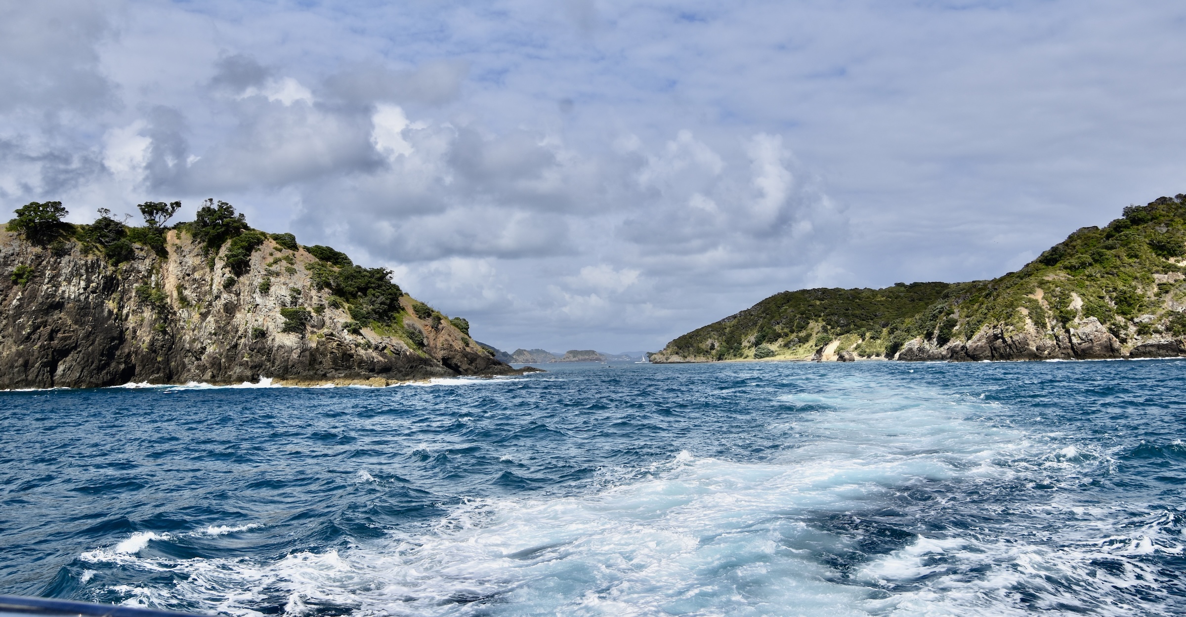
Okay, we’ve toured the Waitangi Treaty Grounds and visited the town of Russell. What’s next? Getting out on the water of course. There are a number of options that all leave from the Paihia pier. We chose the 4.5 hour cruise with Fullers Bay of Islands which costs $160NZD and can be booked on line here. It departs at 8:30 in the morning and stops briefly at Russell pier to pick up passengers there.
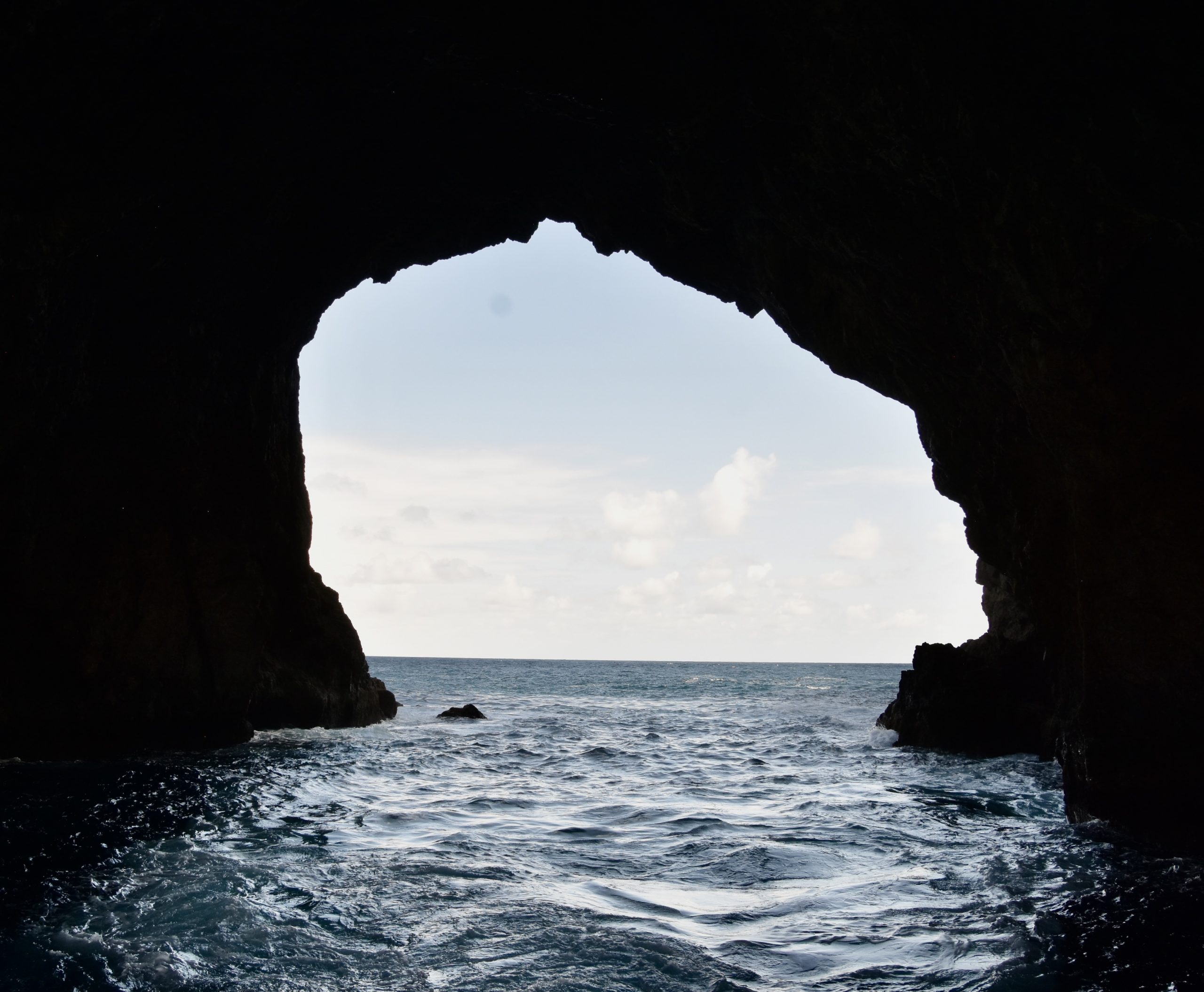
The boat is a catamaran which can really move once it’s outside the no wake zone and is quite stable in the large swell at the mouth of the Bay of Islands. If you scroll up to the map at the beginning of this post you can see the route that it will take to get to Cape Brett and Motukōkako with its famous hole in the rock. Later it will stop at Otehei Bay on Urupukapuka Island for an hour and half before returning to Paihia.
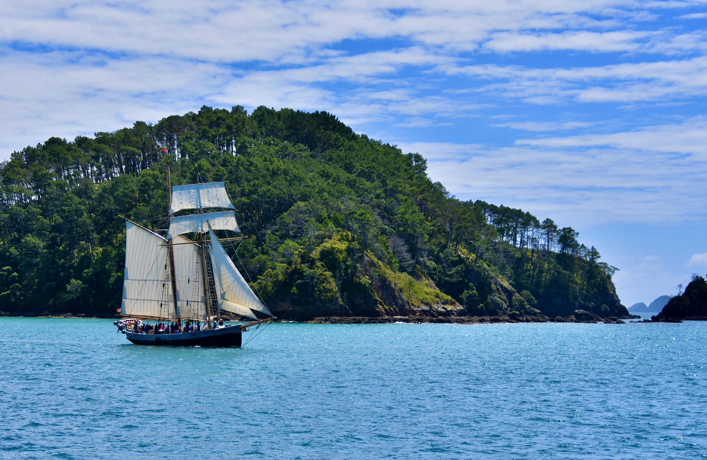
Heading out from Russell we get a look at the fully rigged tall ship R. Tucker Thompson which is another Bay of Islands cruise option offered by Fullers.
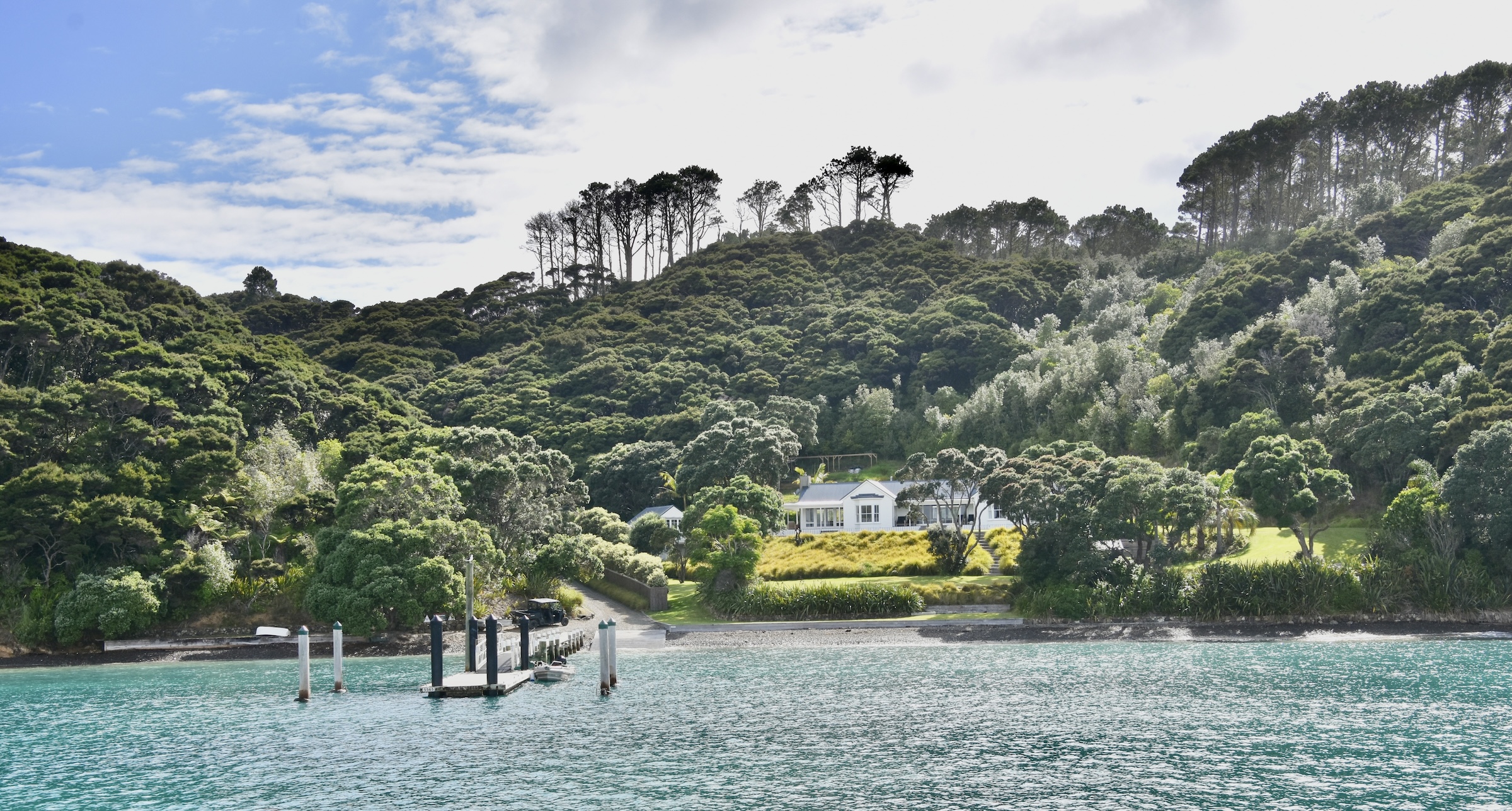
Once out of the inner bay the boat passes by a number of small islands or motus including Motuarohia where Captain Cook anchored in 1769 and communed with the Maori population then living on the island. It is one of a number of motus in Bay of Islands that are part of Project Bird Song whereby all of the introduced species like rats, cats, weasels and other pests have been totally eliminated allowing endangered species like the brown kiwi to thrive in an environment similar to that which existed before European contact. That also involves reforesting motus that had previously been covered by introduced grasses for sheep and cattle grazing.
The boat then speeds up and passes between Waewaewtorea and Okahu on the way to Cape Brett and Hole in the Rock. It’s a really beautiful morning and I can’t think of any place we would rather be than right here in the Bay of Islands.
The boat stops for a briefly circling of Bird Rock which is home to a large colony of red-billed gulls which are endemic to New Zealand.
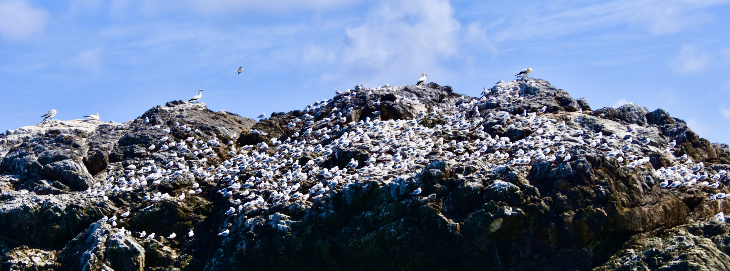
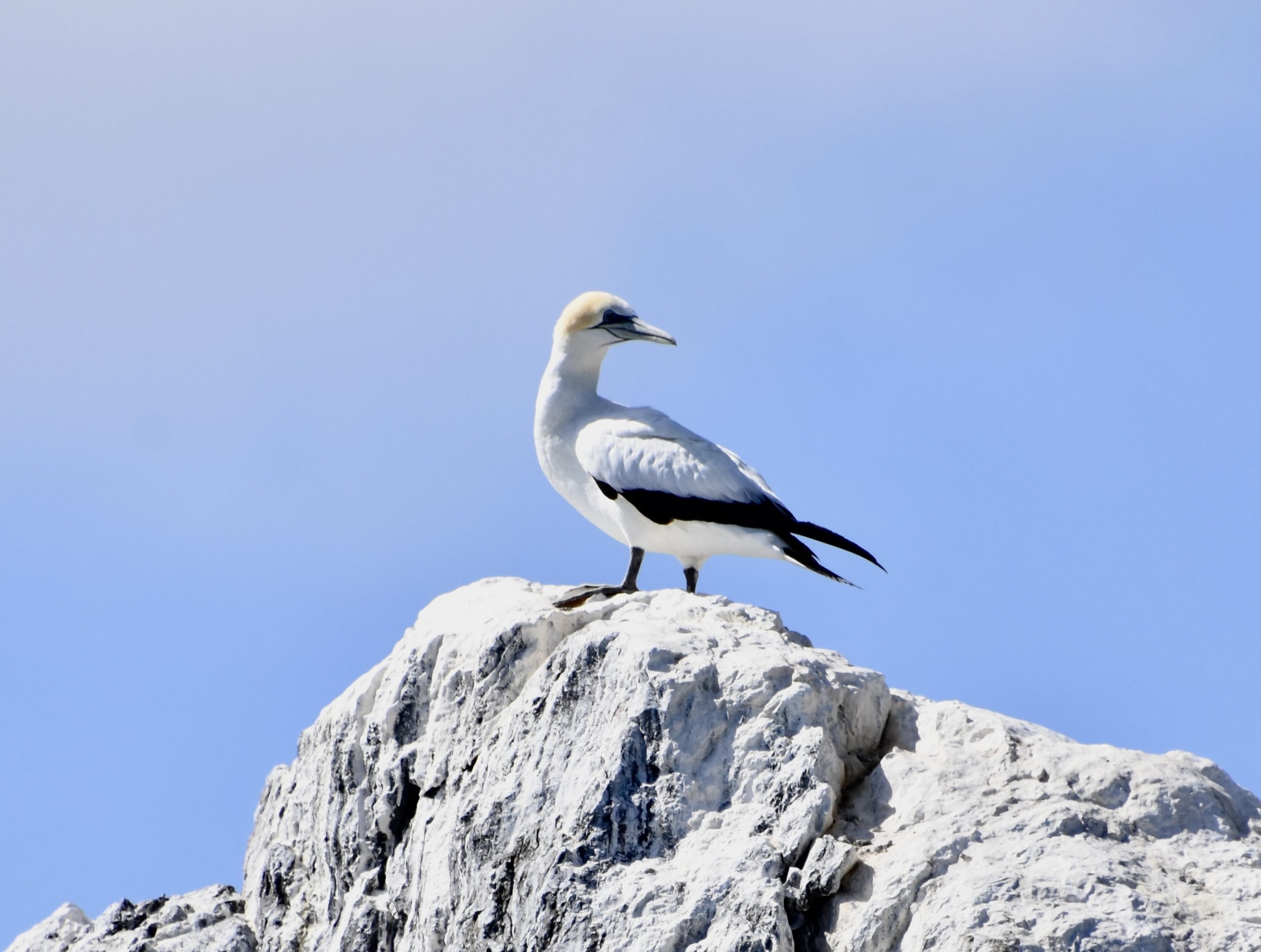
Sitting on top of the rock are a number of much larger Australasian gannets.
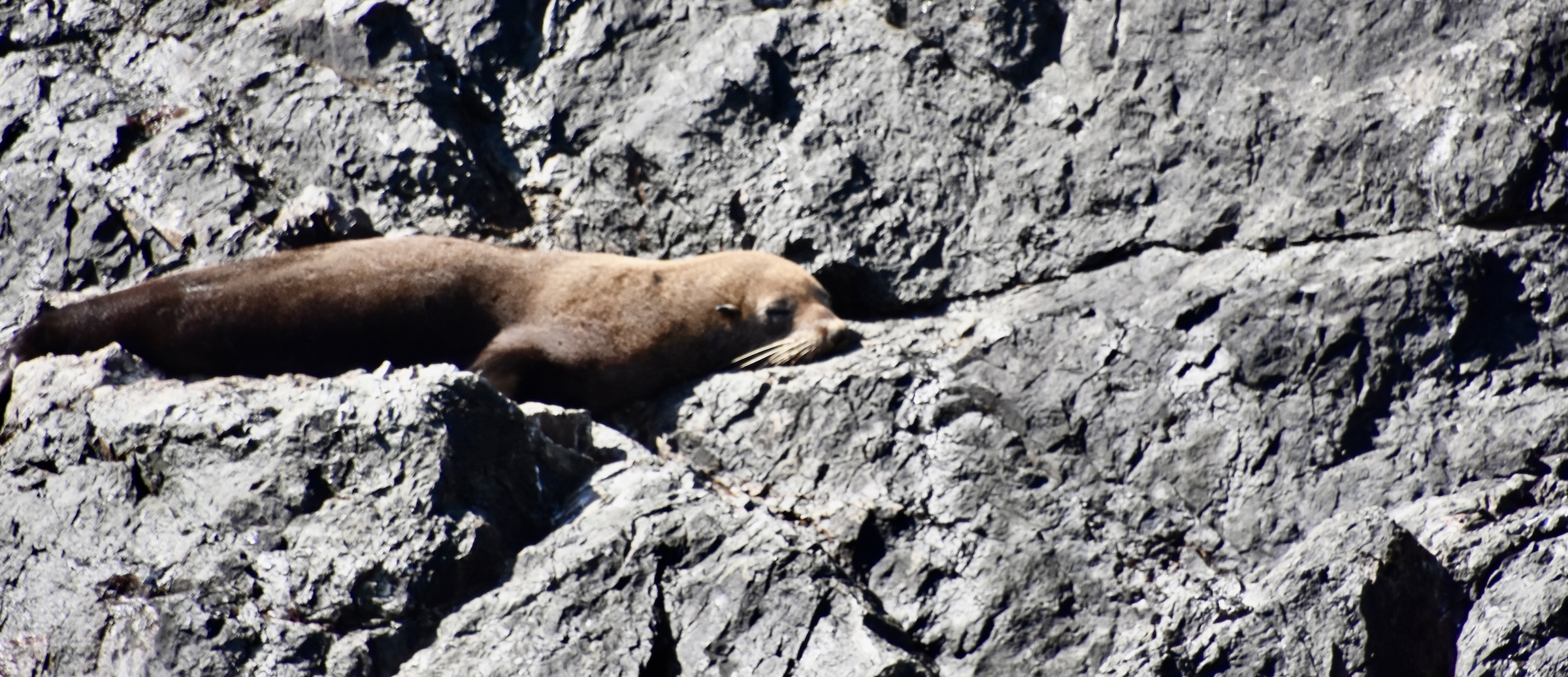
One of the resources that was exploited almost to the point of extinction by the first Europeans was the New Zealand fur seal which were easy targets as they gathered by the thousands on islands and rocky shores of the mainland. One sealing expedition in 1814-15 collected over 400,000 pelts. Not surprisingly, by the time sealing was outlawed in 1894 the species was almost extirpated from New Zealand. Since then the numbers have rebounded and we will see lots of them when we get to South Island. However, they have only recently returned to Bay of Islands with juvenile males seeking new territory after being evicted from their colonies by dominant bulls.
Such is the case with this young male sunning himself on Bird Rock. It’s always a thrill the first time you spot a new species and that holds true with this sighting.
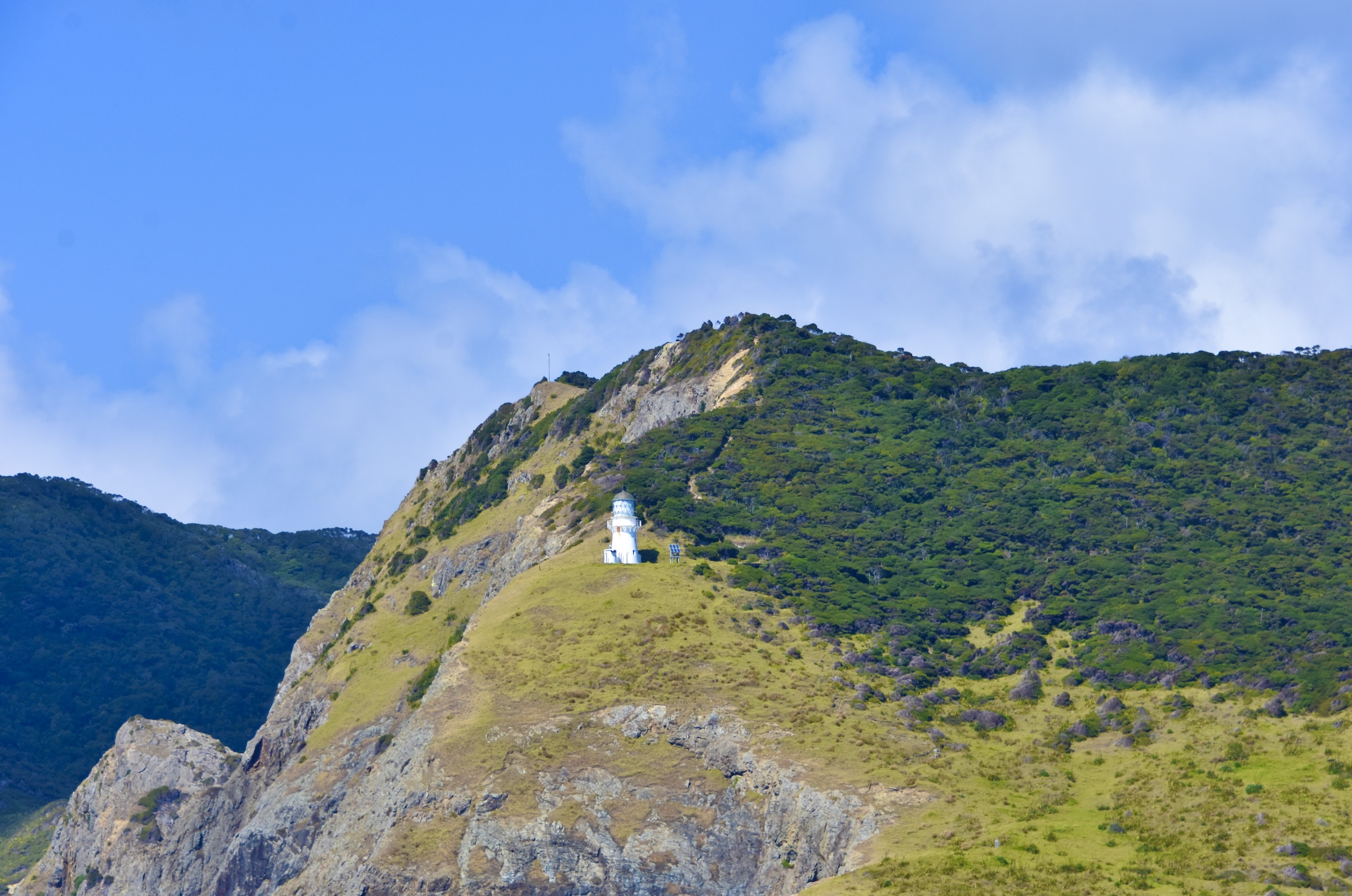
After circling Bird Rock, we motor past Cape Brett with its lighthouse guarding the entrance to the Bay of Islands.
We now reach what is advertised as the highlight of the trip, Hole in the Rock and guess what, it’s a hole in the rock.
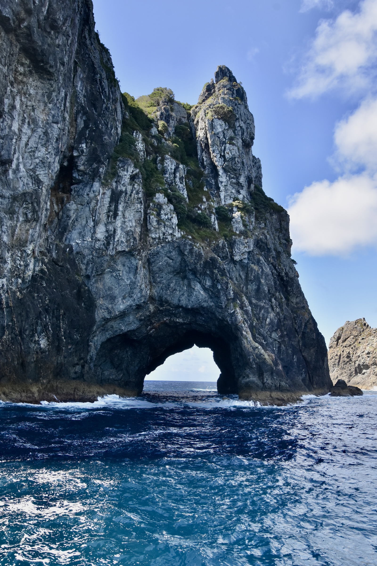
There is a pretty big swell passing through the hole and the captain contemplates whether it’s safe to try to go through and then seems to just say “The hell with it!” and blasts through the hole with only a few feet to spare on each side. It’s actually quite exhilarating because you can contemplate the worst if he doesn’t pull this off properly.
While we had a far off look at the Cape Brett lighthouse on the way out, the boat now moves in for a closer look.
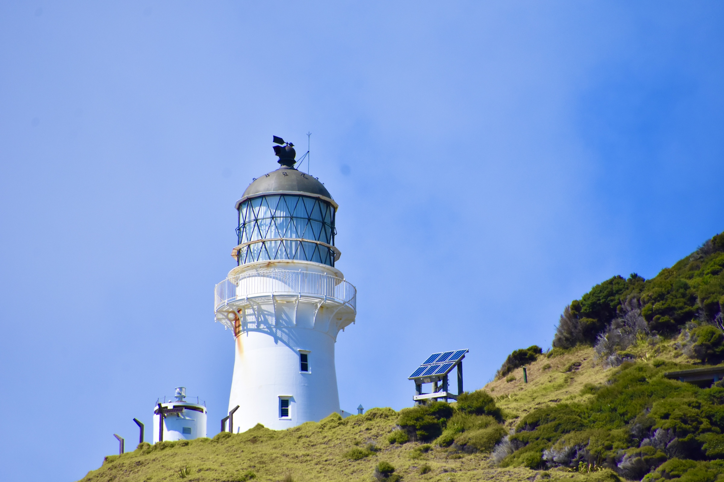
Below it is the old keeper’s house which can now be used by visitors who make the 8-10 hour hike along the Cape Brett Walkway from Oke Bay. As it happens there are two guys there who have done just that. It is apparently one of the most difficult, but rewarding hikes in the country and you’d need to be fit like these two clearly are, to attempt it.
The sightseeing from the boat comes to an end as we pull into Otehei Bay on the largest motu in Bay of Islands, Urupukapuka.
The tour package includes a buffet lunch here and 90 minutes to explore the island which has multiple hiking opportunities as you can see from this map. Sadly, after lunch we don’t have time to do much exploring other than to do some beachcombing and birding along the shore of Otehei Bay. The tour does offer the option of extending your stay on Urupukapuka and returning on the afternoon cruise and if I had to do this again, that’s exactly what I would do. 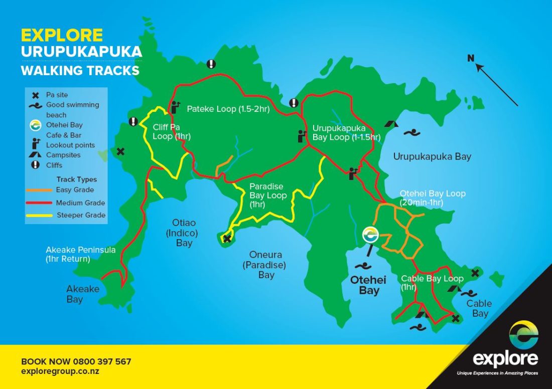 Urupukapuka Island Trails
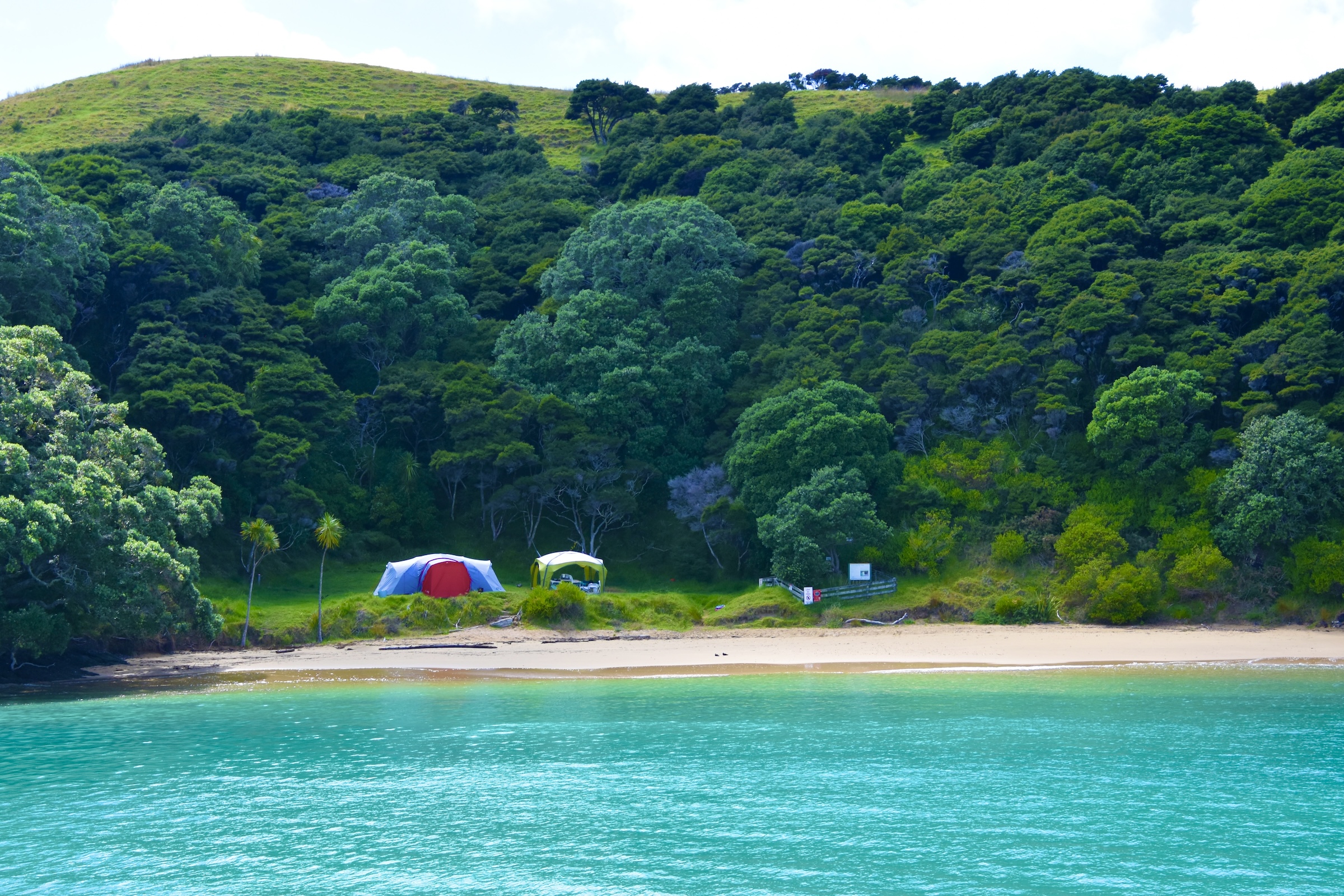
There are regular passenger ferries to Urupukapuka from Paihia and there are quite a number of people who have taken advantage of the opportunity to camp overnight. This only one of many campsites on the island.
After leaving Urupukapuka the boat returns to Paihia pier and all too soon the trip is over, but this excursion on the Bay of Islands will definitely remain in our memories long after we return to our home in Canada. Don’t even think of coming to Paihia and not going on a boat tour.
Pahia Pier
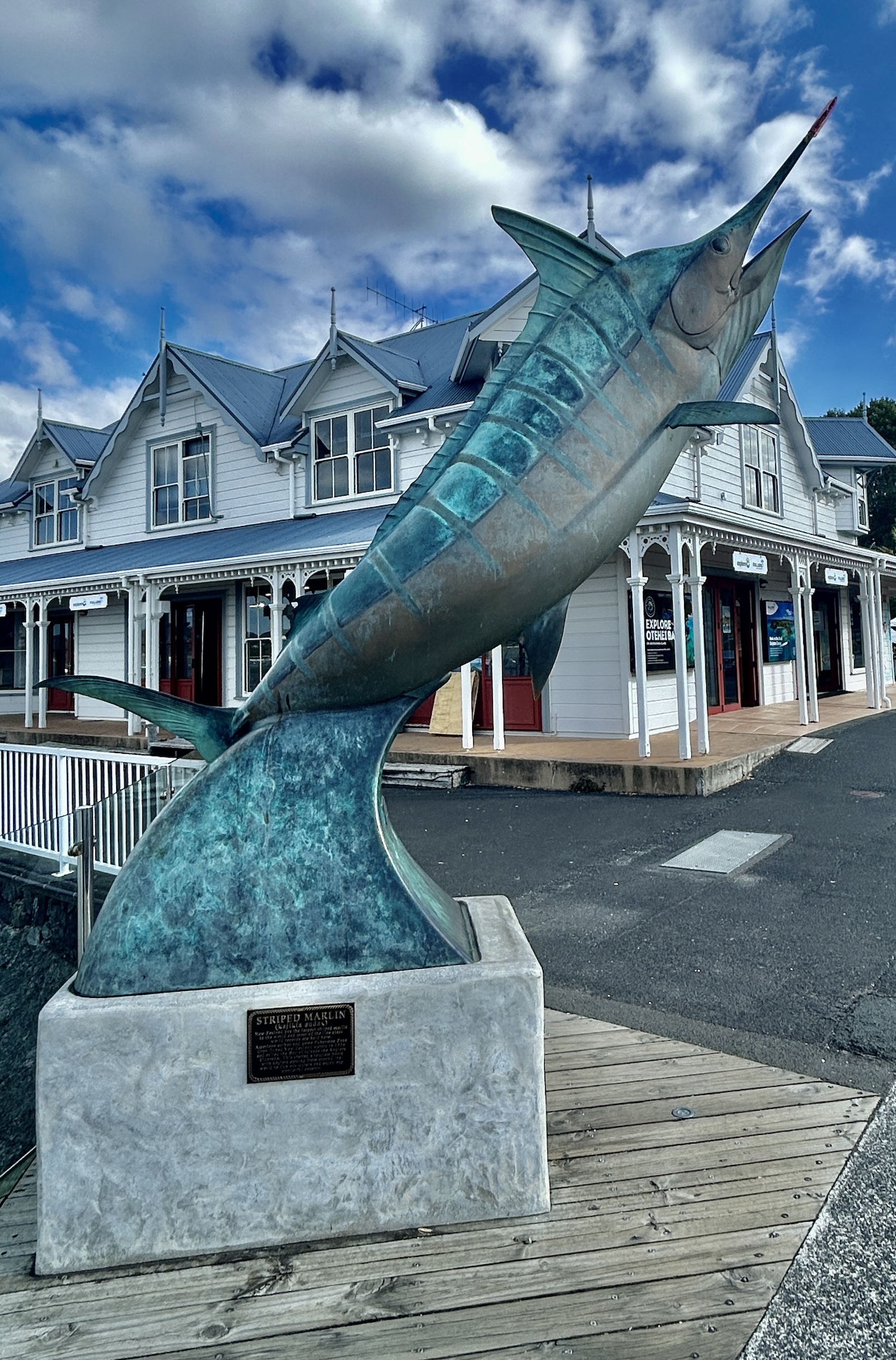
I’ll end this post from Bay of Islands with a visit to the Paihia pier and another connection to my home province of Nova Scotia. This statue of a striped marlin at the entrance to the pier marks the Bay of Islands as one of the premiere big game fishing spots in the world. It will always be associated with American novelist Zane Grey who wrote 90 westerns that sold 40 million copies and made him the Stephen King of the 1920s. He was also a fanatic fisherman who, upon discovering the amazing fishing in Bay of Islands, built a camp on Urupukapuka and returned year after year. Right beside that statue is Zane Grey’s Restaurant and Bar where we watched a Rolling Stones tribute band on a Friday night, amazed that the average age of the audience was probably about 75.
So what’s the Nova Scotia connection? Well Zane Grey did the same thing in Nova Scotia as he did in Bay of Islands. He discovered the fantastic fishing for bluefin tuna off our southwest coast and made it famous around the world. At the mouth of the Shelburne River there is a battered and bereft old boat that was left behind by Zane Grey after one of his visits.
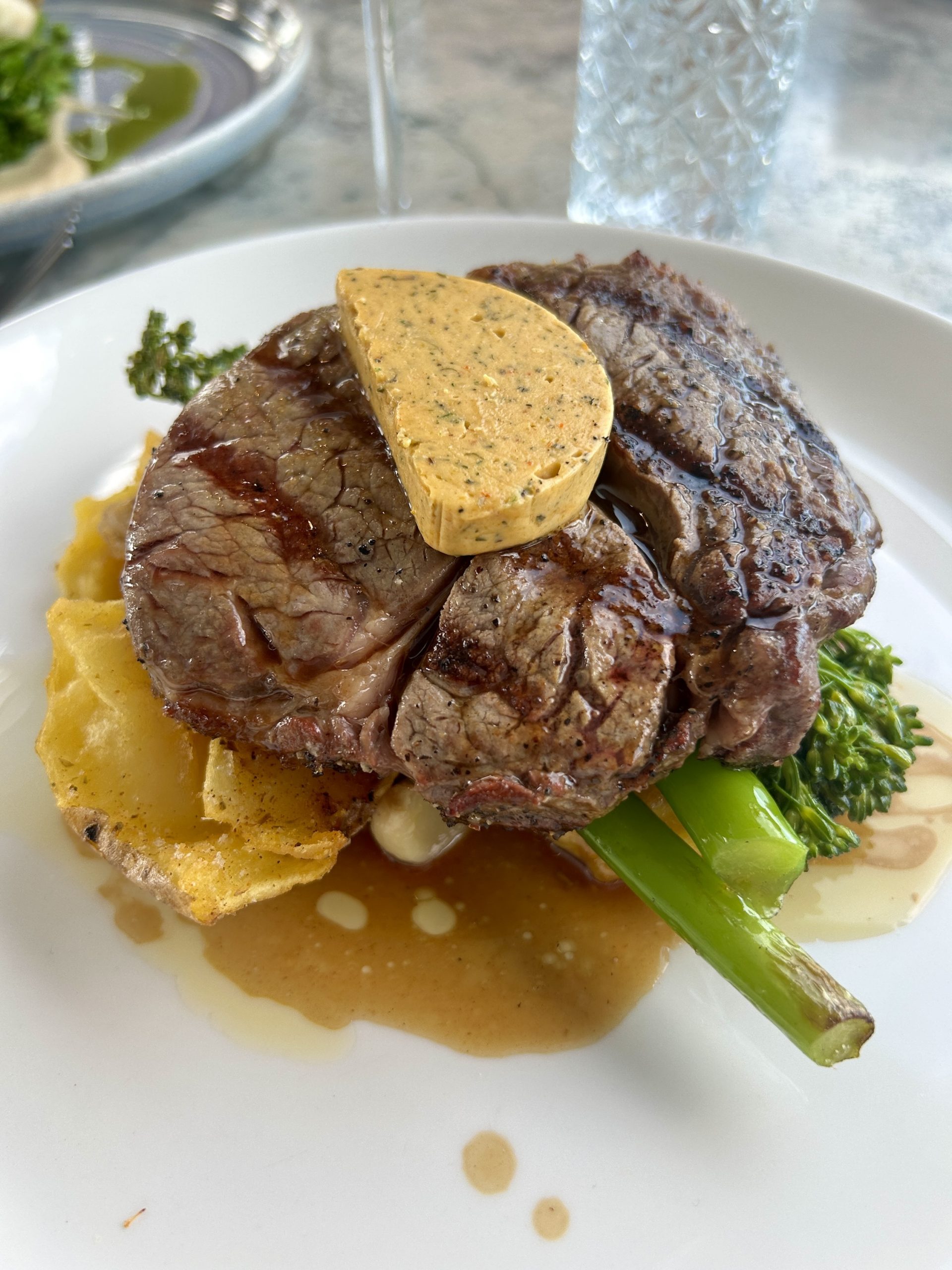
There is another reason to visit Paihia Pier and that is to have a meal at Charlotte’s Kitchen which is at the very end of the pier. Named for a famous early denizen of the area, transported convict Charlotte Badger who escaped from Australia on a ship of mutineers and ended up in Russell. It has a great view of the Bay of Islands and great food to go with it. I had one of best steaks I’ve had in restaurant here.
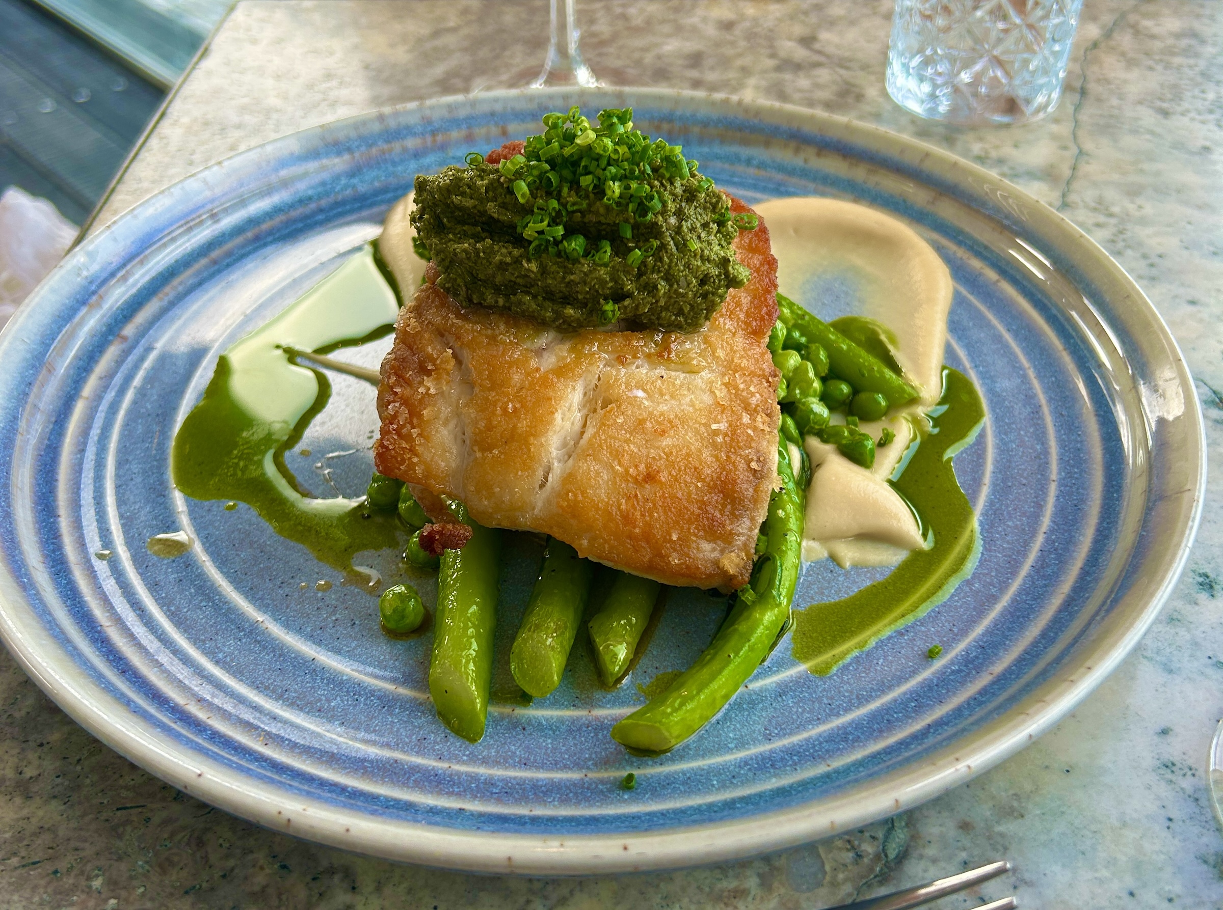
And they know how to do fish as well.
So, so long from Bay of Islands.
In the next post we’ll drive to Cape Reinga at the very northern tip of New Zealand and then visit some of the largest and oldest trees on the planet. I hope you’ll join us.