Bandelier National Monument – Visit in Late Fall

My strategy in visiting a major attraction is always to visit during the shoulder season if possible. There will be far fewer people around, the price may be cheaper and the weather is usually still cooperative. In high season in summer you might be baking in a place like New Mexico, while in the late fall the weather is still warm enough to wear a light jacket in the morning and just a shirt by midday. Such was the case with a recent visit Alison and I made to Bandelier National Monument during the first week of November, 2019. We were in the middle of a two week road trip through the Land of Enchantment and had already visited a number of the state’s top attractions including White Sands and Carlsbad Caverns.
While great natural attractions like these are never to be overlooked, ever since I first made a visit to Mesa Verde National Park longer ago than I care to admit, I have been fascinated with the Indigenous peoples who once inhabited much of the American Southwest. Many of these peoples lived in dwellings constructed either within caves or under the overhanging cliffs of mesas, a geomorphological feature common throughout certain parts of New Mexico, Colorado, Arizona and Utah. We had already visited one such site, Gila Cliff Dwellings National Monument where a small village built right into the side of a cliff had existed for a short period of time in the late 13th century. The people who lived here were part of the Mogollon culture who held sway over a huge territory that included parts of Arizona, New Mexico, Texas and the better part of the Mexican state of Sonora.
This is a map of the area in question showing the demarcation of the three main cultures of the southwest, the Mogollon, the Hohokam and the Anasazi, also called the Pueblo people. Although Bandelier is not marked on this map, it is found just northwest of Santa Fe and is the final stage of Anasazi occupation that began in Mesa Verde and Chaco Canyon around 500 A.D. and ended at Bandelier in about 1550. By the time the Spaniards got into this area in the mid 16th century the Anasazi were, for all intents and purposes, gone. It remains one of the great historical mysteries right up there with the abandonment of the Mayan cities. What happened to the Anasazi and where did they go?
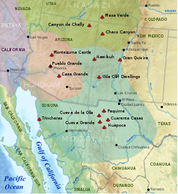
That question has never been satisfactorily answered, but one thing is for sure – they didn’t just disappear off the face of the earth. In all likelihood, due to climate change and probably deforestation or overuse of arable land, they migrated to new areas where they mixed with and were absorbed into existing local populations. Mitochondrial DNA studies may provide the best clues in the long run.
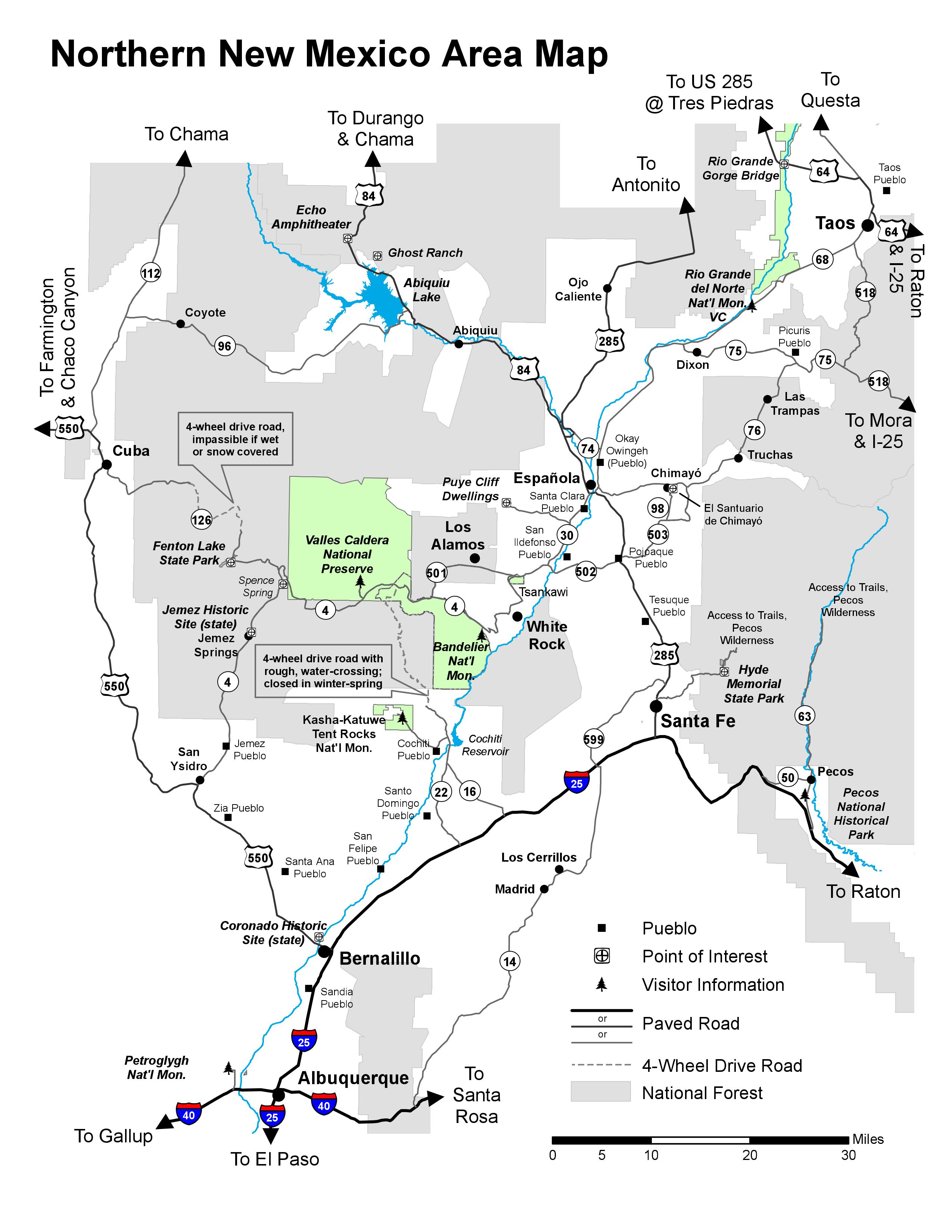
Bandelier National Monument is not that far from Santa Fe and can easily be visited on a day trip which is what we did, with the added bonus of driving back through Los Alamos, America’s Atomic City. The entry fee is $25.00 per vehicle, but with our annual park pass entry was free. Now here’s the deal about visiting during the shoulder season. From May 14 to October 14 you can only enter Bandelier on a shuttle bus that runs from White City every 30 minutes, unless you get there before 9:00 AM. This gives you an idea of just how crowded you might find the place during the summer season.
On the day we visited it was sunny, warm for November and the parking lot was only half full.
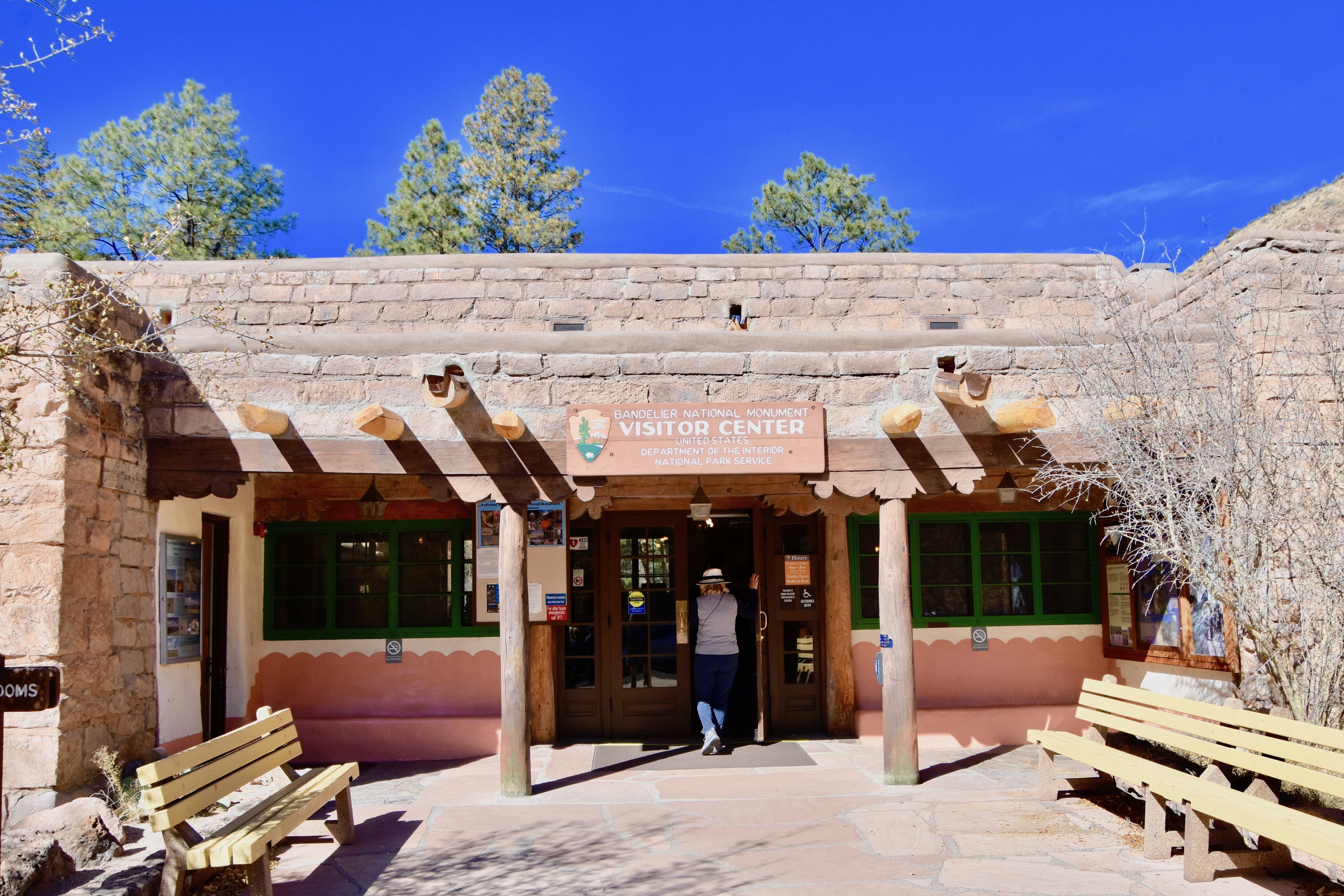
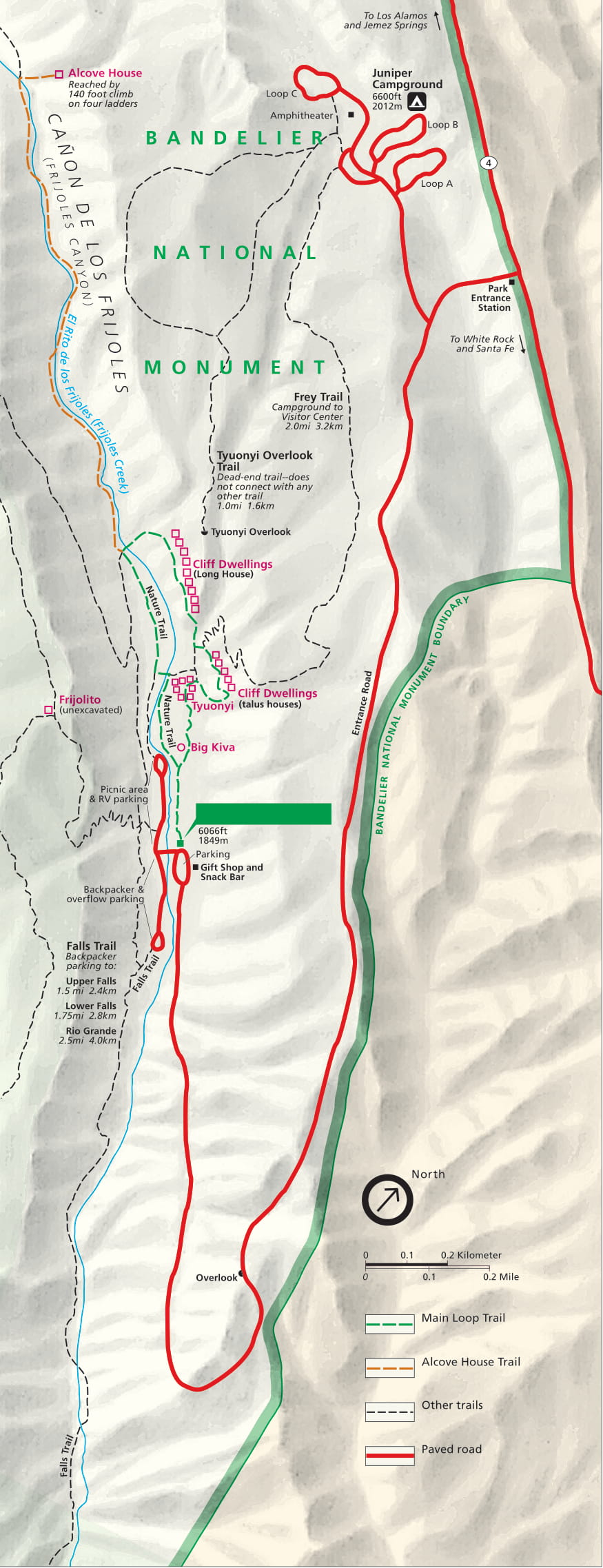
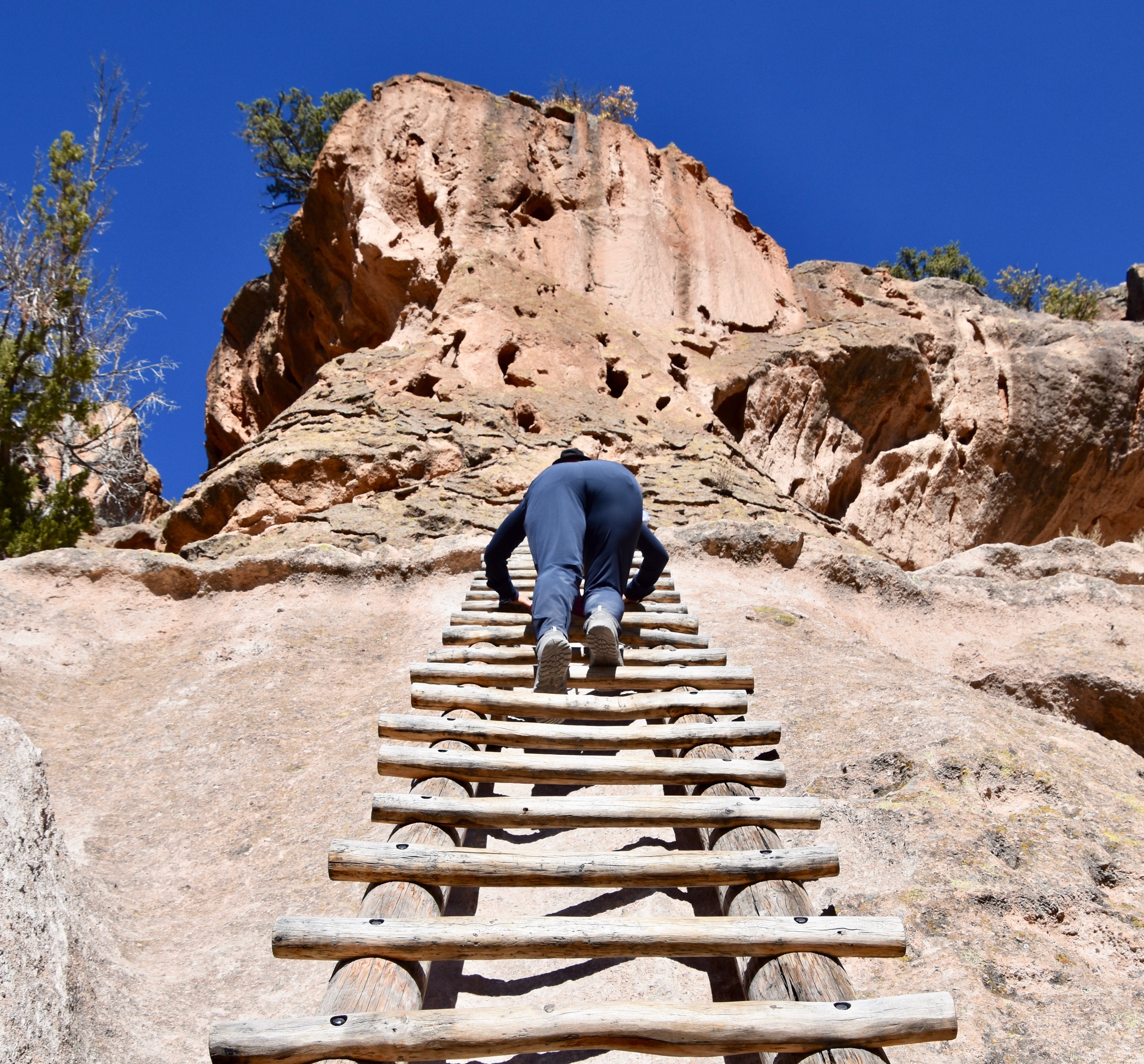
The starting point is the Visitor Center where you will be given a copy of the trail map below and for $2.00 purchase a brochure identifying the numbered spots on the map and you’re ready to start your exploration of Bandelier National Monument. The main circular trail is only 1.2 miles (2 kms.) and takes about an hour. Most visitors will want to continue another half mile each way to Alcove House which is, in my opinion, the star attraction at Bandelier, but it’s not for the faint of heart as it involves climbing four very vertical wooden ladders up to a point 140 feet above the canyon floor.
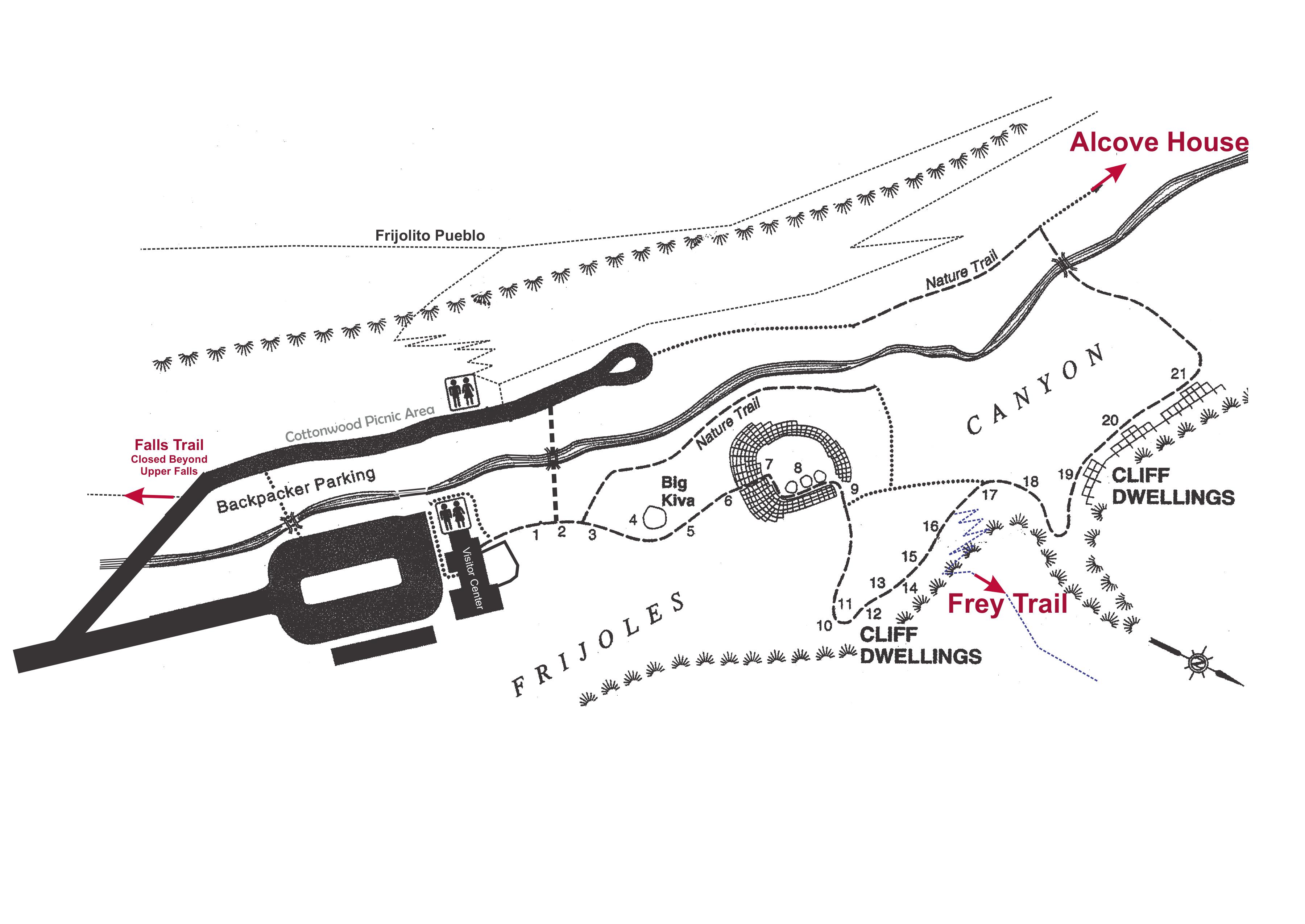
This map gives a better idea of the main trail in Bandelier and the positioning of the various dwellings.
The walk to and from the various highlights was a very pleasant stroll through a mixed forest of ponderosa and piñon pines with the deciduous trees in their fall colours. The circular trail passes along both sides of a small tributary of the Rio Grande, Rito de los Frijoles or in English, Bean Creek. The air is fresh and pine scented and if you bring your binoculars you are likely to spot Western Scrub Jays, Canyon Wrens and Towhees among many of the species that are found year round in Frijoles Canyon. Even without the ruins to explore, this would be a great short walk.
In terms of footwear, if you are going to climb the ladders then you need something that has a good grip, definitely not flip flops.
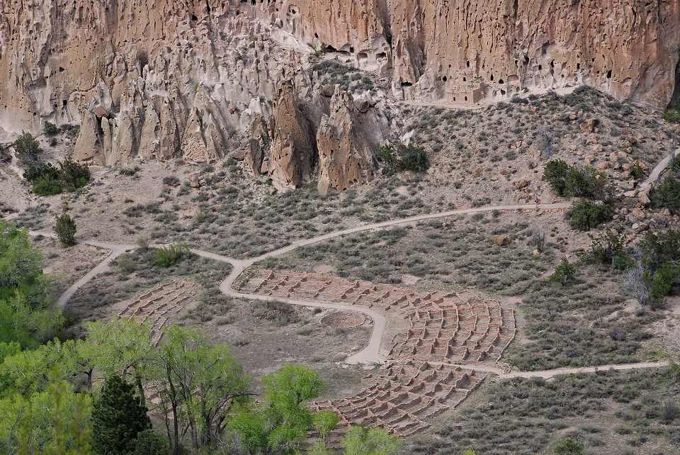
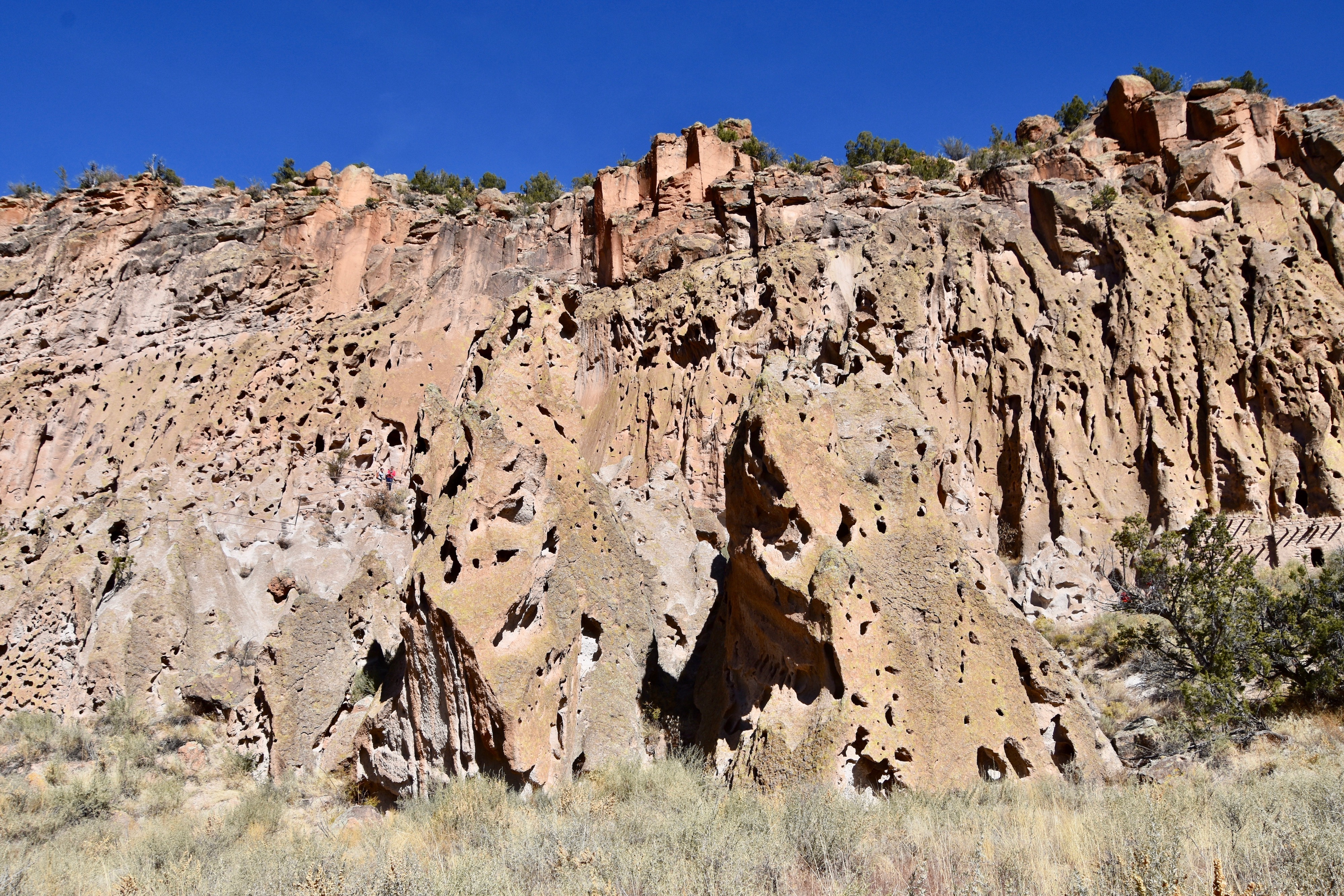
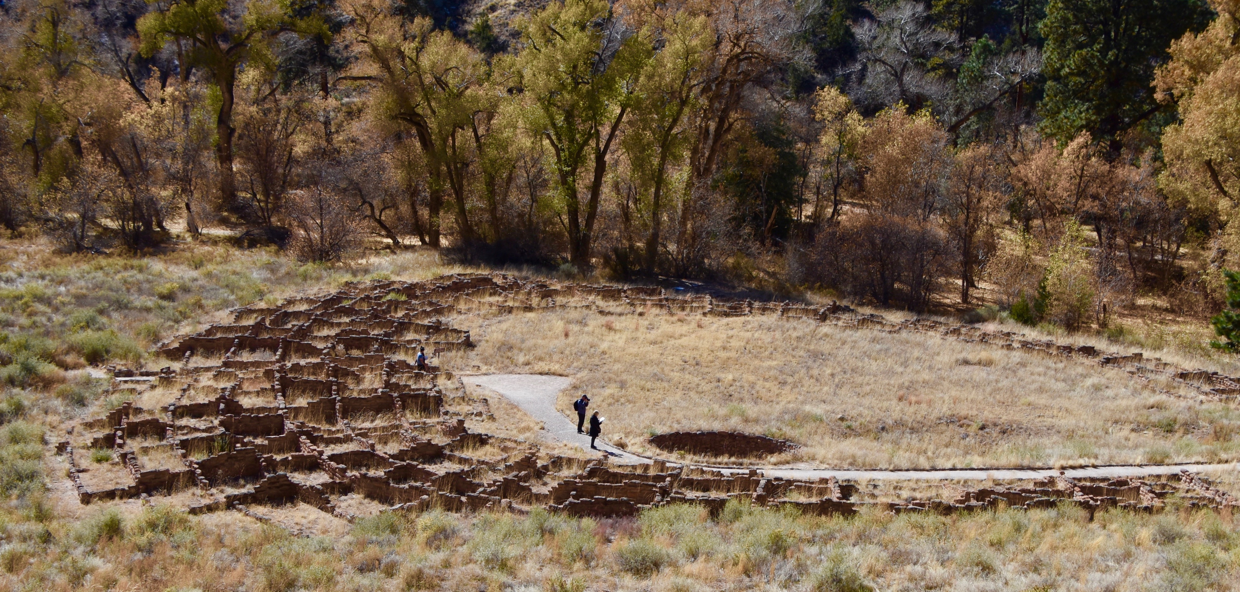
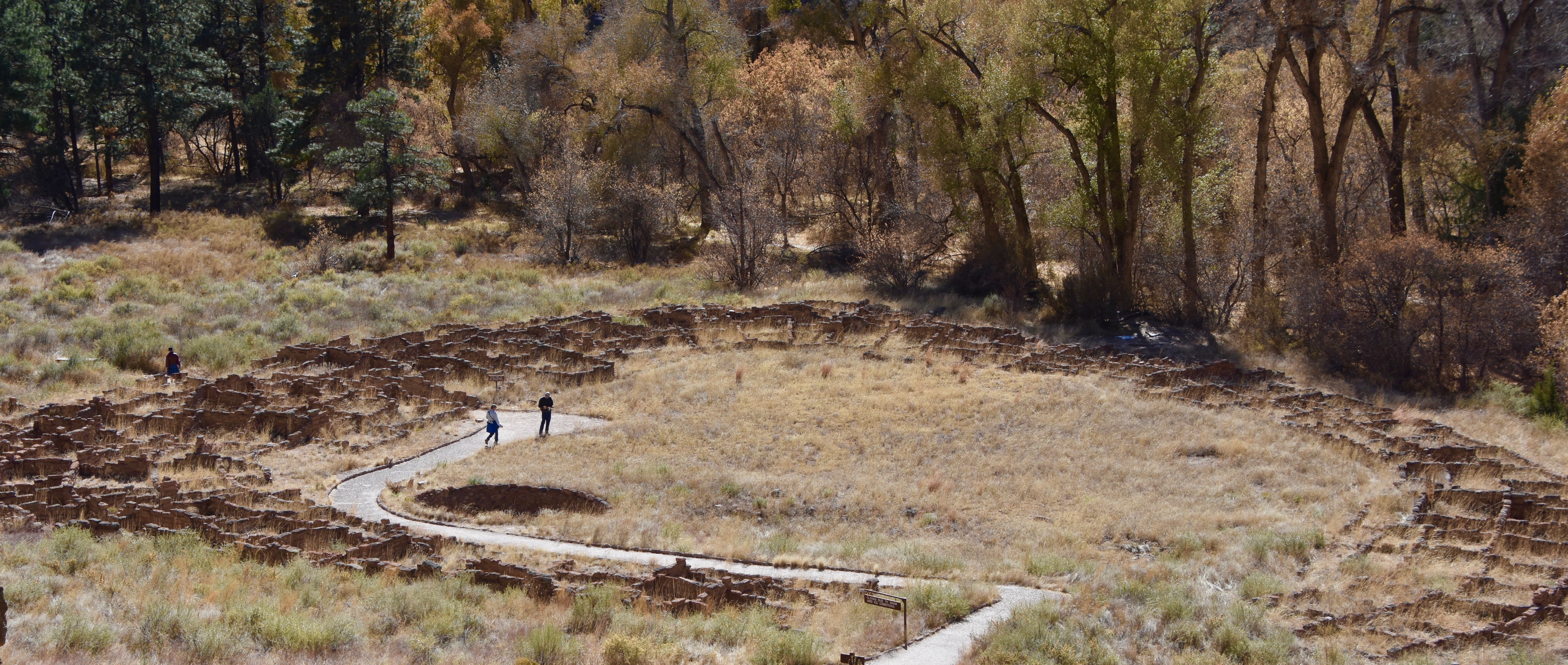
There are actually three types of dwellings to explore at Bandelier. The first is the actual village of Tyuonyi which is a huge pueblo that has 245 ground level rooms and probably had many more above these. The second are the rooms at the base of the cliff which are several stories typified by Long House. The third are those right inside the cliff face which are properly called ‘cavates’ meaning an excavated cave expanded from a natural hole in the cliff face. It is believed that all types of dwellings were used contemporaneously with the people living in the pueblo and long house in summer and retreating to the cavates in winter where it was substantially warmer than on the canyon floor.
This aerial shot from the National Park Service gives a much better idea of the relationship between the pueblo of Tyuonyi and the cavates in the cliff face. In the middle right you can see one the multi-story houses built at the base of the cliff.
OK, so let’s get going.
The first stop is at the great kiva which is a ceremonial structure that would have had a roof when people still lived here. Kivas were the centre of religious and political life for all three of the major Indigenous groups that occupied the southwest and continue to be to this day in many of the pueblos in New Mexico and Arizona. The great kiva would have been sort of a combination of cathedral and town hall, while smaller kivas were for personal religious purposes.
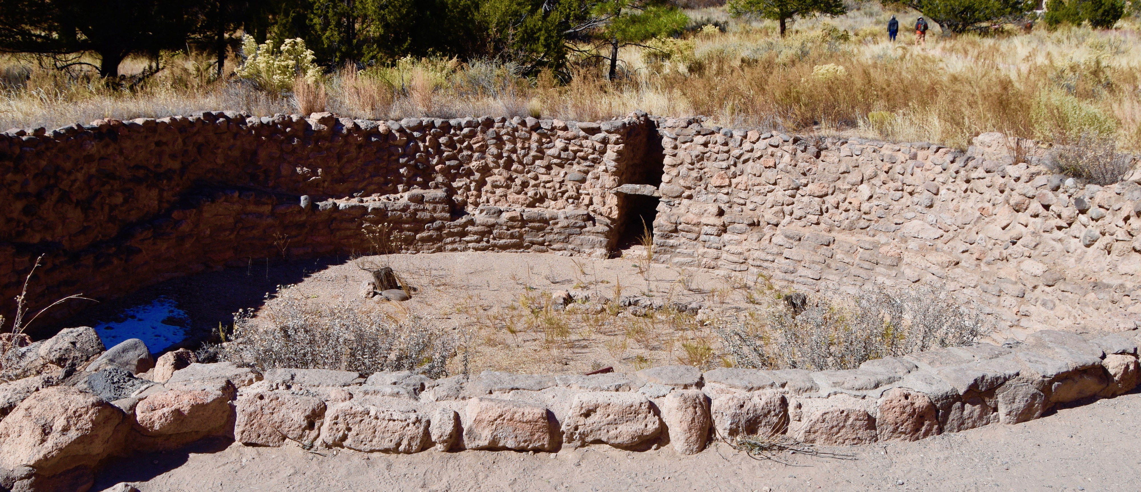
Standing on the edge of the great kiva and looking down I can only get a vague sense of the rituals that were conducted here, but I’m sure to a modern day pueblo dweller it would have tremendous significance.
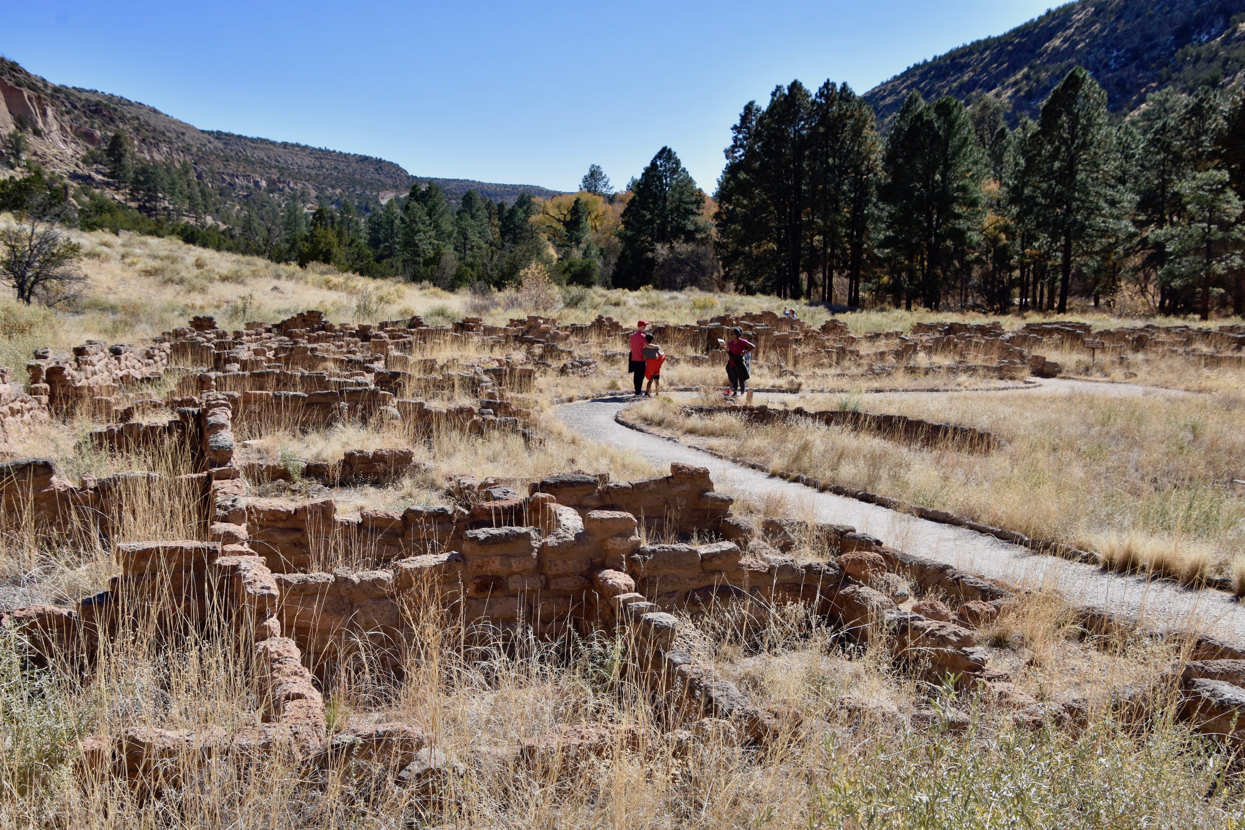
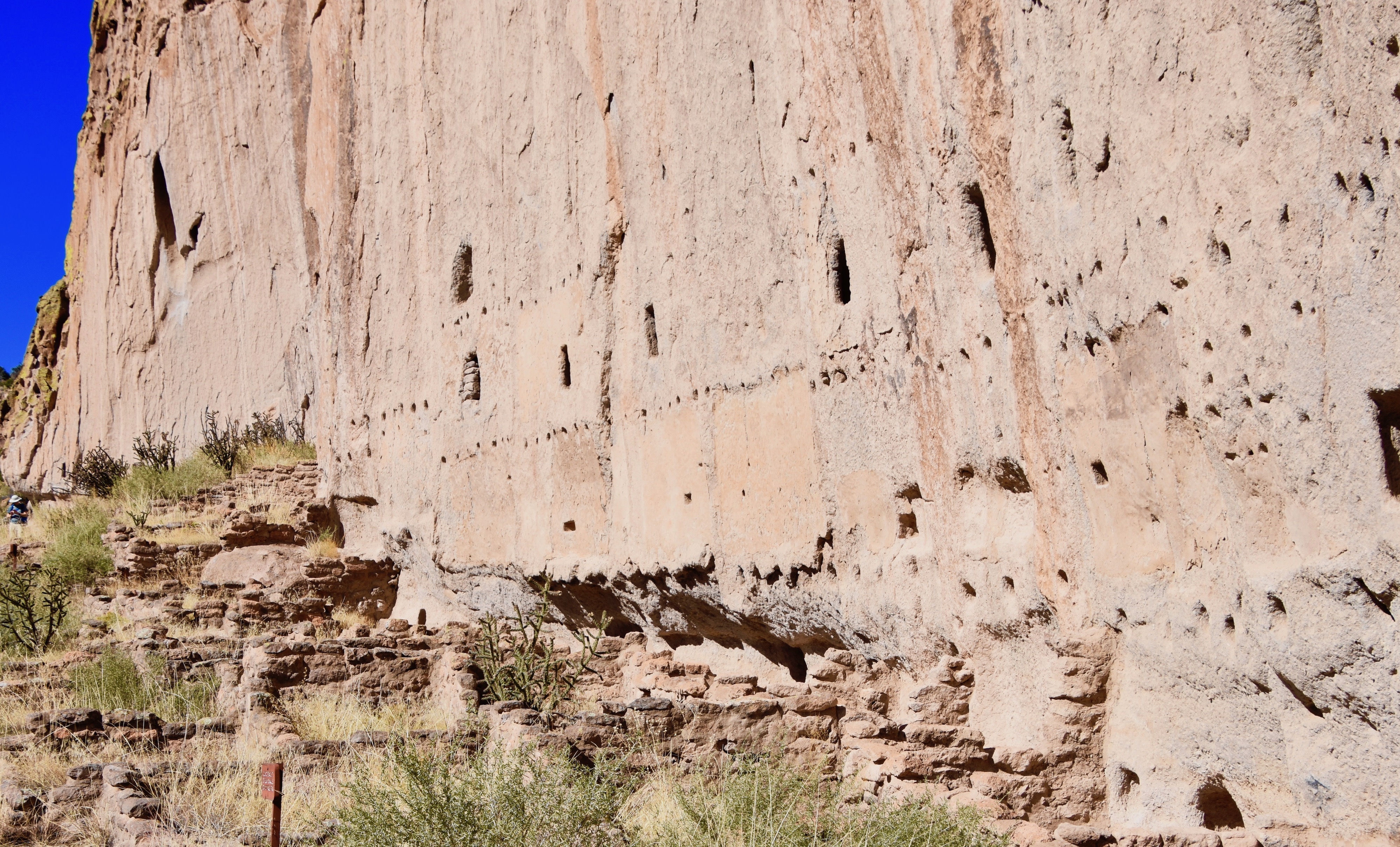
Next the path leads right though the remains of Tyuonyi, but you cannot enter the rooms. The structure is made from volcanic tuff, a type of ejecta that is quite soft and easily eroded or damaged by human traffic. I wouldn’t be surprised if in the future they put a protective roof over the entire structure.
The picture also shows that there are few people around as contrasted with the numbers who would be here in summer.
Looking at the cliffs from Tyuonyi you can see that they are naturally pitted with hundreds of small holes that the Pueblo people would use to create the cavates that became their winter homes.
The trail now turns sharply to the right and ascends to the base of the canyon cliffs. The higher you go the better the views of Tyuonyi pueblo below.
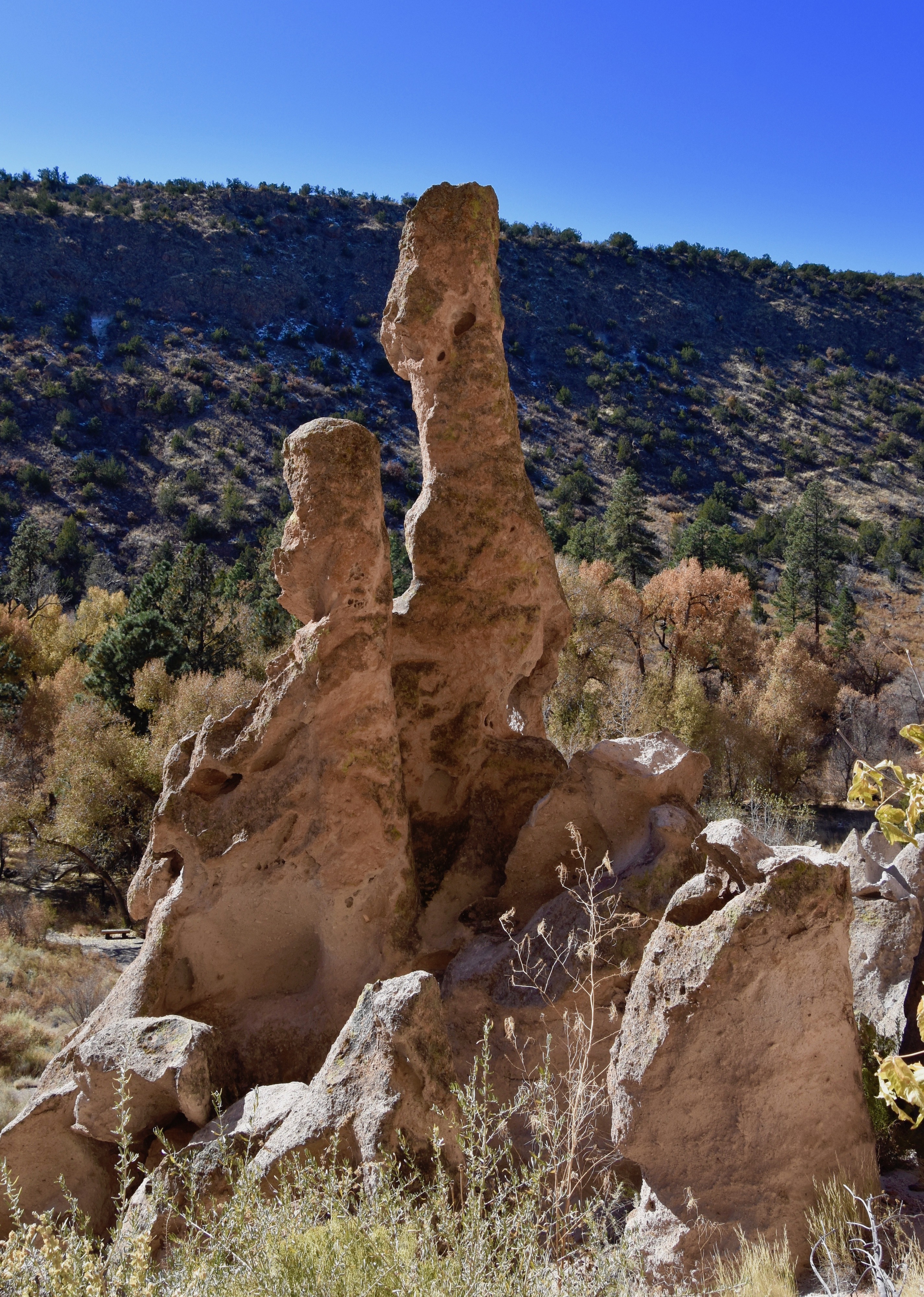
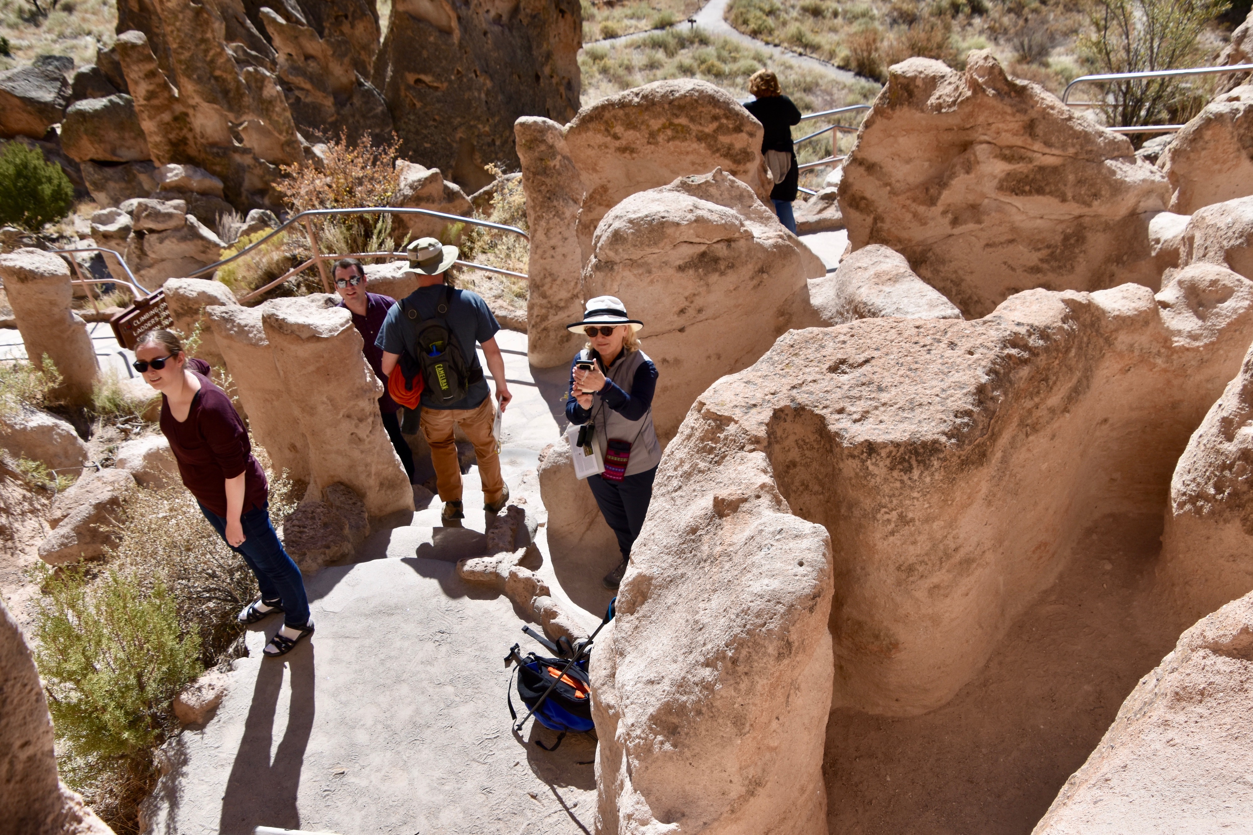
Man made objects are not the only things to see at Bandelier, there are many interesting natural rock formations like these hoodoos.
Just after these formations you come to the first ladder that leads up to a cavate. It’s pretty tame compared to what is to come and there’s not much to see inside.
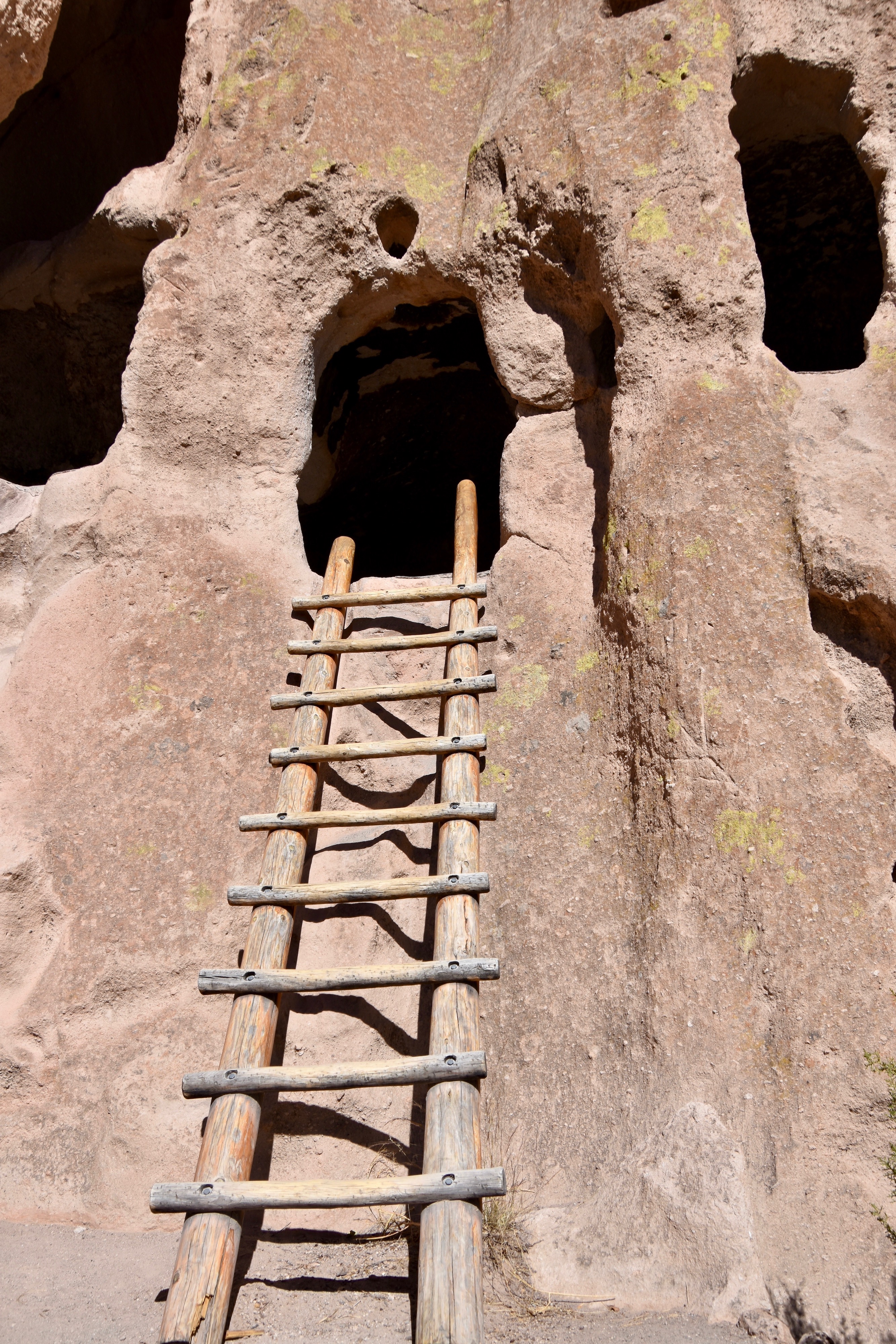
Next come more ladders and the good news is that you don’t need to wait in line for any appreciable time to climb them like you would in summer. This is looking down from the second ladder.
By now you have a great view of Tyuonyi well below and can get an appreciation of just how big it is. You don’t have to travel to Italy, Greece, Turkey, Mexico or Peru to see the remains of once great civilizations. There’s one just below me now.
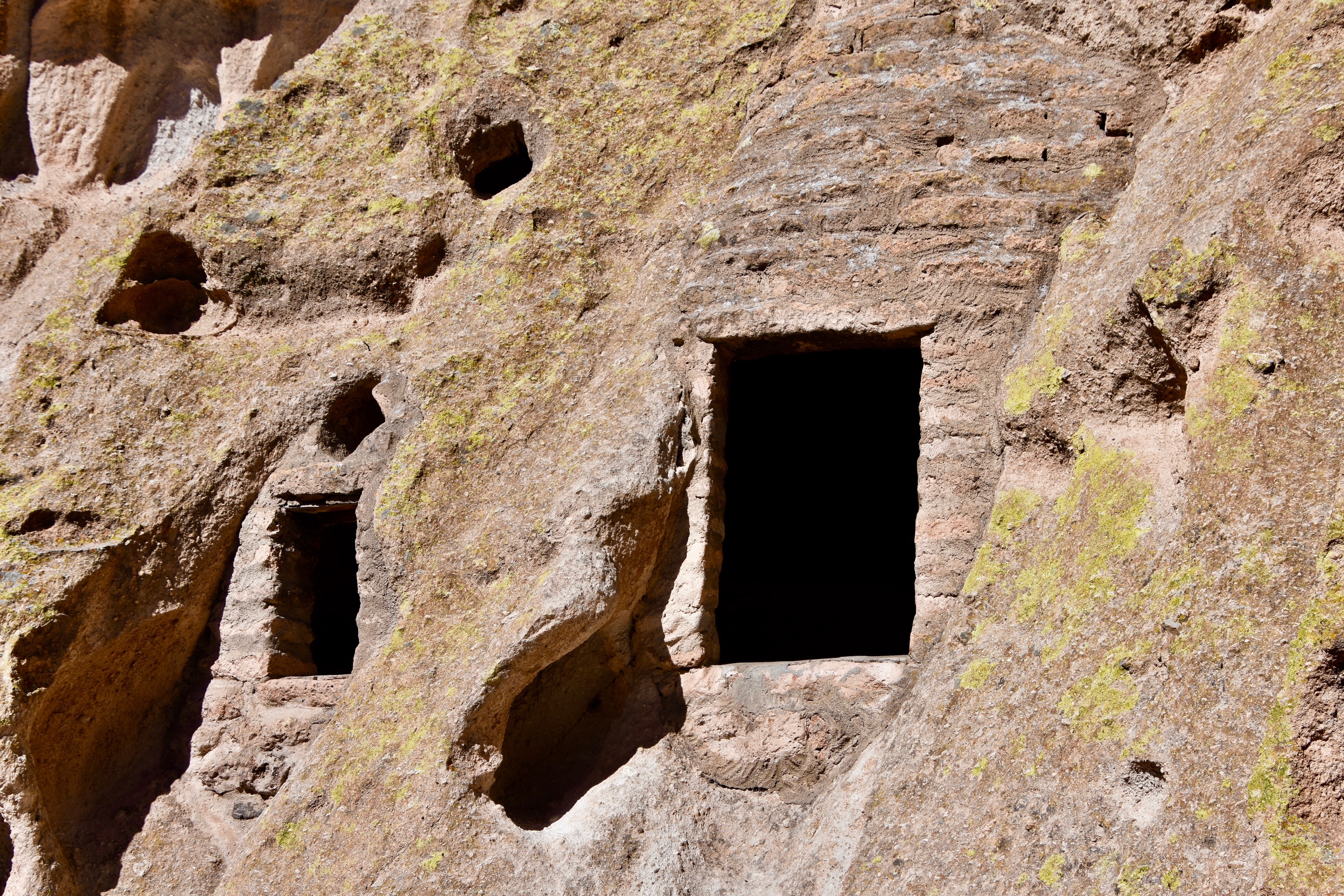
Although most of the cavates have circular entrances a few like these ones have rectangular entrances that have been augmented by tuff stone bricks and mortar. Both these and the more traditional openings would have had coverings that shielded them from the open elements.
Now the trail comes to the first of the homes that were constructed at the base of the cliff with the cavates just above. If we had had time we definitely would have taken the Frey Trail which starts just before this spot and makes its way via a series of switchbacks up to the top of the cliff.
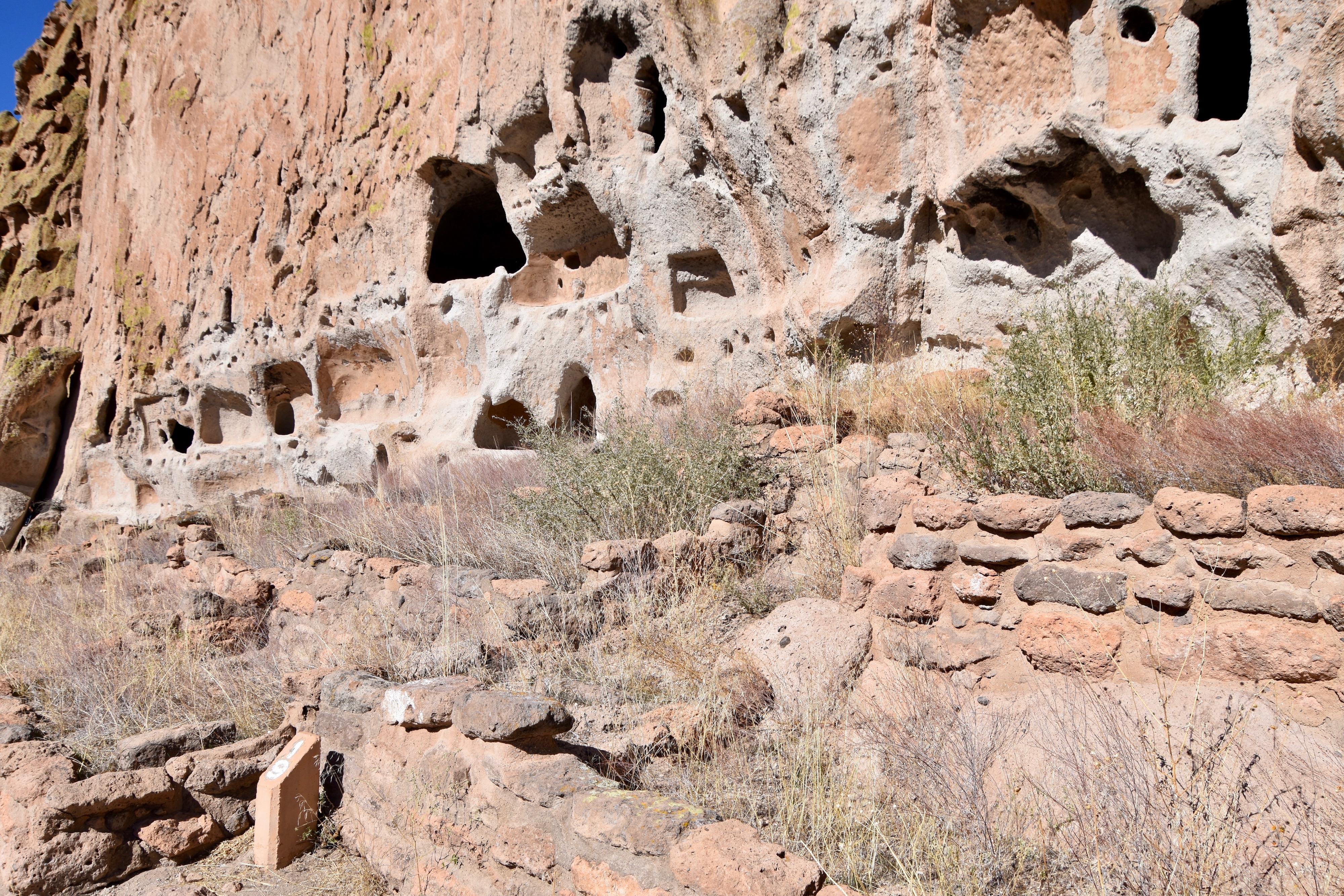
Here is a closeup view of one of these homes built under the overhang of the cliff. The four small holes would have been sockets for logs that would allow for a roof between the house and the cavates above. Also note the soot marks that are found in virtually all cavates. Given that they had no chimneys, they must have been one hell of a smokey place.
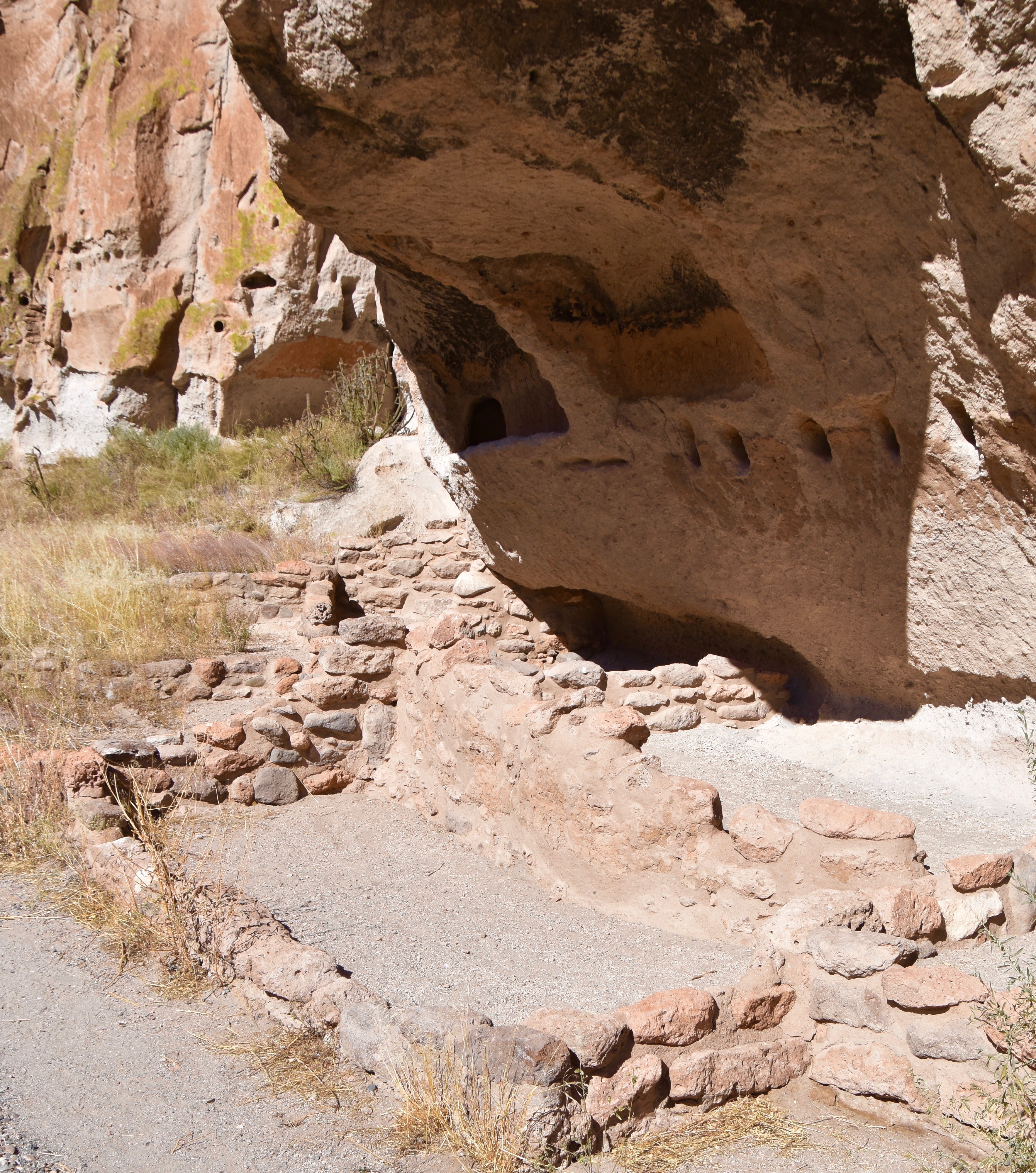
This photo gives a much better view of the many post holes that would be used to separate floors and you can see that what is now just a low wall of tuff bricks was once a three story building that actually fully enclosed some of the cavates.
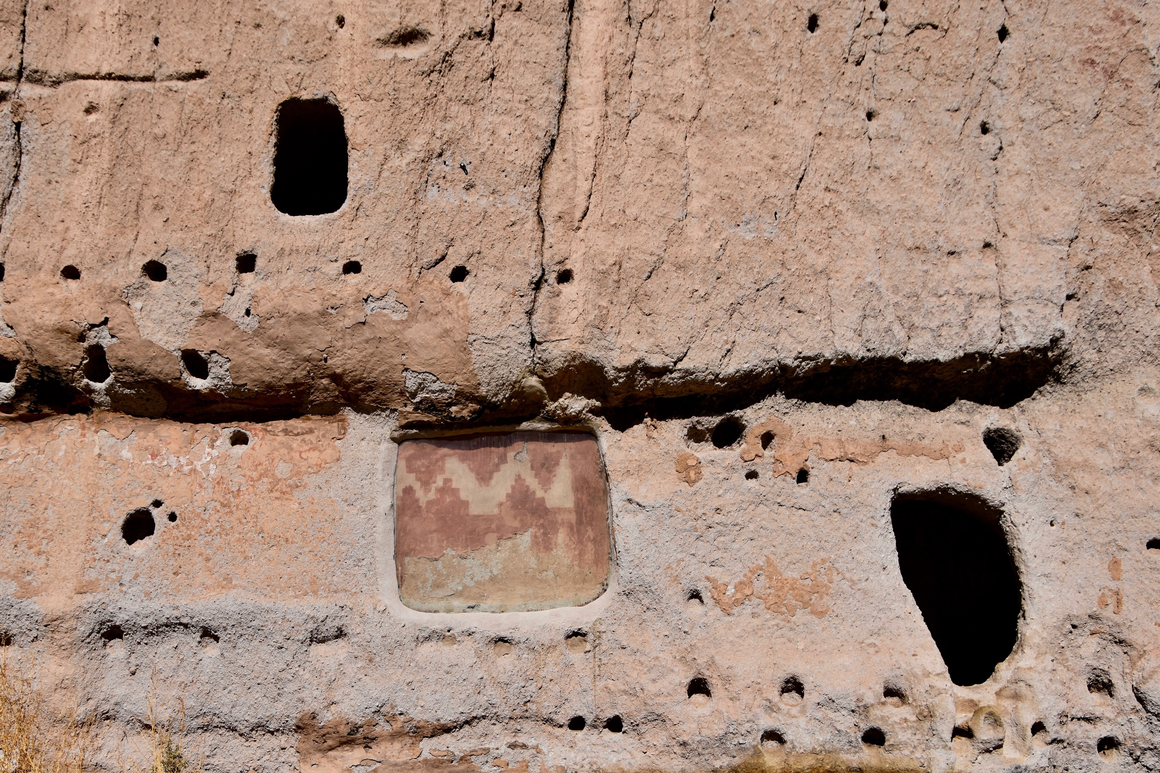
Bandelier National Monument also some some interesting pictographs of which this is the most famous, being part of the back wall of a second story house. For some reason it was covered in plaster and only discovered by accident. Apparently long before modern renovations became a keep up with the Jones’ phenomena, these ancient people also got tired of the same old same old and made changes in the home decor. This is stop 21 on the trail map above.
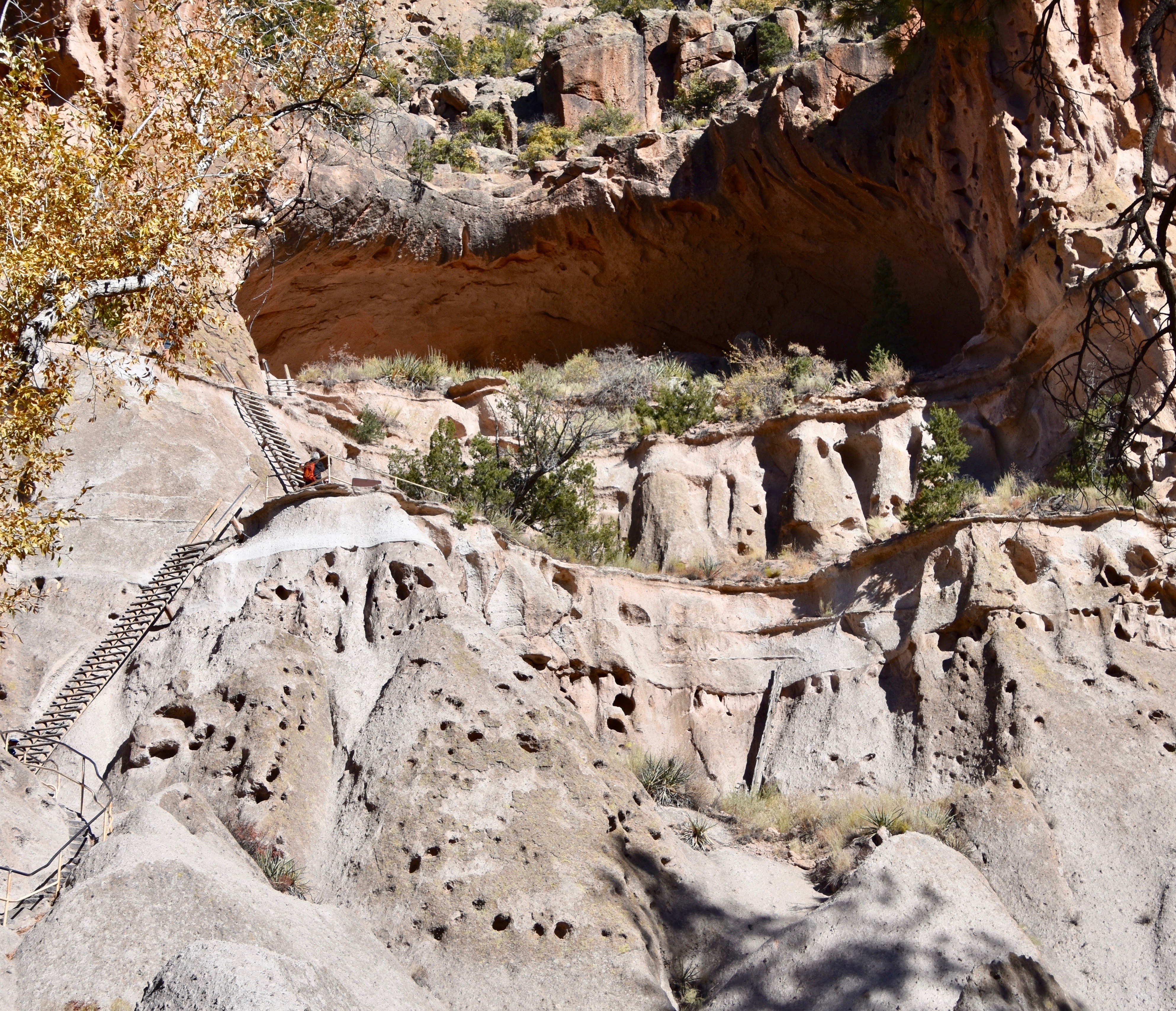
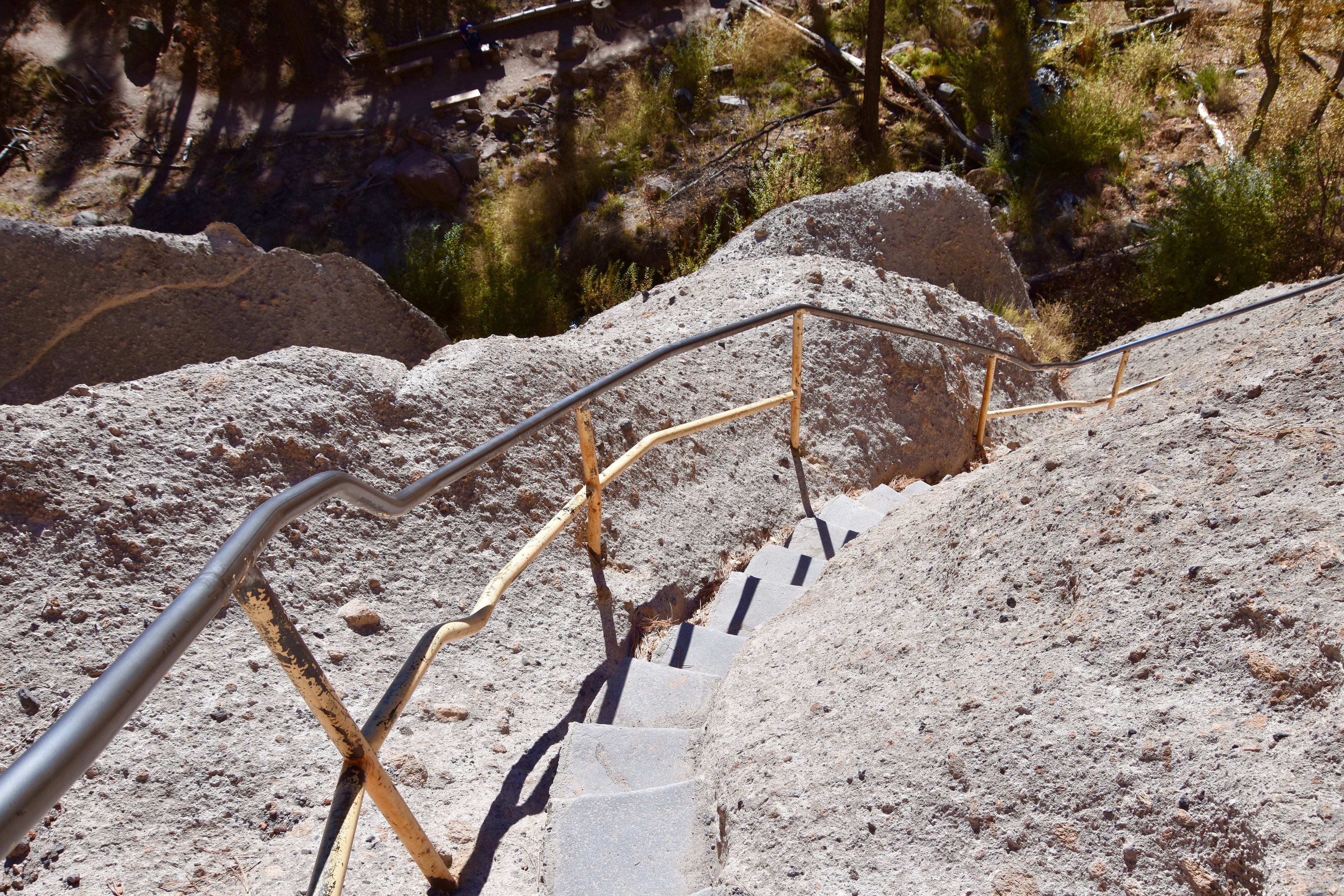
From here the trail makes its way back down to Bean Creek and crosses it for the return to the Visitor Center or you can decide to go in the opposite direction the half mile to Alcove House. We chose the latter.
This is the view from the canyon floor looking up to Alcove House. You can see two of the four ladders on the left and from here it doesn’t look too bad.
But once you get to the bottom of the ladders they are much steeper then they look from afar. Here goes Alison up the first one.
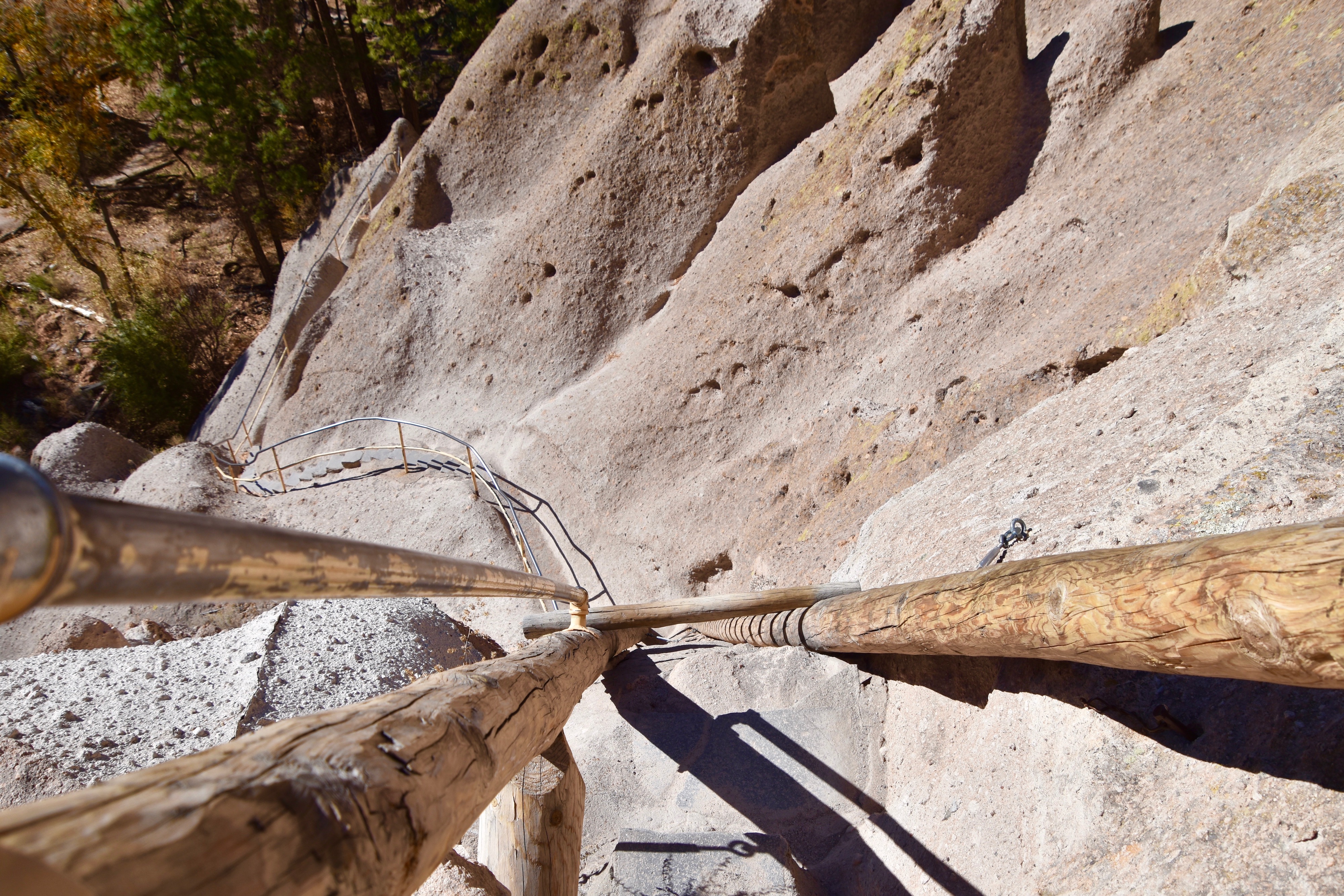
This is looking down the second longest ladder.
The shortest ladder.
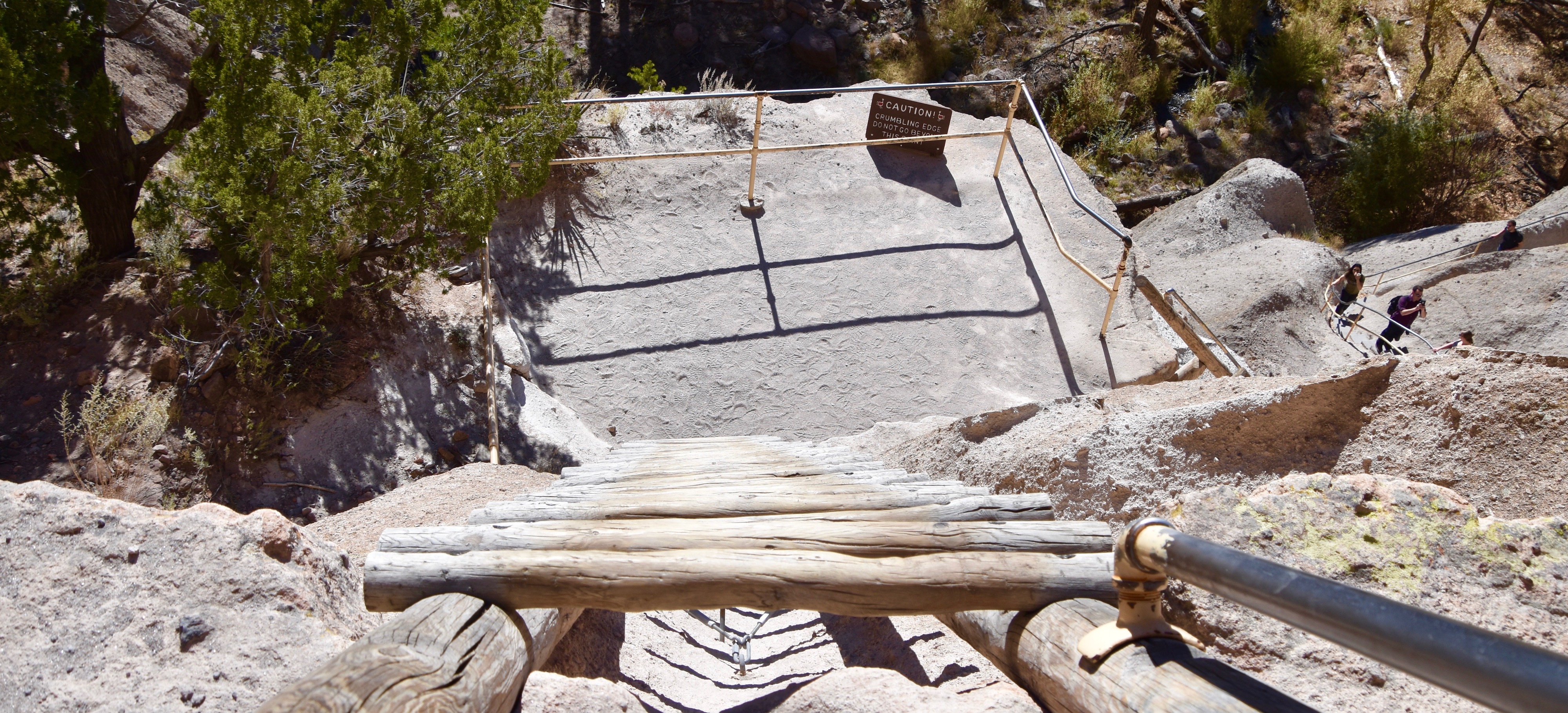
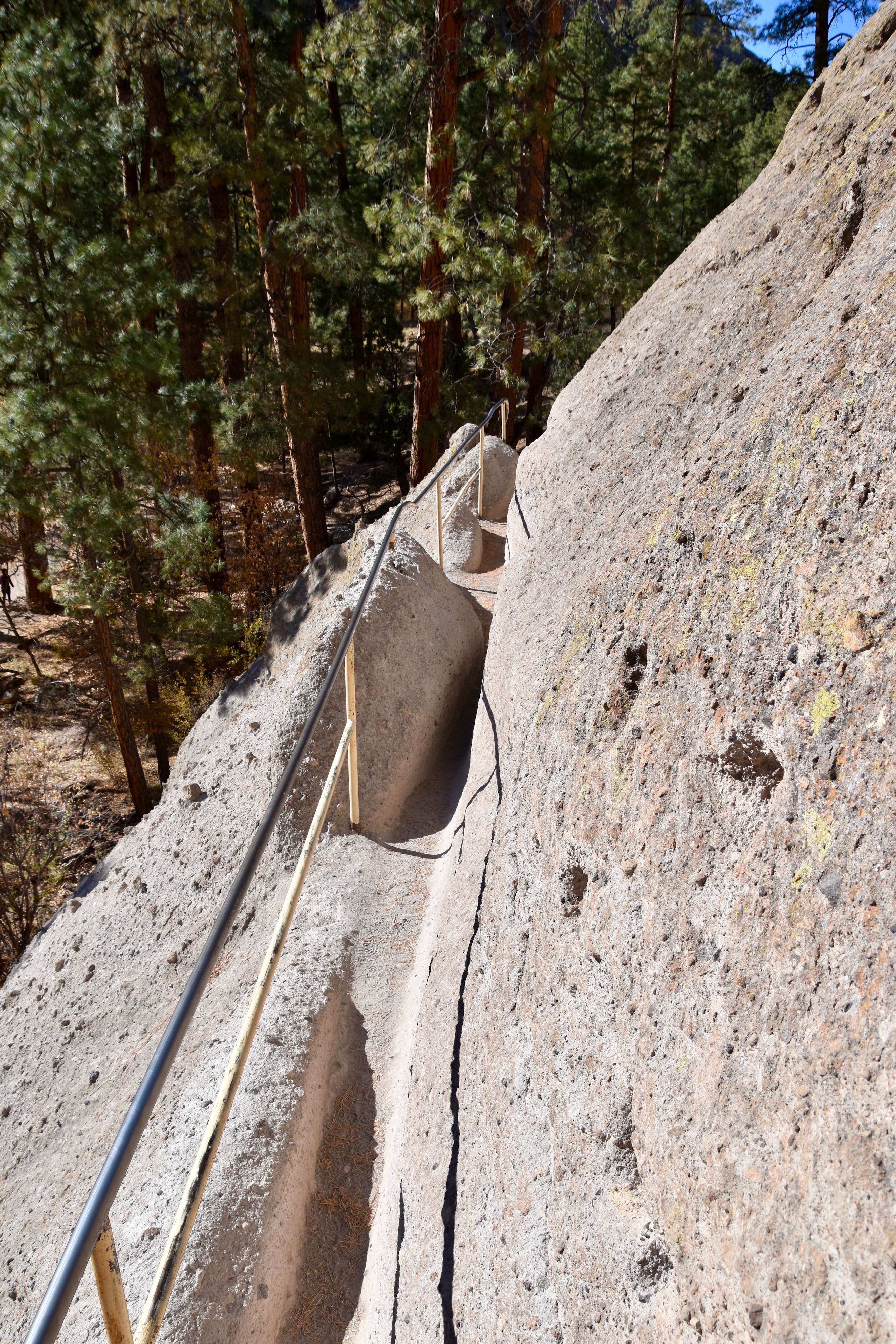
It’s not just the ladders, but the very narrow walkways cut into the side of the cliff that can be potentially scary. There is no way two people can pass each other on one of these. Yet another reason for being here without the crowds.
There’s not many places that can make you claustrophobic and acrophobic at the same time, but this narrow passageway manages to do that.
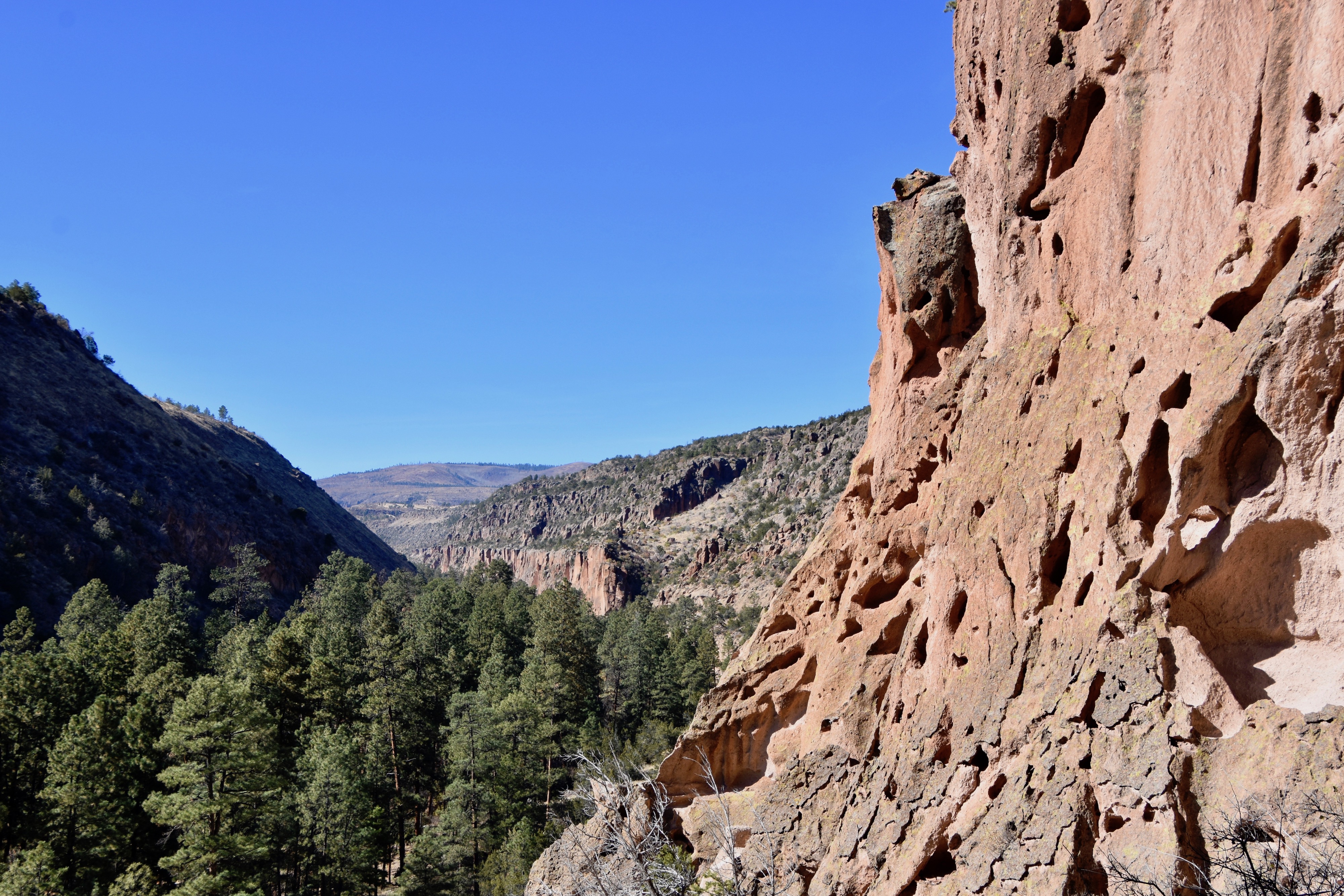
However, all the climbing is more than worth it when you get to the top. This is the view of Frijoles Canyon from Alcove House.
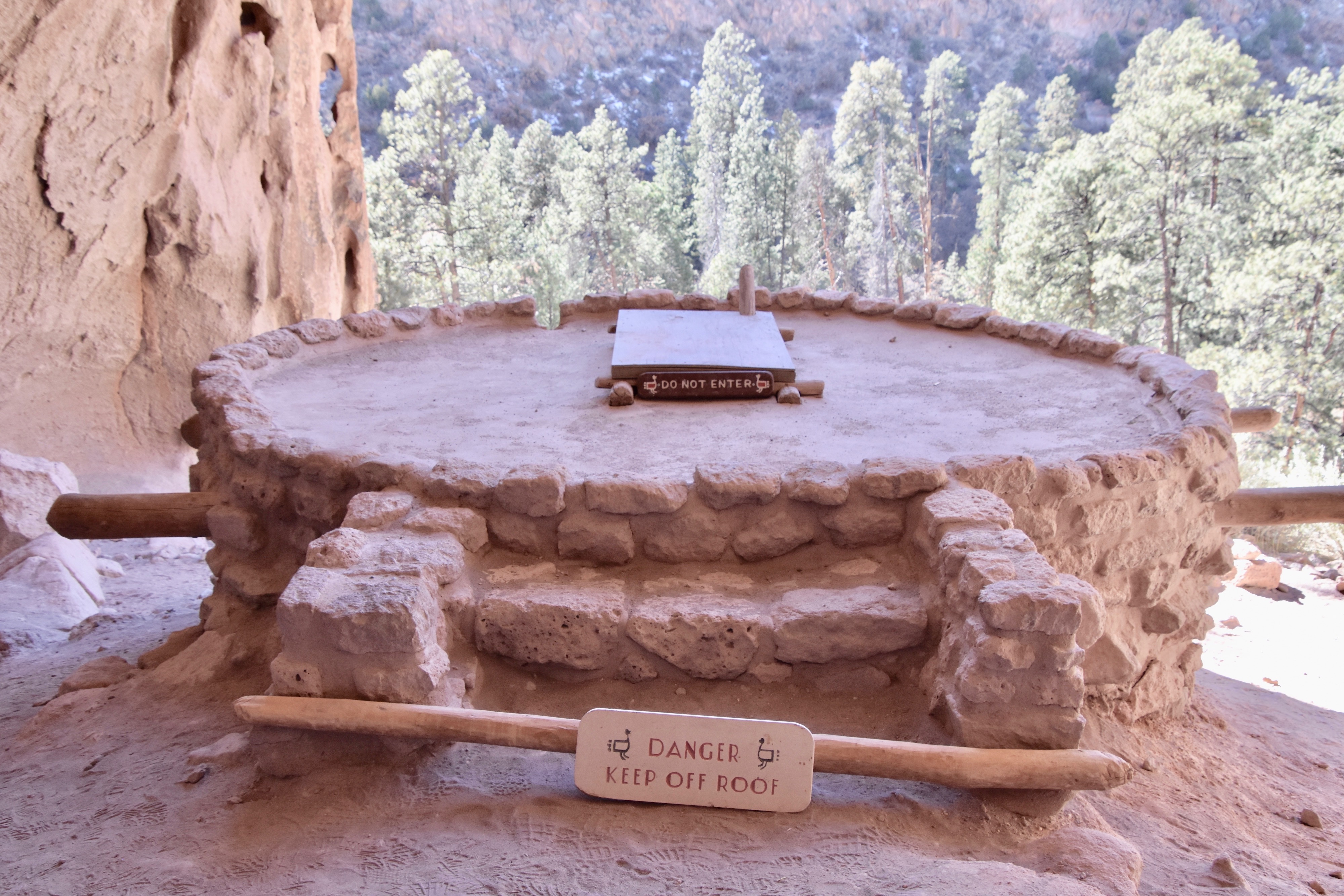
Inside Alcove House is this large kiva which must have been the premiere spot for celebrations and ceremonies in Bandelier. Up to 25 people lived inside Alcove House and I’ll never complain about carrying groceries down to the house ever again.
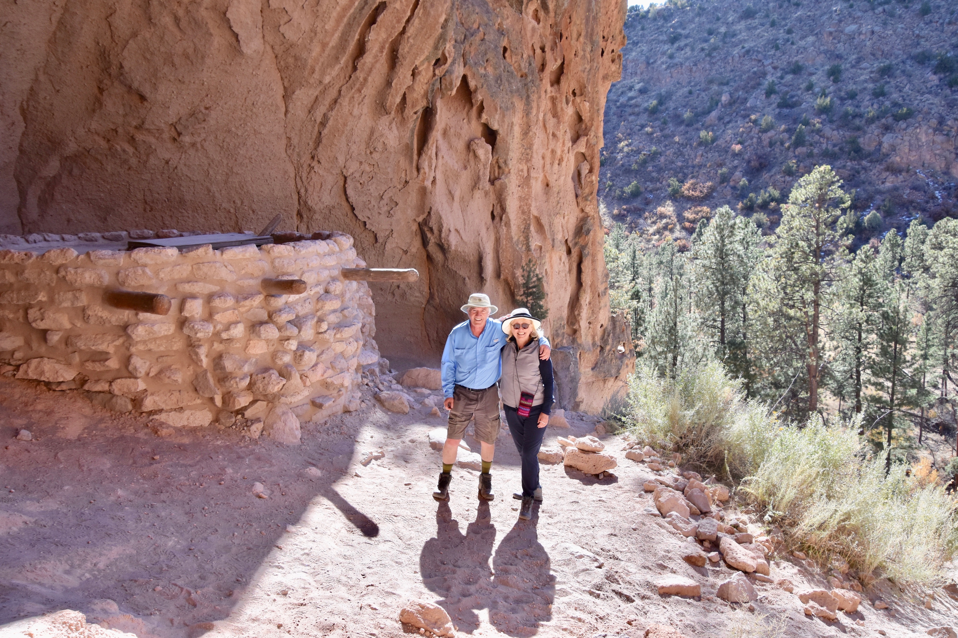
Finally, you will want to get your picture taken here to prove that you climbed to one of the highest aeries in the southwest.
Visiting Bandelier National Monument was one of the highlights of our New Mexico journey and we highly recommend you visit in early November.