Port au Port Peninsula and the French Shore

After visiting the Cape Ray and Cape Anguille lighthouses and exploring the Codroy valley as described in the last post, Alison and I drove straight to the turnoff for the village of St. George’s and followed Route 490 into Stephenville where we spent a comfortable night at the Day’s Inn. We rose early as we had a full day ahead exploring the Port au Port peninsula before going on to Corner Brook. Please join us as we explore Newfoundland’s French Shore by driving the French Ancestor’s Route.
Before setting out, there is something that we want to see right inside Stephenville, the Blanche Brook fossilized trees that can be found by walking an easy circular trail that can be accessed right behind the MacDonald’s on the main drag.
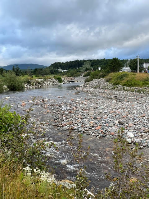
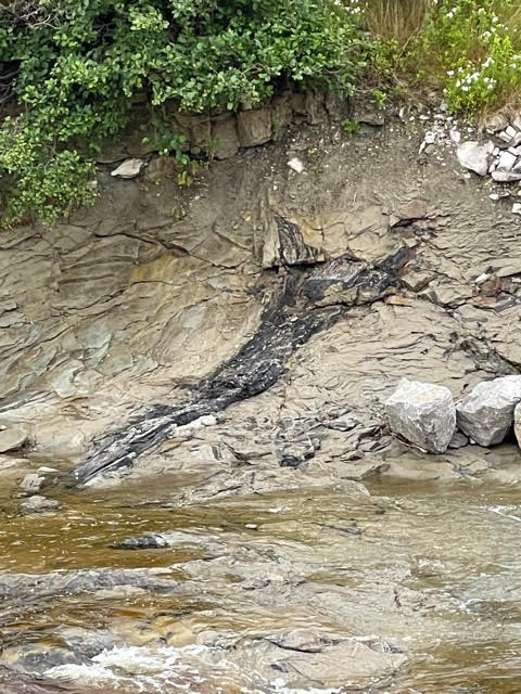
While Blanche Brook may look pretty gentle today, at times it can be raging. In the middle of the circular path you are walking, which is now a park, there once stood over fifty houses that were destroyed by flooding from this stream in 2005. There was an upside though. This same high water and others that have followed have exposed the remains of ancient carboniferous trees.
This one was plainly visible from the opposite side of the brook.
History of Port au Port Peninsula
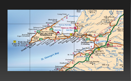
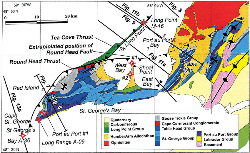
If you look at a map of the west coast of Newfoundland you’ll notice a very unusual triangular appendage that is attached to the rest of the island by a tiny strip of land near the village of Port au Port. This is, of course, the Port au Port Peninsula and the starting point in its history goes back to the complex geology that involves no less than a dozen distinct geologic formations that span hundreds of millions of years. This helps explain how there can be so much different terrain in such a small area as we found out.
The history of settlement in the Port au Port peninsula is as complex as its geology. The first records of the peninsula come from the Basque whalers who frequented the area even before Jacques Cartier came sailing by. They named the place Ophor Portu or ‘port of rest’ and the pronunciation gradually became Port au Port. However, the Basques were not settlers and although there appears to have been a Mi’qmaw presence, it is not believed to be substantial in numbers. Things changed with the Treaty of Utrecht in 1713 and the Treaty of Paris in 1763 which marked the end of the struggle for control of what is now Canada between the English and French with the French ceding all territory except tiny St. Pierre and Miquelon. What most people outside Newfoundland and Labrador probably don’t know is that the French retained the right to fish along the entire west coast of the island under these treaties.
While the right to fish supposedly excluded the right to settle, in practice that was pretty unenforceable by the British. The Heritage Newfoundland and Labrador website reports that in the late 18th century a wave of Acadians from Cape Breton settled in the area, founding Stephenville and setting up farms in pockets from St. George’s to the Codroy Valley. Then things get distinctly weird. Many of the French sailors who fished around the Port au Port peninsula decided that they liked things more ashore than asea and deserted. They formed a number of communities on the peninsula all based on fishing. You then had intermingling and marriage between the Acadians and the French who were mostly Bretons thus producing a population that is surely unique in Canada, if not the world. Who knew that years after France ceased sending immigrants to Quebec and Acadia that there was a new round of settlement on the shores of western Newfoundland? Today the Port au Port peninsula is recognized as the only bilingual community in Newfoundland and Labrador.
The right for France to fish off western Newfoundland continued right up until 1904 and the last deserting sailor came ashore in 1895.
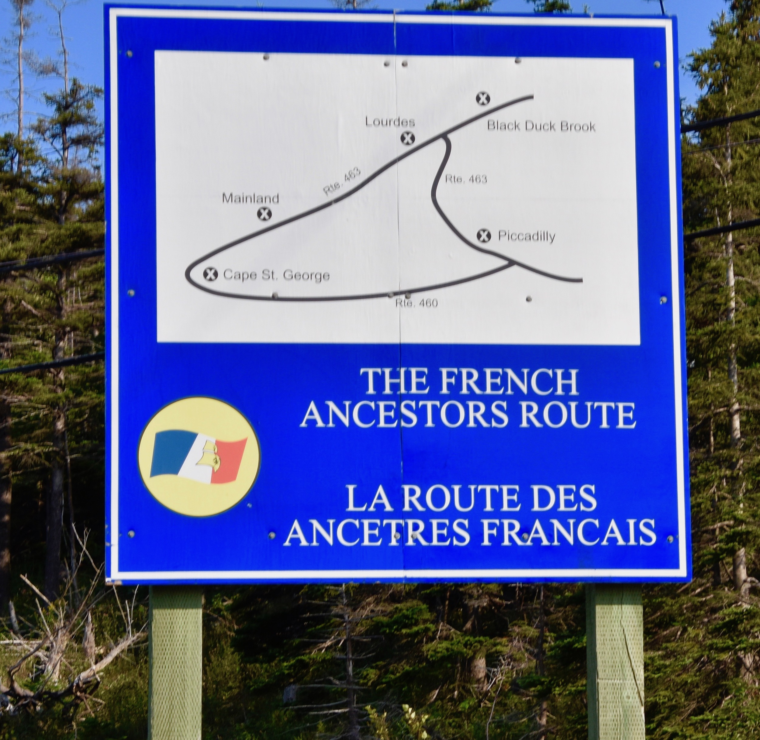
The map shows a paved highway that circumnavigates the Port au Port peninsula and this is what is known as the French Ancestor’s Route. It is 161 kms. (100 miles) and we’ll navigate it in a clockwise direction starting by following Route 360 out of Stephenville as far as Cape St. George. If one were to take the side roads into every one of the over two dozen named communities on the Port au Port peninsula you easily spend more than a day exploring. As this is the first time Alison and I have ever set foot in the area we are just going to play things by ear and see what we see.
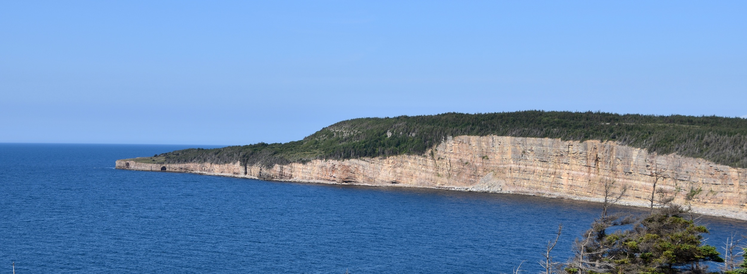
The first thing we notice is the number of new houses and prosperous nature of the communities along the south shore of the Port au Port peninsula. The second is the dramatic seascapes that soon begin to appear starting with these limestone cliffs near Campbells Creek.
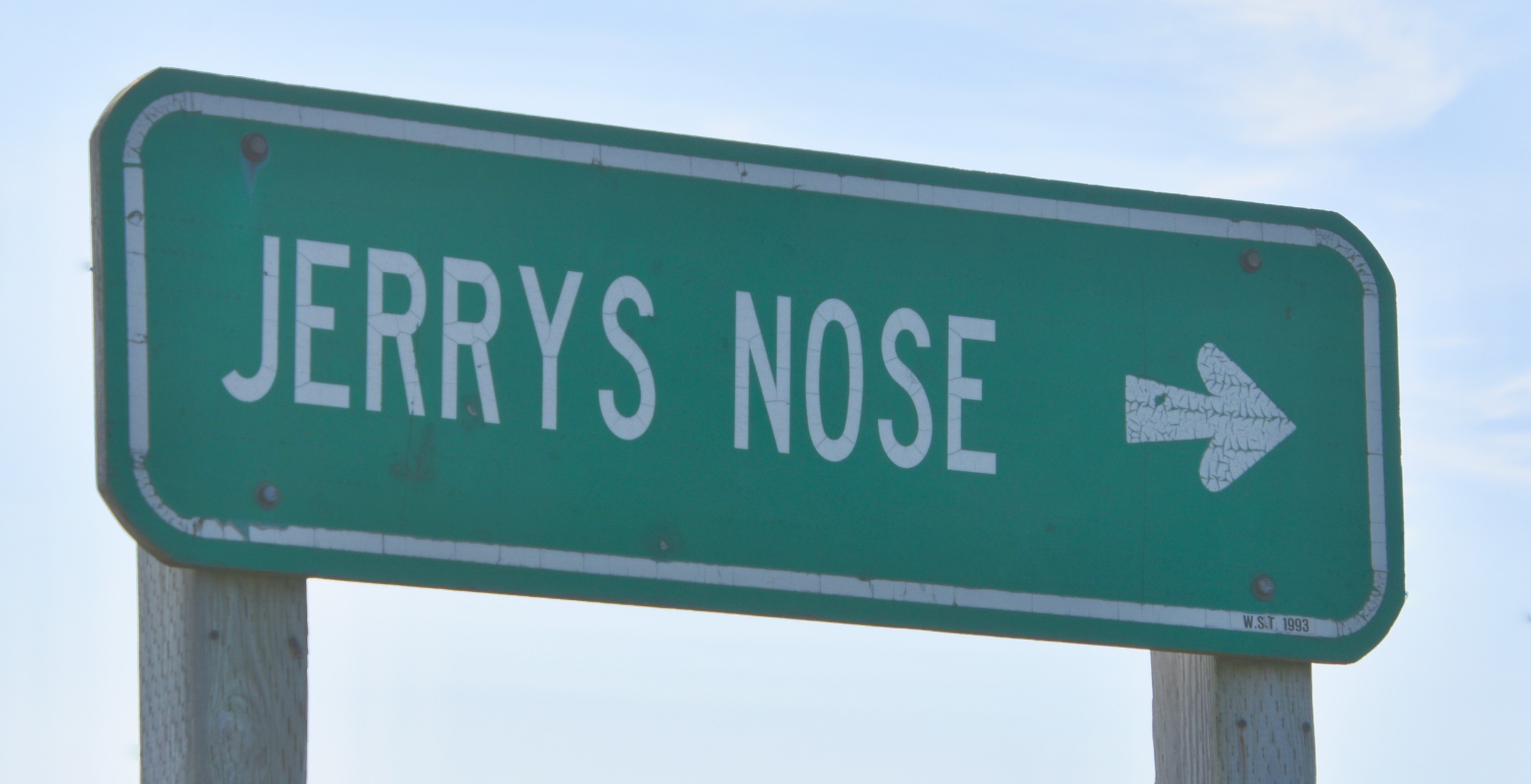
Newfoundland has always been known for its colourful names like Heart’s Content, Joe Batts Arm, Come By Chance and Blow Me Down. Here’s another one to add to the list.
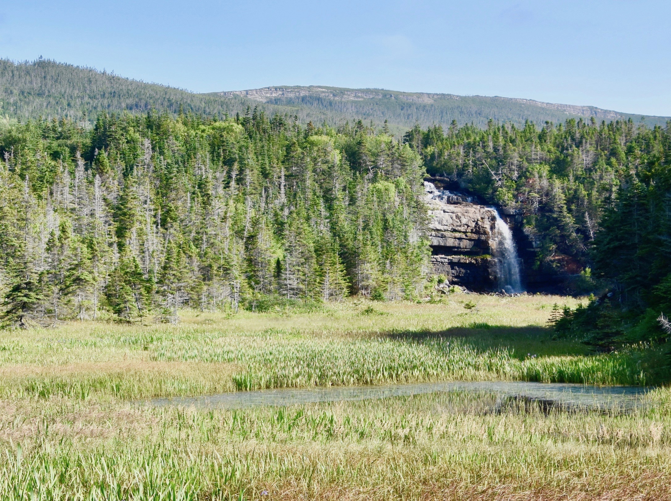
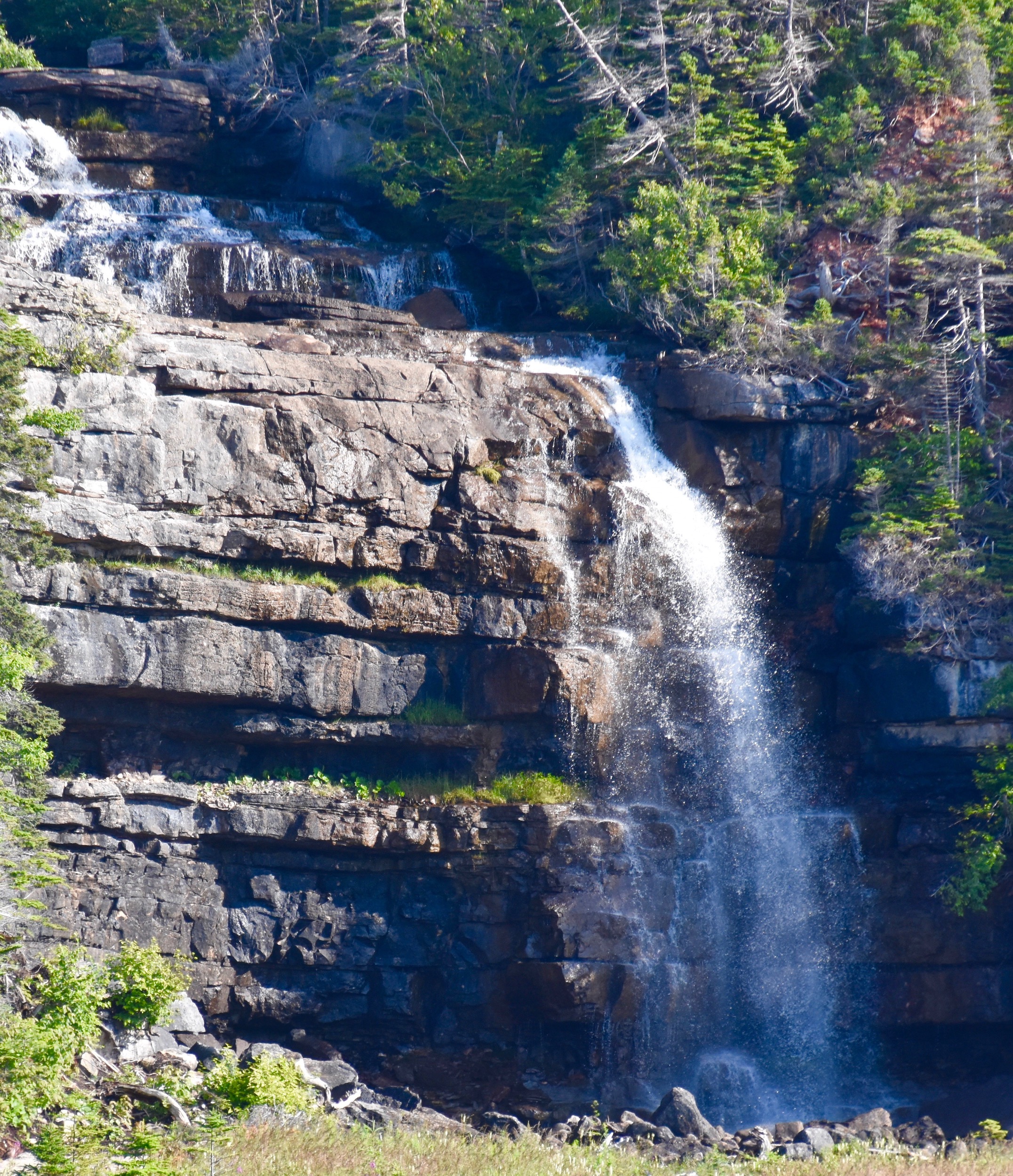
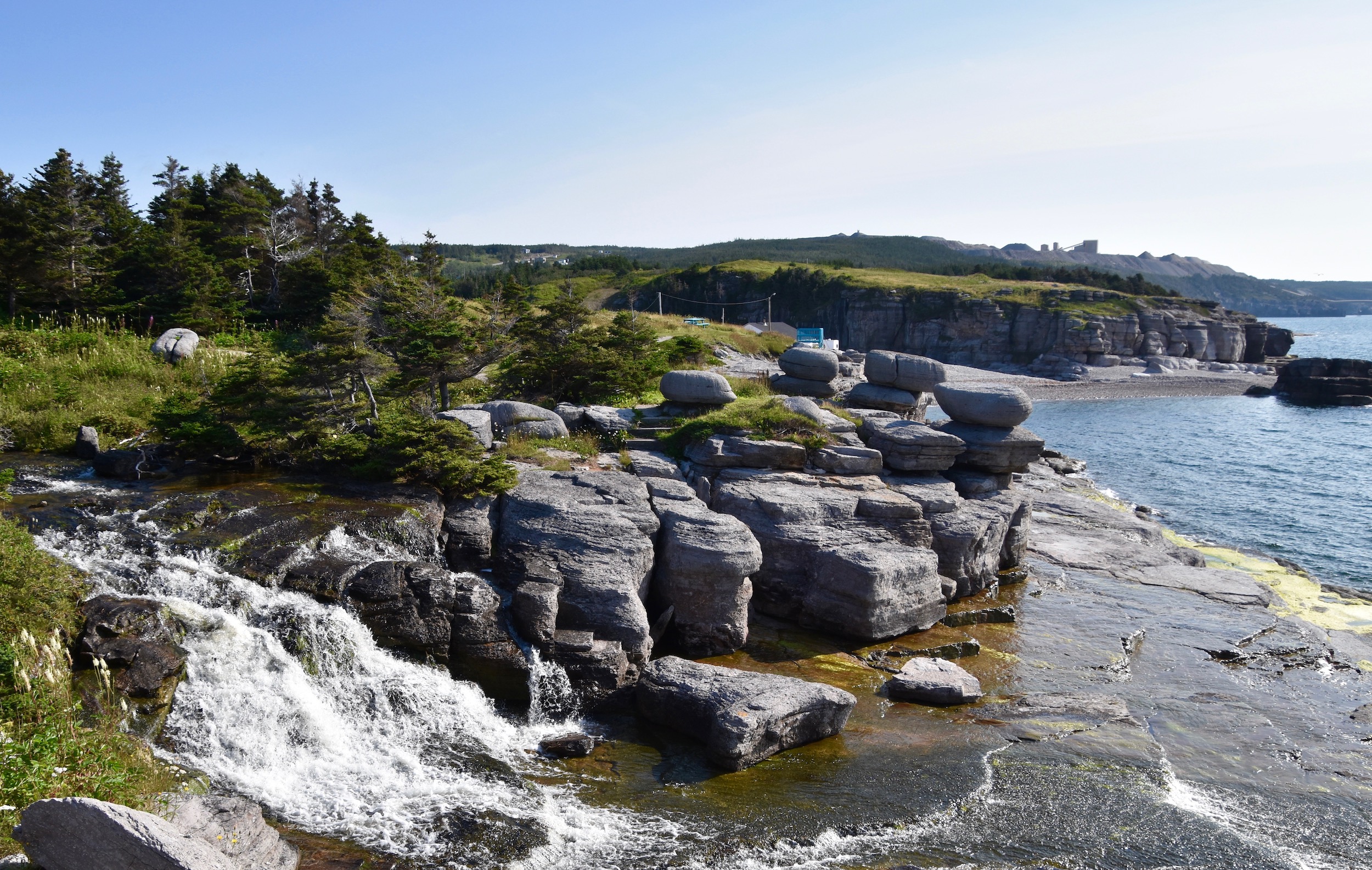
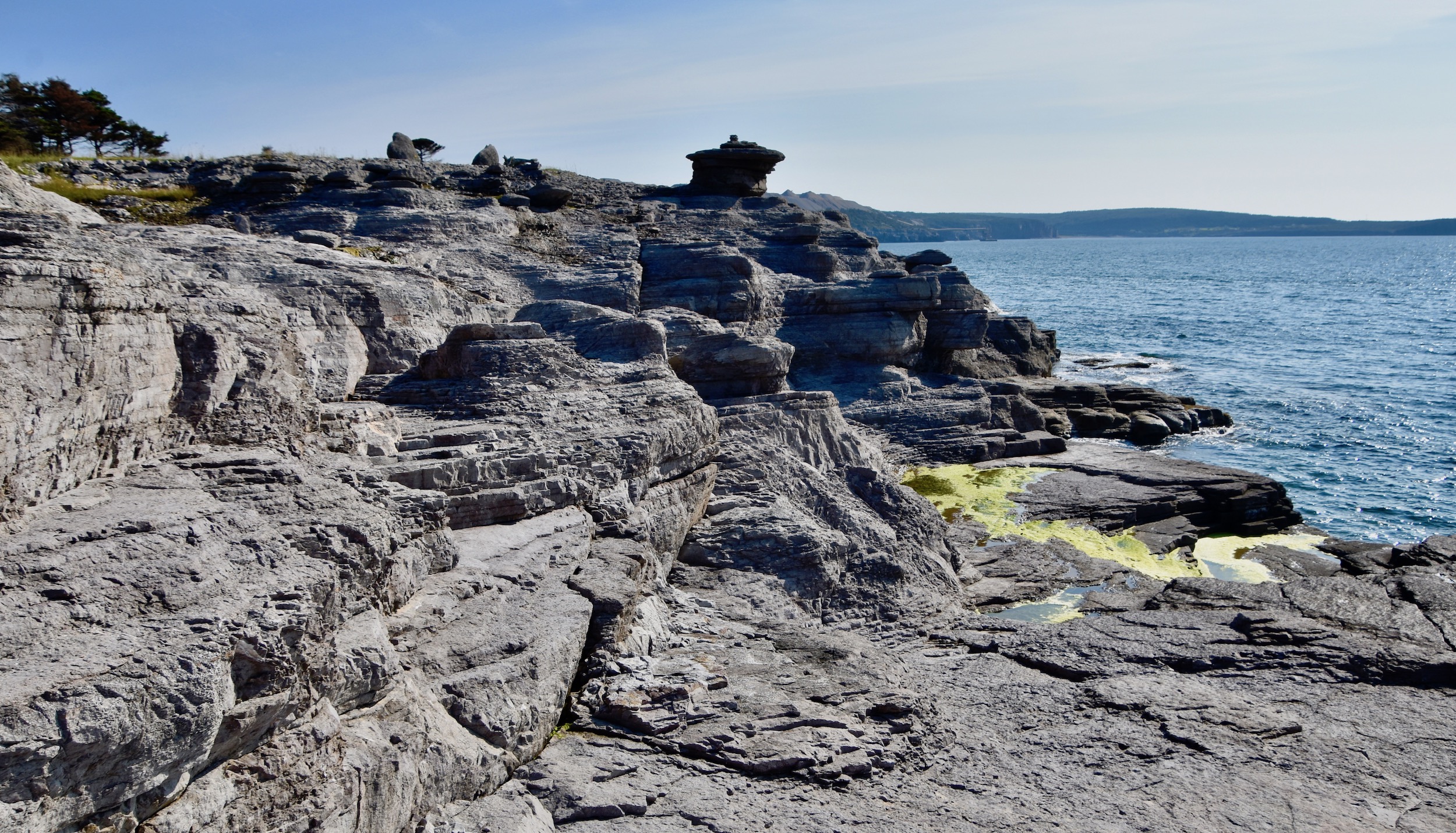
At Sheaves Cove you must turn off to the left when you see the sign for Hidden Falls. This area has some of the most interesting rock formations you will see on your entire trip. This is Hidden Falls on the other side of a marsh that abuts the Sheaves Cove barachois.
You can follow a path to get a closer look.
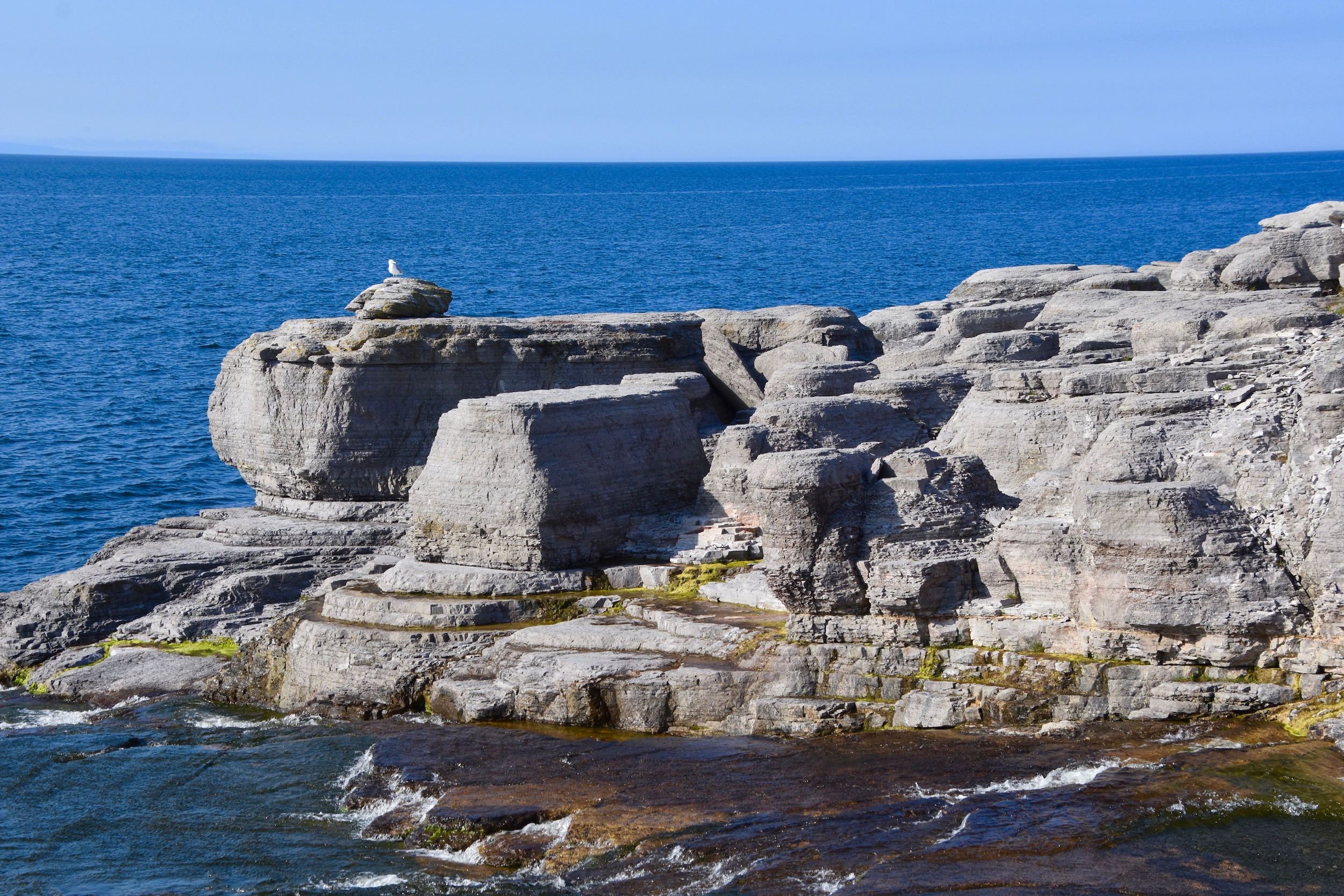
However, we found the path that follows the shoreline even more interesting. These almost hoodoo like formations were just on the other side of a small brook that cascaded down to the sea.
There is a path leading to a bridge that will get you across this brook.
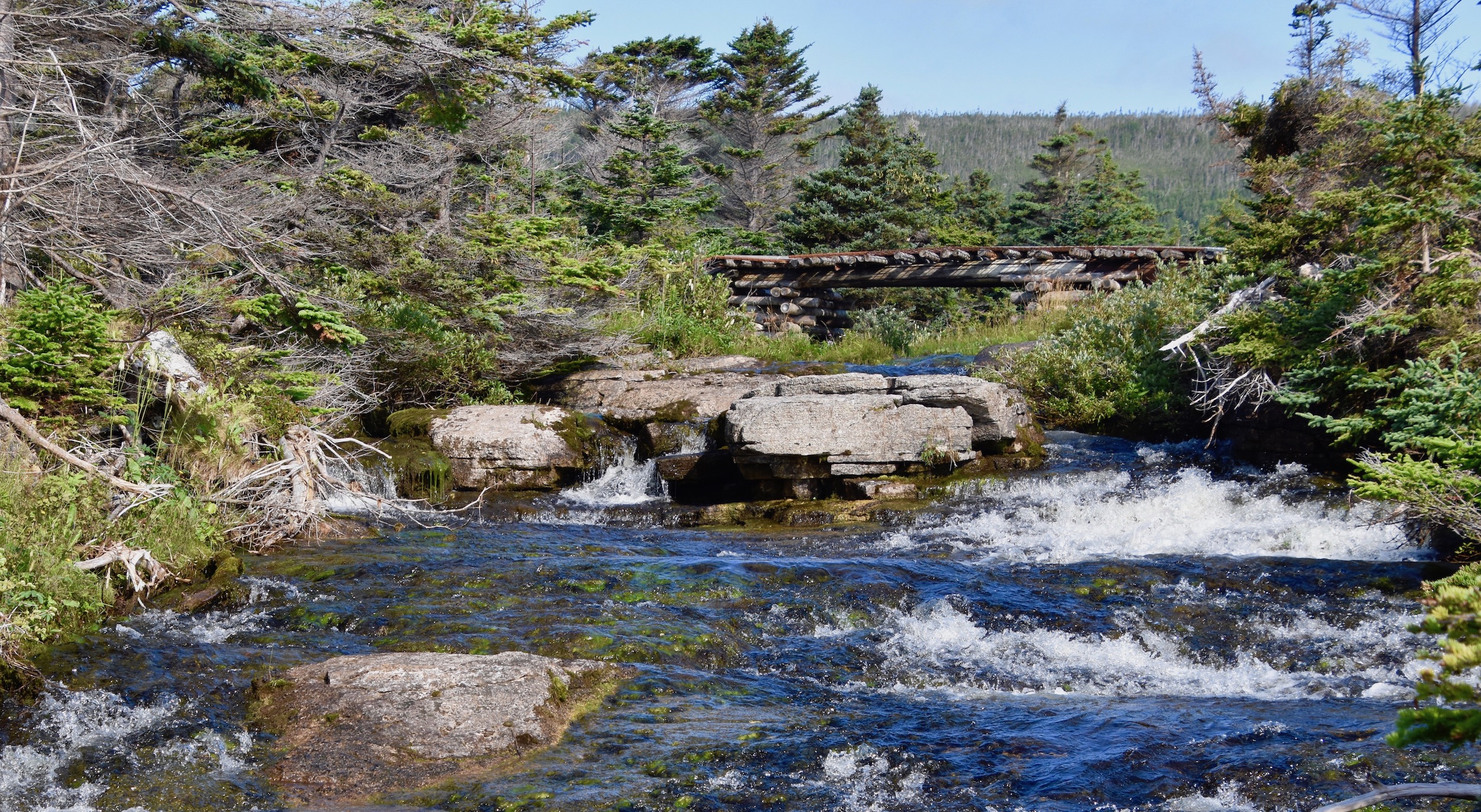
This is the view from the bridge.
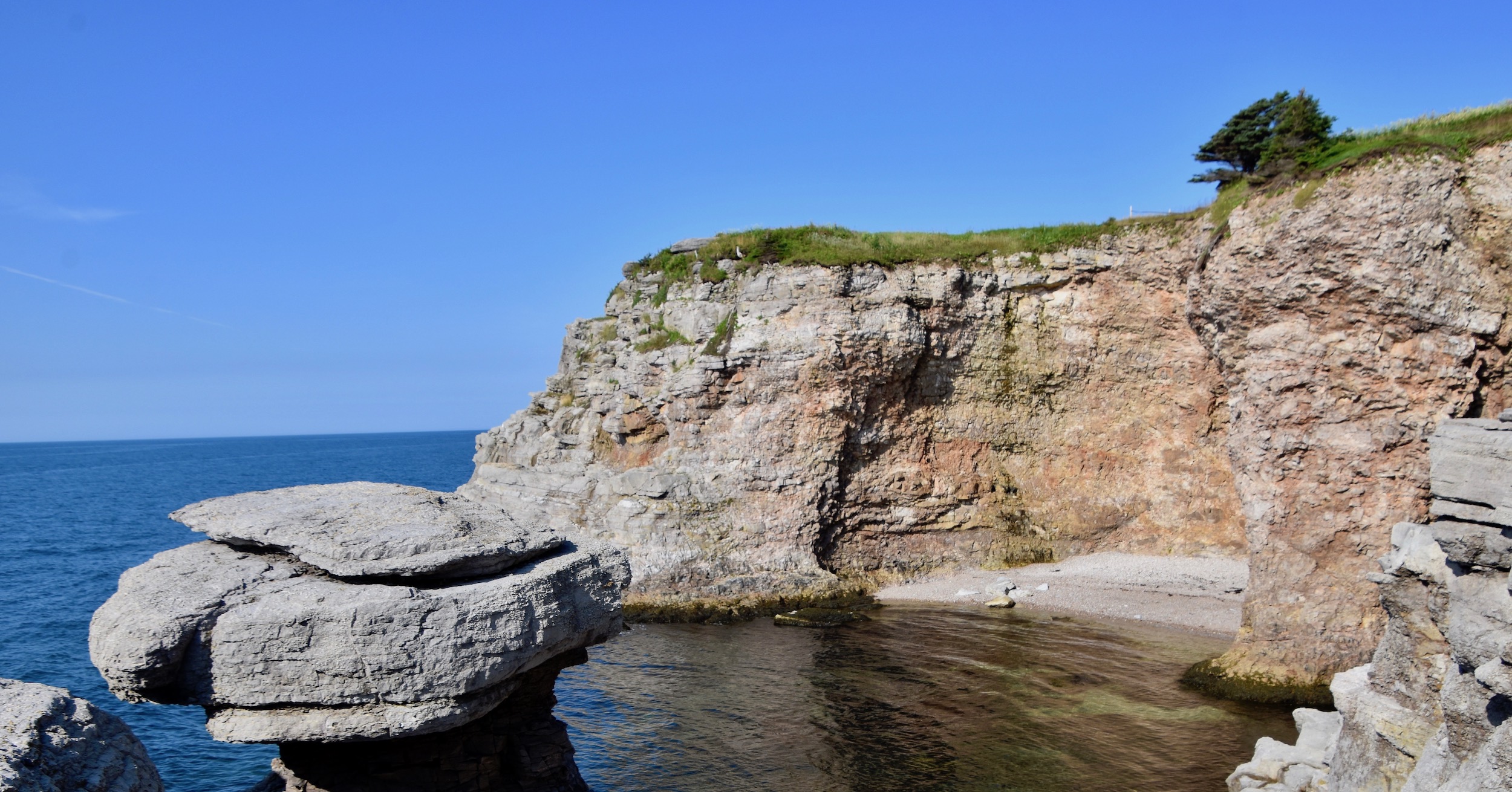
Next from the opposite side you can view the small waterfall and see some genuine hoodoos. A little research reveals that the Port au Port peninsula has a number of spots where you can see these unusual sedimentary rock formations including at Gravels which is the isthmus that connects the peninsula to the mainland. We are just glad to have stumbled across them here at Sheaves Cove.
But there is more. Someone has been kind enough to place a picnic table in this idyllic spot and provide a bird bath as well.
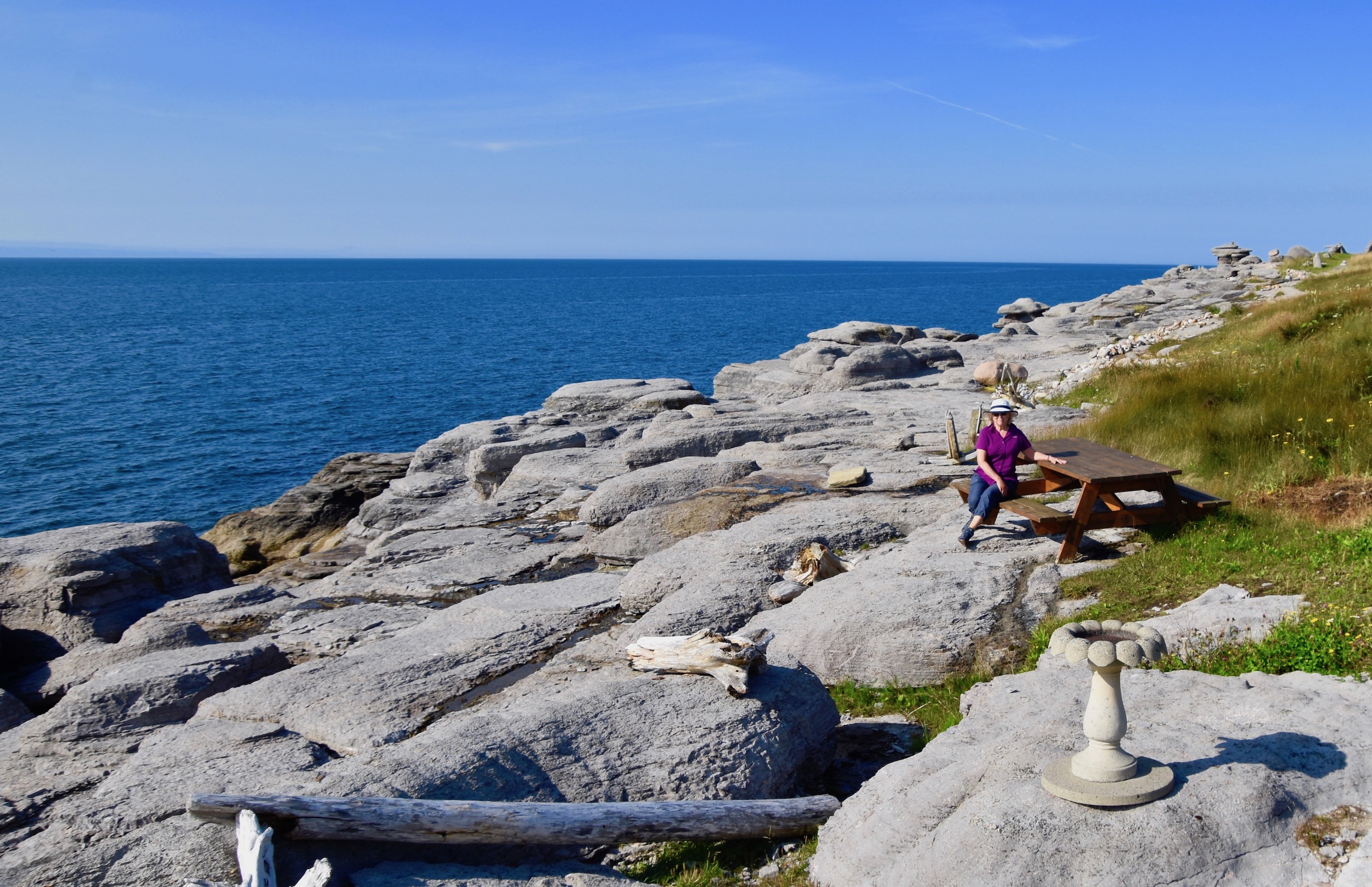
Behind Alison the path continues and the rock formations get even stranger with the one boulder seemingly defying gravity.
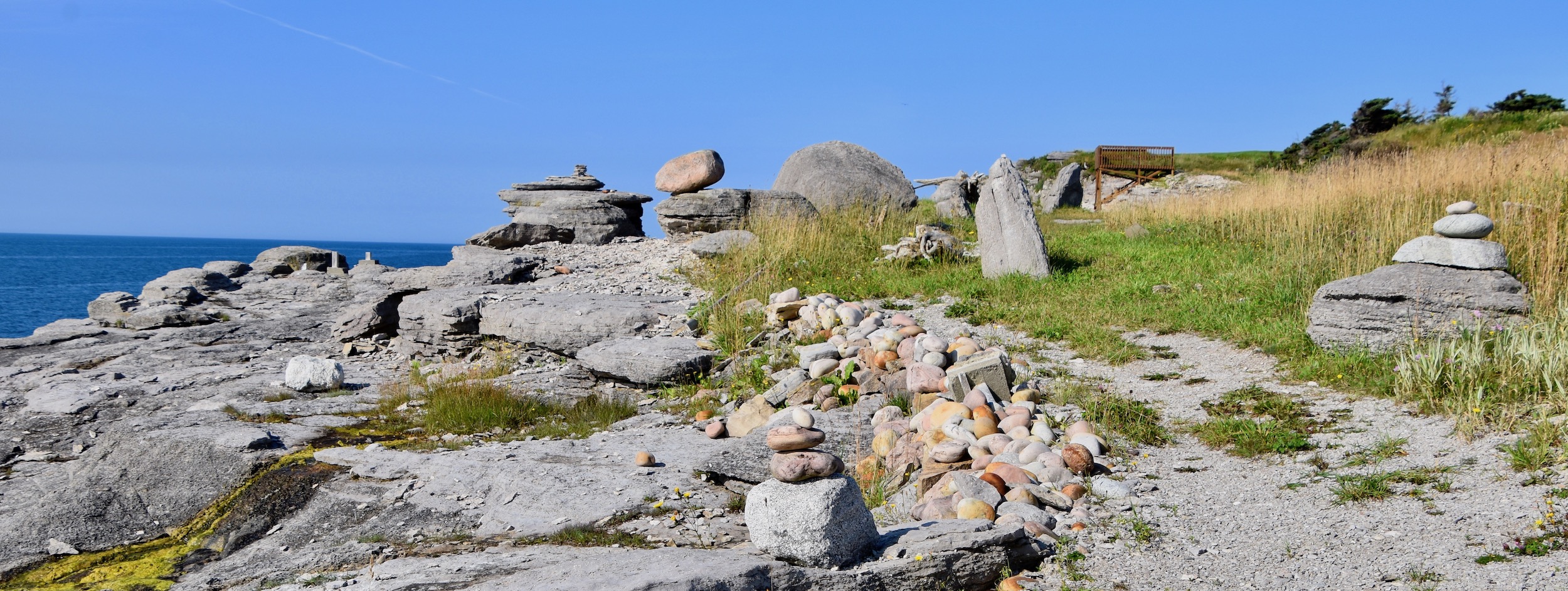
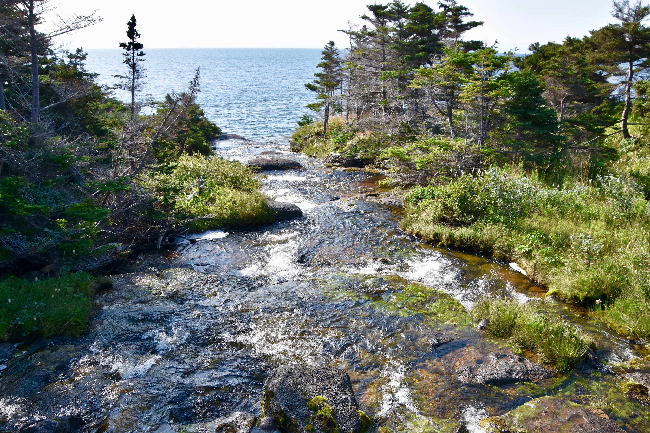
The path leads to a very sheltered cove with a tiny beach which I have very unoriginally called Hidden Cove.
Returning to Sheaves Cove is just as interesting as the short trek out. In my opinion the Port au Port peninsula would be worth visiting if Hidden Falls and the Sheaves Cove rock formations were the only natural attractions, but of course, they are not.
This is Boutte du Cap which marks the southernmost point on the Port au Port peninsula at the tip of Cape St. George. That’s Red Island in the distance. Boutte du Cap is known for the gannet colony that breeds here in season and provides spectacular views of the birds torpedoing into water after mackerel and capelin. By mid-August the birds have fledged and although we spot the occasional gannet offshore we do not see them diving.
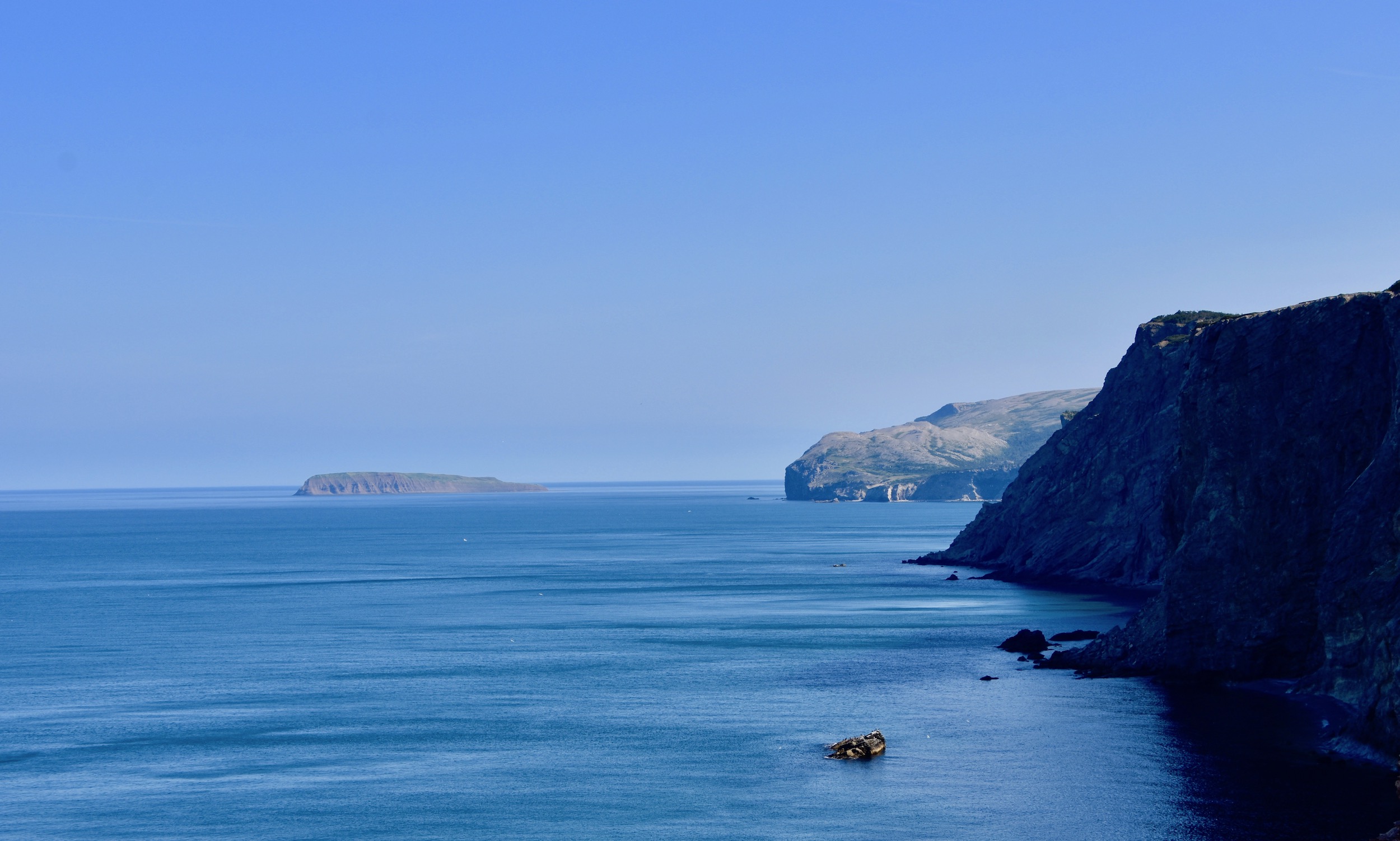
The Cape St. George area is also well known for the whales that pass by its cliffs and are easily spotted from above. There is the chance to see the largest creature that has ever lived on this planet, the blue whale, but that is rare. Far more likely are humpbacks, minkes and finbacks. Unfortunately we draw a blank on what appear to be perfect whale spotting conditions. Still, who’s going to complain when you have a view like this.
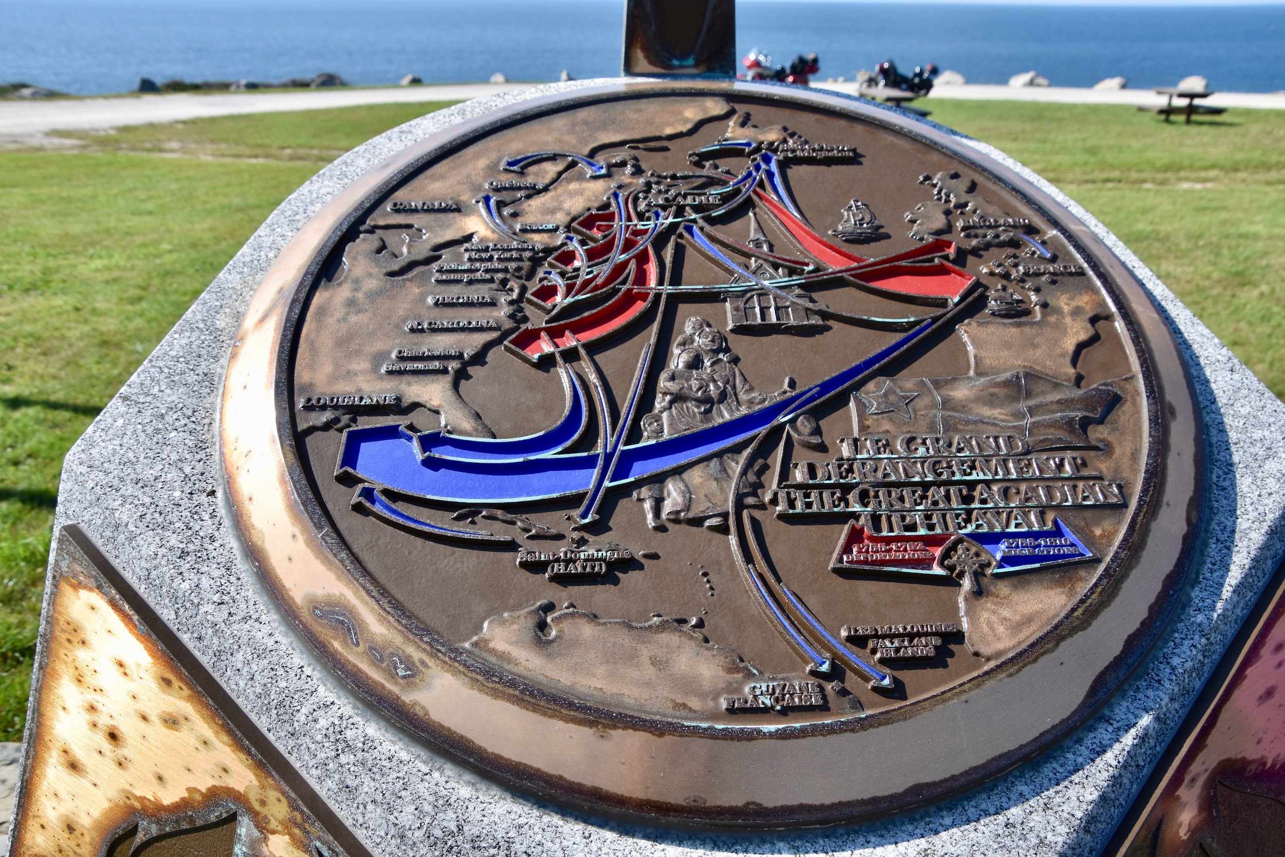
Boutte du Cap also has a small park that contains the only Acadian monument in Newfoundland and Labrador. This brass map shows the deportations from Acadia in red and then in blue the eventual places of resettlement, most notably Louisiana where they became the Cajuns of today.
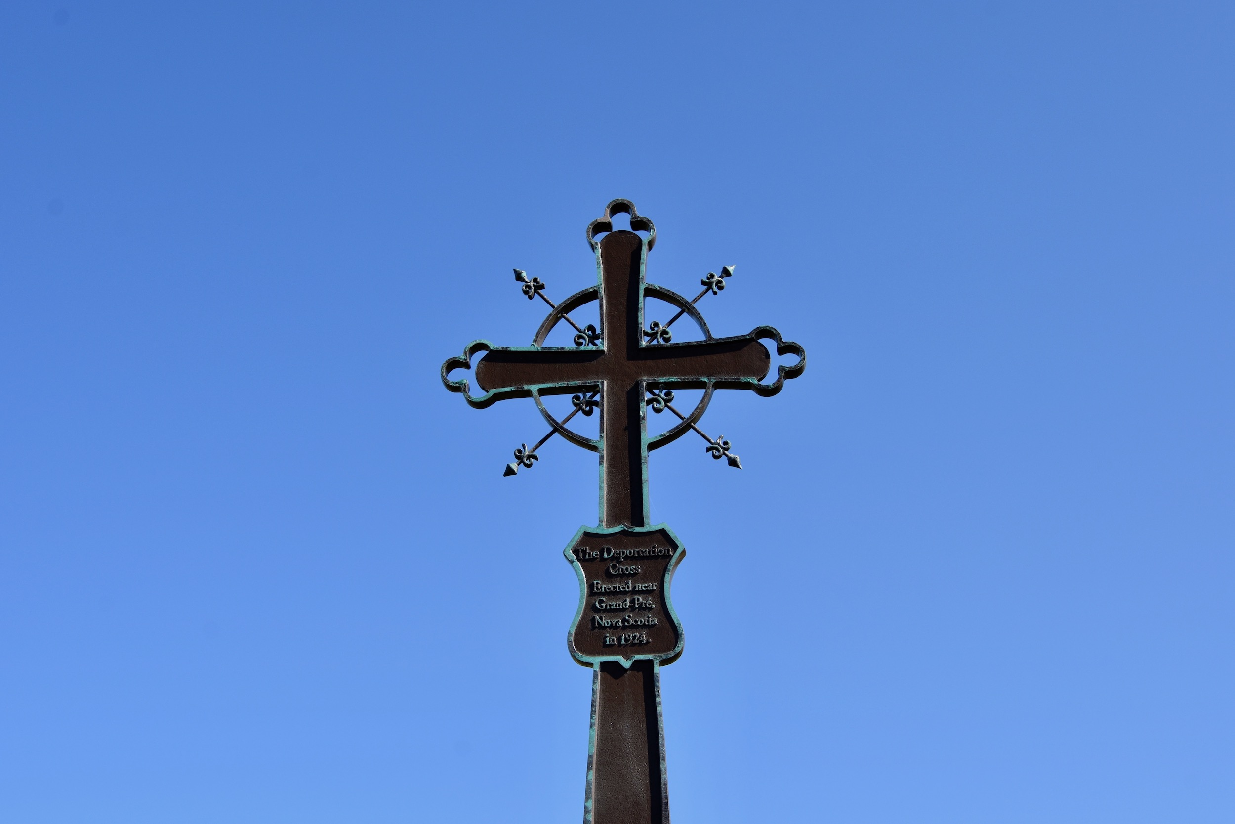
There is a replica of the Grand Pre deportation cross atop the brass map. I was born only a few miles from where the Grand Pre deportations took place and I surely did not expect to find such a monument on the west coast of Newfoundland.
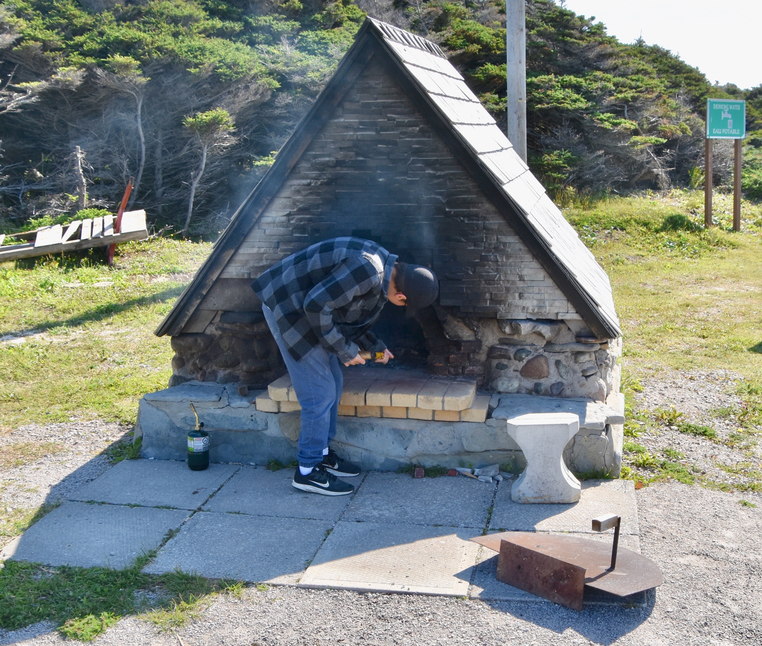
Also on site is an Acadian outdoor bread oven that was apparently once common on the Port au Port peninsula. It is a community oven and anyone can bake bread in it as this fellow is.
After Cape St. George the highway becomes Route 463 which you follow for the rest of the loop. This is a closer look at Red Island than the one from Boutte du Cap. It has an intriguing history. First named by Captain Cook (yes that Captain Cook) because of its reddish colour, it was once one of the main fishing establishments on the entire west coast. Being forbidden to settle on the mainland the French instead cut a set of stairs into the cliff walls and settled on top. This continued right up until 1904 when the fishing rights were extinguished, although the island was used seasonally up until the 1980’s..
Eventually the people who lived on the island got tired of climbing those steps and moved across the water to the mainland and thus the name of this community – Mainland, another unique Newfoundland name.
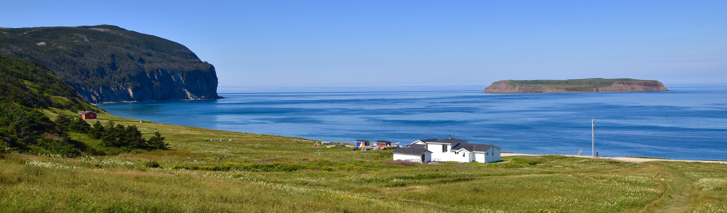
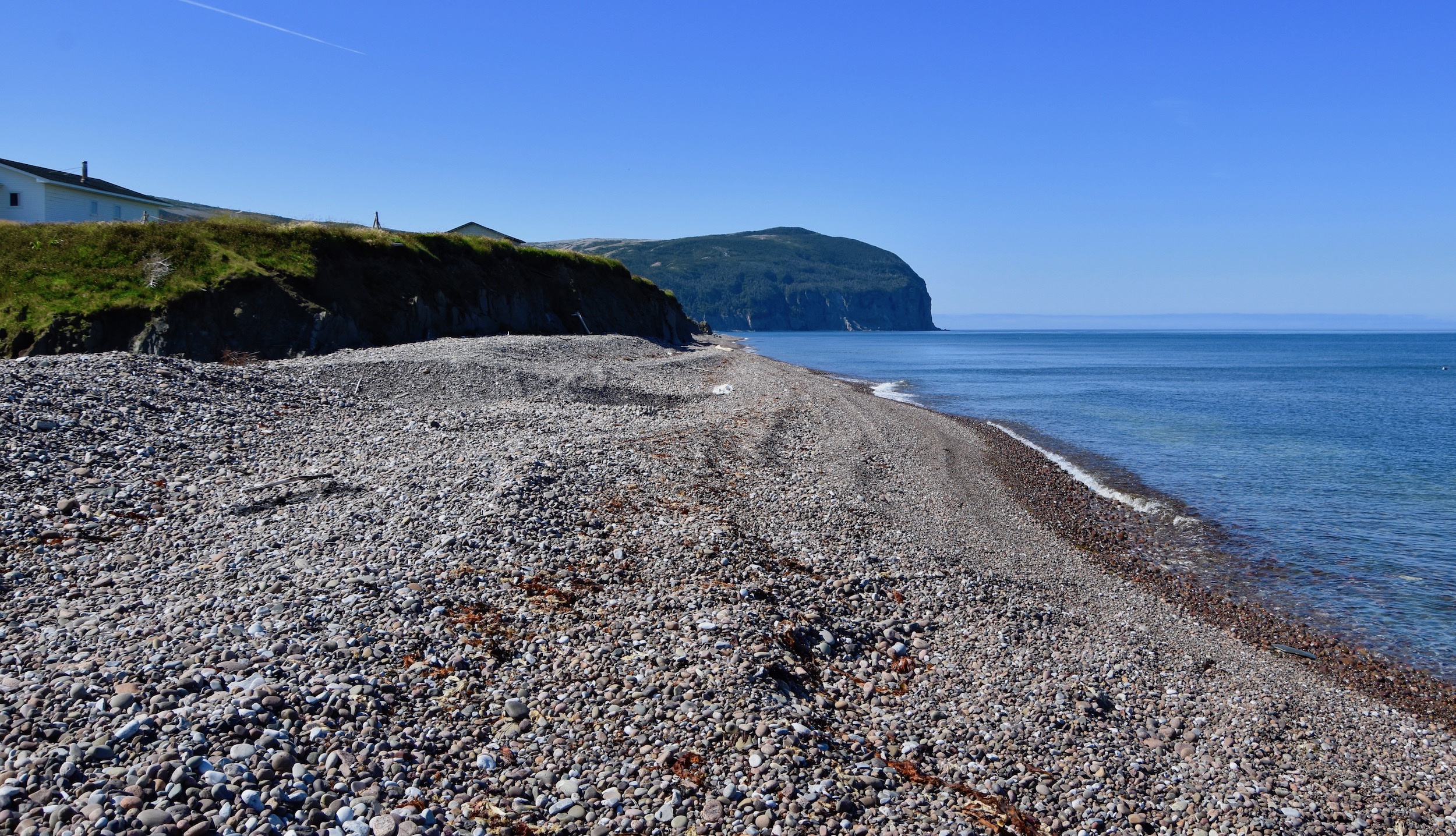
The topography of the Port au Port peninsula changes quite dramatically on the northwest shore from what we have seen on the south shore. It is flatter with more beaches than cliffs. We stopped to check out the beach at Mainland which reminded me very much of the beach at Dieppe, France which proved so treacherous to Canadian troops during the disastrous August 19, 1942 Dieppe Raid. The gravel is of a consistency that makes it well nigh impossible to walk up it at any speed, giving way underfoot constantly.
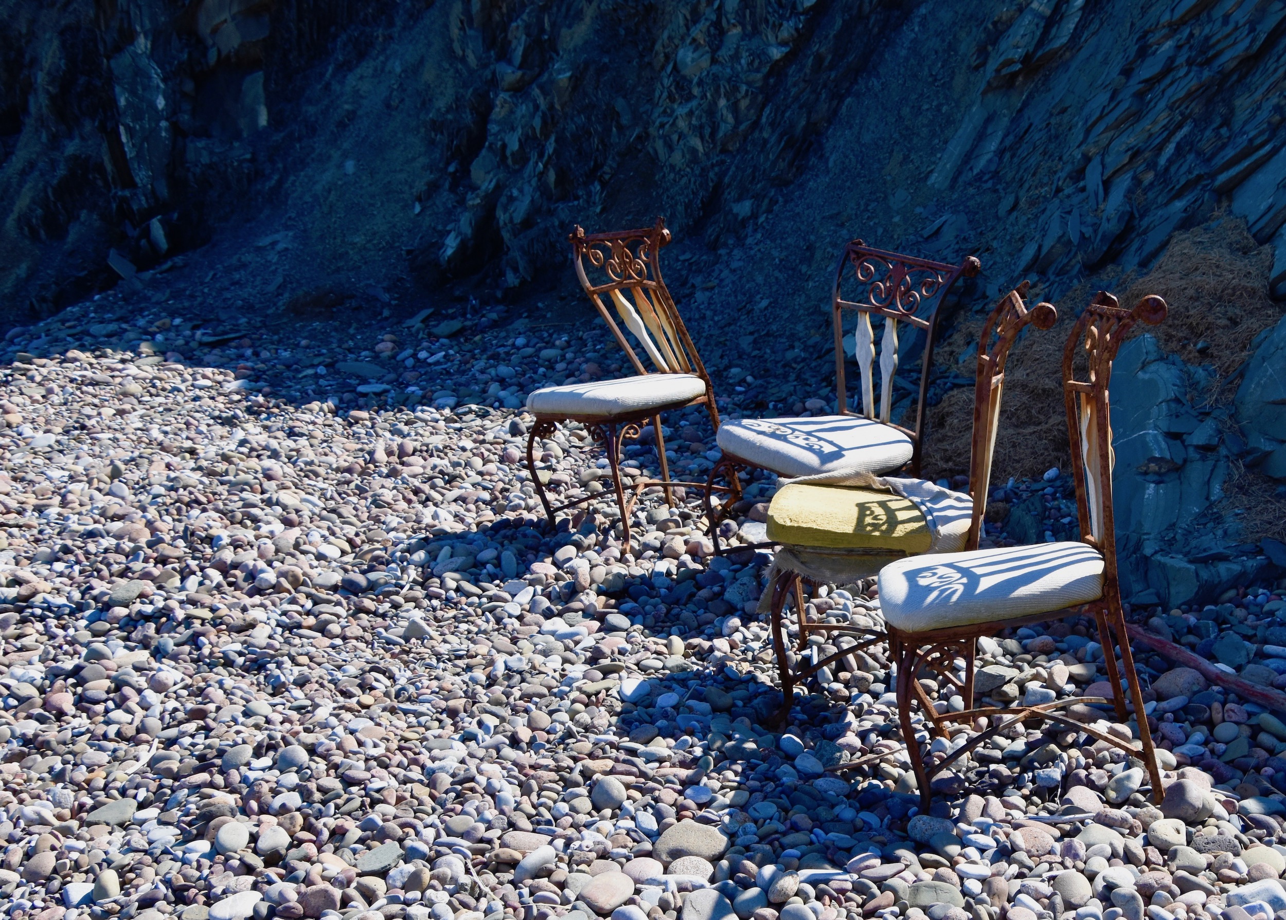
Someone left these four chairs on the beach which were quite photogenic. They look like they would have been quite expensive when new, but the way they are posed made me think they weren’t disconsolate at being abandoned. Maybe the people who sit in them now are ghosts.
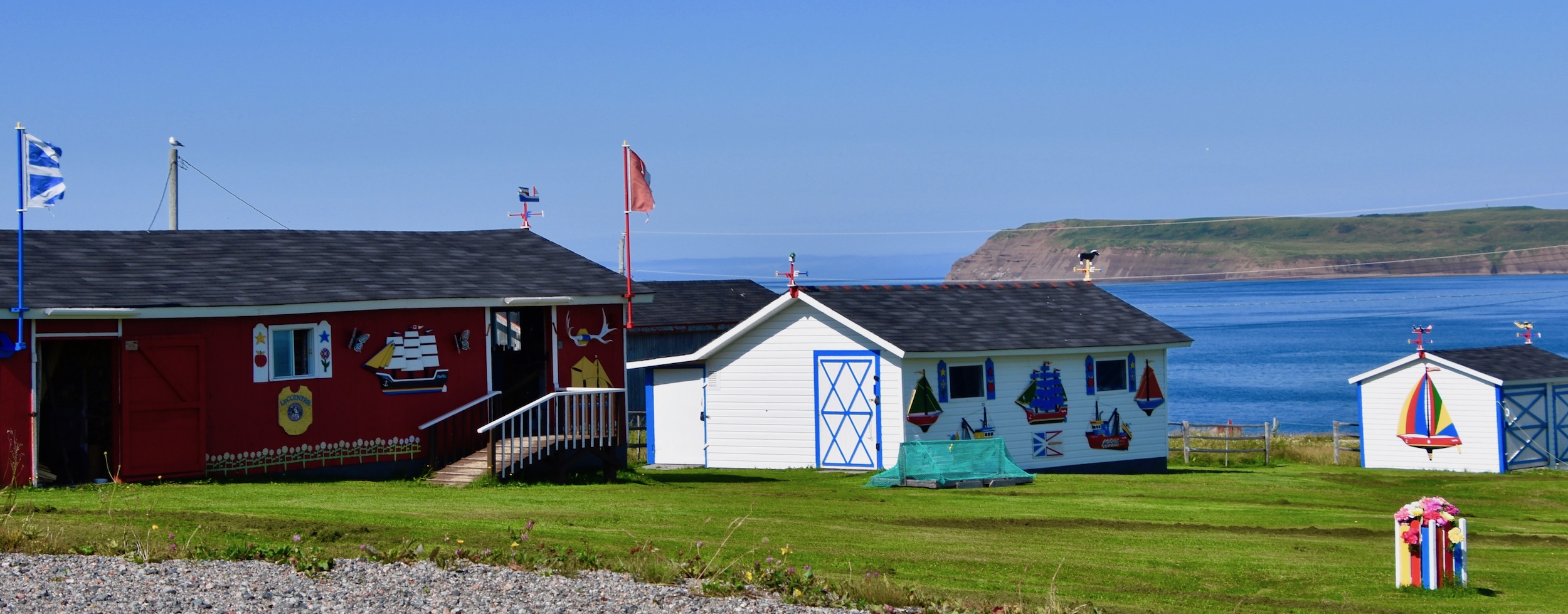
Acadians have always had an affinity for folk art and that is especially apparent in Mainland where a number of houses are gayly decked out in bright coloured pieces, many of which feature the traditional red, white, blue and yellow colours of the Acadian flag.
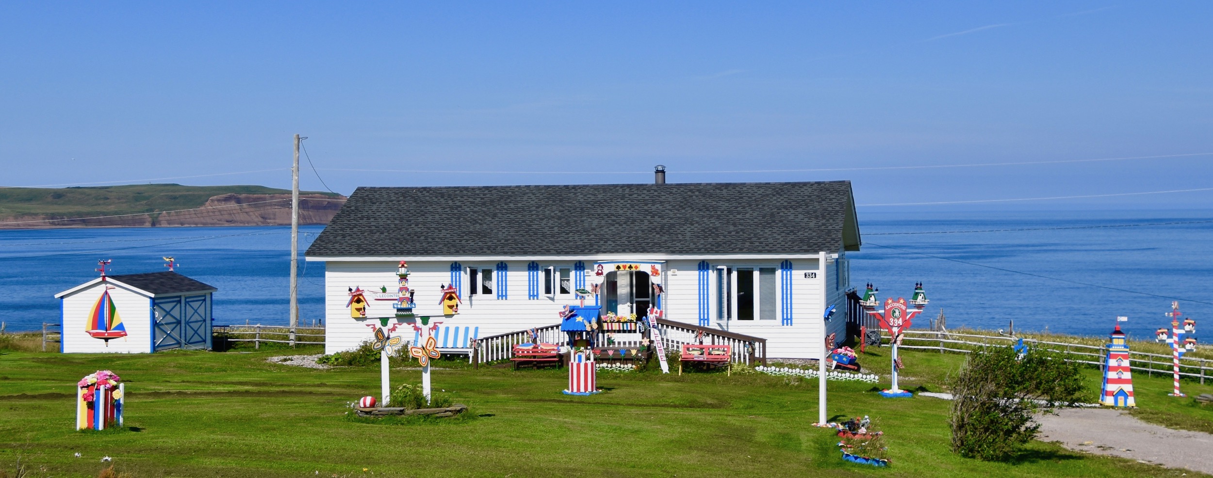
This grouping features a distinctly nautical theme.
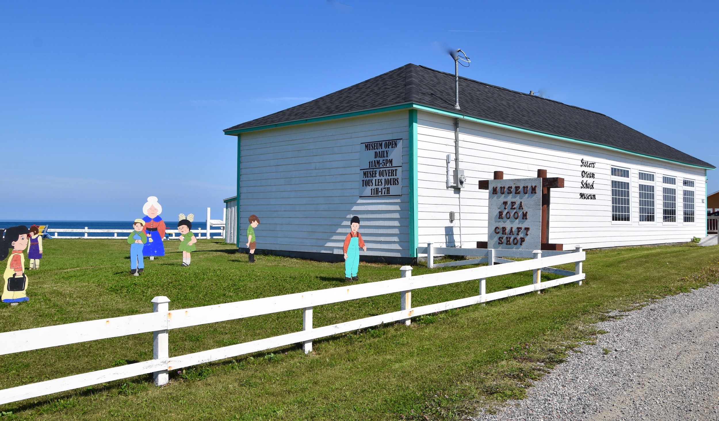
Also in Mainland, the old schoolhouse has been converted into a museum complete with brightly dressed students and a matronly teacher. Next door is a tea room and craft shop.
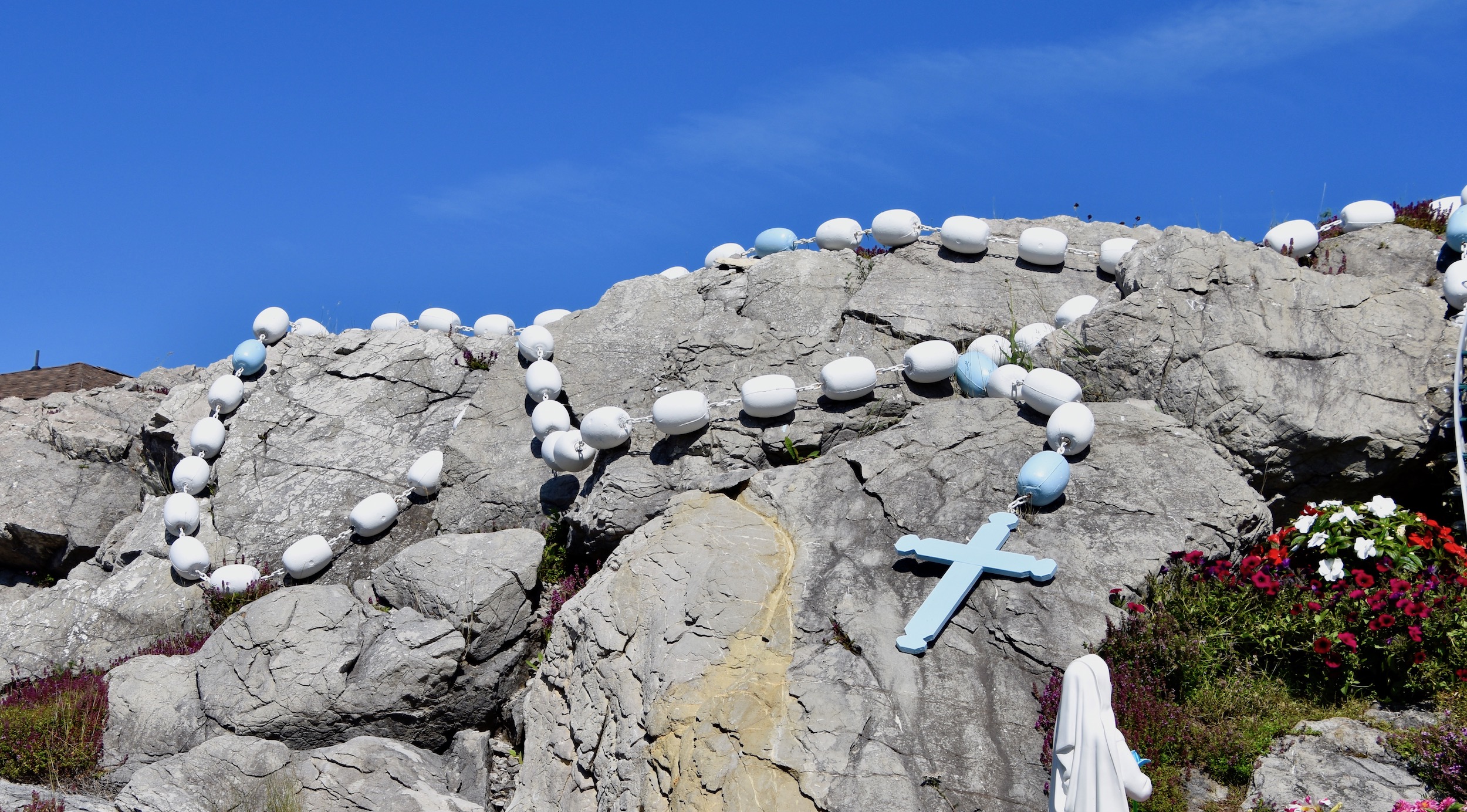
Our final stop on the Port au Port peninsula was at the Our Lady of Lourdes Grotto in the town of Lourdes. Built in 1987 as a place of peace and reflection it is definitely worth stopping to see. This is the grotto fronted by a beautiful array of flowers. The kneeling figure is St. Bernadette.
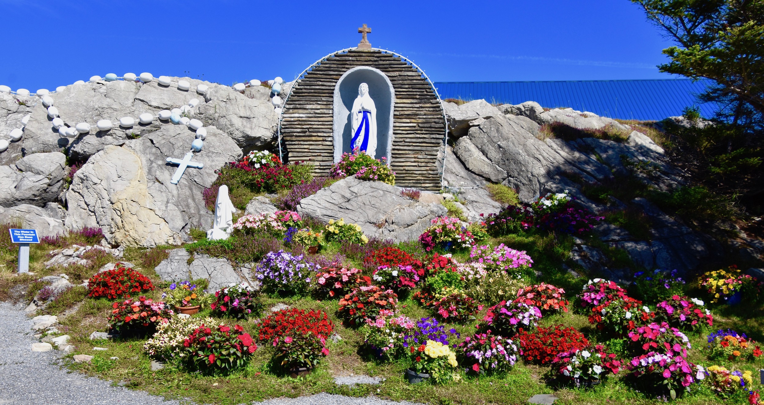
Note the rosary made from fish net buoys beside the Virgin Mary.
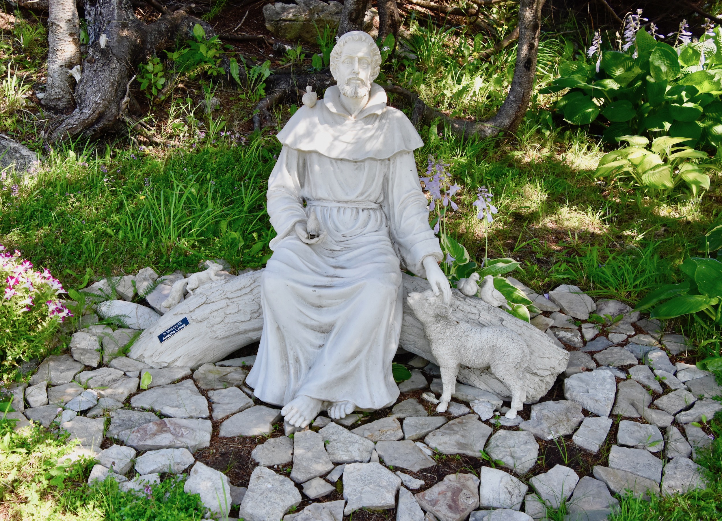
Shaded under a tree is this calming statue of St. Francis of Assisi accompanied by his usual birds and lamb. There are also the fourteen Stations of the Cross in an outdoor setting. Overall we found out stop in this place of quietude a very appropriate place to end our tour of the Port au Port peninsula.
At Lourdes you do have the option of taking a detour out toward Long Point and the Acadian communities of Winterhouse and Black Duck Cove. Looking back at this long finger of land from West Bay I immediately regretted not taking a look. Later finding out that is composed of a rock group that is unique to Long Point compounded my misgivings. Don’t make the same mistake I did.
In the next post Alison and I will do some exploring in the Humber River/Bay of Islands area where we’ll come face to face with Captain Cook and have a chance to zipline above a cascading waterfall. Please join us.