Captain James Cook in Western Newfoundland

This is my fourth post from a recent trip to Newfoundland and Labrador. In the last post Alison and I toured the scenic Port au Port peninsula before moving on to Corner Brook the largest city in western Newfoundland. In this post we’ll explore the legacy of Captain James Cook in this area by recalling a short route along the south side of Bay of Islands to Lark Harbour that we took a few years before. We will then leave the Corner Brook area and enter the beautiful Humber River valley where will be spending the next two days. Please join us.
Captain James Cook
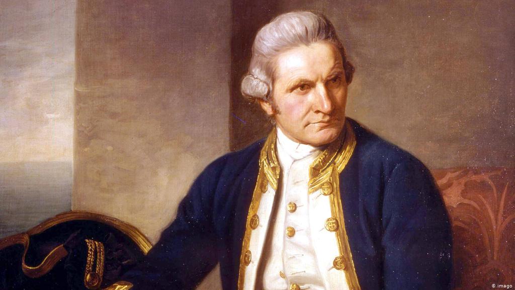
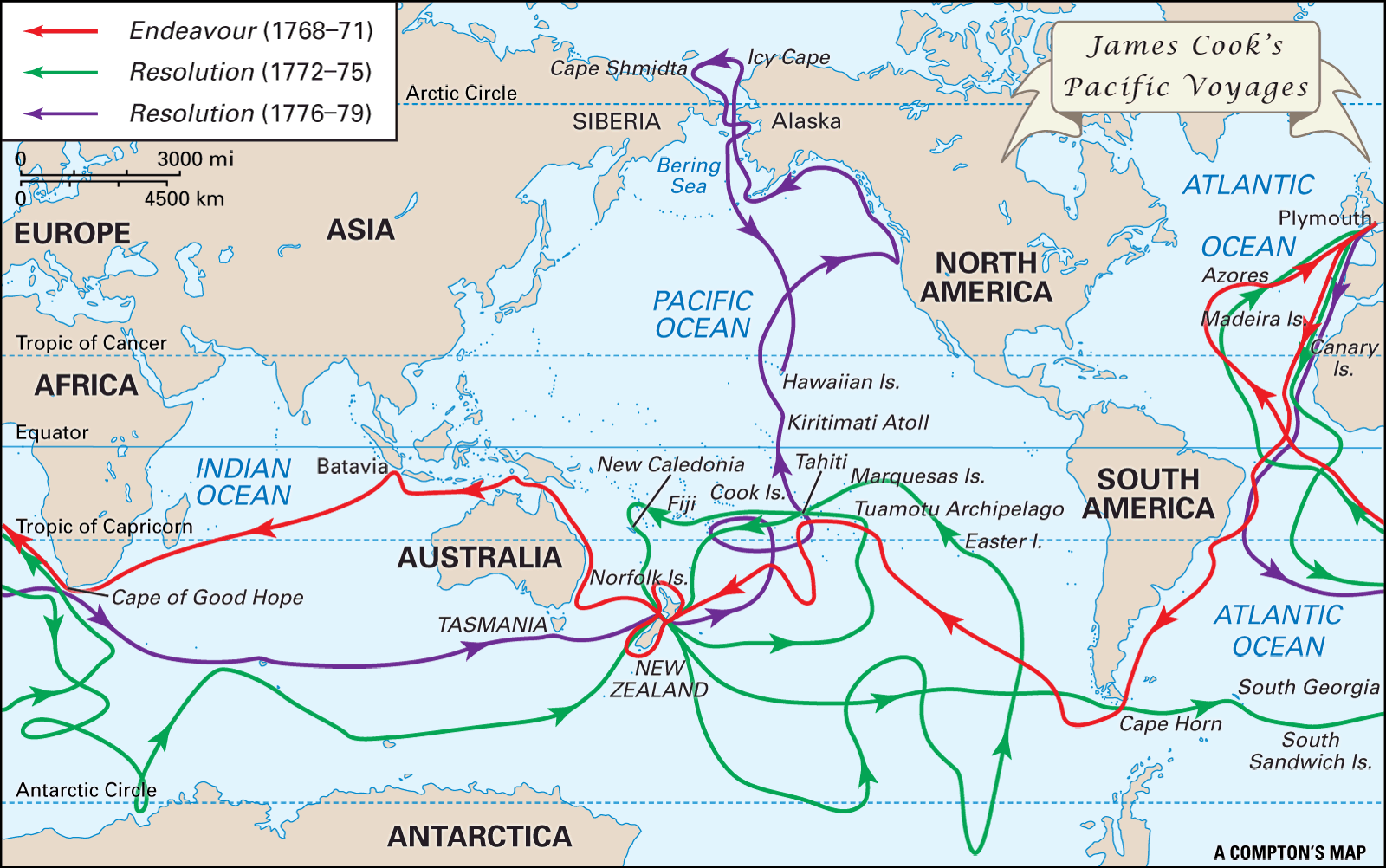
Captain James Cook of the British Royal Navy is arguably the most famous navigator and cartographer of all time. Most people have heard of his three famous South Seas expeditions which ended with his death on a beach on the island of Hawaii. This is a map of those expeditions and if you look at it closely you’ll see they never came near the east coast of North America let alone Newfoundland and Labrador. So that begs the question – why are you writing about Captain James Cook in Newfoundland and Labrador? Well the short answer is that if not for what he had already accomplished in eastern Canada and Newfoundland and Labrador he never would have been chosen to carry out the Pacific expeditions.
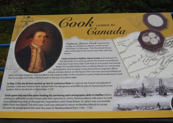
Captain James Cook first came to North America during the Seven Years War as a ship’s master and was first based in Halifax. He was with General Wolfe at the siege of Louisbourg and later the siege of Quebec. It was at the latter that his talents as a navigator and cartographer first came to the fore as he accurately plotted the St. Lawrence River near the French stronghold. Wolfe relied upon Cook’s maps to help him land the troops that made their famous climb up the cliffs to the Plains of Abraham.
After the war Cook was given command of his own ship and ordered to do a complete survey of the island of Newfoundland which took him five years. He finished the last part, the western coast of Newfoundland in 1767 and by then was a well known figure in almost every port and outport in the colony. This was not a case of a famous person staying overnight a la ‘George Washington slept here’, but rather he literally became familiar with and mapped almost every mile of Newfoundland shoreline. His maps were so accurate that they remained in use for over a hundred years. It was only after Captain James Cook completed his Newfoundland stint that he got the plum South Pacific assignment.
The first place we went upon entering Corner Brook was to Captain James Cooke National Historic Site high atop Crow Hill.
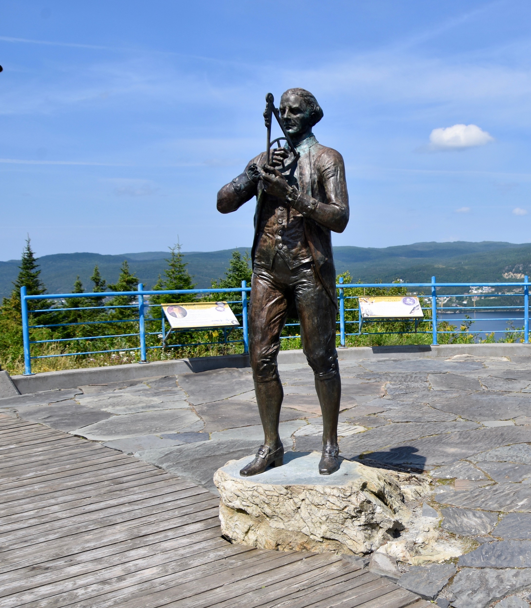
The site consists of this statue portraying Cook as he would have looked while on this spot in 1767 as well as a number of interpretive panels describing his exploits in Canada and Newfoundland and Labrador.
There is also a great view of Bay of Islands which Cook mapped, from atop Crow Hill. After visiting the Captain James Cook Historic Site you have the option of driving the reasonably short, but very scenic Captain Cook’s Trail on Route 450 along the southern arm of Bay of Islands. While we did not do this on this trip I am including a few photos and recollections from when we did drive it a few years ago.
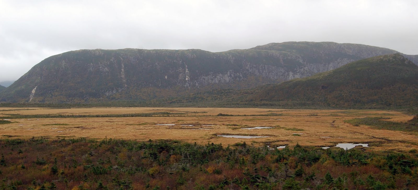
No doubt you’ve heard the expression ‘moose pasture’ usually used to describe some otherwise unremarkable and unproductive terrain, but in Newfoundland and Labrador the meaning is literal and there’s plenty of it all Route 450. To me it’s anything but forlorn and despite the grayness of the day, I think it is a beautiful landscape.
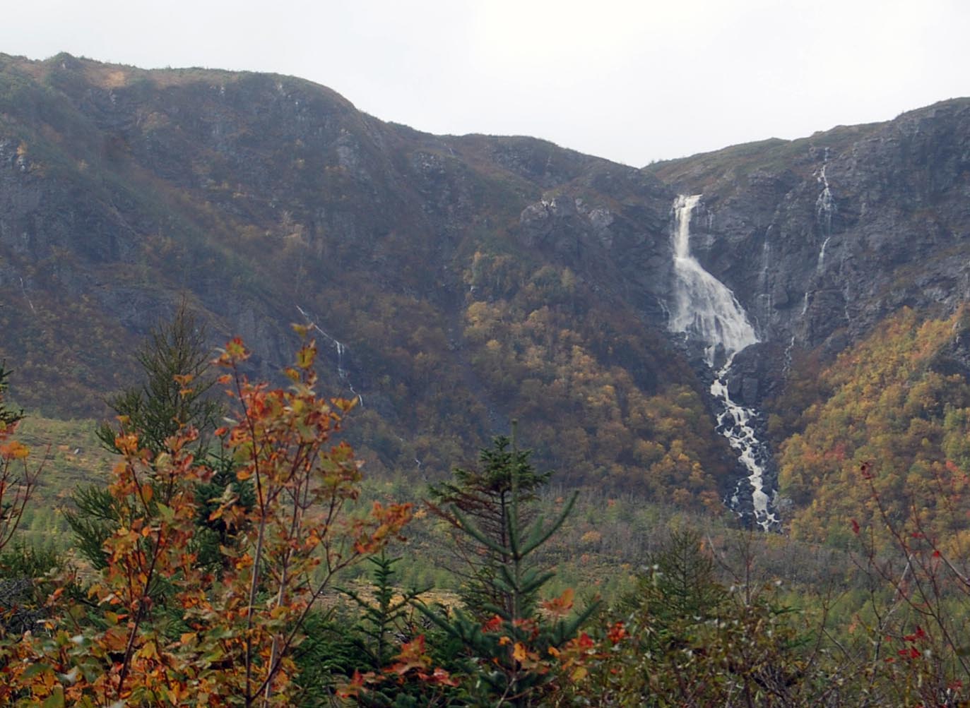
There’s also a great waterfall on this route, although I cannot for the life of me, remember the name. You can tell that this visit was in the fall. One doesn’t usually associate Newfoundland and Labrador with great fall colours, but if you drive this route and the Humber valley in autumn you will seriously impressed.
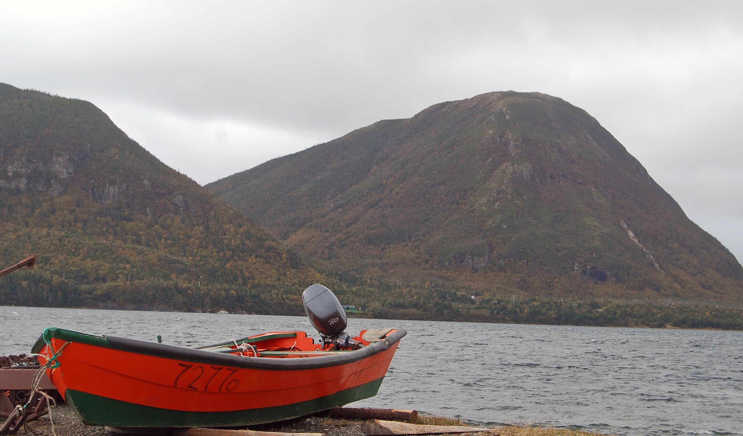
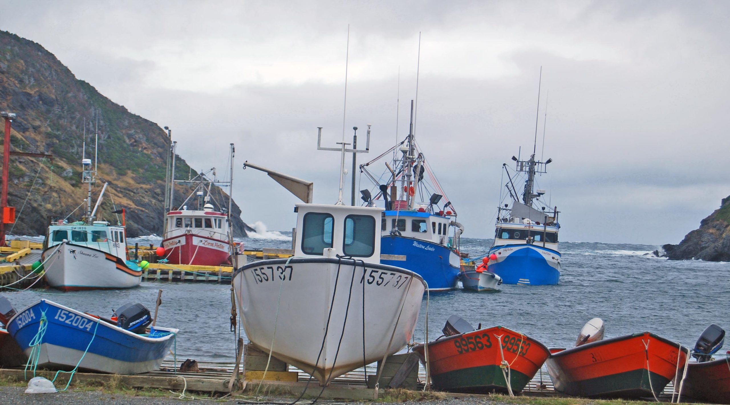
Near the end of the trail you come to the twin communities of Lark Harbour and York Harbour. These places were named after the two ships, the Lark and the York that Captain James Cook commanded during his mapping of western Newfoundland. This just goes to show how closely this area is tied to Cook’s legacy here. This is a photo taken at Lark Harbour looking across to the surprisingly high coastal mountains of the Bay of Islands.
There are a number of hiking options near the end of Captain Cook’s Trail as illustrated on this map.
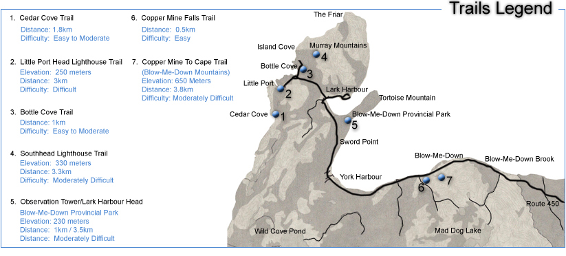
At the very end of the trail is Bottle Cove where a number of these hikes start.
From Bottle Cove you must retrace your steps back to Corner Brook before continuing northward on the Trans-Canada Highway which we will do in the next post.
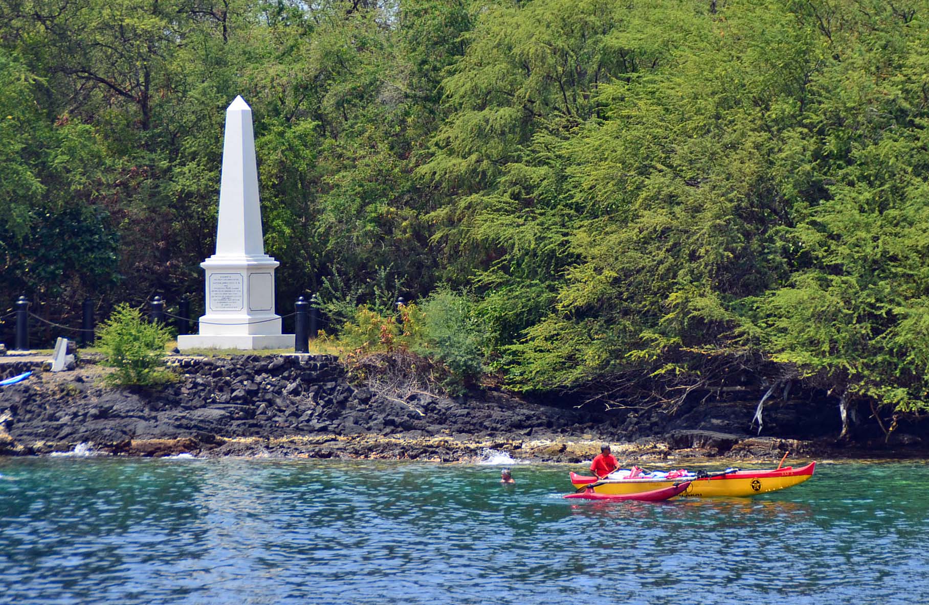
I have always been a fan of Captain James Cook and I think if more people knew about his connection with Atlantic Canada it would attract more tourists to visit the places he first literally put on the map. I end this post with a photo of the Captain James Cook Monument in Keleakekua Bay, Hawaii. This is where he was killed in 1779. We visited here a few years after first seeing the monument in Corner Brook and it seems somehow fitting to have seen the place where he first gained a reputation before seeing where he died. R.I.P. Captain James Cook.