Cappadocia – Where & What Is It

We are well on in our Adventures Abroad tour of western Turkey led by the indomitable Yasemin Reis and today we will finally reach the fabled region known as Cappadocia, a destination I have wanted to visit for many years. Much of what we have seen so far on this trip has been a repeat of previous visits for Alison and me, but not Cappadocia. In this first of several posts I will try to explain where Cappadocia actually is within Turkey and why its landscape is so famous.
In the last post we left behind the Mediterranean coast and headed inland to the religious centre of Konya. Today we will continue almost due east for another almost 250 kms. (155 miles) to the town of Urgup where we will spend the next two nights. However, before we get there we have an important stop just outside the town of Yenikent, the caravansary of Sultanhani.
The Caravansary of Sultanhani
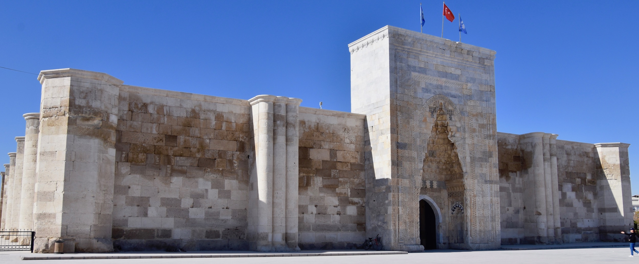
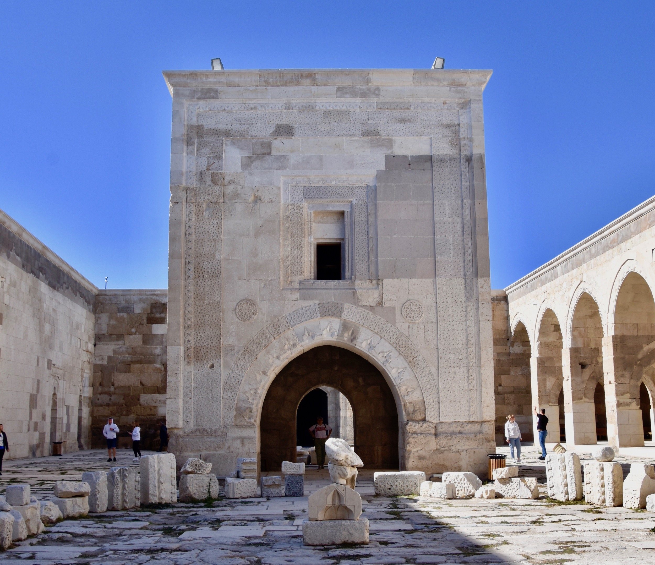
The caravansary was an invention closely related to the ancient Silk Road that linked China with the west along a 6,400 km. (4,000 mile) route that traversed mountains, deserts, steppes and forests. It was usually travelled by merchants in caravans of whom the most famous were the Polos from Venice. It was largely Marco Polo’s writings, dictated from a prison cell, that were responsible for the exotic, mysterious and romantic notions of ‘The Orient’. Despite the protection of travelling in caravans, the Silk Road was still a dangerous place so the merchants needed safe places to spend the night as well as to attend to their daily Islamic religious duties. Thus the caravansary was created of which the Sultanhani is considered the best preserved in Turkey.
It was built by the Seljuk Sultan Alaeddin Keykubad I in 1229 and expanded to its present size by Sultan Kaykhusraw III in 1278. As you can see it has the appearance of a fortress from the outside.
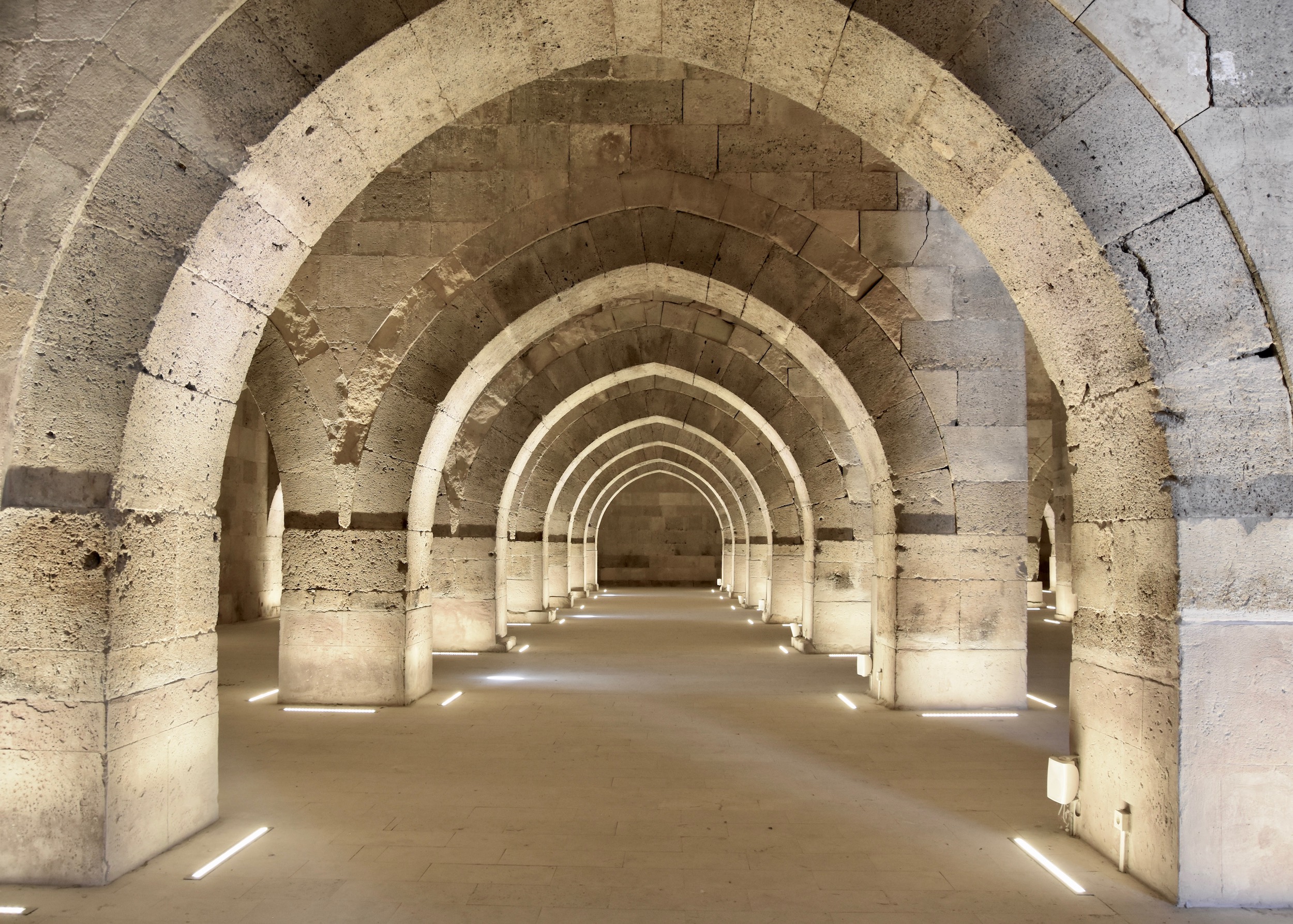
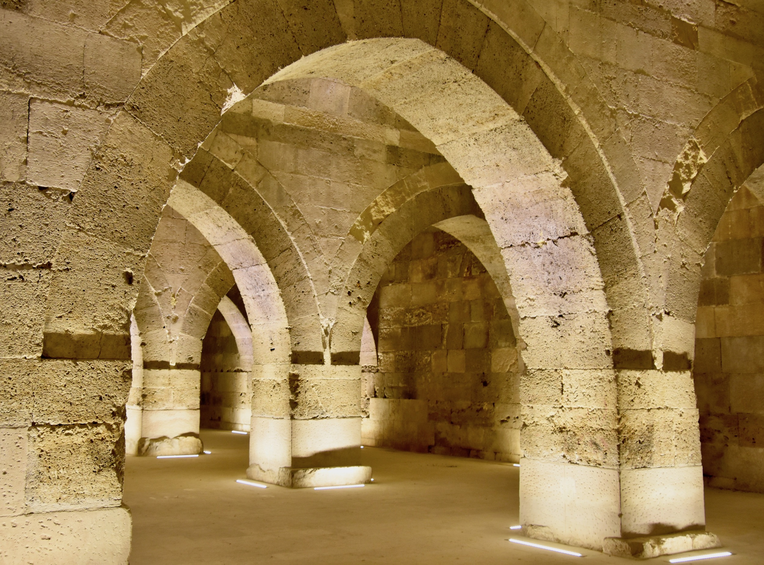
Inside there was plenty of space for stabling horses and camels.
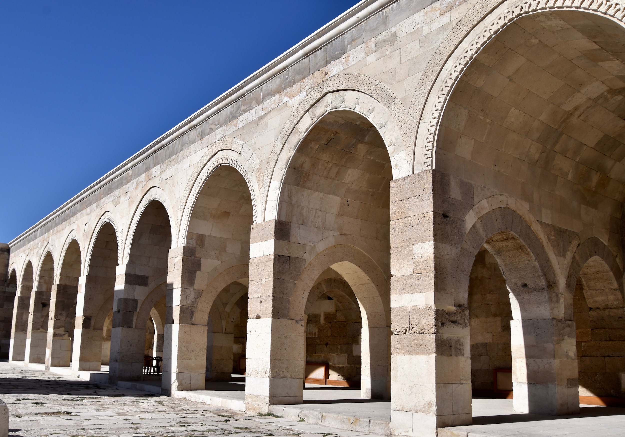
The symmetry of this place is amazing and just begs to be photographed.
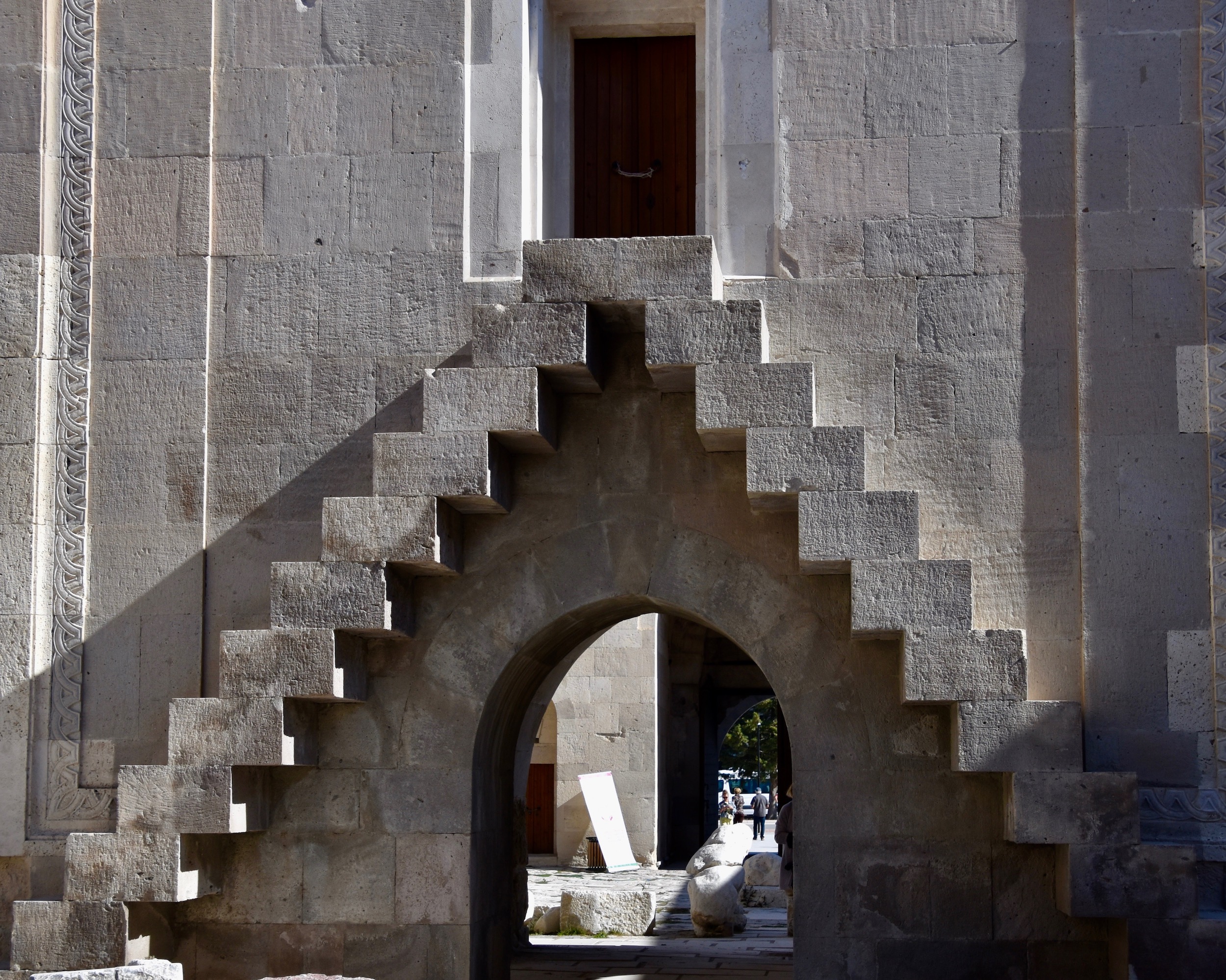
Each caravansary had a special place reserved for only the sultan and his entourage.
These steps leading up to the entrance to the sultan’s quarters look like something out of an M.C.Escher drawing.
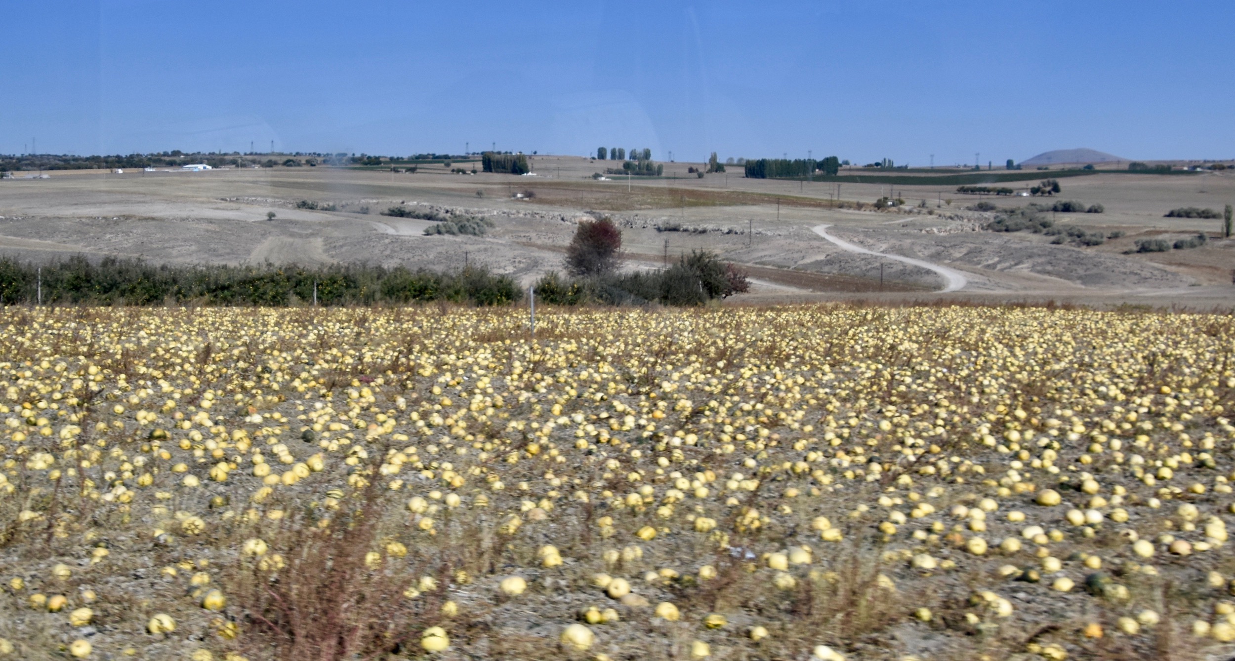
Back on our way to Cappadocia we gradually ascend the high plateau that makes up much of central Anatolia. There are a lot of fields where these gourds are grown which Yasemin explains are an important crop not only for their seeds, but also as a source of soil nutrition.
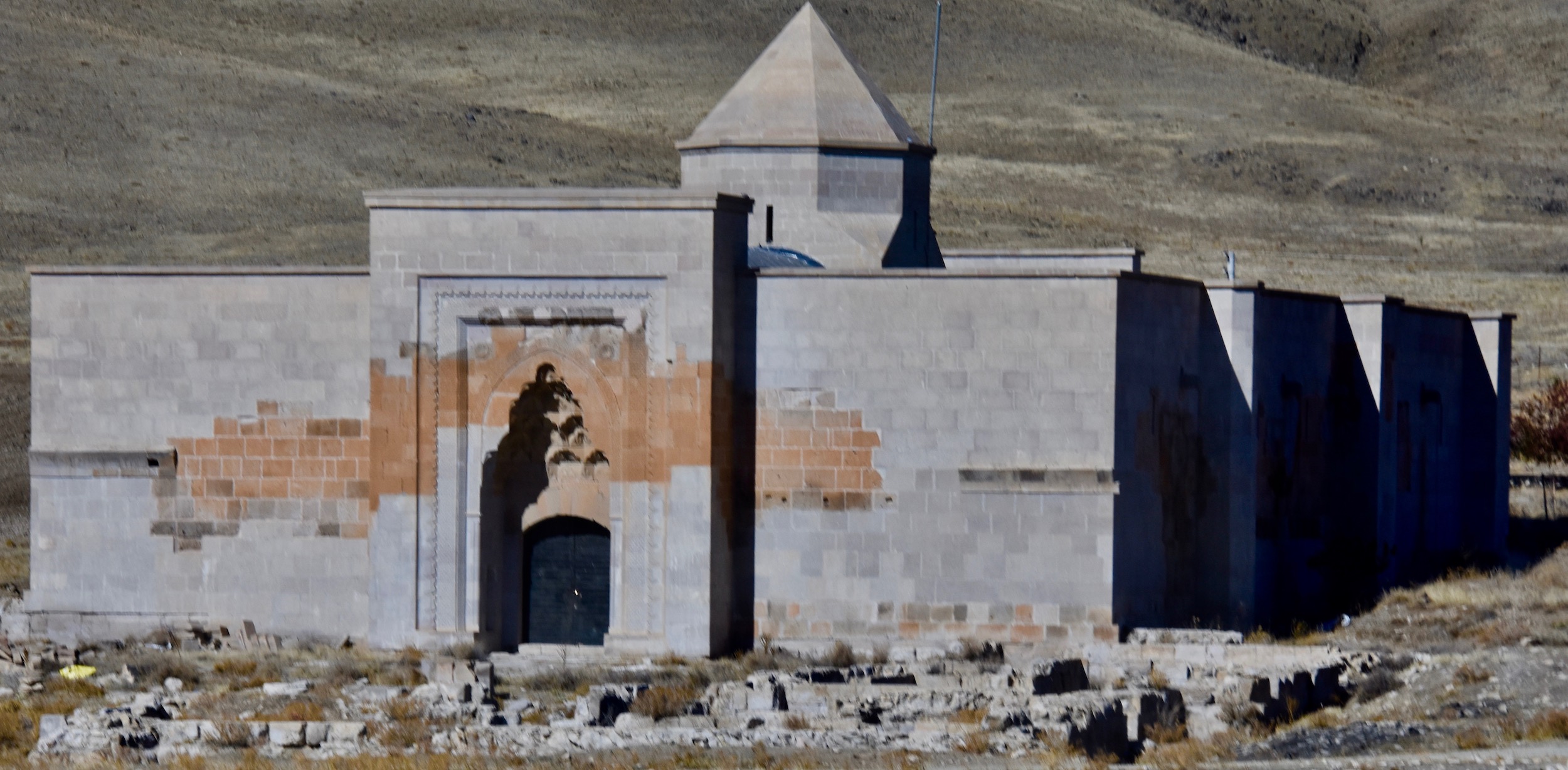
Before reaching Urgup we pass another caravansary, but this one is clearly not open and there appear to be some sort of ruins in front of it. I wonder as we pass by if Marco Polo stayed here.
Where is Cappadocia?
That might sound like a simple question, but look for a map of Cappadocia on the internet and you’ll come up with a lot of variations from a tiny portion of central Anatolia to an area stretching from the Black Sea to the Taurus Mountains to the Iraqi border. I suspect this is because there was an historical area referred to as Cappadocia as far back as the 6th century BCE as being part of the Persian Empire which may have been this big. In later years the area around the Black Sea was referred to as Pontus and Cappadocia became essentially confined to the interior of Anatolia. Herodotus, Strabo and The Acts of the Apostles all mention it, but without much specificity about its boundaries.
For tourism purposes Cappadocia is quite a small area around the little city of Nevsehir which is about half way between Aksaray and Kayseri. The principal sights are found at Goreme and Derinkuyu, although there are literally dozens places throughout the area that are worth visiting. On a tour such this we have time only to focus on the highlights.
OK, so now that we know where Cappadocia is, what’s the big deal about it?
Well, rather than reinvent the wheel I’ll let UNESCO give the description of why it is a World Heritage Site.
Located on the central Anatolia plateau within a volcanic landscape sculpted by erosion to form a succession of mountain ridges, valleys and pinnacles known as “fairy chimneys” or hoodoos, Göreme National Park and the Rock Sites of Cappadocia cover the region between the cities of Nevşehir, Ürgüp and Avanos, the sites of Karain, Karlık, Yeşilöz, Soğanlı and the subterranean cities of Kaymaklı and Derinkuyu. The area is bounded on the south and east by ranges of extinct volcanoes with Erciyes Dağ (3916 m) at one end and Hasan Dağ (3253 m) at the other. The density of its rock-hewn cells, churches, troglodyte villages and subterranean cities within the rock formations make it one of the world’s most striking and largest cave-dwelling complexes. Though interesting from a geological and ethnological point of view, the incomparable beauty of the decor of the Christian sanctuaries makes Cappadocia one of the leading examples of the post-iconoclastic Byzantine art period.
So essentially we’ve got really interesting geologic rock formations that have been hollowed out by early Christians to create not only individual dwellings, but in some cases entire underground cities. Throw in a few extinct (we hope) volcanoes and of course the ballooning for which Cappadocia is almost as well known worldwide and you’ve got a true bucket list destination. I know I can’t wait to see it.
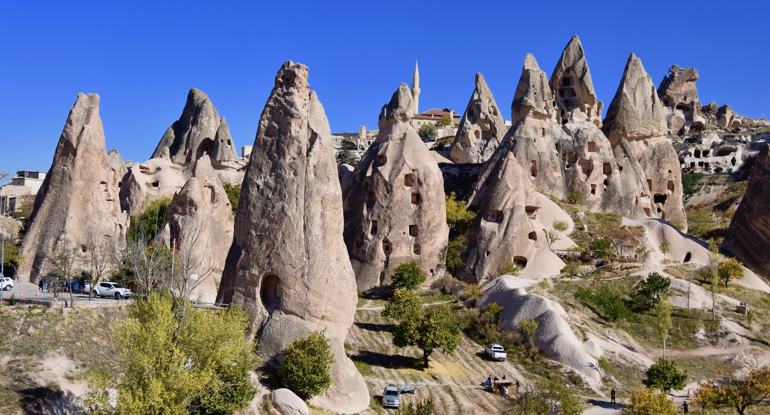
And we don’t have long to wait as almost without warning the flat Anatolian plateau gives way to a landscape that is as phantasmagorical as any I have ever seen. No matter how many photos, videos or travel documentaries you may have seen of the landscape of Cappadocia, nothing can prepare you for the reality.
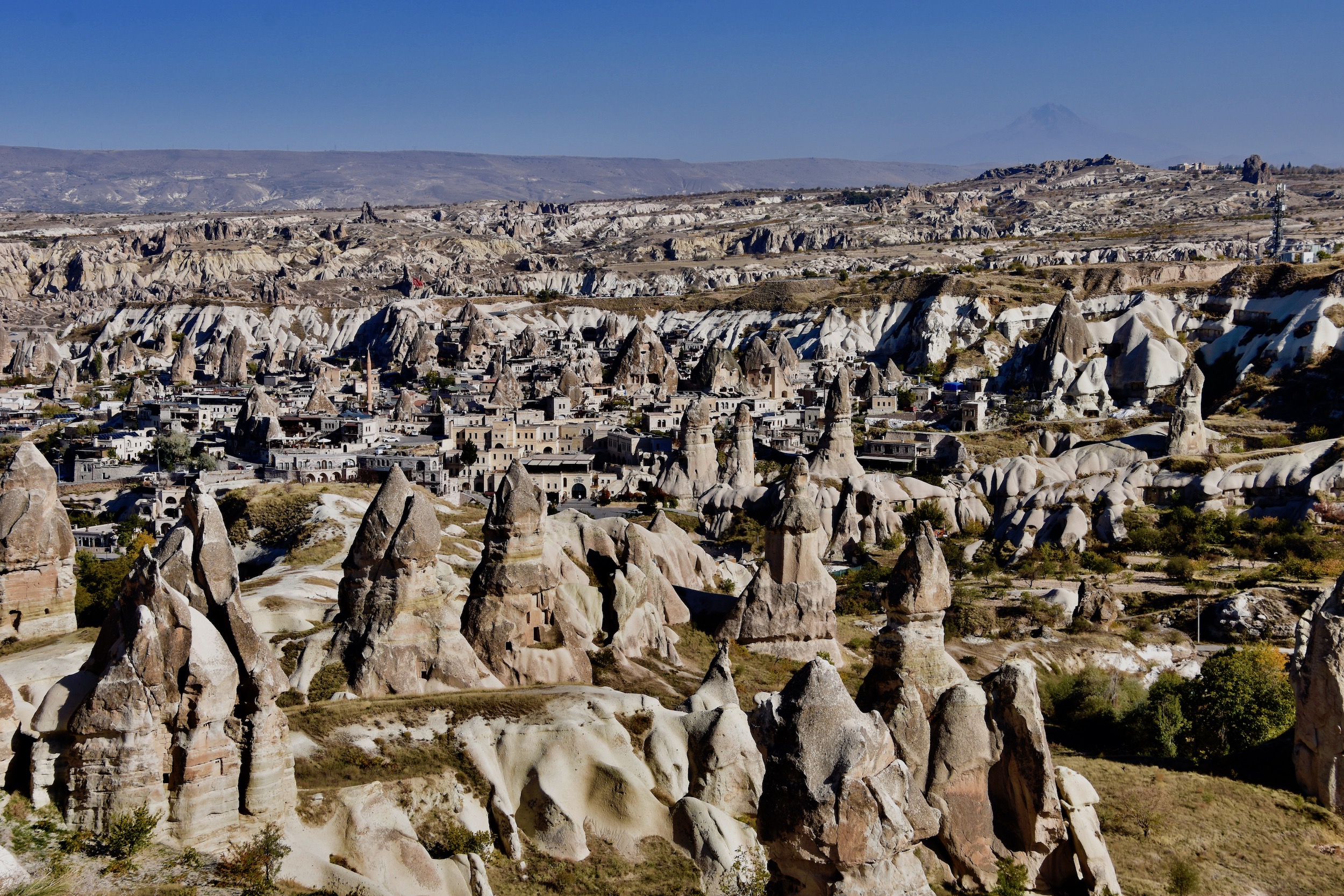
That’s the town of Urgup in the valley surrounded by the fairy chimneys on all side. If you look closely you can see one of the volcanoes in the upper right.
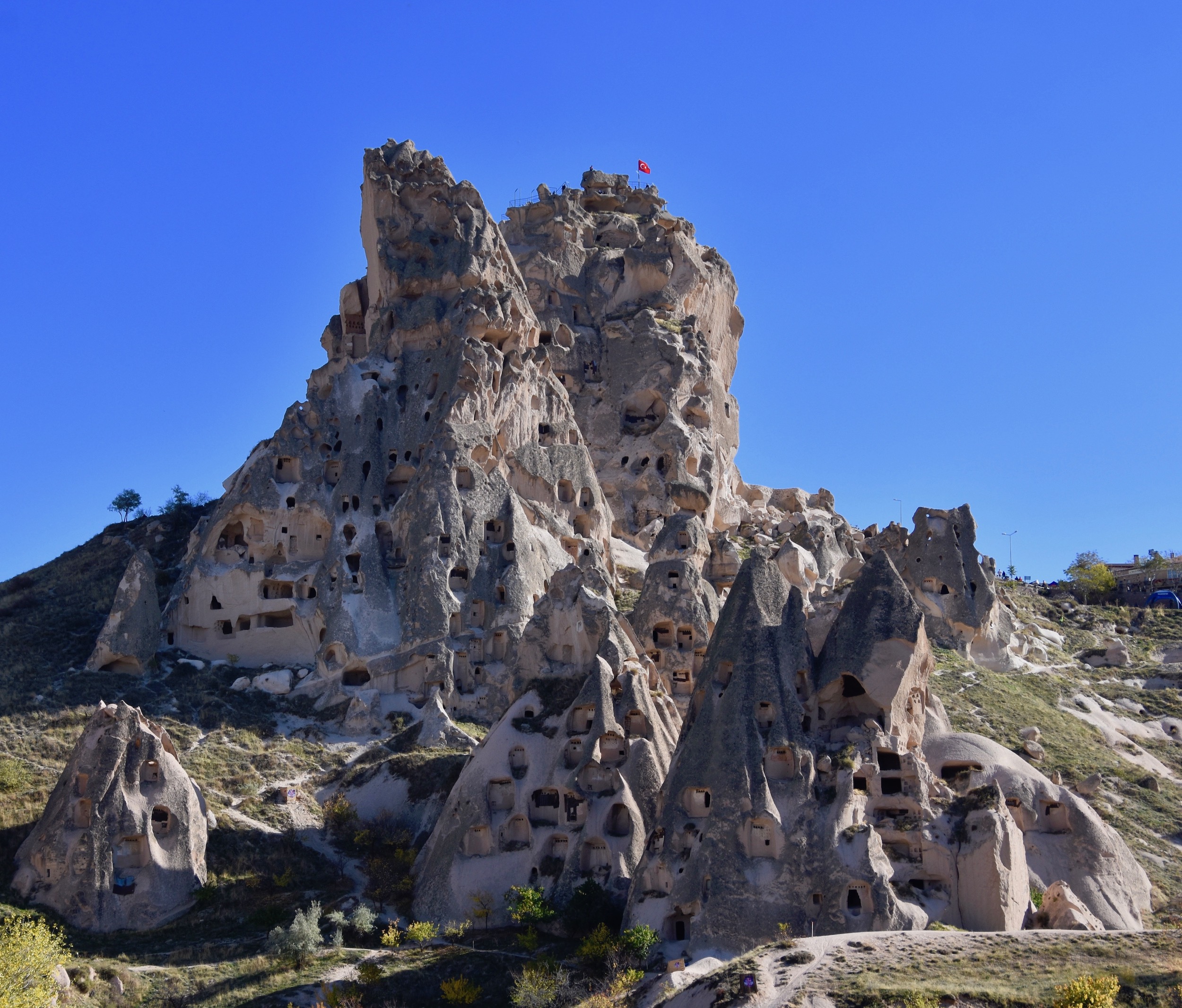
For the purposes of this post I’ll limit what we saw to our first stop at Uçhisar which has a dominant feature known as ‘The Fortress’. You pull into a parking lot that is higher up than most of the surrounding landscape and it’s a great place to view not only The Fortress, but the many other dwelling places cut into the native rock. You can then make you way down among some of the fairy chimneys.
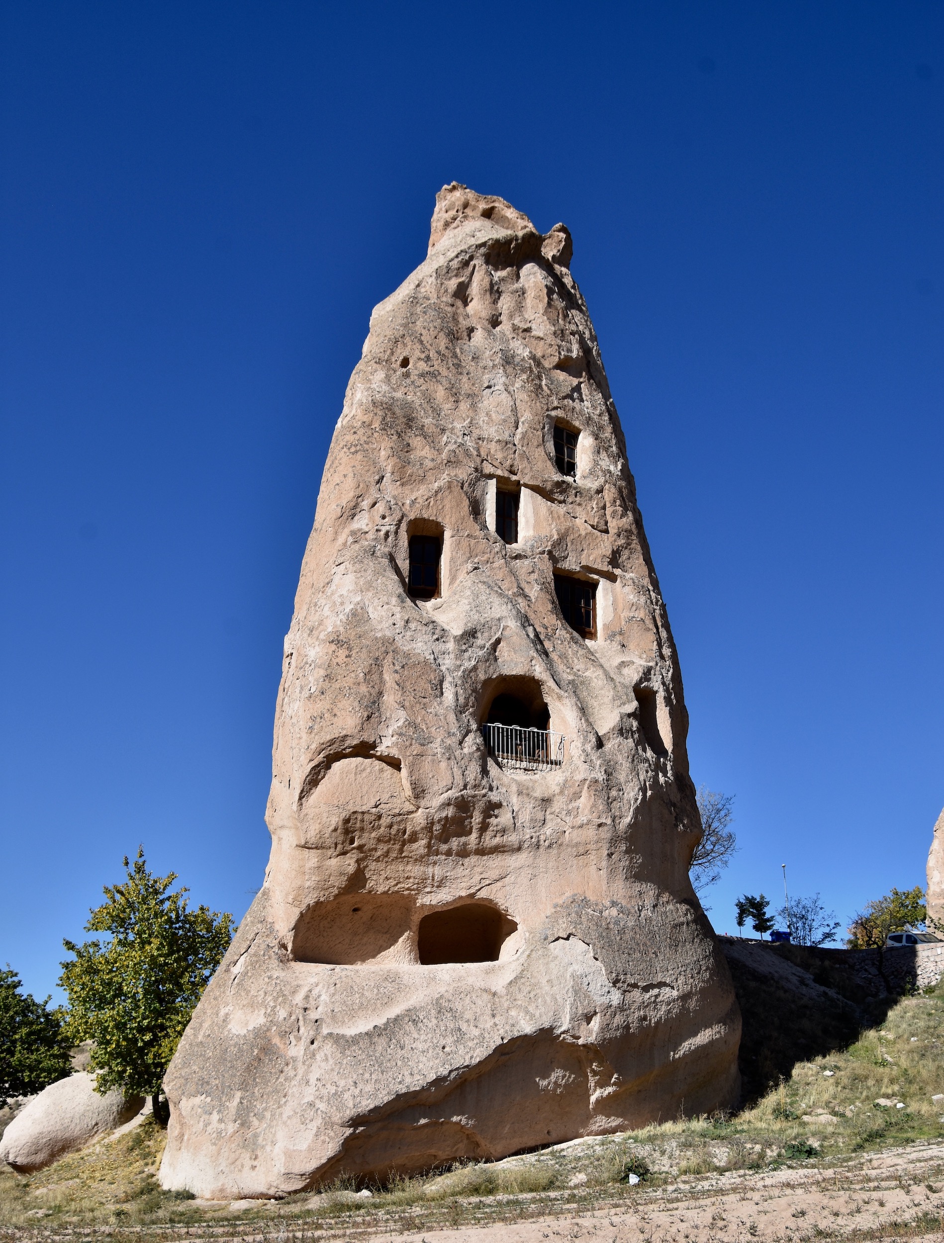
This is The Fortress where, believe it or not, up to 1,000 people once lived. It is now no longer inhabited.
Here are more photos taken at our first stop in Cappadocia.
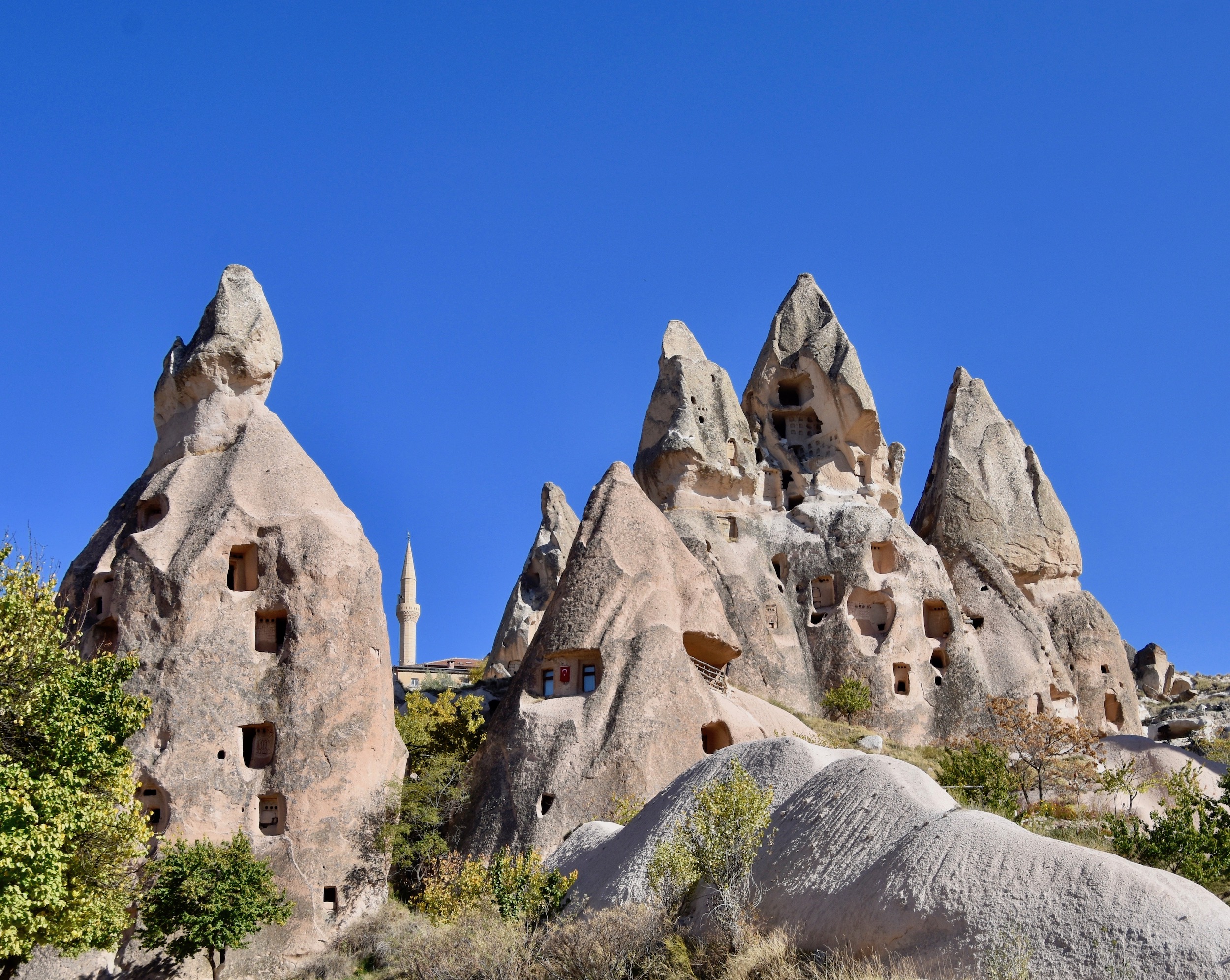
Some of these structures reminded me of the sinister hoods worn by the KKK.
There are actually some people still living in these rocks, but Yasemin said they are used as getaway places and not primary residences. Some people go to their cottage and some go to their rocks.
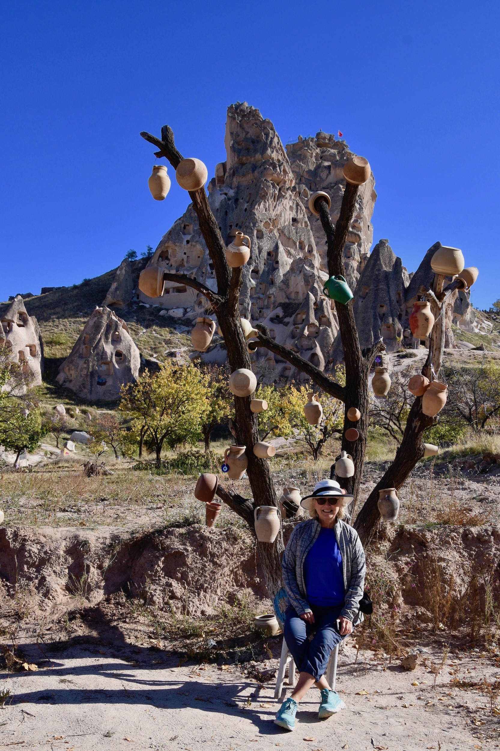
There’s also a tree here bedecked with clay pots for reasons unknown, but it’s a good place for a picture with The Fortress in the background.
Well, that’s a great start and in the next post we’ll see even more of Cappadocia’s amazing sites, but now it’s time to check in to our hotel.
While we weren’t going to be staying in one these fairy chimneys our hotel in Cappadocia was not that far removed.
Alfina Cave Hotel
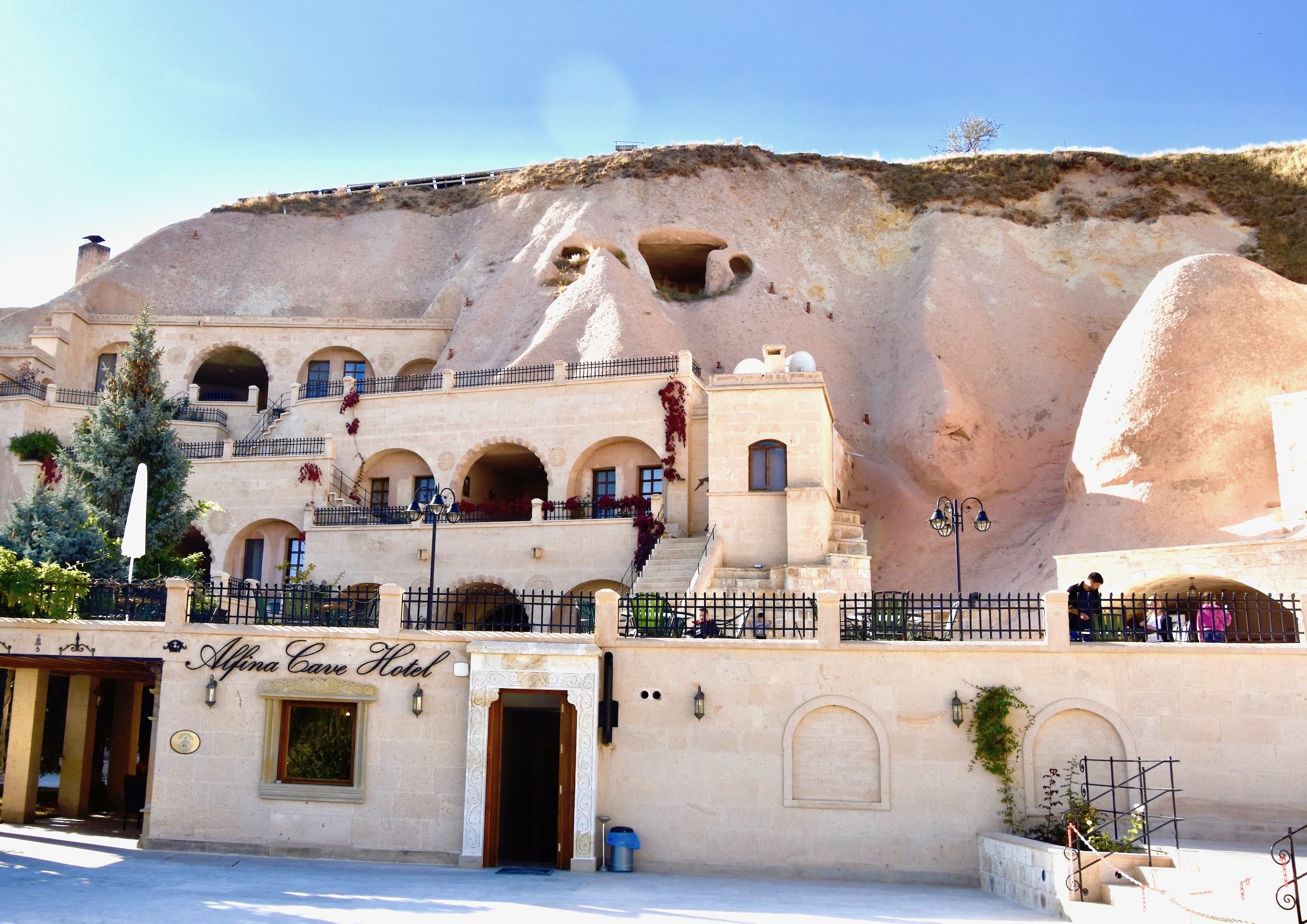
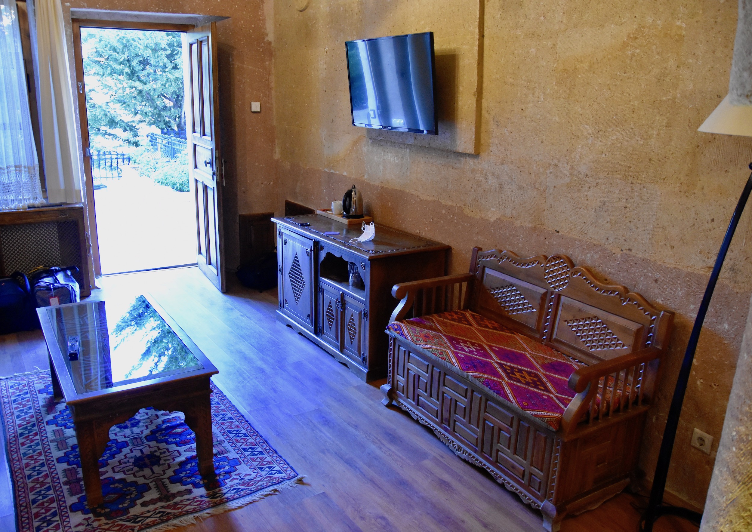
This is the Alfina Cave Hotel, our base in Cappadocia. This was the first of the hotels in Cappadocia that incorporated actual cave dwellings into the hotel proper for an experience that is very unique. This is our room which was hollowed out of the soft volcanic rock which overlies much of the area.
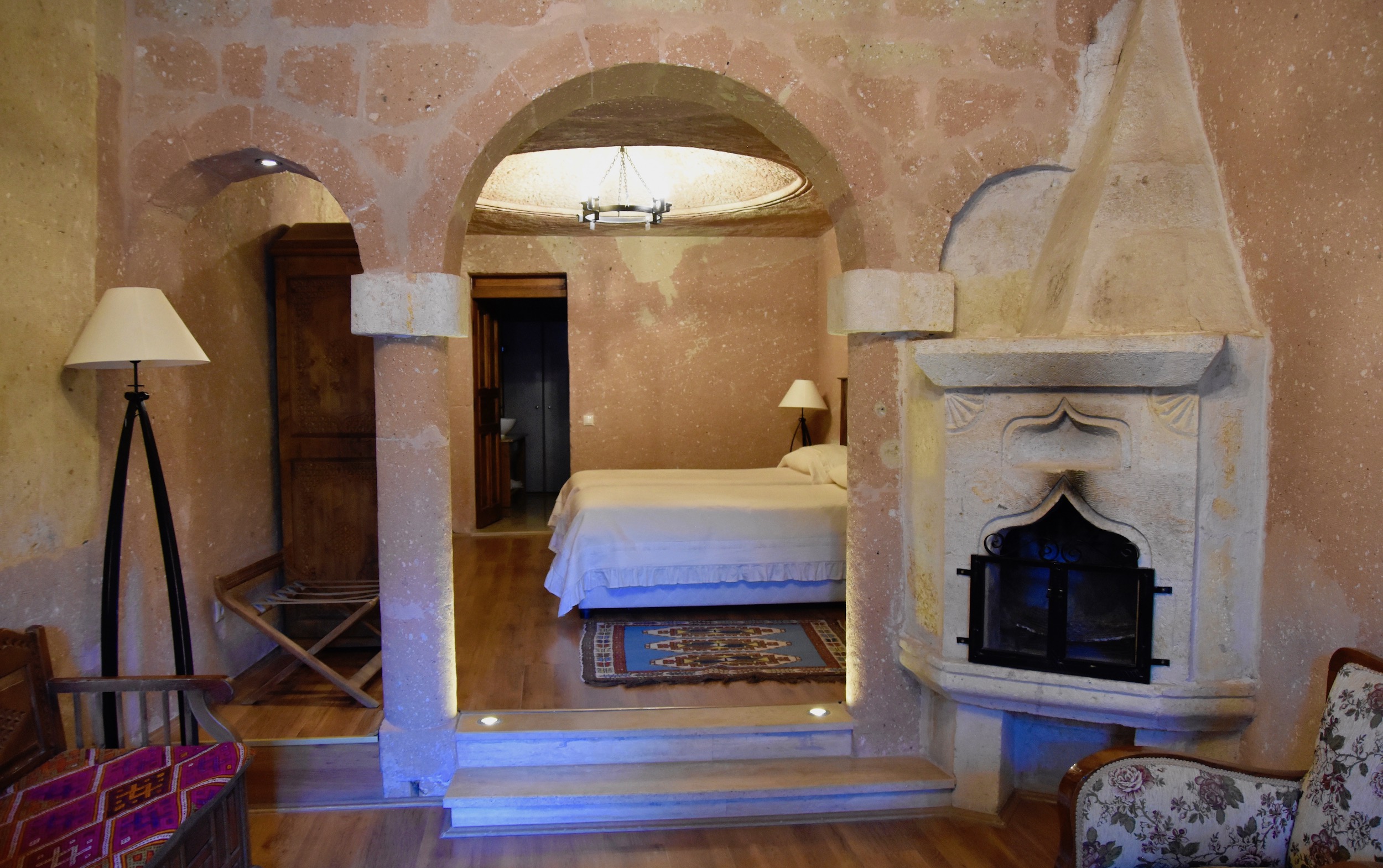
You would think that living in a cave would be dark and musty, but the Alfina was anything but.
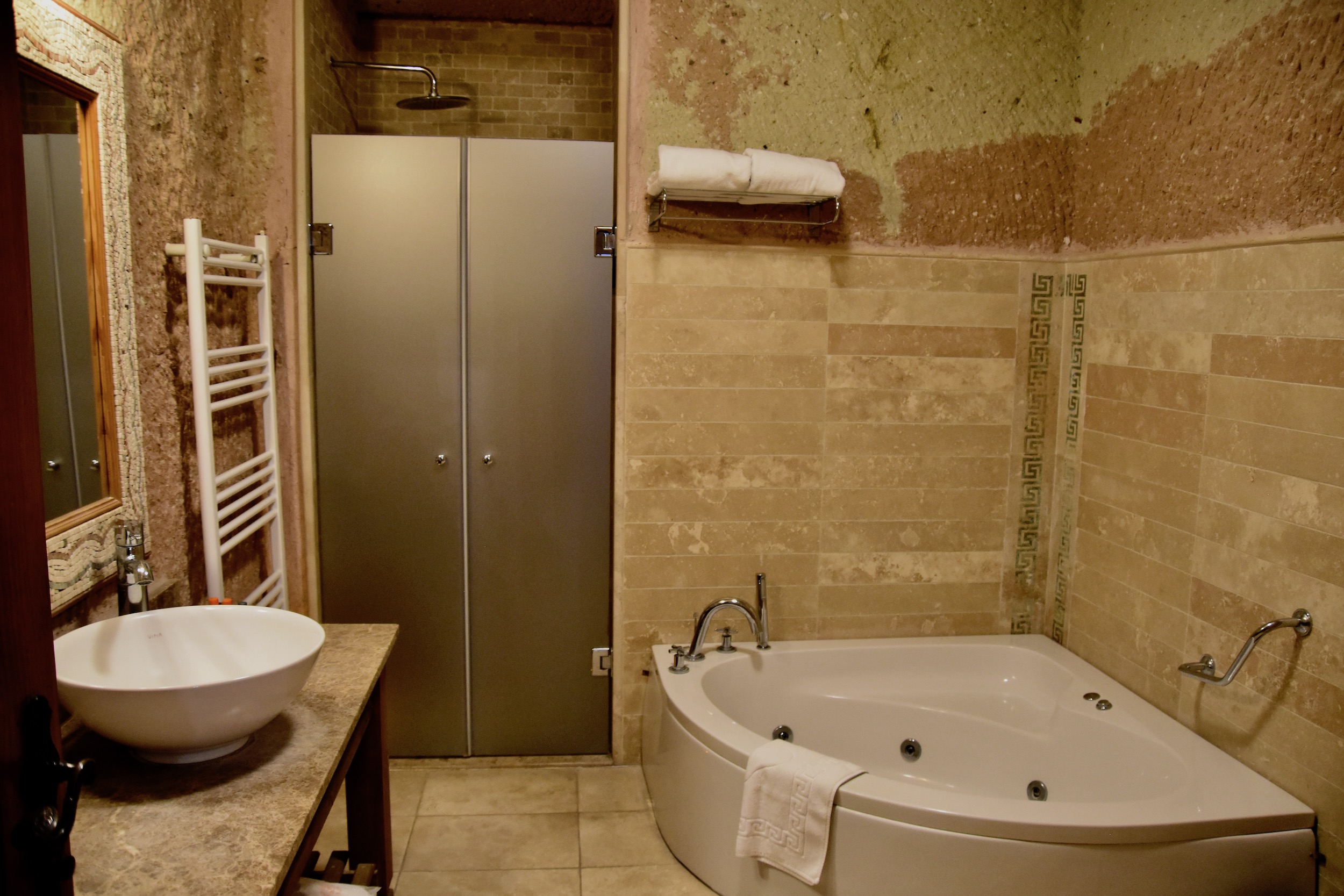
This is the very modern bathroom with both a shower and a jacuzzi tub. After spending some time in the underground cities you’ll be glad of these.
The hotel was within easy walking distance of the centre of Urgup where there are lots of restaurants and shops. And for only the second time since leaving Istanbul, lots of other tourists.
Join us in the next post as we visit the open air museum at Goreme.