Nazca Lines – See Them to Believe Them

In my last post I gave my many reasons for visiting Peru and Bolivia with Adventures Abroad and one near the very top was a flyover of the mysterious Nazca Lines. In this post I’ll give the details of that flyover and why, for me, it was not the anticlimax that others, including some close friends, have said it would be. So fasten your seat belt and join the rest of us on yet another exciting journey with Adventures Abroad.
Adventures Abroad offers quite a number of options for exploring Peru, but not all include the Nazca Lines flyover. For me this was an essential inclusion as I have been fascinated with them since I first read about them in Erich von Daniken’s controversial and now largely debunked Chariots of the Gods? that came out in 1968. Then a gullible teenager, I was ready to believe that they had been built by a lost civilization to call back aliens who had visited and introduced them to advanced technology they could not possibly have invented on their own – sort of an ancient cargo cult. Now I know that’s nonsense, but the fact remains that there is no general agreement as to why they were built and what they represent. They have universal drawing power over people like me and now I’m going to come to my own conclusions.
The Nazca Lines flyover was the first event scheduled on this tour. As I noted in a previous post I had arrived in Peru a day early and spent the time exploring the upscale and quite interesting Miraflores district of Lima. The next day I met nine other intrepid adventure seekers and our guide, Diego Vidal, a native of Cuenca, Ecuador and AAs top guide for most of their South American tours. Later on the tour, in an “It’s a small world” moment, I learned that he is a good friend of Wilson Rosales who was the guide Alison and I used to visit parts of Ecuador not covered by the AA itinerary.
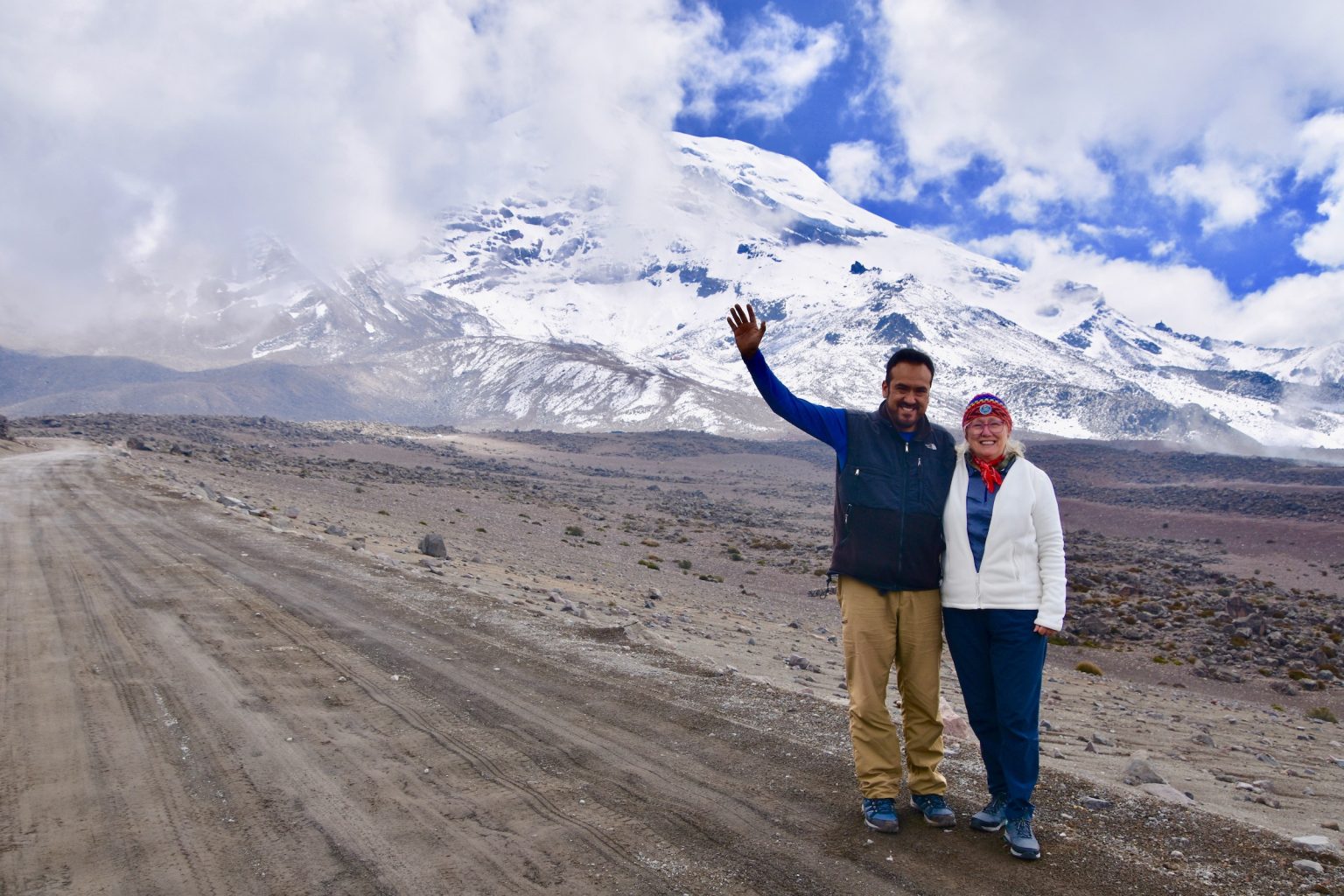
This is Alison and Wilson near Chimborazo, Ecuador’s famous volcano whose peak, due to the Earth’s bulge, is the farthest point from the centre of the earth, technically making it the tallest mountain in the world.
Back to the present.
The original AA itinerary indicated that for our visit to the Nazca Lines we would take a PUBLIC BUS to Paracas from the Lima bus station. And yes, public bus was all in capitals in case we missed it. This was not something any of us were looking forward to. Then, surprise! We were only kidding, you will have our own private bus after all. That made Diego very popular with us right off the bat. A great case of under promising and over delivering.
So the next morning we boarded our PRIVATE BUS and began the 4-5 hour journey to Paracas where we would stay for two nights.

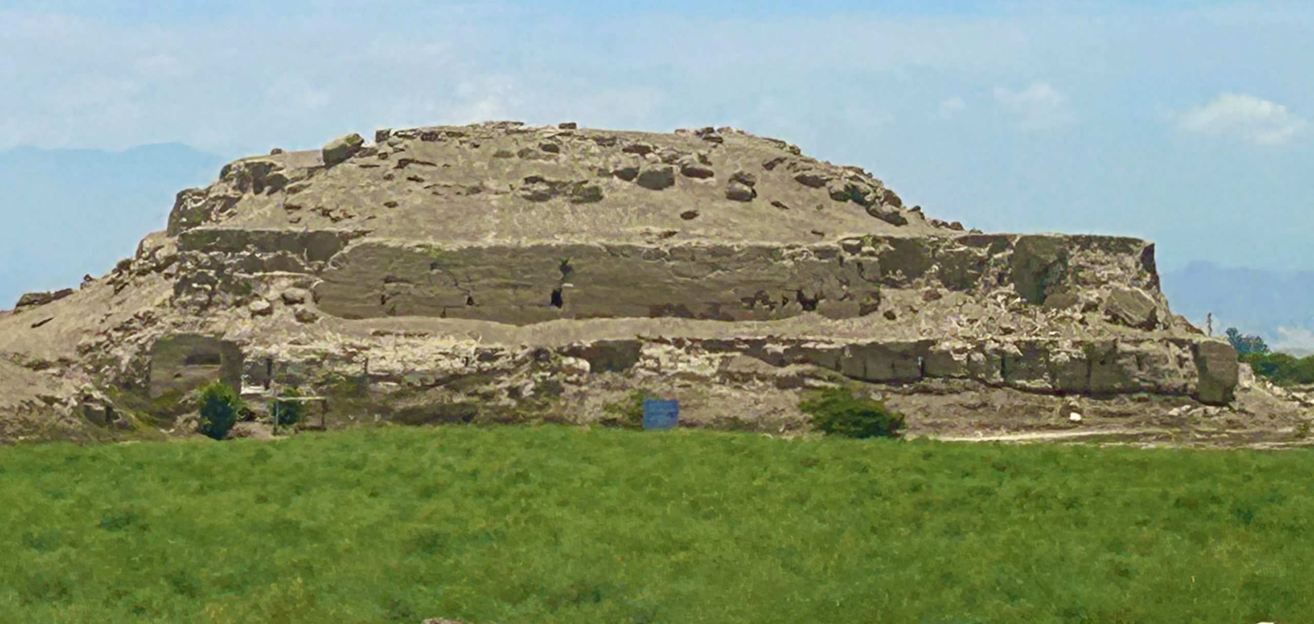
It seemed to take forever to finally get out of Lima and after that the drive was relatively uneventful. I did not know that 10% of Peru is an extension of the Atacama desert and that includes everything from the Chilean/Peruvian border all the way up to Lima. There were a lot of sand dunes and a few unexcavated archaeological sites like this small pyramid.
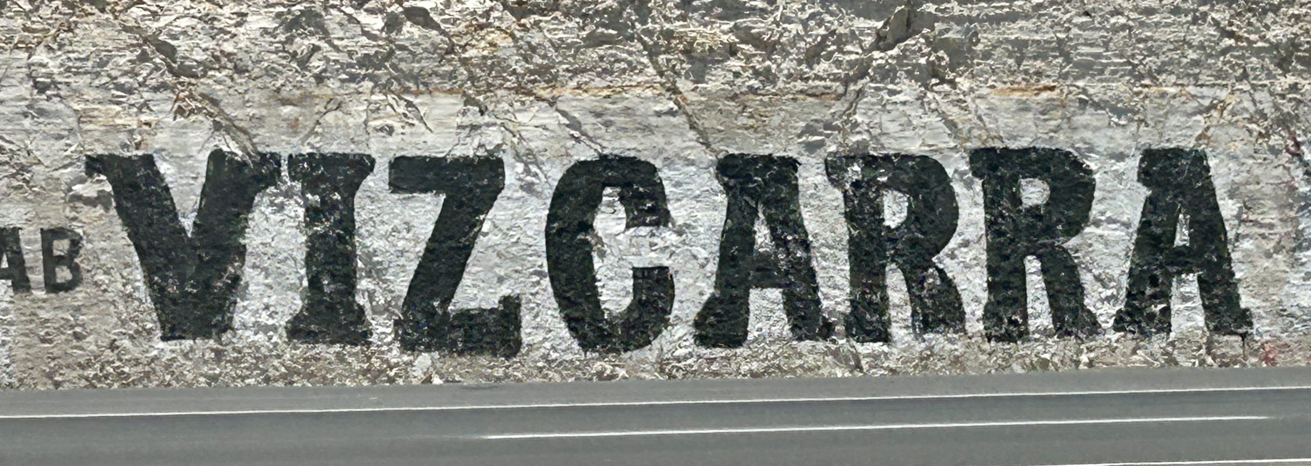
I also learned from Diego that Peru has an upcoming presidential election in April and that there no less than 34 candidates! The names of the candidates appear written on rock faces on the side of the highway like this one for Mario Vizcarra, brother of former President Vincent Vizcarra who is currently serving a 14 year sentence for corruption. In fact no less than four former Presidents are currently serving time. It makes you wonder why anyone would want to be President when the usual denouement is jail time.
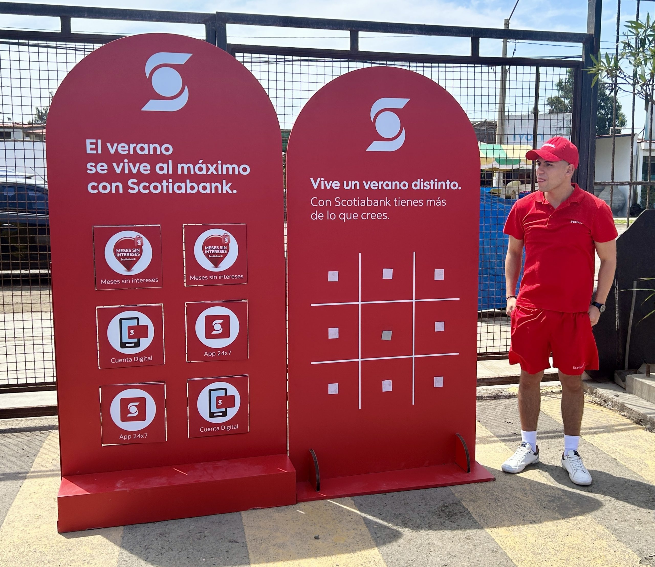
During a pit stop along the way I learned that my province of Nova Scotia has a major connection to Peru. Scotiabank was having a promotion at a roadside mall. I tried to tell this guy that I as from the original home of Scotiabank, but I think he thought I was just another nutty gringo. Over the duration of the tour I discovered that Scotiabank is very big indeed in the country.
We arrived in the seaside tourist town of Paracas around 1:00 PM, had lunch, dropped our things at the hotel where we would spend the next few nights and then headed to the small city of Pisco from where the Naza Lines flights originate. If the name Pisco sounds familiar, it is because it was here that Peru’s signature cocktail, the pisco sour was invented. As I found out on my first day in Peru these are highly potent and highly addictive.
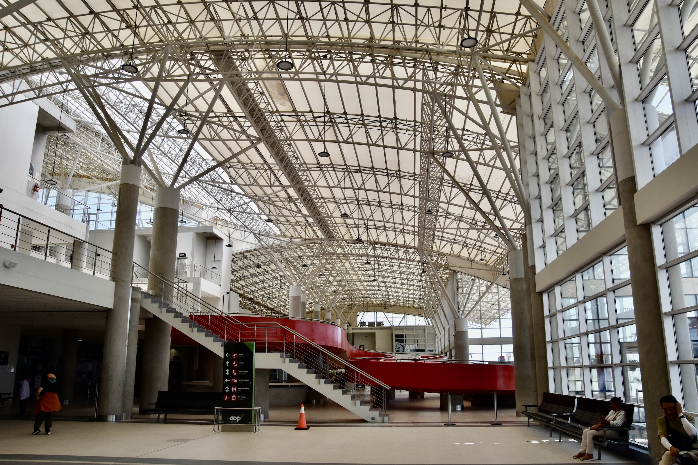
The airport at Pisco is a classic example of why the adage, “If you build it, they will come”, is complete bullshit. The Pisco airport is as big a white elephant as any I have ever seen. Built to be able to handle international flights, it now caters only to the Nazca Lines flyovers with no scheduled flights whatsoever.
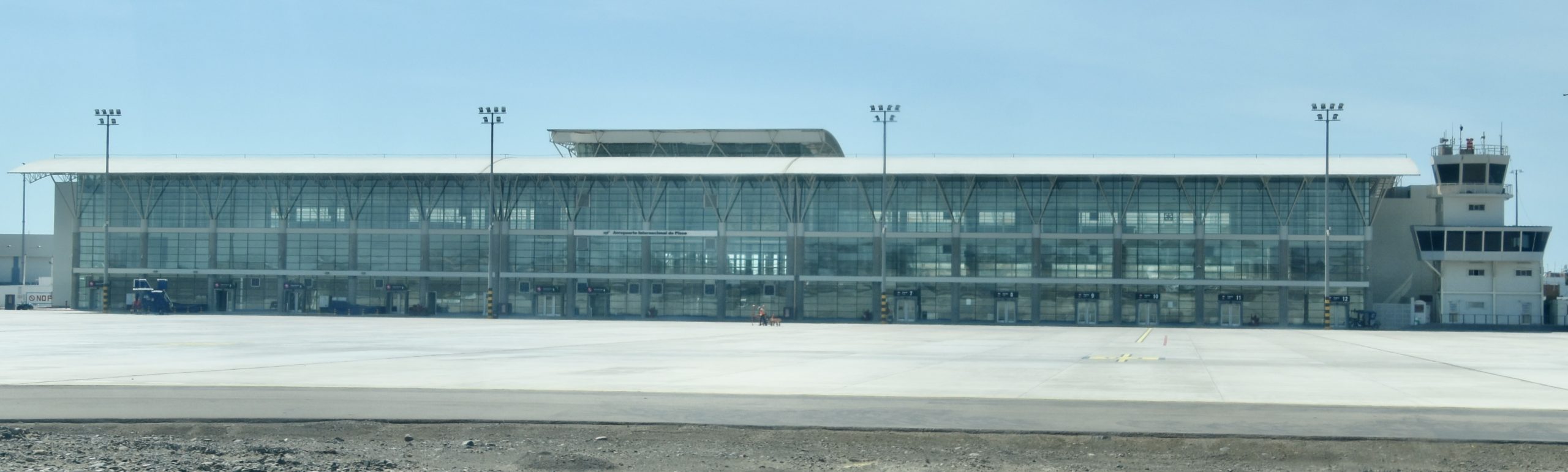
Here is our group checking in at the only check-in desk in the entire airport.

Looking around you see nothing but a vast emptiness.
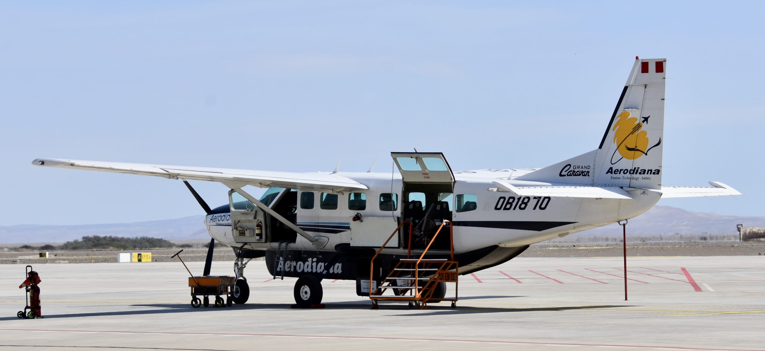
Luckily, this makes us the only game in town and we are soon in the waiting room for our flight. Our group is just the right size to fill the entire plane with everybody getting a window seat. Soon we are led out onto the tarmac to start our journey to the Nazca Lines.
Just What are the Nazca Lines
Before we take off, let’s learn a bit more of what we are about to see starting with what we know for sure. First of all they are geoglyphs which are defined by the Cambridge dictionary as “A large design on the earth’s surface made by people removing or placing, soil, sand, stones etc.” In the case of the Nazca lines they are what are known as negative geoglyphs, created by removing the pebbles and dirt from the surface, leaving tiny depressions that contrast colour wise with the surface. In this case making the depression markings whiter than the surrounding landscape. The reason they have survived is simply because they were built in one of the driest regions on the plant. The Nazca Desert, an extension of the Atacama Desert only gets about twenty minutes of rain a year.
We also know that two distinct groups created the Nazca lines. The first was the Paracas culture that existed from about 800 to 100 BCE. Lines attributed to them date from 400 to 200 BCE. However, these are not the most famous ones. These were created by the Nazca culture that succeeded the Paracas culture in the area around the year 100 BCE and lasted until about 800. The Nazca lines created by this culture date from 100 BCE to around 500.
Why they were built is one of the great archaeological mysteries in the world. Although many theories have been proposed, many related to astronomical events, none has ever been proven. What has been proven quite recently, is that a small group of people could build even the seemingly most complicated of designs in a matter of days. One of the myths about the Nazca lines is that they can only be seen from the air. Spanish conquistadores as early as 1553 described them as trail markers or ancient roads. The reality is that the vast majority of the Nazca Lines are just that – straight lines. It was only in the 1930’s that pilots started describing the more intricate features that cannot be discerned from ground level. Recent techniques using LIDAR or AI have revealed hundreds more of these intricate designs in the Nazca area. Maybe these will help solve the mystery of why they were built and what they mean.
In 1994 the Lines and Geoglyphs of Nazca and Palpa were inscibed as the 700th UNESCO World Heritage Site with this description:
Located in the arid Peruvian coastal plain, some 400 km south of Lima, the geoglyphs of Nasca and the pampas of Jumana cover about 450 km2 . These lines, which were scratched on the surface of the ground between 500 B.C. and A.D. 500, are among archaeology’s greatest enigmas because of their quantity, nature, size and continuity. The geoglyphs depict living creatures, stylized plants and imaginary beings, as well as geometric figures several kilometres long. They are believed to have had ritual astronomical functions.
Well time to hop aboard and see for ourselves if it was worth the time and effort to get to this remote place in Peru.
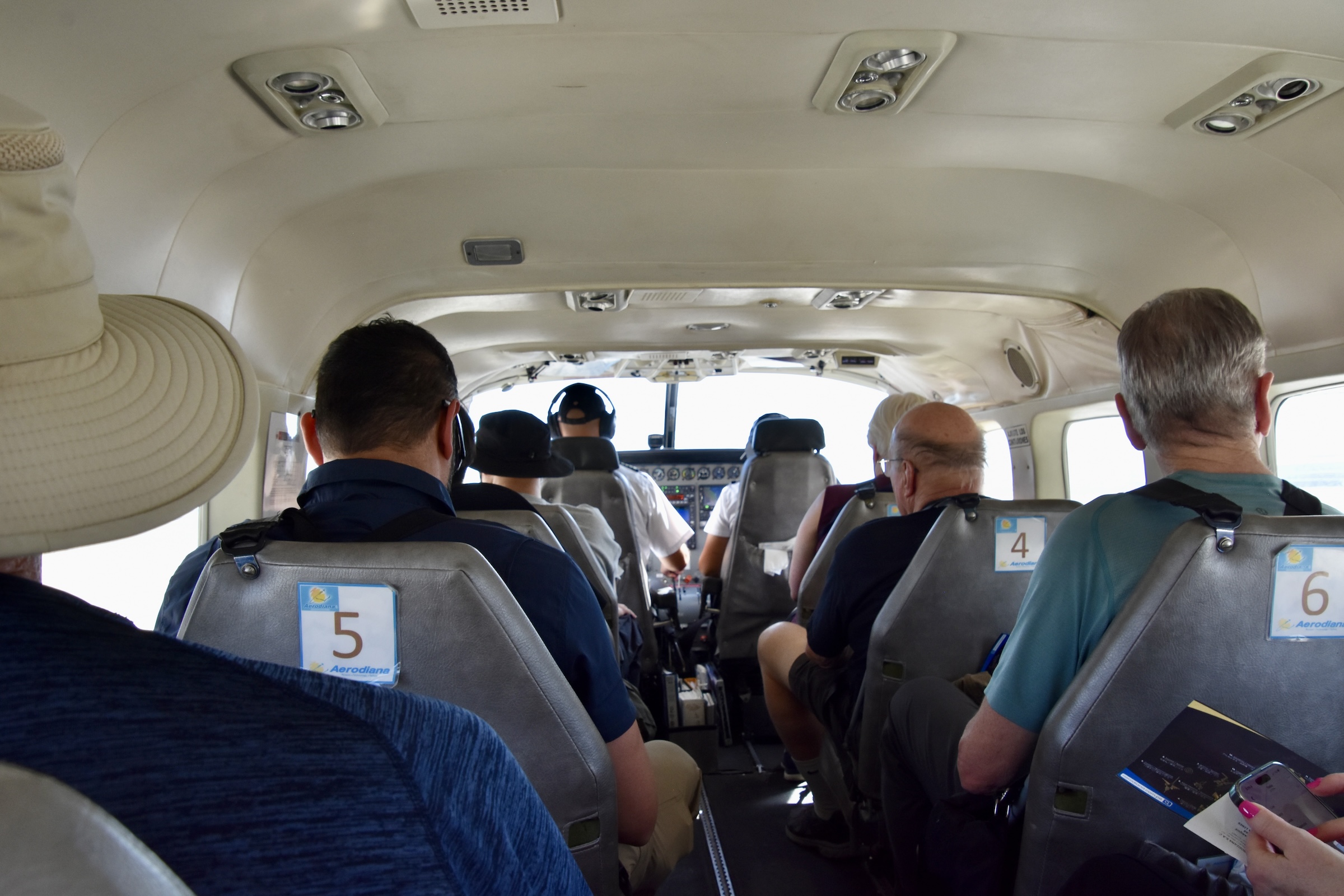
Here’s what it looks like from inside the plane. There two pilots just as in any commercial flight.
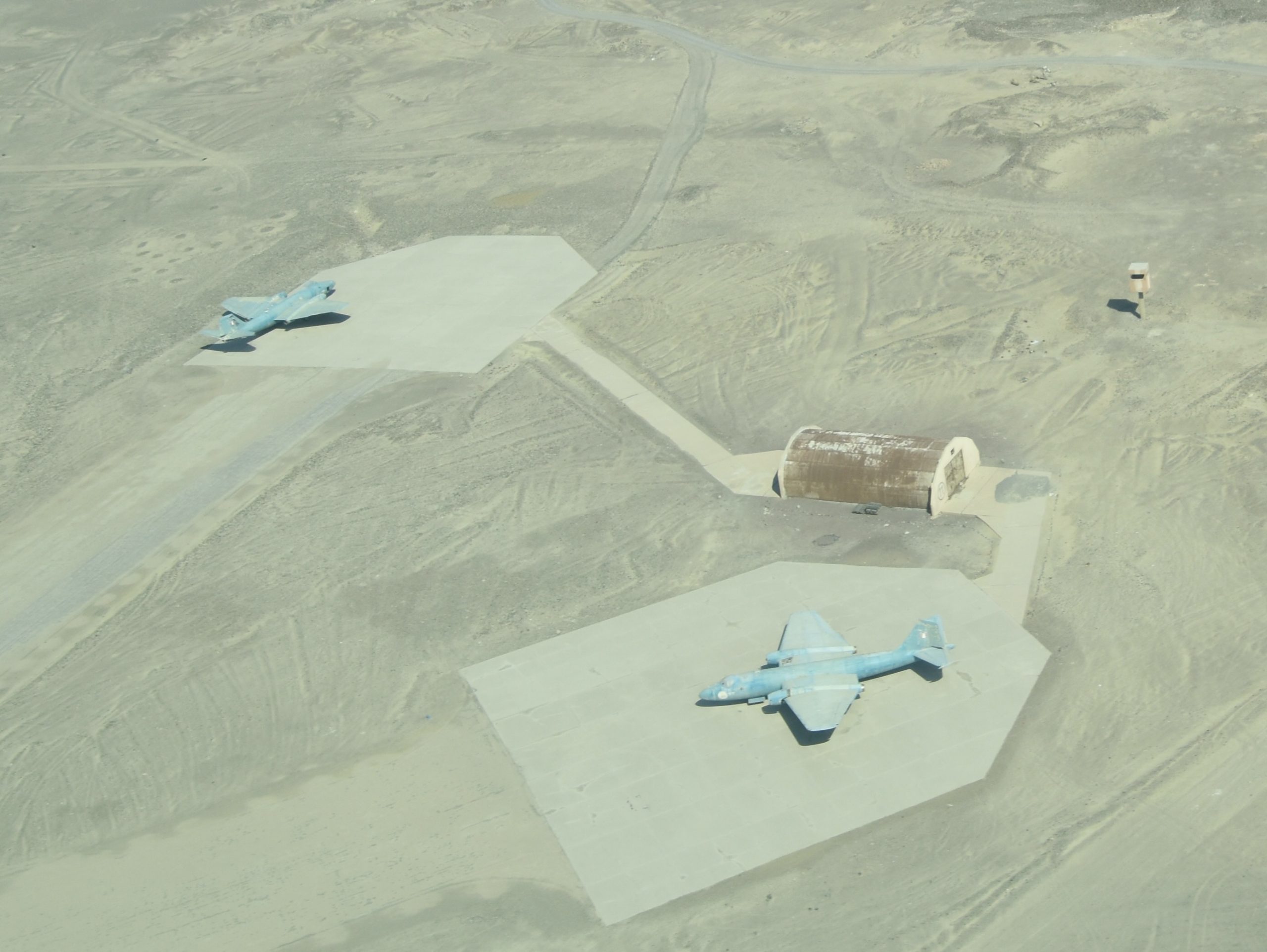
The airport is a fair distance from the Nazca Lines and at least half of the flying time will be getting there and back, but actually there’s plenty to see on the way. Right off the bat, two Peruvian Airforce jets.
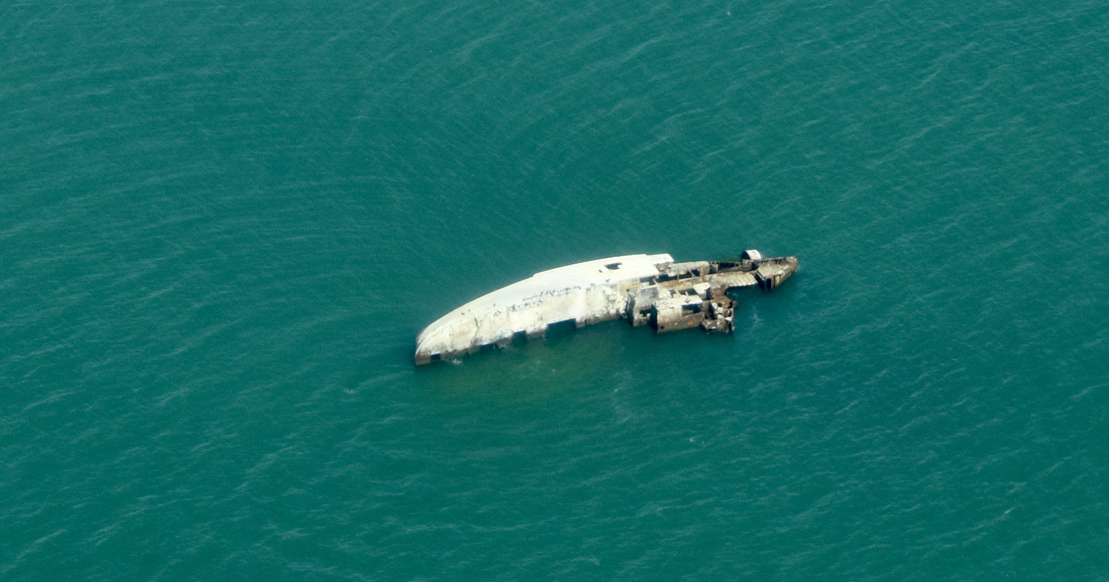
Then a sunken ship. Note the green colour of the water.
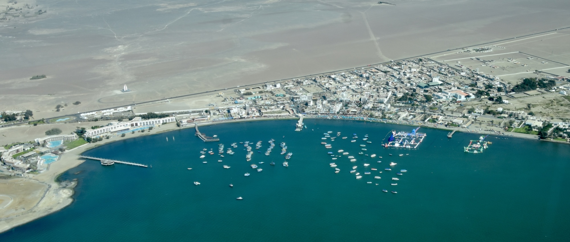
The Paracas fishing fleet.

Then a flyover of Paracas town. Note that the desert starts right across the road and the town is a tiny sliver of activity in an otherwise totally arid environment. See, these flights can be educational as well as fun.
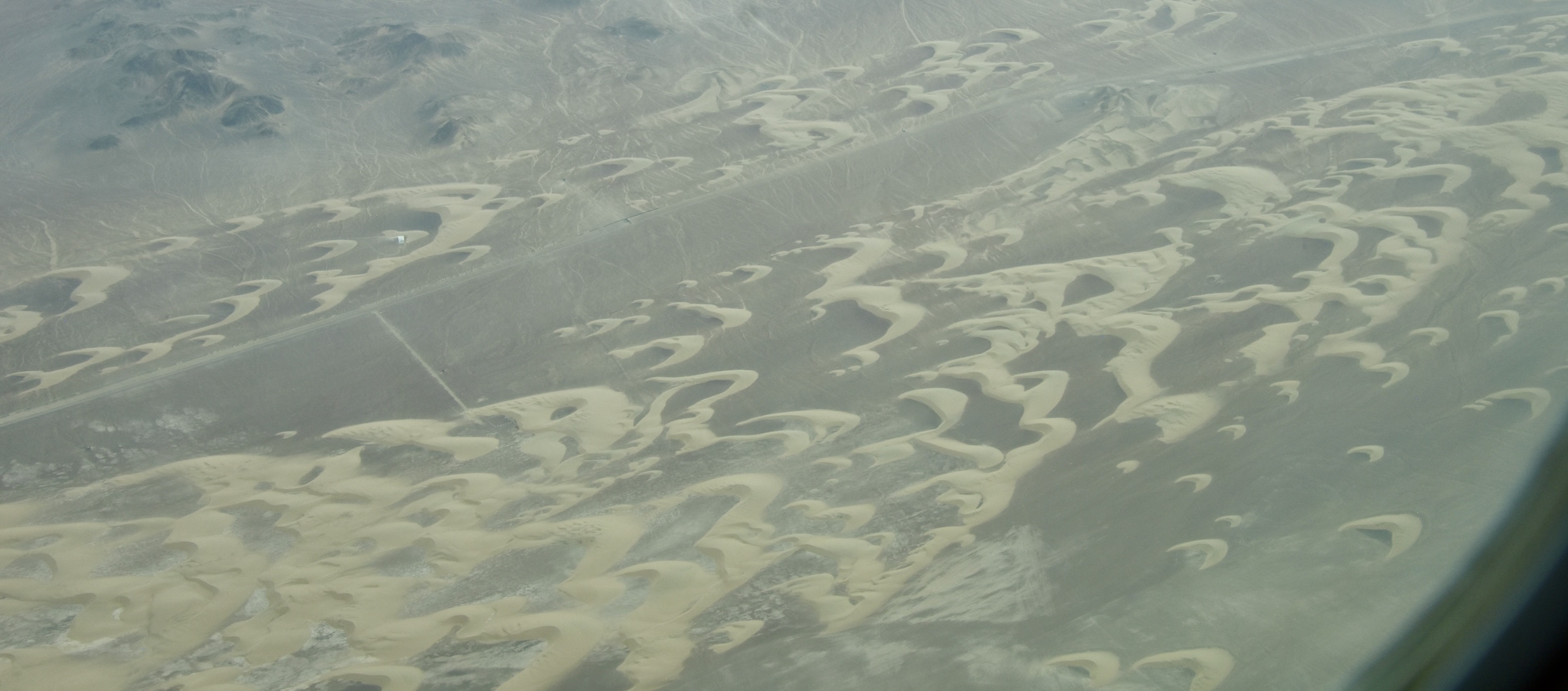
Then we fly for some time over some serious sand dunes.
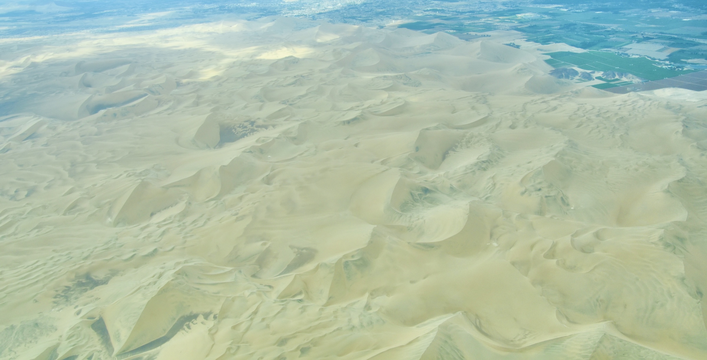
Here are a few classic barchan sand dunes which always look great from the air, like boomerangs made out of sand.
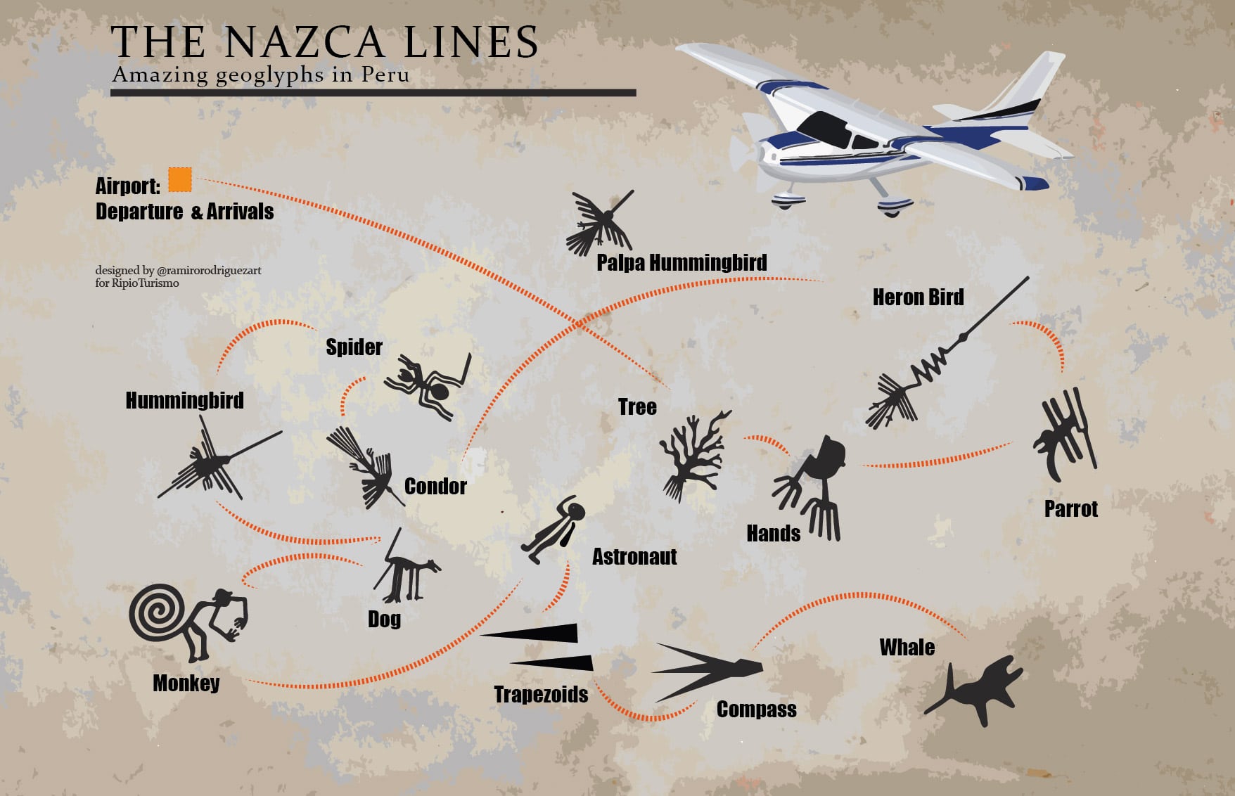
At last we arrive over a few straight Nazca lines and I know that the figures can’t be that far away. We have been given a map similar to this one which shows us the figures we are about to see.
The pilot has told us that he will be banking very sharply over each object in each direction so that everybody gets a good look. And from this point on the ride becomes more like a rollercoaster than a regular plane ride, However, nobody seems to mind because we all want the best look possible.
Now I have to be honest, the sky was overcast so that the light was very flat and the figures did not stand out as well as they might in pure sunshine. How did I manage to come to one of the driest places on earth and get potential rain clouds?
Our first figure was the orca which I confess I did not get a clear look at until we were out of camera range. The reality is that you get only about 10 to 15 seconds directly over each figure so you better have your camera ready. Next was the figure that has caused the most controversy and I did get a good look at it.
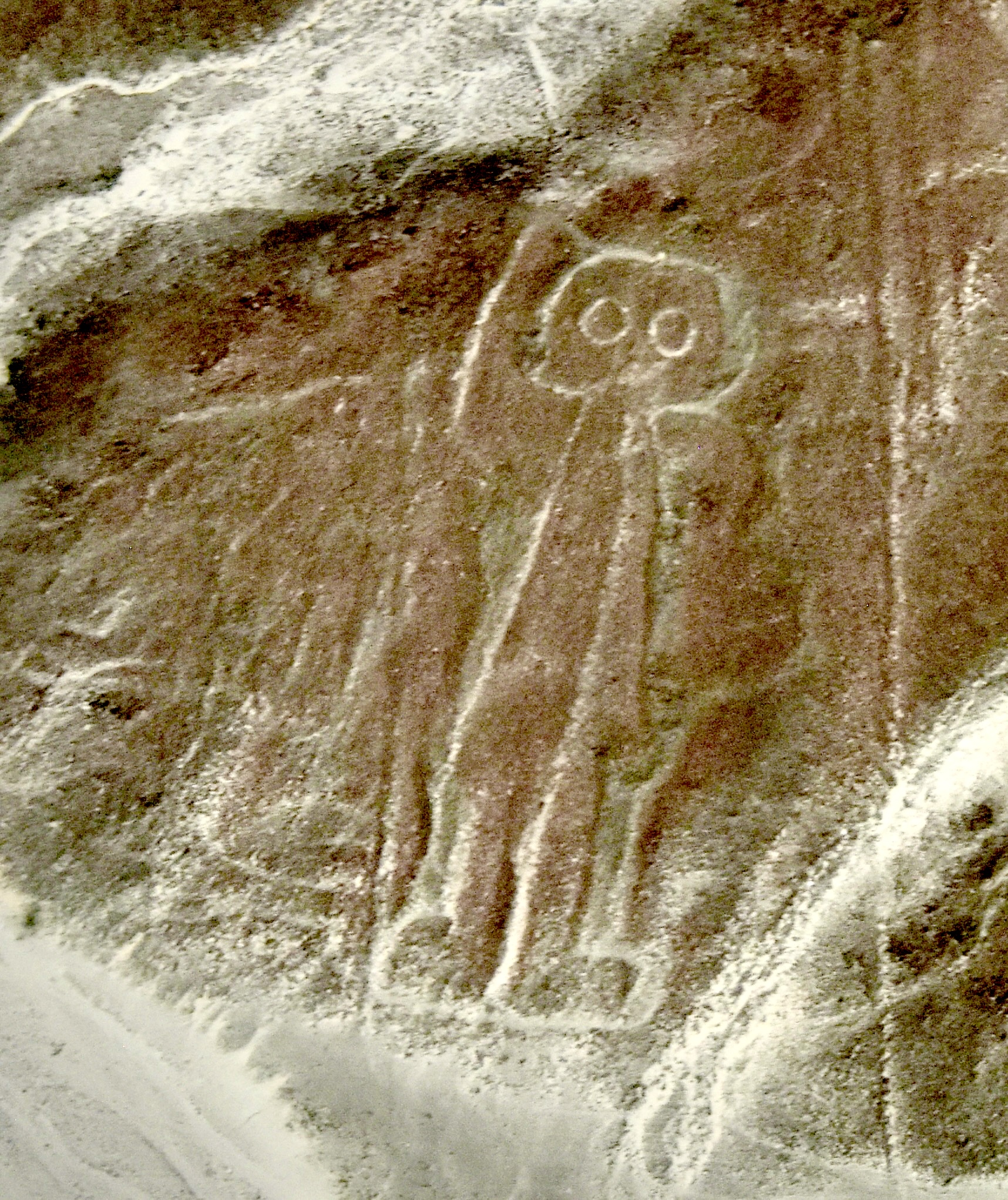
This is the Nazca lines astronaut or if you prefer, alien. Unlike all the other figures this one is on the side of a slope and not on the desert floor. He seems to be raising his right arm in a gesture of welcome.
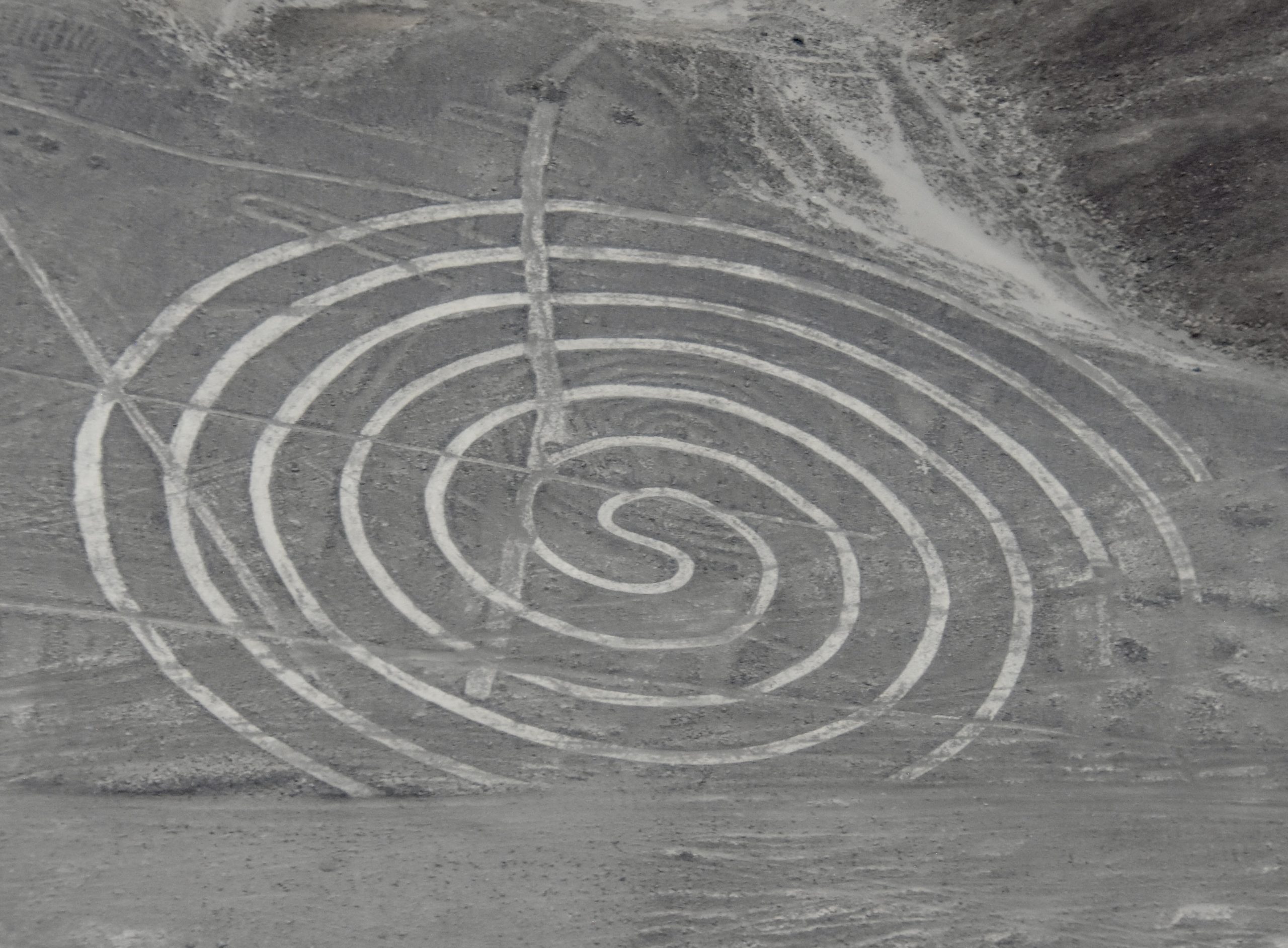
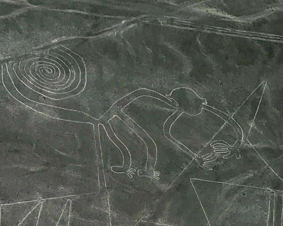
Following that we have the famous spiral which is really quite mesmerizing to see in person. If you look really closely you can see the remnants of a much smaller spiral within it. This may have been a Paracas era figure being overshadowed by a Nazca culture figure.
The first of the birds was the Palpa hummingbird which is really quite stunning.
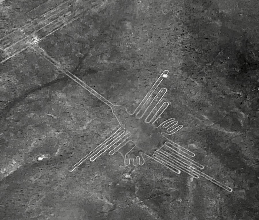
Let’s contrast to the Nazca lines figure simply known as The Hummingbird. To give you a little perspective, this figure is the size of a football field.
Other Nazca lines birds include the condor.
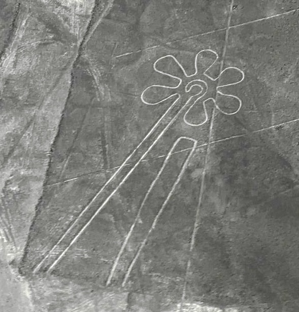
Then there are some simple shapes like the flower.
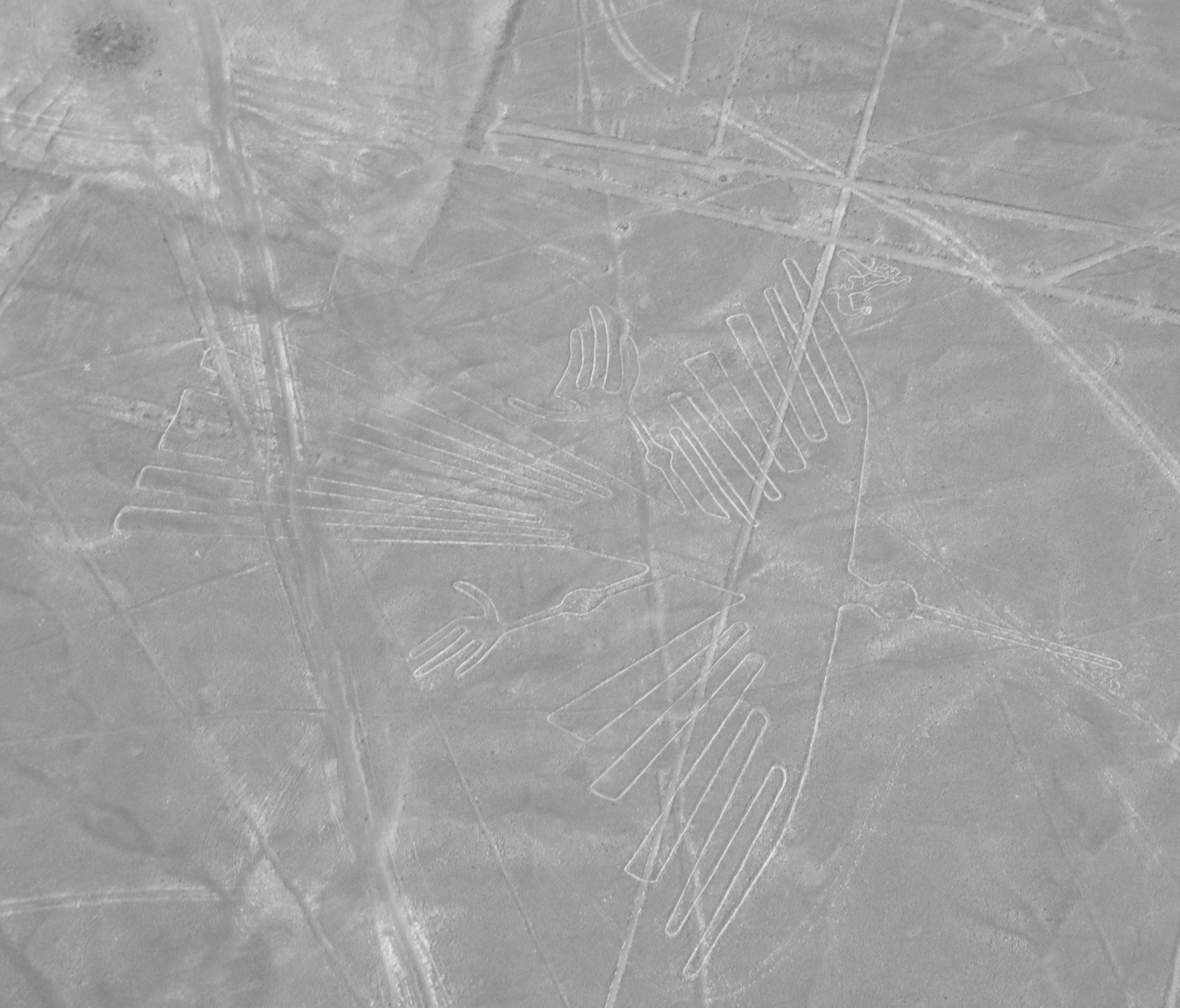
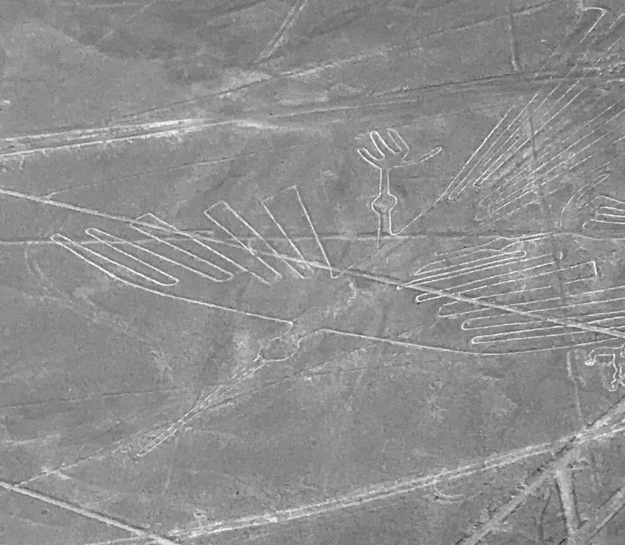
And the squiggly lines that have been identified as seaweed, although the map identifies it as the hands, but our pilot assured us it was indeed seaweed. You can also see the body of the heron.
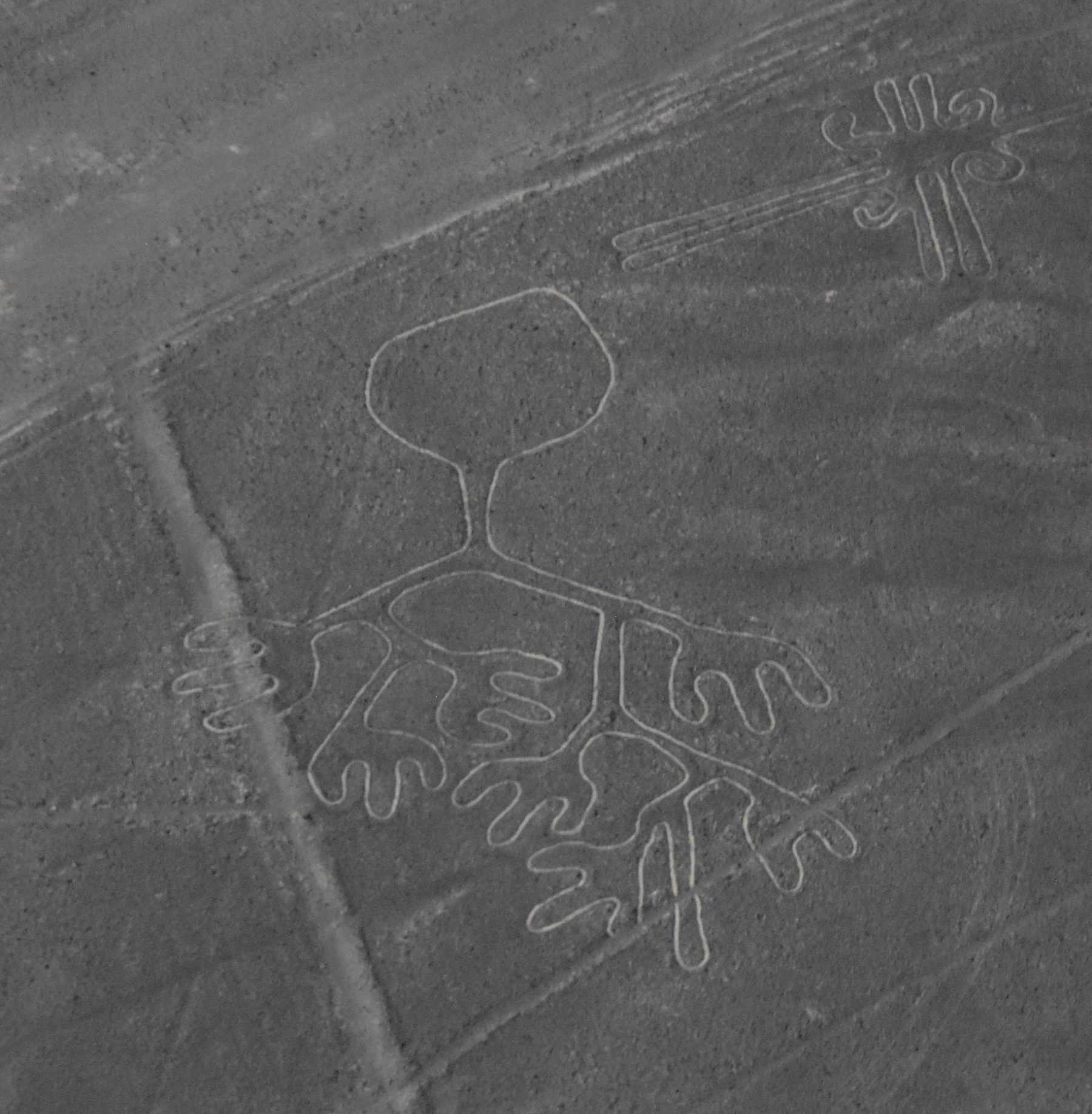
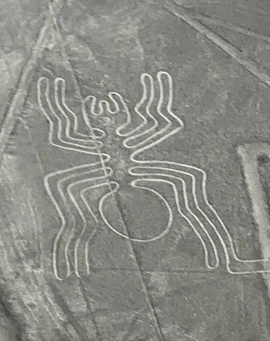
OK, enough with the flowers and seaweed let’s get to the stars of the show and the Nazca lines figures everyone wants to see, starting with the Spider.
And last and certainly not least, the Monkey. That alone is worth travelling great distances just to see; the rest is gravy.
I guess you’ve figured out that I was more than delighted with the Nazca Lines flyover, even if the light wasn’t as good as it could be. However, I think the photos I took speak for themselves. This is simply a one of a kind experience that cannot be duplicated anywhere else in the world. What a great way to kick off this trip.
In the next post we’ll do something almost as exciting as we visit Peru’s Ballestas Islands where I hope to add some new birds to my life list. I hope to see you on board.