Death Valley in Winter – Simply Awesome

I recently made my first and possibly last visit to Las Vegas which lived down to my expectations. After five days of total artificiality I couldn’t wait to get out of town to see something real, experience something natural and breathe fresh air. Looking at a map of the west, I realized that Death Valley was only a few hours away and given that it was the dead of winter decided that it probably would be a good time to visit. Turns out, for once, that was a great decision. Death Valley in winter is one of the most compelling places I’ve ever been to. Here’s why.
Las Vegas to Death Valley
There are a couple of ways to get to Death Valley from Las Vegas. The quickest is to take the I-15 southwest and then turn north on California 127 at the town of Baker. The more interesting route, and the one Alison and I took, is via Nevada 95 to the town of Beatty and then into Death Valley National Park via Highway 374. It’s more interesting because it goes by two very different tourist attractions, one completely ridiculous and the other a genuine western ghost town.
First the ridiculous.
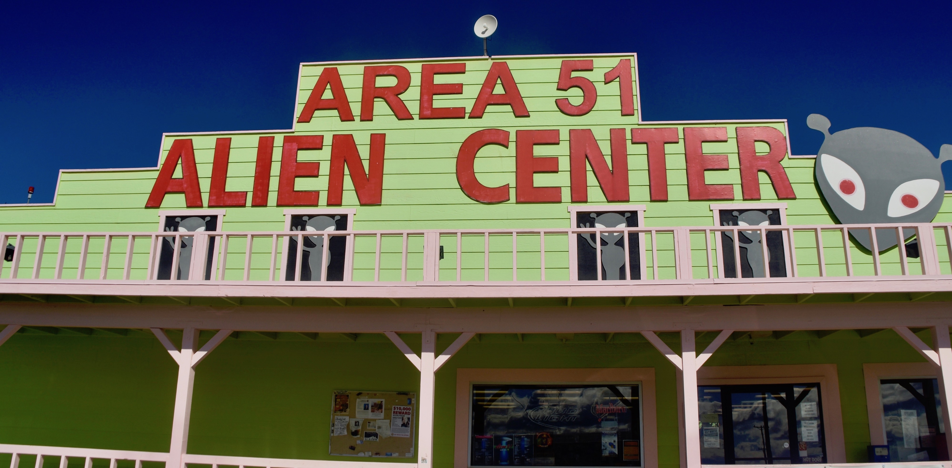
Area 51 is one of the absolute favourite sites on earth for conspiracy theorists. It is in fact a top secret government location spread over many square miles of desert that has spawned persistent claims that it contains the remains of aliens that crash landed on earth in the late 1950’s. UFO sightings in the area are off the charts, and for good reason. Read this article from Popular Mechanics for a logical explanation of what went on here during the Cold War and what continues today as a site for the testing of futuristic experimental aircraft.
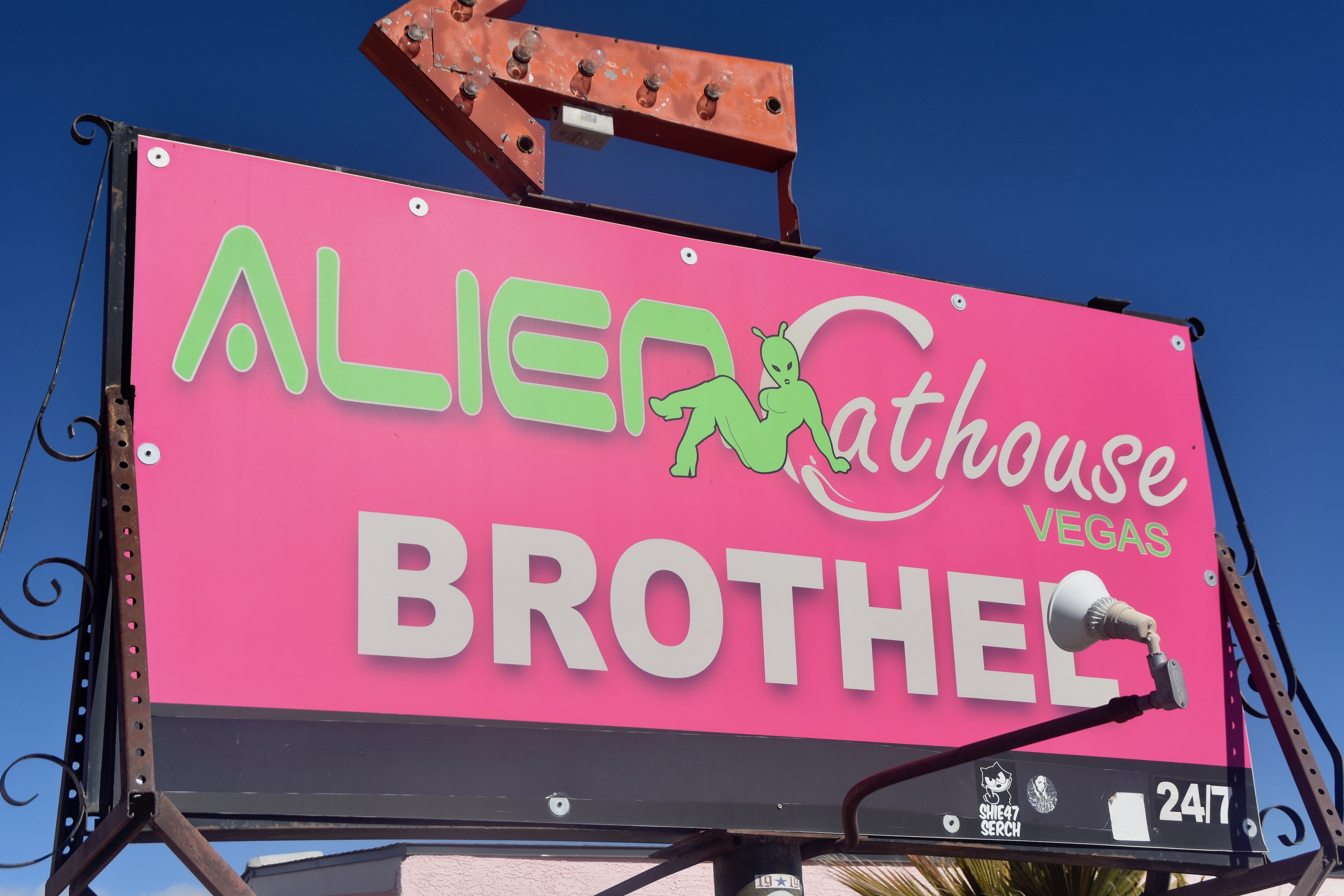
The very few people who live on the periphery of Area 51 have taken full advantage of its outré reputation. The Area 51 Alien Center is really just a general store and restaurant doing a booming business selling alien related souvenirs. If you are really desperate you can go out back and get yourself entertained at the Alien Cathouse Brothel, which advises that it’s under new management. I understand they are bringing in a higher class of aliens.
Back on the road you travel through the Amargosa Desert which looks pretty bleak, but in reality has a lot of wildlife if you know where to look. I don’t, and only see one hell of a lot of tumbleweeds.
Rhyolite
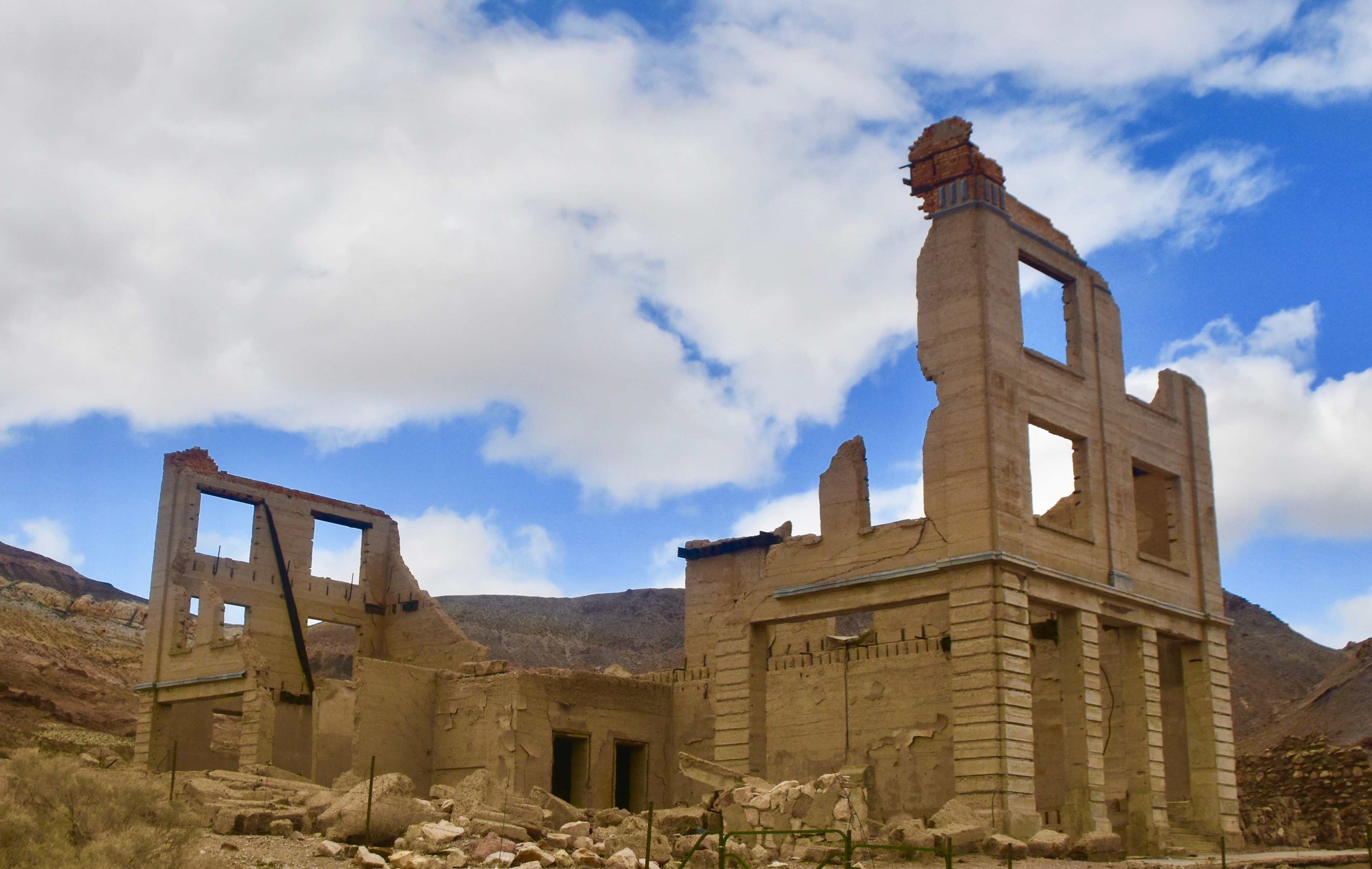
Just outside Beatty where you turn left on Highway 374 towards California there is a sign for the town of Rhyolite, which is actually an honest to goodness ghost town. Rhyolite was founded in 1904 as part of a mini gold rush and lasted only twelve years before being abandoned, but in that time up to 5,000 people lived here. There were schools, a hospital, electric lights, a water system, a stock exchange and many saloons and brothels. That’s hard to fathom as you drive into Rhyolite today. There are still a couple of people living here, but it’s not a tourist attraction in the traditional sense. You just park your car and walk around the few buildings remaining.
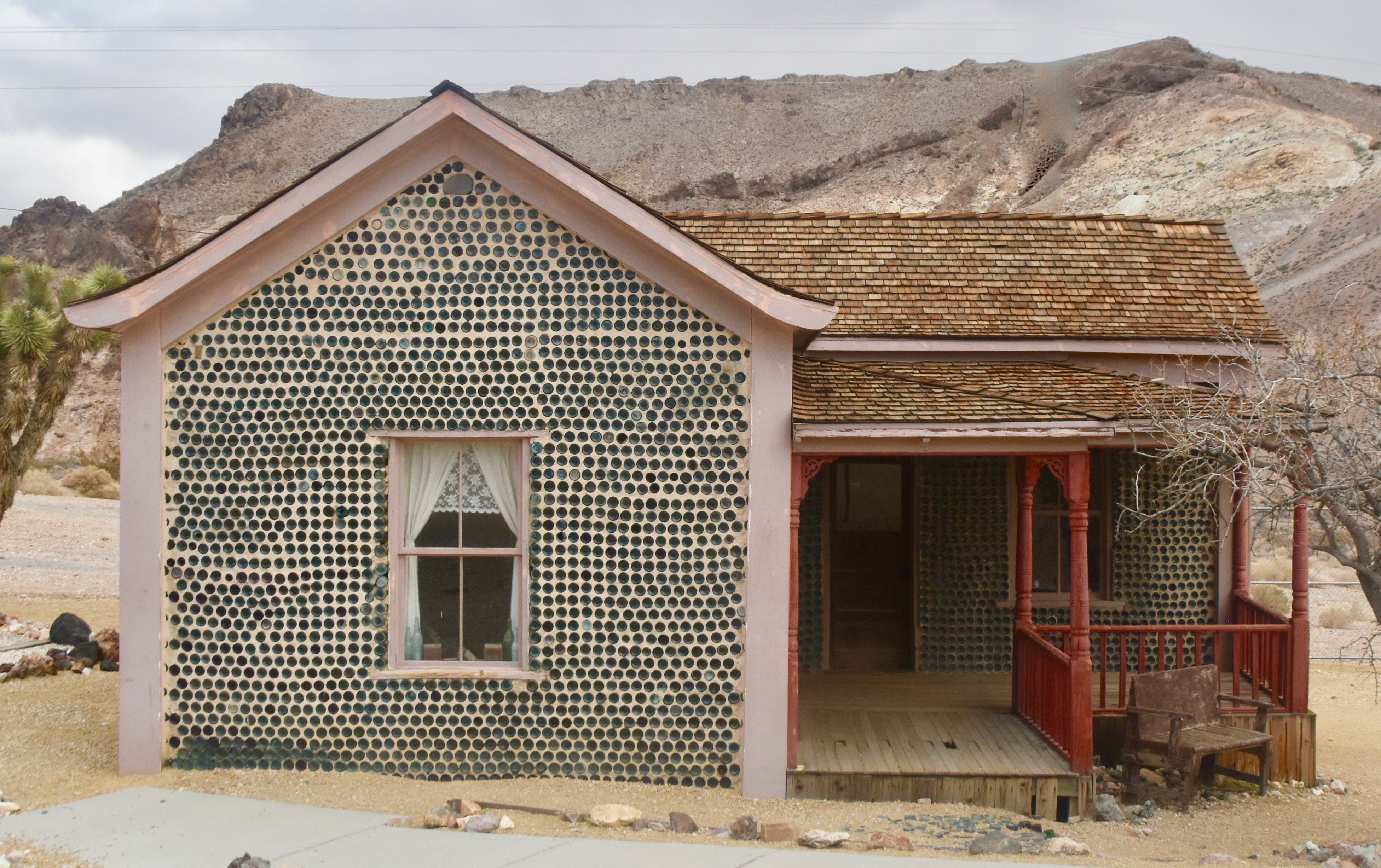
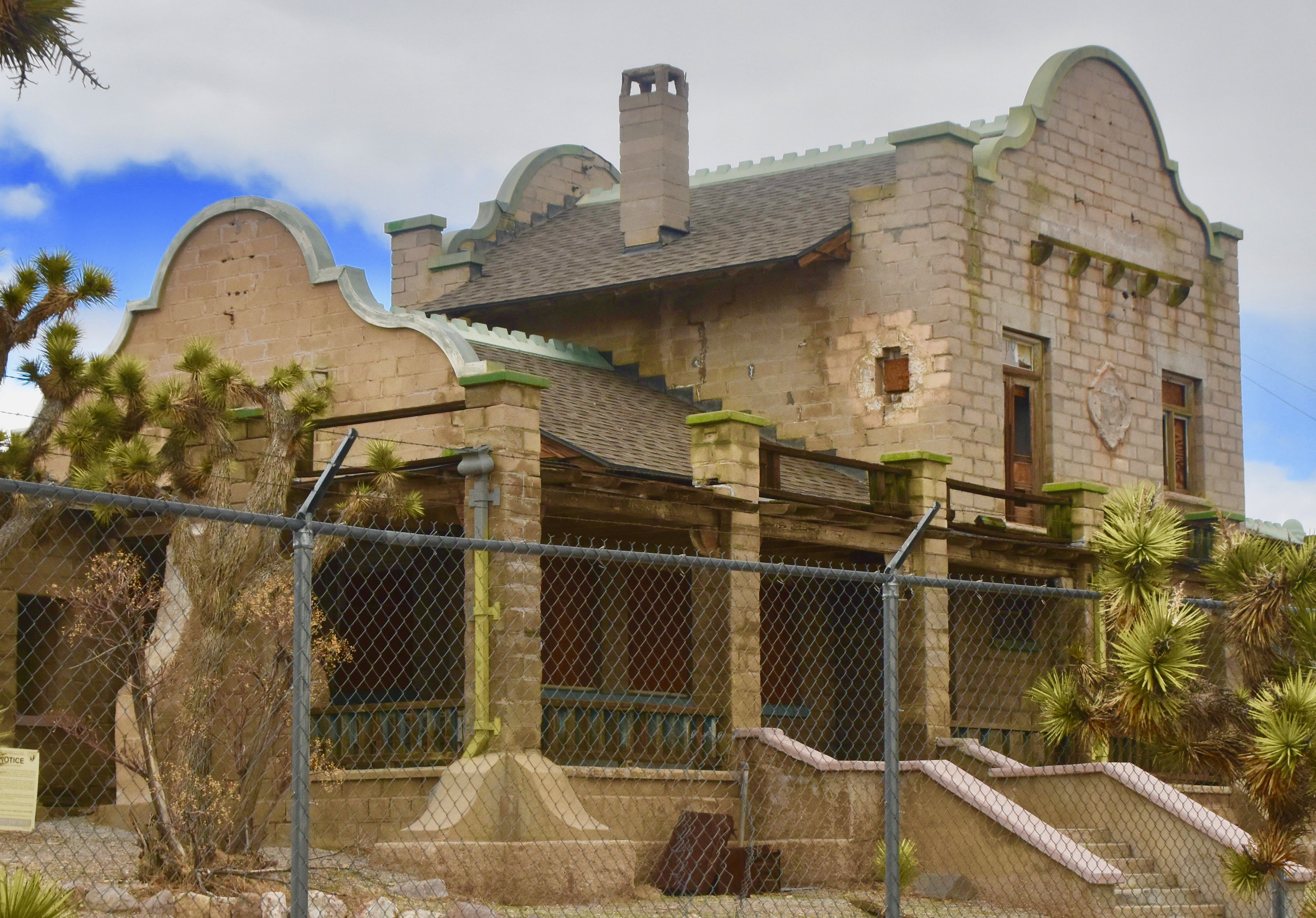
The most famous building is this one made almost entirely from green beer bottles that Tom Kelly collected from the 50+ saloons that once thrived in Rhyolite. It is one of the few buildings that is still maintained and not just left to naturally decay.
Ones that aren’t maintained include the remnant’s of the Cook Bank which once looked like this.
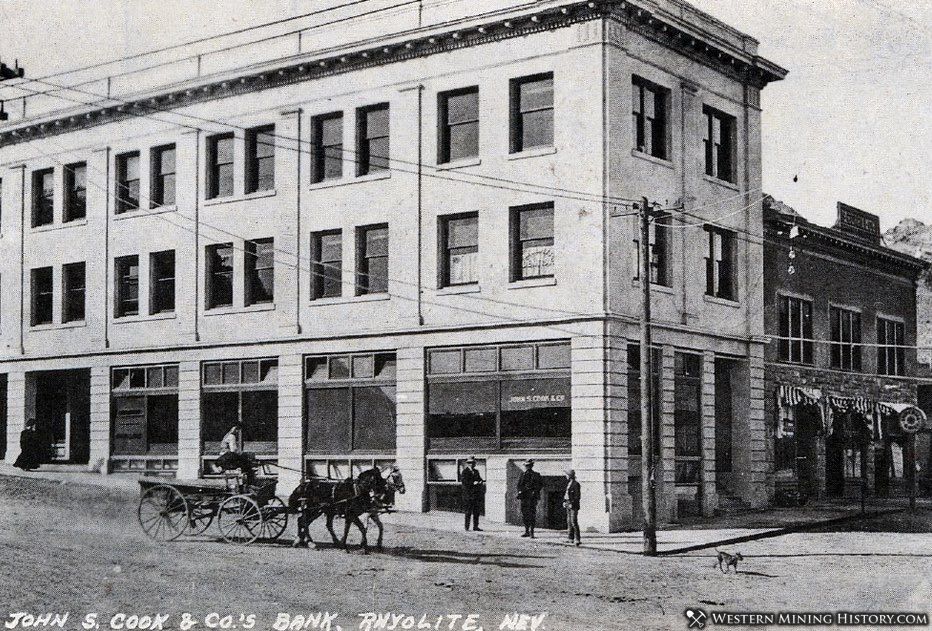
And now looks like this.
The old train station.
If you ever think that things will always stay the same no matter what we do to the environment, just visit a place like Rhyolite where they once lived the Life of Riley.
Death Valley National Park
After leaving Rhyolite the highway rises sharply as it crests the Grapevine Mountains that straddle the California/Nevada border. Before getting into California you enter Death Valley National Park which actually extends into Nevada.
In terms of being a record setting place Death Valley N.P. is a record setter on its own. How about these records? It’s the hottest place on earth – a temperature of 134°F (56.6ºC) was measured at Furnace Creek in 1913. A subsequent claim of a temperature of 136°F (58°C) in the Libyan desert in 1922 has apparently been debunked as inaccurate so Death Valley remains the title holder.
It’s the lowest point in North America. Badwater Basin sits 282 feet below sea level.
It’s the driest place in North America, averaging less than 2½ inches of rain a year. Compare that to where I live in Nova Scotia – it rains or snows 166 days of the year and adds up to nearly 60 inches of precipitation.
Lastly, Death Valley is the largest national park in the continental United States.
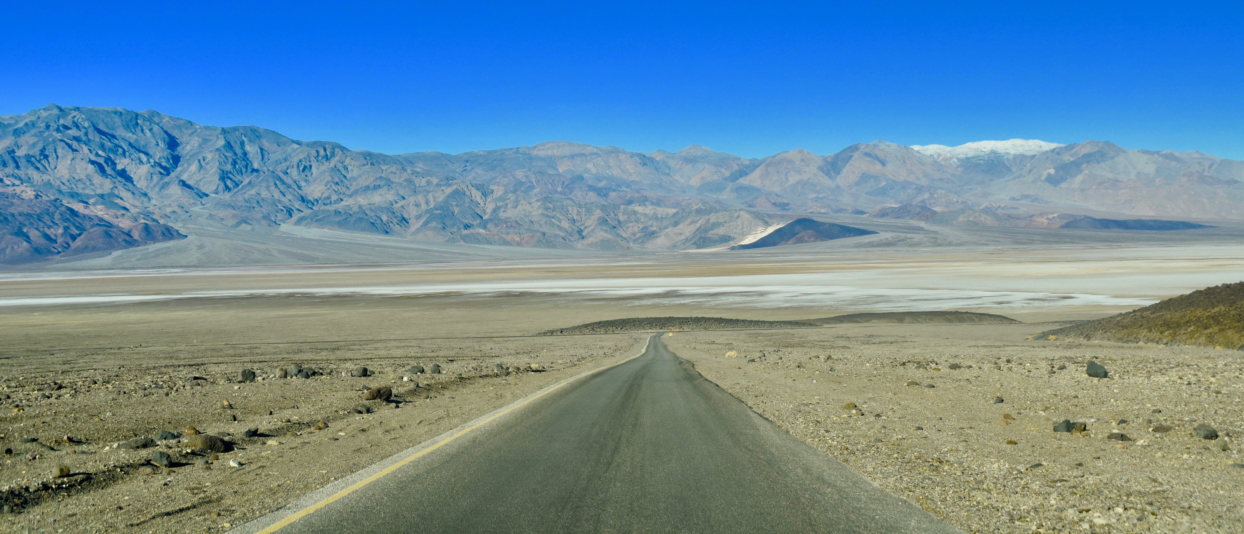
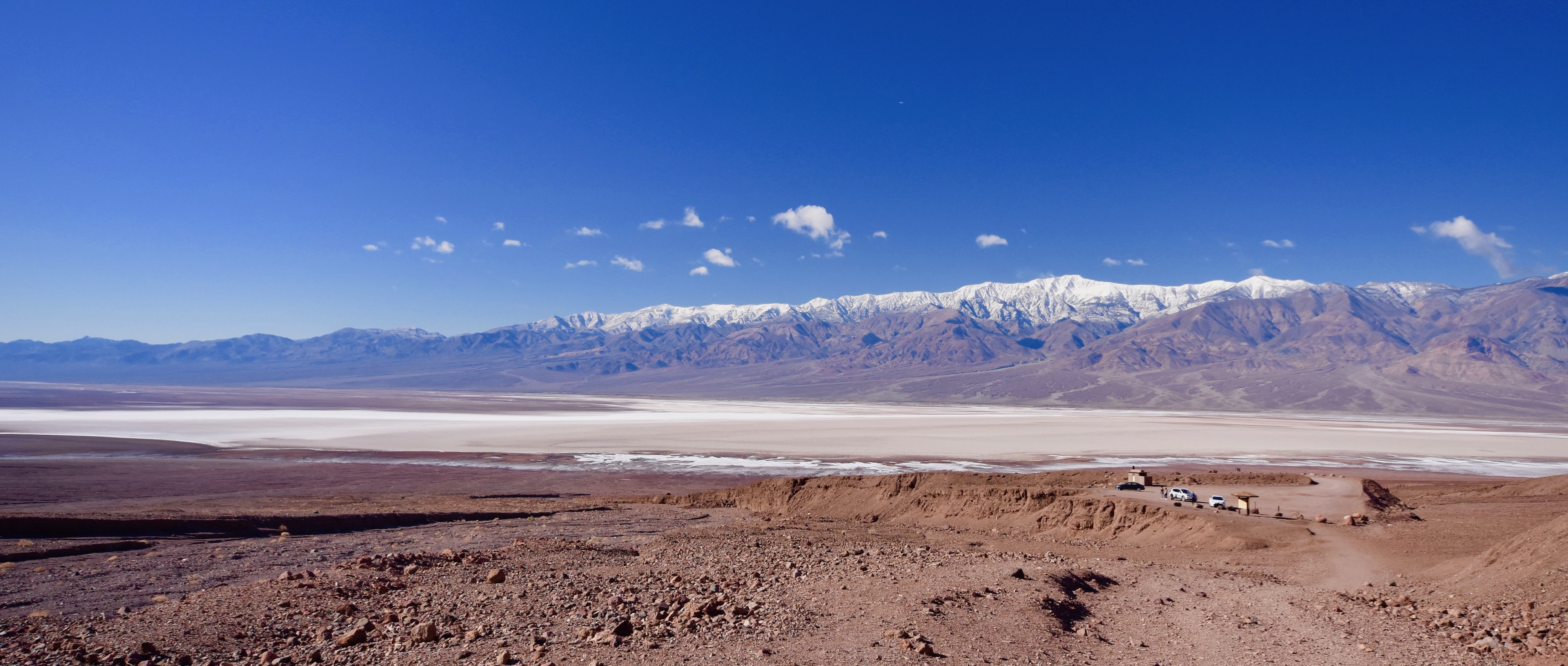
So its a big, dry, hot and low place which is kind of weird because we keep going up, not down. But then, about five miles into California, you come quite suddenly upon this vista.
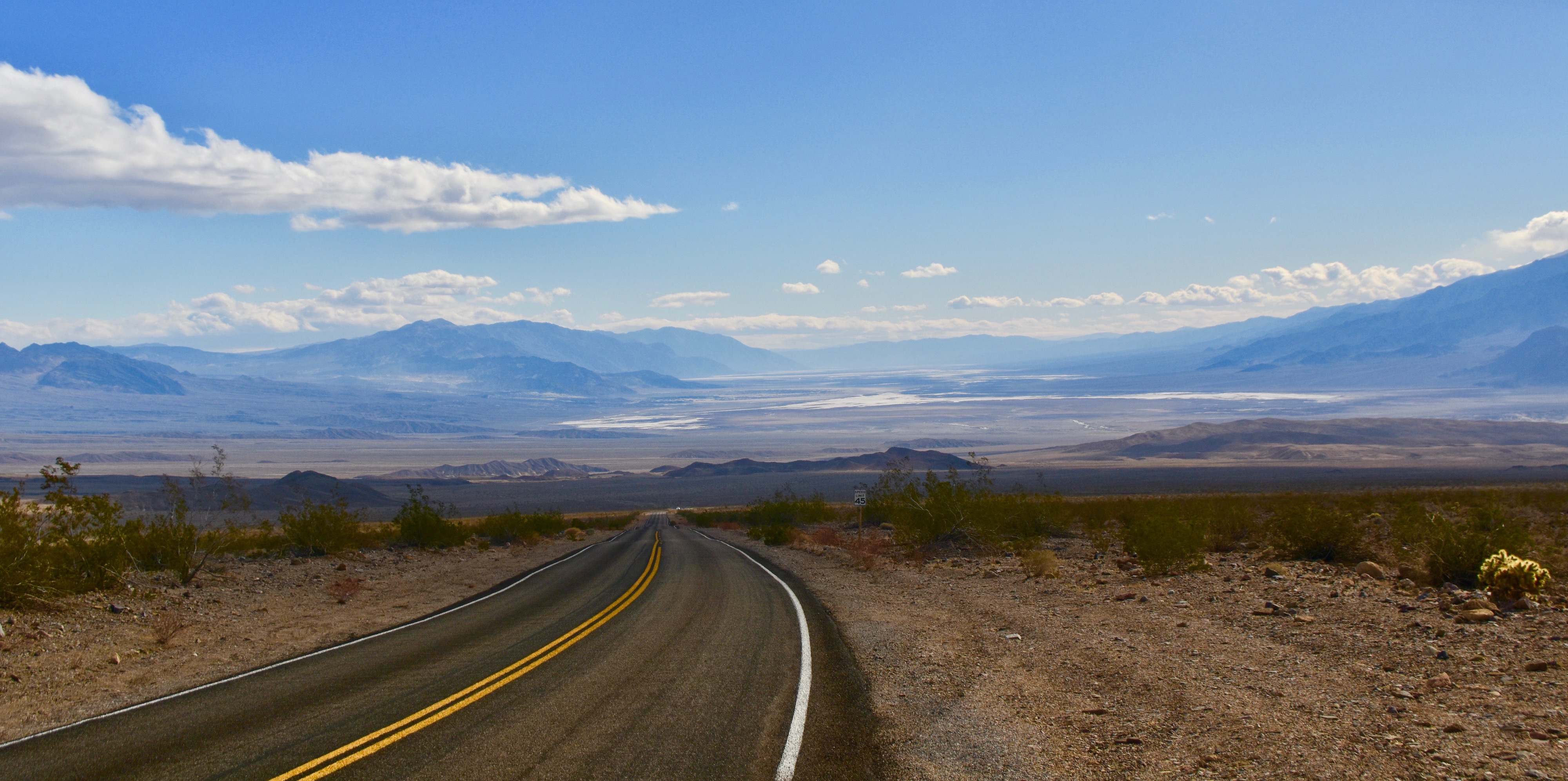
There it is, laid out below and surrounded by mountains on all sides. The white spots are salt flats. Now the highway goes, down, down, down and you get one of those great western panoramas with the seemingly endless road going on and on and on. It’s difficult to explain in words, but this was a view I had seen many times in movies, TV series and documentaries, and yet it was completely different actually being here. Nothing can prepare you for the first look into Death Valley.
Furnace Creek
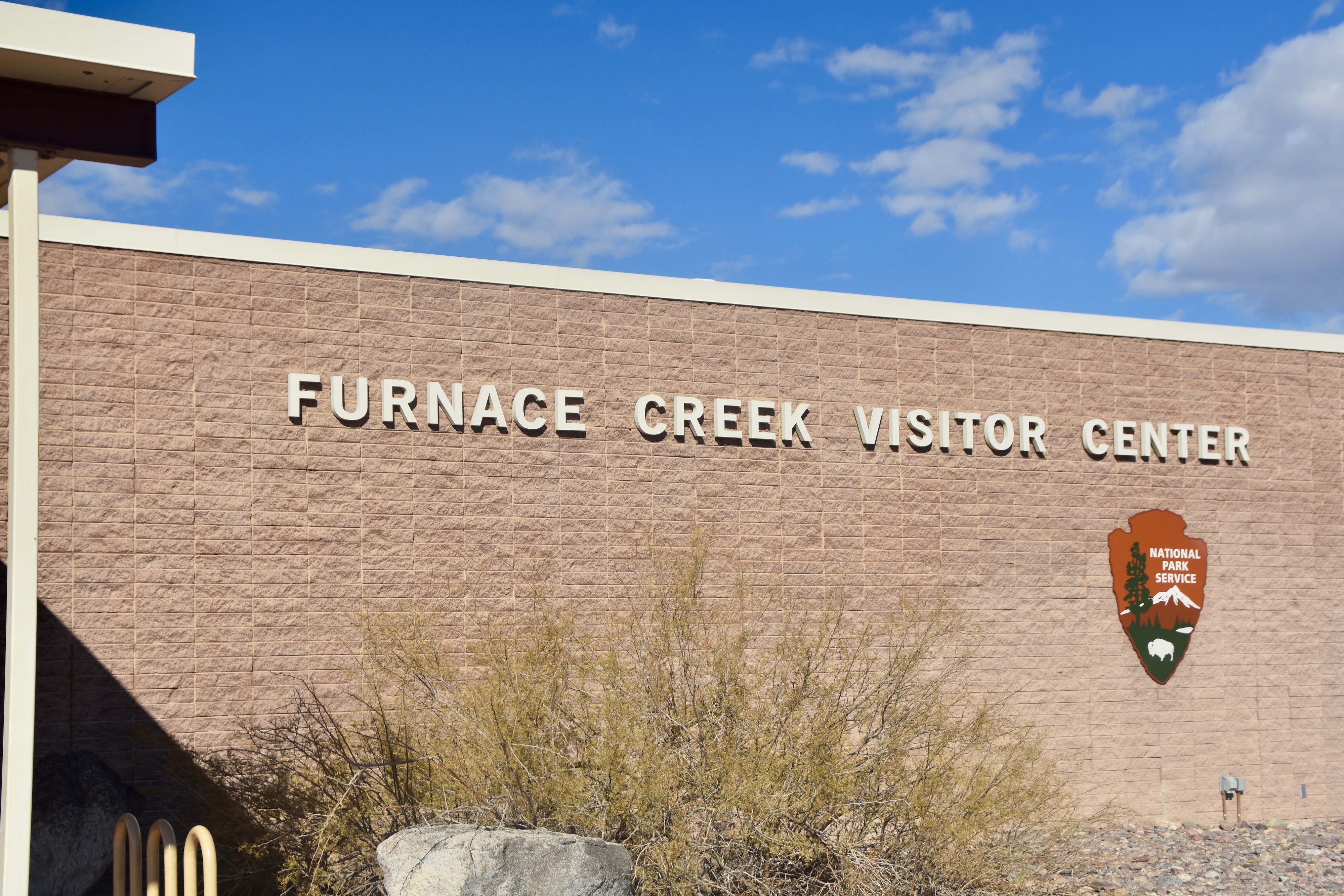
As if the name Death Valley does not conjure up images of, well death, then Furnace Creek only adds to the inferno scenario. It is the only place of any substance in Death Valley and the park headquarters. We checked out the Furnace Creek Visitor Center and got some suggestions as to what to see on a fly through visit like we were making. We then checked into the Ranch at Death Valley which I had booked the night before. It is one of two properties that comprise the Oasis at Death Valley. The other is the 90 year old Inn at Death Valley which was roughly two and a half times as much as the Ranch. I think we made the right choice because pretty well all of the resort’s amenities are at the Ranch including Last Kind Words Saloon, the general store/gift shop and the lowest golf course on earth. The ribs were great at the saloon and the room at the Ranch more than acceptable so I didn’t feel like we were missing anything, except a much higher bill, by staying at the Ranch.
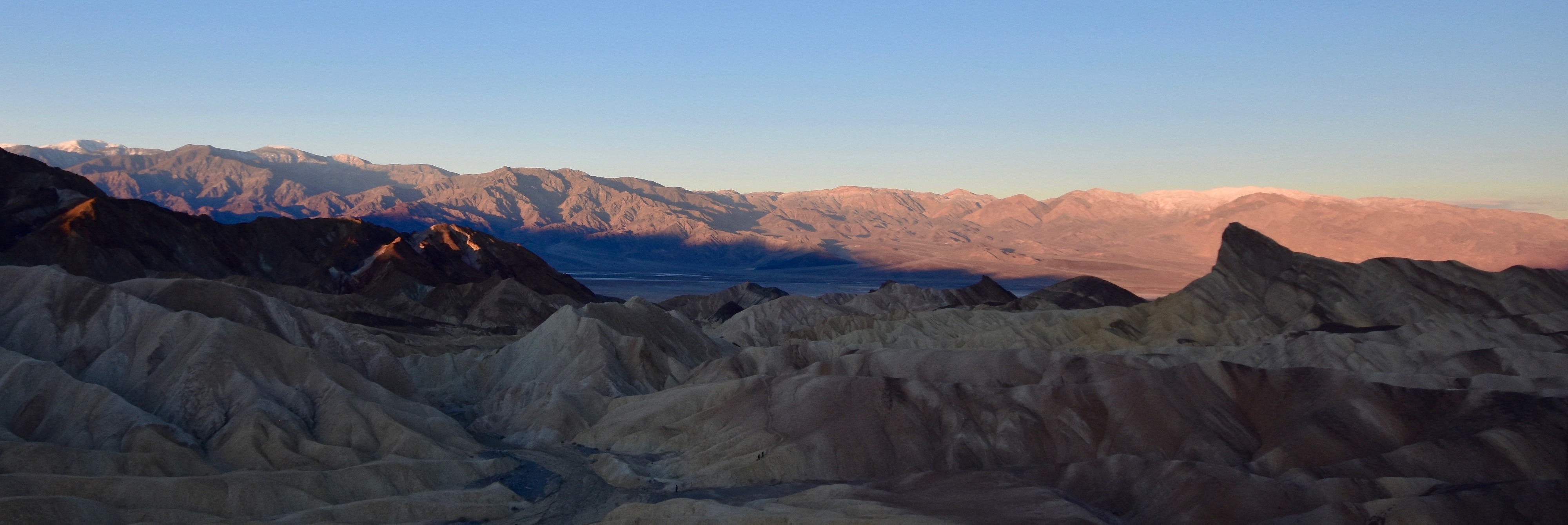
Zabriskie Point
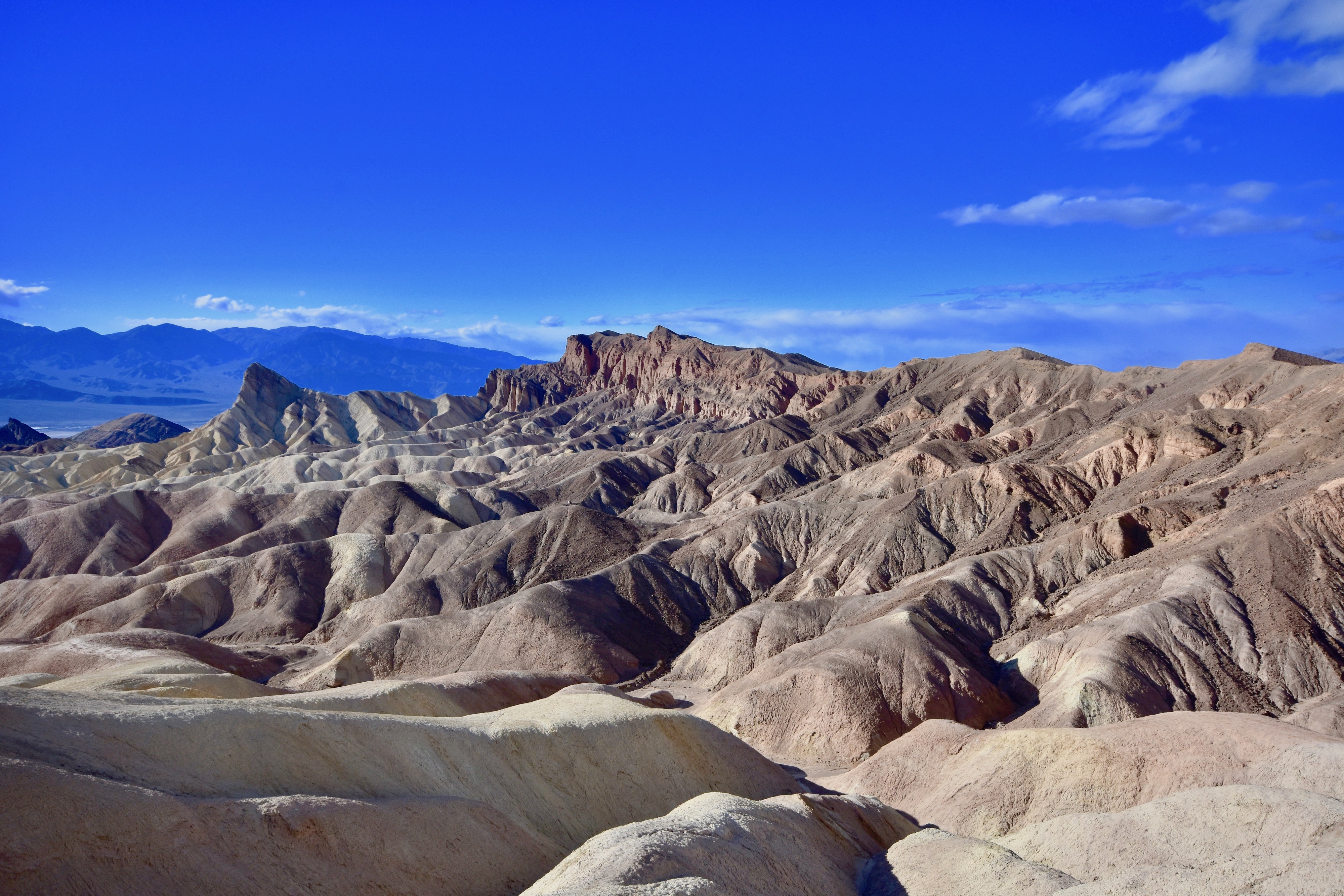
As I mentioned, we got some suggestions at the Visitor Center on what to see in Death Valley and these included the view from Zabriskie Point, Artist’s Palette, the natural bridge and Badwater Basin.
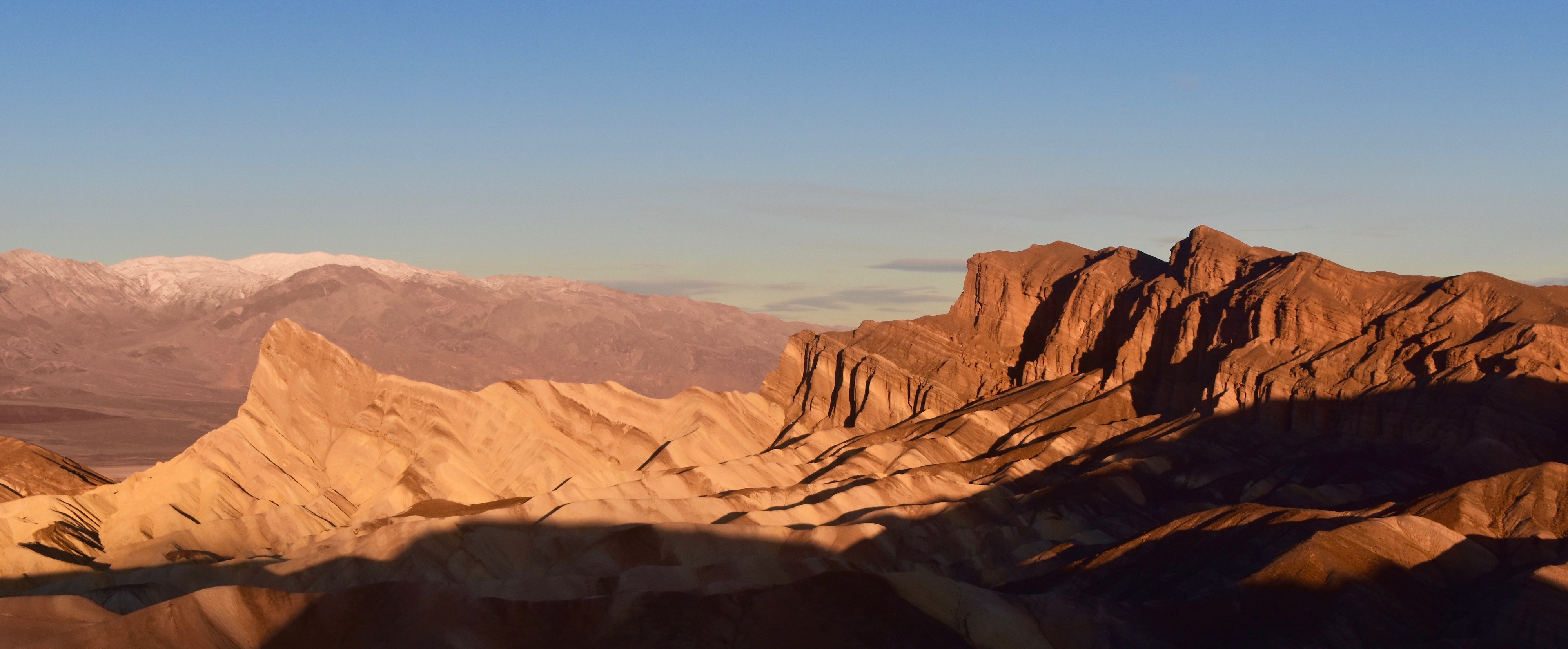
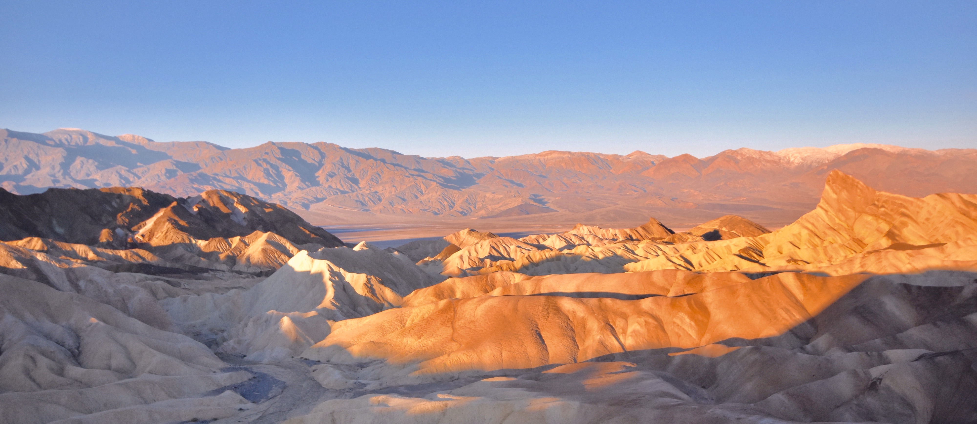
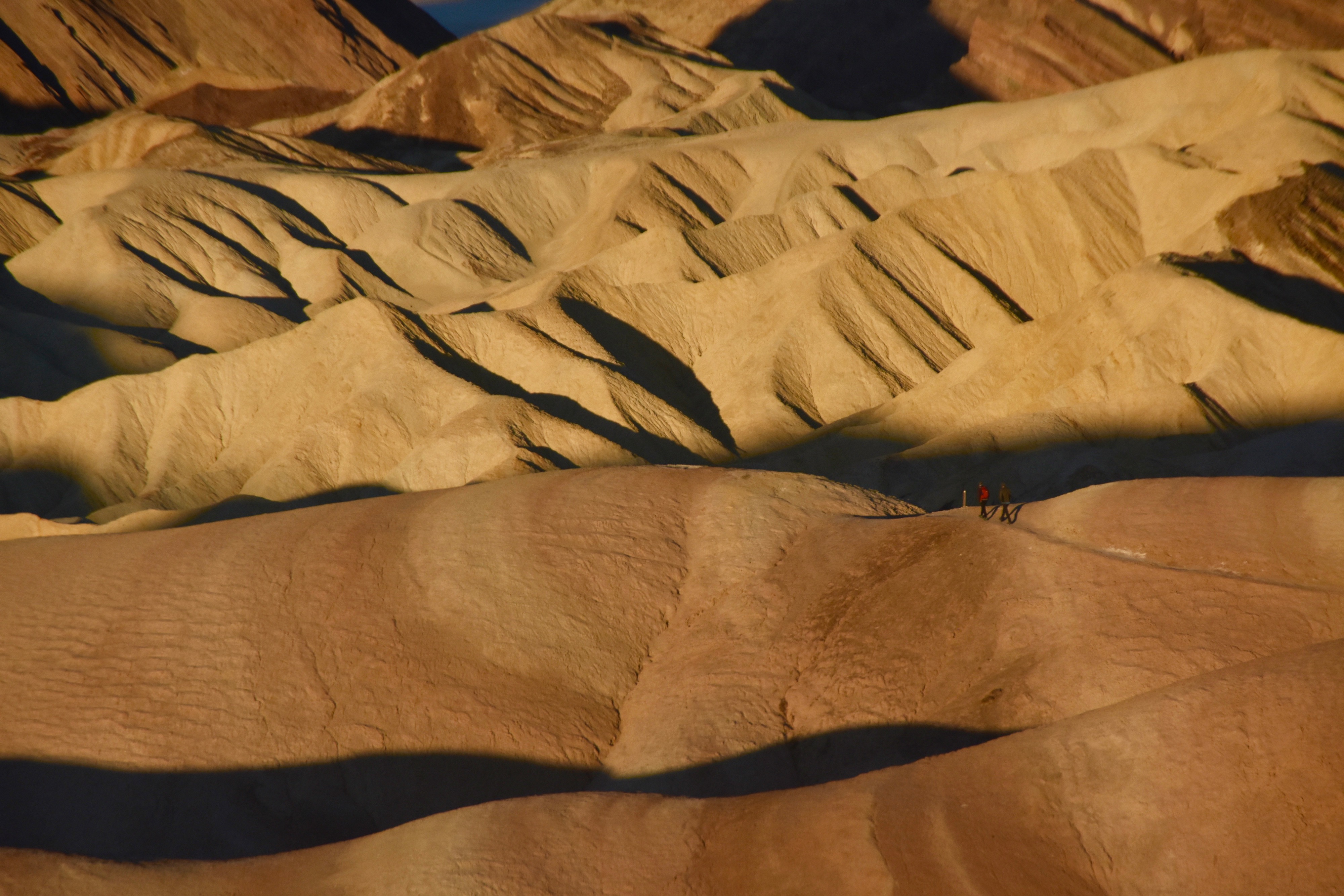
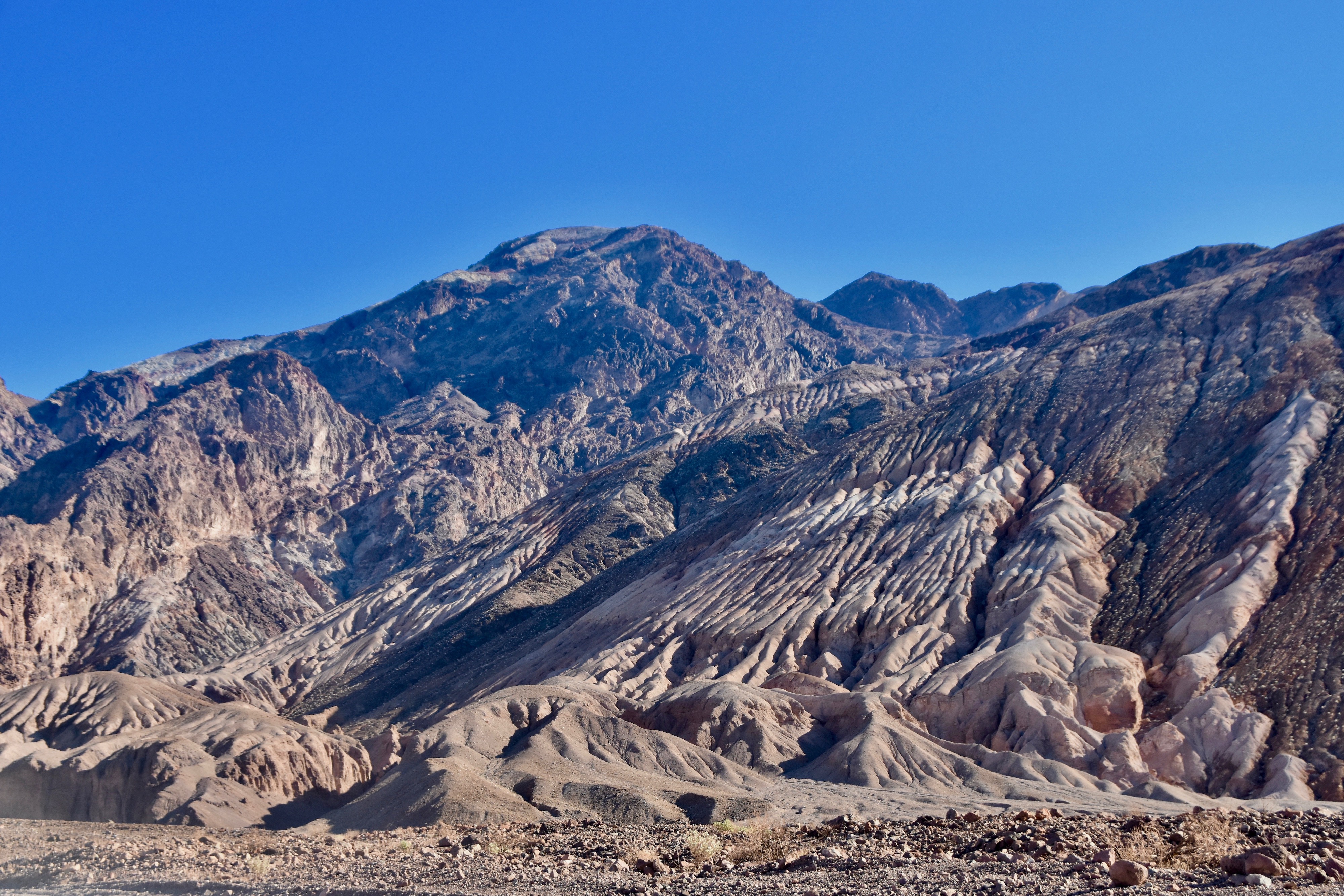
The first stop was a short drive to Zabriskie Point which has perhaps the most well known views in all of Death Valley. There’s a parking lot and then a short walk up a paved path from where you get a 360º view. I went to Zabriskie Point twice. The first was in the afternoon after we checked in. The photo above and the one below illustrate the yellows, browns and blacks for which the area is famous. Those might not sound like the most exciting of colour combinations, but along with the contours and the ever changing shadows, Zabriskie Point is definitely worth your while.
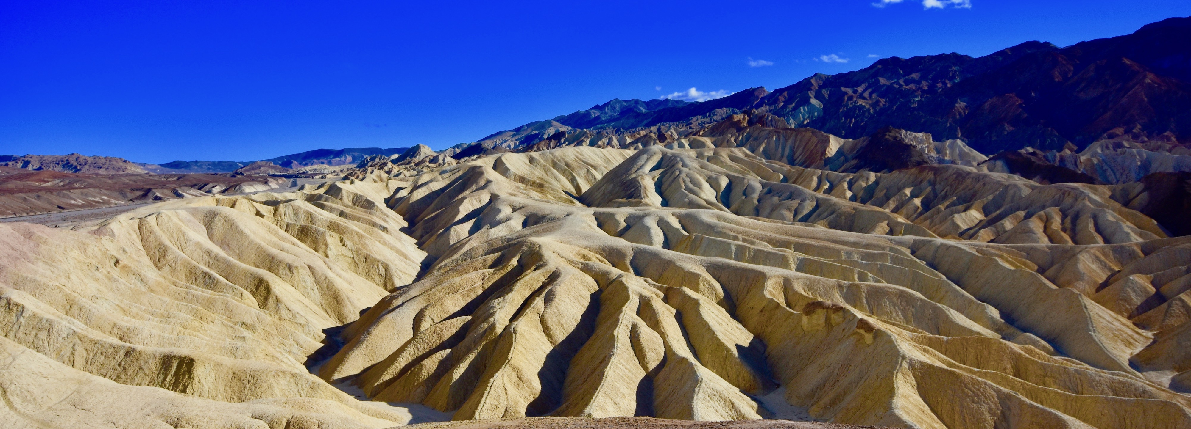
This is a wide angle shot looking in the opposite direction.
It was while I was at Zabriskie Point that I figured out something that had been at the back of my mind since that first long descent into Death Valley. That was just how amazingly clear the air was and how it created an almost surreal affect on the landscape. Everything in my field of vision was super crisp and super sharp. A camera cannot capture the subtlety of this effect on the human eye. You really have to be there to experience and understand it.
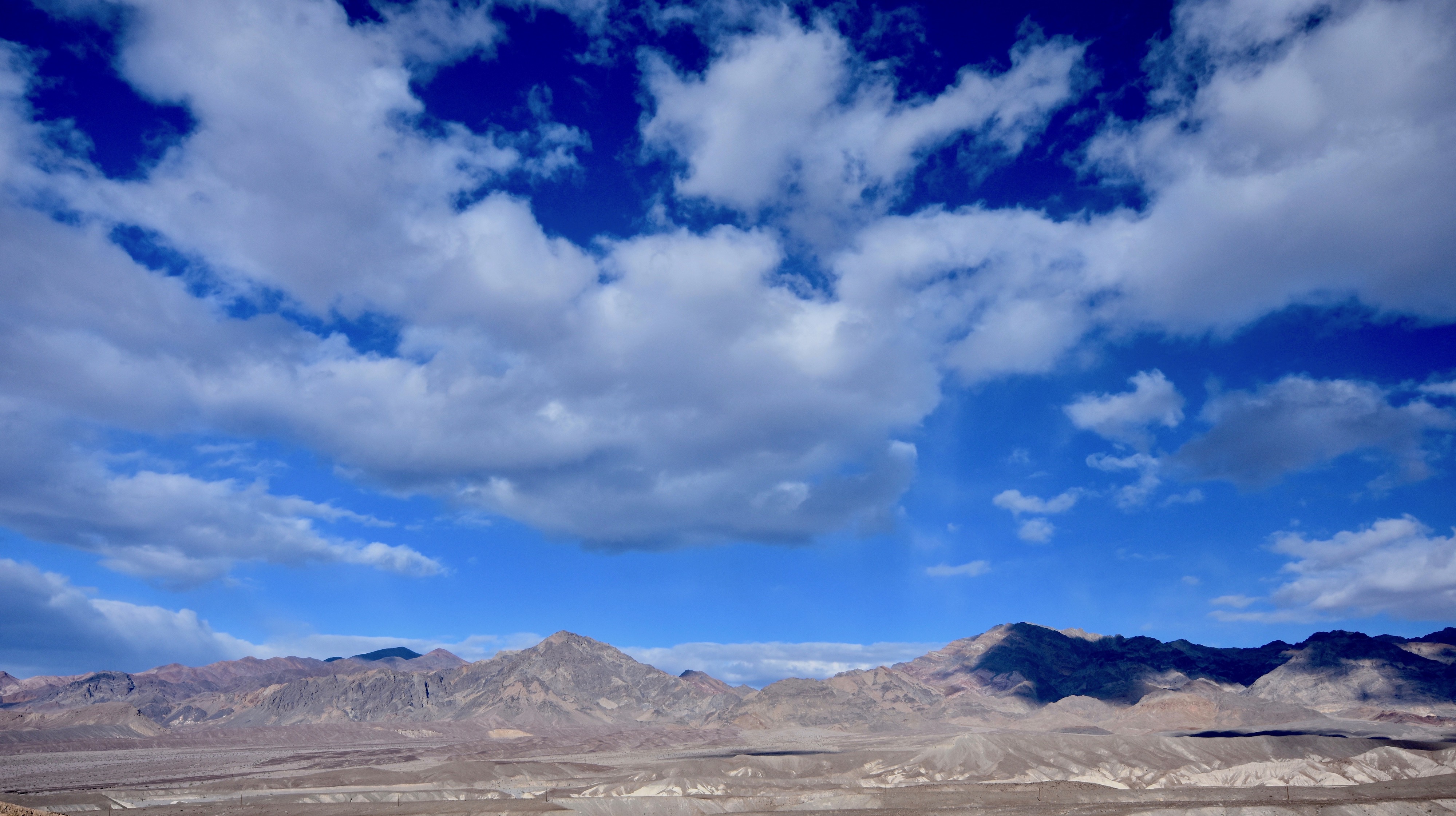
While Zabriskie Point is great at any time of day or night, it draws a crowd for sunrise and that included us. I’ve not mentioned the weather. It was actually quite chilly and about as cold as it ever gets in Death Valley – you can how our fellow sunrise watchers are dressed.
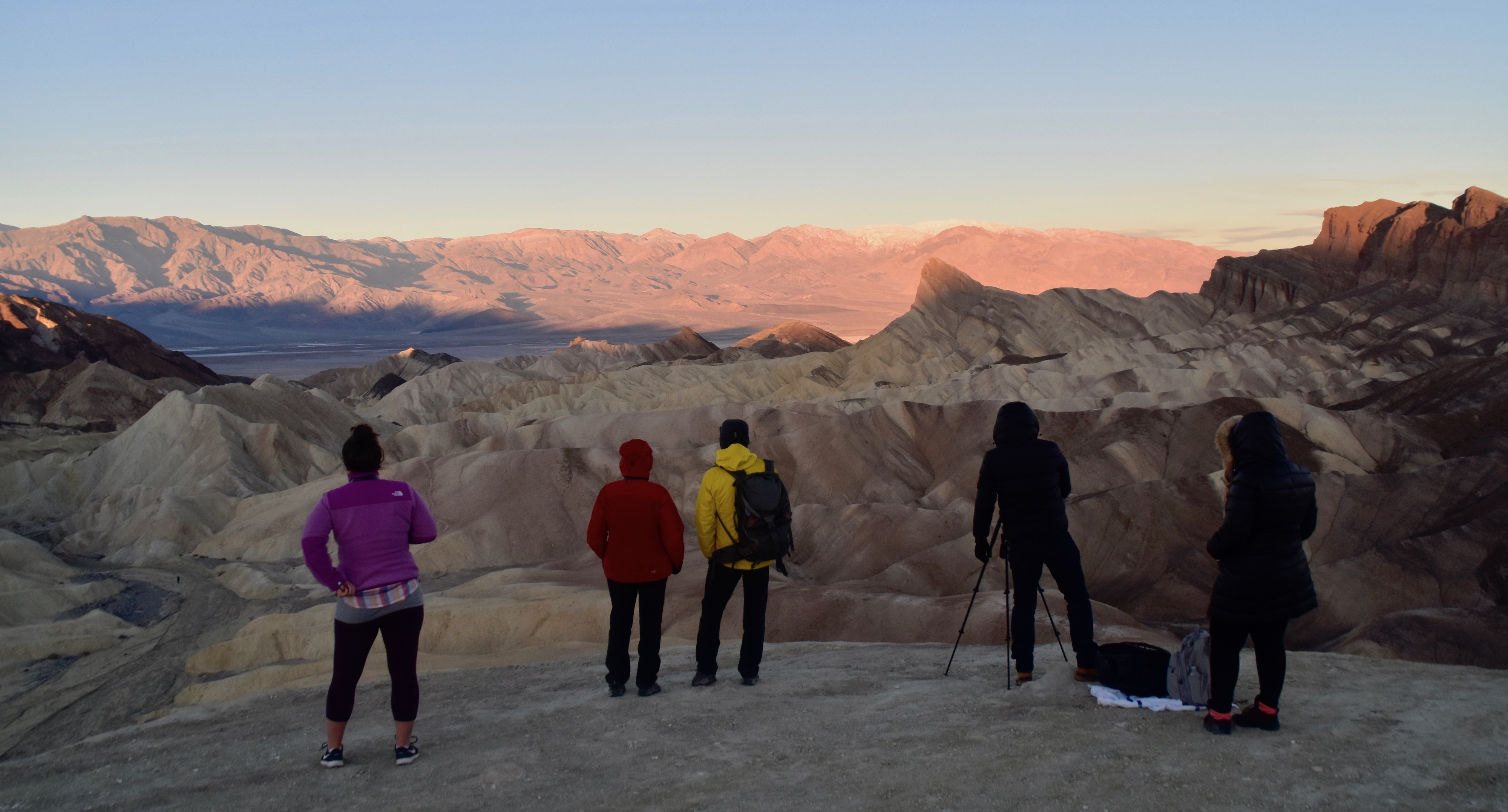
Contrary to any sun up watching I’ve done in the past, at Zabriskie Point you look to the west and not the east.
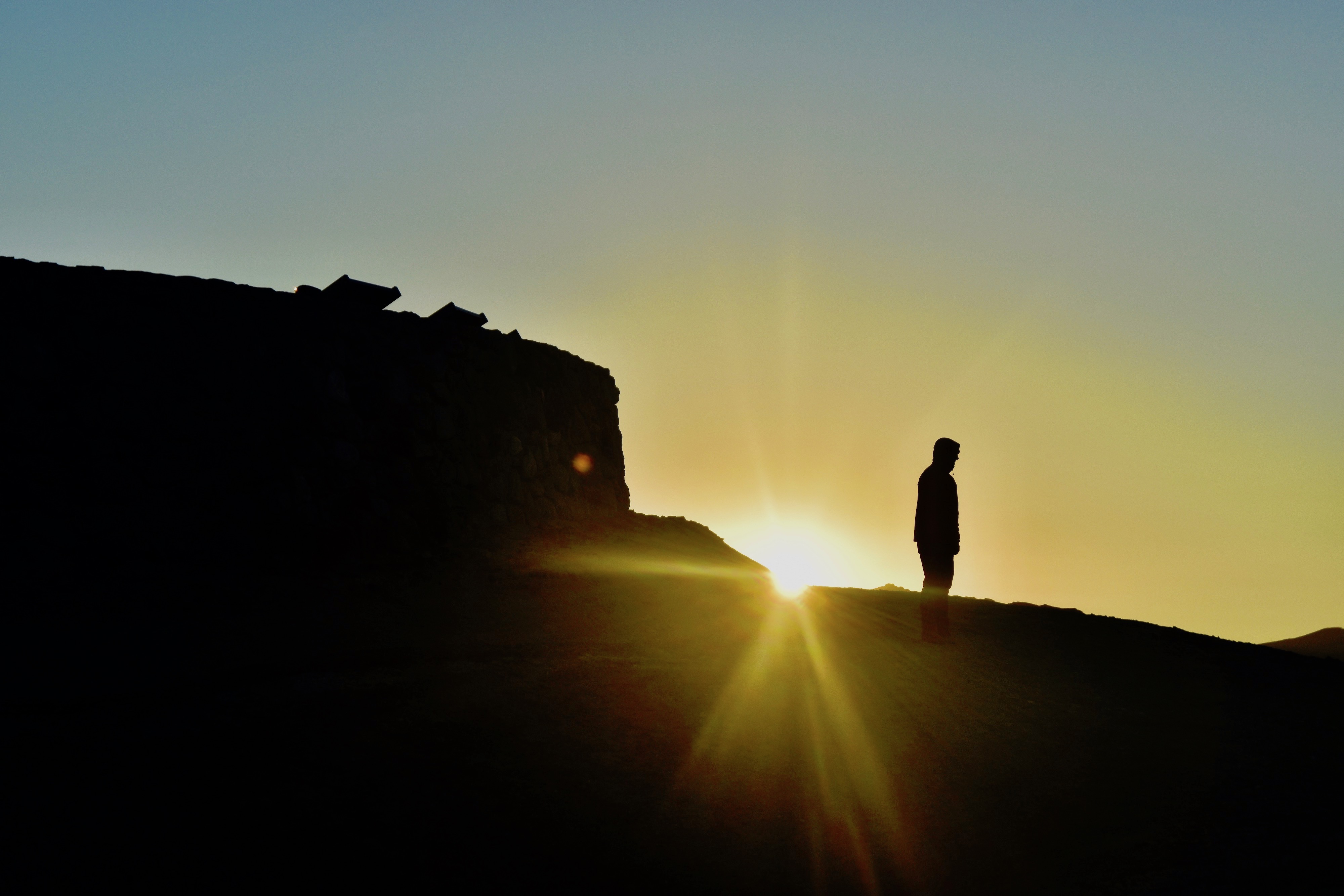
The sun comes up from behind and begins to roll back the shadows starting on the distant mountains and gradually, like a curtain being drawn ever so slowly open, colour replaces monochrome in a display that is wonderful to see.
Hikers head out at dawn to make their way towards Golden Canyon to enjoy being bathed in this delicious sunlight that is not intolerably hot.
PS – If the name Zabriskie Point jogs some sort of memory it’s probably because it is also the name of a controversial 1970 movie by Italian director Michelangelo Antonioni of the same name that featured a lengthy love scene/orgy, take your pick, on Zabriskie Point.

Artist’s Palette, Death Valley
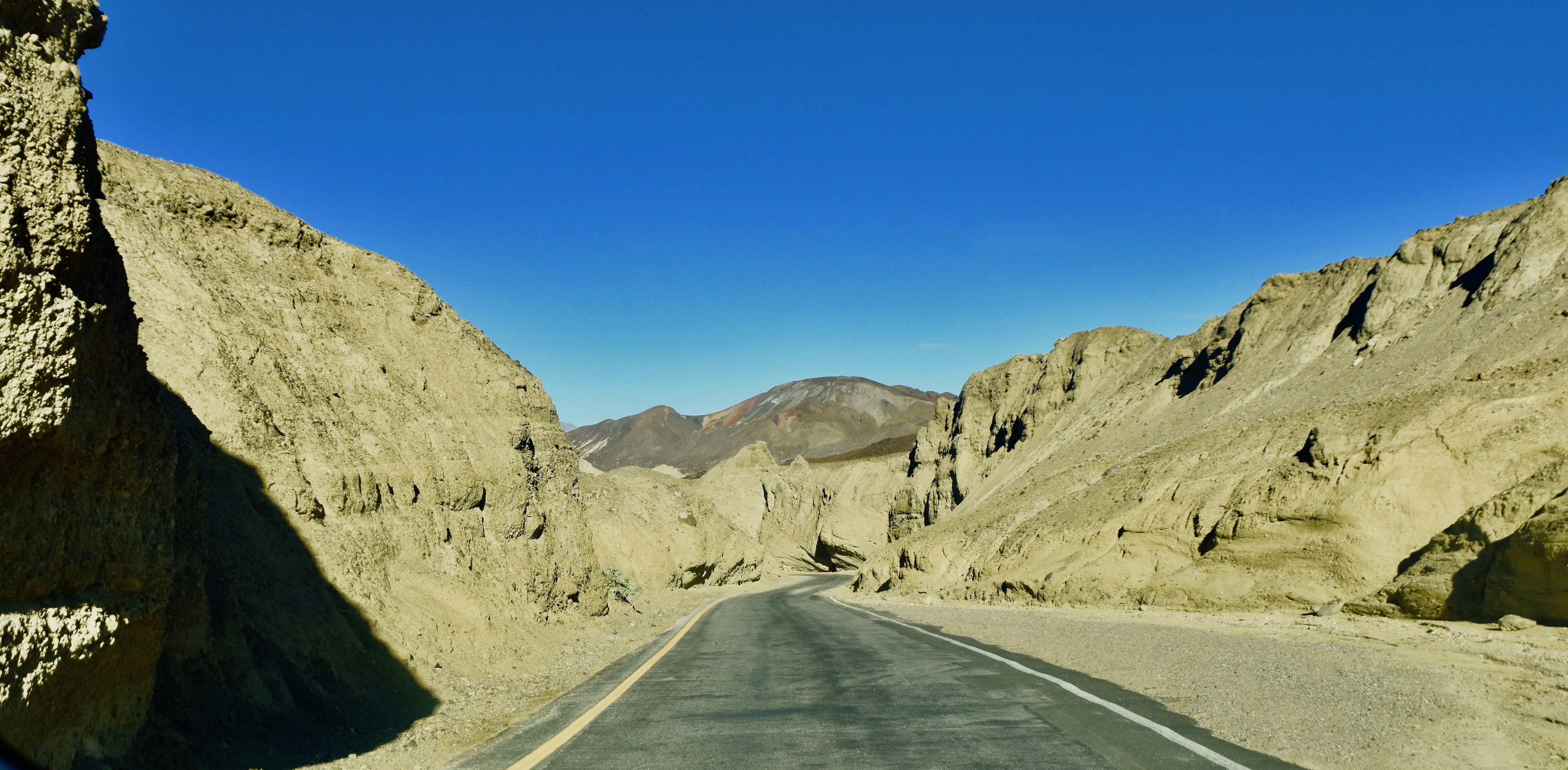
There are two north south routes in Death Valley. Highway 190 which most people take and Highway 178 which most people should take instead. The latter provides access to four must see stops in Death Valley – Artist’s Palette, the Devil’s Golf Course, Natural Bridge and Badwater Basin, in that order heading south from Furnace Creek.
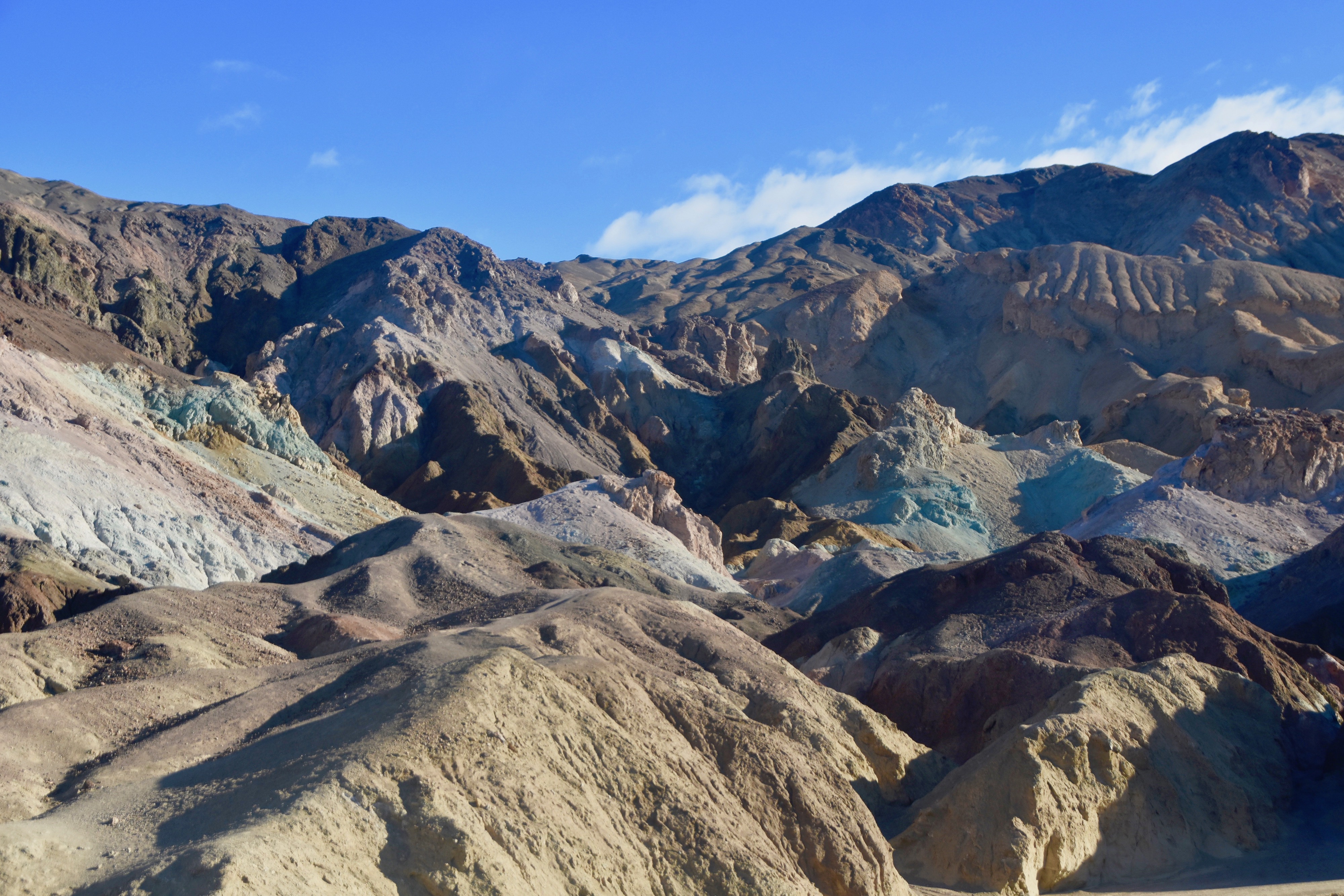
Artist’s Palette is the main reason to take the 9 mile (14½ km.) one way Artist’s Road that makes a loop through a portion of the Death Valley badlands, but it’s not the only reason. The drive itself is interesting, in places winding its way through narrow canyons and in others providing views of the multi-coloured layers of oxidized volcanic debris that many have likened to the dabs of paint on an artist’s palette.
 Artist’s Drive
Artist’s Palette is a viewpoint from which one can get the best view of this phenomena. If you look on the web you will likely find pictures like this, which are probably photoshopped.
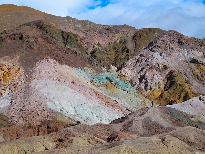
However, even without photoshop Artist’s Palette is pretty amazing. The greens and pinks really do stand out from the brown background.
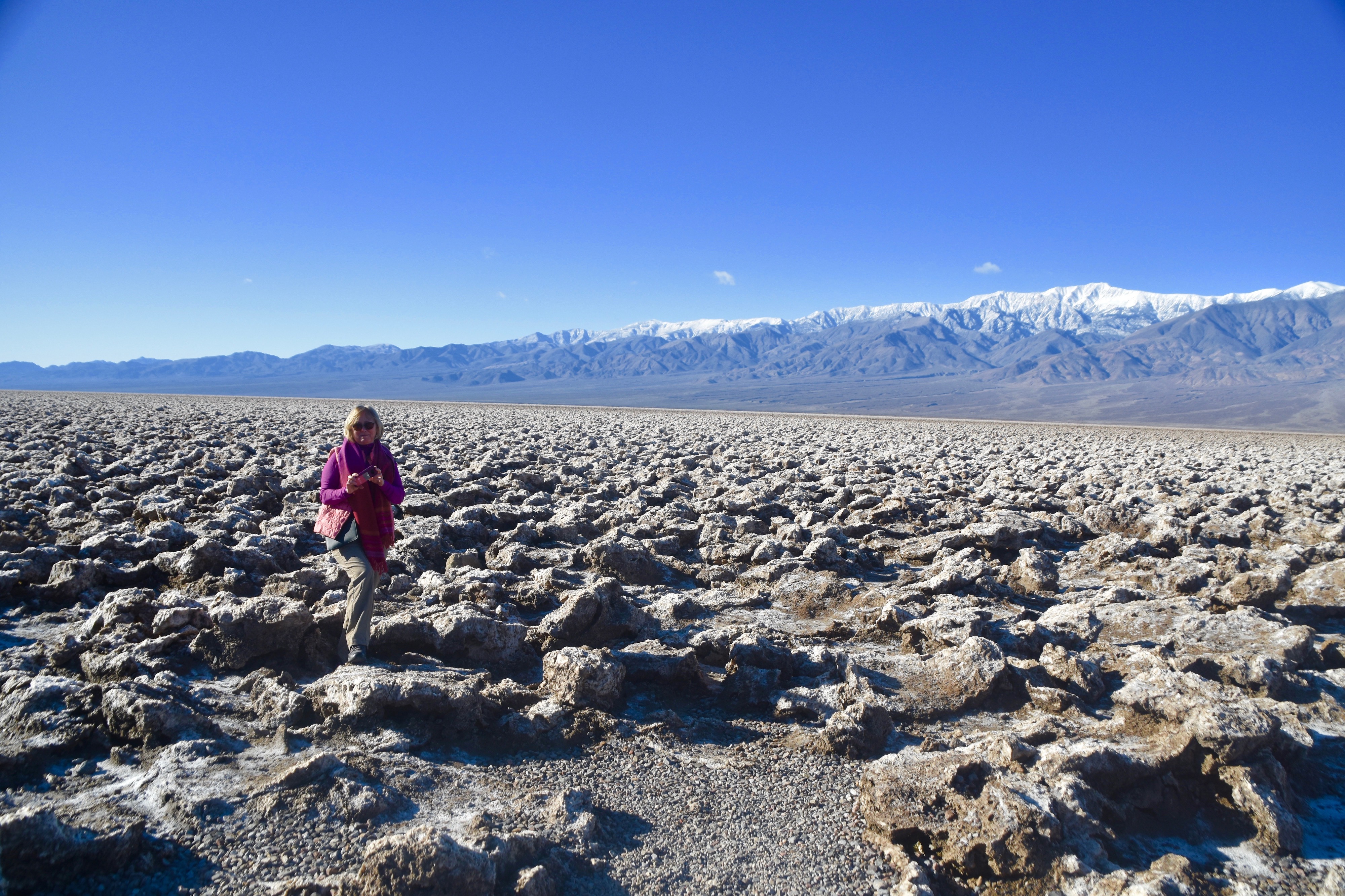
The Devil’s Golf Course, Death Valley
Next up on the Route 178 hit list is the Devil’s Golf Course, something that could not be more different from Artist’s Palette than if the devil had planned it himself. Instead of turning into the mountains, this side road takes you directly into the flat bottom of Death Valley where you come to this.
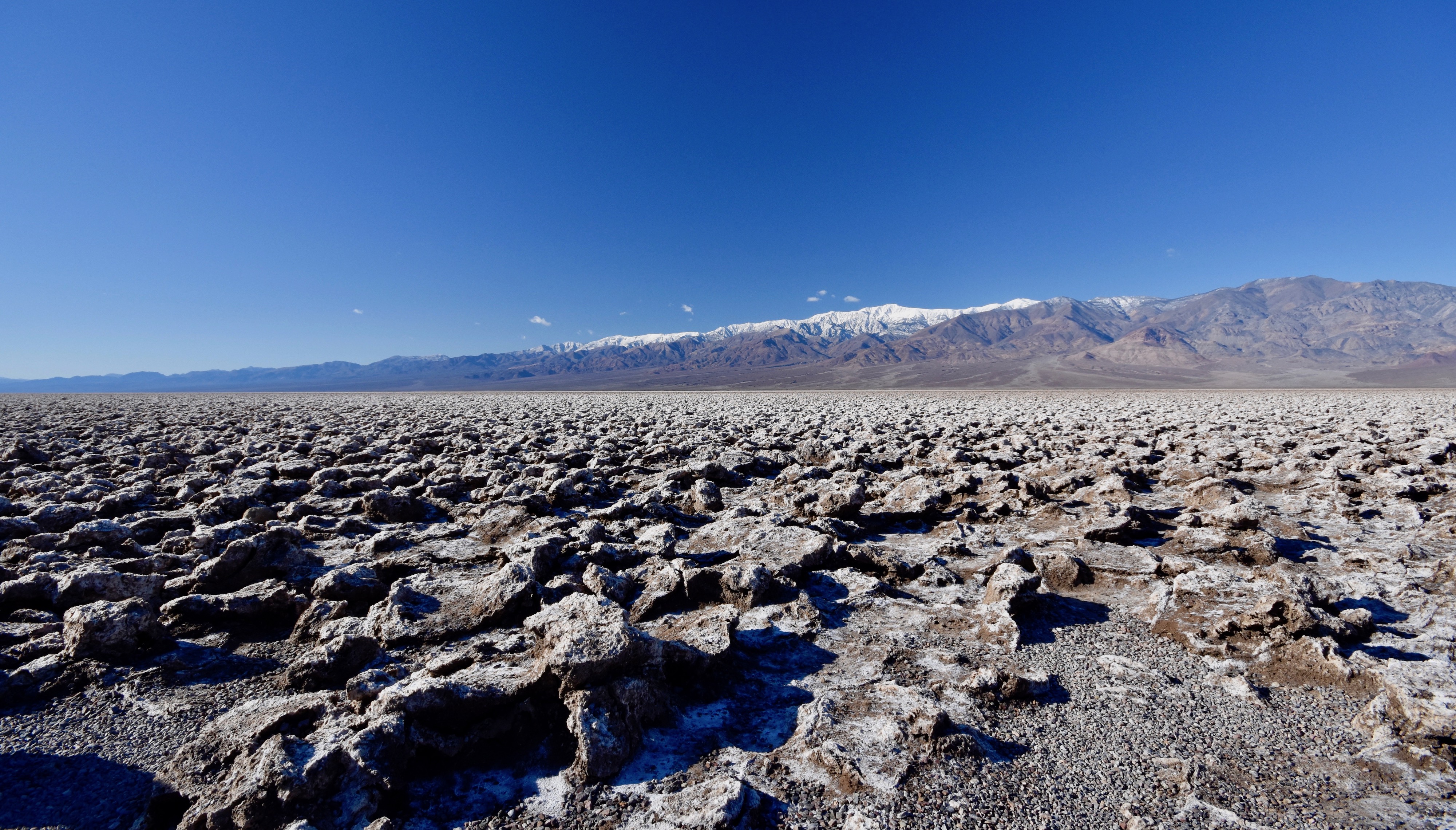
If there was a golf course in Hell, it probably would look like this. Actually it’s made of dried halite salt crystals left behind after the lake that once covered Death Valley dried up. I can’t imagine what the first pioneers must have thought when they crossed the mountains and descended into Death Valley only to find this blocking their way. This is a picture of Alison amidst the salt structures to give an idea of just how difficult, if not impossible, it would be to cross this God forsaken land. Chalk one up for the devil, but it sure is pretty.
Natural Bridge, Death Valley
The highway continues south through lands where the average day time temperature in July is 117° F (47° C) and it looks it.
Absolutely nothing is growing here.
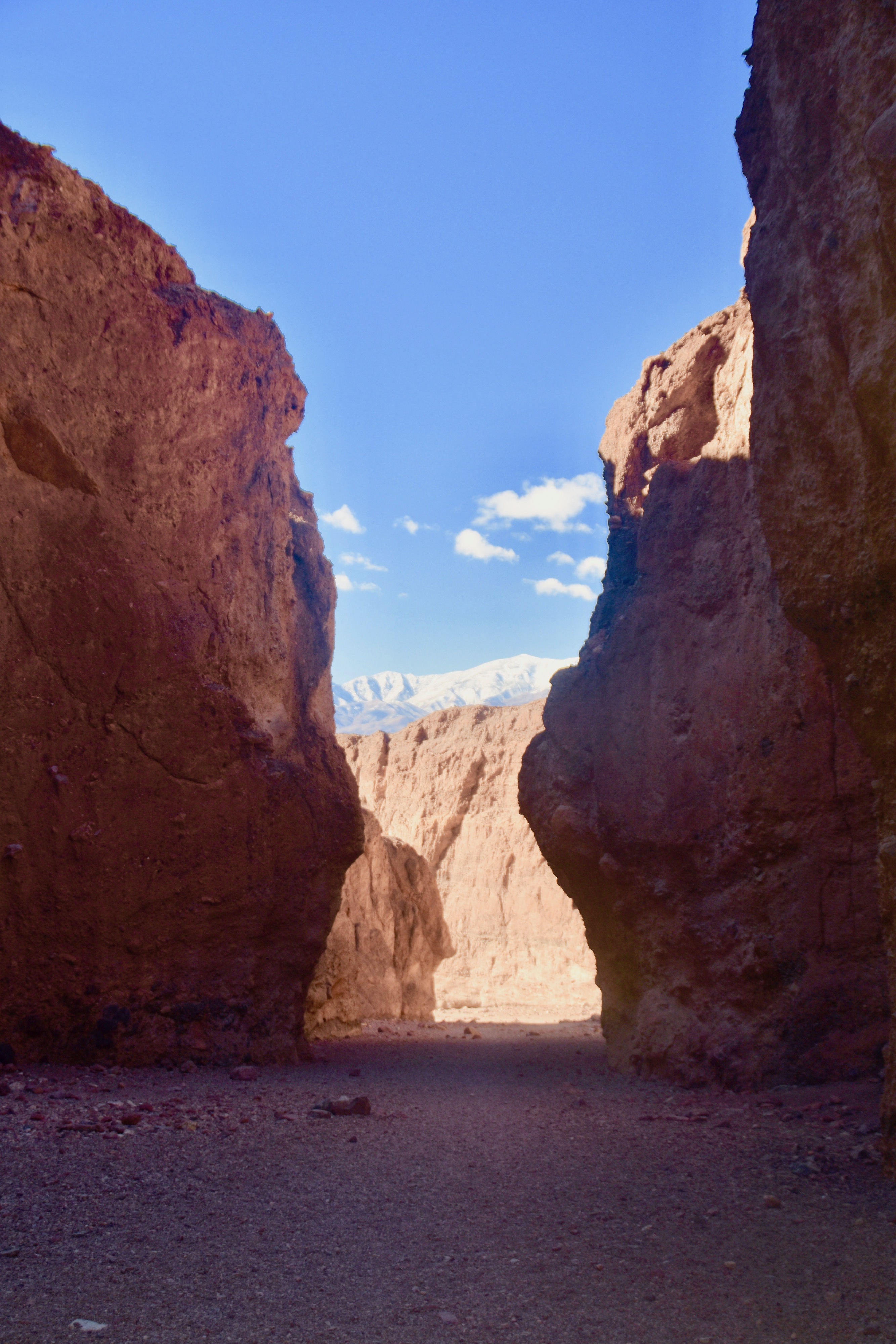
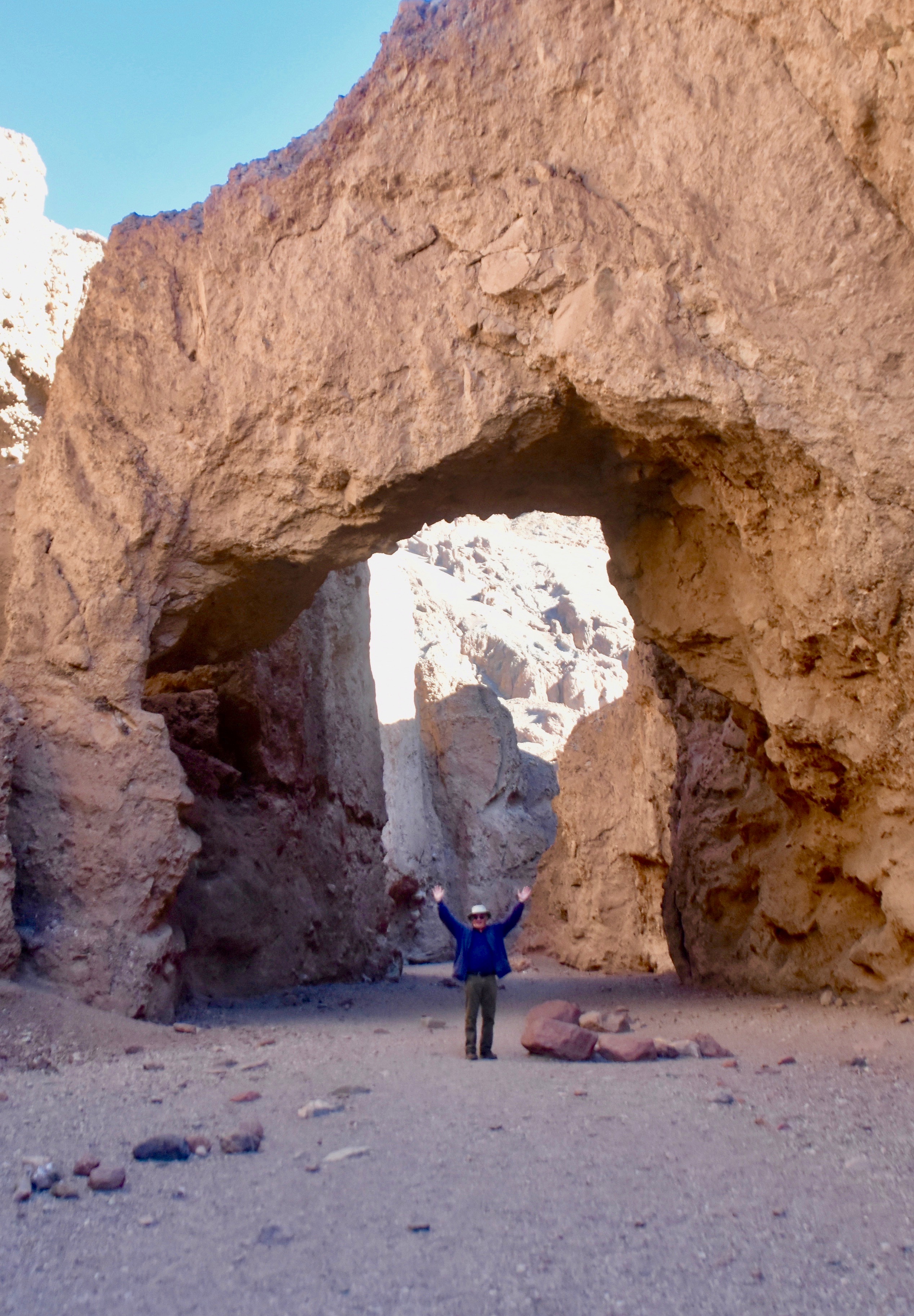
The next turn off is a very rutted and bumpy side road that climbs high up into the eastern side of Death Valley where it ends at the trailhead to Natural Bridge Canyon. This is a photo from near the end of the road. More badlands, no visible life, yet still very awesome.
It only takes about fifteen minutes to get to Natural Bridge, but it’s a decent climb. This is looking back down at the parking lot.
Once you get up here you are in a slot canyon from which there would be no escape in the event of a flash flood. And they do happen. Two people were killed by flash floods in 2004 and in 1987 5,000 people were stranded in the park for days. Happy thoughts as we make our way to the natural bridge.
Rainbow Bridge it is not, but the Natural Bridge at Death Valley is still more than worth the effort to visit.
Badwater Basin, Death Valley
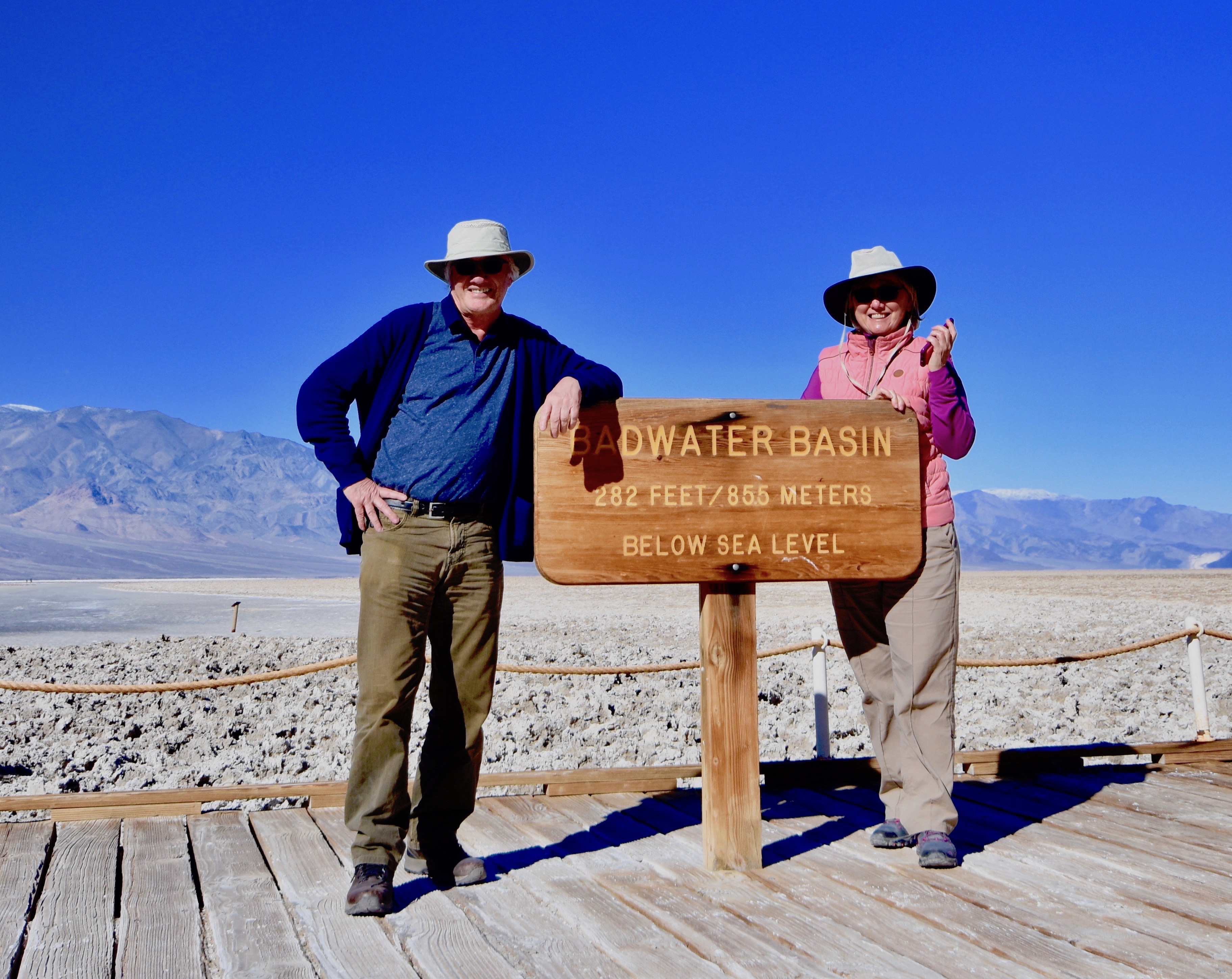
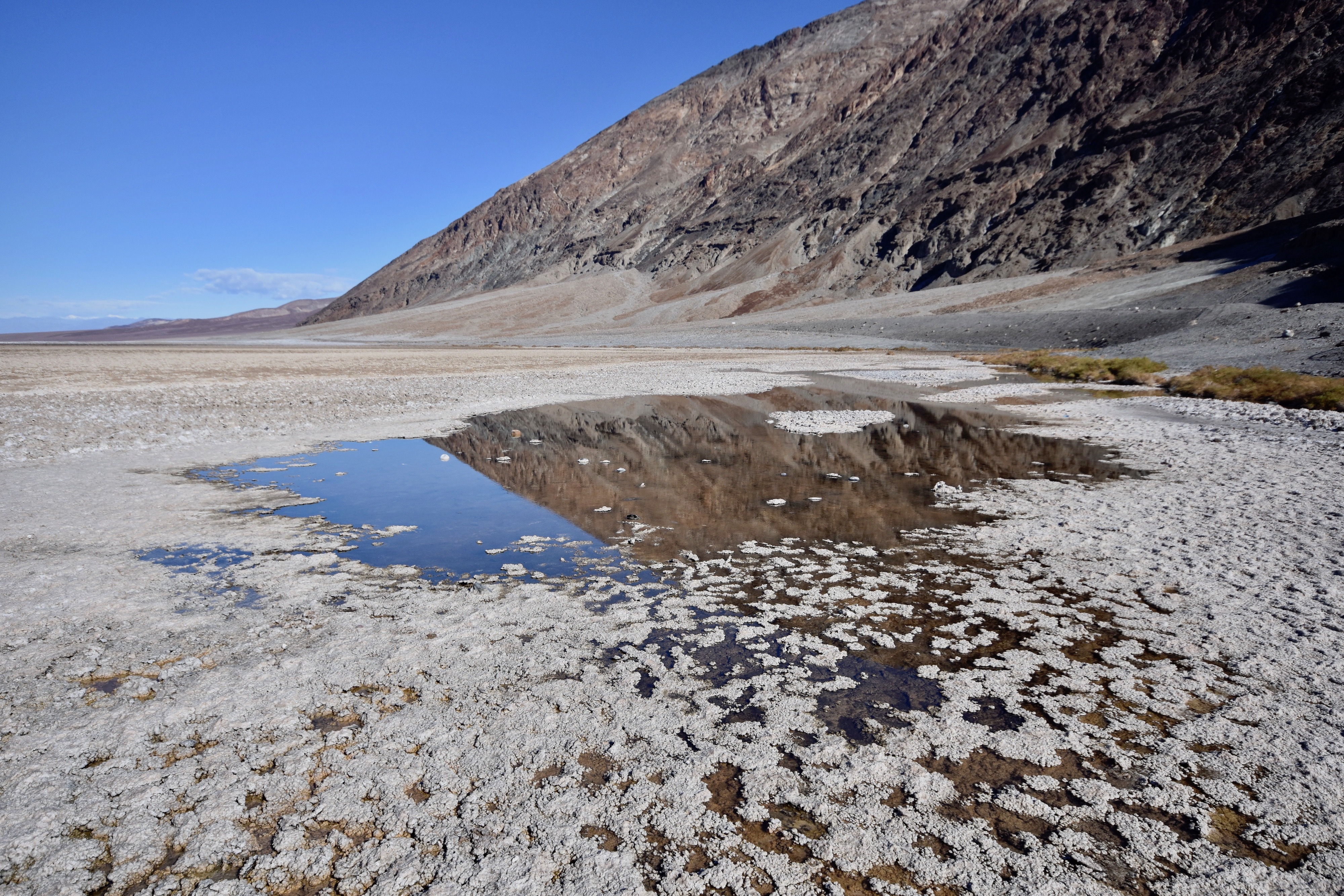
The last stop on our whirlwind tour of Death Valley is Badwater Basin which is the lowest point in North America at -282 feet (85.5 metres) and you’ll surely want to get a picture taken establishing a new low in your relationship.
It looks like a place that would have bad water and it does. Drink this and you’re toast.
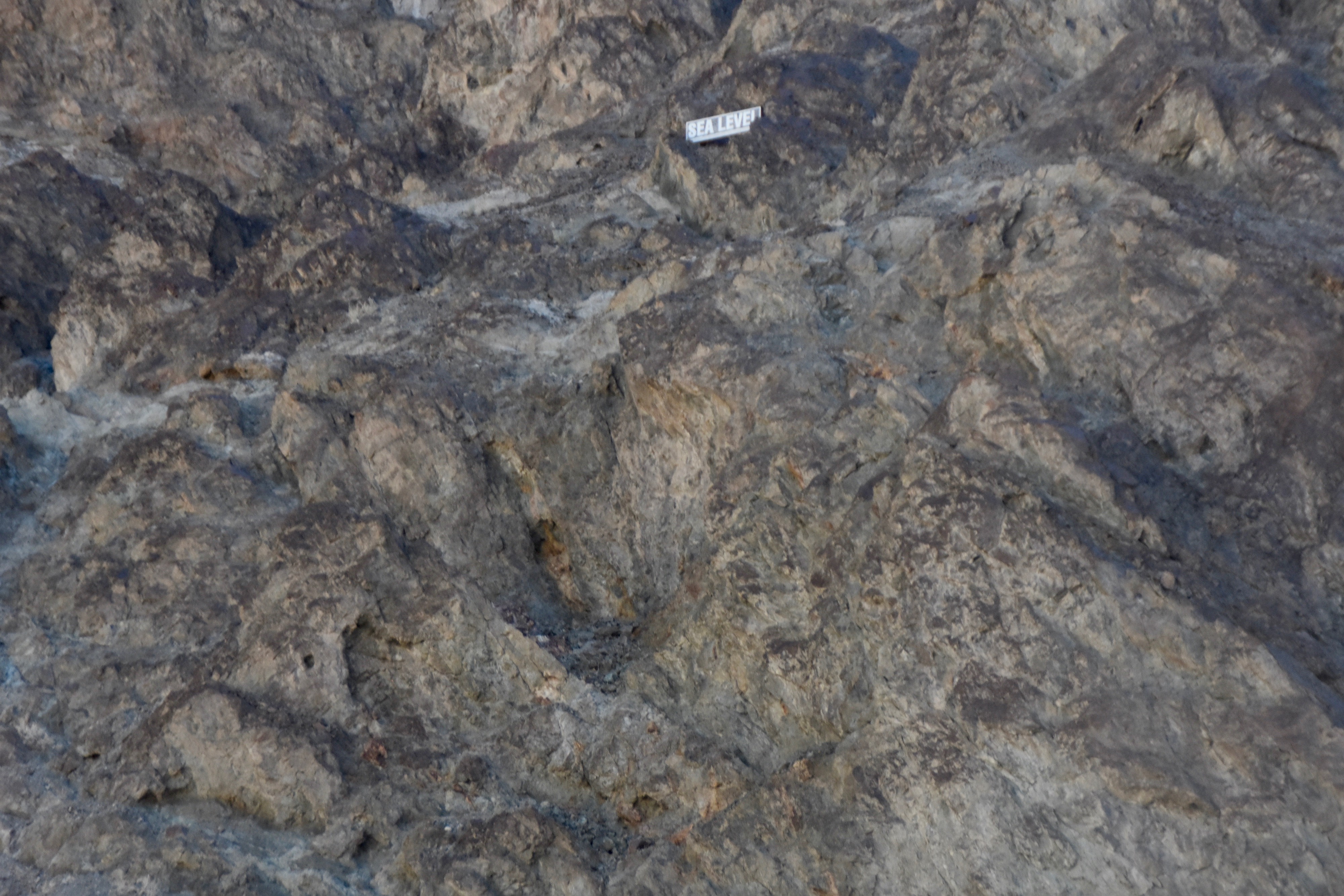
Standing at the lowest point you can look up and see this sign to tell you just how far below sea level you really are. It’s a weird feeling.
So, how can a place described by adjectives like death, devil, badwater, furnace and stovepipe be so beautiful? You’ll just have to visit on your own to find out. Death Valley is truly amazing, but don’t come in July.
Next up is Joshua Tree National Park.