Avenue of the Volcanoes

In my last post from Ecuador we said goodbye to our fellow Adventures Abroad travellers with whom we had spent the previous two weeks exploring Quito, the Galapagos Islands and the Amazon Basin. However, Alison and I were not done our journey through this small but incredibly diverse South American country. I had noted that Adventures Abroad does offer a tour that includes the famed Avenue of the Volcanoes and the UNESCO World Heritage Site of Cuenca, but not in conjunction with the Amazonia excursion. So I decided that we would do this part on our own with a private guide.
Our friend Martin Charlton from AA put me on to South Land Touring, an Ecuadorian company they partner with and with their assistance we put together an itinerary quite similar to that offered by AA with one notable exception. I definitely wanted to see Chimborazo, the highest mountain in Ecuador and one made famous by Alexander von Humboldt when he and a companion first climbed it in 1802. With that in mind, let’s head out onto the Avenue of the Volcanoes.
Avenue of the Volcanoes
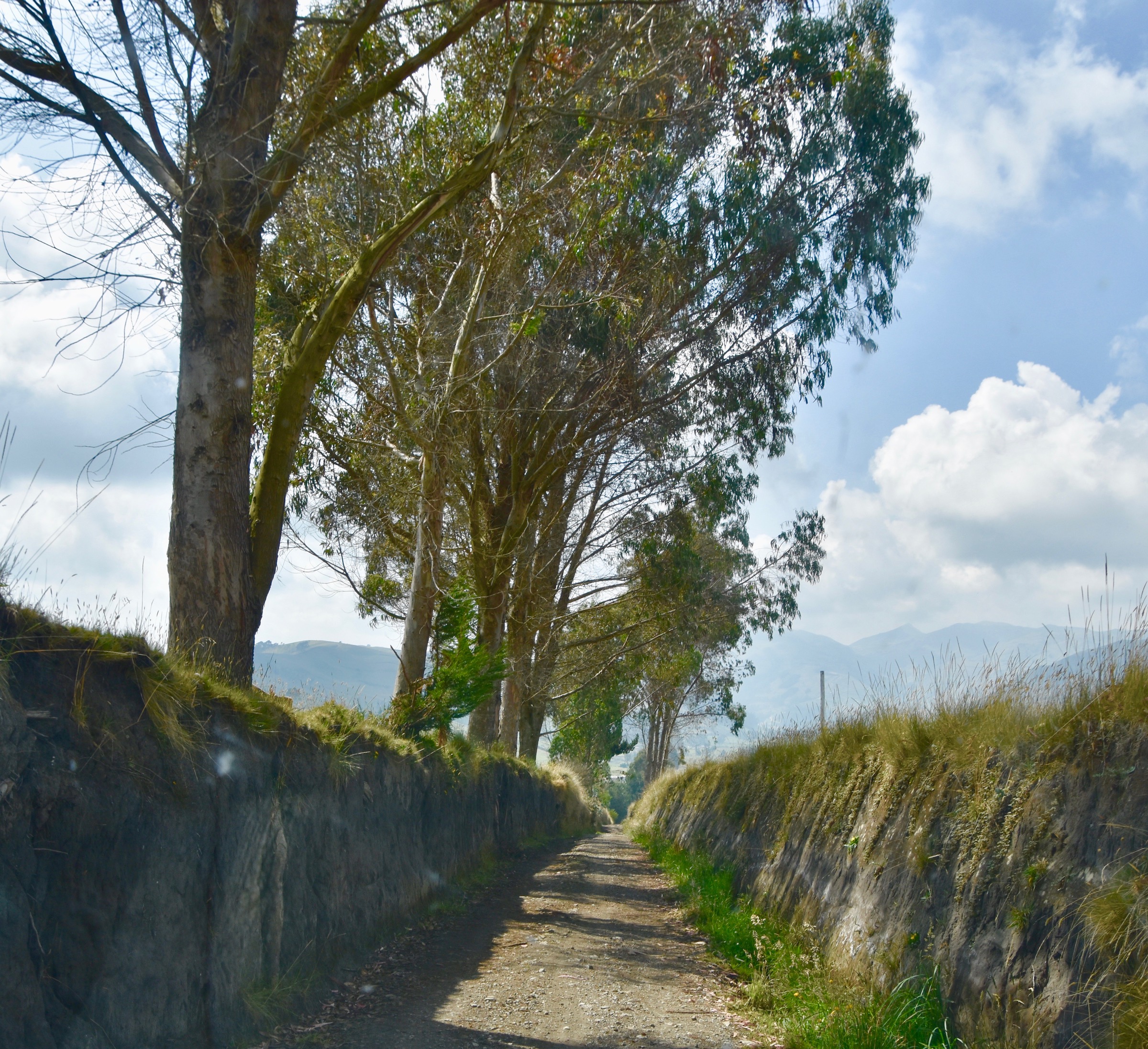
So what exactly is the Avenue of the Volcanoes? As most people know the Andes mountain range is the longest on earth, stretching 8,900 kms. (5,530 miles) from Argentina and Chile in the south to Colombia and Venezuela in the north. It goes straight through Ecuador where a series of volcanoes, both active and inactive, form a continuous, but distinct set of beautiful mountains. Think of the similar line of volcanoes that goes down the western side of the United States from Mount Baker in Washington to Mount Lassen in Northern California and includes Mount Rainier, Mount Hood and Mount Shasta. Contrast this to the type of geologic structures that make up the Rocky Mountains which are not volcanic in origin.
It was the great polymorph Alexander von Humboldt who first named the area between Quito and Cuenca the Avenue of the Volcanoes and the name stuck. Today the Pan-American Highway follows largely the same route as Humboldt did 220 years ago and that’s where we will start our journey.
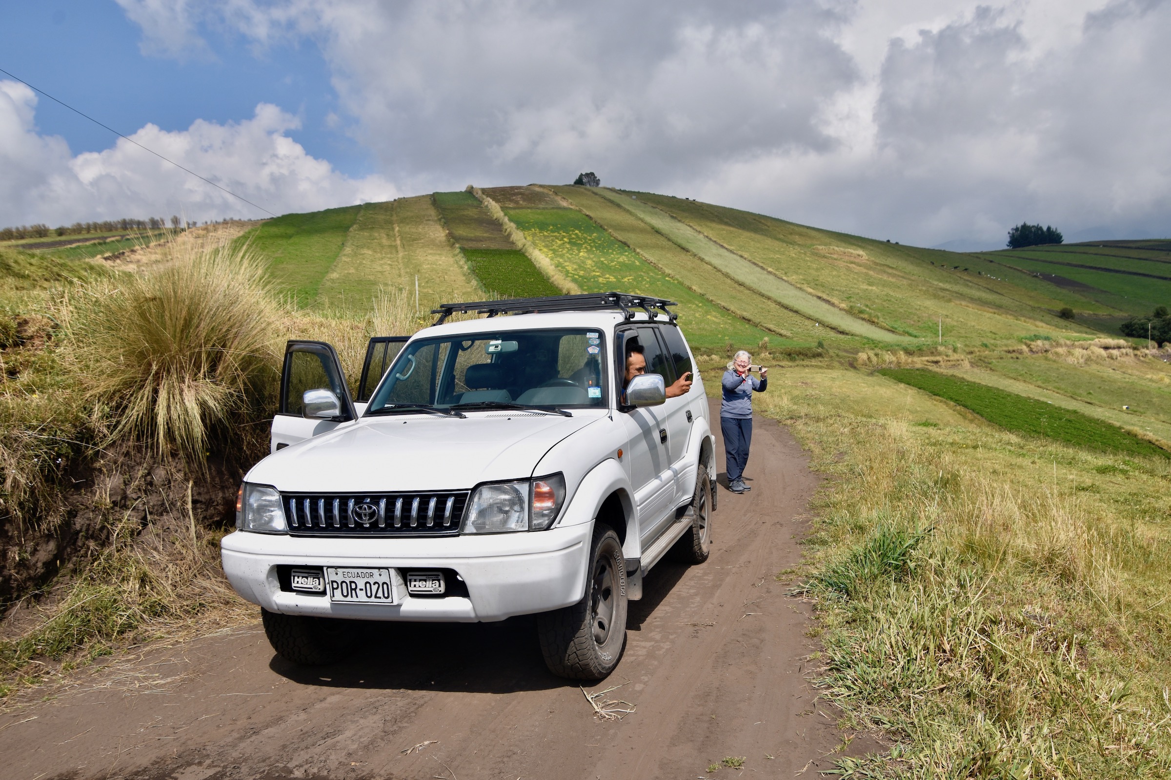
Our guide is Wilson Rosales who picks us up at the Wyndham Quito Airport hotel where we spent the night after flying in from Coca at the end of the trip to the Amazon region. He drives a Toyota SUV that has plenty of room. By staying just outside the city of Quito we are able to avoid the worst of the traffic, skirt the centre and pick up the Pan-American Highway heading south to our first stop.
Cotopaxi
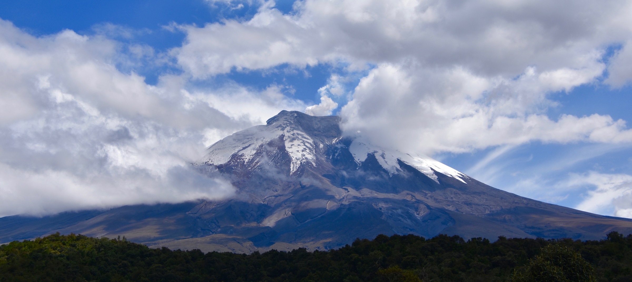
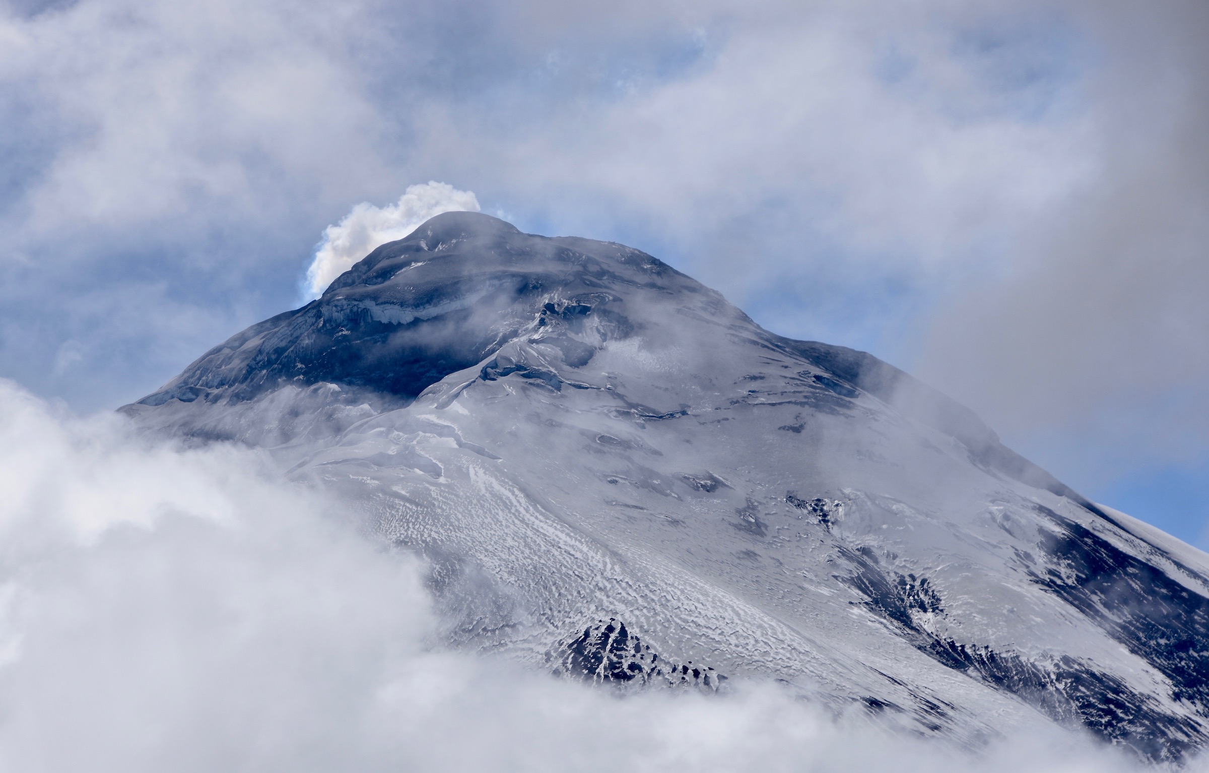
Cotopaxi is the second highest mountain in Ecuador at 19,347 feet (5,897 metres) and among the highest and most active volcanoes in the world. As a stratovolcano it has the classic conical shape that we associate with volcanoes. We first glimpsed Cotopaxi from the top of the TeleferiQo cable car on our second day in Quito, but it was almost totally obscured by clouds. Wilson advises us that this is usually the case with Cotopaxi and the fact that we are getting such a clear view as shown in the photo above is the exception and not the rule.
Cotopaxi is also the centrepiece of Ecuador’s most popular national park which includes a number of other active volcanoes on the Avenue of the Volcanoes. The entrance to the park is a short distance off the Pan-American Highway.
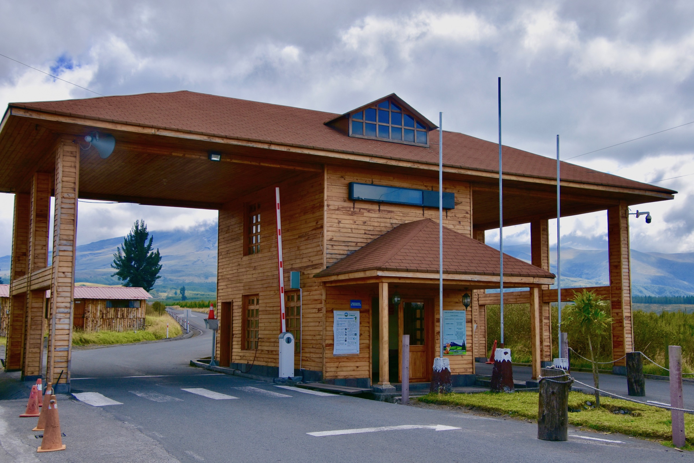
It is a requirement that anyone who wishes to hike any of the trails in Cotopaxi National Park that they hire a local guide and Wilson sees to that while Alison buys some beautiful hand woven ponchos that local women are offering for sale at very reasonable prices. These will make nice Christmas gifts for the better halves of our two sons.
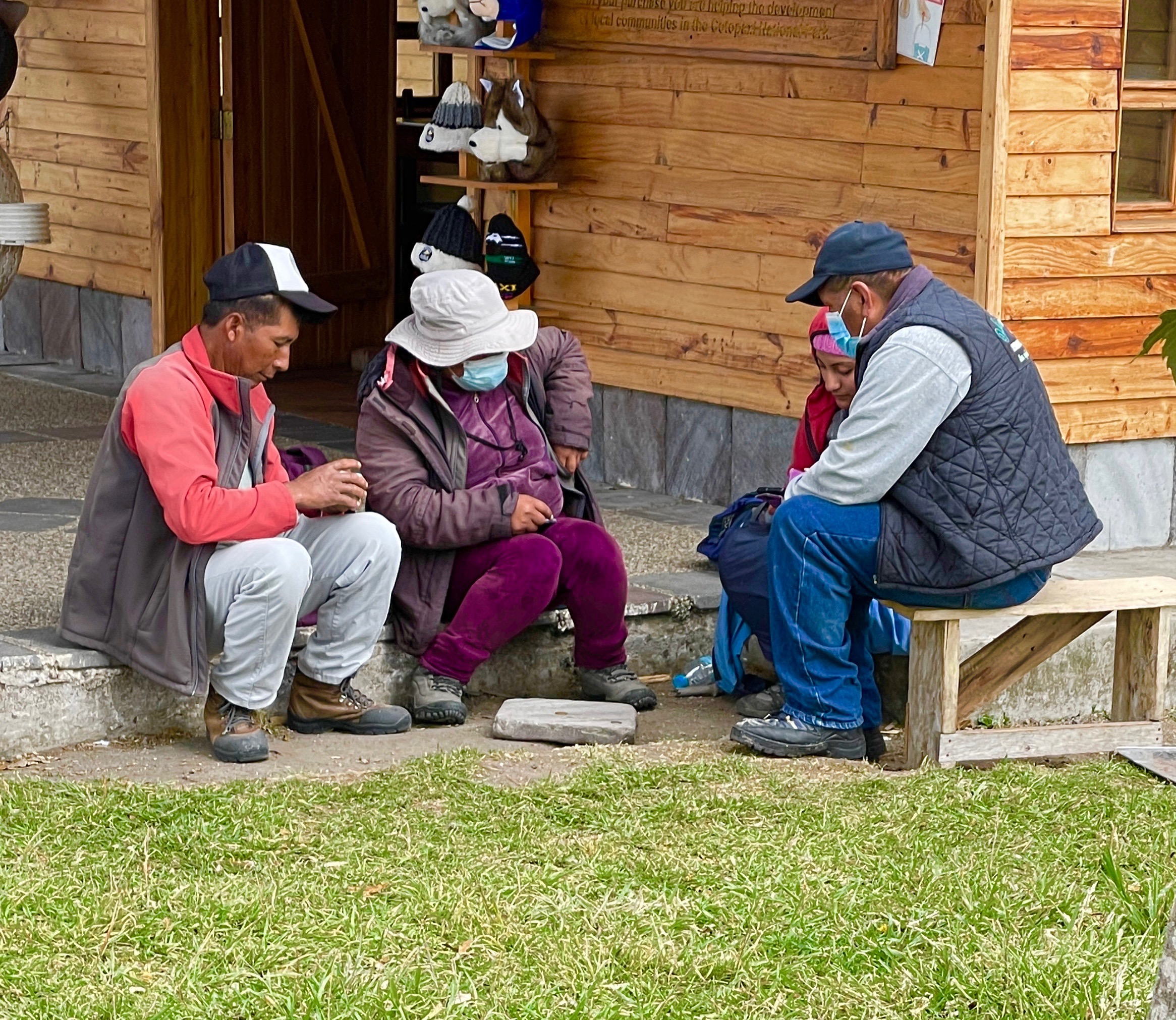
These are a few of the guides available for hire. They are biding their time playing a card game called quaranto which Wilson tells us is very popular in Ecuador.
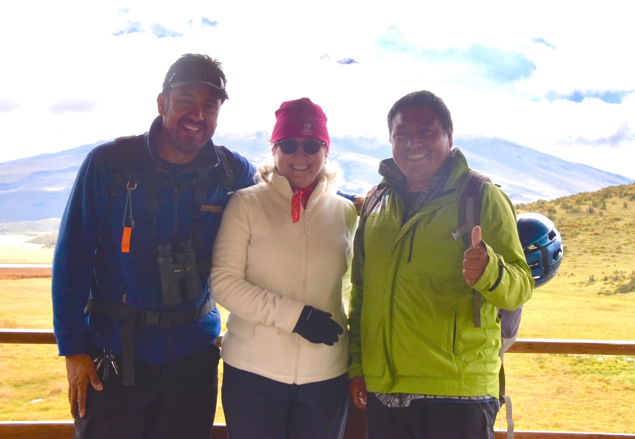
This is our local guide Oscar on the right who will lead us around the Limpiopungo Lagoon trail which is a moderately challenging trail that offers a chance to view the flora and fauna that inhabit these high plains of the Andes. Wilson is on the left side of Alison.
The reason the trail is listed as moderately challenging is not because of any great elevation change, but rather the fact that we are now at 12,400 feet (3779 metres) above sea level. Only last June we were up to 11,786 feet (3,571 metres) on the Jungfraujoch in Switzerland which was the highest we had ever been and there we were surrounded by glaciers and snow everywhere. Here there is grass and shrubland, but the elevation means it’s quite chilly so appropriate outerwear is necessary.
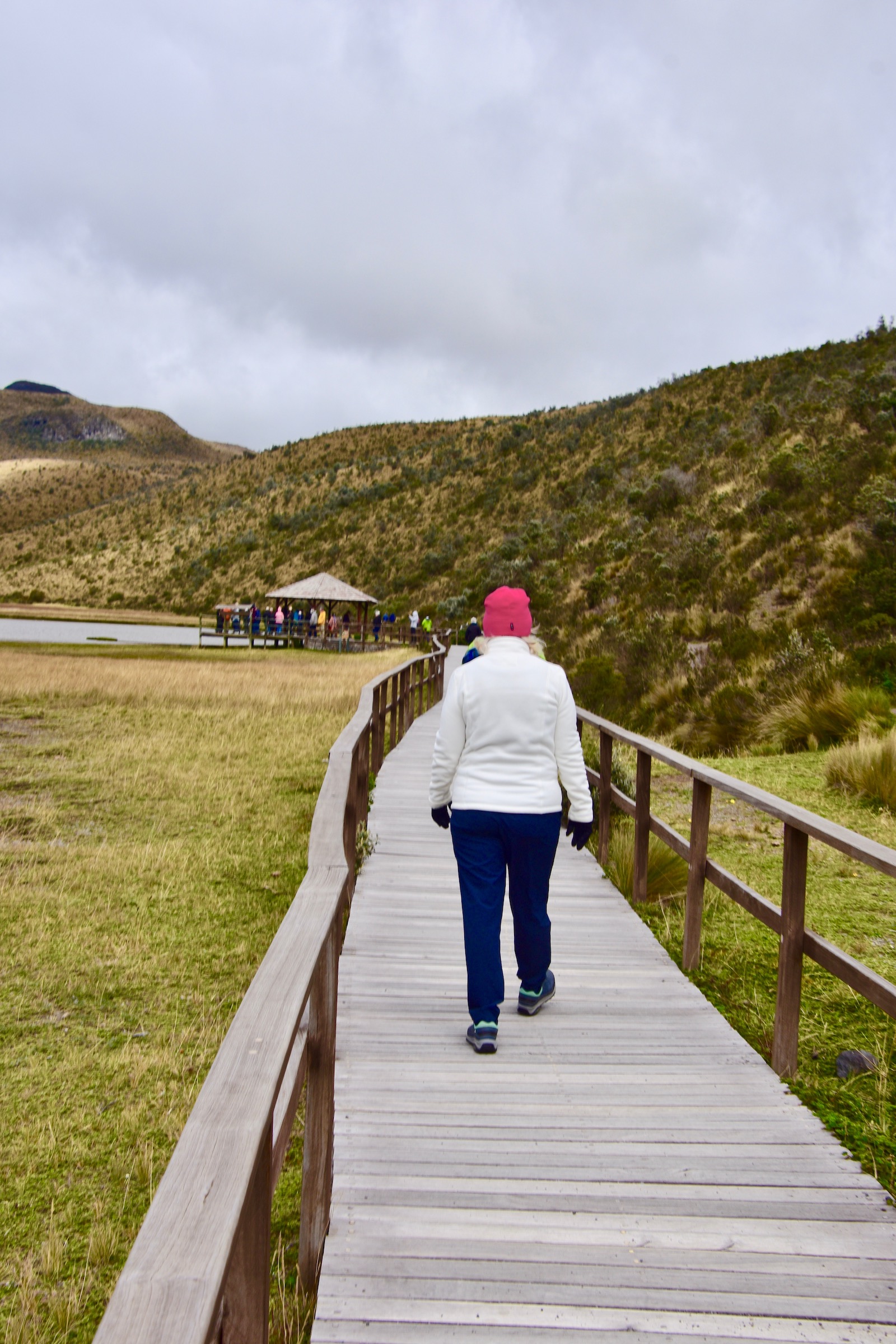
Just before we head out a tour bus arrives and 30 or 40 people get on the trail ahead of us, but luckily they only go as far as the gazebo where they get a group photo and get back on the bus. From here on we have the trail to ourselves. Cotopaxi remains mostly cloud covered during the walk, but on occasion we can see the smoke billowing from its cone as well as the glacier on its upper flanks.
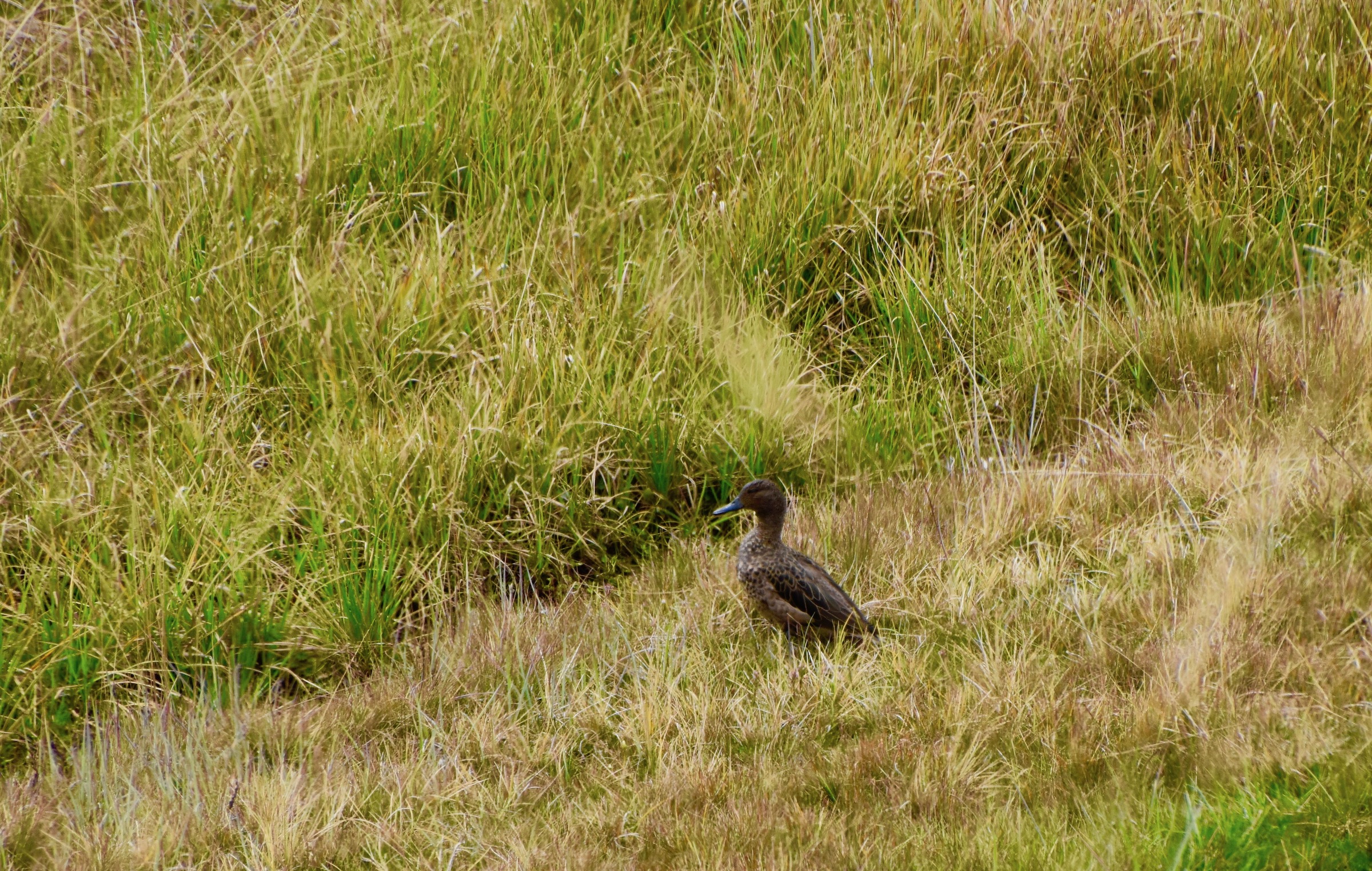
In terms of wildlife there are a number of new species for me including the Andean teal which is found at high elevation freshwater ponds, lakes and lagoons in Colombia, Venezuela and Ecuador.
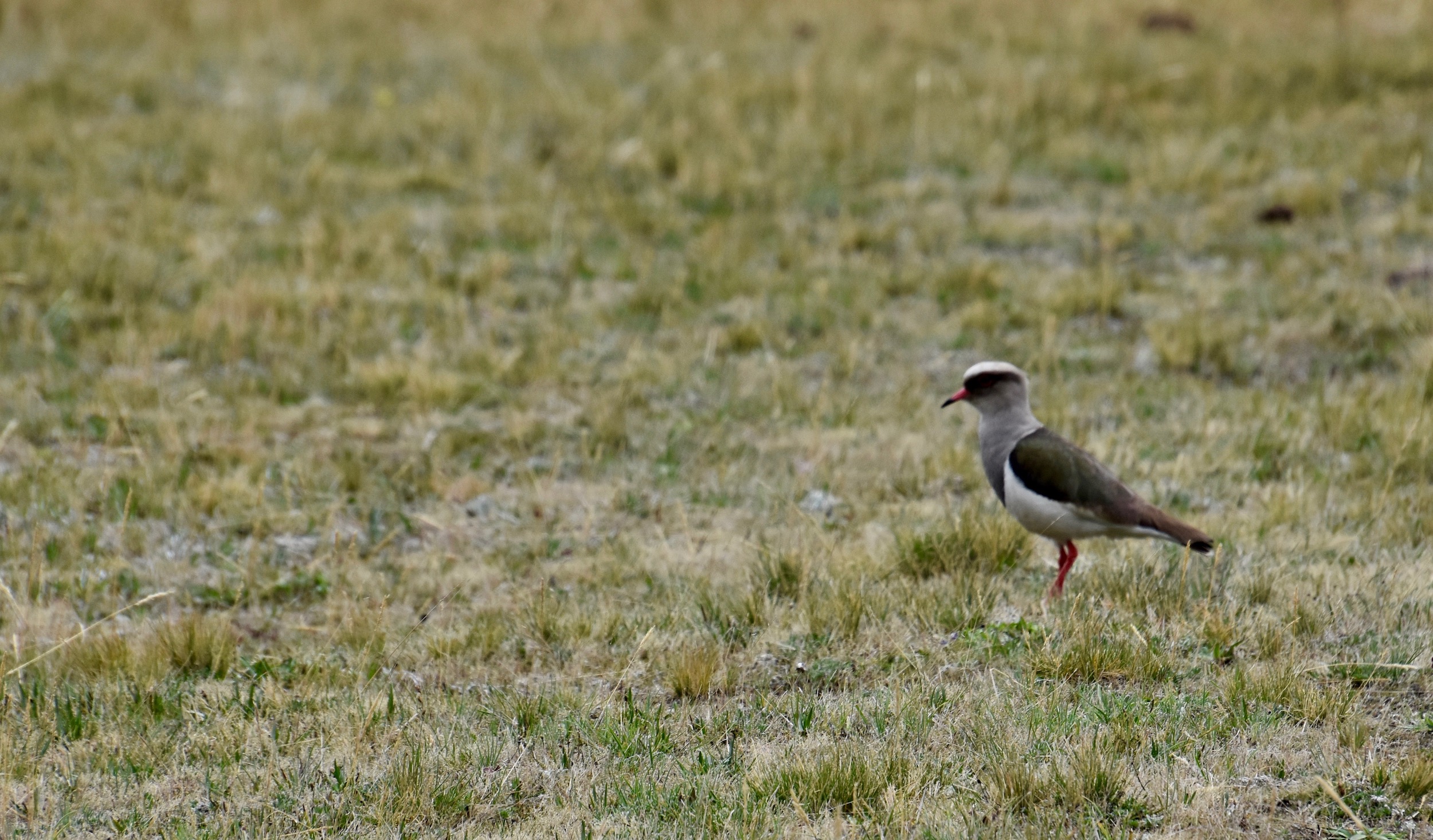
Another species which inhabits similar habitat is the Andean lapwing which is a pretty bird that forages in the boggy areas around the perimeter of the lagoon.
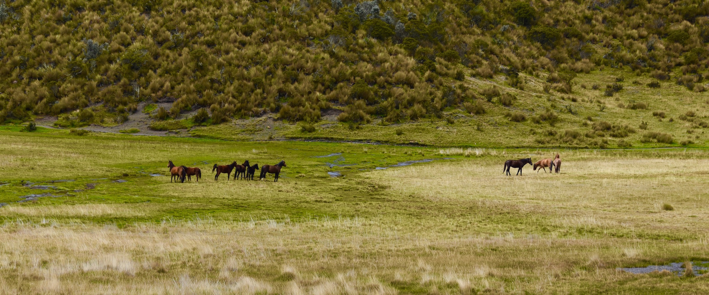
The rarest animal in this environment is one you what not ordinarily think of as endangered. This is a herd of parameros, wild horses that are found exclusively in Cotopaxi National Park and live on the grass of the paramo which is what these high grassy plains are properly called. There are less than 200 left and they trace their bloodlines back to the first horses imported to the Americas in the early 1500’s. The one place you are almost guaranteed to see them is on this Limpiopungo Trail in the Avenue of the Volcanoes.
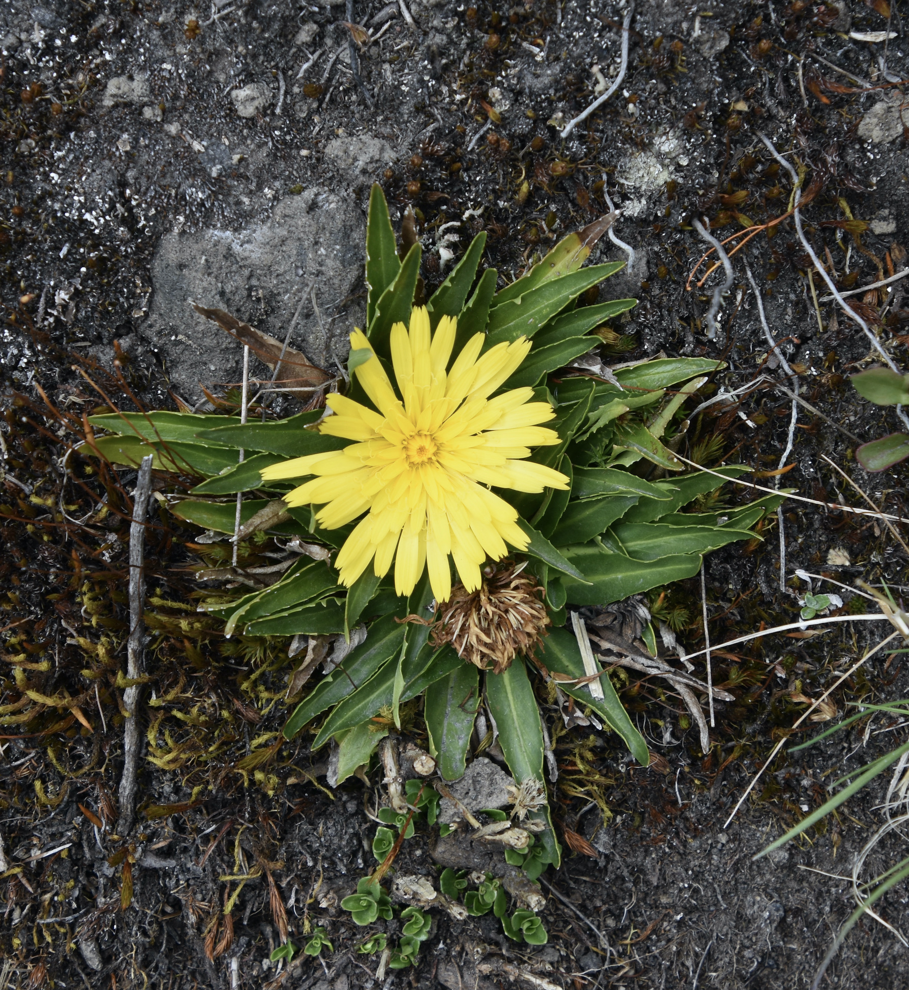
Aside from wildlife there are plenty of alpine wildflowers such chikku chikku, a type of aster found only at these high Andean altitudes.
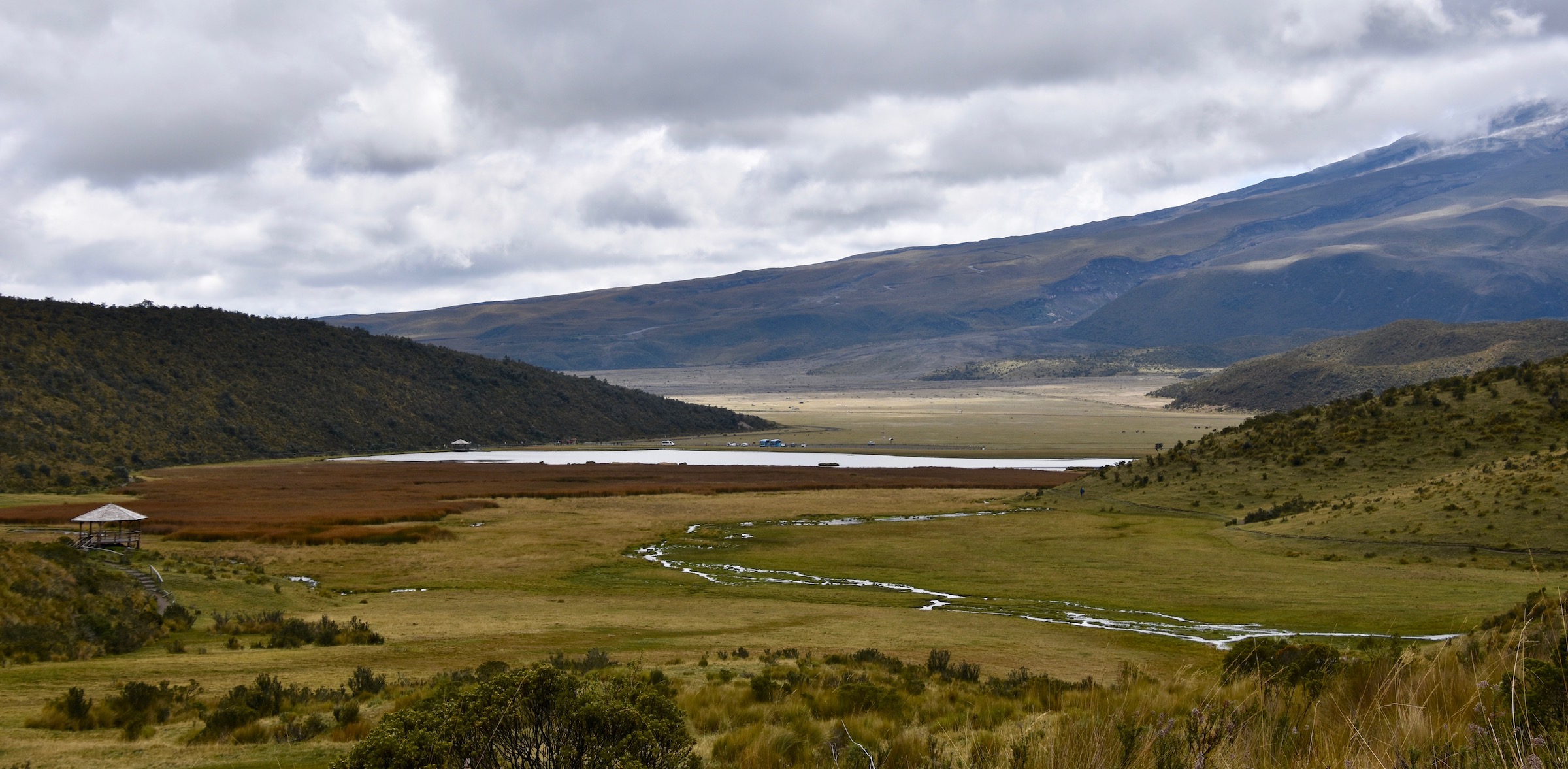
The trail ascends to a high point from where there is a good view of the lagoon and the small stream that feeds into it.
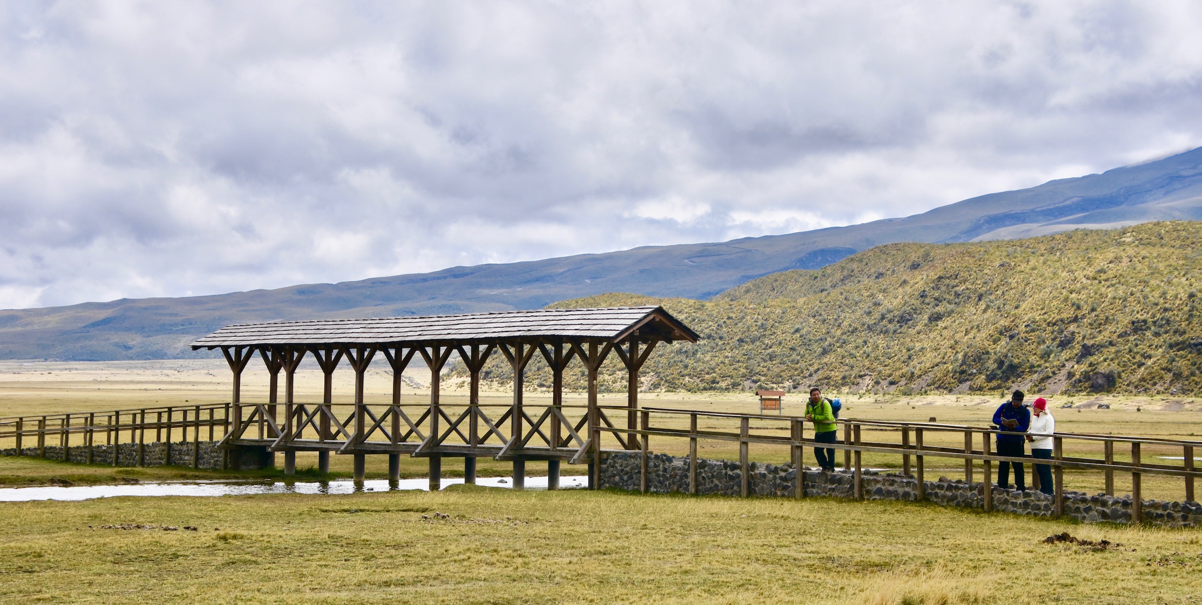
From here the trail continues in a loop until you come to this bridge almost back at the parking lot.
Hacienda La Cienega
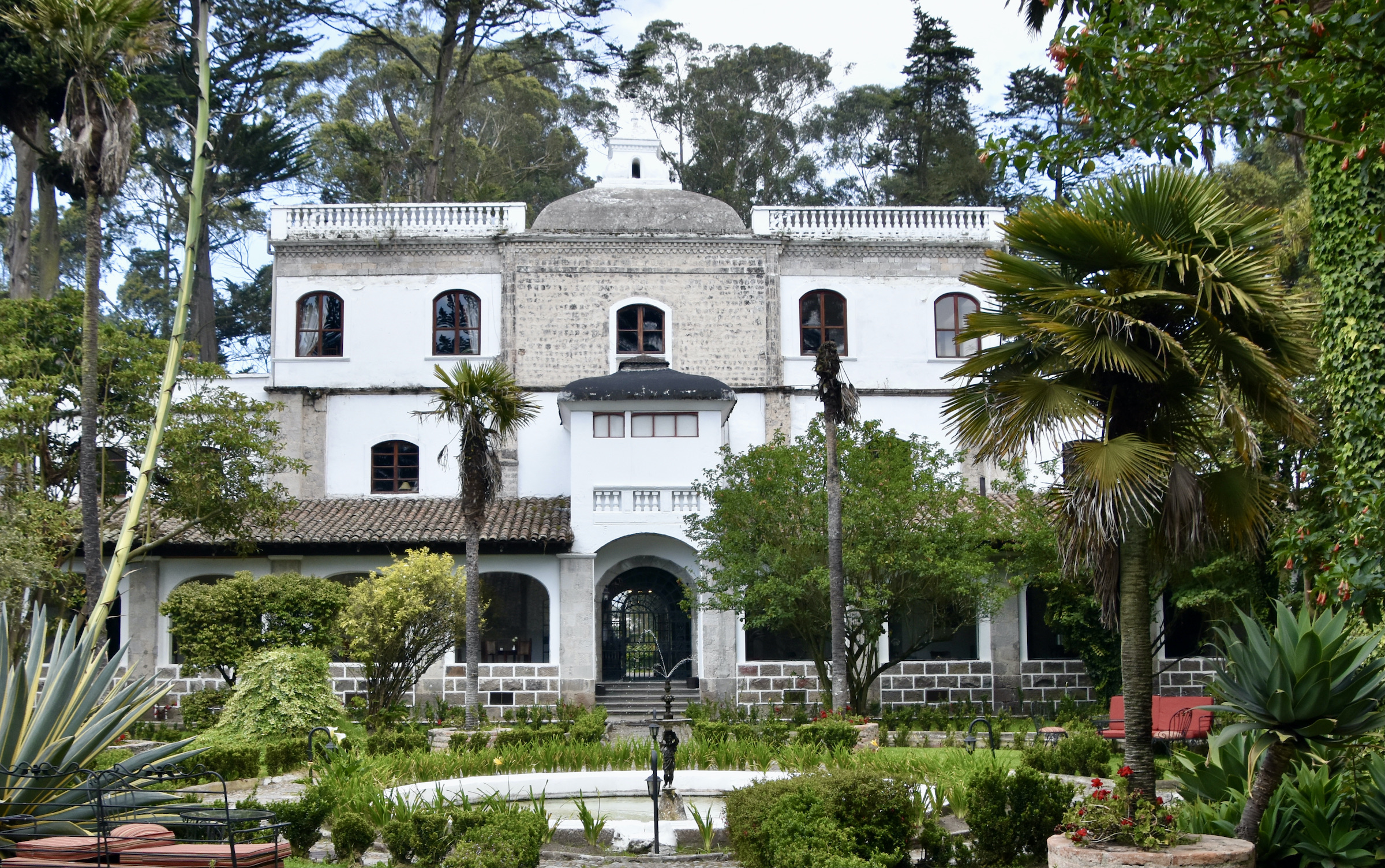
Our tour of the Avenue of the Volcanoes has gotten off to a good start with our visit to Cotopaxi National Park. The next stop is at nearby Hacienda La Cienega which dates back to 1695 and is one of the few haciendas in Ecuador that now operates as a hotel. I note that on the Adventures Abroad itinerary through the Avenue of the Volcanoes that the guests spend the night here. However, we are here just for lunch which is served in appropriate solemnity in the historic dining area. After lunch, which is excellent, we get a chance to poke around the place and Wilson takes us to this room where there is a bust of Alexander von Humboldt.
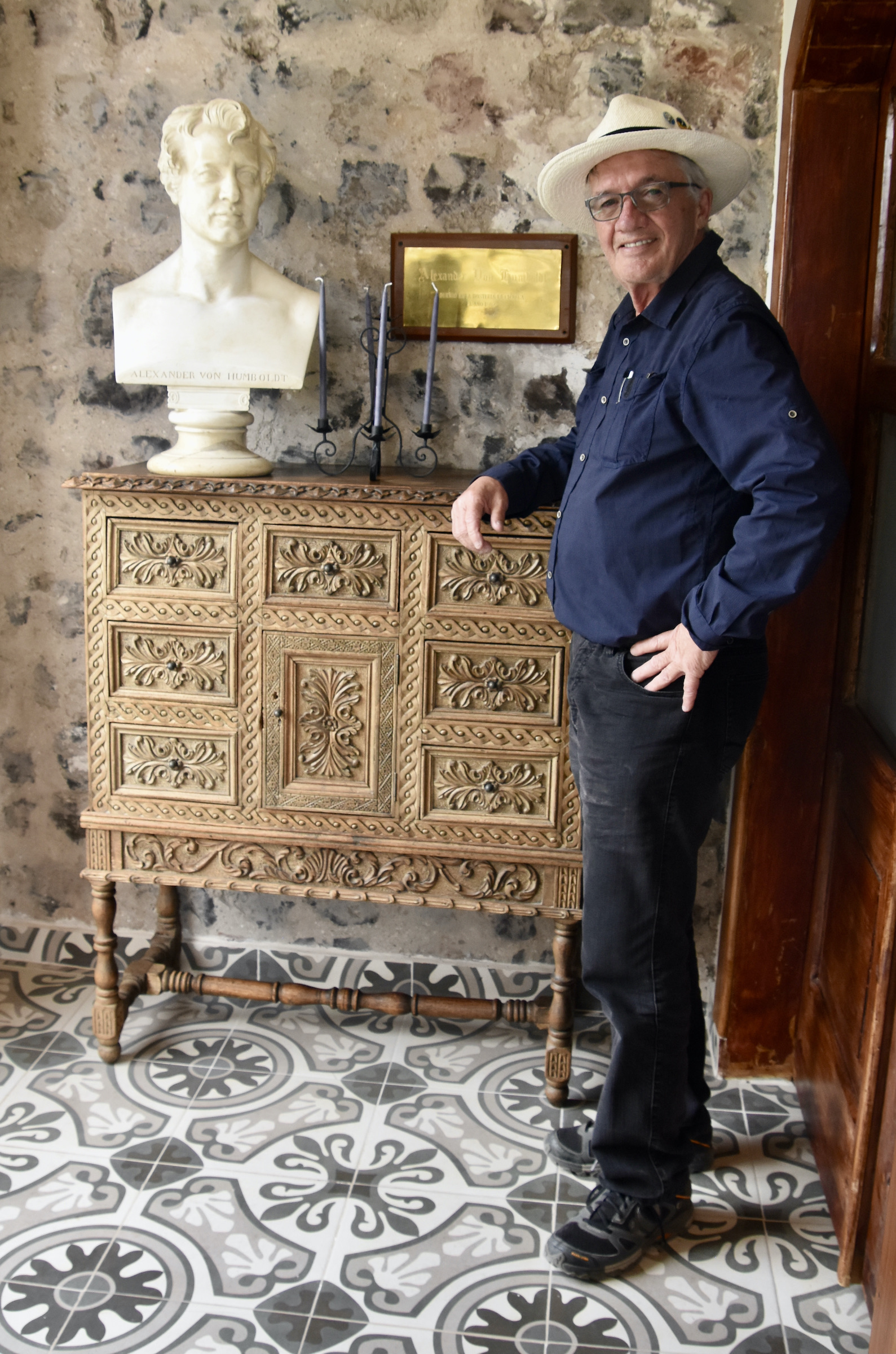
It turns out the great man spent time here in 1802 using the top floor to make observations and drawings of Cotopaxi. You can stay in this suite today if you book far enough in advance.
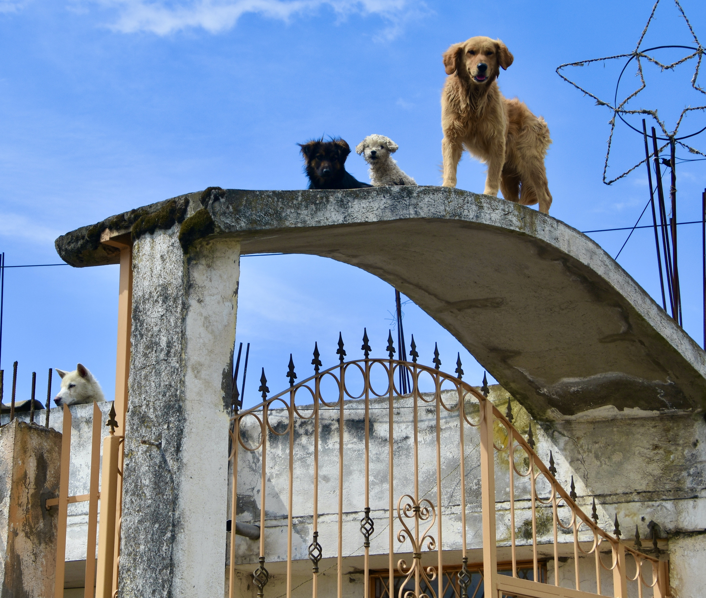
Heading back to the SUV we are observed by a motley crew of dogs from above.
Banos
Our destination for the first night was the small city of Banos which is famous for its hot springs and as the gateway to the Amazon. It is extremely popular with adventure seekers and outdoor types, which is readily apparent from all the outfits offering paragliding, whitewater rafting, canyoning, rock climbing and other ways to get your adrenalin going. When we arrived it was the city’s official birthday celebration and the centre of the city was jammed with celebrants. Our hotel was on the opposite side of the city and Wilson had to do a lot of backtracking and reversing, but contrary to my expectations, he got us through the crowds in surprisingly short order.
Our hotel was directly across the street from a waterfall for which the city is also well known.
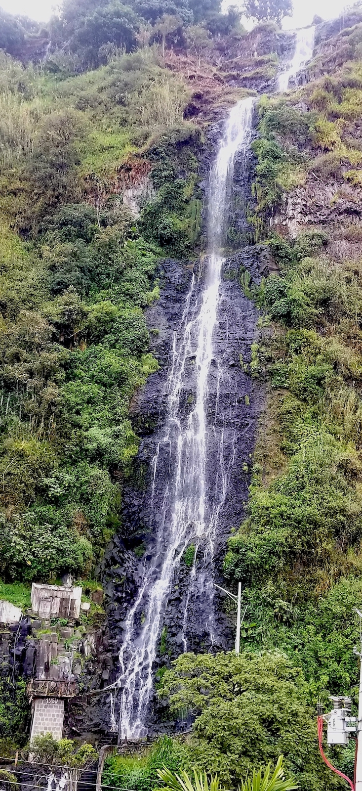
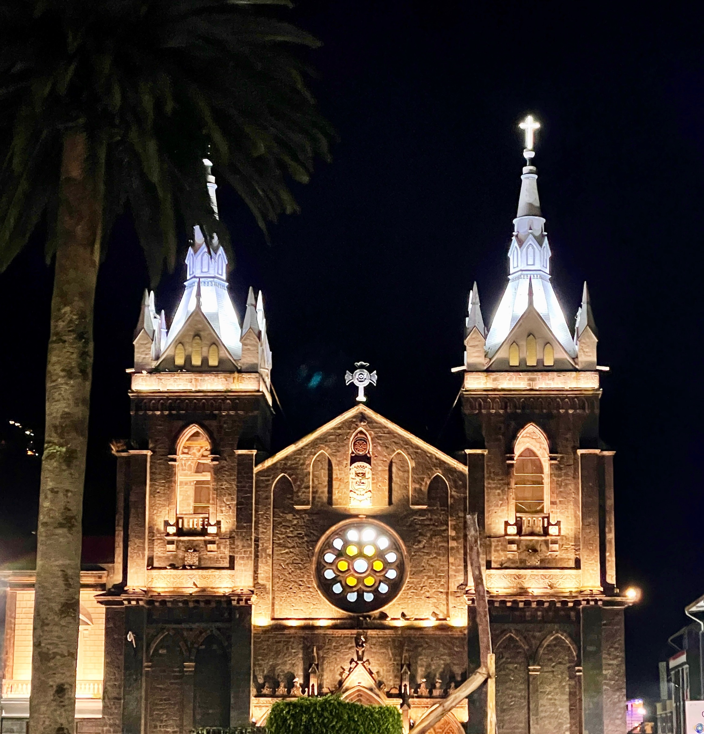
Unfortunately it rained most of the time we were in Banos so we didn’t really get to see much of the city other than the cathedral lit up at night.
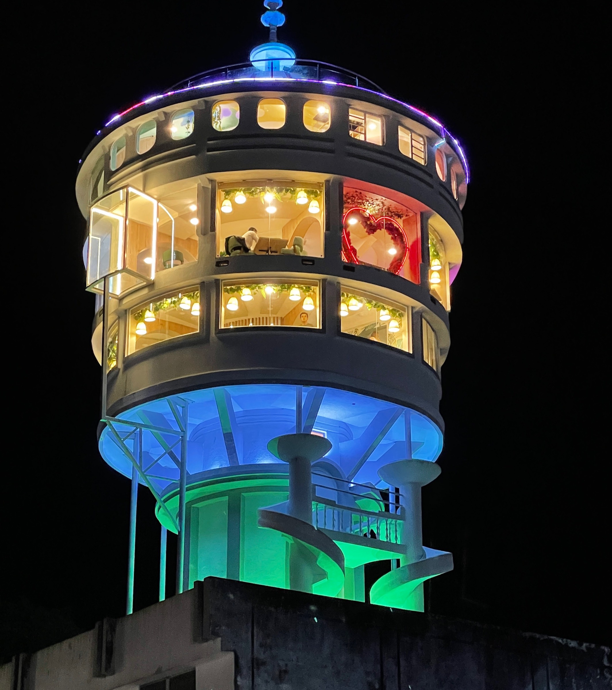
And this space age looking disco turned restaurant. The city also has way more bars, lounges and dance clubs than you would expect for its size. However, most of the young people were pretty partied out from the day’s celebrations and there weren’t too many still sober enough to hit the bars.
Banos is the type of place I would have loved 40 years ago, but alas time does not tick backwards and I can only envy those still young enough to indulge in all that Banos has to offer. The consolation is that we have a big adventure of our own coming up tomorrow.
Chimborazo, Avenue of the Volcanoes
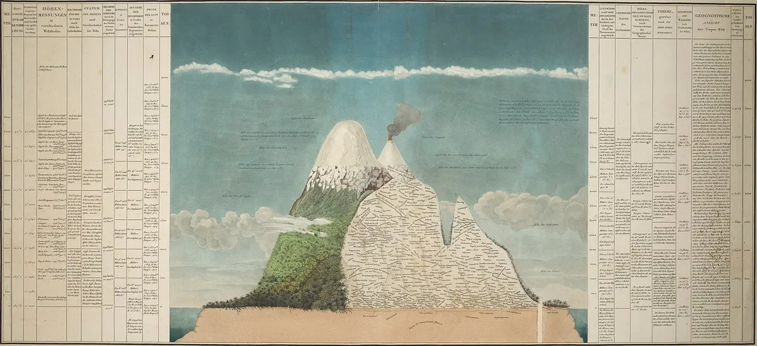
The ultimate accomplishment of Alexander von Humboldt on his Latin American sojourn was undoubtedly the ascent of Chimborazo with his companion, botanist Aime Bonpland in 1802. At 20,548 feet (6,263 metres) it was then believed to be the highest mountain on earth. We now know that there are many higher mountains in the Himalayas, the Karakoram and even the Andes. However, here’s the rub – in terms of actual distance from the centre of the earth, Chimborazo is the highest point on the planet. That’s because the earth bulges at the equator, so Von Humboldt was not actually mistaken. Above is a map he drew with detailed calculations of the flora and fauna, temperature and other data he meticulously recorded while on the way up. It’s not clear that he actually made the summit given lack of oxygen and the eternal snows that started much lower than than they do today, but it was still one hell of an accomplishment at the time.
So, in planning this itinerary I definitely wanted to add Chimborazo to the places to see and this morning that’s where we are headed. Chimborazo is much harder to get to than Cotopaxi as it lies well off the Pan-American Highway and you have to circle the mountain and approach it from the west side. You can see from all the squiggles on the map that there is a lot of sharp turns and ups and downs.
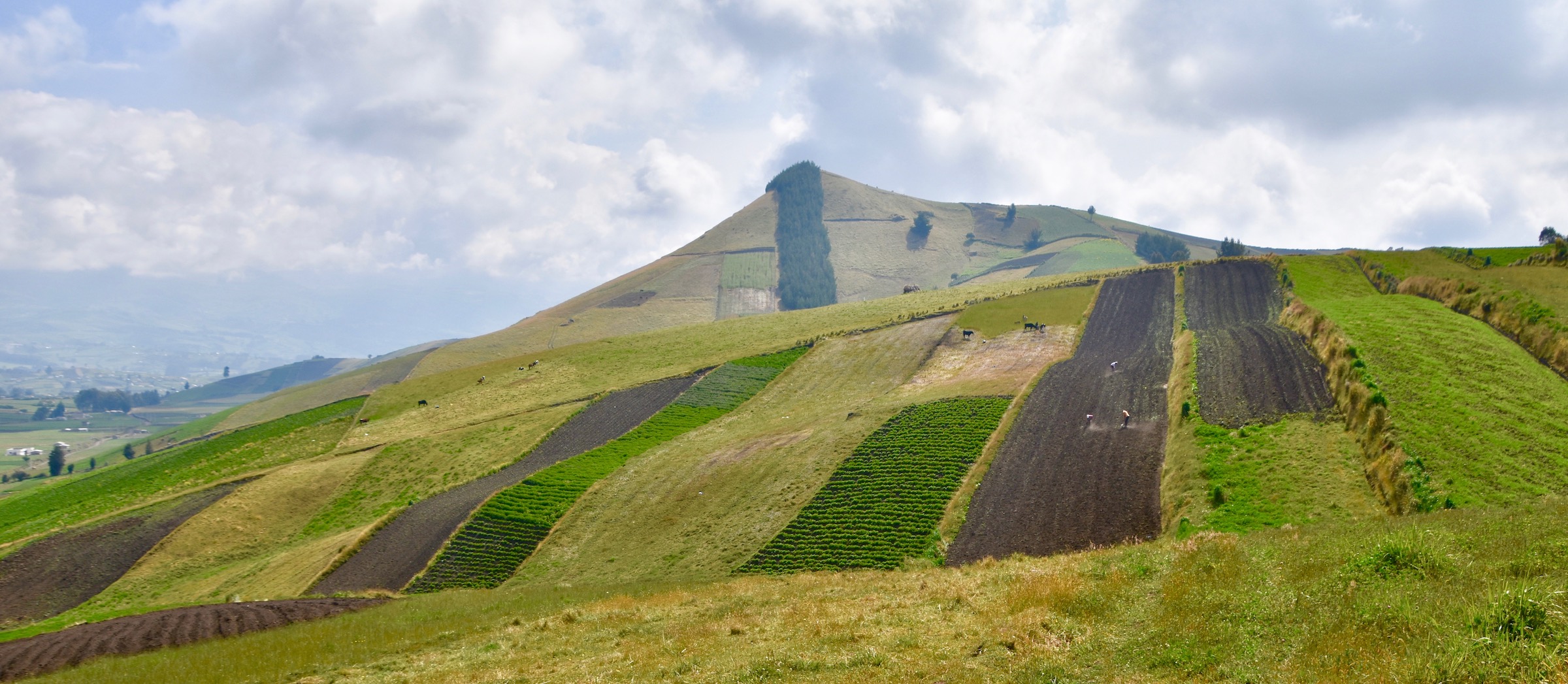
Wilson believes he knows a short cut that might save us up to an hour so we leave the usual route and head into the Ecuadorean highlands. I’m not sure if we saved any time or not because there was some backtracking involved, particularly when a large tree completely blocked the mountain lane we were following. However I can say with certainty that this was a great way to see the way of life of the farmers who make a living growing crops and tending cows and sheep at over 12,000 feet. The volcanic soil is rich in nutrients and the fields are divided into strips rather than squares or rectangles. Given the location almost on the equator various crops are grown year round with some always ready for harvest.
This is the lane we were travelling on until we came to the fallen tree and had to back up a long way.
However, Alison and I didn’t care as we were just enjoying this off the beaten track experience. Every once in a while Wilson would stop and ask directions and eventually we made our way to the far side of Chimborazo and the entrance road.
The biggest question was going to be the same one as at Cotopaxi – would we actually get to see Chimborazo or would it be cloud-covered? That seems to be the million dollar question in the Avenue of the Volcanoes and it wasn’t looking good. This was our first glimpse and it didn’t reveal much.
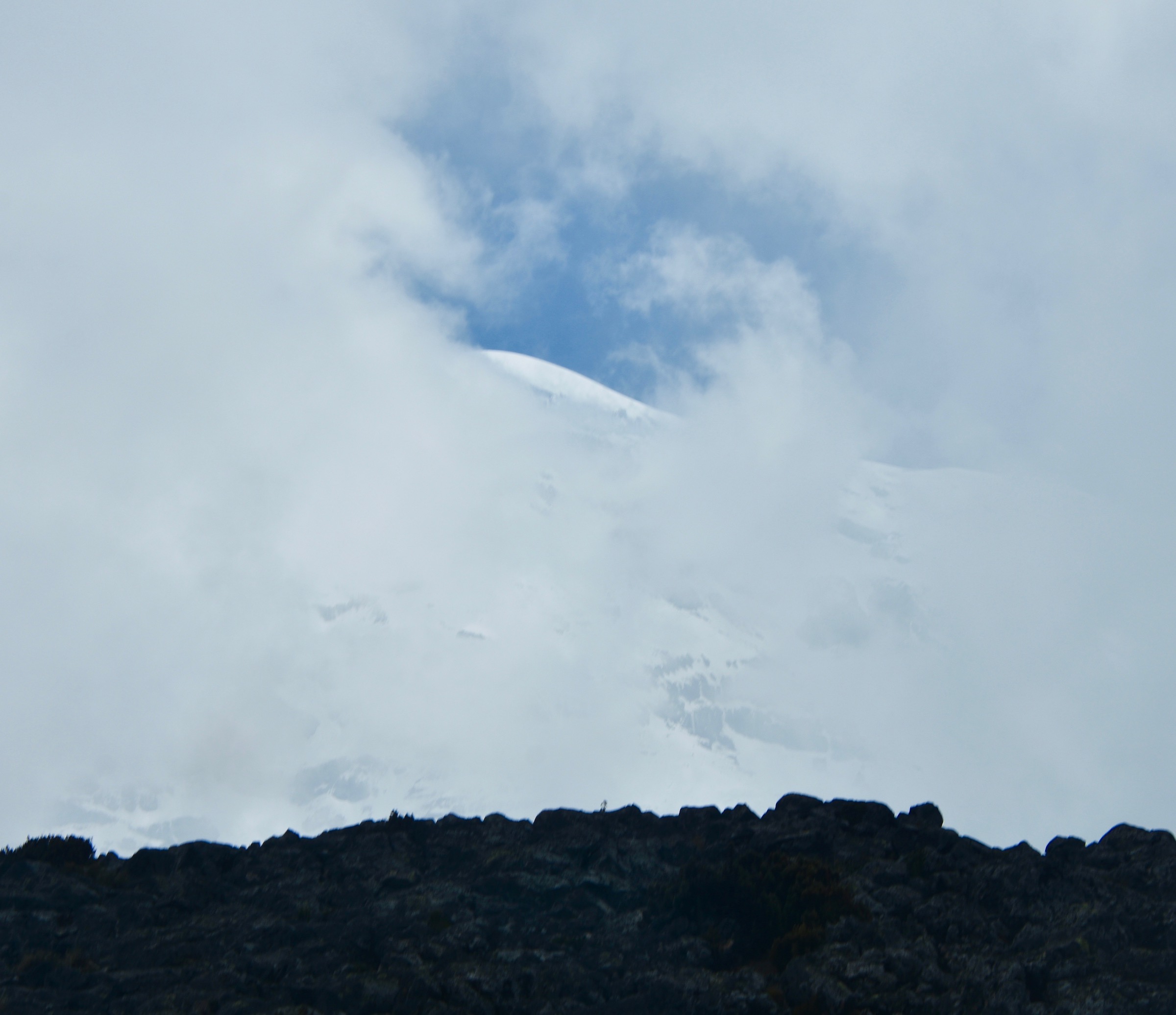
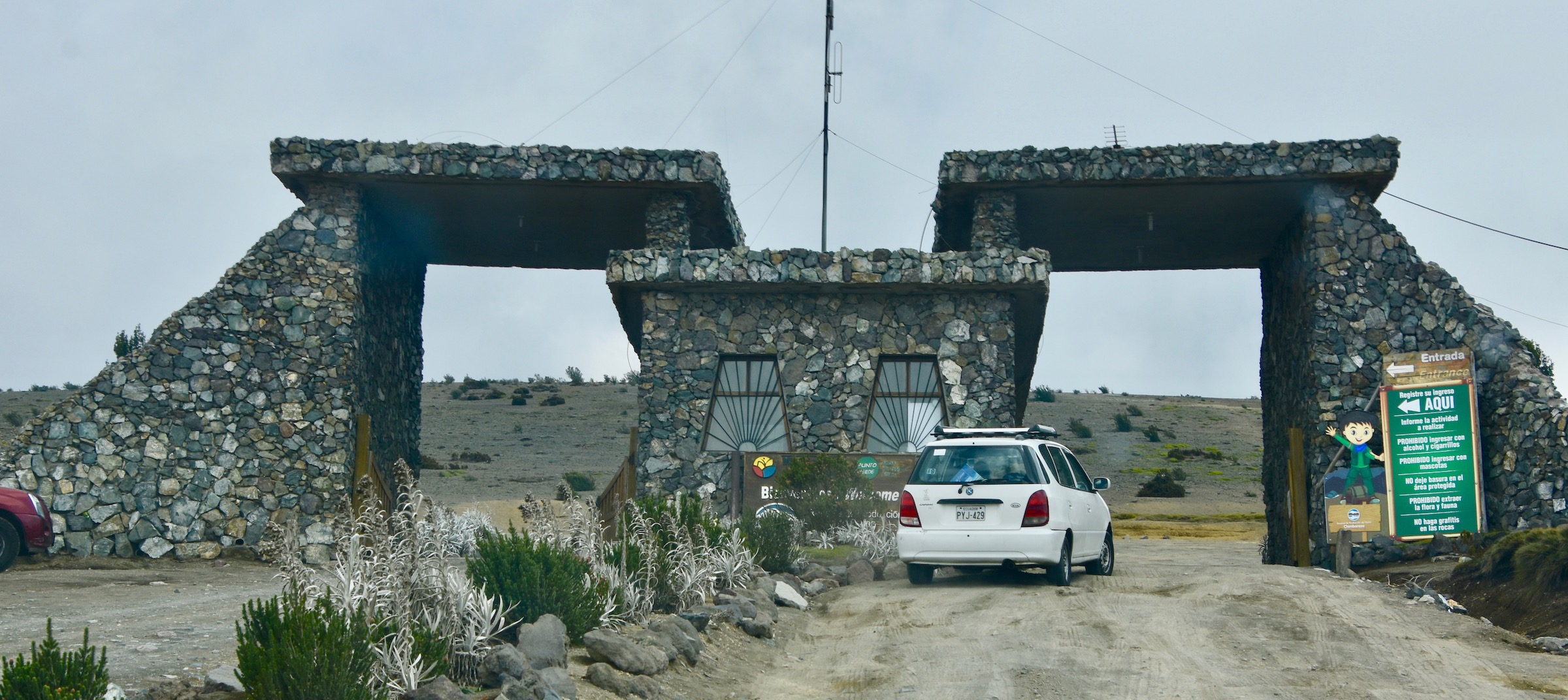
Undaunted we continued to climb passing the entrance to the Wildlife Reserve that encompasses the lands around the volcano with still no Chimborazo in sight.
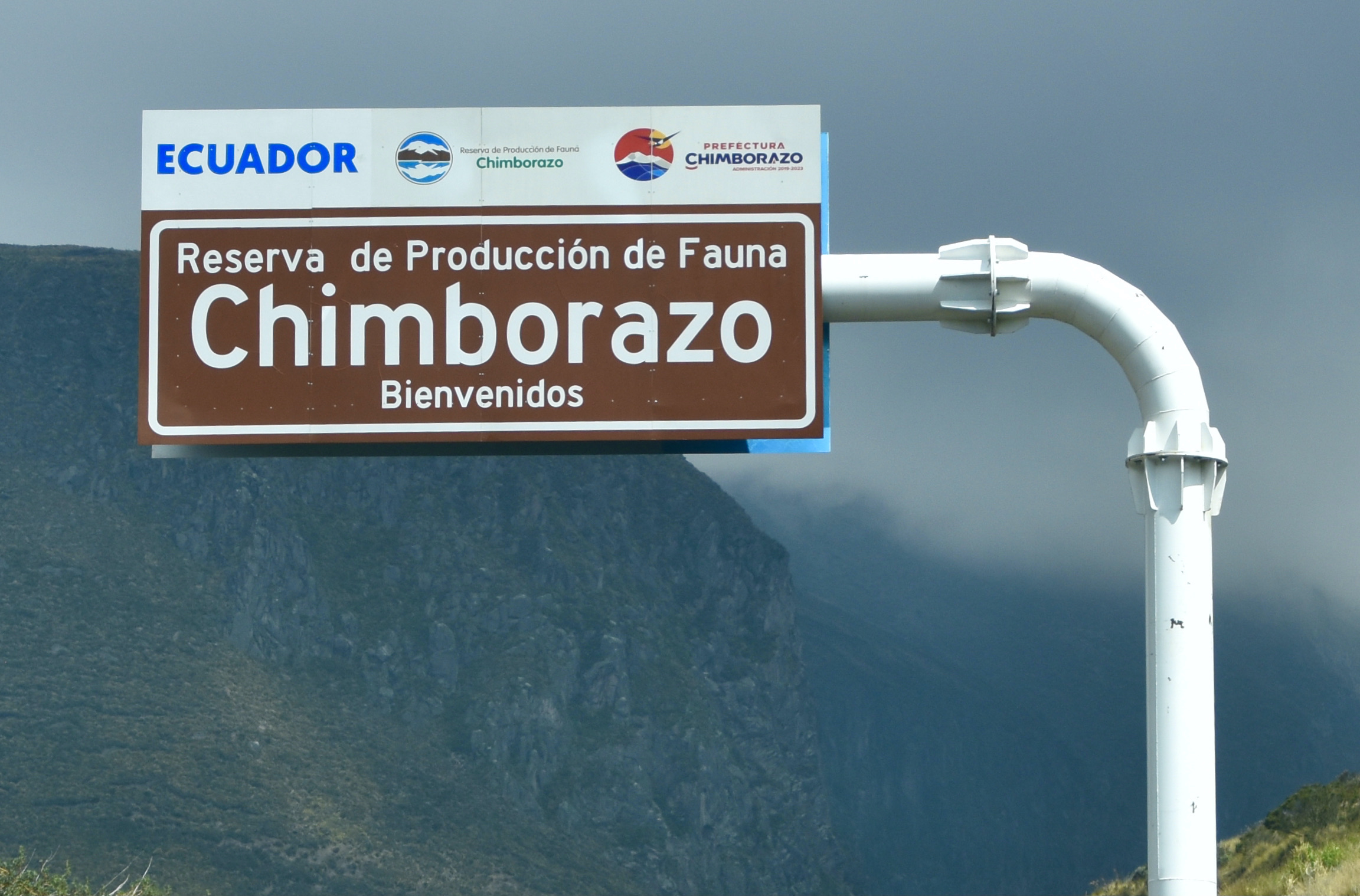
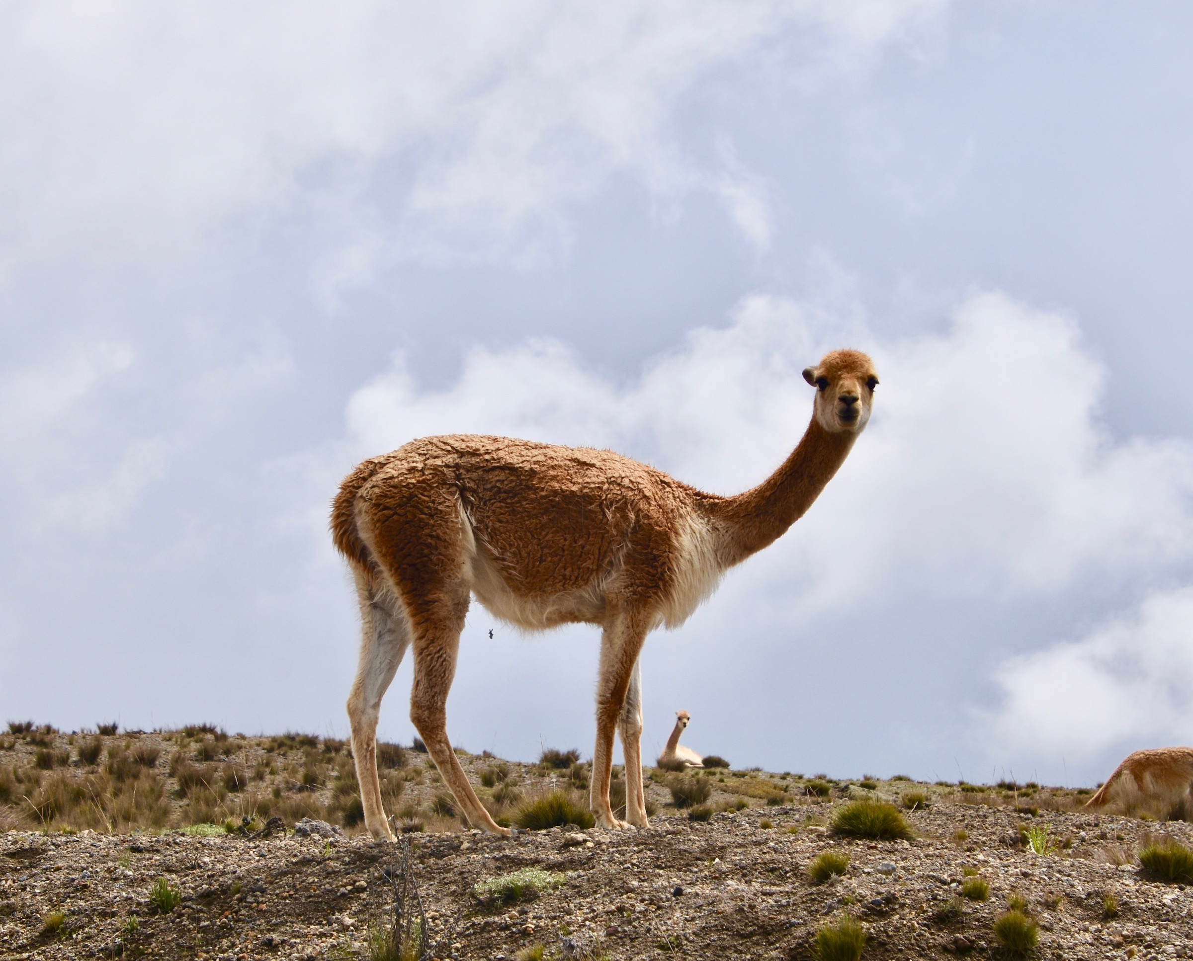
However, not far past this point we did get an unexpected bonus. Vicunas are the smallest and rarest of the four camelid species of South America, the others being llamas, alpacas and guanacos. While we’ve all seen llama and alpaca farms, vicunas and guanacos have never been domesticated and both were almost hunted to extinction. The Chimborazo Wildlife Reserve was established with the goal of bringing the vicunas back to a sustainable population in the wild. There are fewer than 3,000 in Ecuador of which the great majority live on the slopes of Chimborazo.
We saw a fair number in one spot with this one peering right at us. Despite being wild they seemed to have no fear which allowed for getting some decent photos.
Still no Chimborazo as we passed through the entrance gate well above the tree line. We were now also well above any previous altitude that Alison and I had ever reached.
Wilson didn’t pretend that the cloud cover was going to lift and dampened our expectations, but said it would still be worthwhile to continue on up to the end of the road another ten kms. on or so. We agreed, paid the entrance fee and soldiered on.
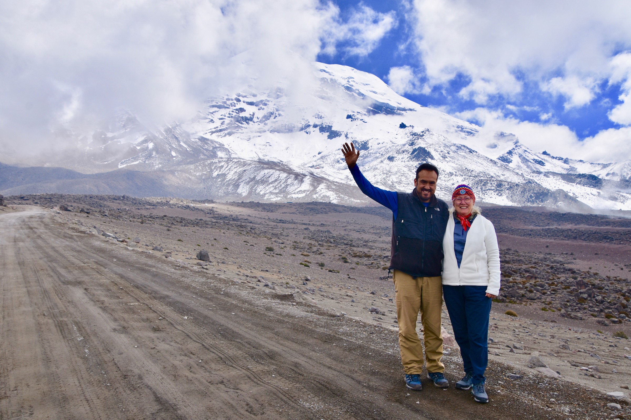
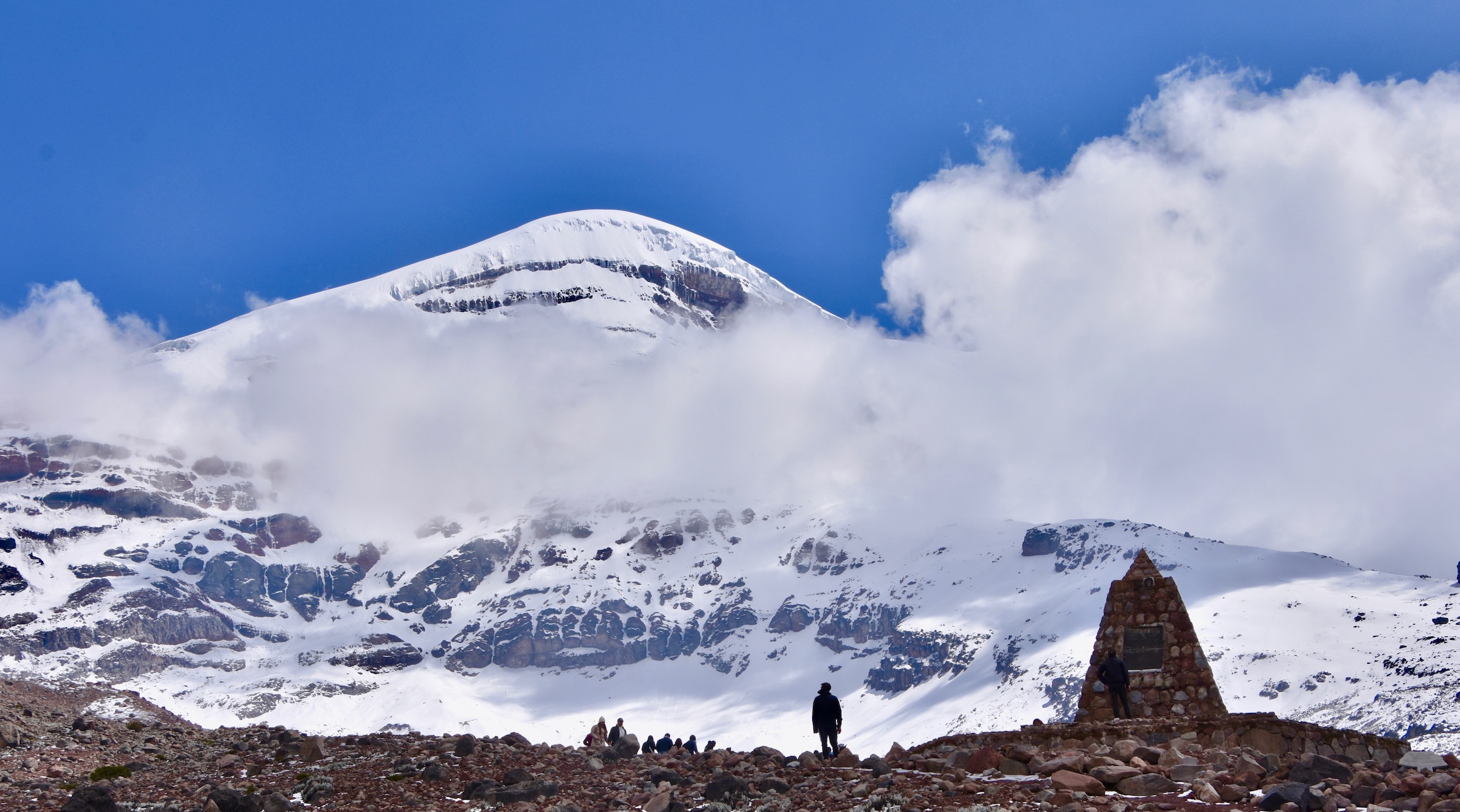
Then, as at Cotopaxi, there it was in all its splendour. I could see that Wilson was very pleasantly surprised and a bit shocked as he told us seeing Chimborazo uncovered was definitely the exception and not the rule. We celebrated by getting as many photos as we could in case the clouds rolled back in.
The road to Chimborazo and the highest you can go on the Avenue of the Volcanoes ends at 15,800 feet where I posed for my Chimborazo moment.
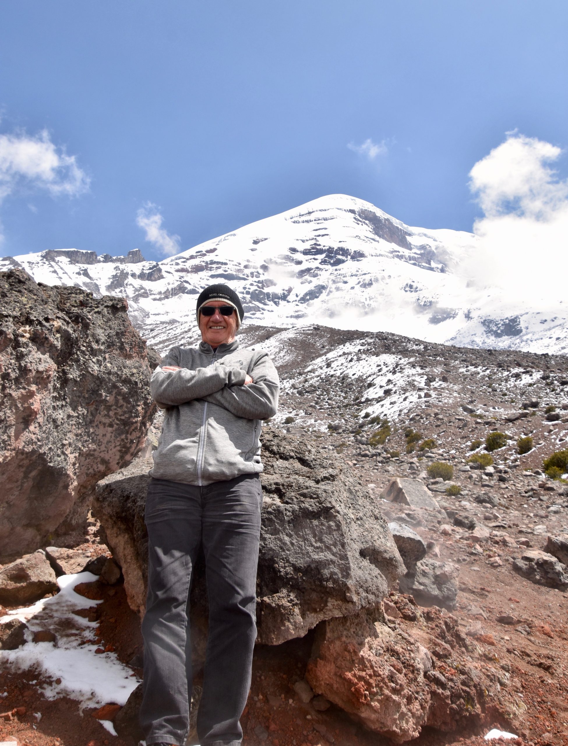
Now how did two sea level dwellers make out at this type of altitude? Alison not so great – she needed Wilson’s help to walk after a few minutes. I was a bit better and climbed up another 200 feet to break the 16,000 foot barrier and get this photo of the Simon Bolivar monument, but I sure wouldn’t be running any races up here.
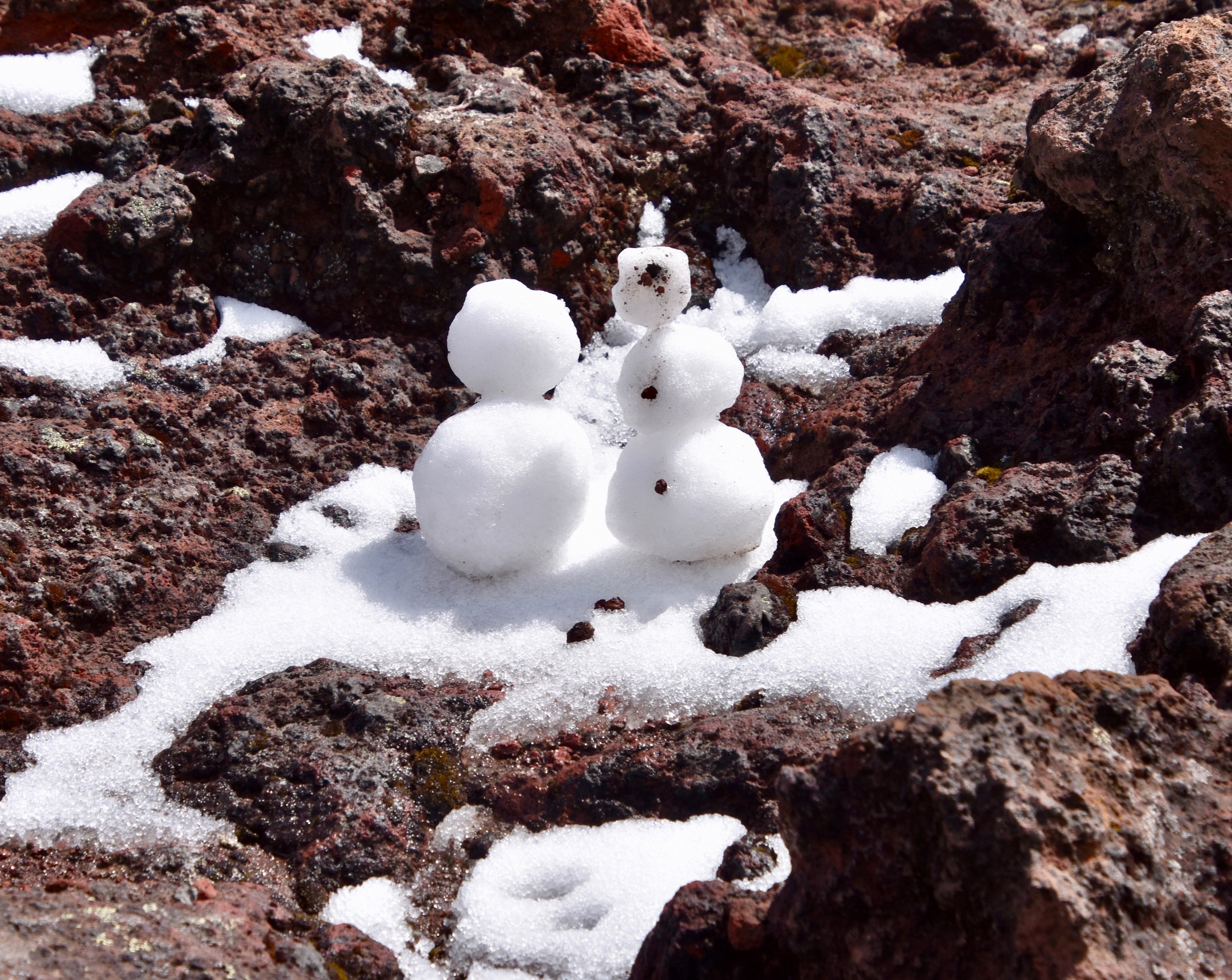
Someone had made these tiny snowmen which was a nice touch.
We didn’t spend much time outside here because of the effects of the altitude, but looking back, I am glad we did it and my appreciation of Alexander von Humboldt just went up several notches. We drove up here; he had to walk and as far as I know kept on going well past were we had stopped.
In my final post from Ecuador we’ll visit the city of Cuenca which is a UNESCO World Heritage Sight with an amazing colonial centre. Hope you’ll join us there.