Lake Titicaca from Peru

It’s hard to believe, but after just eleven days the Peru portion of the Adventures Abroad Kingdoms of the Andes tour is coming to an end. It seems we have been here much longer as there have been so many highlights packed into that short period of time including the city of Lima, the Nazca Lines, the Ballestas Islands, Cusco and most amazingly of all, Machu Picchu. But there is one more adventure that awaits us and it’s yet another blockbuster on most people’s bucket list – Lake Titicaca. So please join us one more time in Peru as we venture out on to the world’s highest navigable lake to explore the famed floating islands and visit a place where women make belts for their husbands from their own hair.
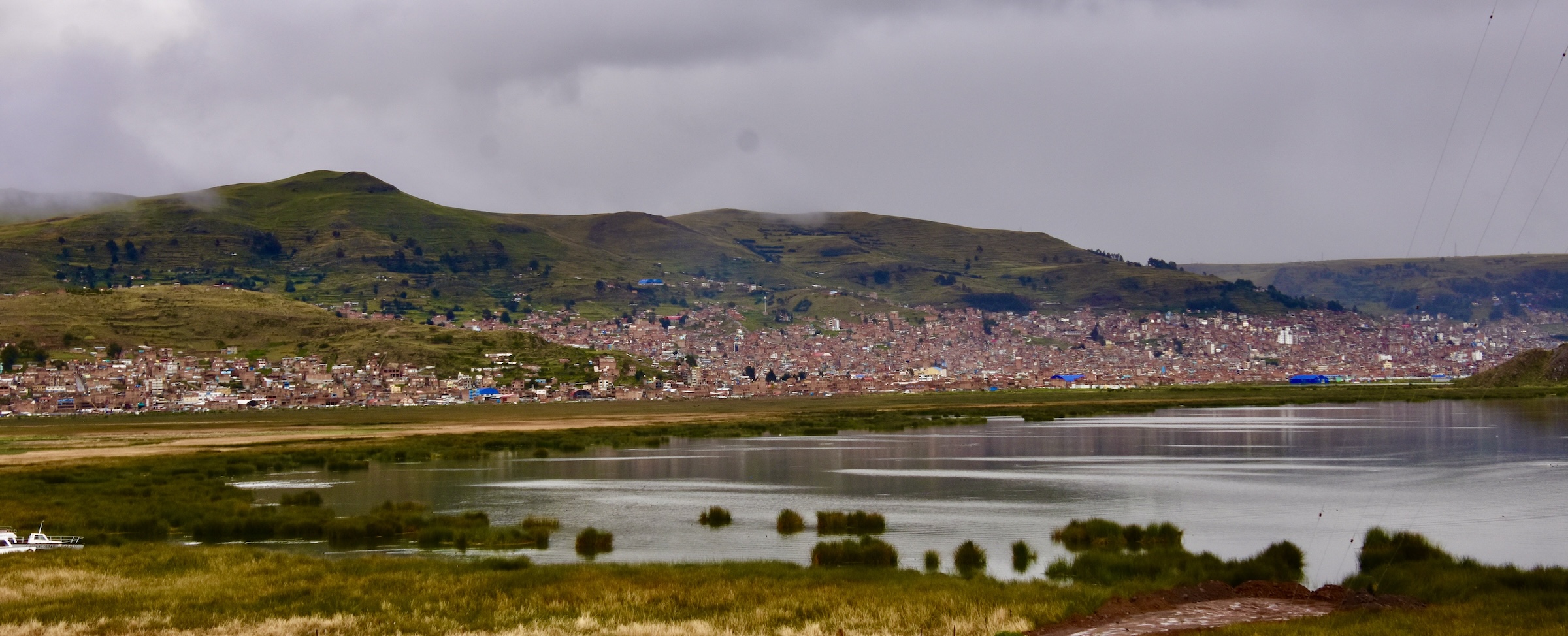
In the last post we visited the Incan site of Raqchi after which we followed the Ruta del Sol over La Raya Pass at 4,335 metres (14,222 feet) and gradually descended to the city of Puno on the shores of Lake Titicaca which is at an elevation of 3,812 metres (12,507 feet), so it’s not exactly in the lowlands.
Our hotel in Puno was on the outskirts of the city and I had this view from my room at the Hotel Jose Antonio.
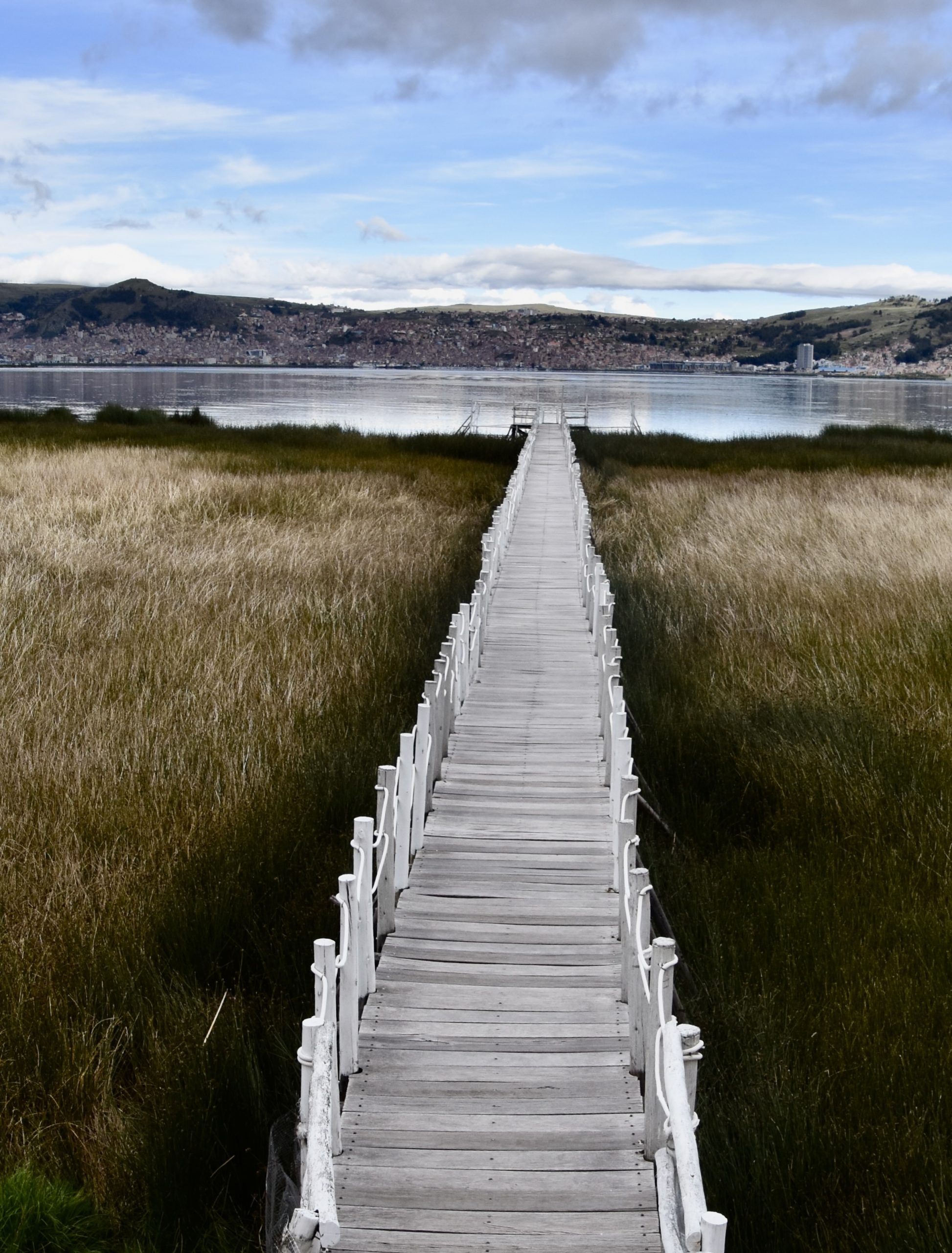
The hotel had a long pier that jutted out into Puno Bay and I got up early to do a little birding.
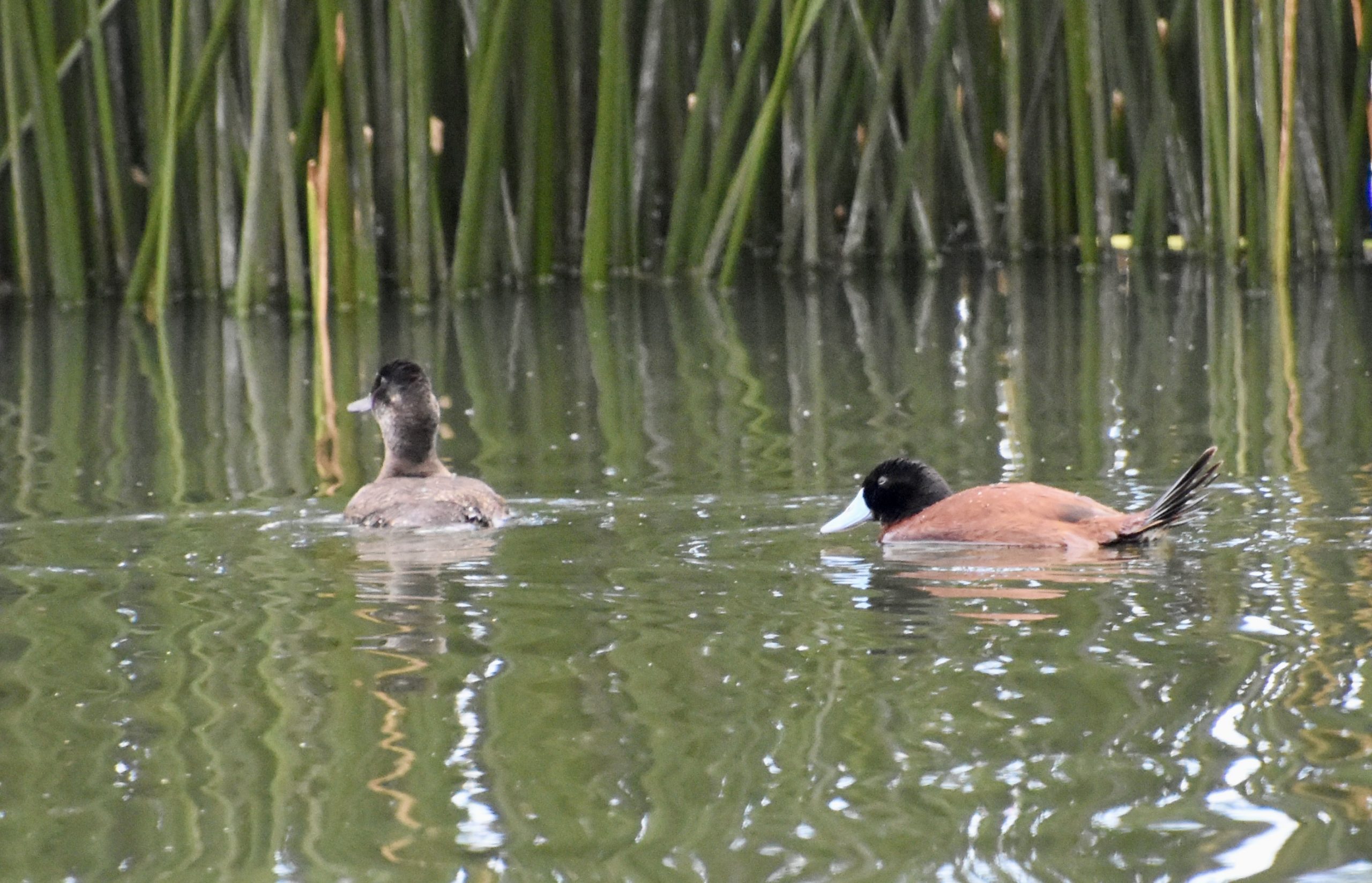
I was rewarded with a couple of good sightings including a pair of Andean ducks which are South America’s equivalent of the North American ruddy duck.
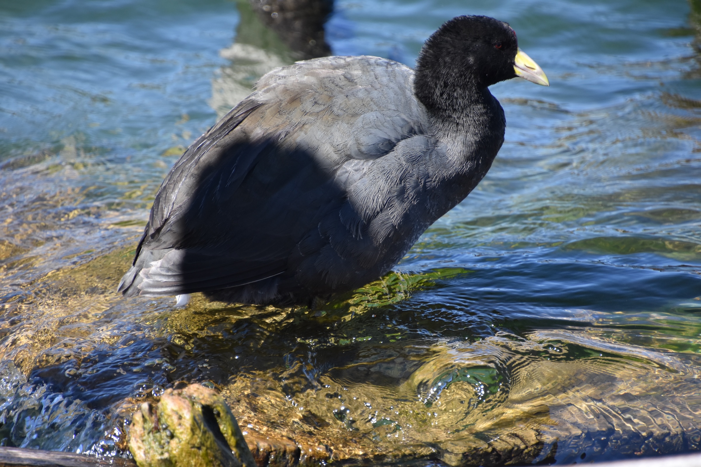
And a Giant Coot, which compared to other coots was truly enormous. They are flightless and only found at altitudes higher than 3,600 metres (11,800 feet) in a small region of the South American altiplano, the second highest plateau on earth. So this was a pretty good way to start the day with a new life lister.
Lake Titicaca – Just the Facts
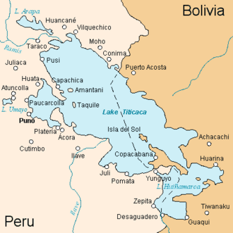
Lake Titicaca is the largest freshwater lake in South America and at 3,812 metres (12,507 feet) the highest navigable lake in the world. As you can see from the map, it is split between Peru and Bolivia with the city of Puno inside a substantial bay. It is here that Lake Titicaca’s famous floating islands are found. Properly called Uros named for the people who inhabit them, they are one of Peru’s top tourist attractions. Less known, but equally fascinating is the island of Taquile where the 2,200 inhabitants still speak Quechua, the language of the Incas and produce some of the best hand made textiles to be found anywhere.
On the Bolivian side is the Isla del Sol which the Incas believed was the birthplace of their civilization. We will visit it later on this tour, but for today we will explore Lake Titicaca from the Peruvian side. Let’s go!
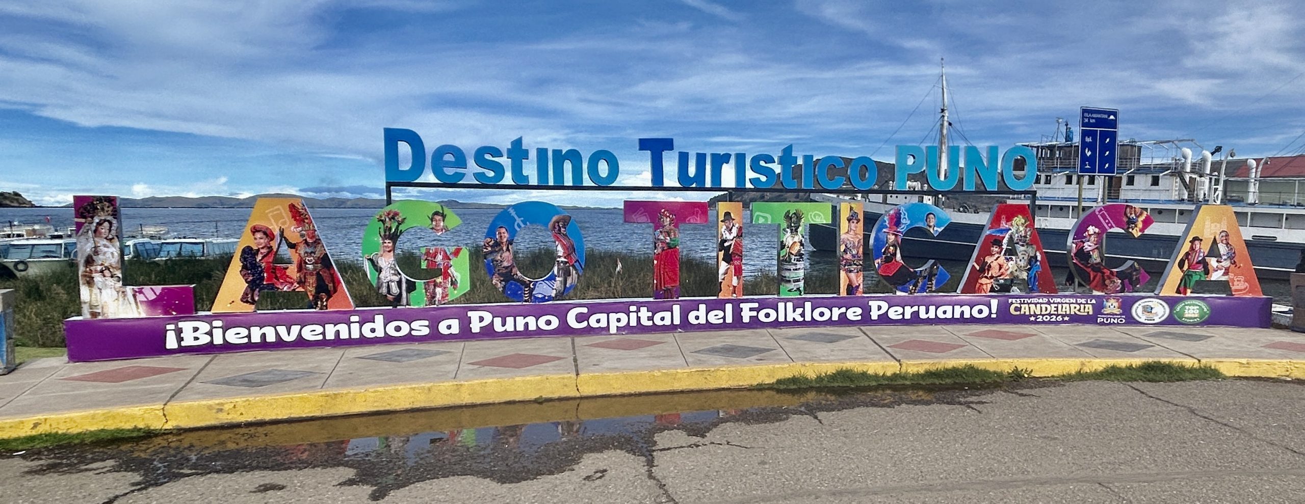
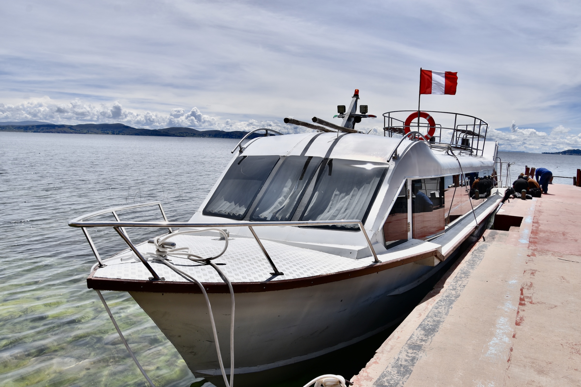
After breakfast we made our way down to the Puno waterfront and disembarked beside this sign and then walked to our boat which was awaiting us.
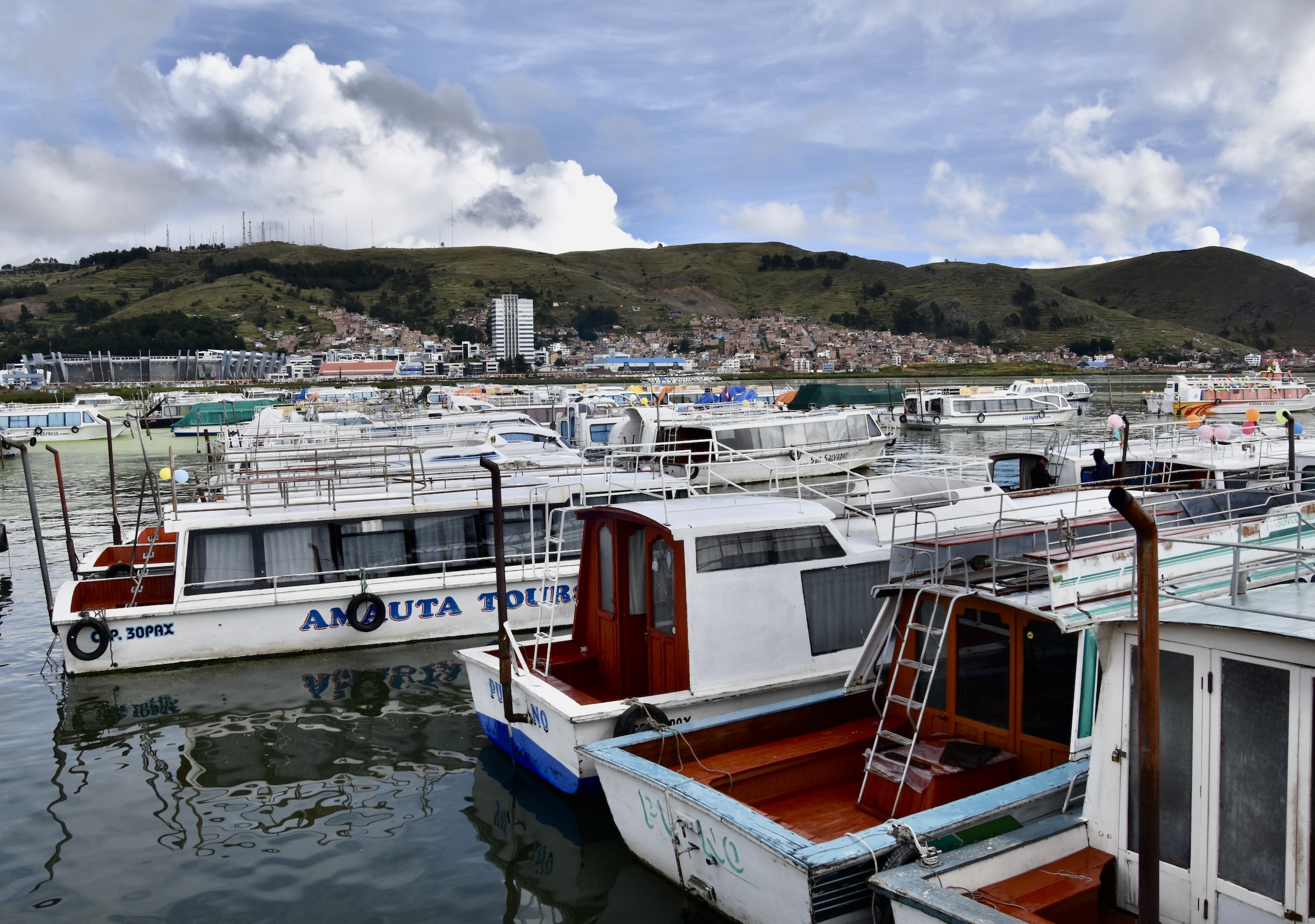
Looking around I could see literally dozens of other boats sitting idle and once again was reminded of how fortunate we were to be here in the so-called ‘off season’. During our entire time at Lake Titicaca in both Peru and Bolivia, our group was one of a very few tourist outings to be seen.
I also noticed one of Lake Titicaca’s famous ‘knock down’ ships, the SS Ollanta. It was built in England in 1931 exactly as it looks here, and then completely disassembled and shipped to Peru where its parts were carried by rail to Puno and reassembled to become the largest ship that ever plied the waters of Lake Titicaca. It’s still operational and available for charters.

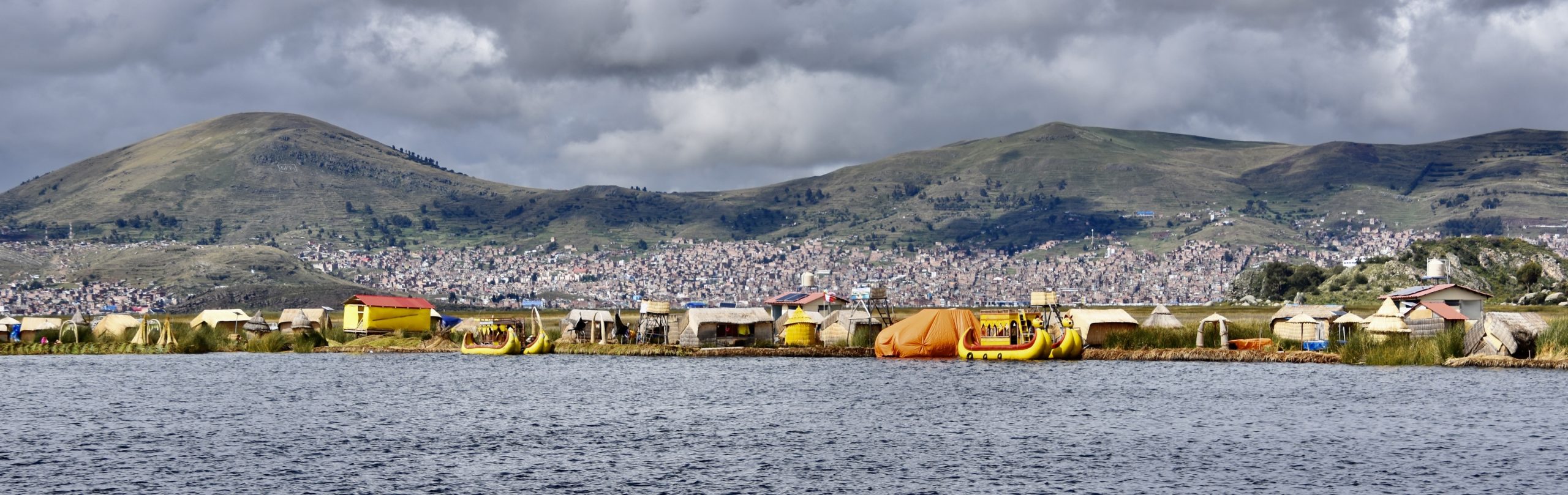
Lake Titicaca’s manmade floating islands are located about 30 minutes from Puno and there are about a 100 or so on the lake. The numbers fluctuate because each island has a lifespan of only about 30 years so new ones are still being built while others are abandoned. It is hard to believe until you actually step onto one of these islands that they are legitimate, made of nothing but the totora reeds that are found around the shores of Lake Titicaca. The first question to ask yourself is, why? They are not that far from the lakeshore so why go to all the trouble of constructing an artificial island when there’s all that real land all around the lake? The Uros are descendants of the Pukara culture who inhabited the area as early as 1500 BCE and about whom not very much is known. Why they left the land for the lake is speculative, but the most widely accepted theory is that they were effectively forced to by the incursion of the Incas into their territory in the 15th century.
Originally the floating islands were located far out into Lake Titicaca, many kilometres from shore and all but inaccessible to tourists or any visitors for that matter. In 1986 the islands were devastated by an unprecedented storm and a collective decision was made to move the islands much closer to Puno and that in turn made them into instant tourist attractions.
This photo gives some perspective of how close the islands are to Puno.
The Uros went from being one of the last true hunter-gathering civilizations on earth to relying mostly on tourism almost overnight.That being said, the islands are still maintained exactly as they have been for centuries and while there are some very touristy elements of a visit to a floating island, it is still an experience that you would not want to miss. Each island has a name and we have arrived at Condor Island with its distinct presence in the middle of the place.
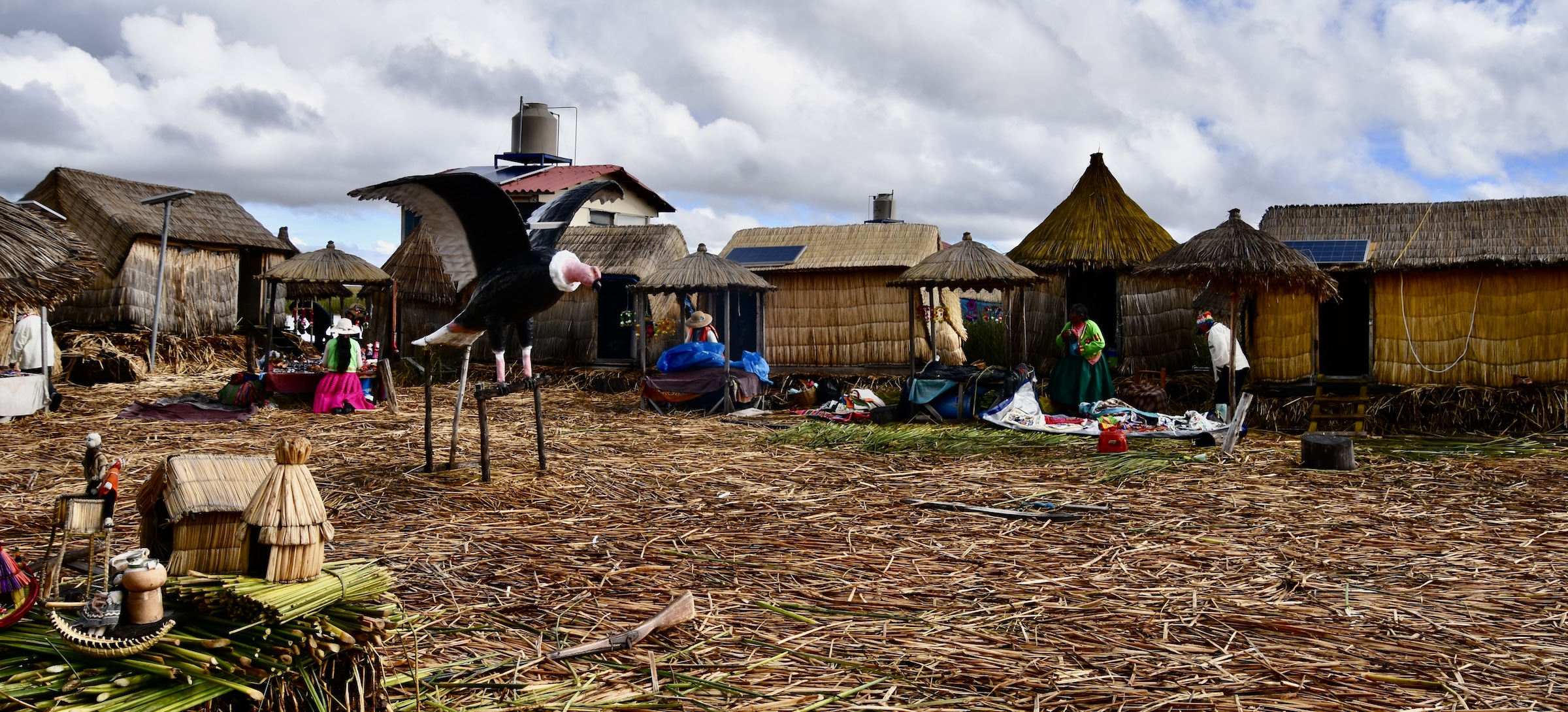
Each island is the home of one extended family of between 15 to 30 inhabitants. The total number of Uros people varies greatly because many now spend more time on the mainland than on the lake, so the estimates go from 1,200 to 4,000. Even at the higher number, it is really a very small group.
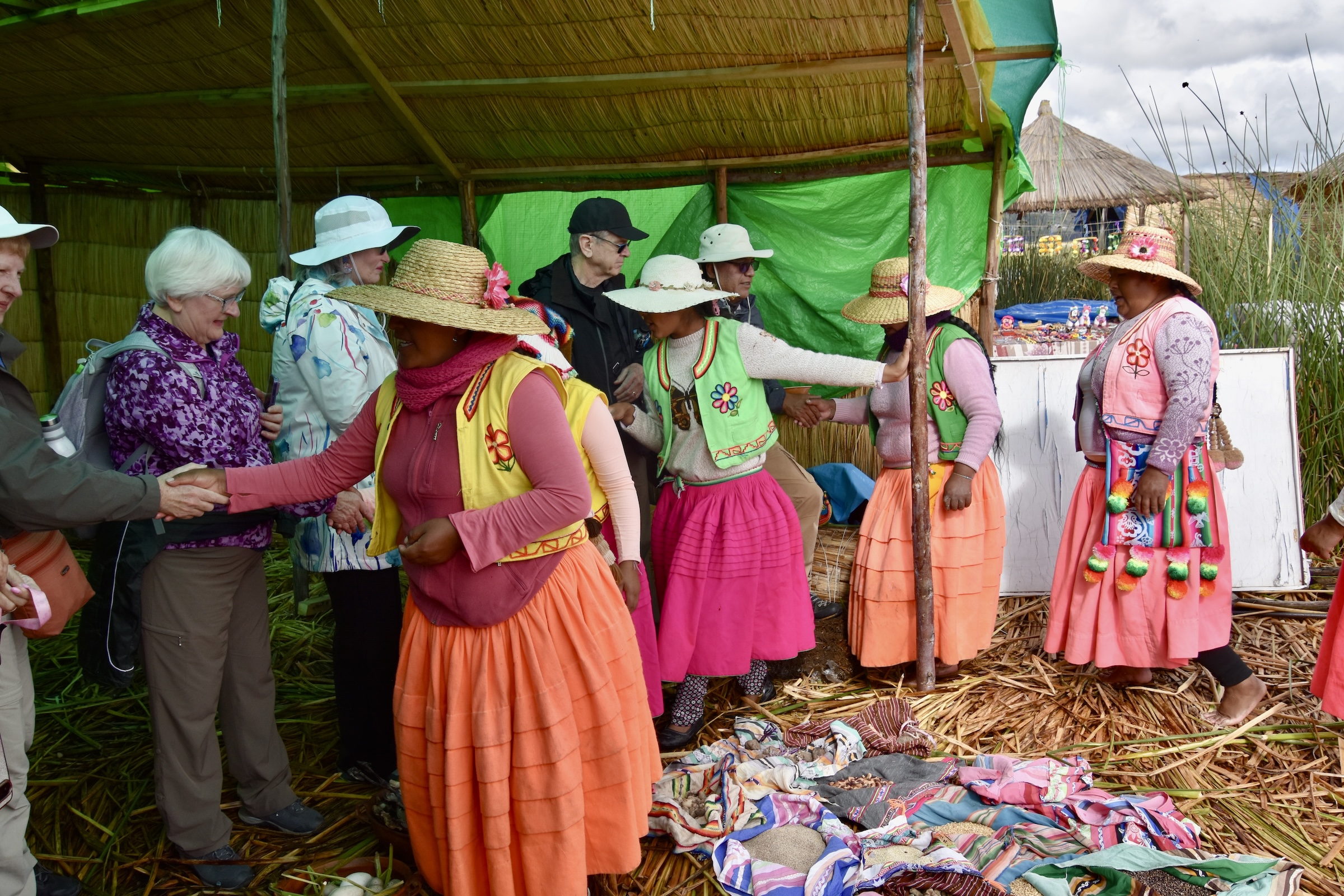
The first thing I notice on stepping onto the island is that it’s a bit like stepping onto a trampoline as the surface is definitely bouncy. As you can see from the photo above, the residents are dressed in their traditional garb and are mostly going about their business which consists of weaving, constant island maintenance and food gathering and preparation.
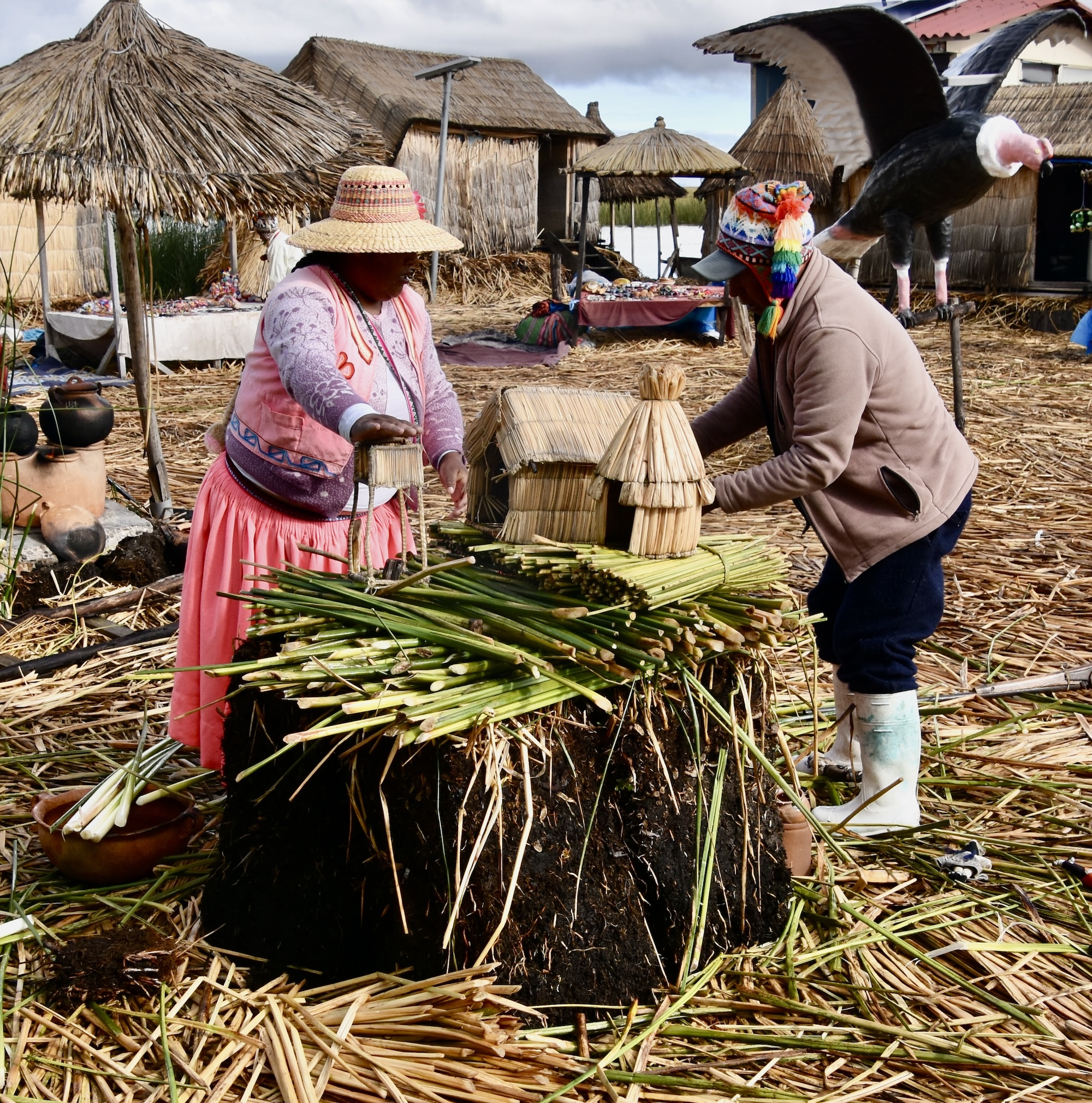
We are greeted by a number of elders and given a demonstration of just how these islands are constructed out of nothing but reeds.
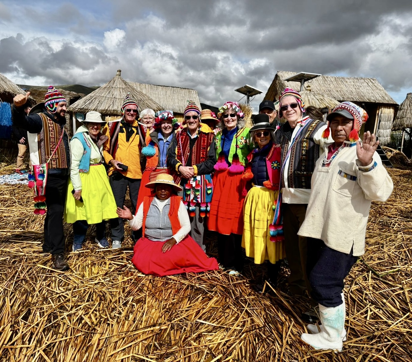
There are a number of other demonstrations that I won’t go into detail about, but they all involve the traditional hunter-gatherer culture that the Uros relied upon almost exclusively until that 1986 disaster. After these we were are divided into groups of three and taken into individual homes where we are given the opportunity to don traditional Uros dress which most of us accepted. Gathering together the AA group now looks like this. It was quite a hoot.
At the end of our visit our guides shake all of our hands before we depart.
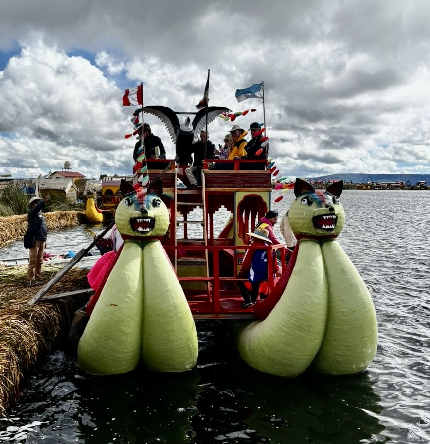
Instead of leaving the island on the boat we came on, most of us board one of the famous Lake Titicaca reed boats. Yes they look like something you’d find at a carnival, but trust me, they are the real deal, made entirely from totora reeds.
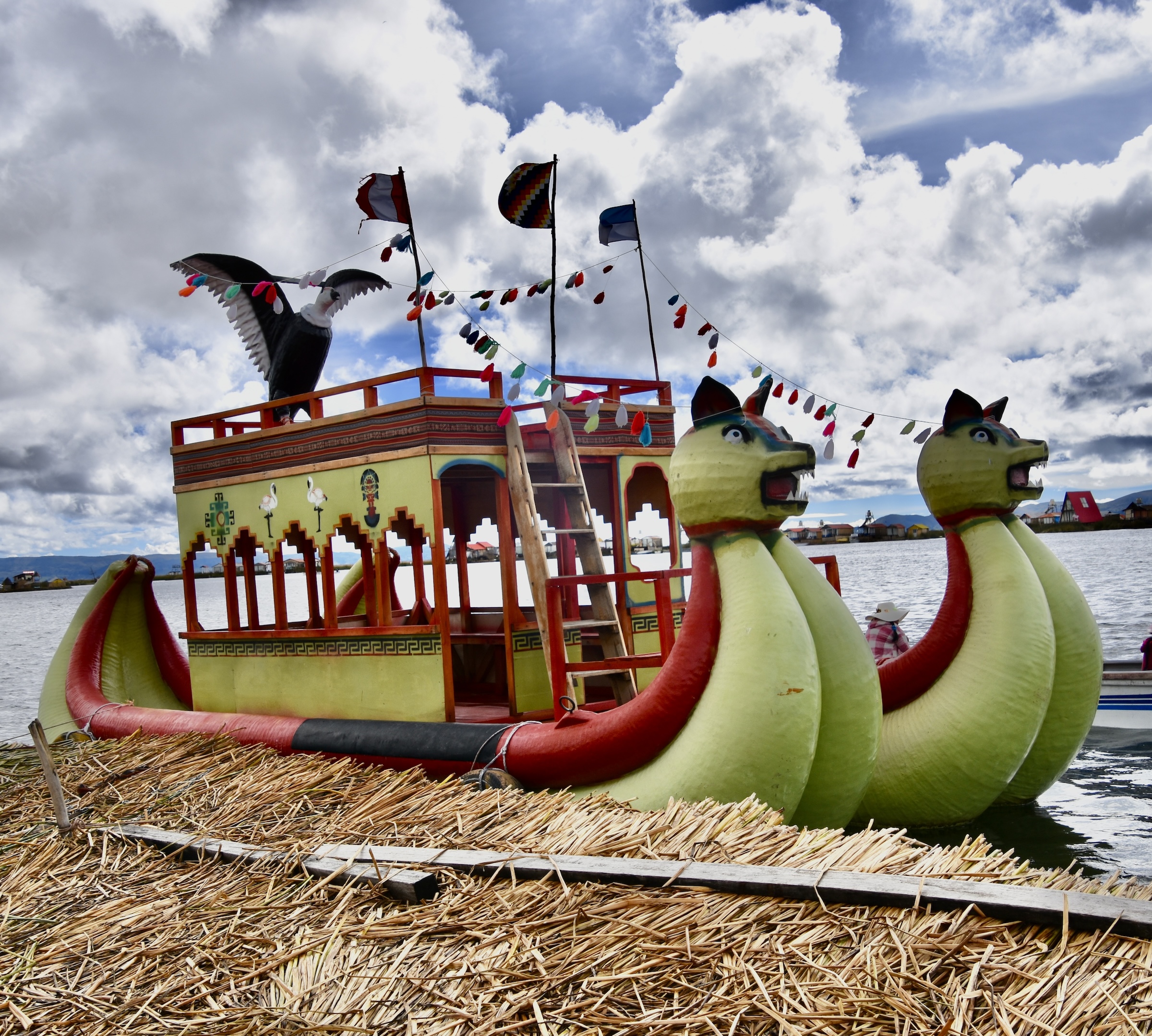
These boats have no method of propulsion and are pushed by a tiny boat that acts like a tug pushing us forward to an adjacent island.
This is our landing spot. From atop the reed boat you get a better perspective of what these floating islands look like.
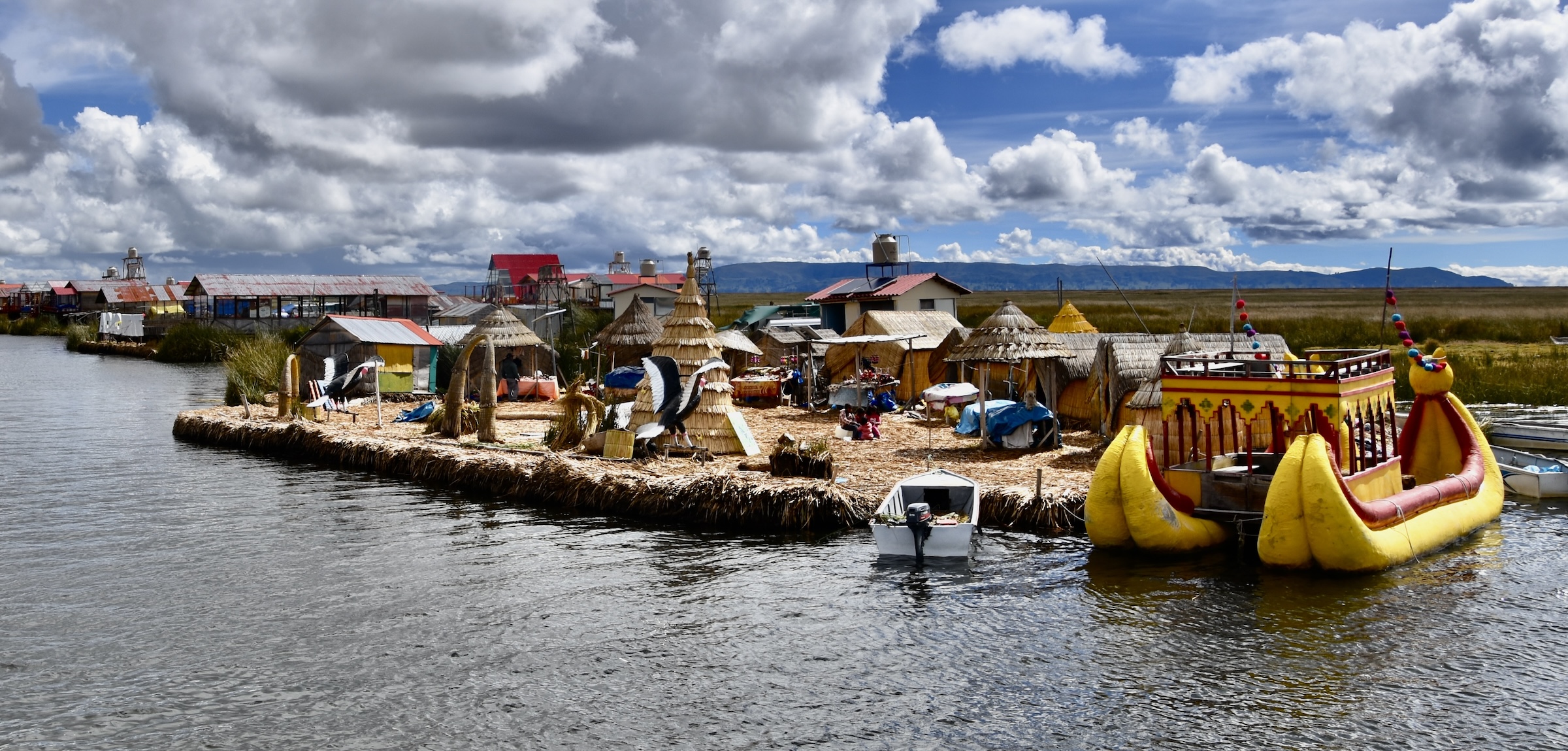
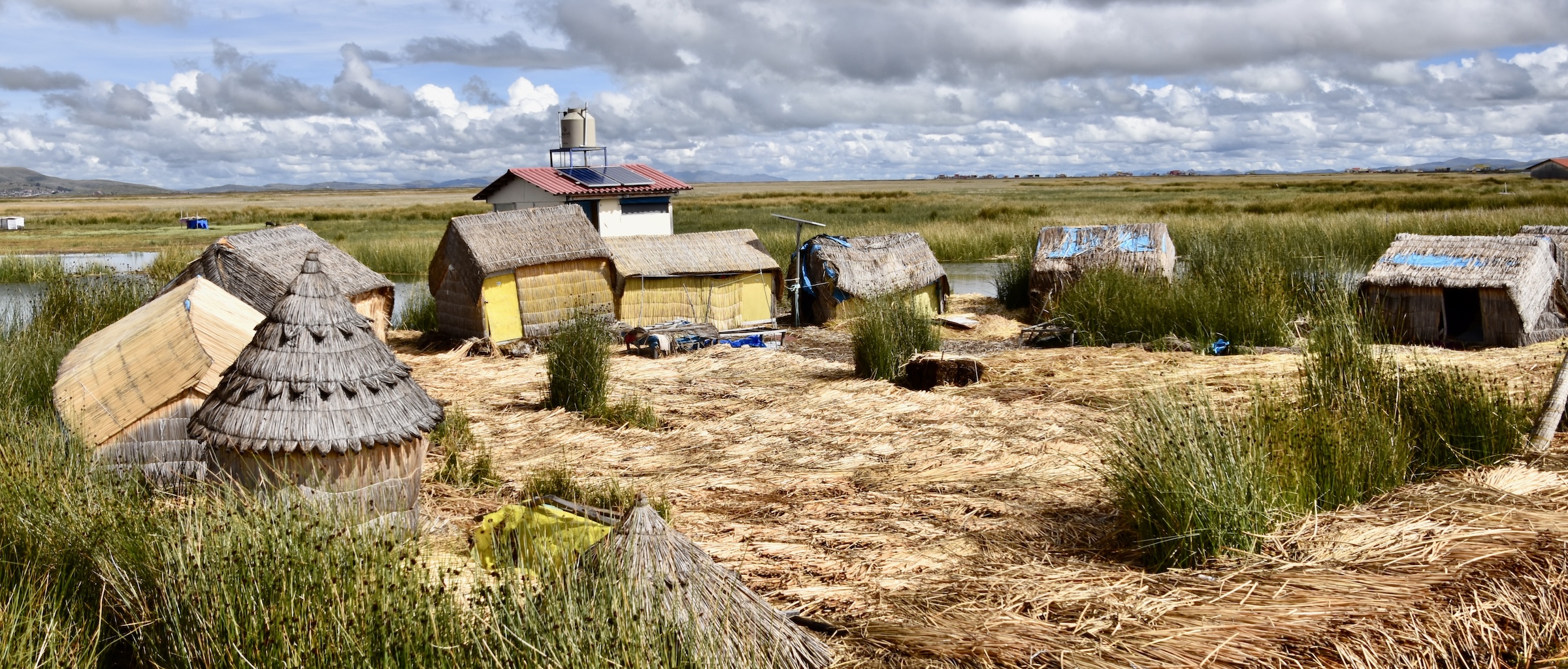
We also get to see that not all the islands are set up for tourists. This one for example is much closer in appearance to what the pre-1986 islands would have looked like, except for the solar panels.
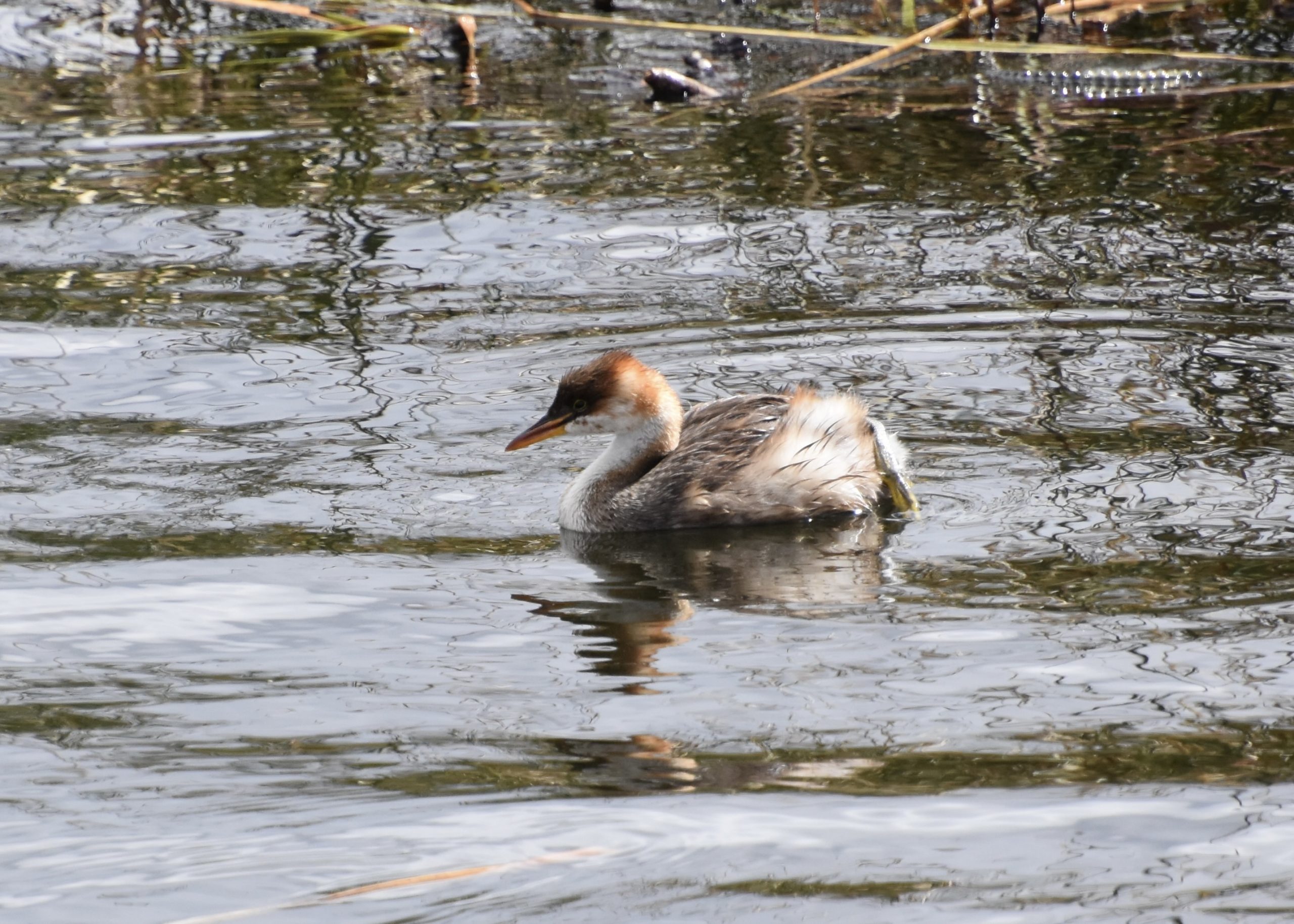
While waiting for our excursion boat to pick us up I got my second life lister of the day, a Titicaca grebe. These birds are only found on Lake Titicaca and a few smaller lakes. Unlike all other grebe species they are flightless and there are less than 1,000 of them left.
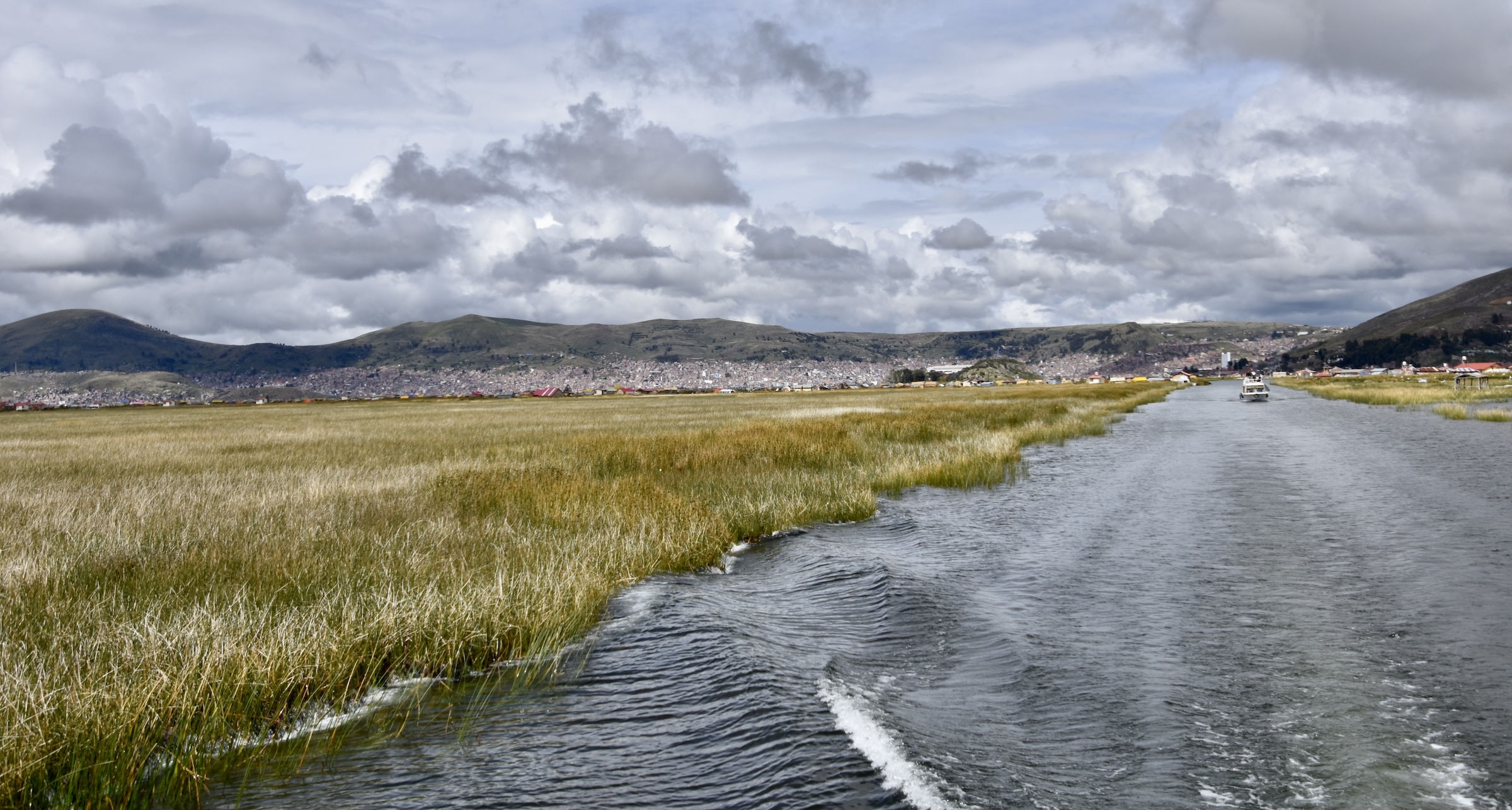
We now headed out for into the vast expanse of Lake Titicaca for Taquile Island, but to get there we first had to navigate a narrow channel through the totora reeds.
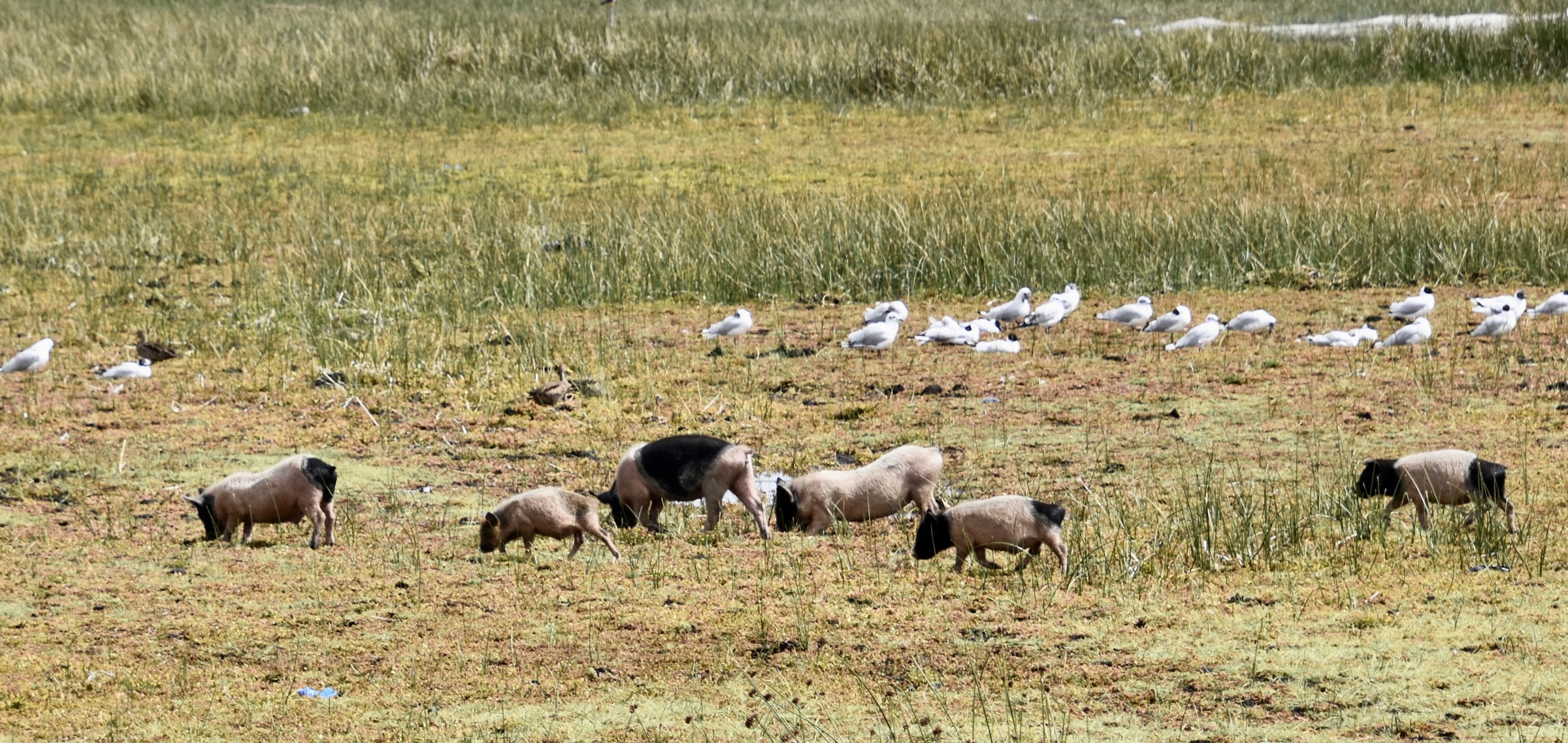
There was a ton of wildlife on both the water and the reed beds including these roaming pigs.
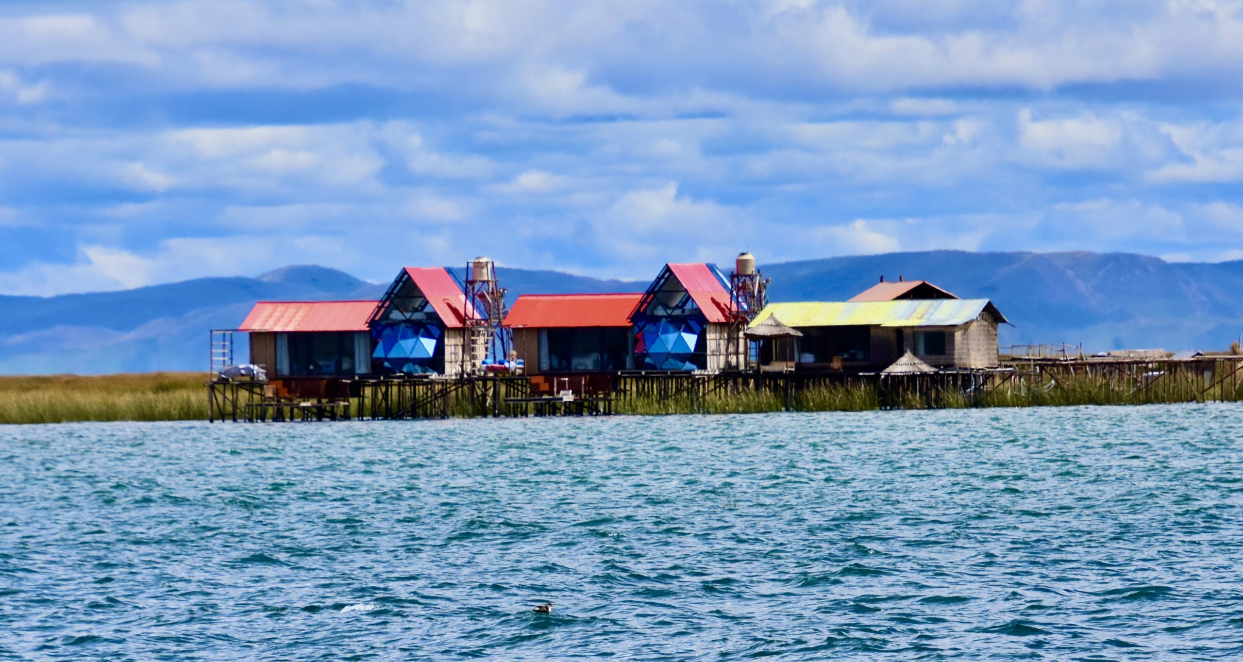
There were also some substantial abodes built on stilts far out into the lake.
Taquile Island
While the floating islands of Lake Titicaca are a pretty well known tourist attraction, Taquile Island is not. The main reason is that getting there takes time – it’s about 40 kms. (25 miles) from Puno and even on a calm day it will be at least a three hour journey each way, but it’s definitely worth it.
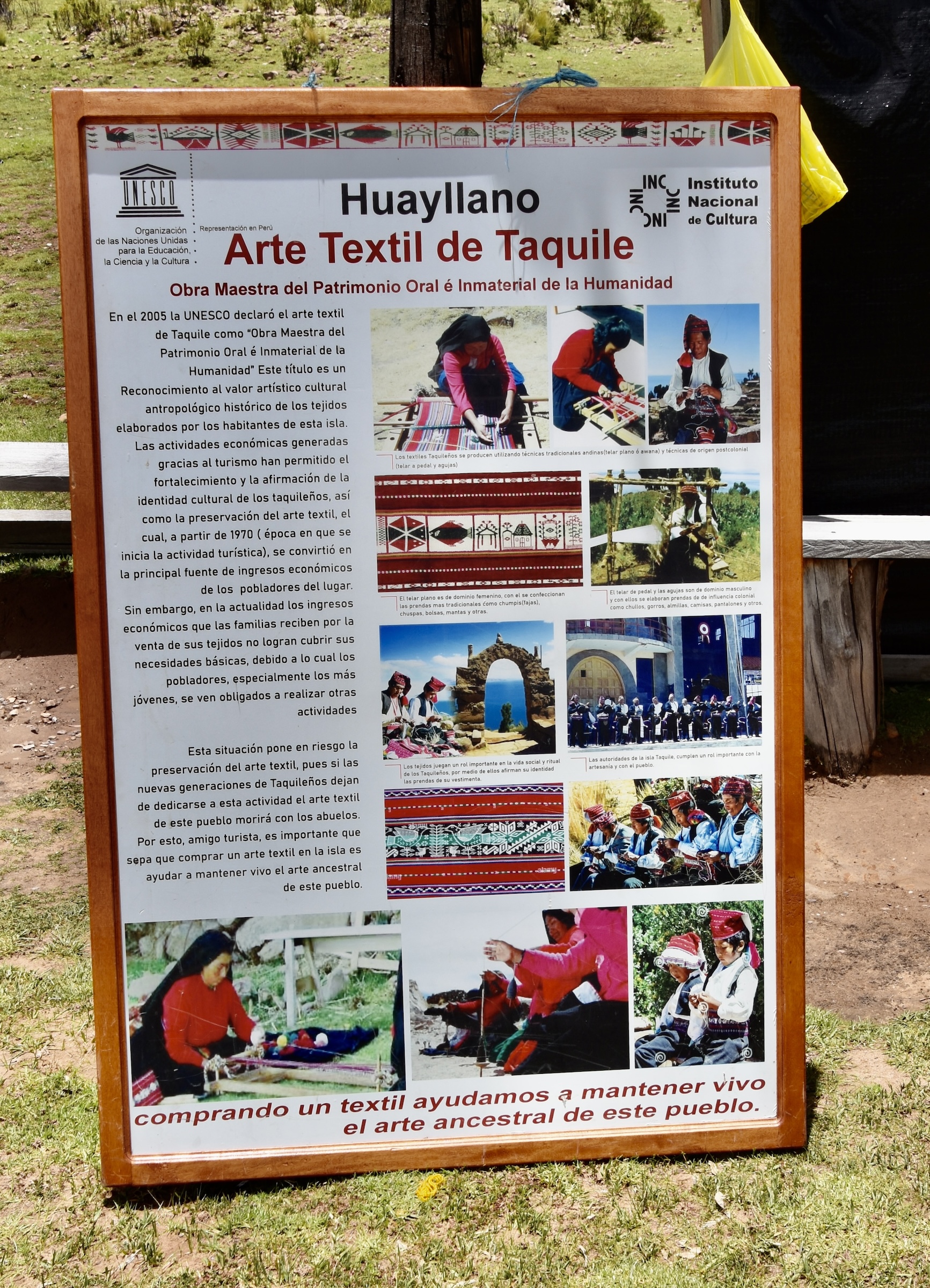
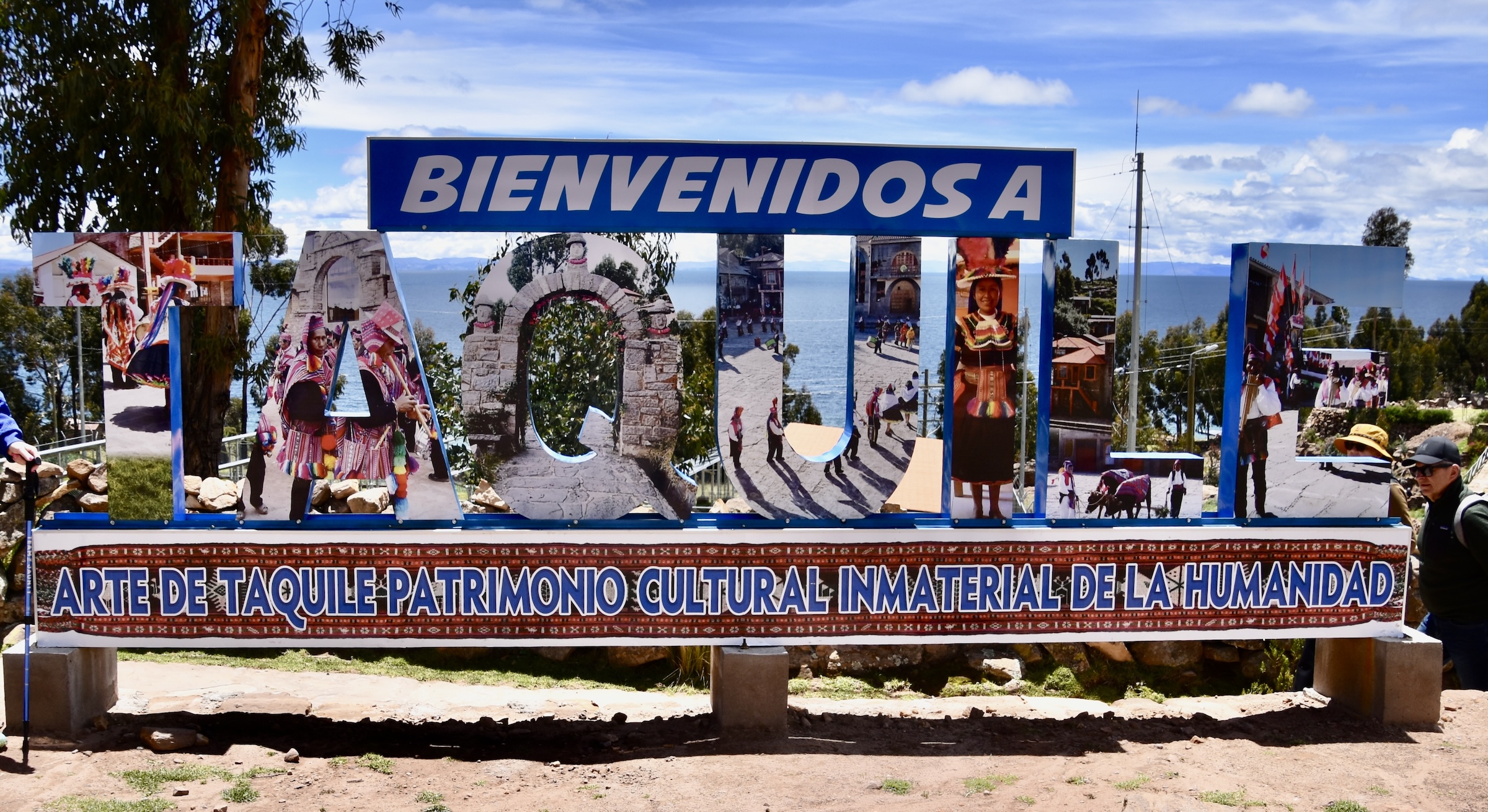
Like the Uros, the Taquileños are an ancient society that still lives much as they did when they came to the island thousands of years ago and they have a unique communal culture that is recognized by UNESCO as one of the Intangible Cultural Heritage groups in the world. While most people know about UNESCO World Heritage Sites, the Intangible Cultural Heritage designation was only created in 2003. Taquile was inscribed in 2008, the first in Peru, with this description:
The island of Taquile located in Lake Titicaca on the Peruvian High Andean Plateau, is known for its textile art, which is produced as an everyday activity by both men and women, regardless of their age, and worn by all community members.
The people of Taquile were relatively isolated from the mainland until the 1950s, and the notion of community is still very strong among them. This is reflected in the organization of community life and in collective decision-making.The weaving tradition on the island goes back to the ancient Inca, Pukara and Colla civilizations, thus keeping alive aspects of pre-Hispanic Andean cultures.
Although the Taquileños pre-date the Incas, they do speak the Incan language Quechua. Altogether there are about 2,200 of them living on this island which has no motorized vehicles and interestingly, no dogs. There are some modern amenities like a solar panel array that provides most of the island’s electricity.
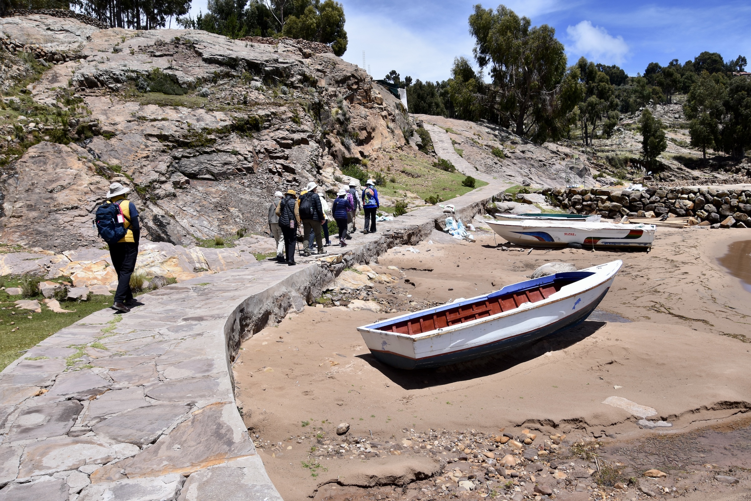
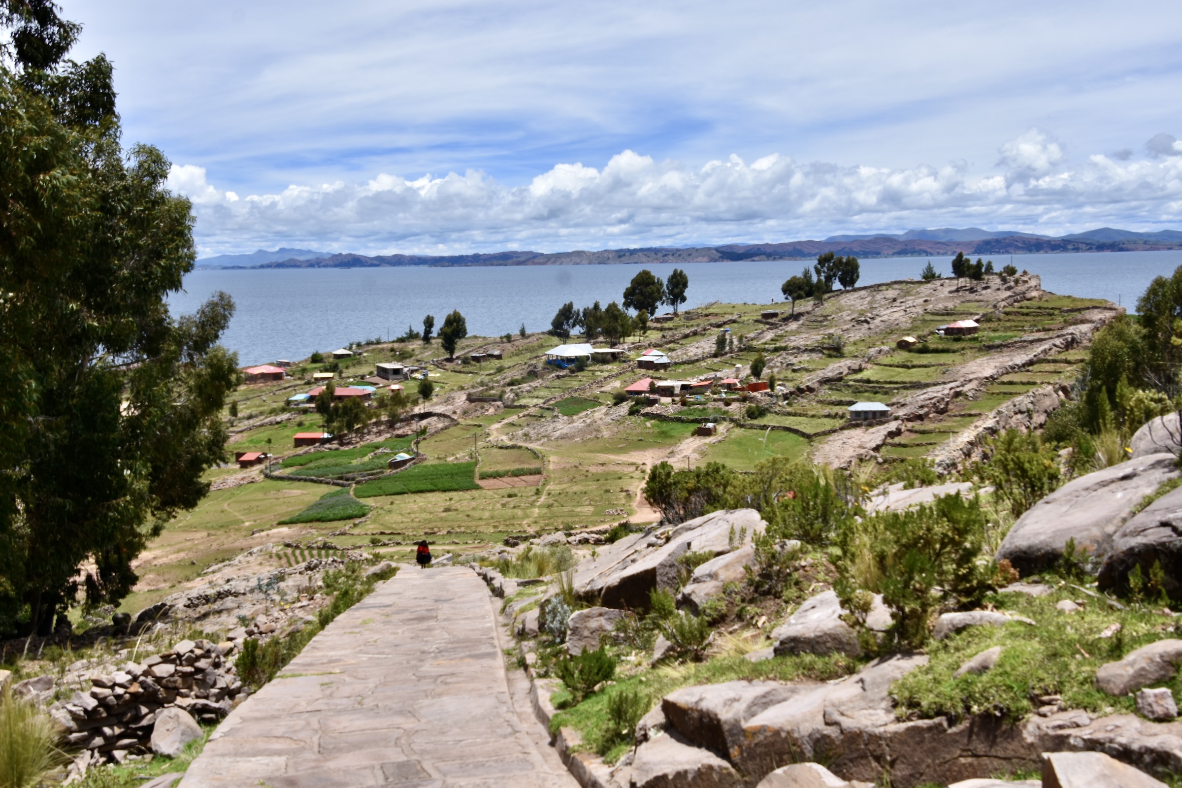
We land near a beach on the island and follow a path inland led by our local guide Blady.
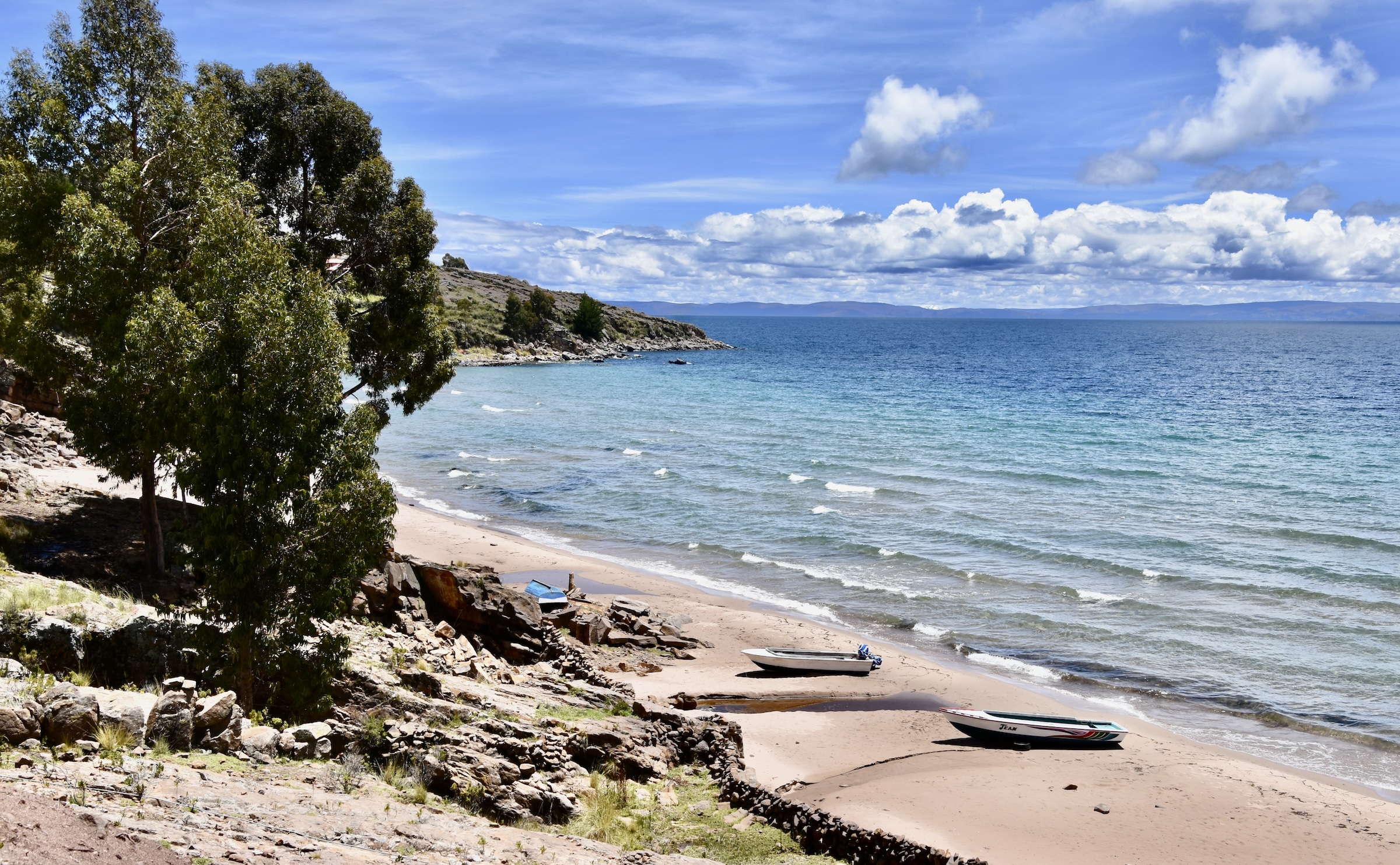
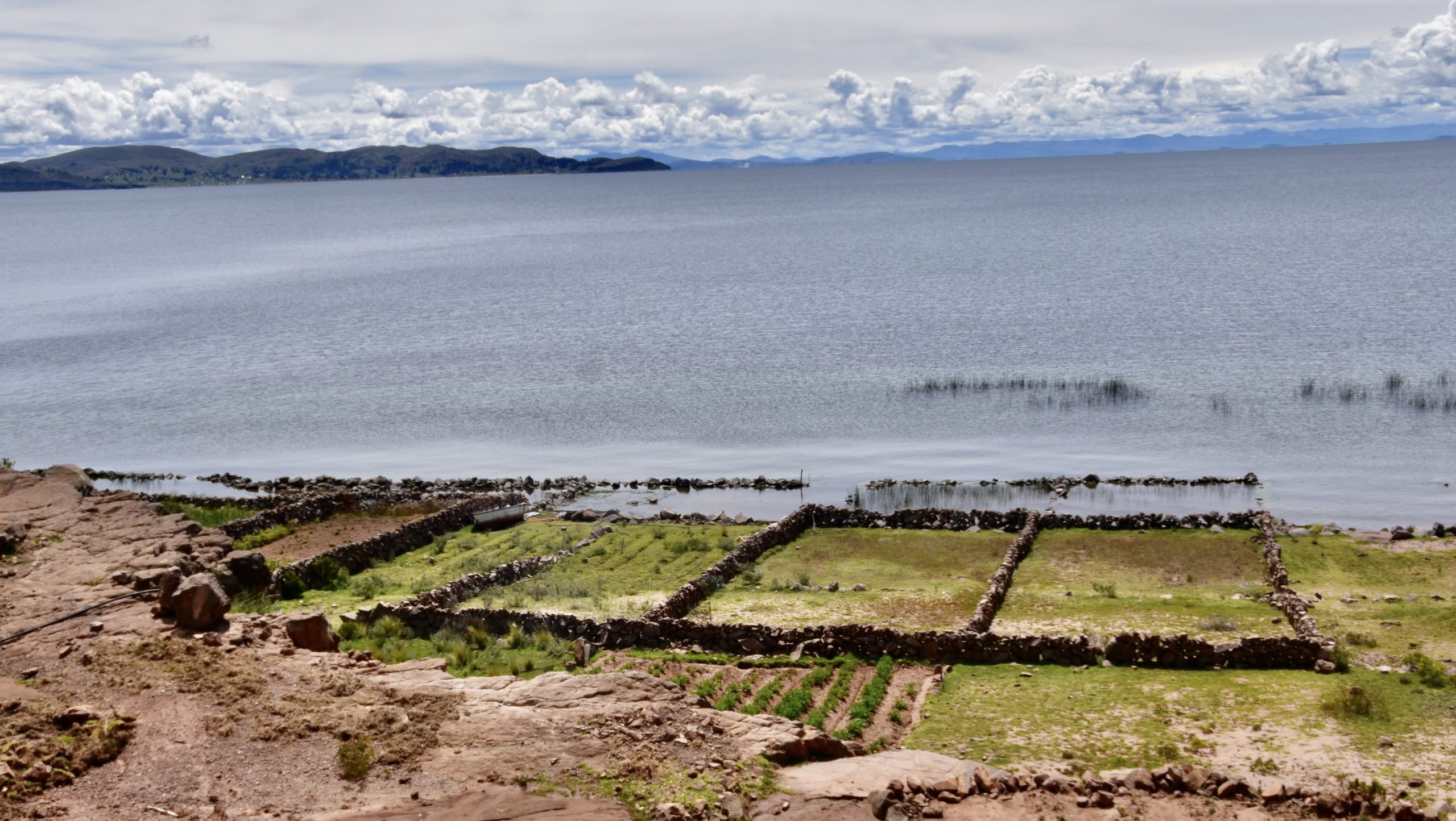
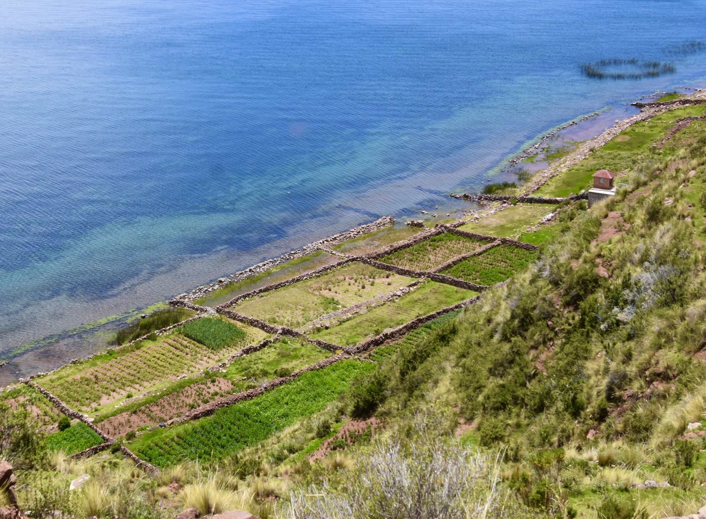
The one thing I was not expecting about Lake Titicaca was a scene like this. We’re over 3,800 metres (12,500 feet) high and if someone told this was a photo taken in the Mediterranean, I would believe it.
There are terraces on the island that are well over a thousand years old and lakefront garden plots with ancient stone walls.
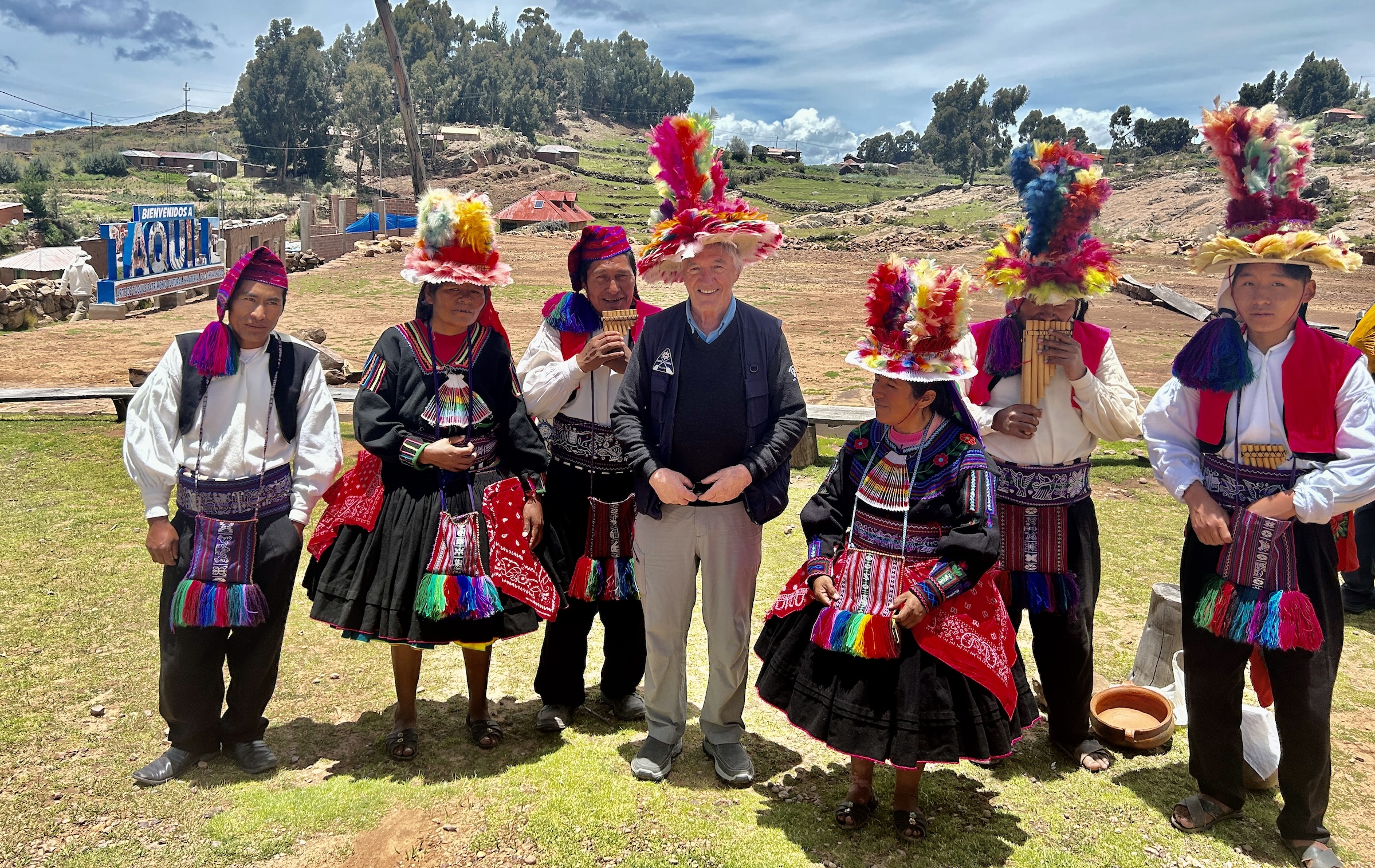
After about 20 minutes of steady uphill walking we come to an open area where a number of Taquileño men and women are there to greet us.
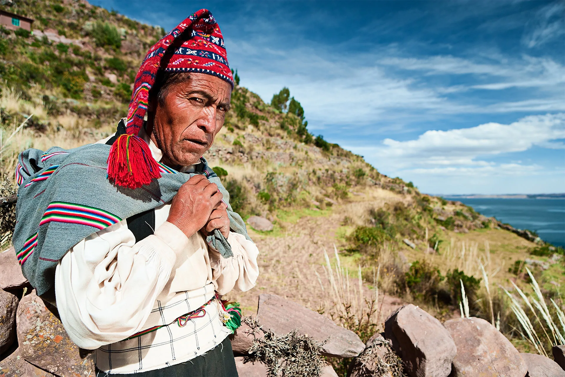
What makes this culture so unique is the division of labour. Known as ‘the island of the knitting men’, all the knitting is done exclusively by men and just like in Appalachia where you might see men constantly whittling, here the men are constantly knitting, whether walking or sitting. Starting at age eight they start by making their own unique hats called chullos and as they get older and better at it, the chullos get more elaborate and are the primary lures in attracting a mate. However, it is not the woman who chooses whether or not the chullo passes muster, but rather the prospective father-in-law. If he accepts the chullo then the bargain is sealed, although the bride must already have indicated her willingness to marry the suitor.
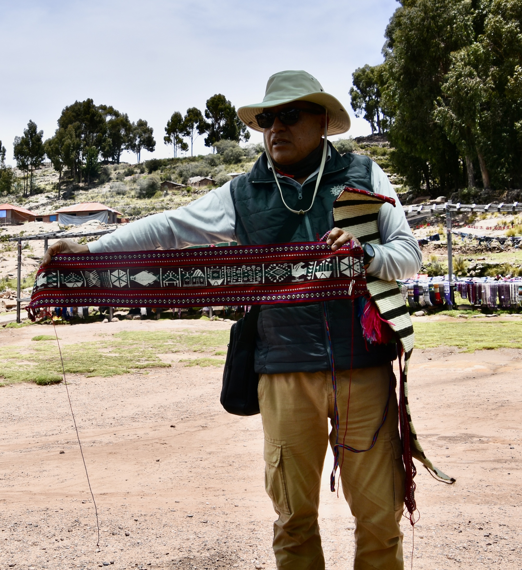
After the proposal is accepted he then knits his own chullo such as the one in this photo from the BBC website. Then it’s the wife’s turn to respond by weaving a belt called a chumpi for her husband to be, but this is no ordinary belt. It’s made from her own hair, which she cuts for the first time in her life, and finely woven wool. Each chumpi is divided into 12 panels with symbols that represent her family’s traditions.
The taquileños then demonstrate a traditional dance wearing fiesta dress and many in the group join in what really is a pretty joyous occassion.
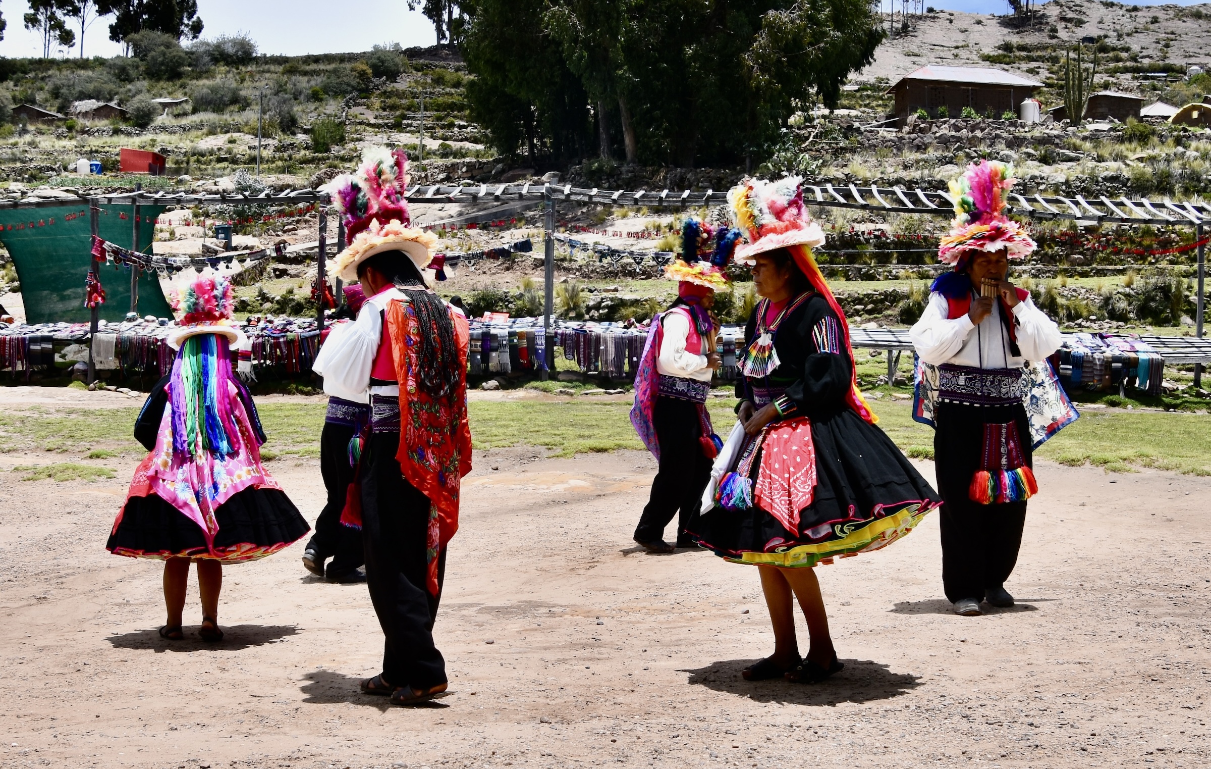
Even I eventually succumbed and for the second time today found myself wearing one of the more colourful hats I have ever donned.
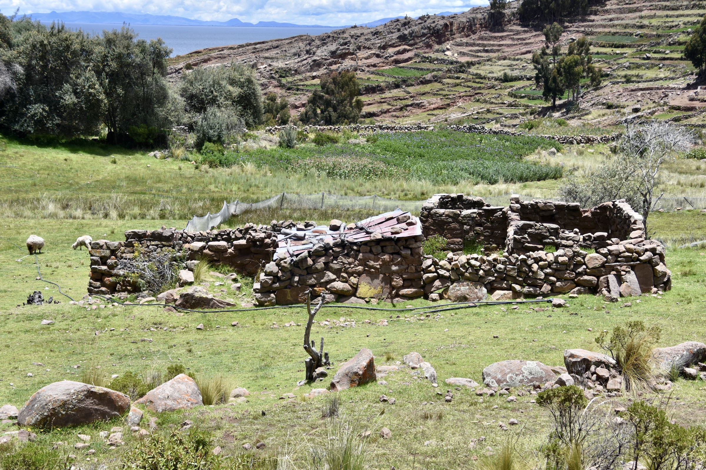
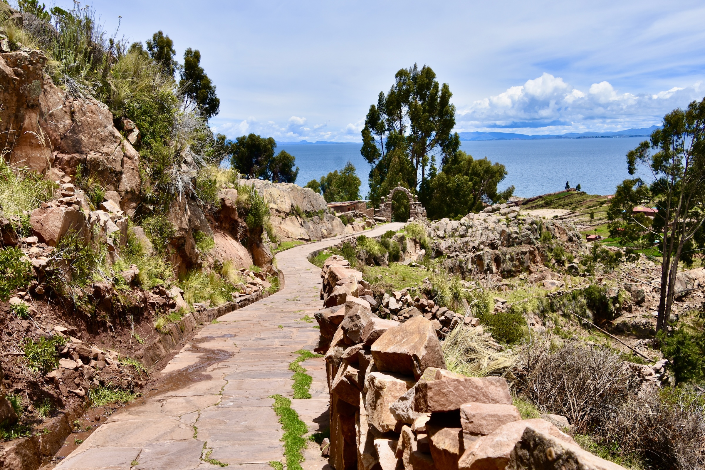
We said our goodbyes to the taquileños and began a steady climb up and over the top of Taquile which rises over 200 metres (700 feet) above Lake Titicaca so it was a relatively slow pace. Again and again I found myself amazed at this place and how much it reminded me of being on Crete or Sicily, right down to the fact that despite the elevation, it was actually hot and sunny.
Instead of seeing Roman or Greek ruins there were views like this with an abandoned building that could have been a thousand years old for all I knew.
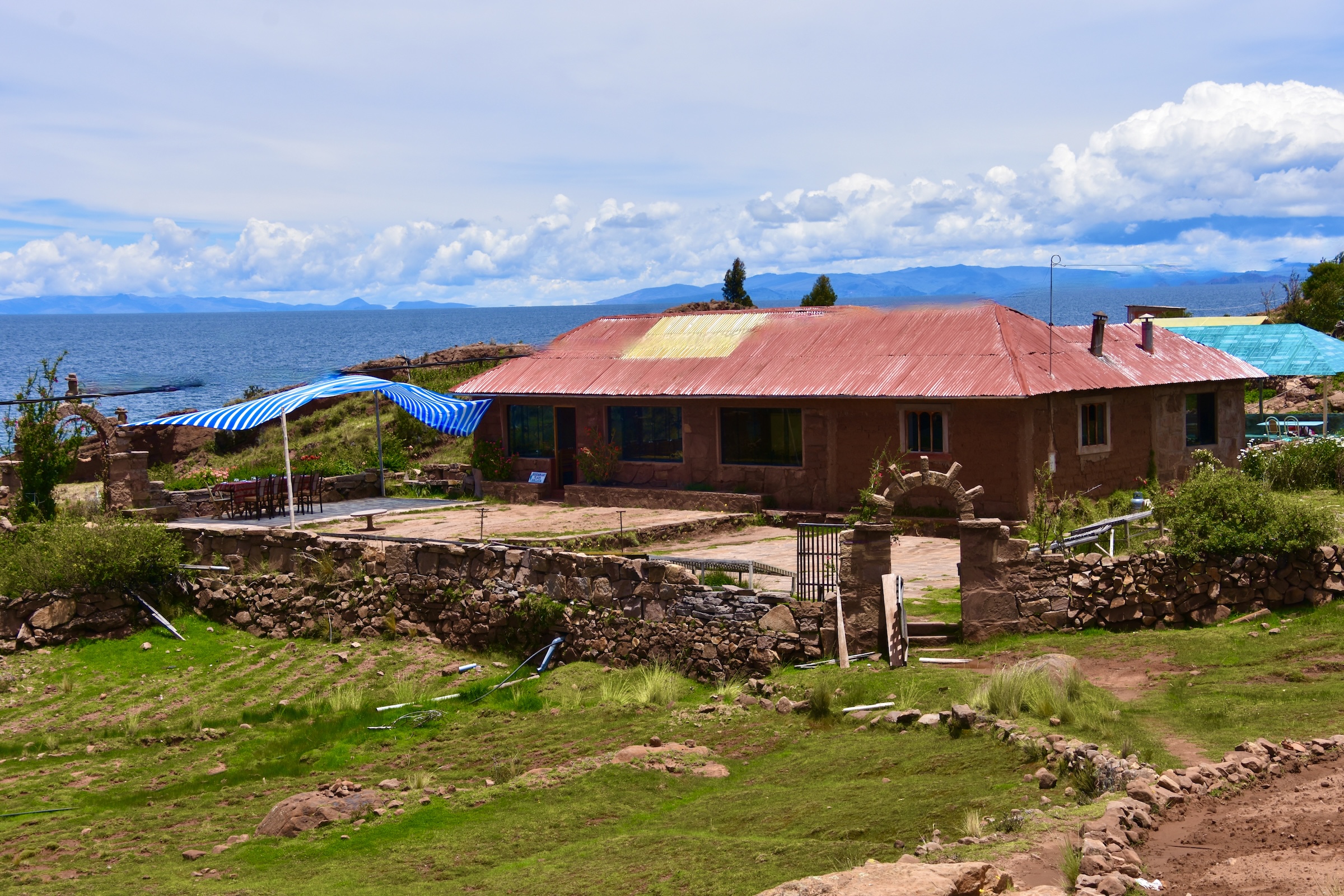
Cresting the top we gradually made our descent down to this tiny settlement where the only restaurant on the island is located.
This is the Kolkata Beach Restaurant where we had a late lunch before heading back to the boat which had repositioned to the other side of the island.
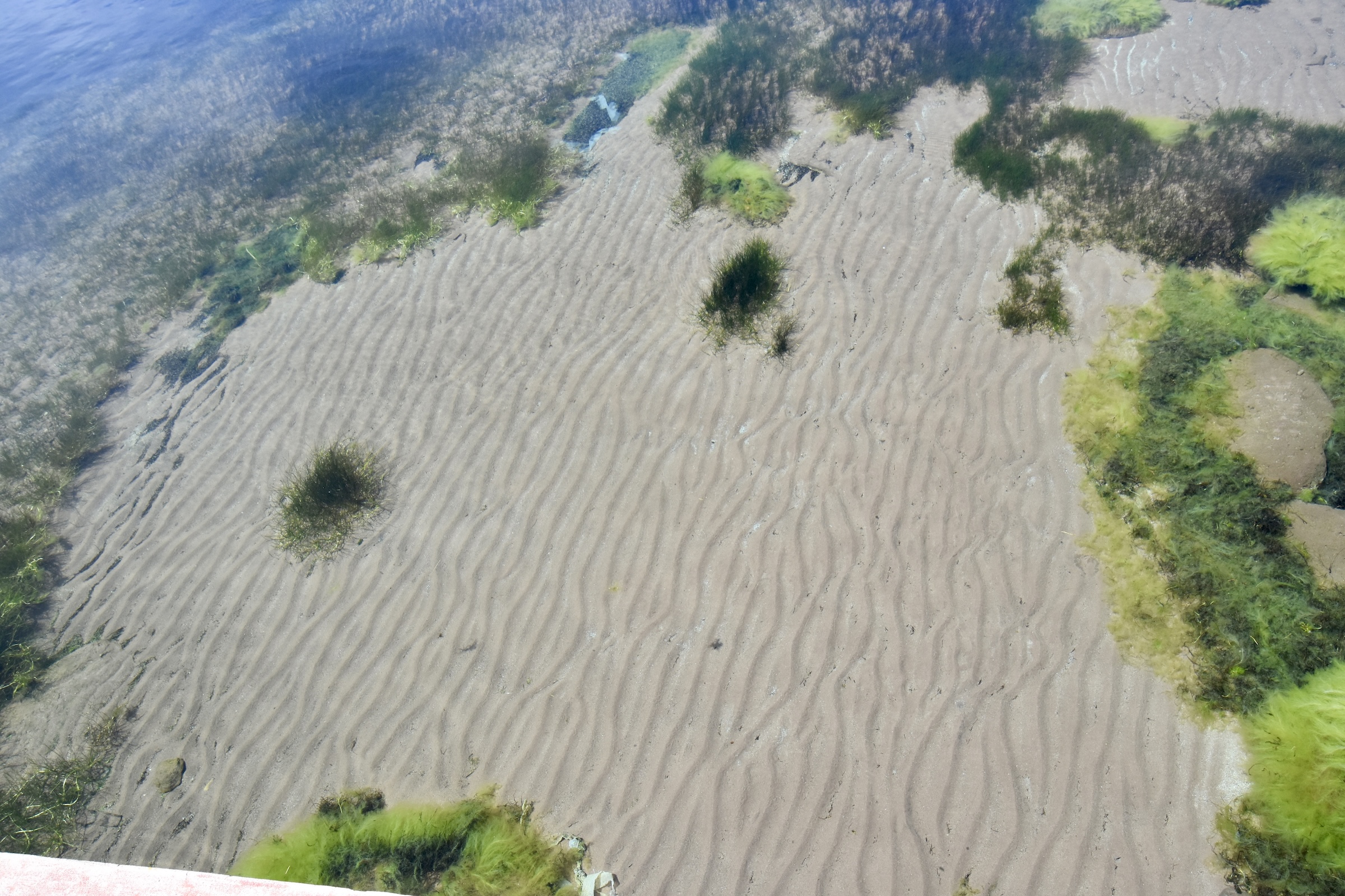
The water in the Lake Titicaca is incredibly clear as you can see from this photo taken from the jetty where we reboarded the boat. It doesn’t look like it, but that sand is about ten feet below the surface.
On the way back to Puno I had time to think of just how wrong my preconceptions about Lake Titicaca had been. I was expecting some kind of fog bound frigid landscape and instead found a sunny, warm and inviting environment that was about 180° from that. It was, as I should know by now, one of the main reasons why travel is so important to getting a truly balanced world view.
In the next post we’ll cross the border into Bolivia and begin our exploration of Lake Titicaca from the opposite side of the lake. I hope you’ll join us.